
Folding - Pocket - Case Maps (sold)
The last great cartographic masterpiece of Ming China.
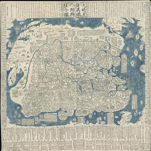
Complete Map of the Nine Border Towns of the Great Ming and of the Human Presence and Travel Routes of the Ten Thousand Countries. / 大明九邊萬國人跡路程全圖 / Dàmíng jiǔ biān wànguó rén jì lùchéng quán tú.
sold
- Digital Map Information
- Suitable for large format printing
- Full resolution TIFF file
- ICC color profile embedded
- Delivered instantly via download link
A rare and extraordinary 1663 (Kangxi 2) xylographic map of Ming China, and indeed the entire world, by Wáng Jūnfǔ (王君甫) issued during the reign of the Kangxi Emperor (1661 – 1722). This massively proportioned map focuses on China, which, bounded on the ... (more details)
Largest map of the Philippines Printed in the Philippines w/ Distinguished Provenance.
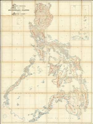
Carta General del Archipiélago Filipino.
sold
- Digital Map Information
- Suitable for large format printing
- File Size: 2002.83 MB
- File Type: ZIP / TIFF
- ICC color profile embedded
- Delivered instantly via download link
This is the only known example of Salvador Chofré's spectacular 1897 map of the Philippines - what must be considered the largest and most detailed Spanish map of the Philippines issued in the 19th century. The map was produced by Salvador Chofré, Manila's first lithographer at the height of his career, likely by government request in the face of the Philippine Revolution (1896 - 1898). The present example is likely a proof, as no other example or publishing history is known. What is known is that this example was acquired by American naval officer Henry Glass in 1898, when he participated in the invasion and surrender of Manila. The U.S. Navy reportedly reproduced it, very likely from this example, at a 50% reduced scale, although we have found no trace of said reproduction. The present map accompanied Glass when he returned to the United States, serving in San Francisco and attaining the rank of Rear Admiral, and was subsequently passed down through his family until we acquired it. (more details)
First Japanese Printed Map to show European geographical information with Buddhist world-view.
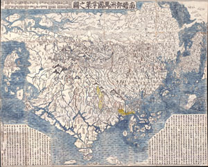
Nansenbushu Bankoku Shoka No Zu (Outline Map of All Countries of the Universe)
sold
- Digital Map Information
- Suitable for large format printing
- Full resolution TIFF file
- ICC color profile embedded
- Delivered instantly via download link
A seminal map. This is the first Japanese printed map to depict the world, including Europe and America, from a Buddhist cosmographical perspective. Printed by woodblock in 1710 (Hoei 7), this map was composed by the Buddhist monk Rokashi Hotan. Inspired by ... (more details)
The first Japanese map of the world from a Buddhist cosmographical perspective - a seminal map.
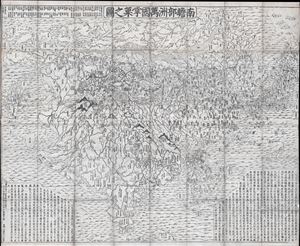
Nansenbushu Bankoku Shoka No Zu (Outline Map of All Countries of the Universe)
sold
- Digital Map Information
- Suitable for large format printing
- DPI: 300
- File Size: 91.94 MB
- File Type: ZIP / TIFF
- ICC color profile embedded
- Delivered instantly via download link
A seminal map of extreme significance. This is the first Japanese printed map to depict the world, including Europe and America, from a Buddhist cosmographical perspective. Printed by woodblock in 1710 (Hoei 7), this map was composed by the Buddhist monk ... (more details)
The Ming and the Myriad Countries.
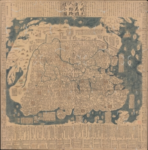
大明九邊萬國人跡路程全圖 / [Complete Map of the Nine Border Crossings of the Great Ming and of the Routes and Settlements of the Myriad Countries].
sold
- Digital Map Information
- Suitable for large format printing
- Full resolution TIFF file
- ICC color profile embedded
- Delivered instantly via download link
An extraordinary 1663 xylographic map of Ming China, and indeed the world by Wang Junfu (王君甫), issued in the second year of the reign of the Kangxi Emperor (r. 1661 – 1722) of the Qing Dynasty. Among other features, it is notable for being dated after the Qing had already displaced the Ming and established a new dynasty, suggesting that it was surreptitiously published and circulated among Ming Loyalists. (more details)
Nansenbushu: First Japanese Printed Map to show European geographical information with Buddhist world-view.
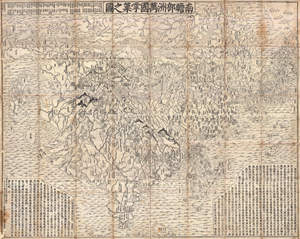
Nansenbushu Bankoku Shoka No Zu (Outline Map of All Countries of the Universe)
sold
- Digital Map Information
- Suitable for large format printing
- DPI: 300
- File Size: 330.31 MB
- File Type: ZIP / TIFF
- ICC color profile embedded
- Delivered instantly via download link
A seminal map of extreme significance. This is the first Japanese printed map to depict the world, including Europe and America, from a Buddhist cosmographical perspective. Printed by woodblock in 1710 (Hoei 7), this map was composed by the Buddhist monk ... (more details)
Best 19th century map of London.
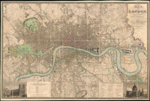
Map of London, from An Actual Survey made in the Years 1824, 1824 and 1826 by C. and J. Greenwood.
sold
- Digital Map Information
- Suitable for large format printing
- File Size: 284.14 MB
- File Type: ZIP / TIFF
- ICC color profile embedded
- Delivered instantly via download link
This is the rare 1830 second edition of Christopher and John Greenwood's large-scale map of London, here in a spectacularly preserved example. It is considered the largest and finest plan of London to appear in the 19th century. The present example is linen-backed and accompanied by its original green leather slipcase. (more details)
A most important Civil War map of Washington D.C.
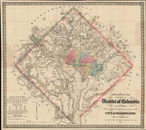
Topographical Map of the Original District of Columbia and Environs: Showing the Fortifications around the City of Washington.
sold
- Digital Map Information
- Suitable for large format printing
- File Size: 51.63 MB
- File Type: ZIP / TIFF
- ICC color profile embedded
- Delivered instantly via download link
Known as 'The Arnold Map', this is the most important Civil War era map of Washington D.C. and vicinity. This map was issued by Edward Greene 'Aloha Vivarttas' Arnold and G. W. Colton in 1862, just after the Second Battle of Bull Run. Centered on the White House, the map illustrates the 'original' ten-mile-square diamond-shaped land allocation set aside for the District of Columbia. As a cartographic piece, Arnold's map exceeded in quality all previous maps of the region, noting roads, canals, turnpikes, railroads, and mills, as well offering a meticulous presentation of topography. Significantly, it illustrates the 51 fortifications, army hospitals, and dozens of small batteries - all critical wartime reconnaissance. (more details)
The best 19th century map of London.
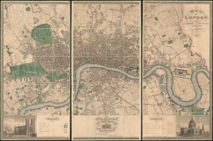
Map of London, from An Actual Survey made in the Years 1824, 1824 and 1826 by C. an J. Greenwood.
sold
- Digital Map Information
- Suitable for large format printing
- Full resolution TIFF file
- ICC color profile embedded
- Delivered instantly via download link
This is the rare first edition of Christopher and John Greenwood's large-scale 1827 map of London, here in a spectacularly preserved example. It is considered the largest and finest plan of London to appear in the 19th century. The present example is presented in three linen-backed folding sections, and is accompanied by its original leather slipcase. (more details)
The Colton Map - one of the largest and most beautiful maps of New York City pulished in the 19th century - in an unrecorded state.
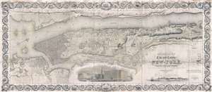
Topographical Map of the City and County of New-York, and the adjacent Country: With Views in the border of the principal Buildings and interesting Scenery of the Island.
sold
- Digital Map Information
- Suitable for large format printing
- DPI: 300
- File Size: 74.68 MB
- File Type: ZIP / TIFF
- ICC color profile embedded
- Delivered instantly via download link
Known as 'The Colton Map,' this is an unrecorded state of an 1840 map of New York City (Manhattan) by David H. Burr and John Hutchins Colton considered to be the finest and most decorative map of the city to appear in the 19th century. According to map ... (more details)
First map to name Abu Dhabi.
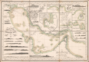
Reduzirte-Karte vom Persischen Golf.
sold
- Digital Map Information
- Suitable for large format printing
- Full resolution TIFF file
- ICC color profile embedded
- Delivered instantly via download link
This is Heinrich Berghaus's groundbreaking 1832 map of the Persian Gulf, identified by historian Cyrus Alai as 'the most detailed' map of the Gulf. Significantly, it is the earliest printed map to name Abu Dhabi (Abuthubbi / Bûthabîn / أبوظبي). The map was part of Berghaus's seminal Atlas von Asia, a loose-leaf collection of highly detailed regional maps of Asia, each an individual masterpiece of cartographic achievement. (more details)
One of the earliest printed maps of Shanghai and the first Japanese map of Shanghai.
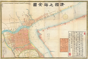
清國上海全圖 / Shinkoku shanhai zenzu. / Qīng guó shànghǎi quán tú. / Qing Shanghai Full Map.
sold
- Digital Map Information
- Suitable for large format printing
- File Size: 29.06 MB
- File Type: ZIP / TIFF
- ICC color profile embedded
- Delivered instantly via download link
An extraordinary discovery, this is the first Japanese map of Shanghai, China, and one of the earliest printed maps of Shanghai. Published in 1873, or Meiji 6, this large format map covers Qing Shanghai's old foreign district. From the conflux of the ... (more details)
Slave-suppression Masterplan.
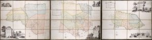
To the Right Honorable Robert Earl of Holdernesse, this map of the County of Cornwall, in the Island of Jamaica. (laid down from the papers, and under the direction of Henry Moore Esqr. His Majesty's Lieutenant Governor, and Commander in Chief of that Island, in the years 1756,-57,-58,-59,-60, and 61, and from a great number of actual surveys performed by the publishers) is humbly inscribed. / To the Right Honorable Wills Earl of Hillsborough, First Lord Commissioner of Trade and Plantations, this map of the County of Middlesex, in the Island of Jamaica. (laid down from the papers, and under the direction of Henry Moore Esqr. His Majesty's Lieutenant Governor and Commander in Chief of that Island in the years 1756,-57,-58,-59,-60, and 61, and from a great number of actual surveys performed by the publishers) is humbly inscribed. / To the Right Honorable George Grenville Esqr. First Lord Commissioner of the Treasury, Chancellor and under Treasurer of the Exchequers and c. and c. This map of the County of Surry, in the Island of Jamaica. (laid down from the papers and under the direction of Henry Moore Esqr. His Majesty's Lieutenant Governor and Commander in Chief of that Island in the years 1756,-57,-58,-59,-60, and 61, and from a great number of actual surveys performed by the publishers)is humbly inscribed.
sold
A seminal production, this is the 1763 Craskell-Simpson map of Jamaica, in three parts. It is the first broadly accurate map of Jamaica and the template for most subsequent representations of the island until the Roberston map of 1804. More importantly, the Craskell-Simpson map is best understood as a response to Tacky's Rebellion (April 1760 - October 1761) and, as such, is a masterplan for slave suppression. The map was commissioned by Henry Moore (1714 - 1769), who also, ironically, commissioned the Ratzer plan of New York, then likewise on the cusp of rebellion. It is the only work (either written or graphic) that records virtually every plantation and pen (large farms) in Jamaica at the height of the island's sugar boom, when it was the most valuable possession of the British Empire. (more details)
'Largest scale map of the territory...' - Streeter
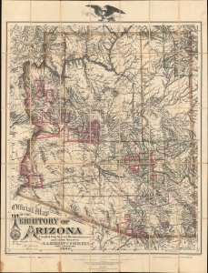
Official Map of the Territory of Arizona.
sold
- Digital Map Information
- Suitable for large format printing
- Full resolution TIFF file
- ICC color profile embedded
- Delivered instantly via download link
This is the first official map of Arizona Territory, published in 1880 by Emil A. Eckhoff and Paul Riecker. Rumsey calls this 'one of the best maps of Arizona as a territory.' It represents the primary cartographic resource during one of the most exciting and romantic periods of Arizona's history - recording the Arizona Silver and Copper mining boom, the early development of the territory's infrastructure and railroads, and the era of frontier lawlessness marked by the Gunfight at O.K. Corral, and other similar events. (more details)
Malaspina hydrography and Ildefonso de Aragón geography.
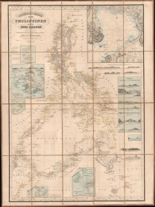
Reduzierte Karte von den Philippinen und den Sulu Inseln.
sold
- Digital Map Information
- Suitable for large format printing
- File Size: 1049.97 MB
- File Type: ZIP / TIFF
- ICC color profile embedded
- Delivered instantly via download link
This is a striking 1832 Heinrich Berghaus map of the Philippines. It was issued for Berghaus' looseleaf Atlas von Asien, the best-informed general cartographic work on Asia to appear in the mid-19th century. It is the first large-scale map to comprehensively incorporate both the Malaspina hydrography and Ildefonso de Aragón seminal geographical surveys. (more details)
'Hail Fredonia!'
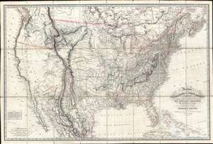
Fredonia, or the United States of North America; including also Cabotia, or the Canadian Provinces; the Western Territory to the Pacific Ocean; and the Northern Part of the Mexican States.
sold
- Digital Map Information
- Suitable for large format printing
- Full resolution TIFF file
- ICC color profile embedded
- Delivered instantly via download link
A fine example of the rare 1830 first obtainable edition of the famous Richard Holmes Laurie 'Fredonia' map of the United States. The map is best known for its advocation of a new name for the United States - Fredonia, which it is argued would build national pride and solidarity, as well as better distinguish it from Canada (Cabotia) and Mexico. Aside from the map's 'Fredish' qualities, this is considered one of the best early 'Manifest Destiny' maps issued in the wake of Lewis and Clark (1804 - 1806), thus illustrating the United States spreading coast-to-coast. It is derived from the most up-to-date sources and includes much of interest throughout. In Florida, it is one of the earliest maps to note the Cape Florida Settlement, a squatter community that was the precursor of modern-day Miami. (more details)
The final state of the landmark Ebert-Gilpin map of Colorado.
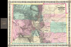
Map of Colorado Territory, Embracing the Central Gold Region.
sold
- Digital Map Information
- Suitable for large format printing
- File Size: 37.2 MB
- File Type: ZIP / TIFF
- ICC color profile embedded
- Delivered instantly via download link
An exceptional discovery, this is the 1870 Colton issue of the famous Ebert-Gilpin plan of Colorado. The Ebert-Gilpin Map, as it is commonly known, was first issued in 1862 and is considered to be the first commercially published map of Colorado ... (more details)
The final state of the landmark Ebert-Gilpin map of Colorado and the only example to show the apocryphal Sahwatch Lake. The first to show the Kansas Pacific Railroad.
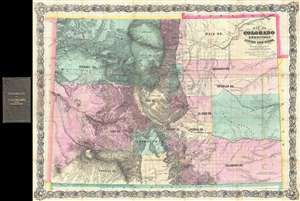
Map of Colorado Territory, Embracing the Central Gold Region.
sold
- Digital Map Information
- Suitable for large format printing
- Full resolution TIFF file
- ICC color profile embedded
- Delivered instantly via download link
An exceptional discovery, this is the 1870 Colton issue of the famous Ebert-Gilpin plan of Colorado. The Ebert-Gilpin Map, as it is commonly known, was first issued in 1862 and is considered to be the first commercially published map of Colorado ... (more details)
Unrecorded first state of a foundational map with extensive manuscript additions relating to American Indian Reservations established in 1867-8.
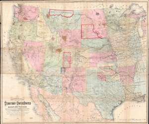
National Map of the Territory of the United States From The Mississippi River To The Pacific Ocean.
sold
- Digital Map Information
- Suitable for large format printing
- Full resolution TIFF file
- ICC color profile embedded
- Delivered instantly via download link
An extraordinary first-edition first-state example of William J. Keeler’s 1867 map of the Trans-Mississippi West - considered the finest post-Civil War railroad era map of the west - with unique manuscript annotations and additions relating to the American Indian Reservation System. This one of a kind historic document was likely the official example retained by the Indian Bureau, and possibly by Keeler himself, to administer and document the development of the American Indian Reservation system through the late 1860s. (more details)
This is one of best early large maps of the United States and the premier map for its period.' - David Rumsey
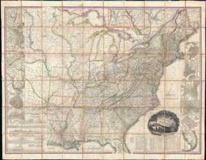
United States of America.
sold
- Digital Map Information
- Suitable for large format printing
- Full resolution TIFF file
- ICC color profile embedded
- Delivered instantly via download link
This, the first edition of Henry Schenck Tanner's 1829 wall map of the United States, is one of the most important American maps of the 19th century. The map covers from the Missouri river in the vicinity of Fort Mandan eastward to the ... (more details)
This is one of best early large maps of the United States and the premier map for its period.' - David Rumsey
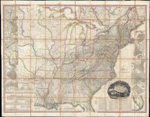
United States of America.
sold
- Digital Map Information
- Suitable for large format printing
- Full resolution TIFF file
- ICC color profile embedded
- Delivered instantly via download link
This, the first edition of Henry Schenck Tanner's 1829 wall map of the United States, is one of the most important American maps of the 19th century. The map covers from the Missouri river in the vicinity of Fort Mandan eastward to the ... (more details)
First American Board Game - fostering patriotism in the first generation of born U.S. citizens.
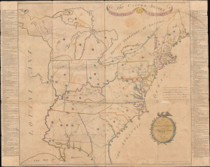
The United States Geographical Amusement / To the Youth of the United States this Map is dedicated by the Author.
sold
- Digital Map Information
- Suitable for large format printing
- Full resolution TIFF file
- ICC color profile embedded
- Delivered instantly via download link
This is the 1806 Jacob Johnson geography game map of the United States - the first American domestically-produced board game. With rich side panel content emphasizing patriotic themes surrounding the American Revolutionary War (1775 - 1783), this map was issued to foster the emerging sense of American identity in the first generation to come of age as citizens of the United States. The map game is, moreover, an important example of early American printing. (more details)
Likely used in the field during the American Revolutionary war.
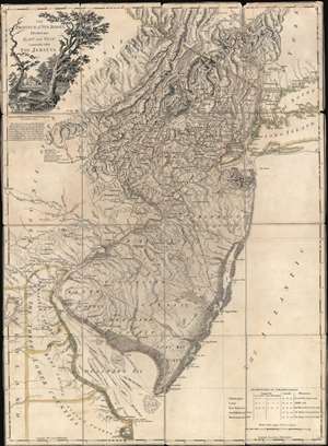
The Province of New Jersey Divided into East and West, commonly called The Jerseys.
sold
- Digital Map Information
- Suitable for large format printing
- Full resolution TIFF file
- ICC color profile embedded
- Delivered instantly via download link
A most fascinating 1777 first-state first-edition map of New Jersey by William Faden and Bernard Ratzer likely used in the field during the American Revolutionary War by the German Hessian supply officer, Friedrich Wilhelm von Wurmb. While focused on New Jersey, coverage extends to include eastern Pennsylvania, Delaware, and New York City. It captures the state's complex topography, noting the Jersey Highlands and the Palisades in the north and the Pine Barrens and coastal marshes in the south. New Jersey is here broken down into 12 counties, as they existed at the time, as well as multiple towns and roads. Note that there are no coastal routes through Monmouth County, requiring travelers instead to travel inland to Crosswicks, then south east to Egg Harbor, before continuing south. There is also an annotation regarding the settlement of Fort Helsingburg, near Salem on the Delaware River, where in 1640, Swedish settlers attempt to establish a colony. (more details)
Lost treasure of Parisian Cartography.
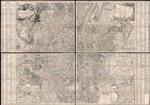
Plan de la Ville de Paris et de ses Faubourgs dédié au Roi.
sold
- Digital Map Information
- Suitable for large format printing
- Full resolution TIFF file
- ICC color profile embedded
- Delivered instantly via download link
The only known example, in this edition, of Bernard-Antoine Jaillot's 1748/1767 large-scale map of Paris. The map is centered on the Île de la Cité and is oriented to the southeast, with the Seine running vertically through the center of the map - a convention established in 1713 by the author's father Bernard-Jean-Hyacinthe Jaillot and followed in 1736-8 by Louis Bretez, and again, here. Coverage extends from the Faubourg Saint-Antoine to the Île des Cygnes that (attached to the Champ de Mars in the late 18th century), and from the Faubourg de Glories to the modern-day 14th arrondissement. Elaborate allegorical cartouches by Pierre-Alexandre Aveline appear in the upper left and right and feature titling and a legend, respectively. In the lower-left and right, inset maps detail the environs of Paris and France in general. The main map is flanked on either side by an exhaustive index of streets and important civic, military, government, mercantile, and ecclesiastical centers. (more details)
Extraordinary Spanish military map of the Philippines.
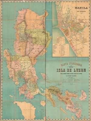
Carta Itineraria de la Isla de Luzon por el Teniente Coronel de E. M. del Ejercity de Filipinas.
sold
- Digital Map Information
- Suitable for large format printing
- Full resolution TIFF file
- ICC color profile embedded
- Delivered instantly via download link
A very rare and important large-scale 6-color chromolithograph 1882 map of Luzon and Manila, the Philippines, by the Spanish military engineer Anselmo Olleros y Mansilla. The map details all of Luzon as well as the surrounding waters. It is color coded by political-military districts (as defined by the Spanish administration) and shows proposed railroads, telegraph stations, existing roads broken down by grade, and more. Topography is illustrated throughout using delicate shading with mountain peaks labeled in red. (more details)
A previously unknown early manuscript map of the early vicinity of Saigon or Ho Chi Minh City, Vietnam.
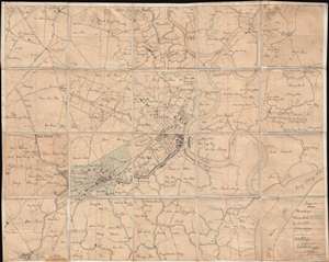
[Saigon and Cholon]
sold
- Digital Map Information
- Suitable for large format printing
- File Size: 40.34 MB
- File Type: ZIP / TIFF
- ICC color profile embedded
- Delivered instantly via download link
The finest and most detailed manuscript map yet discovered illustrating Saigon or Ho Chi Minh City, Vietnam. The map is centered on the center of Saigon City, west of the Song Sai Gon River between the Nhiêu Lộc River and the Bến ... (more details)
1st Official Map of Massachusetts.
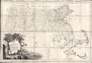
Map of Massachusetts Proper Compiled form Actual Surveys made by Order of the General Court, and under the inspection of Agents of their appointment, by Osgood Carleton.
sold
- Digital Map Information
- Suitable for large format printing
- Full resolution TIFF file
- ICC color profile embedded
- Delivered instantly via download link
Known as 'The Agent's Map', this is a fine example of the first official map of Massachusetts, published in 1801 by Osgood Carleton. The map emerged out of a long and complex struggle to produce a large-scale, accurate, and comprehensive state map - something increasingly important in the heady early days of independence following the American Revolutionary War (1775 - 1783). This expansive map covers all of Massachusetts in considerable detail, giving no attention whatsoever to the neighboring states. While generally ignoring topography, the map offers superb practical detail throughout, noting roads, county borders, schools, meeting houses, courts, milage from Boston, and more. The sole mountain illustrated is the Hoosack Range, near modern-day North Adams. (more details)
First map to show U.S. claims to British Columbia.
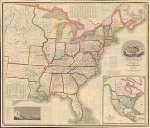
Map of the United States of North America Compiled from the Latest and most Authentic Information by David H. Vance.
sold
- Digital Map Information
- Suitable for large format printing
- DPI: 600
- File Size: 277.94 MB
- File Type: ZIP / TIFF
- ICC color profile embedded
- Delivered instantly via download link
This is the first edition of David Vance and Anthony Finley's outstanding wall map of the United States, published in 1825, here in a remarkable fresh state. This map is significant with regard to its early date, contemporaneous with Amos Lay's map, but more ambitions and predating the 1829 Tanner map by 4 years, as well as its detailed coverage of historic developments. Converge encompasses the Untitled States as it appeared at the time, extending from roughly the Texas Border (100° West of Greenwich / 27° West of Washington) to the Pacific and from the Saint Lawrence River to the Florida Keys. A large inset map appears in the lower right quadrant, illustrating the whole of North America. This is the first map to illustrate American claims to British Columbia that would later spark the 54°40' Debate. (more details)
Japan sets its sights on Korea.
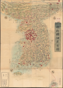
朝鮮國細見全圖 / [Complete Map of Korea].
sold
- Digital Map Information
- Suitable for large format printing
- Full resolution TIFF file
- ICC color profile embedded
- Delivered instantly via download link
A stunning 1873 large-scale map of Korea edited by Somezaki Nobufusa (染崎延房). It was produced in the wake of Japan's Meiji Restoration, as ambitious empire builders were eyeing their neighbor to the west for imperial expansion. (more details)
Celebrating the exploratory explosion of late 18th century.
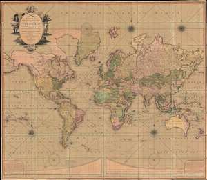
Bowles's New Four-Sheet Map of The World on Mercator's Projection Exhibiting the Several Quarters of the Globe divided into their respective Empires, Kingdoms, States, and c. agreeable to the latest Treaties and Political Regulations now existing; Together with all the New Discovers and most interesting Tracks of those eminent Circumnavigators Cook, Byron, Bougainville, Perouse, Vancouver and c.
sold
- Digital Map Information
- Suitable for large format printing
- Full resolution TIFF file
- ICC color profile embedded
- Delivered instantly via download link
A beautiful old-color example of the Bowles and Carver 1801 large-format wall map of the world, on a Mercator Projection. The map celebrates the great strides forward made in world-exploration in the late 18th century - particularly by British navigators. The striking cartouche, situated in the upper left, features a sea captain consulting a nautical chart on the left, and a navigator with a sextant on the right. The cartouche is surmounted by a large anchor, the symbol of the British Admiralty. At the base of the map trade goods pile up, signifying wealth. Within the title area itself, a trumpet and telescope are crossed like swords, equating exploration with conquest. (more details)
Highly decorative map promoted as the 'largest best, and most detaled' map fo the United States to appear as of 1849.
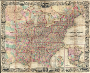
Map of the United States of America Including Canada, and a large portion of Texas, Showing Base Meridian and Township Lines of the U.S. Surveys, Including Lands alotted to the Indian Tribes west of the Mississippi, The various internal improvements.
sold
- Digital Map Information
- Suitable for large format printing
- DPI: 300
- File Size: 147.52 MB
- File Type: ZIP / TIFF
- ICC color profile embedded
- Delivered instantly via download link
A striking large format 1849 case map of the United States by J. Calvin Smith. The map covers from Austin Texas to the eastern seaboard and from Lake Superior to the Gulf of Mexico. When it was introduced, this map was hailed as the ... (more details)
Height of British Colonialism Land co-optation in Malaya.
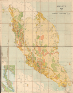
Malaya 1927 Showing Alienated Land.
sold
- Digital Map Information
- Suitable for large format printing
- File Size: 134.17 MB
- File Type: ZIP / TIFF
- ICC color profile embedded
- Delivered instantly via download link
This is a rare and important large format (72 x 56.25 in) 1927 F.M.S. Survey folding wall map of the Malay Peninsula, including Singapore and the Straits Settlements. Among other features, it provides a comprehensive view of land usage (or in this case, 'Alienation' of the lands from Malay populations into British company ownership) across the Malay Peninsula at the height of the colonial era. (more details)