
Folding - Pocket - Case Maps
Most important chronicle and map of early Singapore.
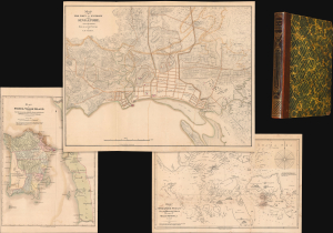
Notices of the Indian Archipelago, and adjacent countries; being a collection of papers relating to Borneo, Celebes, Bali, Java, Sumatra, Nias, the Philippine Islands, Sulu, Siam, Cochin China, Malayan Peninsula, etc.
$32,000.00
Acquire
- Digital Map Information
- Suitable for large format printing
- Full resolution TIFF file
- ICC color profile embedded
- Delivered instantly via download link
A rare example of John Henry Moor's 1837 Notices of the Indian Archipelago, containing within the most important early map of Singapore, as well as otherwise lost reprints of important articles from the Singapore Chronicle, and additional maps of Penang, Singapore Strait, the East Indian Archipelago, Malacca, and Borneo. Moor's work is considered one of the most significant records of early Singapore and one of the first books published in Singapore. (more details)
Largest and Best Map of Lower Canada after the War of 1812.
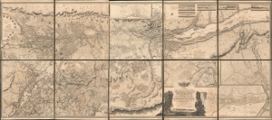
To His Royal Highness George Augustus Frederick, Prince of Wales, Duke of Cornwall ... and Prince Regent of the United Kingdom of Great Britain and Ireland; this Topographical map of the Province of Lower Canada, shewing its division into Districts, Counties, Seigniories, and Townships with all the Lands reserved both for the Crown and the Clergy ... Is with his Royal Hyghnes's Special Permission, Most gratefully dedicated by a Faithful and Zealous Canadian Subject, and His Royal Highnes's Most Obedient and Devoted Servant, Joseph Bouchette, His Majesty's Surveyor General of the Province and Lieutt. Colonel C.M.
$25,000.00
Acquire
- Digital Map Information
- Suitable for large format printing
- File Size: 317.57 MB
- File Type: ZIP / TIFF
- ICC color profile embedded
- Delivered instantly via download link
This is Joseph Bouchette's monumental 10-sheet map of Lower Canada. Appearing at the end of the War of 1812, this is the largest, best, and most influential map of Canada issued in the 19th century. David Rumsey correctly praises it, saying that the 'graphic elegance of the large map is the equal (or perhaps the superior) of any of the contemporary maps that I have seen'. In its pre-publication manuscript form, it played a significant role in the Treaty of Ghent, which ended the War of 1812 and began the establishment of formal U.S.-Canada borders. Due to its extreme rarity, the significance of this map is often overlooked, and it is poorly represented in scholarly literature. (more details)
Battle for the Fate of the Levant.
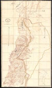
ردشمنلوا میسرت كنویامه هیرب هناخسدنهم هطیرح وبشا [This map was drawn by the Imperial Engineering Office].
$20,000.00
Acquire
- Digital Map Information
- Suitable for large format printing
- Full resolution TIFF file
- ICC color profile embedded
- Delivered instantly via download link
An extraordinary, one-of-a-kind large-format manuscript folding map of Ottoman Syria produced by the sultan's Imperial Engineering Office c. 1832. It was made in the context of the First Egyptian Ottoman War (1831 - 1833), which saw the region temporarily come under Egyptian rule. (more details)
Most important Canadian immigration and settlement initiative.
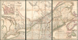
To His Most Excellent Majesty King William IVth This Map of the Provinces of Lower and Upper Canada, Nova Scotia, New Brunswick, Newfoundland and Prince Edwards Island, with a Large Section of the United States...
$19,500.00
Acquire
- Digital Map Information
- Suitable for large format printing
- Full resolution TIFF file
- ICC color profile embedded
- Delivered instantly via download link
This is Joseph-Francis Bouchette's rare large-scale 1831 map of Canada - a seminal map relating to Canadian development, immigration, and land usage. The map details the provinces of Upper and Lower Canada (Ontario and Quebec), which were established in 1791. Most significantly, the map focuses on lands, towns, roads, and districts designated to the Canada Company - the most important immigration and settlement initiative in Canadian history. The Canada Company’s copious settlements are indicated on the map by an asterisk or a cross next to each name. Bouchette notes land disputes between the United States and British North America in Maine and Oregon, but predictably advocates exclusively for British positions. (more details)
Grandest Cartographic Representation of Regency London.
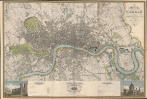
Map of London, from An Actual Survey made in the Years 1824, 1824 and 1826 by C. an J. Greenwood.
$15,000.00
Acquire
- Digital Map Information
- Suitable for large format printing
- Full resolution TIFF file
- ICC color profile embedded
- Delivered instantly via download link
This is the rare first edition of Christopher and John Greenwood's large-scale 1827 map of London, produced at the height of the Regency period, during which the city was being crafted into a neoclassical metropolis, driven by the Prince Regent (George IV) himself but realized by his favored architect, John Nash. Greenwood's map, in its grand presentation and monumental scope, is the essential cartographic expression of the Regency, and it is considered the largest and finest plan of London to appear in the 19th century. (more details)
Striking large-format map of New York City.
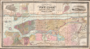
City and County Map of New-York Brooklyn, Williamsburgh, Jersey City and the adjacent Waters etc.
$15,000.00
Acquire
- Digital Map Information
- Suitable for large format printing
- File Size: 101.07 MB
- File Type: ZIP / TIFF
- ICC color profile embedded
- Delivered instantly via download link
This is J. H. Colton's large and impressive case map of New York City, including Brooklyn and Williamsburg. It is one of the largest and best maps of New York City to emerge in the mid-19th century. (more details)
The first official Japanese regional map using western cartographic technology. A wonder of copper engraving!

峨羅斯及亞西亞ノ圖 / [Map of Russia and Asia].
$12,000.00
Acquire
- Digital Map Information
- Suitable for large format printing
- File Size: 109.25 MB
- File Type: ZIP / TIFF
- ICC color profile embedded
- Delivered instantly via download link
An extraordinary 1867 (Keio 3) map of Siberia and Alaska illustrates a moment of cultural collision and transformation. Printed in Japan using a remarkable multi-color copperplate process, the map is a conic projection covering Asia from the Caspian Sea to the Bering Strait. It extends farther east to include Alaska, and south to encompass Nepal, Korea, Tibet, most of China, and all of Japan. This is the first Japanese regional map to incorporate contemporaneous western cartographic technology for official strategic and military use. (more details)
Best general mapping of Arabia in Persia - drawn from first hand reports and exploration.
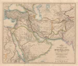
Map of the Counties Situated between the Rivers Nile and Indus; serving as an Inex to the work on the Expedition for hte Survey of the Euphrates and Tigris Drawn from Materials furinished by Lieut. Colonel Chesney R. S. F.R.S.
$12,000.00
Acquire
- Digital Map Information
- Suitable for large format printing
- Full resolution TIFF file
- ICC color profile embedded
- Delivered instantly via download link
This is a 1850 general map of Arabia and Persia, illustrating the route of Rawdon Chesney's Euphrates Expedition (1835 - 1837). Decades before the Suez Canal, Chesney proposed the Euphrates as a viable route for steamers to reach the Persian Gulf and, thus, India, avoiding the dangerous months-long voyage around Africa. The cartography presented is the most advanced general mapping of Arabia and Persia then available, being either directly derived from the 1830s Euphrates Expedition or collected from local sources en route. (more details)
Most engrossingly detailed map of Southeast Asia to appear the first half of the 19th century.
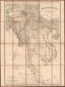
Hinterindien.
$12,000.00
Acquire
- Digital Map Information
- Suitable for large format printing
- File Size: 47.71 MB
- File Type: ZIP / TIFF
- ICC color profile embedded
- Delivered instantly via download link
This is a striking 1832 Heinrich Berghaus map of Southeast Asia, comprising Burma, Siam (Thailand), Laos, Cambodia, Vietnam, Malaya, and Singapore. It was issued for Berghaus' looseleaf Atlas von Asien, the best-informed general cartographic work on Asia to appear in the mid-19th century. (more details)
A most important map of eastern Canada detailing British settlement and colonization in the early 19th century.
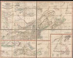
A Map of Cabotia; Comprehending The Provinces of Upper and Lower Canada, New-Brunswick And Nova-Scotia, with Breton Island, Newfoundland, &c. And Including also, The Adjacent Parts of the United States. Compiled from a great Variety of Original Documents. By John Purdy.
$10,500.00
Acquire
- Digital Map Information
- Suitable for large format printing
- DPI: 300
- File Size: 72.87 MB
- File Type: ZIP / TIFF
- ICC color profile embedded
- Delivered instantly via download link
A fine example of Purdy's important 1821 map of Cabotia or Canada and New England – at the time the largest and finest map of that region. Cabotia is Purdy's manufactured term for eastern Canada or those lands discovered by John Cabot in 1497. The map covers from Lake Michigan to Newfoundland and from Labrador to New York City. Within Canada, it includes all of Ontario, Quebec, Nova Scotia, New Brunswick and Nova Scotia, and Newfoundland. In the United States, it includes all of New England, Michigan, and New York, as well as parts of Ohio and Pennsylvania. There are no fewer than 10 inset detail maps including a map of the Great lakes, the environs of Quebec, the St. Lawrence River, Niagara and vicinity, Newfoundland, Nova Scotia, Halifax, St. John, and New York Harbor. (more details)
Greatest 19th century map of the East Indies.
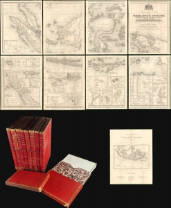
Algemene Kaart van Nederlandsch Oostindie...
$9,500.00
Acquire
- Digital Map Information
- Suitable for large format printing
- Full resolution TIFF file
- ICC color profile embedded
- Delivered instantly via download link
This expansive 1842 8-sheet map of the East Indies compiled by Gijsbert Franco von Derfelden van Hinderstein is the largest and most important map of the East Indies made in the mid-19th century. Compiled from 1820 to 1840, it is the first map to depict the administrative divisions of the Dutch East Indies as the islands progressively came under Dutch administration. The current example is handsomely housed in 9 gilt-stamped leather slipcases. (more details)
London in the Early Days of Britain's Imperial Century.
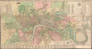
Cary's New and Accurate Plan of London and Westminster, the Borough of Southwark and parts adjacent...
$9,000.00
Acquire
- Digital Map Information
- Suitable for large format printing
- Full resolution TIFF file
- ICC color profile embedded
- Delivered instantly via download link
This is John Cary's 1816 large-format folding map of London, England. Nearly five feet in length, the map allows for the presentation of the city down to a minute level of detail at a time when its face was rapidly changing, with the construction of grand new buildings, bridges, docks, and canals. (more details)
Issued in the final days of Old Shangai just after the January 28 Incident or Shanghai Incident.
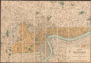
Map of Shanghai.
$9,000.00
Acquire
- Digital Map Information
- Suitable for large format printing
- File Size: 66.6 MB
- File Type: ZIP / TIFF
- ICC color profile embedded
- Delivered instantly via download link
An extremely rare 1933 North-China Daily News and Herald map of Shanghai. Focusing on the Bund and the International Settlement, the map extends from the Shanghai Hangchow Railroad in the west to the Shanghai Baptist College (now the University of Shanghai) in the east. Derived roughly from the Municipal Council Map of the same year, this map is in intensely detailed, with streets, businesses, clubs, parks, government offices, and civic institutions noted. This map was issued shortly after the 1932 Shanghai Incident in the final days of Shanghai's pre-war boomtime. (more details)
'...worthy of a place in any nobleman's library' - Australian Mail
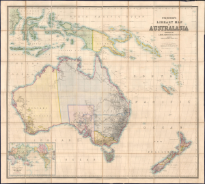
Stanford's Library Map of Australasia.
$8,500.00
Acquire
- Digital Map Information
- Suitable for large format printing
- File Size: 129.08 MB
- File Type: ZIP / TIFF
- ICC color profile embedded
- Delivered instantly via download link
The astounding 1859 first edition of A. Kieth Johnston and Edward Stanford's large-format Library Map of Australasia, comprising Australia, New Zealand, and New Guinea. This is arguably the largest and most detailed general map of Australia to appear in the 19th century, issued a month before the official establishment of Queensland in June 1859. (more details)
Brooklyn equivalent of the 1811 Commissioners' Plan.
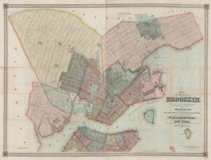
Map of the city of Brooklyn, as laid out by commissioners, and confirmed by acts of the Legislature of the state of New York, made from actual surveys the farm lines and names of original owners being accurately drawn from authentic sources. Containing also a map of the Village of Williamsburgh, and part of the city of New-York: compiled from accurate surveys and documents and showing the true relative position of all.
$8,500.00
Acquire
- Digital Map Information
- Suitable for large format printing
- DPI: 600
- File Size: 210.77 MB
- File Type: ZIP / TIFF
- ICC color profile embedded
- Delivered instantly via download link
This is J. H. Colton's impressive large-scale 1852 map of Brooklyn and Williamsburg. In its 1839 first edition, it is the Brooklyn equivalent to both the 1811 Commissioner' Plan and Colton's great 1836 map of Manhattan, and as such can reasonably be considered the most important and best map of Brooklyn to appear in the 19th century. The present map, 1852, is, in so far as we can tell, the third edition, retaining much of the significance of the first, while also featuring fascinating updates illustrating the break-neck pace with which Brooklyn was then urbanizing. (more details)
First Official Map of Massachusetts.
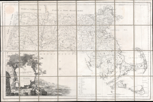
Map of Massachusetts Proper Compiled form Actual Surveys made by Order of the General Court, and under the inspection of Agents of their appointment, by Osgood Carleton.
$7,800.00
Acquire
- Digital Map Information
- Suitable for large format printing
- Full resolution TIFF file
- ICC color profile embedded
- Delivered instantly via download link
Known as 'The Agent's Map', this is a fine example of the first official map of Massachusetts, published in 1801 by Osgood Carleton. The map emerged out of a long and complex struggle to produce a large-scale, accurate, and comprehensive state map - something increasingly important in the heady early days of independence following the American Revolutionary War (1775 - 1783). (more details)
Spectacular wall map of Paris.
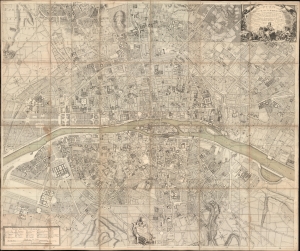
Plan de la Ville et Fauxbourgs de Paris Divise en 20 Quartiers dont la plus grande partie a ete rectifee d'apres differens desseins leve Geometrique, tires du Cabinet de Mr. Cevalier de * * * *... Dedie aux Citoyens de la Capitale Par... Desnos... 1777.
$7,500.00
Acquire
- Digital Map Information
- Suitable for large format printing
- File Size: 265.55 MB
- File Type: ZIP / TIFF
- ICC color profile embedded
- Delivered instantly via download link
This is a spectacular 1777 large-scale map of Paris by Louis-François Deharme, published by Louis Charles Desnos. The map captures Paris during the reign of Louis XV, a period of growing unrest and inter-class resentment that would ultimately culminate in the French Revolution (1789 - 1799). (more details)
Texas as a Republic!
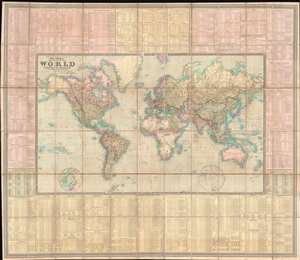
To Her Most Gracious Majesty Queen Victoria, This Map of the World on Mercator's Projection, is most respectfully dedicated, by Her devoted Subjects J. and C. Walker.
$7,500.00
Acquire
- Digital Map Information
- Suitable for large format printing
- File Size: 175.51 MB
- File Type: ZIP / TIFF
- ICC color profile embedded
- Delivered instantly via download link
A dramatic first edition of J. and C. Walker's 1840 highly decorative wall map of the world on Mercator's Projection - notable here for its bold inclusion of the Republic of Texas. It also rather neutrally addresses the ambiguity of the Oregon Question - an ongoing dispute between the United States and British Canada over claims to British Columbia that would not be resolved until 1846. This deluxe edition of the map is enhanced by extensive tables offering statistics and data on all parts of the world. (more details)
One of the largest and most beautiful American commercial maps published in the 19th century.
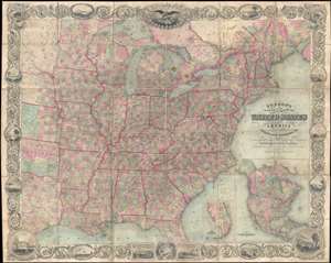
Map of the United States of America Including Canada, and a large portion of Texas, Showing Base Meridian and Township Lines of the U.S. Surveys, Including Lands alotted to the Indian Tribes west of the Mississippi, The various internal improvements.
$7,500.00
Acquire
- Digital Map Information
- Suitable for large format printing
- Full resolution TIFF file
- ICC color profile embedded
- Delivered instantly via download link
One of the most striking American large format wall maps ever issued. This is the 1862 American Civil War era case map of the United States by J. Calvin Smith and updated by J. H. Colton. The map covers from Austin Texas to the eastern seaboard and from Lake Superior to the Gulf of Mexico. Smith first introduced this map in 1843 buy the present much revised and updated example is the 1862 Civil War Colton edition. When it was introduced in 1843, this map was hailed as the largest, best, and most detailed map of the United States yet published. (more details)
'The Balbi Map' - largest commercial map of Italy of the 19th century.
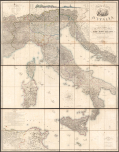
Gran Carta d'Italia.
$7,000.00
Acquire
- Digital Map Information
- Suitable for large format printing
- Full resolution TIFF file
- ICC color profile embedded
- Delivered instantly via download link
A truly 'ginormous' production, this is Giuseppe Civelli's great map of Italy, here in its 1845 first edition. The map measures nearly 100 inches high and eighty inches wide, making it one of the largest maps we have seen. It was issued in the early days of the Italian Risorgimento and can be seen as a unique symbol aspiring to a newly ascendant sense of shared Italian national identity. (more details)
Diplomat's synthesis of Paraguayan Geography.
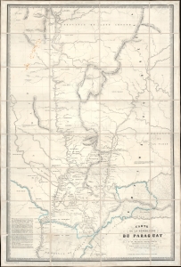
Carte de la Républiuque Du Paraguay dédiée et présentée à sa Majesté Napoléon III Empereur des Français, par le Comte Lucien de Brayer Consul de France au Paraguay. Publiée pat en 1863.
$7,000.00
Acquire
- Digital Map Information
- Suitable for large format printing
- File Size: 62.01 MB
- File Type: ZIP / TIFF
- ICC color profile embedded
- Delivered instantly via download link
This is an extremely rare 1863 map of Paraguay, produced by Alfred Lucien de Brayer, Napoleon III of France's consul to the South American country. It was published to commemorate the 10th year of France's diplomatic recognition of Paraguay's independence and probably as an attempt to bolster de Brayer's damaged reputation with the Emperor. The map is superbly detailed, laying out Paraguay and its frontier regions. It details the administrative regions within the country; neighboring indigenous tribes and nations are noted, as well as the bordering regions of Brazil and Argentina. (more details)
A diplomat's synthesis of Paraguayan Geography.
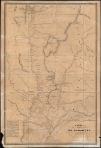
Carte de la Républiuque Du Paraguay dédiée et présentée à sa Majesté Napoléon III Empereur des Français, par le Comte Lucien de Brayer Consul de France au Paraguay.. Publiée pat en 1863.
$7,000.00
Acquire
- Digital Map Information
- Suitable for large format printing
- File Size: 214.29 MB
- File Type: ZIP / TIFF
- ICC color profile embedded
- Delivered instantly via download link
This is an extremely rare 1863 map of Paraguay, produced by Alfred Lucien de Brayer, Napoleon III of France's consul to the South American country. It was published to commemorate the 10th year of France's diplomatic recognition of Paraguay's independence, and probably as an attempt to bolster de Brayer's damaged reputation with the Emperor. The map is superbly detailed, laying out Paraguay and its frontier regions. It details the administrative regions within the country; neighboring indigenous tribes and nations are noted as well as the bordering regions of Brazil and Argentina. (more details)
Best early map of Long Island.
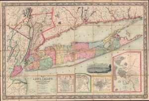
Map of Long Island, with the Environs of New-York and the Southern Part of Connecticut, compiled from Various Surveys and Documents.
$6,750.00
Acquire
- Digital Map Information
- Suitable for large format printing
- File Size: 203.5 MB
- File Type: ZIP / TIFF
- ICC color profile embedded
- Delivered instantly via download link
A fine example of John Calvin Smith and J. H. Colton's 1856 map of Long Island. This is the largest, most significant, and most beautiful map of Long Island to be issued in the 19th century. It is also very likely the first map published by American cartographic titan, J. H. Colton. (more details)
Seminal map of the Trans-Mississippi showing mineral deposits and the emergence of the American Indian Reservation System.
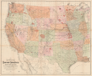
National Map of the Territory of the United States From The Mississippi River To The Pacific Ocean.
$6,500.00
Acquire
- Digital Map Information
- Suitable for large format printing
- File Size: 175.65 MB
- File Type: ZIP / TIFF
- ICC color profile embedded
- Delivered instantly via download link
An extraordinary first-edition third-state example of William J. Keeler's seminal 1867 map of the Trans-Mississippi West - considered the finest post-Civil War railroad era map of the West. The map is noteworthy for its meticulous mapping of mineral deposits and the often overlapping evolution of the American Indian Reservation System. Significantly, this is the finest example of this important map we have seen. Most examples of this map, because it was mounted on linen on a single sheet rather than dissected, typically exhibit significant wear and condition issues. The present example, likely opened only a few times in its long life, exhibits an exceptional state of preservation. (more details)
One of the earliest large-format maps to illustrate the discoveries of Lewis and Clark.
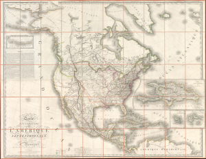
Carte Encyprotype de L'Amérique Septentrionale, Dédiée et présentée à Monsieur, Par M. Brué, Ingénieur-Géographe de S. A. Royale.
$6,500.00
Acquire
- Digital Map Information
- Suitable for large format printing
- File Size: 141.05 MB
- File Type: ZIP / TIFF
- ICC color profile embedded
- Delivered instantly via download link
This is the first edition of Adrien-Hubert Brué's 1815 map of North America, significant as one of the earliest publications to illustrate cartographically and in detail the achievements of the Lewis and Clark Expedition. (more details)
Seminal map of the Trans-Mississippi, in a true 1st Edition 1st State.
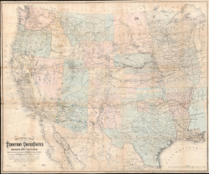
National Map of the Territory of the United States From The Mississippi River To The Pacific Ocean.
$6,500.00
Acquire
- Digital Map Information
- Suitable for large format printing
- Full resolution TIFF file
- ICC color profile embedded
- Delivered instantly via download link
An extraordinary first-edition first-state example of William J. Keeler's seminal 1867 map of the Trans-Mississippi West - considered the finest post-Civil War railroad era map of the West. This is the true first edition, without American Indian reservations, which were added in subsequent editions issued within the same year. (more details)
Proto-State of Franklin and the colony of New Iberia (Morgania).
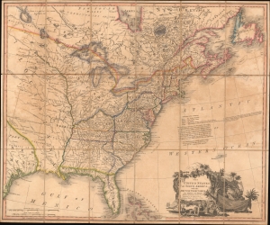
The United States of North America: with the British Territories and Those of Spain.
$6,500.00
Acquire
- Digital Map Information
- Suitable for large format printing
- Full resolution TIFF file
- ICC color profile embedded
- Delivered instantly via download link
This is Faden's 1808 map of the United States, representing the new nation as it was struggling to resolve issues of state vs. federal sovereignty, land rights, American Indian relations, domestic and foreign speculators, and frontier opportunism. It includes the ephemeral proto-state of Franklinia and the colony of New Iberia. (more details)
One of the largest commercial maps we have seen.
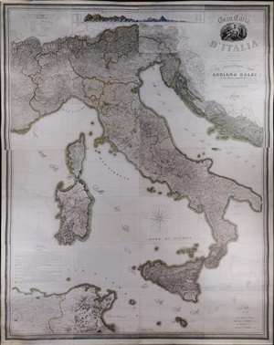
A truly 'ginormous' production, this is Giuseppe Civelli's great map of Italy, here in its 1845 first edition. The map measures nearly 100 inches high and eighty inches wide, making it one of the largest maps we have seen. It was issued in the early days of the Italian Risorgimento and can be seen as a unique symbol aspiring to a newly ascendant sense of shared Italian national identity. The map embraces the whole of the Italian peninsula and Sicily, as well as Corsica, Sardinia, Dalmatia, Malta, North Africa, and the northern Italian states. Along the top of the map, there appears a detailed comparative elevation chart. Throughout the detail is staggering, making this great work the finest map of Italy to appear in the 19th century. (more details)
Second published map of Iowa City.

Iowa City and its Environs.
$6,000.00
Acquire
- Digital Map Information
- Suitable for large format printing
- Full resolution TIFF file
- ICC color profile embedded
- Delivered instantly via download link
This rare 1854 J. H. Millar map of Iowa City - considered the second published map of the city - offers an extraordinary portrait of Iowa's first state capital during a period of rapid growth, real estate speculation, and suburban development. Twelve surrounding vignette views by celebrated Iowa artist George Henry Yewell depict churches, civic institutions, prominent residences, Clinton Street, and the State House, making this scarce map an exceptional visual record of mid-19th-century Iowa City. (more details)
Most Detailed Ottoman Map of Montenegro Ever Produced.
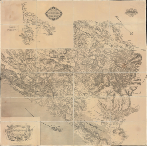
... ١٨٦٩ سنه سی اوستريا دولتی جغرافيا جمعيت عسكريه سی واسطه سيله تنظيم قلنان قره طاغ وجوارينك خريطه سی اولوب / [This is a map of Montenegro and its Surroundings, prepared by means of the Austrian Militärgeographisches Institut in the year 1869...].
$6,000.00
Acquire
- Digital Map Information
- Suitable for large format printing
- Full resolution TIFF file
- ICC color profile embedded
- Delivered instantly via download link
This is a rare 1875 Ottoman Turkish large-format folding map of Montenegro produced by the Erkân-ı Harbiye Dairesi, the General Staff Department of the Ottoman military, based on an earlier 1869 Austrian map prepared by the Militärgeographisches Institut. Combining Austrian and Ottoman cartographic knowledge, largely gained during the Ottoman-Montenegrin War (1861 - 1862), it is the most detailed Ottoman map of Montenegro produced before the kingdom's independence. (more details)
French recognition of the Republic of Texas.
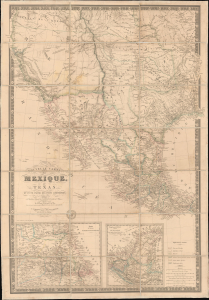
Nouvelle Carte du Mexique, du Texas et d'une partie des états limitrophes...
$6,000.00
Acquire
- Digital Map Information
- Suitable for large format printing
- Full resolution TIFF file
- ICC color profile embedded
- Delivered instantly via download link
This is the 1845 edition of Adrien-Hubert Brué's seminal map of Mexico and the Republic of Texas - issued at the peak of the Mexican-American War (1846 - 1848). Wheat rightly hails this as a 'most important map.' Its significance is as expansive as its coverage, ranging from up-to-date cartography regarding the Republic of Texas (and the French recognition thereof), to some of the first printed mappings of the cartography of Jedediah Smith, to one of the earliest uses of the term 'Arizona' on a printed map. (more details)
'Confidential' detailed map of Nepal caught between empires.
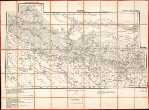
Nepal, with part of Tibet: N[orthern] T[rans] F[rontier] Sheets No. 15. 16. 22. 23.
$5,500.00
Acquire
- Digital Map Information
- Suitable for large format printing
- File Size: 261.1 MB
- Full resolution TIFF file
- ICC color profile embedded
- Delivered instantly via download link
This is a rare 1892 large-format dissected folding map of Nepal and nearby territories produced by the Survey of India. It is the first edition of the most complete and accurate 19th-century survey of Nepal, far exceeding earlier maps in detail and comprehensiveness. Produced during a period of inter-imperial competition in the Himalayas, this map is a product of equal parts espionage and exploration. (more details)