
Idaho - Montana - Wyoming (sold)
Pony Express Broadside.
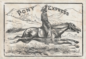
Pony Express.
sold
- Digital Map Information
- Suitable for large format printing
- File Size: 1593.38 MB
- File Type: ZIP / TIFF
- ICC color profile embedded
- Delivered instantly via download link
This is a large and dramatic c. 1860-61 xylographic broadside promoting the Pony Express - one of just two known surviving examples. Its striking size and visual grandeur are unmatched by any other Pony Express piece with which we are aware. Moreover, with a lifespan of just 18 months, and the general mystique driving interest the Pony Express, all such promotional material is of the utmost rarity and desirability. (more details)
Silver boomtown by the first African American Lithographer.
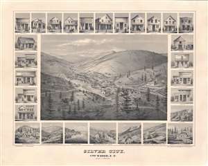
Silver City, Owyhee, I.T.
sold
- Digital Map Information
- Suitable for large format printing
- File Size: 52.62 MB
- File Type: ZIP / TIFF
- ICC color profile embedded
- Delivered instantly via download link
A remarkable 1866 bird's-eye view of Silver City, Idaho Territory, issued by Grafton Tyler Brown, America's first African American lithographer, and presenting the mining boomtown at its height of prosperity. Silver City experienced one of America's richest mineral strikes, producing gold and silver for more than 40 years. This view is one of only two known examples, significant not only for its historic illustration of a pop-up boomtown in full bloom, but also for being one of the few surviving views engraved and printed by Grafton T. Brown. Unlike many views, it has the unique distinction of being drawn from daguerreotype photographs taken by Philip Frederick Castleman, who visited with a supply caravan in 1866. (more details)
Unrecorded first state of a foundational map with extensive manuscript additions relating to American Indian Reservations established in 1867-8.
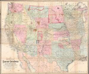
National Map of the Territory of the United States From The Mississippi River To The Pacific Ocean.
sold
- Digital Map Information
- Suitable for large format printing
- Full resolution TIFF file
- ICC color profile embedded
- Delivered instantly via download link
An extraordinary first-edition first-state example of William J. Keeler’s 1867 map of the Trans-Mississippi West - considered the finest post-Civil War railroad era map of the west - with unique manuscript annotations and additions relating to the American Indian Reservation System. This one of a kind historic document was likely the official example retained by the Indian Bureau, and possibly by Keeler himself, to administer and document the development of the American Indian Reservation system through the late 1860s. (more details)
Covered wagons in the Rockies - on the overland trail.

Our-Camp 62d Pine-Grove-Creek Rocky Mountains.
sold
- Digital Map Information
- Suitable for large format printing
- File Size: 86.98 MB
- File Type: ZIP / TIFF
- ICC color profile embedded
- Delivered instantly via download link
An exceptional discovery, this is a Daniel A. Jenks' original 1859 pen-and-ink drawing depicting a camp in the Platte Valley, in the Rocky Mountains of modern-day Wyoming, composed on his overland journey to California. It is part of a series of drawings Jenks composed trail-side covering his Transmississippi travels from 1849 to 1865. This is the only known example of one of Jenks' individual drawings appearing on the market. (more details)
The finest commercial map of Wyoming Territory issued at the height of the Wyoming Cattle Boom.
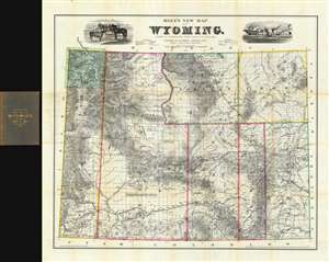
Holt's New Map of Wyoming.
sold
- Digital Map Information
- Suitable for large format printing
- File Size: 85.59 MB
- File Type: ZIP / TIFF
- ICC color profile embedded
- Delivered instantly via download link
A near flawless 1884 second edition of Holt's important and rare separate-issue map of Wyoming Territory. Issued at the height of the Wyoming Cattle Boom (Bubble), Holt's map is considered to be one of the finest maps of Wyoming and the earliest commercially published map to show the territory in significant detail. Throughout, the level of attention to accuracy is extraordinary, with individual residences, ranches, forts, Indian reservations, mining districts, resources, railroads, stage roads, and regular roads named. To the left and right the title, vignettes of cattle and a meat processing plant pay homage to the Wyoming Territory's then bourgeoning cattle industry. In the upper left corner of the map, Yellowstone National Park is mapped with care. (more details)
The quintessential trail map of the American west.
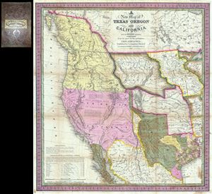
A New Map of Texas Oregon and California with the Regions Adjoining.
sold
- Digital Map Information
- Suitable for large format printing
- Full resolution TIFF file
- ICC color profile embedded
- Delivered instantly via download link
Considered 'the quintessential trail map of the American West' Samuel Augustus Mitchell's 'New Map of Texas Oregon and California' is one of the most important 19th century pocket maps ever issued. In Mitchell's own words This map comprises all that portion of ... (more details)
An exceptionally scarce variant of a cornerstone map of the American west and the finest of its era.
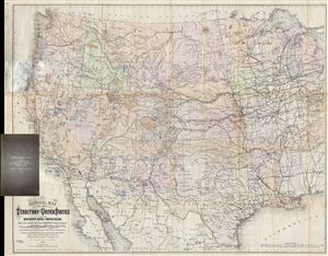
National Map of the Territory of the United States From The Mississippi River To The Pacific Ocean. Madeby the authority of the Hon. O. H. Browning Secretary of the Interior. In the Office of the Indian Bureau Chiefly For Government Purposes under the direction of the Hon. N.G. Taylor, Commisr. of Indian Affairsa and Hon. Chas E. Mix Chief Clerk of the Indian Bureau.
sold
- Digital Map Information
- Suitable for large format printing
- File Size: 46.46 MB
- File Type: ZIP / TIFF
- ICC color profile embedded
- Delivered instantly via download link
A map of the utmost importance and scarcity, this is William J. Keeler's 1868 pocket map of the American west, considered the 'the largest, finest and most detailed map of the West as it was then known.' The map covers from Detroit and Cincinnati westward to ... (more details)
Foundational Map of the Transmississippi.
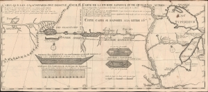
Carte que les Gnacsitares ont Dessine sur / Carte de la Riviere Longue et de quelques Autres qui se Dechargent dans le Grand Fleuve Missisipi.
sold
- Digital Map Information
- Suitable for large format printing
- File Size: 14.91 MB
- File Type: ZIP / TIFF
- ICC color profile embedded
- Delivered instantly via download link
A foundational and influential map, this is the 1703 first edition of Baron Louis-Armand de Lom d'Arce de Lahontan's seminal map of the westernmost Great Lakes, the Mississippi River, and its enigmatic tributary river, the Riviere Longue or Long River, extending westwards towards the Rocky Mountains. Although Baron de Lahontan's cartography has been severely criticized and considered apocryphal by some, it exerted a profound influence on other mapmakers of the era, including Herman Moll, John Senex, Henry Popple, and Guillaume Delisle. (more details)
Scarce, Superbly Detailed Map of the Northwestern Territories and States: First Detailed Map Naming the Wyoming Terrirory
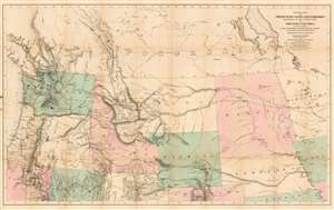
General Map of the North Pacific States and Territories Belonging to the United States and of British Columbia, Extending from Lake Superior to the Pacific Ocean and Between Latitude 39 degrees and 53 degrees North. Exhibiting Mail Routes, Gold Mines, and Including the Most Recent Surveys of the Topographical Bureau. Prepared by Captain John Mullan. ... Drawn by Edward Freyhold, T.E. Lithographed by J. Bien, 24 Vesey, St. N.Y.
sold
- Digital Map Information
- Suitable for large format printing
- File Size: 44.63 MB
- File Type: ZIP / TIFF
- ICC color profile embedded
- Delivered instantly via download link
This the 1865 Mullan - Freyhold map of the American Northwest. It shows the territories of Washington, Idaho, Montana, Wyoming, Dakota and Nebraska, and the State of Oregon in completion, and portions of California, Minnesota, Iowa, Kansas, Colorado, Utah and Nevada. The lithographed map - with hand wash color to distinguish the territories from one another - is beautifully executed and detailed. Carl Wheat esteemed this 'very fine' map so well that he chose it for the frontispiece of the fifth volume of Mapping the Transmississippi West. In discussing Freyhold, in particular, Wheat rhapsodizes:
Edwin (sic) Freyhold, who seems to have been responsible for the actual drawing of the topography, was an unrivaled expert in this type of work. His penned originals are almost unbelievably delicate, and must be examined with a powerful magnifying glass to be appreciated.Indeed, the map's details are superbly drafted and lithographed, with clear, legible typography and beautifully hachured mountains. The map, and the guide accompanying it, was intended to aid and encourage hopeful emigrants to the new territories of the northwest, particularly prospectors. The map relies heavily on data arising from Mullan's tenure as superintendent of construction for the northern military wagon road running from Walla Walla to Fort Benton on the upper Milk River, and indeed Wheat specifically praises the detail of its trails: Mullan's road is shown in its several variants, including Mullan' proposed (and rejected) route to Walla-Walla via Fort Laramie. Another route following the Yellowstone River west and crossing the mountains via Beaver Head Valley is indicated to the south of the Mullan road. Well-established U.S. Mail routes are shown in the southern part of the map. (more details)
Extraordinary Panorama showing the Route of the Mormon Pioneers and the Westward Expansion.
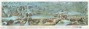
Route of the Mormon Pioneers from Nauvoo to Great Salt Lake.
sold
- Digital Map Information
- Suitable for large format printing
- File Size: 23.46 MB
- File Type: ZIP / TIFF
- ICC color profile embedded
- Delivered instantly via download link
This is an extraordinary and striking 1899 chromolithograph panoramic bird-eye view and map of the 1,300 mile Mormon Trail. This view, by Millroy and Hayes, covers the region between the Mississippi River and Great Salt Lake and chronicles the westward ... (more details)
A definitive map of the Pacific Northwest, considered by Wheat, 'really quite extraordinary.'
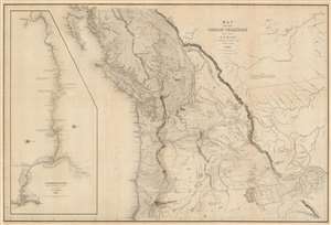
Map of the Oregon Territory by the U.S. Ex. Ex.
sold
- Digital Map Information
- Suitable for large format printing
- DPI: 600
- File Size: 59.51 MB
- File Type: ZIP / TIFF
- ICC color profile embedded
- Delivered instantly via download link
This important and extraordinary production is Commodore Wilkes' 1841 U.S. exploring expedition map of Oregon Territory, the finest and most important map of Oregon of the 19th century. The map covers roughly from the 50th parallel to Mount Shasta, the upper Sacramento River, and Great Salt Lake (Youta Lake) and from the Pacific to the Black Hills. It includes, either in part or full, modern day Washington, Oregon, British Columbia, Vancouver, Idaho, Utah, Nevada, Montana, Wyoming, and California. A large inset occupying the left quadrants focuses on the Columbia River where the United States exploring expedition lost one of its ships, the Peacock, on the infamous Columbia Bar. Topography is rendered by hachure and the engravers even made some attempt to illustrate the vast pine forests of the Pacific Northwest. (more details)
Early surveying expedition to the American West.
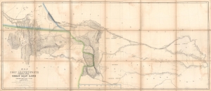
Map of a Reconnaissance between Fort Leavenworth and the Missouri River, and the Great Salt Lake in the Territory of Utah, made in 1849 and 1850…
sold
- Digital Map Information
- Suitable for large format printing
- Full resolution TIFF file
- ICC color profile embedded
- Delivered instantly via download link
A monumental map, matching the landscape it depicts, this is Howard Stansbury's seminal map of the lands between Fort Leavenworth, Kansas, and Pilot Peak (now Nevada), west of the Great Salt Lake. Originally published in 1852 as part of the Stansbury Report presented to the U.S. Congress that year, the present example is mounted on linen and folds into a case, as it was intended for a member of Congress. This is hand-down the finest example we've seen of this map, and if you are considering it for your collection, this is the one you want. (more details)
Indian Wars, gold and silver discoveries, and the construction of the Northern Pacific Railroad.
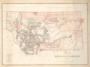
Montana Territory.
sold
- Digital Map Information
- Suitable for large format printing
- File Size: 77.64 MB
- File Type: ZIP / TIFF
- ICC color profile embedded
- Delivered instantly via download link
An impressive large scale 1879 map of Montana during its territorial period. It is one of the earliest obtainable maps of Montana Territory, covering its formative period during various Indian Wars, gold and silver discoveries, and the construction of the Northern Pacific Railroad. (more details)
A definitive map of the Pacific Northwest, considered by Wheat, 'really quite extraordinary.'
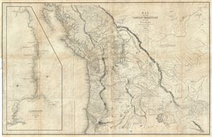
Map of the Oregon Territory by the U.S. Ex. Ex.
sold
- Digital Map Information
- Suitable for large format printing
- DPI: 300
- File Size: 29.57 MB
- File Type: ZIP / TIFF
- ICC color profile embedded
- Delivered instantly via download link
This important and extraordinary production is Commodore Wilkes' 1841 U.S. Exploring Expedition map of Oregon Territory. The map covers roughly from the 50th parallel to Mount Shasta, the upper Sacramento River, and Great Salt Lake (labeled Youta Lake) ... (more details)
Rare and dramatic Bird's-Eye View of Helena, Montana.
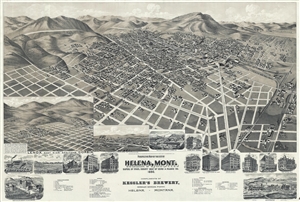
Perspective map of the city of Helena, Mont. Capital of State, county seat of Lewis & Clarke Co.
sold
- Digital Map Information
- Suitable for large format printing
- Full resolution TIFF file
- ICC color profile embedded
- Delivered instantly via download link
A dramatic bird's-eye view of Helena, Montana, issued by the Henry Wellge and the American Publishing Company in 1890. This impressive view is a fine example of Wellge's work, which is known for monumental size and emphasis of the horizontal dimension. ... (more details)
Striking chromolithograph of Yellowstone!
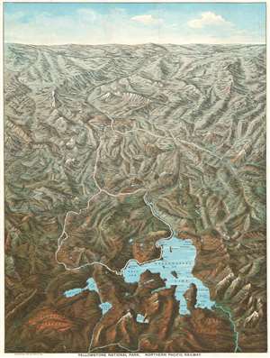
Yellowstone National Park. Northern Pacific Railway.
sold
- Digital Map Information
- Suitable for large format printing
- Full resolution TIFF file
- ICC color profile embedded
- Delivered instantly via download link
This is an 1895 Charles S. Fee chromolithograph bird's-eye view map of Yellowstone National Park, Wyoming. With Yellowstone Lake in the foreground, the view extends northward as far as Bozeman and Livingston, Montana. Fee includes impressive detail throughout, identifying mountains, plateaus, lakes, geyser basins, and hot springs. Yellowstone landmarks, such as Elephant Back, the Grand Canyon, and Old Faithful (in the Upper Geyser Basin), are labeled. The Lake Hotel, Fountain Hotel, Canon Hotel, and Mammoth Hot Springs Hotel all appear. The Yellowstone River snakes its way through the park and roads (colored white, so they stand out) wind their way from north to south. The Northern Pacific Railway runs across the top of the view and south from Livingston to Cinnabar, just outside Yellowstone. (more details)
First edition of Montana's revolutionary railroad map.
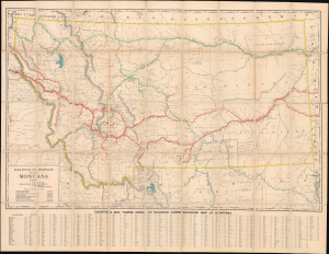
Railroad Commission Map of Montana.
sold
- Digital Map Information
- Suitable for large format printing
- File Size: 116.44 MB
- File Type: ZIP / TIFF
- ICC color profile embedded
- Delivered instantly via download link
A rare 1908 large format first edition railroad map of Montana issued for the Railroad Commission - possibly the best map of Montana to be issued in the first ten years of the 20th century. The map covers all of Montana and parts of the adjacent lands in considerable detail, naming towns, Indian Reservations, rivers, National Forests, Battlegrounds, Indian Agencies, counties, and, of course, railroads. Along the bottom, roughly 1,000 towns are identified and referenced. (more details)
Early Depiction of Native Americans on the Upper Missouri.
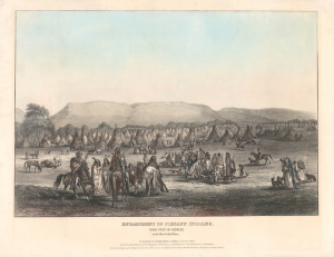
Encampment of Piekann Indians. Near Fort McKenzie on the Muscleshell River.
sold
- Digital Map Information
- Suitable for large format printing
- File Size: 17.25 MB
- File Type: ZIP / TIFF
- ICC color profile embedded
- Delivered instantly via download link
This is a rare 1842 view of an encampment of Piegan Blackfeet near Fort McKenzie, a trading post on the Upper Missouri River in today's Montana. It is based on an 1833 drawing by Karl Bodmer, a member of a scientific expedition to the American frontier led by the German naturalist Prince Maximilian of Wied-Neuwied, whose dramatic, colorful portrayals of Plains Indians were among the earliest to become widely known in both America and Europe. (more details)
Early Silkscreened Example: Yellowstone National Park during the New Deal.
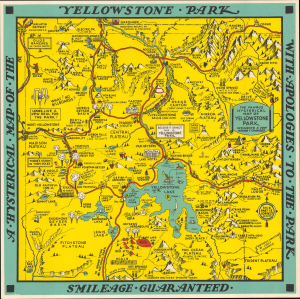
A Hysterical Map of the Yellowstone Park with Apologies to the Park. Smilage Guaranteed. / The Famous Hysterical Map of Yellowstone Park Including a few minor? Changes.
sold
- Digital Map Information
- Suitable for large format printing
- File Size: 13.58 MB
- File Type: ZIP / TIFF
- ICC color profile embedded
- Delivered instantly via download link
A cheerful 1936 pictorial map of Yellowstone Park, 'hatched and scratched' by the American printer and humorist Jolly Lindgren - here in a rare early larger-sized, hand-silkscreened, never-folded exemplar. (more details)
A scarce and incredibly charming pictorial map of Yellowstone National Park.
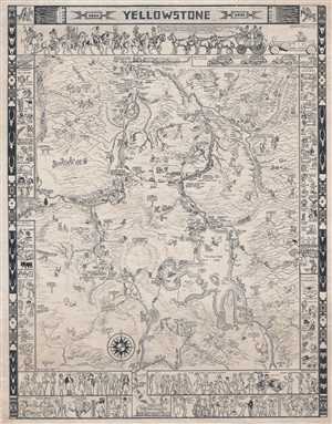
This is a scare 1935 Jo Mora pictorial map of Yellowstone National Park. The map depicts the park in detail from West Yellowstone, Montana to the east entrance to the park and from Gardiner, Montana to the park's south entrance. Signposts included ... (more details)
A tribute to the Pacific Railroad and the conquest of the American West.
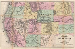
Williams' New Trans-Continental Map of The Pacific R.R. and Routes of Overland Travel to Colorado, Nebraska, The Black Hills, Utah, Idaho, Nevada, Montana, California and the Pacific Coast.
sold
- Digital Map Information
- Suitable for large format printing
- File Size: 30.27 MB
- File Type: ZIP / TIFF
- ICC color profile embedded
- Delivered instantly via download link
A scarce and exceptionally attractive first edition example of Henry Williams' 1876 map of the Pacific Railroad. Centered on the line of the Pacific Railroad as it travels westward across the continent to California, this map covers from Omaha, ... (more details)
Extraordinary panorama illustrating the route of the Mormon pioneers and the westward expansion.
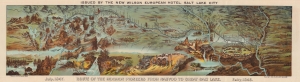
Route of the Mormon Pioneers from Nauvoo to Great Salt Lake.
sold
- Digital Map Information
- Suitable for large format printing
- Full resolution TIFF file
- ICC color profile embedded
- Delivered instantly via download link
This is a beautiful 1899 chromolithograph panoramic bird-eye view map of the 1,300-mile Mormon Trail. It is one of the finest illustrations of the Mormon migration ever published. (more details)
Free land to the 1,000,000!
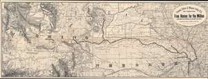
Fremont, Elkhorn and Missouri Valley R.R. and Connections, to the Free Homes for theMillion in Northwestern Nebraska and Southwestern Dakota. / The Elkhorn Valley Line to Northern Nebraska, Central Wyoming and The black Hills.
sold
- Digital Map Information
- Suitable for large format printing
- Full resolution TIFF file
- ICC color profile embedded
- Delivered instantly via download link
This is an impressive and highly detailed 1886 Rand McNally map of Wyoming, Dakota, and Nebraska issued to promoted migration to free 'government lands' in the west. It also illustrates the route of the important Fremont, Elkhorn and Missouri Valley Railroad. (more details)
'An Excellent Map' -Wheat
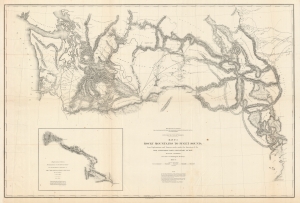
Map No. 3 Rocky Mountains to Puget Sound; from Explorations and Surveys Made Under the Direction of the Hon. Jefferson Davis Secretary of War.
sold
- Digital Map Information
- Suitable for large format printing
- File Size: 105.16 MB
- File Type: ZIP / TIFF
- ICC color profile embedded
- Delivered instantly via download link
This is a superb example of the map detailing Isaac Stevens' 1853-1854 reconnaissance of a railway route through the Rocky Mountains to the Pacific. This was part of a broad United States effort to determine a workable rail route to the Pacific through the Rockies, in the hope of opening Asian markets to American trade. Stevens, then en route to take up his new role as governor and Superintendent of Indian Affairs for the Washington Territory, successfully bid to undertake this survey of the route, which was executed over most of 1853 and part of 1854. (more details)
Scarce map illustrating early fur trading outposts.
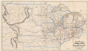
A New Map of the Great West.
sold
- Digital Map Information
- Suitable for large format printing
- File Size: 10.96 MB
- File Type: ZIP / TIFF
- ICC color profile embedded
- Delivered instantly via download link
An uncommon and fascinating map of the American Midwest drawn by Erastus Flavel Beadle in 1856. The map extends from Ohio to the Rocky Mountains and from Canada to Texas' northernmost border, including all of the Great Lakes, and early configurations of Nebraska, Kansas, and Minnesota Territories. East of the Mississippi, the map offers a detailed accounting of the railroad system, with individual lines named. West of the Mississippi, the map focuses on American Indian groups, topography, river systems, and trading posts. The routes taken by John Fremont and Stephen W. Kearny are noted. (more details)
The only commercial atlas map to specifically illustrate Nebraska territory at its ephemeral fullest.
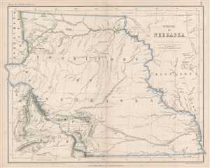
Territory of Nebraska.
sold
- Digital Map Information
- Suitable for large format printing
- File Size: 4.79 MB
- File Type: ZIP / TIFF
- ICC color profile embedded
- Delivered instantly via download link
This is a rare 1857 Henry Darwin Rogers map of the ephemeral Nebraska Territory at its fullest, extending from Kansas to the Canadian border. Few maps illustrate Nebraska in this form, and most of those only as part of a larger map. The ... (more details)
Overview of Montana's early railroad development.
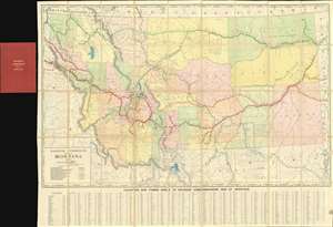
Railroad Commission Map of Montana.
sold
- Digital Map Information
- Suitable for large format printing
- Full resolution TIFF file
- ICC color profile embedded
- Delivered instantly via download link
A rare 1910 large format railroad map of Montana issued for the Railroad Commission - possibly the best map of Montana to be issued in the first ten years of the 20th century. The map covers all of Montana and parts of the adjacent lands in considerable detail, naming towns, Indian Reservations, rivers, National Forests, Battlegrounds, Indian Agencies, counties, and of course, railroads. Along the bottom, roughly 1,000 towns are identified and referenced. (more details)
Colorful Geological survey view of the Black Hills height of the Black Hills Gold Rush!
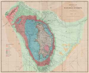
Geological Map of the Black Hills of Dakota.
sold
- Digital Map Information
- Suitable for large format printing
- File Size: 19.2 MB
- File Type: ZIP / TIFF
- ICC color profile embedded
- Delivered instantly via download link
This is an 1879 Henry Newton geological map of the Black Hills during the height of the Black Hills Gold Rush. The Black Hills are a spectacular mountain range in the northern plains states of South Dakota and Wyoming. Per Carl Wheat, ... (more details)
1852 Stansbury Map of the Great Salt Lake to Fort Leavenworth Route (Colorado, Utah, Wyoming, Kansas
A seminal mapping of the emigrant roads west.
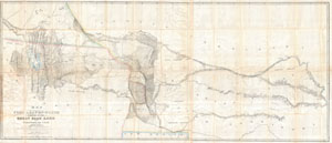
Map of a Reconnoissance between Fort Levenworth and the Missouri River, and the Great Salt Lake in the Territory of Utah, made in 1849 and 1850 …
sold
- Digital Map Information
- Suitable for large format printing
- DPI: 300
- File Size: 51.86 MB
- File Type: ZIP / TIFF
- ICC color profile embedded
- Delivered instantly via download link
It had been a daring feat of exploration, succeeding where the mountain men had all failed, and by means of his map ... Stansbury had painted at least one more bold stroke into the unfinished portrait of the national landscape. - ... (more details)
A seminal mapping of the emigrant roads west.
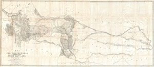
Map of a Reconnoissance between Fort Levenworth and the Missouri River, and the Great Salt Lake in the Territory of Utah, made in 1849 and 1850 …
sold
- Digital Map Information
- Suitable for large format printing
- DPI: 300
- File Size: 55.59 MB
- File Type: ZIP / TIFF
- ICC color profile embedded
- Delivered instantly via download link
It had been a daring feat of exploration, succeeding where the mountain men had all failed, and by means of his map ... Stansbury had painted at least one more bold stroke into the unfinished portrait of the national landscape. - ... (more details)
Focusing on Lewis and Clark's Crossing of the Rockies.
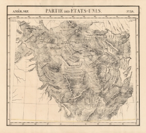
Amer. Sep. Partie des Etats-Unis No. 39.
sold
- Digital Map Information
- Suitable for large format printing
- DPI: 600
- File Size: 70.54 MB
- File Type: ZIP / TIFF
- ICC color profile embedded
- Delivered instantly via download link
This is Philipe Vandermaelen's revised 1827 map of the eastern Oregon Territory, capturing the mountainous region between the upper Missouri River and the headwaters of the Columbia River, which is now Idaho and the western parts of Montana and Wyoming. It was the largest-scale map of this region produced to date - 'no mapmaker had previously attempted to use such a large scale for any western American area.' (Wheat). Like all of the maps from Vandermaelen's Atlas, it is the also the first map of the region executed in lithograph. (more details)
Governor Stevens map of the proposed northern route of the Transcontinental Railroad.
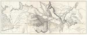
Explorations and Surveys for a Rail Road Route from the Mississippi River to the Pacific Ocean. War Department. Routes near the 47th and 49th Parallels. Milk R. to the Crossing of the Columbia R.
sold
- Digital Map Information
- Suitable for large format printing
- File Size: 33.43 MB
- File Type: ZIP / TIFF
- ICC color profile embedded
- Delivered instantly via download link
This is an 1855 Isaac I. Stevens map of the explorations to discover a proposed northern route of the transcontinental railroad. Carl I. Wheat considers this map so significant that he illustrates it in full. The map depicts from ... (more details)