
China - Japan - Korea
Bockscar's in-flight navigation map of Nagasaki Bombing.
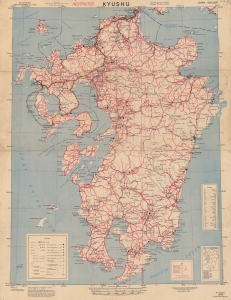
Recording one of the most significant moments in the 20th century, this is a 1945 U.S. Army Corps of Engineers 'Special Strike Map' of Kyushu, Japan, featuring manuscript notations tracing the inbound flight path of Bockscar during 'Fat Man' atomic bombing attack on Nagasaki, Japan, on August 9, 1945. This map was likely used by Bockscar's in-flight navigator James Van Pelt (1918 - 1994) to redirect the mission from the primary target, Kokura, to the secondary target, Nagasaki. (more details)
Largest and Most Detailed Early-19th Century Map of China.

This is a massive (98 x 134 in) 64-sheet 1832 wall map of Qing China, prepared by Dong Fangli and Li Zhaoluo. Building on administrative maps of the early-mid Qing, it represented the most detailed and accurate mapping of China and surrounding territories under Qing suzerainty produced in the early 19th century. (more details)
The first Chinese designed and issued commercial map.
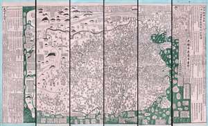
古今地舆全圖 / Full Modern and Ancient Map.
$65,000.00
Acquire
- Digital Map Information
- Suitable for large format printing
- Full resolution TIFF file
- ICC color profile embedded
- Delivered instantly via download link
A rare and important discovery, this is Mingjie Liu's (刘明杰) (1857 - 1911) important 1892 (Guangxu 18) Qing Era xylographic (woodcut) map of China - the earliest known example of what is considered China's first commercial map and possibly the first Chinese comical map. The map was revolutionary when Liu created it, as this was neither administrative nor religious; instead, it was a commercially marketed folk piece, muban nianhua (木版年画), created in Yangjiabu, Shandong, for traditional Chinese New Year festivals. Coverage extends to all of China, as well as marginal inclusions in the form of tenuous mappings of foreign places, including European countries, Southeast Asia, India, and apocryphal destinations. (more details)
First Municipal Council Maps - the origins of modern Shanghai.
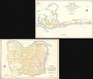
Plan of the English Settlement at Shanghae. / Plan of the Hong Kew (Hong Que.) or American Settlement, at Shanghae.
$45,000.00
Acquire
- Digital Map Information
- Suitable for large format printing
- Full resolution TIFF file
- ICC color profile embedded
- Delivered instantly via download link
The holy grail of Shanghai cartography, this 1866 map set is the most important, largest scale, and most beautiful early presentation of Shanghai. These are the first maps issued by the Shanghai Municipal Council, resulting from a landmark 1864-66 survey that followed the consolidation of the British Concession with the American Settlement. Their issue ended two decades of development lethargy and launched major urbanization and modernization projects that established Shanghai as the major gateway to China. As such, these maps, more than any other, represent the birth of Shanghai as a modern city. (more details)
First Buddhist map of the world.
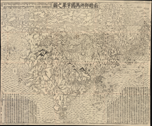
南瞻部洲萬國掌菓之圖 / Nansen bushū bankoku shōka no zu / [Map of the Countries in Jambudvipa].
$25,000.00
Acquire
- Digital Map Information
- Suitable for large format printing
- File Size: 187.54 MB
- File Type: ZIP / TIFF
- ICC color profile embedded
- Delivered instantly via download link
This is the seminal 1710 (Hoei 7) woodblock Buddhist world map composed by the monk Rokashi Hotan. It is the first Japanese printed map to depict the world, including Europe and America, from a Buddhist cosmographical perspective. Inspired by the 1653 publication of Si-yu-ki (or Xiyuji 西域記), a pilgrimage narrative of the Chinese monk Hsuang-Tsang's (or Xuanzang 玄奘, 602 - 604 CE) travels to India in search of sacred Sanskrit writings, it attempts to reconcile Buddhist and Western cartography. (more details)
'A masterpiece designed to give a general picture of the Old and New' - Old Maps of Korea
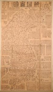
海左全図 [Haezwa Jeon-do / Map of the Country in the West of the Sea.]
$22,000.00
Acquire
- Digital Map Information
- Suitable for large format printing
- Full resolution TIFF file
- ICC color profile embedded
- Delivered instantly via download link
A rare discovery, this c. 1850 woodblock map is one of the few early Korean maps of Korea to be found outside of Korea. It is significant on many levels, being a record of Korea following the reign of King Sunjo (조선 순조; 1790 - 1834), a period when Korea was facing increased pressure from foreign powers, including Japan, Russia, and China. It is also significant for illustrating Korea's disputed island, Dokdo. (more details)
First map of the American Concession in Shanghai?
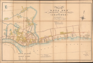
Plan of the Hong Kew (Hong Que.) or American Settlement, at Shanghae.
$19,000.00
Acquire
- Digital Map Information
- Suitable for large format printing
- File Size: 142.69 MB
- File Type: ZIP / TIFF
- ICC color profile embedded
- Delivered instantly via download link
A remarkable, rare, and highly detailed 1866 map of Hong Kew (Hongkou, 虹口区), or the American Concession in Shanghai - possibly the earliest known map to specifically illustrate the American Settlement. The map follows shortly after the formal establishment of the Concession and subsequent International Settlement in 1863 and details in manuscript the construction of subterranean drainage lines by the Shanghai Municipal Council. (more details)
Operational archive documenting the final preparations for the invasion of Okinawa, the last great amphibious campaign of World War II.
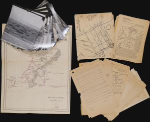
Okinawa Shima and Adjacent Islands. Screen Plan Okinawa--1. / U.S.S. Monrovia (APA-31) Amphibious Assault on Okinawa.
$18,000.00
Acquire
An extraordinary discovery and an even more improbable survival, this archive from the U.S.S. Monrovia preserves the operational record of the April 1, 1945, Invasion of Okinawa, the final great amphibious campaign of World War II (1939 - 1945). Comprising aerial reconnaissance photographs, operational maps, and briefing papers prepared as late as March 31, 1945, the collection captures the tense final hours before the assault. Few surviving archives so vividly illustrate the intelligence, planning, and meticulous coordination behind one of the most consequential military landings of the twentieth century. (more details)
First printed map to show Hong Kong in any form.
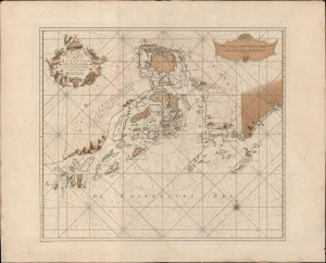
Pas-Kaart van het in en opkomen van de Rivier van Quantong aan de Zuid Kust van China strekkende van het eiland S. Joan, tot aan de Noorder Lemes, met alle tot hiertoe bekende ankerplaatzen, dieptens en droogtens.
$18,000.00
Acquire
- Digital Map Information
- Suitable for large format printing
- DPI: 600
- File Size: 828.08 MB
- File Type: ZIP / TIFF
- ICC color profile embedded
- Delivered instantly via download link
The rare 1753 Johannes II van Keulen / Jan de Marre nautical map of the Pearl River Delta (廣東河口海圖), including Macau (Macao), Lantao (Lantoan), Guangzhou (Quantong), and the first printed mapping of Hong Kong (Lantaon Falso). This rare map in fine original color was compiled for the sixth volume of the Zee-Fakkel - the legendary Dutch East India Company (VOC / Vereenigde Oostindische Compagnie) 'Secret Atlas.' (more details)
First separate map of the Pacific - in an exceptional old color example.
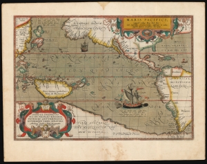
Maris Pacifici (quod vulgo Mar del Zur).
$17,500.00
Acquire
- Digital Map Information
- Suitable for large format printing
- Full resolution TIFF file
- ICC color profile embedded
- Delivered instantly via download link
This is Abraham Ortelius' 1589 map of the Pacific; here is the best example to appear on the market in recent years, with a strong strike and fine original color. Abraham Ortelius' map is as important as it is beautiful - Burden hailed it as 'one of the most important maps that appeared in the Ortelius atlases' and 'one of Ortelius' most desirable maps'. The map is not only the first to focus on the Pacific Ocean, but it is also the first acquirable map to separately identify North and South America. (more details)
Shanghai at the height of the 'Concession Period.'
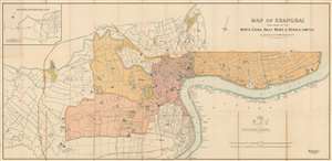
Map of Shanghai Published by the North-China Daily News and Herald, Limited.
$17,500.00
Acquire
- Digital Map Information
- Suitable for large format printing
- File Size: 62.63 MB
- File Type: ZIP / TIFF
- ICC color profile embedded
- Delivered instantly via download link
An extremely rare 1918 North-China Daily News and Herald map of Shanghai, China. Focusing on the Bund and the International Settlement, the map extends from the Shanghai Hangchow Ningpo Railroad in the west to Post Garden and the Standard Oil facility in the east. Derived roughly from the Municipal Council Map of the same year, this map is intensely detailed, with streets, businesses, clubs, parks, government offices, and civic institutions noted. Just outside the International Settlement boundary the Shanghai Jewish Club is noted. (more details)
First printed map of the Western Hemisphere in one of its earliest printings.
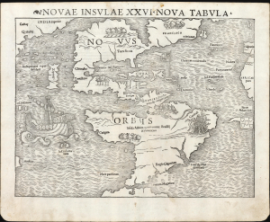
Novae Insulae XVII Nova Tabula.
$12,500.00
Acquire
- Digital Map Information
- Suitable for large format printing
- Full resolution TIFF file
- ICC color profile embedded
- Delivered instantly via download link
This is a superb example of Sebastian Münster's 1540 map of America, the first printed map of the Western Hemisphere. It is the first map to name the Pacific Ocean and the Straits of Magellan, and among the earliest acquirable maps to show and name Japan (Zipangri, located surprisingly close to America). This is the 2nd state of the map from the 1545 3rd printing of Geographia, marking this map as one of the handful printed during Münster's lifetime. (more details)
The first official Japanese regional map using western cartographic technology. A wonder of copper engraving!

峨羅斯及亞西亞ノ圖 / [Map of Russia and Asia].
$12,000.00
Acquire
- Digital Map Information
- Suitable for large format printing
- File Size: 109.25 MB
- File Type: ZIP / TIFF
- ICC color profile embedded
- Delivered instantly via download link
An extraordinary 1867 (Keio 3) map of Siberia and Alaska illustrates a moment of cultural collision and transformation. Printed in Japan using a remarkable multi-color copperplate process, the map is a conic projection covering Asia from the Caspian Sea to the Bering Strait. It extends farther east to include Alaska, and south to encompass Nepal, Korea, Tibet, most of China, and all of Japan. This is the first Japanese regional map to incorporate contemporaneous western cartographic technology for official strategic and military use. (more details)
Oldest map of any part of Shanghai.
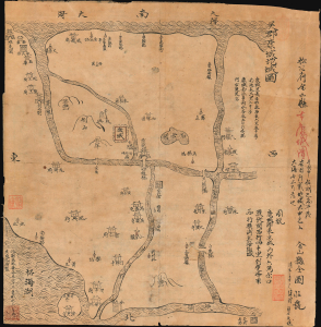
Regional map of Wujun Kangcheng. / 吳郡康城地域圖 / Full map of Jinshan County. 金山縣全圖
$12,000.00
Acquire
- Digital Map Information
- Suitable for large format printing
- File Size: 9.32 MB
- File Type: ZIP / TIFF
- ICC color profile embedded
- Delivered instantly via download link
This is an extraordinary Qing-era Chinese manuscript map by Huang Tingxi (黄廷熙) illustrating Jinshan County, today the Jinshan District of Shanghai Municipality, as it was c. 322 AD / CE. Much of the territory depicted here is underwater today, but this map nonetheless represents the earliest specific cartographic representation of the Shanghai region. (more details)
Imperial Struggle for the Manchu Homeland
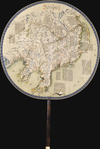
東三省俄部邊防全省圖說 / [Illustrated Description of the Russian Section of the Three Eastern Provinces for Border Defense].
$11,000.00
Acquire
- Digital Map Information
- Suitable for large format printing
- Full resolution TIFF file
- ICC color profile embedded
- Delivered instantly via download link
This is a stunning c. 1900 manuscript fan map of Manchuria prepared by a group of Qing military officers led by one surnamed Ren. Demonstrating astonishingly fine and meticulous workmanship, it covers the border region of Manchuria at a time when Qing rule of their Manchu homeland was greatly imperiled by both the Russian Empire and Imperial Japan. (more details)
Japanese diplomatic and propaganda con-job on the Qing.
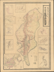
Detailed Map of Taiwan Field Survey. / 實地踏測台灣詳密地圖
$11,000.00
Acquire
- Digital Map Information
- Suitable for large format printing
- Full resolution TIFF file
- ICC color profile embedded
- Delivered instantly via download link
This 1895 Nakamura Yoshimatsu map of Taiwan is one of the most unsung but influential examples of persuasive cartography ever published. The large-scale map of Taiwan appeared at the end of the First Sino-Japanese War (August 1, 1894 - April 17, 1895), just prior to the Treaty of Shimonoseki (April 17, 1895) and the Japanese invasion of Taiwan (May 29, 1895 - October 21, 1895). The map, attributed to a likely fictional British naval officer named John Waters, employs creative cartography to reshape Taiwan, while retaining the overall area, effectively reducing the size of Qing-controlled Formosa and increasing the size of the ungoverned 'savage zones' - a ploy that played into the Japanese position that the Qing did not truly possess the island. It was likely presented at the Shimonoseki negotiations, where the Japanese were able to take advantage of Qing China's infamous lack of cartographic knowledge about Formosa to formally seize the island. This is the first edition of this map, published on January 20, 1895. It also accompanies the booklet Taiwan-tō Chishi-yō (臺灣島地誌撮要), a combination gazetteer of Taiwan and historiographical justification of the Japanese seizure of the island using Confucian political morality and just-war rhetoric. (more details)
Extremely Rare Italian map of Southeast Asia.
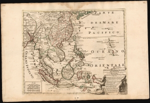
Penisola Dell Indie Orientali De La Del Gange Con Tutte l'Isole cosi Filippine della Sondaq, Ceilan, e Moluche Altre, seconde le Relationi piu moderne descritta da Nicolo De Fer.
$9,500.00
Acquire
- Digital Map Information
- Suitable for large format printing
- File Size: 26 MB
- File Type: ZIP / TIFF
- ICC color profile embedded
- Delivered instantly via download link
This is an exceptionally rare and beautifully engraved 1717 map of Southeast Asia by Neapolitan engraver Paolo Petrini, published in the composite atlas Atlante Partenopeo. Dated 1717, it presents Southeast Asia, the Philippines, and the East Indies after the cartography of the French mapmaker, Nicolas De Fer. (more details)
Issued in the final days of Old Shangai just after the January 28 Incident or Shanghai Incident.
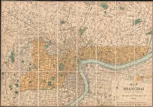
Map of Shanghai.
$9,000.00
Acquire
- Digital Map Information
- Suitable for large format printing
- File Size: 66.6 MB
- File Type: ZIP / TIFF
- ICC color profile embedded
- Delivered instantly via download link
An extremely rare 1933 North-China Daily News and Herald map of Shanghai. Focusing on the Bund and the International Settlement, the map extends from the Shanghai Hangchow Railroad in the west to the Shanghai Baptist College (now the University of Shanghai) in the east. Derived roughly from the Municipal Council Map of the same year, this map is in intensely detailed, with streets, businesses, clubs, parks, government offices, and civic institutions noted. This map was issued shortly after the 1932 Shanghai Incident in the final days of Shanghai's pre-war boomtime. (more details)
Making Light of Perry's Gunboat Diplomacy.
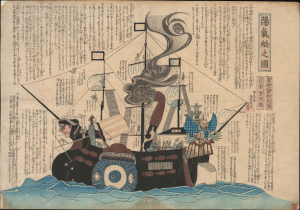
陽氣舩之圖 / [View of the Merry Ship].
$6,500.00
Acquire
- Digital Map Information
- Suitable for large format printing
- Full resolution TIFF file
- ICC color profile embedded
- Delivered instantly via download link
This is a rare c. 1854 kawaraban satirical woodblock print, produced by the pseudonymous Kanoka Mamaro (寒翁窠馬麿), depicting one of Commodore Matthew Perry's 'black ships.' It demonstrates that, even amid a strict regime of censorship, Japanese publishers sought to profit by informing and entertaining the public, including with irreverent takes on the historically significant events underway. (more details)
Foreigners so strange.
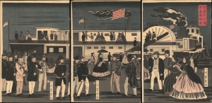
亜墨利加國蒸気車往來 / [The Comings and Goings of an American Steamship].
$5,500.00
Acquire
- Digital Map Information
- Suitable for large format printing
- Full resolution TIFF file
- ICC color profile embedded
- Delivered instantly via download link
This is Utagawa Yoshikazu's 1861 ukiyo-e woodblock triptych of an American steamship and passengers at Yokohama, an intriguing depiction of foreigners in Japan from the early days after Yokohama's opening as a treaty port. It is notable for reflecting both the curiosity of Japanese artists about the new arrivals and their imperfect understanding of these visitors. (more details)
Most visually engaging atlas map of the world from the early Colonial period.
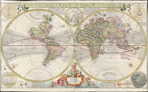
A New and Correct Map of the World Laid Down According to the Newest Discoveries, and from the Most Exact Observations, by Herman Moll Geographer.
$5,500.00
Acquire
- Digital Map Information
- Suitable for large format printing
- Full resolution TIFF file
- ICC color profile embedded
- Delivered instantly via download link
This is Herman Moll's 1707 / 1726, large-format double-hemisphere map of the world. It is the largest and most visually entertaining English atlas map of the world from the early Colonial period; it captures a view of the world in the midst of a transformation from the state of the art of the 17th century to a more scientifically focused style of cartography. The new mode - predominantly French - dominates the map: ironic, given Moll's adopted English chauvinism. (more details)
First European Atlas map specifically of China.
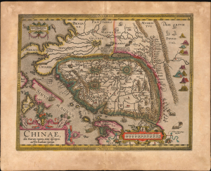
Chinae, olim Sinarum regionis, nova descriptio. auctore Ludovico Georgio.
$5,500.00
Acquire
- Digital Map Information
- Suitable for large format printing
- Full resolution TIFF file
- ICC color profile embedded
- Delivered instantly via download link
This is Abraham Ortelius' 1584 map of China, the first specific map of China, Southeast Asia, and the Philippines to appear in an atlas, here in an original-color example of a 1608 Vrients edition. This is the first printed European map of China and first atlas map to name the Philippines as an archipelago. This map remained definative regional map until superceded in 1655 maps of Martino Martini (卫匡国; 1614 - 1661). (more details)
Suppressed and groundbreaking first edition!
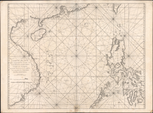
Carte Plate Qui comprend les Coste de Tsiompa, de la Cochinchine, le Golfe de Tunquin, une partie des Costes de la Chine aves une partie de l'Archipel des Isles Philippines.
$5,500.00
Acquire
- Digital Map Information
- Suitable for large format printing
- File Size: 47.63 MB
- File Type: ZIP / TIFF
- ICC color profile embedded
- Delivered instantly via download link
This is the exceedingly rare 1745 nautical map of the South China Sea and the Philippines, which appeared in Mannevillette's banned first edition of his groundbreaking nautical atlas, the Neptune Oriental. When published, this chart represented the finest available cartography of the South China Sea, Southeast China Coast, and the Philippines - thus defining the Canton-Macao-Manila triangle. It was so accurate that French authorities, fearing for the security of their colonial empire, ordered all examples banned and destroyed. The map is additionally notable for its early and idiosyncratic inclusion of various islands, banks, and atolls in the area, many of which have become hotly disputed in recent decades. (more details)
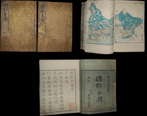
Entitled Kokugun Zenzu and printed c. 1838 (Tenpo 9), this is an early Japanese atlas of exceptional rarity, beauty and importance. Compiled by Motonobu Aoo and Toshiro Eirakayu based upon the works of Japan's 18th century master cartographer Ino Tadataka, this set ... (more details)
Tokyo's Foreign Quarter in the Early Meiji Period.
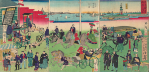
東京繁榮流行の往来 / [The Comings and Goings of Prosperity and Fashions in Tokyo].
$4,500.00
Acquire
- Digital Map Information
- Suitable for large format printing
- Full resolution TIFF file
- ICC color profile embedded
- Delivered instantly via download link
This is an 1870 ukiyo-e depiction of the Tsukiji neighborhood of Tokyo, drawn by Utagawa Hiroshige III and published by Masadaya Heikichi. It displays the neighborhood just months after it was designated as the foreign residence quarter of Tokyo following the Meiji Restoration, emphasizing the rapid importation of foreign technologies, fashion, and manners. (more details)
Planning the Colonial Capital.
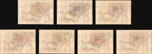
附圖第一號 京城都市計畫區域圖, 附圖第二號 京城都市計畫地域圖... / [Appendix Map No. 1. Keijo Capital City Plan Area Plan, Appendix Map No. 2. Keijo Capital City Plan Land Use Map...].
$4,500.00
Acquire
- Digital Map Information
- Suitable for large format printing
- Full resolution TIFF file
- ICC color profile embedded
- Delivered instantly via download link
This is a set of seven large-format c. 1925 planning maps of Seoul (Keijō), produced during the Japanese colonial period. Together, they constitute a remarkable survival from the Japanese colonial era and provide a window into a forgotten chapter in the history of one of the world's largest cities. (more details)
First modern Chinese map of Beijing.
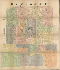
Capital City Inside and Out. / 京都市內外城地圖 / Jing dushi neiwaicheng ditu.
$4,500.00
Acquire
- Digital Map Information
- Suitable for large format printing
- Full resolution TIFF file
- ICC color profile embedded
- Delivered instantly via download link
This is an important ROC (Republic of China) 5 (民國五年), or 1916 map of Beijing, prepared by the municipal government for administrative purposes. This map, the first truly sophisticated Chinese map of Beijing, was the definitive city plan for roughly 20 years until it was superseded in 1936. The map covers the old walled center of Beijing, including the Imperial City, Forbidden City, Tartar City, and Chinese City. (more details)
Internal WWII power struggle between the Japanese Navy and Army.
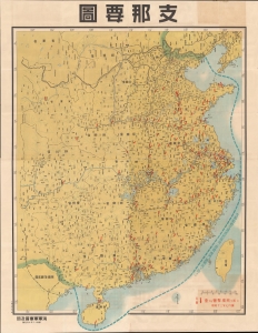
支那要圖 / [Map of China].
$4,000.00
Acquire
- Digital Map Information
- Suitable for large format printing
- File Size: 237.76 MB
- File Type: ZIP / TIFF
- ICC color profile embedded
- Delivered instantly via download link
This enormous 1938 wall map of China was produced by the propaganda arm of the Imperial Japanese Navy to document bombing raids. It is also propaganda vehicle related to the power struggle between the Japanese Army and Navy and their tussle for influence with the government, the Supreme War Council (軍事参議院), and the Emperor. The outcome of this struggle - in favor of the navy - ultimately came to define the Japanese Pacific War strategy. Of note, given this map's rarity and lack of publication information typical of the period (indicating both printing and publication dates), it is evident that this map was produced exclusively for internal naval use. (more details)
Japan's First True Railway.
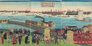
東京高輪海岸蒸氣車鐵道圖 / [Steam Train on the Railway along the Tokyo-Takanawa Coastline].
$4,000.00
Acquire
- Digital Map Information
- Suitable for large format printing
- Full resolution TIFF file
- ICC color profile embedded
- Delivered instantly via download link
A remarkable view of Japan's first modern railway, this ukiyo-e woodblock triptych was drawn by Utagawa Hiroshige III and published by Tsunajima Kamekichi in 1871. (more details)
The Rapid Expansion of Yokohama.
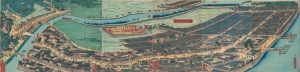
再改橫濱風景 / [Up-to-date View of Yokohama].
$4,000.00
Acquire
- Digital Map Information
- Suitable for large format printing
- Full resolution TIFF file
- ICC color profile embedded
- Delivered instantly via download link
This is a stunning 1861 panoramic set of six ukiyo-e (nishiki-e) Utagawa Sadahide woodblock prints depicting the port of Yokohama. The port opened to foreign trade in 1859, just two years earlier, becoming Japan's primary point of contact with the West. Sadahide was the most prolific among a school of woodblock artists chronicling these momentous changes. (more details)
Targeting map for the invasion of Iwo Jima.
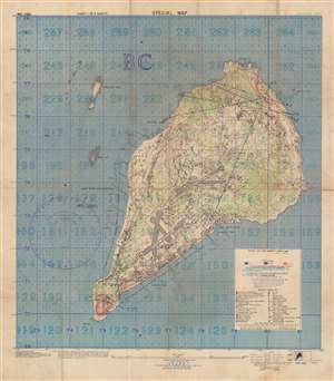
Special Air and Gunnery Target Map. Iwo Jima.
$4,000.00
Acquire
- Digital Map Information
- Suitable for large format printing
- File Size: 94.09 MB
- File Type: ZIP / TIFF
- ICC color profile embedded
- Delivered instantly via download link
This is a 1944 U.S. Navy map of Iwo Jima prepared for the American Invasion of Iwo Jima - one of the most hard-fought battles in World War II's Pacific Theater. The map is the smaller but broader of two maps issued by the U.S. Navy for the invasion, and in this case, is intended as a gunnery and targeting map. The smaller size, likely made it more practical in the field, while the larger scope, allowed for a wider targeting range. (more details)
Passion for foreign technology.
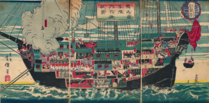
獨逸國軍艦内郭機械圖 / [Drawing of the Internal Workings of a German Navy Ship].
$3,500.00
Acquire
- Digital Map Information
- Suitable for large format printing
- Full resolution TIFF file
- ICC color profile embedded
- Delivered instantly via download link
A scarce c. 1874 ukiyo-e (more specifically, nishiki-e) triptych depicting lively scenes aboard a German naval ship, prepared by the artist Unsen. It is an example of Japan's flourishing interest in foreign technology and practices in the early Meiji period and specifically represents the special connection between the Prussian-led German Empire and the Empire of Japan. (more details)