
West Indies - Caribbean (sold)
First detailed, printed map specifically of South America.
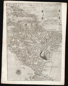
La descrittione di tutto il Peru.
sold
- Digital Map Information
- Suitable for large format printing
- DPI: 600
- File Size: 42.91 MB
- File Type: ZIP / TIFF
- ICC color profile embedded
- Delivered instantly via download link
A superb, untrimmed, first-state example of Paolo Forlani's rare 1562 map of South America. It is the first large-scale, accurate printed map of the southern part of the Americas and is the only map of South America to be produced in the 'Lafreri School' of mapmaking. It is among Forlani's greatest works, and is a prize map not only for collectors of South America in particular, but also the Caribbean, Florida and Bermuda. Through its connection to the 1562 map of Diego Gutiérrez, it offers the most direct available link to contemporaneous Spanish mapping of her American colonies obtainable. (more details)
First printed nautical chart of the Gulf of Mexico and Florida.
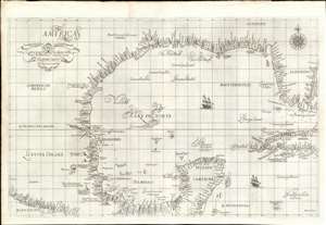
Carta particolare della Baia di Messico con la Costa.
sold
- Digital Map Information
- Suitable for large format printing
- Full resolution TIFF file
- ICC color profile embedded
- Delivered instantly via download link
A seminal production, this is a fine first-edition, first-state example of Sir Robert Dudley's 1645 - 47 maritime map of the Gulf of Mexico, the first printed nautical chart of that region. It is also the first to be printed using Mercator's Projection - thus making it the first to be practical for actual navigation. Likewise it is also the first to accurately indicate prevailing winds and ocean currents in the Gulf. Coverage extends from the Pacific Coast of Mexico to eastern Florida, and from Galveston Bay (Texas) to modern day Belize and the Bay of Honduras), inclusive of the Yucatan Peninsula and western Cuba. The whole is stunningly engraved in Antonio Francesco Lucini's masterful Italian baroque hand, complete with fine calligraphy and idiosyncratic styling. (more details)
Slave-suppression Masterplan.
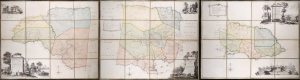
To the Right Honorable Robert Earl of Holdernesse, this map of the County of Cornwall, in the Island of Jamaica. (laid down from the papers, and under the direction of Henry Moore Esqr. His Majesty's Lieutenant Governor, and Commander in Chief of that Island, in the years 1756,-57,-58,-59,-60, and 61, and from a great number of actual surveys performed by the publishers) is humbly inscribed. / To the Right Honorable Wills Earl of Hillsborough, First Lord Commissioner of Trade and Plantations, this map of the County of Middlesex, in the Island of Jamaica. (laid down from the papers, and under the direction of Henry Moore Esqr. His Majesty's Lieutenant Governor and Commander in Chief of that Island in the years 1756,-57,-58,-59,-60, and 61, and from a great number of actual surveys performed by the publishers) is humbly inscribed. / To the Right Honorable George Grenville Esqr. First Lord Commissioner of the Treasury, Chancellor and under Treasurer of the Exchequers and c. and c. This map of the County of Surry, in the Island of Jamaica. (laid down from the papers and under the direction of Henry Moore Esqr. His Majesty's Lieutenant Governor and Commander in Chief of that Island in the years 1756,-57,-58,-59,-60, and 61, and from a great number of actual surveys performed by the publishers)is humbly inscribed.
sold
A seminal production, this is the 1763 Craskell-Simpson map of Jamaica, in three parts. It is the first broadly accurate map of Jamaica and the template for most subsequent representations of the island until the Roberston map of 1804. More importantly, the Craskell-Simpson map is best understood as a response to Tacky's Rebellion (April 1760 - October 1761) and, as such, is a masterplan for slave suppression. The map was commissioned by Henry Moore (1714 - 1769), who also, ironically, commissioned the Ratzer plan of New York, then likewise on the cusp of rebellion. It is the only work (either written or graphic) that records virtually every plantation and pen (large farms) in Jamaica at the height of the island's sugar boom, when it was the most valuable possession of the British Empire. (more details)
One of the first dedicated maps of South America, and the first to hint at the location of El Dorado.
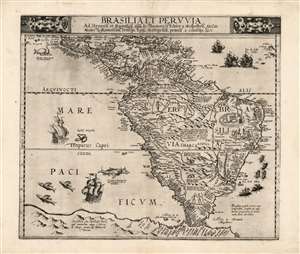
Brasilia et Peruvia.
sold
- Digital Map Information
- Suitable for large format printing
- Full resolution TIFF file
- ICC color profile embedded
- Delivered instantly via download link
This is Cornelis De Jode's 1593 map of South America, the second, full-size map of the area to appear in an atlas, predated only by the 1578 map produced by his father, Gerard De Jode. This rare map, printed in a single edition, outstripped contemporaneous efforts by De Bry and Ortelius in terms of accuracy and beauty. The map covers from Central America and the Caribbean to embrace all of South America; beyond the Strait of Magellan Tierra del Fuego appears, not as a small island or archipelago but extending into a massive 'Terra Australis.' The Amazon River is shown, along with the notation that its denizens practiced cannibalism (Vespucci's sensationalistic description to this effect had long legs; note also the cannibal scene adorning Brazil.) (more details)
The only known example of Grierson's 1732 piracy of Herman Moll's Codfish Map of North America.
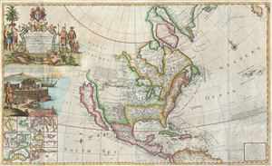
To His Grace Hugh, Lord Archbishop of Armagh, Primate and Metropolitan of all Ireland and One of the Lords Justices of the said Kingdom this map of North America According to the Newest and most Exact Observations is most humbly Dedicated by your Graces most humble Serv: Geo: Grierson.
sold
- Digital Map Information
- Suitable for large format printing
- Full resolution TIFF file
- ICC color profile embedded
- Delivered instantly via download link
An antique map discovery of the utmost rarity. Ostensibly, this is a fine example of Hermann MollÂ's important and highly desirable 1720 Codfish Map, entitled 'To the Right Honourable John Lord Sommers...' Upon closer inspection however, an entirely different ... (more details)
Definitive field Atlas of the Revolutionary War.
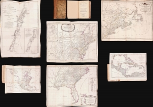
The American Military Pocket Atlas; being An approved Collection of Correct Maps, both General and Particular, of The British Colonies; Especially those which now are, or probably may be The Theatre of War.
sold
This is Sayer and Bennet's 1776 'Holster Atlas', one of the most sought-after cartographic works of the American Revolution. It was published at the beginning of the Revolution and presented as a collection of maps approved by British military authorities for use in the field. (more details)
A Magnificent, Boldly Decorative Wall Map of the Americas.
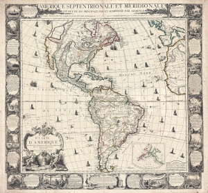
Amerique Septentrionale et Meridionale Divisée en ses Principaux Pais et Subdivisée par Audience. / Nle. Carte D'Amerique Dressée sur les Mémories le plus récens et assujetie aux derniers Observations Astronomiques.
sold
- Digital Map Information
- Suitable for large format printing
- Full resolution TIFF file
- ICC color profile embedded
- Delivered instantly via download link
A rare and highly decorative 1761 French wall map of America issued by Louis Charles Desnos. The map covers all of America, from the northern reaches of Hudson Bay to Tierro del Fuego - which just breaks the lower border. Items of note include a bold depiction of the imaginary Sea of the West (Mer d l'Ouest) and a large 'Lac des Zarayes' in South America. An inset in the lower right details the Pacific Northwest and the Bering Strait, incorporating the Sea of the West with the Apocryphal voyages of Admiral Bartholomew de Fonte and the Chinese legends of an American colony named 'Fusang'. A wealth of ships fill the seas as well as nautical routes by famous explorers. The whole is surrounded by a strikingly engraved border illustrating the indigenous peoples of the Americas - frequently in the processes of martyring missionaries and worshiping idols, but also engaging in trade, fishing, and other more mundane activities. (more details)
Rare Broadside Map chronicling the last resurgence in piracy in the West Indies.
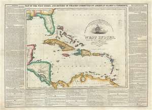
Map of the West Indies, and the History of Piracies Committed on American Seamen and Commerce. / To the Gallant Officers and Seamen of the American Navy, the Protectors of our Commerce in the West India Seas this Map Is Respectfully Inscribed by the Publishers. / West Indies, from the latest and best authorities.
sold
- Digital Map Information
- Suitable for large format printing
- DPI: 300
- File Size: 20.03 MB
- File Type: ZIP / TIFF
- ICC color profile embedded
- Delivered instantly via download link
A remarkable, separately issued, and extremely rare 1825 broadside map by Nathaniel and Simeon Smith Jocelyn of New Haven, Connecticut, responding to the last great outbreak of West Indian piracy between 1817 and 1825. It responds with gratitude to the defending ... (more details)
The most influential map of Florida ever printed.
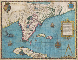
Floridae Americae Provinciae Recens & Exactissima Descriptio Auctore Iacobo Le Moyne cui Cognomen de Morgues, qui Laudonierum …
sold
- Digital Map Information
- Suitable for large format printing
- DPI: 300
- File Size: 13.89 MB
- File Type: ZIP / TIFF
- ICC color profile embedded
- Delivered instantly via download link
…the most remarkable and important map, which has been preserved from the sixteenth century maps, of that part of the East Coast which lies between Cape Hatteras and Cape Florida … the first French map to show Florida … considered the most important map ... (more details)
Earliest Acquirable map to name 'America'
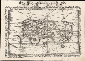
Orbis Typus Universalis Iuxta Hydrographorum Traditionem Exactissime Depicta. 1522 L. F.
sold
- Digital Map Information
- Suitable for large format printing
- File Size: 17.38 MB
- File Type: ZIP / TIFF
- ICC color profile embedded
- Delivered instantly via download link
This is Lorenz Fries' 1522 map of the world in its 1535 edition: a key discovery-era document, being the second earliest acquirable printed map to name 'America' (appearing here in South America). (more details)
Earliest Acquirable use of 'America' on a map.
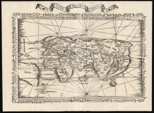
Orbis Typus Universalis Iuxta Hydrographorum Traditionem Exactissime Depicta. 1522 L. F.
sold
- Digital Map Information
- Suitable for large format printing
- File Size: 19.83 MB
- File Type: ZIP / TIFF
- ICC color profile embedded
- Delivered instantly via download link
This is a superb example of Lorenz Fries's 1522 map of the world in its 1535 edition: a key discovery-era document, being the second earliest, acquirable, printed map to name 'America' (appearing here in South America). (more details)
Important colonial period map of the American Southeast - with seashell and coral cartouche!
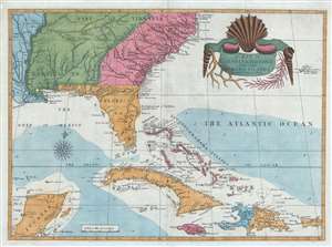
A Map of Carolina, Florida and the Bahama Islands with the Adjacent Parts.
sold
- Digital Map Information
- Suitable for large format printing
- DPI: 300
- File Size: 9.49 MB
- File Type: ZIP / TIFF
- ICC color profile embedded
- Delivered instantly via download link
A fine example of Mark Catesby’s rare 1743 / 1771 map of the southeastern parts of North America. This map is considered one of the finest maps of the colonial era American southeast. The map covers from the Mississippi River and from Cape Charles and Cape Henry to Jamaica, including all of North Carolina, South Carolina, Georgia, Florida, Louisiana, Cuba, Hispaniola, the Bahamas, Porto Rico, and parts of the Yucatan. Among other features, the map is notable for its remarkable cartouche design, which includes shells, corals, and seaweeds indigenous to the Americas. The map is furthermore an important reference for early forts, Indian tribes, English factories, and more in the southeast. The river systems of Georgia and Carolina are particularly impressive in their detail. (more details)
Revelatory map of the Americas.
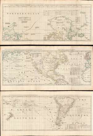
A Chart of North and South America, including the Atlantic and Pacific Oceans, with the nearest Coasts of Europe, Africa, and Asia.
sold
- Digital Map Information
- Suitable for large format printing
- Full resolution TIFF file
- ICC color profile embedded
- Delivered instantly via download link
A wonderful 1775 map of the Americas or Western Hemisphere by John Green, also known as Braddock Mead. The map in fact consists of three related maps covering, from top: Canada and the Arctic; the modern day United States, Central America, and the West Indies; and South America. The map is a masterpiece of late 18th century cartography by one of the least understood and most controversial cartographers of his age. Mead composed the map in protest to what he believed to be the flagrantly spurious and irresponsible speculative cartography of Frenchmen Joseph-Nicolas De l'Isle (1688 - 1768) and Phillipe Buache (1700 - 1773). (more details)
Reconciling New Discovery with Ptolemy.
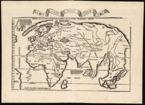
Tabu. Nova Orbis.
sold
- Digital Map Information
- Suitable for large format printing
- Full resolution TIFF file
- ICC color profile embedded
- Delivered instantly via download link
A superb example of Lorenz Fries's 1522 map of the world. This is one of the great Discovery-Era world maps, capturing the impact of contemporary exploration on the late-Roman cartographic models of Ptolemy. (more details)
A call for brotherhood against the hated English.
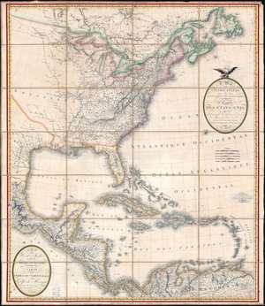
A Map of the United States and Canada, New-Scotland, New-Brunswick and New-Foundland. / Carte des Etats-Unis, avec le Canada, La Nouvelle Ecosse, Le Nouveau Brunswick et Terre-Neuve. / A Map of the West-Indies and of the Mexican-Gulph. / Carte des Indies Occidental et du Golfe du Méxique.
sold
- Digital Map Information
- Suitable for large format printing
- Full resolution TIFF file
- ICC color profile embedded
- Delivered instantly via download link
A lavish, large-scale French map of the United States and West Indies issued in September of 1812 - shortly after the outbreak of the War of 1812 (1812 - 1815). This is one of the few major French cartographic productions not focused on Europe to appear during the Napoleonic Wars (1803 - 1815) and needs to be addressed in this context to be fully understood. With titles both in English and French, it calls for brotherhood and alliance against the hated English. (more details)
Guide to the Golden Age of Piracy. Full old color.
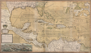
A Map of the West-Indies or the Islands of America in the North Sea; with ye adjacent Countries; explaining what belongs to Spain, England, France, Holland etc. also ye Trade Winds, and ye several Tracts made by ye Galeons and Flota from place to place. According to ye newest and most exact observations, by Herman Moll, Geographer.
sold
- Digital Map Information
- Suitable for large format printing
- Full resolution TIFF file
- ICC color profile embedded
- Delivered instantly via download link
Published in 1726, this is an early printing of Herman Moll's superb map of the West Indies, Caribbean, Gulf of Mexico, Mexico, and the Spanish Main - with full old color. Monumental in proportion, rich in descriptive text, and exhaustive in its attention to detail, this map is best understood as a guide to English piracy and privateering in the West Indies. Moll, most likely through his acquaintance with pirates William Dampier and Woodes Rogers, offers a wealth of information on the traffic of silver bearing Spanish treasure fleets en route from the Mexican port of Veracruz, through the islands, to Spanish ports in Europe. (more details)
The heyday of rum production in colonial Martinique.
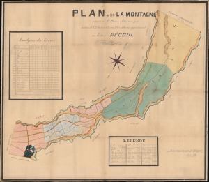
Plan de l'Htion La Montagne situèe a St. Pierre-Martinique contenant 521 hectares, 08 ares, 83 centiares, appartenant aux hèritiers Pécoul.
sold
- Digital Map Information
- Suitable for large format printing
- File Size: 247.21 MB
- File Type: ZIP / TIFF
- ICC color profile embedded
- Delivered instantly via download link
This large-scale 1886 manuscript wall map illustrates the original sugar plantation and rum refiners of the Pécoul family, the 'Habitation la Montagne', Martinique. The map illustrates the hey-day French colonial plantation culture and rum production in Martinique, before the 1902 eruption of Mount Pelée. (more details)
Unrecorded chart of Florida and the Greater Antilles.
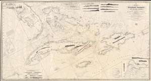
A New Chart of the Windward Passages and Bahama Islands, With the Islands of Hayti, Jamaica, Cuba, etc.
sold
- Digital Map Information
- Suitable for large format printing
- DPI: 600
- File Size: 81.76 MB
- File Type: ZIP / TIFF
- ICC color profile embedded
- Delivered instantly via download link
A rare and unusual 1848 John Purdy / Richard Holmes Laurie Blueback nautical chart or maritime map of Florida, the Bahamas, and the Greater Antilles - here in its only known surviving example. Oriented sharply to the northeast, the chart offers expansive coverage, embracing all of peninsular Florida, Cuba, the Bahamas, Hispaniola (Santo Domingo / Haiti), Jamaica, and Puerto Rico. The map exhibits some manuscript nautical annotations regarding lighthouses in the Bahamas and Cuba, but it is faded and unreadable. Insets detail important ports, including Havana, New Providence (Nassau), Matanzas, Guantanamo, the Morant Kays, and Kingston (Jamaica). (more details)
Penned by a Benjamin Franklin correspondent
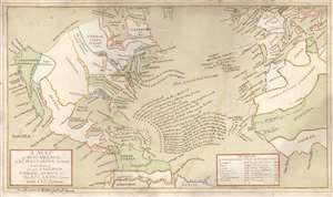
A Map of North America, and the West India Islands, with part of South America, Europe, Africa and The Atlantic Ocean with It's Islands von Benjamin Webb gezeichnet.
sold
- Digital Map Information
- Suitable for large format printing
- Full resolution TIFF file
- ICC color profile embedded
- Delivered instantly via download link
This is a beautifully executed c. 1763 manuscript map by Benjamin Webb, a German emigre working in London and a sometime correspondent with Benjamin Franklin. The map depicts the British Colonies in North America and the Atlantic, highlighting the European spheres of influence pursuant to the 1763 Treaty of Paris, which ended the Seven Years' War (1756 - 1763). It is uniformly meticulous and completed in a fine hand. It very likely was produced by Webb as part of his employment as a schoolmaster in London. Webb's map utilizes a geographical framework of mid-eighteenth century German cartography but includes numerous annotations bringing the map up to date with the 1763 Treaty of Paris. The combination of these elements are unique to this map, and fix its date with reasonable accuracy. (more details)
Logwood and the cusp of change.
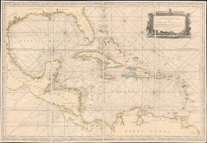
A New General Chart of the West Indies From the latest Marine Journals and Surveys, Regulated and Ascertained by Astronomical Observations.
sold
- Digital Map Information
- Suitable for large format printing
- File Size: 46.27 MB
- File Type: ZIP / TIFF
- ICC color profile embedded
- Delivered instantly via download link
This is Robert Sayer's exceptional 1790 nautical map of the West Indies and Gulf of Mexico. This map emerged, much updated, on the cusp of significant regional upheaval, including conflicts related to the French Revolutionary Wars (1792 - 1802) and the Haitian Revolution (1791 - 1804), events that disrupted shipping, provoked privateering and blockades, and reshaped the patterns of trade. (more details)
Earliest published sea chart focusing on the California coast!
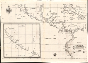
Carta prima generale d'America dell'India Occidentale e Mare del Zur.
sold
- Digital Map Information
- Suitable for large format printing
- File Size: 22.42 MB
- File Type: ZIP / TIFF
- ICC color profile embedded
- Delivered instantly via download link
This is the 1646 first state of Robert Dudley's chart of the middle part of the Americas, illustrating the proximity of the Caribbean Sea and the Pacific Ocean and emphasizing the narrow parts of Central America dividing the two bodies of water. The chart features the western part of the Caribbean, but it is particularly noted for being the first printed sea chart to focus on the Pacific coast, including California. It is, along with Dudley's more narrowly focused charts, the first printed chart of the West Indies and South Florida to employ the Mercator Projection. An inset chart in the lower left focuses specifically on the coast of California, from Baja to Cap Mendocino. (more details)
Only America map of the Mercator Atlas.
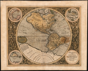
America, siue, India Nova : ad magnae Gerardi Mercatoris aui vniversalis imitationem in compendium redacta.
sold
- Digital Map Information
- Suitable for large format printing
- Full resolution TIFF file
- ICC color profile embedded
- Delivered instantly via download link
This is Mercator's 1595 America, one of the most visually arresting maps of the Western Hemisphere. It is the only map of America to appear in an atlas directly connected to the great Gerard Mercator, here in a first Atlas edition of 1595. (more details)
Extraordinary large format map of Cuba combining Cuban mapmaking and New York publishing.
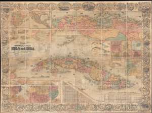
Mapa Físico Político é Itinerario de la Isla De Cuba Acompañado de varios lanos particulares y de noticias estadisticas por D. Jose Maria de la Torre…
sold
- Digital Map Information
- Suitable for large format printing
- File Size: 108.14 MB
- File Type: ZIP / TIFF
- ICC color profile embedded
- Delivered instantly via download link
A wonderful 1862 wall map of Cuba by the Cuban historian José María de la Torre y de la Torre and the American map publisher Joseph H. Colton. The map covers all of Cuba and the surrounding waters with several massive insets, including a detail of the ... (more details)
Guide to the Golden Age of Piracy.
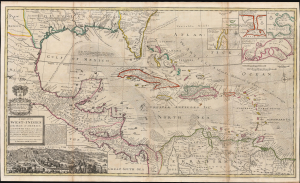
A Map of the West-Indies or the Islands of America in the North Sea; with ye adjacent Countries; explaining what belongs to Spain, England, France, Holland etc. also ye Trade Winds, and ye several Tracts made by ye Galeons and Flota from place to place. According to ye newest and most exact observations, by Herman Moll, Geographer.
sold
- Digital Map Information
- Suitable for large format printing
- File Size: 59.66 MB
- File Type: ZIP / TIFF
- ICC color profile embedded
- Delivered instantly via download link
Published in 1726, this is an early printing of Herman Moll's superb map of the West Indies, Caribbean, Gulf of Mexico, Mexico, and the Spanish Main. Monumental in proportion, rich in descriptive text, and exhaustive in its attention to detail, this map is best understood as a guide to English piracy and privateering in the West Indies. Moll, most likely through his acquaintance with pirates William Dampier and Woodes Rogers, offers a wealth of information on the traffic of silver bearing Spanish treasure fleets en route from the Mexican port of Veracruz, through the islands, to Spanish ports in Europe. (more details)
Manuscript Whaler's Annotations in Gulf of Mexico.
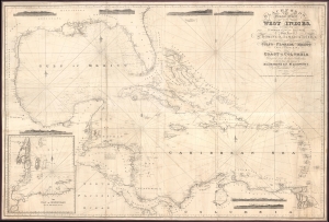
Blachfords, New General Chart of the West Indies, Including the Caribee and Virgin Islands, Porto Rico, St. Domingo, Jamaica and Cuba. The Windward Passages gulfs of Florida and Mexico, Bay of Honduras, And Coast of Colombia Compiled from the best Authorities, Including the surveys of Mr. A. de Mayne R.N., Mr. Lockwood etc.
sold
- Digital Map Information
- Suitable for large format printing
- File Size: 113.86 MB
- File Type: ZIP / TIFF
- ICC color profile embedded
- Delivered instantly via download link
A spectacular 1838 / 1843 Blachford blueback nautical map of the West Indies, including Florida, the Gulf of Mexico, the Caribbean, and Central America. This beautiful map features pencil manuscript annotations in the Gulf of Mexico that strongly suggest whaling. (more details)
First usable printed nautical chart of Hispaniola and Puerto Rico.
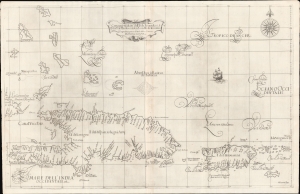
Carta particolare dell'Isola Ispaniola è S. Gioni. nel'India ocidentle. con l'Isola Intorno.
sold
- Digital Map Information
- Suitable for large format printing
- DPI: 600
- File Size: 732.44 MB
- File Type: ZIP / TIFF
- ICC color profile embedded
- Delivered instantly via download link
This is the first edition of Sir Robert Dudley's rare 1647 nautical map of the eastern Greater Antilles, including Hispaniola, Puerto Rico, the Virgin Islands, Turks and Caicos, St. Croix, and the southern Bahamas. Like most Caribbean maps from Dudley's Arcano del Mare, this represents the first usable printed nautical chart of Hispaniola and Puerto Rico. (more details)
The Caribbean and American East Coast from the Finest Printed Globe of the 17th Century.
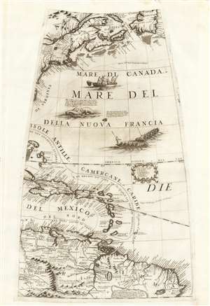
[Untitled Globe Gore of Eastern North and South America from the Equator to approximately 50º north].
sold
- Digital Map Information
- Suitable for large format printing
- Full resolution TIFF file
- ICC color profile embedded
- Delivered instantly via download link
This scarce, beautiful engraving is the globe gore presenting a map of the American northeast, the West Indies, and Terra Firma in South America, engraved in 1688 for Vincenzo Coronelli's 42-inch (3 1/2 foot) terrestrial globe, reprinted in 1697 for inclusion in his Libro dei Globi and Isolario. The map spans from the Equator in the south to Newfoundland in the north, centered on the Tropic of Cancer. It includes Canada in the vicinity of the Saint Lawrence River and Acadia, New England and New York, and part of the coastline around the Chesapeake Bay. The West Indies are shown from the Bahamas to Trinidad, stretching from the eastern part of Cuba to Barbados, including the imaginary island of Fonseca. The gore's southern extents show the northern parts of South America, from modern day Venezuela to the Orinoco Delta and the Guianas, and the fabled city of El Dorado. (more details)
Prepared for French participation in the American Revolutionary War.
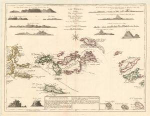
Les Vierges, Levées Par Les Anglais, et Par Les Dannois, Traduit de l'Anglais.
sold
- Digital Map Information
- Suitable for large format printing
- Full resolution TIFF file
- ICC color profile embedded
- Delivered instantly via download link
A rare 1779 map of the Virgin Islands by Georges-Louis Le Rouge prepared in anticipation of French participation in the American Revolutionary War (1775 - 1783). (more details)
Seminal Map of the American Southwest by 'World's Greatest Living Man'.

Carte Du Mexique et des Pays Limitrophes Situes Au Nord et a l'est Dressee d'apres la Grande Carte de la Nouvelle Espagne De Mr. A. De Humboldt et d'autres Materiaux par J.B. Poirson.
sold
- Digital Map Information
- Suitable for large format printing
- DPI: 300
- File Size: 15.17 MB
- File Type: ZIP / TIFF
- ICC color profile embedded
- Delivered instantly via download link
A seminal 1811 map of Mexico and the American West by Alexander von Humboldt. Humboldt, who during his lifetime was considered the 'world's greatest living man,' composed this map during his 1803 sojourn in Mexico. Though often playing second fiddle ... (more details)
An early unrecorded variant of Senex's large map of North America.
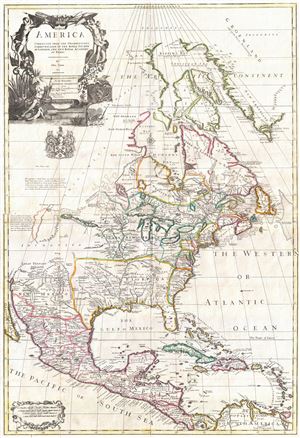
North America corrected from the observations communicated to the Royal Society at London, and the Royal Academy at Paris.
sold
- Digital Map Information
- Suitable for large format printing
- Full resolution TIFF file
- ICC color profile embedded
- Delivered instantly via download link
An exceptional and influential 1710 British map of North America by John Senex. Hands down the most ambitions British mapping of North America produced thus far, Senex's large format map covers all of North America from the unexplored high arctic to ... (more details)
A c. 1720 map guide to English piracy and privateering in the West Indies.
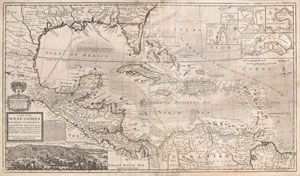
A Map of the West-Indies or the Islands of America in the North Sea; with ye adjacent Countries; explaining what belongs to Spain, England, France, Holland &c. also ye Trade Winds, and ye several Tracts made by ye Galeons and Flota from place to place. According to ye newest and most exact observations, by Herman Moll, Geographer.
sold
- Digital Map Information
- Suitable for large format printing
- DPI: 300
- File Size: 39.29 MB
- File Type: ZIP / TIFF
- ICC color profile embedded
- Delivered instantly via download link
One of the most remarkable and intriguing maps of the West Indies to appear in the 18th century. This is Herman Moll's superb circa 1720 mapping of the West Indies, Caribbean, Gulf of Mexico, Mexico, and the Spanish Main. Monumental in ... (more details)
An unrecorded variant of Senex's large map of North America.

North America corrected from the observations communicated to the Royal Society at London, and the Royal Academy at Paris.
sold
- Digital Map Information
- Suitable for large format printing
- DPI: 300
- File Size: 21.34 MB
- File Type: ZIP / TIFF
- ICC color profile embedded
- Delivered instantly via download link
An exceptional and influential 1710 British map of North America by John Senex. Hands down the most ambitions British mapping of North America produced thus far, Senex's large format map covers all of North America from the unexplored ... (more details)