
World
Rare, Distinctive World Map with a Unique Projection.
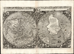
Hemispheriū Ab Aequinoctli Linea, Ad Circulū Poli Arctici / Hemispheriū Ad Circulū Poli Ātarctici.
$62,500.00
Acquire
- Digital Map Information
- Suitable for large format printing
- DPI: 600
- File Size: 26.2 mb
- File Type: TIFF
- # of Files: 1
- ICC color profile embedded
- Delivered instantly via download link
This is Cornelis De Jode's rare 1593 double-polar projection map of the world. It is among the most striking early world maps and among the earliest to introduce the double hemispheric polar projection. Moreover, as a competitor to Ortelius' cartography, it is the sole obtainable map to preserve the innovative Guillaume Postel/Antwerp Unicum cartography. The map is quite rare, having been published in only a single edition. (more details)
Holy Grail Map - 1st Map of the North Pole.
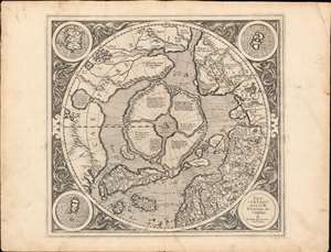
Septentrionalium Terrarum descriptio.
$30,000.00
Acquire
- Digital Map Information
- Suitable for large format printing
- Full resolution TIFF file
- ICC color profile embedded
- Delivered instantly via download link
This is the first edition, first state of Gerard Mercator's seminal 1595 map of the Arctic, the great cartographer's most interesting and important atlas map. In this first edition, it is the scarcest of Mercator's atlas maps and a holy grail for any Arctic collector. For all its flaws and inaccuracies, it is a schematized interpretation of factual voyages between Norway, England, Iceland, Greenland, and Labrador (Markland). (more details)
First Buddhist map of the world.
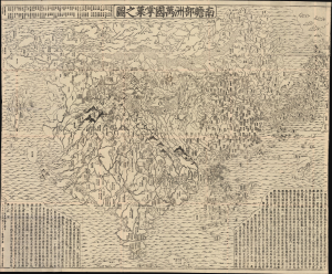
南瞻部洲萬國掌菓之圖 / Nansen bushū bankoku shōka no zu / [Map of the Countries in Jambudvipa].
$25,000.00
Acquire
- Digital Map Information
- Suitable for large format printing
- File Size: 187.54 MB
- File Type: ZIP / TIFF
- ICC color profile embedded
- Delivered instantly via download link
This is the seminal 1710 (Hoei 7) woodblock Buddhist world map composed by the monk Rokashi Hotan. It is the first Japanese printed map to depict the world, including Europe and America, from a Buddhist cosmographical perspective. Inspired by the 1653 publication of Si-yu-ki (or Xiyuji 西域記), a pilgrimage narrative of the Chinese monk Hsuang-Tsang's (or Xuanzang 玄奘, 602 - 604 CE) travels to India in search of sacred Sanskrit writings, it attempts to reconcile Buddhist and Western cartography. (more details)
One of the most decorative maps of the 18th century - here in a pristine uncolored examples.
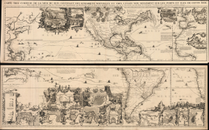
Carte très curieuse de la Mer du Sud, contenant des Remarques Nouvelles et très utiles non seulement sur des Ports et Îles de cette Mer, mais aussy sur les principaux Pays de l'Amerique tant Septentrionale que Méridionale en a été faite.
$18,000.00
Acquire
- Digital Map Information
- Suitable for large format printing
- File Size: 293.48 MB
- File Type: ZIP / TIFF
- ICC color profile embedded
- Delivered instantly via download link
One of the most spectacularly decorative maps of the 18th century, this is Henri Chatelain's magnificent 1719 map of the Americas and the Pacific. The map emerged on the cusp of a new age of global exploration wherein world-spanning trade routes offered Europeans unprecedented exposure to new cultures, peoples, and trade opportunities. It is no mistake that his map of America, as seen here, presents the continent as the center of a staggering array of trade networks reaching from Europe to America itself, the South Pacific, and Africa. (more details)
One of the most decorative maps of the 18th century.
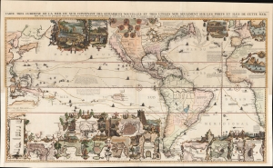
Carte très curieuse de la Mer du Sud, contenant des Remarques Nouvelles et très utiles non seulement sur des Ports et Îles de cette Mer, mais aussy sur les principaux Pays de l'Amerique tant Septentrionale que Méridionale en a été faite.
$15,500.00
Acquire
- Digital Map Information
- Suitable for large format printing
- Full resolution TIFF file
- ICC color profile embedded
- Delivered instantly via download link
One of the most spectacularly decorative maps of the 18th century, this is Henri Chatelain's magnificent 1719 map of the Americas and the Pacific. This sumptuously engraved map is centered on the American continent but extends west to include all of the Pacific as far as Beijing (Peking), China and Australia, and eastward to include much of Europe and the western half of Africa. Longitudinally it extends from the Hudson Bay to the southern tip of Tierra del Fuego. The map is graphically rich with a wealth of lush inset maps and vignette illustrations throughout. The whole is further embellished with copious annotations offering Chatelain's insights on local traditions, flora and fauna, political commentary, and notes on trade. (more details)
The best introduction to Cosmography, in a complete, original example.
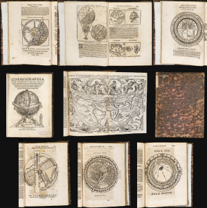
Cosmographia Petri Apiani, Per Gemmam Frisium apud Louanienses Medicum et Mathematicū insignem, iam demum ab omnibus vindicata mendis, ac nonnullis quoque locis aucta. Additis eiusdem argumenti libellis ipsius Gemmae Frisij.
$11,000.00
Acquire
- Digital Map Information
- Suitable for large format printing
- Full resolution TIFF file
- ICC color profile embedded
- Delivered instantly via download link
This is Gemma Frisius' 1564 edition of Peter Apian's Cosmographia, which from 1524 was the essential scholarly introduction to the world and its place in the cosmos. This concise text touched on astronomy, geography, cartography, and navigation. It was not a rote copy of Apianus' text, with significant commentary from Gemma, as well as that scholar's own world map. The text includes its five volvelles, all assembled and in their original condition. These manipulable diagrams are often found missing parts or replaced in facsimile; the condition of these here represents a remarkable survival. (more details)
Japan's view of the world, and its place, with some exaggeration.
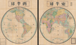
東半球 / Eastern Hemisphere / 西半球 / Western Hemisphere.
$10,000.00
Acquire
- Digital Map Information
- Suitable for large format printing
- File Size: 455.86 MB
- File Type: ZIP / TIFF
- ICC color profile embedded
- Delivered instantly via download link
This is a very scarce and enormous Meiji 9 or 1876 Japanese double hemisphere world map set by Hayami Iwakichi. Aside from its sheet immensity, the map is notable for reflecting changing Japanese understanding of world geography in the fallout from the Meiji Restoration. Hayami offers a very Japanese worldview superimposed upon a modern world map, with some places are diminished and others exaggerated in size to reflect not only their importance to Japan, but also Japan's perspective regarding its own position on the world stage. (more details)
Texas as a Republic!
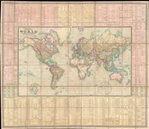
To Her Most Gracious Majesty Queen Victoria, This Map of the World on Mercator's Projection, is most respectfully dedicated, by Her devoted Subjects J. and C. Walker.
$7,500.00
Acquire
- Digital Map Information
- Suitable for large format printing
- File Size: 175.51 MB
- File Type: ZIP / TIFF
- ICC color profile embedded
- Delivered instantly via download link
A dramatic first edition of J. and C. Walker's 1840 highly decorative wall map of the world on Mercator's Projection - notable here for its bold inclusion of the Republic of Texas. It also rather neutrally addresses the ambiguity of the Oregon Question - an ongoing dispute between the United States and British Canada over claims to British Columbia that would not be resolved until 1846. This deluxe edition of the map is enhanced by extensive tables offering statistics and data on all parts of the world. (more details)
Unique historical record.
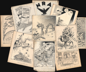
A collection of 30 manuscript political cartoons, many with cartographic content, drawn by Frank 'Ket' Kettlewell for the Oakland Tribune. As a group, they constitute a unique comic record of world events c. 1916 - 1935. Each hand-drawn cartoon is a visually striking San Francisco-centric commentary on domestic or international affairs. 'Ket' has signed each, with many most featuring his signature tiny bird (which occasionally comments). (more details)
Classic Dutch World, updated French Cartography.
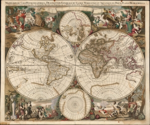
Mappe-Monde Geo-Hydrographique, ou Description Generale Du Globe Terrestre et Aquatique En Deux-Plans-Hemispheres
$6,500.00
Acquire
- Digital Map Information
- Suitable for large format printing
- File Size: 28.15 MB
- File Type: ZIP / TIFF
- ICC color profile embedded
- Delivered instantly via download link
This is a striking, original color example of Gerard Valk's classic 1686 double hemisphere map of the world. The map combines the aesthetics of the Dutch Golden Age with the superior French cartography of Nicolas Sanson. (more details)
Celebrating the Empire from Occupied France.
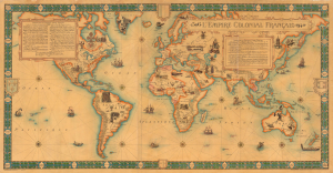
L'Empire Colonial Francais, 1506 - 1940.
$6,500.00
Acquire
- Digital Map Information
- Suitable for large format printing
- Full resolution TIFF file
- ICC color profile embedded
- Delivered instantly via download link
This is a highly scarce, visually stunning, and very large-format (38.25 x 73.25 in.) wall map of the world highlighting the French colonial empire, prepared by the cartographic firm Girard et Barrère. Curiously, it was produced in March 1944, when France itself was under German occupation and the empire was divided against itself among loyalists of Vichy and Free France. (more details)
Wonderment with the world.
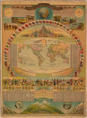
Bacon's Chart of Useful Knowledge.
$6,000.00
Acquire
- Digital Map Information
- Suitable for large format printing
- Full resolution TIFF file
- ICC color profile embedded
- Delivered instantly via download link
This is George W. Bacon's striking wall-map style compendium of all 'useful knowledge' - a densely informative chromolithographic masterpiece. Bacon's map/chart emerges out of the great age of data collection - a period following the Age of Discovery in which improved transportation and intellectual optimism encouraged a furious effort to catalog, 'collect', and contextualize the natural world. The present map synthesizes these efforts into a single dense infographic aimed at both the next generation of explorer/scientists and the armchair adventurer. Herein, information is effectively summarized and categorized, embracing an impressive range of subjects: astronomy, geography, transportation, ethnology, geology, anthropology, and more. (more details)
'Most Attractive of its Time' -Shirley
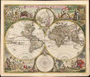
Nova Orbis Tabula In Lucem Edita, A. F. de Wit.
$6,000.00
Acquire
- Digital Map Information
- Suitable for large format printing
- Full resolution TIFF file
- ICC color profile embedded
- Delivered instantly via download link
This is a striking c. 1689 example, in original color, of Frederick De Wit's classic double hemisphere map of the world. Shirley praised it as 'one of the most attractive of its time'. It features many of the tropes of 17th-century Dutch mapmaking: Insular California, imaginary islands, etc., as well as new discoveries, such as Western Australia, and cartographic reconsiderations, among them the removal of the imaginary Terra Australis. (more details)
Most visually engaging atlas map of the world from the early Colonial period.
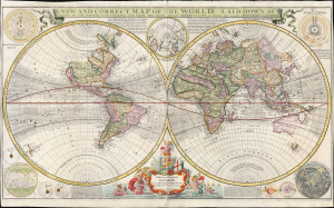
A New and Correct Map of the World Laid Down According to the Newest Discoveries, and from the Most Exact Observations, by Herman Moll Geographer.
$5,500.00
Acquire
- Digital Map Information
- Suitable for large format printing
- Full resolution TIFF file
- ICC color profile embedded
- Delivered instantly via download link
This is Herman Moll's 1707 / 1726, large-format double-hemisphere map of the world. It is the largest and most visually entertaining English atlas map of the world from the early Colonial period; it captures a view of the world in the midst of a transformation from the state of the art of the 17th century to a more scientifically focused style of cartography. The new mode - predominantly French - dominates the map: ironic, given Moll's adopted English chauvinism. (more details)
The 'Around the World in 80 Days' zeitgeist.
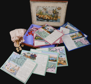
A rare French geographical game designed by J. X. Matenet and published by Bussière in Paris c. 1875. The game captures the French fascination with world travel at the height of the Around the World in Eighty Days era, when advances in infrastructure and technology made casual global voyages achievable. (more details)
'Most Attractive of its Time' -Shirley
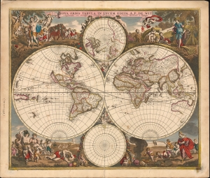
Nova Orbis Tabula In Lucem Edita, A. F. de Wit.
$5,500.00
Acquire
- Digital Map Information
- Suitable for large format printing
- File Size: 31.77 MB
- File Type: ZIP / TIFF
- ICC color profile embedded
- Delivered instantly via download link
This is a striking c. 1689 example, in original color, of Frederick De Wit's classic double hemisphere map of the world. Shirley praised it as 'one of the most attractive of its time'. It features many of the tropes of 17th-century Dutch mapmaking: Isular California, imaginary islands, etc., as well as new discoveries, such as Western Australia, and cartographic reconsiderations, among them the removal of the imaginaryTerra Australis. (more details)
'Towards thee I roll, thou all-destroying but unconquering whale...' -Melville
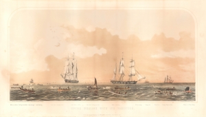
Sperm Whaling with Its Varieties.
$5,000.00
Acquire
- Digital Map Information
- Suitable for large format printing
- File Size: 21.24 MB
- File Type: ZIP / TIFF
- ICC color profile embedded
- Delivered instantly via download link
This is Benjamin Russell's stunning 1870 chromolithograph view of the American sperm whaling industry, printed by John Henry Bufford. (more details)
Monk's only world map.
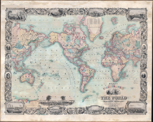
Monk's New Illuminated Steel Plate Map of The World Embracing all the Latest Discoveries and Exploration on Mercator's Projection.
$4,750.00
Acquire
- Digital Map Information
- Suitable for large format printing
- File Size: 156.9 MB
- File Type: ZIP / TIFF
- ICC color profile embedded
- Delivered instantly via download link
This is a magnificent 1860 wall map of the world issued by Jacob Monk and David Griffing Johnson. The map is subtitled 'illuminated' and is a lavish production, rich with detail and graphic content. (more details)
A lost map...
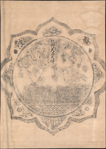
北野天満大神 / [The Great 'Kami' of Kitano Shrine].
$4,500.00
Acquire
- Digital Map Information
- Suitable for large format printing
- File Size: 87.3 MB
- File Type: ZIP / TIFF
- ICC color profile embedded
- Delivered instantly via download link
This is a unique rubbing of a Meiji 13 or 1880 map of the Eastern Hemisphere from a carving on the back of a bronze mirror at Kitano Tenmangū Shrine, Kyoto. The mirror and the map were given by the Nissan Nagamori-kō to the Kitano Tenmangū Shrine in 1880. Nonetheless, the map was forgotten until 2015, when it was rediscovered by shrine caretakers, but this rubbing dates to the early Meiji, shortly after the mirror-map was carved. This rubbing was thus likely done for or by one of the Nissan Nagamori-kō, or possibly a pilgrim to the shine shortly after it was donated, but before the mirror was mounted - hiding the map and making all further rubbings impossible. (more details)
Ephemeral mapping of a brief yet serious German threat to British economic dominance. Also - Texas at its largest!
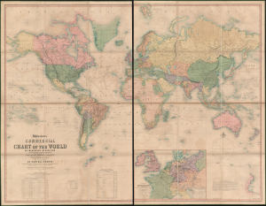
Johnstons' Commercial Chart of the World on Mercators Projection from the latest and Best Authorities Containing the Position of Every Place of Commercial Importance, Shhowing the Princial Currents of hte Ocean with their Direction and Rate of Progress. With an Enlarged Map of Central Europe Showing the Railway Communication between the Different Countries, and Distinguishing the States which compose the German Customs Union.
$4,500.00
Acquire
- Digital Map Information
- Suitable for large format printing
- Full resolution TIFF file
- ICC color profile embedded
- Delivered instantly via download link
An impressive large-scale first edition example of A. K. Johnston's 1849 map of the world. The map features a wealth of fascinating and relevant content, including an ephemeral pre-Compromise of 1850 map of Texas, hints at the threat to British commercial dominance posed by the German Zollverein, and a remarkably comprehensive mapping of caravan routes through the Sahara. (more details)
Baroque Masterpiece in the Scientific Mapping of The World.
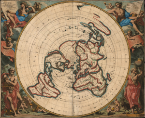
Planisphere terrestre: suivant les nouvelles observations des astronomes.../ Planispherium terrestre: secundum recentiores astronomorum observationes...
$4,250.00
Acquire
- Digital Map Information
- Suitable for large format printing
- File Size: 34.28 MB
- File Type: ZIP / TIFF
- ICC color profile embedded
- Delivered instantly via download link
This beautiful north polar projection map of the world, published in 1713 by Pieter van der Aa, is the most attractive depiction of a lost cartographic monument: Giovanni Domenico Cassini's eight-meter world map, which at one time adorned the floor of the Paris Observatory. That mammoth work can be considered the earliest scientific map of the world: it was the first to fix longitude based upon accurate astronomical observation. The present map is a glorious work of baroque art, embellished by the masterful decorative engravings of Gilliam van der Gouwen, based on the drawings of Jan Goeree. (more details)
Complete set: Covarrubias' Pageant of the Pacific.
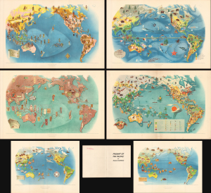
Pageant of the Pacific.
$4,000.00
Acquire
- Digital Map Information
- Suitable for large format printing
- Full resolution TIFF file
- ICC color profile embedded
- Delivered instantly via download link
This is a complete set of the 1943 second edition of Miguel Covarrubias' pictorial maps of the Pacific, originally painted as a set of murals for Pacific House at the Golden Gate International Exposition (1939 - 1940). (more details)
French Cartography and Dutch Decorative Engraving.
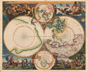
Les Deux Poles Arctique ou Septentrional, et Antarctique ou Meridional, ou Description des Terres Arctiques et Antarctiques ; et des Pays circomvoisins jusques aux 45. Degres de Latitude.
$4,000.00
Acquire
- Digital Map Information
- Suitable for large format printing
- Full resolution TIFF file
- ICC color profile embedded
- Delivered instantly via download link
This is a beautiful example of Peter Mortier's 1696 double-hemisphere map of the northern and southern hemispheres. The primary hemispheres focus on the northern and southern thirds of the world. The secondary hemispheres show the entire world, centered respectively on Paris and its antipodes. (more details)
Sanson Family Map of the World, Updated. Rare Edition.
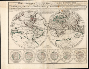
Mappe-Monde ou Description du Globe Terrrestre vû en Concave ou en creux en Deux Hemispheres ou l'on trouve en General le Rapport que toutes ses Parties ont avec les Cieux, entr' Elles, et avec l'Histoire...
$3,500.00
Acquire
- Digital Map Information
- Suitable for large format printing
- Full resolution TIFF file
- ICC color profile embedded
- Delivered instantly via download link
This is Pierre Moullart-Sanson's map of the world, in its c. 1730 edition published by Gilles Robert de Vaugondy. Moullard-Sanson's 17th-century geography and elegant engraving are largely unchanged, with the notable correction to California noted below. (more details)
First printed example of a Babinet / Mollweide Projection.
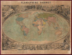
Planisphère Babinet Physique et Politique.
$3,500.00
Acquire
- Digital Map Information
- Suitable for large format printing
- File Size: 150.01 MB
- File Type: ZIP / TIFF
- ICC color profile embedded
- Delivered instantly via download link
A stunning c. 1860 wall-sized map of the world on a Mollweide or Babinet Projection surrounded by elaborate allegorical imagery. Our research suggests this is one of the earliest, if not the earliest, published examples of a Mollweide Projection. (more details)
Extremely Rare Advert for an Essential Aviation Tool.
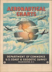
This is a very rare and possibly unique 1959 map poster advertising aeronautical charts produced by the U.S. Coast and Geodetic Survey (U.S.C.G.S.). As passenger air travel exploded in the postwar period, U.S.C.G.S. charts became an indispensable tool for pilots to ensure as safe and comfortable a ride as possible. This poster, and a similar poster for nautical charts, was issued to advertise U.S.C.G.S. charts. (more details)
Environmental Movement - Earth Day.
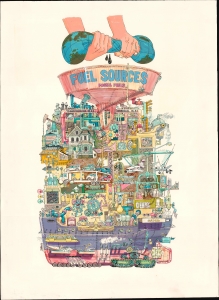
This is the c. 1970 original art for Darrel Millsap's unpublished illustration of the global fossil fuel industry. The image is a harsh criticism of global waste and energy consumption, issued at the beginning of the U.S. environmentalism movement, most likely associated with the 1970 launch of Earth Day. (more details)
Golden age of Quackery.
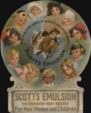
What Makes the Ripple of Dimples Around the World? Scotts Emulsion. / Scott's Emulsion The Standard Body Builder for Men Women and Children.
$3,000.00
Acquire
- Digital Map Information
- Suitable for large format printing
- File Size: 1179.5 MB
- File Type: ZIP / TIFF
- ICC color profile embedded
- Delivered instantly via download link
A dramatic die-cut 1911 chromolithograph advertisement for Scott's Emulsion Cod Fish Oil - one of the few medications from the Golden Age of Quackery that actually worked. (more details)
Swiss New Year Broadside promoting geographical sciences.
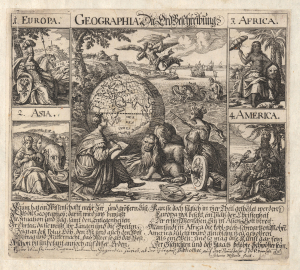
Geographia: Die Erd Beschreibung.
$2,800.00
Acquire
- Digital Map Information
- Suitable for large format printing
- Full resolution TIFF file
- ICC color profile embedded
- Delivered instantly via download link
This is a rare 1706 Johannes Meyer broadside dedicated to the science of geography, showing allegorical representations of the continents and a globe. It includes a German text describing the purposes of geography as well as briefly describing the four parts of the world: Europe, Asia, Africa, and America. (more details)
One of the Most Influential Japanese Maps of the 19th Century. / Japanese recognition of the Sea of Korea.
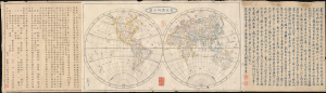
新製輿地全圖 / [Newly-Made Complete Map of the World].
$2,500.00
Acquire
- Digital Map Information
- Suitable for large format printing
- File Size: 30.62 MB
- File Type: ZIP / TIFF
- ICC color profile embedded
- Delivered instantly via download link
This is a fascinating 1844 Mitsukuri Shōgo double-hemisphere world map with descriptive text. Based on a somewhat earlier French map, it is important in the migration of Western geographic knowledge to Japan, even in the years before Japan was 'forced open' by American warships, hastening the end of its period of isolation. It is also unusual as one of the very few Japanese maps to recognize the 'Sea of Korea' toponym. (more details)
Whimsical pair of early American schoolgirl maps.
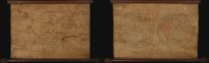
A remarkable c. 1810 pair of manuscript 'schoolgirl' maps exhibiting the world in hemispheres and the United States of America, respectively. The drafting of such maps was an important part of girls' education at the time, carrying with it the didactic function of inculcating a shared sense of identity and civic virtues. (more details)
Massive chromolithograph geographical advertisement.
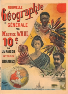
Nouvelle Géographie Générale par Maurice Wahl.
$2,250.00
Acquire
- Digital Map Information
- Suitable for large format printing
- Full resolution TIFF file
- ICC color profile embedded
- Delivered instantly via download link
A massive and lavish French chromolithograph poster promoting the 1899 Garnier Frères release of Maurice Wahl's Nouvelle Géographie Générale. Wahl's Géographie was a two-volume mass-market geographical text by the well-known academic geographer and pedagogue Maurice Wahl (1853 - 1900). As an affordable production rich with practical information, it received wide acclaim and was a publishing success - no doubt in part because of this poster. (more details)