
Arabia (sold)
First Islamic Wall Map of the Arabian Peninsula.
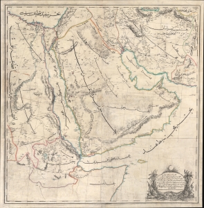
...مملك محروسهء شاهانه دن آسيا / [The Royal Palace of Asia...].
sold
- Digital Map Information
- Suitable for large format printing
- File Size: 172.65 MB
- File Type: ZIP / TIFF
- ICC color profile embedded
- Delivered instantly via download link
A rare large-format 1871 Ottoman wall map of Arabia by military officer Yusbasi Husni (Hüsnü) Efendi. This is the earliest known large-scale Islamic wall map of Arabia. It was produced amid major administrative changes and cartographic developments, when the Ottoman Empire was securing its tenuous control of Mecca, Medina, and Yemen against both internal and external pressure. (more details)
Earliest Acquirable Printed Map of Arabia.
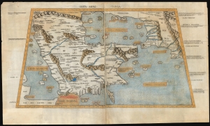
Sexta Asiae Tabula.
sold
- Digital Map Information
- Suitable for large format printing
- Full resolution TIFF file
- ICC color profile embedded
- Delivered instantly via download link
A foundational work of Renaissance cartography: this is the first acquirable printed map of the Arabian Peninsula. Appearing in the Rome edition of Ptolemy, in its 1478 printing, it is preceded only by the unacquirable 1477 Bologna Ptolemy. Ptolemy's 2nd-century innovation of representing the three-dimensional world on a grided mathematical projection provided the basis of all modern cartography. Of all the early printed versions of Ptolemy's maps, those produced for the Rome edition are considered the finest until Mercator's 1578 edition. The present example is embellished with attractive old hand color. (more details)
Earliest Map of Abu Dhabi after Independence.
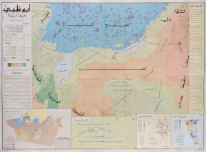
This is a large-format c. 1971 Arabic-language map of Abu Dhabi and environs prepared by Mohamed Morsi Abdullah. It constitutes the earliest official map of Abu Dhabi as an independent, post-colonial entity and as the capital of the United Arab Emirates (U.A.E.). (more details)
One of the Earliest Printed Maps of Arabia.
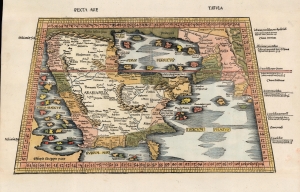
Sexta Asie Tabula.
sold
- Digital Map Information
- Suitable for large format printing
- Full resolution TIFF file
- ICC color profile embedded
- Delivered instantly via download link
This is the Waldseemüller / Ringmann 1513 map of Arabia, considered one of the earliest acquirable maps of the Arabian Peninsula and essential to any serious Arabia collection. It was issued for Waldseemüller and Ringmann's 1513 Geographie Opus Novissima, then the most thoroughly edited and amended edition of Ptolemy. Moreover, this map was the most detailed map of the Arabian Peninsula to have been produced to date, illustrating and naming many of the islands of the Red Sea and the Persian Gulf, and including comprehensive interior detail. Despite presenting ancient geography, the detail of Ptolemaic maps of the region had yet to be improved upon significantly, and so this map remained one of the most detailed maps of the Arabian Peninsula available, illustrating and naming many of the islands of the Red Sea and the Persian Gulf, and including comprehensive interior detail. (more details)
An Unusual Wall Map of the Gulf Region.
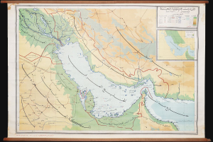
This is a rare c. 1972 wall map of the Persian / Arabian Gulf region by Ibrahim Hilmi al-Ghouri. Published by the Scientific Foundation for Educational Aids, it was likely intended for classroom use in the United Arab Emirates. (more details)
Seminal Map heralding the birth of Qatar's Petroleum Industry.
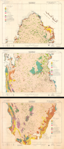
This is a remarkable, very large-format 1970 bilingual three-sheet geological map of Qatar, prepared by an international team of geologists and published by Ali Mohammed Jaidah. It represents the first comprehensive geological survey of the country and therefore played an important role in the subsequent development of Qatar's oil and gas industry. (more details)
Abu Dhabi on the Cusp of Independence and Modernization.
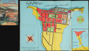
مَدِينَةُ أَبُو ظَبِي الحَدِيثَة [Modern Abu Dhabi City]. / عَامَانِ زَاهِيَان فِي تَارِيخِ إِمَارَةِ أَبُو ظَبِي [Two Glorious Years in the History of the Emirate of Abu Dhabi].
sold
This is a rare 1968 folding map of Abu Dhabi, appearing in the scarce Arabic edition of the Two Glorious Years in the History of the Emirate of Abu Dhabi. The map and book were published in a period of rapid transformation for the emirate, which was preparing for independence and implementing the early phase of a radical modern urban plan. (more details)
Birth of Qatar's Petroleum Boom, Prepared on the Eve of Independence
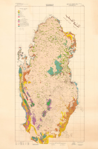
This is a stunning, large-format 1970 bilingual geological map of Qatar, prepared by an international team of geologists and published by Ali Mohammed Jaidah. It represents the first comprehensive geological survey of the country and therefore played an important role in the subsequent development of Qatar's oil and gas industry. (more details)
Foundational map of the Nile Delta and the basis of all subsequent regional maps.
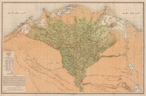
كهاريطات الءواجه الءباحاري ليلأقاليم الءميصريياه / [Map of the Egyptian Regions facing the Sea].
sold
- Digital Map Information
- Suitable for large format printing
- File Size: 168.02 MB
- File Type: ZIP / TIFF
- ICC color profile embedded
- Delivered instantly via download link
A striking, important, and rare Arabic-language chromolithographed map of the Nile Delta, prepared in 1872 by Mahmoud Bey al-Falaky. Aside from its aesthetic qualities, it also represented the most accurate map of the region when it was produced, combining the most up-to-date cartographic methods with extensive research on local placenames, terrain, and topography. As this map replaced French benchmark maps of the region from the early 19th century, it became the new gold standard and was continually used as the basis for most subsequent maps. (more details)
House of Saud's modernization of Mecca.
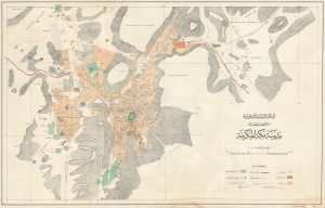
المملكة العربية السعودية (الأقطار الحجازية) مدينة مكة المكرمة / [The Kingdom of Saudi Arabia (Hejaz Territories) the Holy City of Mecca].
sold
- Digital Map Information
- Suitable for large format printing
- File Size: 35.37 MB
- File Type: ZIP / TIFF
- ICC color profile embedded
- Delivered instantly via download link
A remarkable find, this scarce, large-format Arabic-language map of the holy city of Mecca was prepared in 1948 by the Survey of Egypt. This map reflects an effort by the House of Saud to mark their rule over the Hejaz and the holy sites therein by making Mecca more accessible to Muslims. (more details)
House of Saud's Modernization of Mecca.
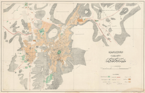
المملكة العربية السعودية (الأقطار الحجازية) مدينة مكة المكرمة / [The Kingdom of Saudi Arabia (Hejaz Territories) the Holy City of Mecca].
sold
- Digital Map Information
- Suitable for large format printing
- File Size: 38.6 MB
- File Type: ZIP / TIFF
- ICC color profile embedded
- Delivered instantly via download link
A remarkable find; this scarce, large-format Arabic-language map of the holy city of Mecca was prepared in 1948 by the Survey of Egypt. This map reflects an effort by the House of Saud to mark their rule over the Hejaz and the holy sites therein by making Mecca more accessible to Muslim pilgrims. (more details)
A gorgeous pictorial map of Africa featuring illustrations of African wildlife.
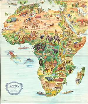
Afrika i bilder.
sold
- Digital Map Information
- Suitable for large format printing
- File Size: 48.65 MB
- File Type: ZIP / TIFF
- ICC color profile embedded
- Delivered instantly via download link
This is a stunning c. 1955 B. Lindblad pictorial map of Africa. The map depicts the region from the Atlantic Ocean to the Persian Gulf and the Indian Ocean and from Spain, Sicily, and Greece to the Cape of Good Hope. Beautifully illustrated, the incredible biodiversity of this vast continent is on full display. The relative prosperity of French Colonial Africa along the Mediterranean is highlighted by green hills, mountains, and buildings meant to denote cities. The ruins of Carthage are illustrated in Tunisia, as are the Pyramids at Giza in Egypt. The artist emphasized the life-giving power of the Nile River by making the river valley a blue and green channel through the brown wasteland of the Sahara. The nomadic lifestyle of the people living in the Sahara is shown, complete with camels and horses.
Sub-Saharan Africa is verdantly colored, with West Africa featuring a native village and locals fashioning ivory into trinkets. The wildlife of the region is, of course, the map's focus. Elephants, gazelles, gorillas, leopards, hippos, lions, and giraffes are only a few of the species illustrated. The duality of native existence up against modern technology and the constant drive to exploit Africa's seemingly infinite natural resources also take center stage, with a large tractor and a diamond mine drawn next to local villages and livestock.
The Middle East and the Arabian Peninsula are also illustrated in the upper right corner, complete with an illustration of the Great Mosque of Mecca in profile. Oil derricks are depicted along the Persian Gulf, along with a tanker plying the Gulf's waters to take the 'black gold' to market. (more details)
Sub-Saharan Africa is verdantly colored, with West Africa featuring a native village and locals fashioning ivory into trinkets. The wildlife of the region is, of course, the map's focus. Elephants, gazelles, gorillas, leopards, hippos, lions, and giraffes are only a few of the species illustrated. The duality of native existence up against modern technology and the constant drive to exploit Africa's seemingly infinite natural resources also take center stage, with a large tractor and a diamond mine drawn next to local villages and livestock.
The Middle East and the Arabian Peninsula are also illustrated in the upper right corner, complete with an illustration of the Great Mosque of Mecca in profile. Oil derricks are depicted along the Persian Gulf, along with a tanker plying the Gulf's waters to take the 'black gold' to market. (more details)
A rare, early copperplate map of India, Persia, and Arabia.
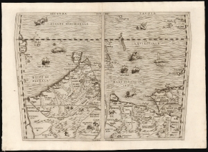
Seconda Tavola.
sold
- Digital Map Information
- Suitable for large format printing
- File Size: 10.98 MB
- File Type: ZIP / TIFF
- ICC color profile embedded
- Delivered instantly via download link
This is a scarce copperplate edition, commonly dated 1563, of the first accurate map of South Asia, including India, Arabia, and the Persian Gulf. It was drawn for Giovanni Battista Ramusio by his friend, the great cartographer Giacomo Gastaldi. The map was first published in Volume I of Ramusio's delle Navigationi et Viaggi in 1554, but this copperplate edition was engraved by Niccolo Nelli to replace the original woodblock after it was lost in a fire. (more details)
Giant blueback working nautical chart of the Indian Ocean with in manuscript navigational notes.
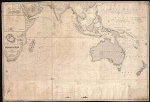
Indian Ocean.
sold
- Digital Map Information
- Suitable for large format printing
- Full resolution TIFF file
- ICC color profile embedded
- Delivered instantly via download link
This is a gigantic 1874 James Imray and Son blueback working nautical chart or maritime map of the Indian Ocean covered in manuscript notations. The map depicts the world from East Africa to Fiji and from Taiwan and the Persian Gulf to 60 degrees south latitude. Manuscript pencil notations trace at least three, possibly four, voyages across the Indian Ocean. These notations mark the vessel's location on its trip across the ocean and notes what is most likely the day of the expedition. Apart from these four voyages, numerous routes between various points throughout the region are also illustrated, with a particular concentration running from the Gulf of Aden to the East Indies, frequented trade routes between England and the Netherlands and these colonies rich in natural resources. Myriad locations are identified throughout, particularly along the coastlines and small islands making up parts of archipelagos situated throughout the Pacific Ocean and the China Sea. Eight inset maps are situated on the map's left side and illustrate Cargados Carajos, Coetivy, Rodrigues, Wood Island, Farquhar Passage, Tromelin, Réunion, and the cities of Saint Paul and Saint Denis on Réunion. (more details)
Rare Peek into Daily Life in the Emirates during the 1950s.
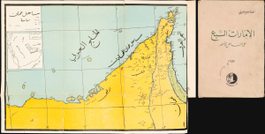
ساحل عمان [Coast of Oman]. / الإمارات السبع على الساحل الأخضر [The Seven Emirates on the Green Coast].
sold
This is a 1957 map of the Trucial States, the future United Arab Emirates, that appeared in the book The Seven Emirates on the Green Coast, written by Ahmad Qasim Al-Burini. Al-Burini's account is one of the most detailed historical accounts of the emirates in this formative period. (more details)
Red Sea and French attempts to sieze control of the India Ocean.
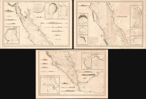
Carte Générale de la Mer Rouge...
sold
- Digital Map Information
- Suitable for large format printing
- Full resolution TIFF file
- ICC color profile embedded
- Delivered instantly via download link
This is a c. 1799 set of three nautical maps or charts covering the Red Sea, produced by the French Dépôt Général de la Marine. At the time, the Red Sea had become a key strategic waterway due to Napoleon's invasion of Egypt and the wider geopolitical struggles of the French Revolutionary Wars, prompting significant remapping. (more details)
One of the earliest maps to name Kuwait (El Koueit ox Grane), Dubai (Debai) and Abu Dhabi (Abuthubbi).
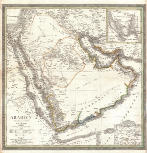
Arabien.
sold
- Digital Map Information
- Suitable for large format printing
- DPI: 600
- File Size: 28.2 MB
- File Type: ZIP / TIFF
- ICC color profile embedded
- Delivered instantly via download link
This is an 1841 Carl Ferdinand Weiland map of Arabia - considered one of the earliest modern scientific mappings of the Arabian Peninsula and one of the earliest maps to name Kuwait (El Koueit ox Grane), Dubai (Dubai), and Abu Dhabi (Abuthubbi). (more details)
One of the Earliest Modern Maps of the Indian Ocean.
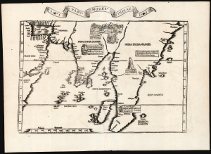
Tabu. Moder. Indiae.
sold
- Digital Map Information
- Suitable for large format printing
- Full resolution TIFF file
- ICC color profile embedded
- Delivered instantly via download link
This is Laurent Fries' edition of the earliest acquirable modern mapping of South Asia. While the topography and place names are faithfully drawn from Martin Waldseemüller's map of 1513, Fries' map also includes evocative woodcut illustrations and descriptive text drawn not from the 1513 Ptolemy, but instead from Waldseemüller's 1516 Carta Marina. Consequently, the geography shown here was thoroughly modern. (more details)
A foundational map of Persia, Arabia, and India.
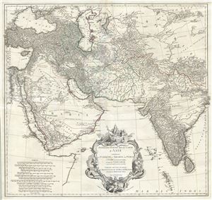
Premiere Partie de la Carte d'Asie contenant La Turquie, L'Arabie, La Perse, L'Inde en deca du Gange et de la Tartarie ce qui est limitrophe de la Perse et de l'Inde.
sold
- Digital Map Information
- Suitable for large format printing
- DPI: 300
- File Size: 36.34 MB
- File Type: ZIP / TIFF
- ICC color profile embedded
- Delivered instantly via download link
A monumental and highly detailed 1751 map of India, Persia, and Arabia by the French cartographer Jean Baptiste Bourguignon d'Anville. Centered on Persia, this map covers from Istanbul to eastern India and Tibet, and from the Black Sea to the Maldives. It offers ... (more details)
A foundational map of Persia, Arabia, and India.
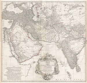
Premiere Partie de la Carte d'Asie contenant La Turquie, L'Arabie, La Perse, L'Inde en deca du Gange et de la Tartarie ce qui est limitrophe de la Perse et de l'Inde.
sold
- Digital Map Information
- Suitable for large format printing
- DPI: 300
- File Size: 34.98 MB
- File Type: ZIP / TIFF
- ICC color profile embedded
- Delivered instantly via download link
A monumental and highly detailed 1751 map of India, Persia, and Arabia by the French cartographer Jean Baptiste Bourguignon d'Anville. Centered on Persia, this map covers from Istanbul to eastern India and Tibet, and from the Black Sea to the Maldives. It offers ... (more details)
A foundational map of Persia, Arabia, and India.
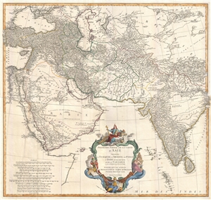
Premiere Partie de la Carte d'Asie contenant La Turquie, L'Arabie, La Perse, L'Inde en deca du Gange et de la Tartarie ce qui est limitrophe de la Perse et de l'Inde.
sold
- Digital Map Information
- Suitable for large format printing
- DPI: 300
- File Size: 25.92 MB
- File Type: ZIP / TIFF
- ICC color profile embedded
- Delivered instantly via download link
A monumental and highly detailed 1751 map of India, Persia, and Arabia by the French cartographer Jean Baptiste Bourguignon d'Anville. Centered on Persia, this map covers from Istanbul to eastern India and Tibet, and from the Black Sea to the Maldives. It offers ... (more details)
Most finely-engraved Ptolemaic map of Arabia.
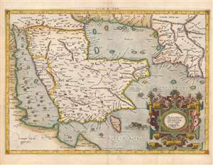
Asiae VI Tab.
sold
- Digital Map Information
- Suitable for large format printing
- Full resolution TIFF file
- ICC color profile embedded
- Delivered instantly via download link
This is Gerard Mercator's map of the Arabian Peninsula, based on the second-century mapping of Claudius Ptolemy (c. 100 - 170), the progenitor of modern geography. Mercator executed this map for his 1578 Duisberg edition of Ptolemy's Geographia, intended to be the definitive edition of that foundational work. (more details)
Earliest Printed Map to show the Hajj.
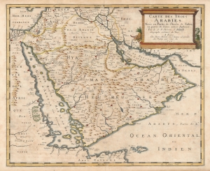
Carte des Trois Arabies Tirée en Parte de l'Arabe de Nubie, en partie de divers autres Autheurs, Par le S. N. Sanson d'Abbeville, Geographe ordinaire du Roy, A Paris.
sold
- Digital Map Information
- Suitable for large format printing
- Full resolution TIFF file
- ICC color profile embedded
- Delivered instantly via download link
This is an attractive example of Nicolas Sanson's scarce 1654 map of the Arabian Peninsula. As indicated in the title, it depicts the three Arabias: Arabie Petree, Arabie Deserte, and Arabia Heureuse; that is, Stony Arabia, Desert Arabia, and 'Happy' Arabia. The map depicts both shores of the Red Sea and the Persian Gulf, and the Indian Ocean island of Zocotora off the horn of Africa. The map includes Mecca and Medina, and the pattern of named settlements describes the Hajj routes: along the Red Sea coast, the overland routes across the peninsula from Basra, and the route to Mecca from Damascus. The Kingdom of Bahrain (Bahraim) appears as well. The largest portion of the Arabian Peninsula is here named Hyaman, ou Arabie Heureuse: 'Yemen, or Happy Arabia.' (more details)
I confess that my scheme is still a mere dream, and I do not shut my eyes to the fact that so long as I alone believe it to be possible, it is virtually impossible.' -de Lesseps
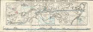
Wyld's Oficial Map of the Suez Maritime Canal.
sold
- Digital Map Information
- Suitable for large format printing
- File Size: 11.43 MB
- File Type: ZIP / TIFF
- ICC color profile embedded
- Delivered instantly via download link
An extremely rare 1869 James Wyld map of the Suez Canal issued shortly before the Canal was opened. The canal was officially opened on November 17, 1869, and Wyld copyrighted this map on November 12, 1869, just in time to capitalize and general enthusiasm over canal's completion. The map covers the full extent of the Canal form the Mediterranean to the Red Sea. There are inset charts of Ismailia, Suez Bay, and Port Said. A further inset in the upper left, illustrates the canal within the context of the British Empire, whose possessions are highlighted in red. A profile section of the canal appears along the bottom border. (more details)
Earliest accurate European map of Mecca.
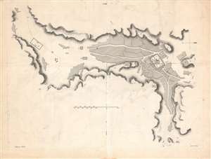
[Plan de la ville de La Mecque].
sold
- Digital Map Information
- Suitable for large format printing
- DPI: 600
- File Size: 30.23 MB
- File Type: ZIP / TIFF
- ICC color profile embedded
- Delivered instantly via download link
A groundbreaking 1814 map of Mecca by Ali Bey el Abbassi. This was the first accurate city map of Mecca produced by a non-Muslim European - Ali Bey el Abbassi, a Spanish-born Arabist who spent years traveling throughout Arabia and North Africa. It displays the holy city as it appeared in the early 19th century. (more details)
Critical Node of the Global Oil Supply.
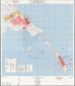
Tactical Commanders' Terrain Analysis Ras Tanura Area Ras Tanura Urban Area Map / Ras Tanura Area Orientation Map AP-1-380-46-65-INT. TacCTA Ras Tanura Saudi Arabia.
sold
This is a 1965 Tactical Commanders' Terrain Analysis (TacCTA) map of Ras Tanura, Saudi Arabia, prepared by the Army Map Service for the Defense Intelligence Agency. The area is home to a large Saudi Aramco oil refinery and port, the main avenue for Saudi Arabia's oil exports, and the map would have been vital for any military operation that might take place there. (more details)
Foundations of Modern Abu Dhabi.
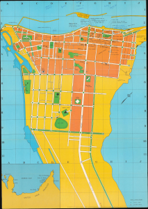
This is a 1977 tourist map of Abu Dhabi in the United Arab Emirates printed by Alsace Print and Production for the local firm Consent-Consolidated Enterprises. It coincides with a transformational period in the Emirate's history, when it was in the midst of a breakneck modernization scheme that built the city known today. (more details)
From the best sources.
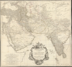
Erster Theil der Karte von Asien welche die Türkei, Arabien, Persien Indien diesseits des Ganges und einen Theil der Tatarei enthält.
sold
- Digital Map Information
- Suitable for large format printing
- DPI: 600
- File Size: 1087.81 MB
- File Type: ZIP / TIFF
- ICC color profile embedded
- Delivered instantly via download link
A striking 1786 separate-issue F. A. Schrämbl map of India, Persia, and Arabia. It is based upon the best cartographic sources of the era and was engraved for one of the first Austrian world atlases, Schrämbl's Allgemeiner Grosser Atlas. The present example is a separate issue likely predating the 1800 publication of the atlas. (more details)
Quirky 18th century British multi-sheet wall map of the Near and Middle East.
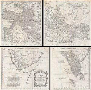
First Part of Asia, being Turkey, Arabia, Persia, most of India and Tartary.
sold
- Digital Map Information
- Suitable for large format printing
- DPI: 300
- File Size: 43.02 MB
- File Type: ZIP / TIFF
- ICC color profile embedded
- Delivered instantly via download link
A curious and uncommon four panel wall map 1786 map of India, Persia, and Arabia by the english publisher M. Postlethwayte. Published in four separate panels, this map can be either joined as a single massive map as assembled, as above, in separate panels. As a ... (more details)
Depicts the entire area of conflict during The Great Game.
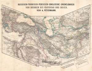
Russisch-Turkisch-Persisch-Englische Grenzländer von Bosnien vis Kaschgar und Indien.
sold
- Digital Map Information
- Suitable for large format printing
- File Size: 34.97 MB
- File Type: ZIP / TIFF
- ICC color profile embedded
- Delivered instantly via download link
This is a scarce and unusual 1877 Augustus Petermann map of the Middle East and Central Asia at the height of The Great Game, a decades-long diplomatic duel between the British and Russian Empires. Detailing the entire theater of war, the map's polyconic projection covers from the Balkans to British India; Crimea to the Persian Gulf and Indian Ocean. The Russian Empire stretches across the top of the map, an ever-expanding threat to countries to the south with deep water ports on the Mediterranean Sea and Indian Ocean. Throughout the 19th century, the Russian drive southward led to several wars with Persia and Turkey, which also embroiled British and French interests, staging Russia as 'the great enemy'. (more details)
Monumental map of Arabia, Persia and India based on D'Anville.
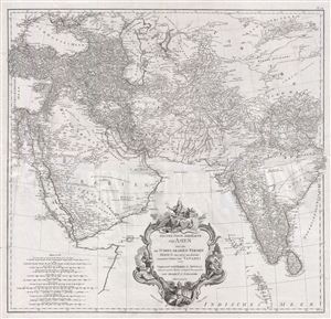
Erster Theil der Karte von Asien welche die Türkei, Arabien, Persien Indien diesseits des Ganges und einen Theil der Tatarei enthält.
sold
- Digital Map Information
- Suitable for large format printing
- DPI: 300
- File Size: 37.9 MB
- File Type: ZIP / TIFF
- ICC color profile embedded
- Delivered instantly via download link
A monumental and highly detailed 1786 map of India, Persia, and Arabia by the Austrian cartographer F. A. Scharembl. Centered on Persia, this map covers from Istanbul to eastern India and Tibet, and from the Black Sea to the Maldives. Schraembl derived this ... (more details)
The first edition of the first modern map of Arabia and the foundation of most subsequent maps of Arabia until the mid-18th century.
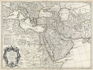
Carte de la Turquie de L'Arabie et de la Perse.
sold
- Digital Map Information
- Suitable for large format printing
- Full resolution TIFF file
- ICC color profile embedded
- Delivered instantly via download link
A scarce first edition first state example of Guillaume De L'Isle's 1701 map of Arabia, Turkey, and Persia. This is a foundational map and may be considered the first modern map of the Arabian Peninsula, in which the vagaries of the Ptolemaic era were at ... (more details)