
Austria - Switzerland - Hungary
Second military survey of the Habsburg lands.
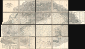
Administrativ-und General-Karte des Königreiches Ungarn... [Administrative and General Map of the Kingdom of Hungary...]
$3,500.00
Acquire
- Digital Map Information
- Suitable for large format printing
- Full resolution TIFF file
- ICC color profile embedded
- Delivered instantly via download link
This is an impressive 17-sheet 1858 Royal Military Geographical Institute map of Hungary. Beautifully engraved, this was the most important and detailed map of Hungary to date, a product of the Franziszeische Landesaufnahme, the Second Military Mapping Survey of the Austrian Empire. (more details)
Hungarian anti-fascist poster printed soon after the liberation of Budapest.
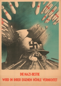
Die Nazi-Bestie Wird in Ihrer Eigenen Höhle Vernichtet.
$2,500.00
Acquire
- Digital Map Information
- Suitable for large format printing
- File Size: 45.74 MB
- File Type: ZIP / TIFF
- ICC color profile embedded
- Delivered instantly via download link
This is a powerful 1945 WWII Era Sándor Ék anti-Nazi pro-soviet propaganda poster published shortly after the liberation of Budapest. (more details)
The Mighty Matterhorn in splendid topographic detail.
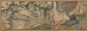
Haack Bild und Karte., No. 3. Monte Rosa - Matterhorn...
$1,800.00
Acquire
- Digital Map Information
- Suitable for large format printing
- File Size: 154.3 MB
- File Type: ZIP / TIFF
- ICC color profile embedded
- Delivered instantly via download link
This is a massive (28 x 77 in.) c. 1917 Justus Perthes wall map of a portion of the Alps along the Italian-Swiss border, including the famous Matterhorn. Published at the height of the early 20th-century alpine mountaineering boom, it provides a meticulous topographical overview of the Monte Rosa-Matterhorn region, one of the most challenging and storied areas for mountaineering in the world. (more details)
Gardasee, guarding the frontier.
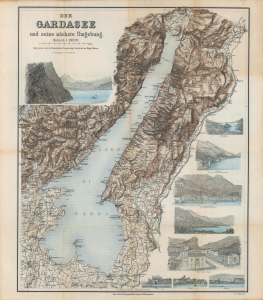
Der Gardasee und seine nächste Umgebung.
$1,500.00
Acquire
- Digital Map Information
- Suitable for large format printing
- Full resolution TIFF file
- ICC color profile embedded
- Delivered instantly via download link
A c. 1890 map and set of views of Lake Garda, Italy, produced by the Kartographisches Institut, based in Hildburghausen. It was intended for German-speaking tourists, who were drawn to Garda despite the relatively recent fighting during the Italian Risorgimento, continued territorial divisions, and simmering tensions. (more details)
Follows the 36th Infantry from Salerno to Austria.
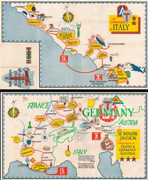
Campaigns of the 36th Infantry Division in World War II. Campaigns in Italy. The 36th Infantry Division Campaigns in France Germany Austria.
$1,400.00
Acquire
- Digital Map Information
- Suitable for large format printing
- Full resolution TIFF file
- ICC color profile embedded
- Delivered instantly via download link
This is a set of two 1945 World War II pictorial route maps of Italy, France, Germany, and Austria following the 36th Infantry Division's progress during the conflict. Yellow and red bursts mark important battles, including Salerno, Rome, Vesoul, and Hagenau. Other pictorial elements reference life encountered along the way, such as children asking for chocolate and the wonder of French champagne. (more details)
Ephemeral WWII mimeograph Route Map following the 318th Infantry Regiment.
Map Route CT 318.
$1,000.00
Acquire
- Digital Map Information
- Suitable for large format printing
- Full resolution TIFF file
- ICC color profile embedded
- Delivered instantly via download link
This is a 1945 mimeographed World War II unit route map of the 318th Infantry Regiment in Europe. It records the regiment's fight across Europe, noting milestones, and includes an operational report of the last days of combat in the European theatre, May 6-7, 1945, on the verso. As a mimeograph, this route map is unusual for the genre and limited by the medium, making it exceptionally ephemeral. (more details)
Balancing Out the Balkans.
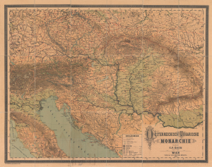
Oesterreichisch Ungarische Monarchie.
$1,000.00
Acquire
- Digital Map Information
- Suitable for large format printing
- File Size: 223.67 MB
- File Type: ZIP / TIFF
- ICC color profile embedded
- Delivered instantly via download link
This is a massive (56 x 70.5 in.) folding wall map of the Austro-Hungarian Empire, prepared in 1882 by Carl Friedrich Baur. It depicts the lands of the Dual Monarchy in the aftermath of the 1878 Congress of Berlin, which saw Austria-Hungary occupy Bosnia and Herzegovina as part of a coordinated effort to limit Russian influence in the Balkans. (more details)
Wars of Religion in Switzerland.
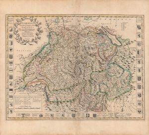
Switzerland and the country of the Grisons : wherein is described the XIII Switz cantons with their allies...
$1,000.00
Acquire
- Digital Map Information
- Suitable for large format printing
- Full resolution TIFF file
- ICC color profile embedded
- Delivered instantly via download link
A beautiful, original color example of John Senex's 1721 map of Switzerland, which appeared in his book A New General Atlas containing a Geographical and Historical account of All the Empires, Kingdoms, and other Dominions of the World. It captures the Swiss Confederation at a moment of internal strife due to confessional differences, which resulted in a change in the balance of power within the Confederation. (more details)
Multiethnic Heartland of the Habsburg Realm.
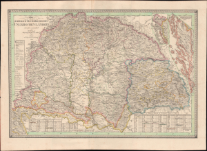
Charte von den Kaiserlich Oesterreichischen Ungarischen Ländern.
$950.00
Acquire
- Digital Map Information
- Suitable for large format printing
- File Size: 50.41 MB
- File Type: ZIP / TIFF
- ICC color profile embedded
- Delivered instantly via download link
This is Friedrich Wilhelm Streit's rare 1830 map of the Kingdom of Hungary and associated territories, published by the Geographisches Institut, Weimar. It displays the Lands of the Hungarian Crown, including Transylvania, Slovakia, and much of today's Croatia, in the wake of the Napoleonic Wars (1803 - 1815) as the Habsburgs adjusted to a changed political landscape. (more details)
Brno Journeyman certificate.
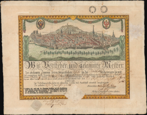
We, the village teacher and all the masters...
$950.00
Acquire
- Digital Map Information
- Suitable for large format printing
- File Size: 16.71 MB
- File Type: ZIP / TIFF
- ICC color profile embedded
- Delivered instantly via download link
A most unusual and likely unique 1825 bird's-eye view of Brno, Moravia, Czech Republic, issued as part of a journeyman's guild-issued certificate of accomplishment. Such certificates were issued throughout the Austrian Empire, but appear to have been exceptionally typical of Brno. (more details)
First Map of the Crownland of Serbia.
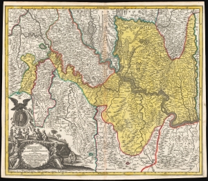
Iustissimae causae heroica virtute propugnatae gloriosiss. Triumphi Praemium, sive accurata delineatio Provinciarum et Urbium quae duabus celeberrimis expeditionibus Iusto Domino ac Victori restitutae et Pace Passarowiziensi : A° 1718 d. 21 Julii a debellatis Turc. concessae et assignatae sunt.
$950.00
Acquire
- Digital Map Information
- Suitable for large format printing
- DPI: 600
- File Size: 70.88 MB
- File Type: ZIP / TIFF
- ICC color profile embedded
- Delivered instantly via download link
This is a beautiful, first state example of Matthias Seutter's 1718 map of Serbia, Timisoara, and parts of modern-day Croatia, Bosnia, and Bulgaria, showing these lands after they passed to the Austrian Empire from the Ottoman Turks following the July 22, 1718, Treaty of Passarowitz. (more details)
One of the earliest maps of Lake Geneva based on local knowledge.
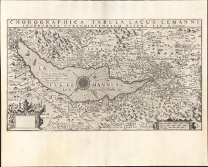
Chorographica Tabula Lacus Lemanni Locorumque Circumiacentium Auctore Iac. G. Genevensi.
$850.00
Acquire
- Digital Map Information
- Suitable for large format printing
- Full resolution TIFF file
- ICC color profile embedded
- Delivered instantly via download link
An uncommon and beautiful map of Lake Geneva engraved by Jodocus Hondius for his 1606 edition of the Mercator Atlas. It is one of the best-detailed maps of the region based on firsthand description, derived from the manuscript map of native Jacques Goulart. (more details)
Stomping Grounds of Freud, Mahler, Klimt, Zweig, and Herzl.
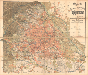
Plan der Reichshaupt und Residenzstadt Wien mit Angabe der neuen Bezirkseintheilung und der früheren Gemeindegrenzen.
$800.00
Acquire
- Digital Map Information
- Suitable for large format printing
- File Size: 1459.94 MB
- File Type: ZIP / TIFF
- ICC color profile embedded
- Delivered instantly via download link
This 1897 chromolithographed large-format folding map of Vienna was prepared by Freytag and Berndt for publication by A. Hartleben's Verlag. It presents the city during a period of drastic transformation when it had become one of the most dynamic intellectual and artistic centers in the world. (more details)
Tank Destroyers during World War II.
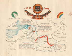
Fightin' 'B' Company 692 T.D. Bn.
$800.00
Acquire
- Digital Map Information
- Suitable for large format printing
- File Size: 16.83 MB
- File Type: ZIP / TIFF
- ICC color profile embedded
- Delivered instantly via download link
This is a c. 1945 World War II unit route map of Company B, 692nd Tank Destroyer Battalion, in Europe. The map follows Company B from its September 26, 1944, debarkation in Europe through France, Belgium, and Germany until May 8, 1945, V-E Day, the end of the war in Europe. (more details)
Frontier of Europe and the Ottoman Empire.
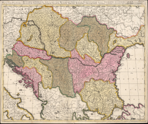
Hungaria Generalis, divisa in proprie dictam Hungariam, Principatum Transylvaniam, Regiones Dalmatiae, Sclavoniae, Moldaviae, Valachiae, Bulgariae, Croatiae, Bosniae, Serviae, Romaniae et Bessarabiae.
$750.00
Acquire
- Digital Map Information
- Suitable for large format printing
- File Size: 24.44 MB
- File Type: ZIP / TIFF
- ICC color profile embedded
- Delivered instantly via download link
This is a beautiful, contemporary-color example of Gerard and Leonard Valk's c. 1705 map of the lands surrounding the course of the Danube, extending from Vienna to the Black Sea. The map encompasses the perennial seat of war between Christian European powers and the Turkish Empire. (more details)
Lovely Lake Geneva, with a city plan.
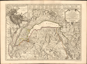
Carte du Lac de Genève et des Pays Circonvoisins...
$750.00
Acquire
- Digital Map Information
- Suitable for large format printing
- DPI: 600
- File Size: 41.06 MB
- File Type: ZIP / TIFF
- ICC color profile embedded
- Delivered instantly via download link
This beautiful engraving is Philippe Buache's 1740 map of Lake Geneva and environs, covering the northwestern end of the European Alpine region that today straddles the border between France and Switzerland. (more details)
Capital of the Austrian Empire.
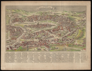
Die Haupt und Residenz Stadt Wien.
$750.00
Acquire
- Digital Map Information
- Suitable for large format printing
- DPI: 600
- File Size: 44.62 MB
- File Type: ZIP / TIFF
- ICC color profile embedded
- Delivered instantly via download link
This is a rare, anonymous c. 1830 bird's-eye view of Vienna, roughly oriented to the south. (more details)
Swiss Cheese Mafia!
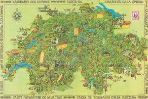
A celebrated 1978 Otto M. Müller pictorial propaganda map of Switzerland illustrating cheese production. The map was issued by the despotic Schweizer Käseunion (Swiss Cheese Union), a corrupt cartel intent on limiting and controlling Swiss cheese production. It promotes the 14 cheeses supported by the SCU, among them reblochon, raclette, gruyere, Emmental, and Tilsiter - ignoring the thousands of other cheeses the union disowned. This map and other propaganda efforts are responsible for transforming fondu and raclette into national dishes and marginalizing Switzerland's centuries-old cheesemaking traditions. (more details)
At the height of the Biedermeier period.
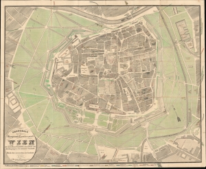
Gundriss der innern haupt-und Residenzstade Wien mit ihren Haus Nummern, dem Glacis und dem Eingange in die nächsten Vorstädte Nach der Neuesten Ausnahme.
$750.00
Acquire
- Digital Map Information
- Suitable for large format printing
- File Size: 55.91 MB
- File Type: ZIP / TIFF
- ICC color profile embedded
- Delivered instantly via download link
This is a rare 1834 J. Bermann map of Vienna (Wein) composed to illustrate Johann Hehl’s accompanying city guide. It illustrates Vienna at the height of the Biedermeier Period (1815 - 1848) when a growing educated middle class was redefining social norms within the urban landscape. (more details)
First edition of Mercator's Map of Transylvania.
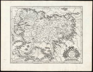
Transylvania.
$750.00
Acquire
- Digital Map Information
- Suitable for large format printing
- DPI: 600
- File Size: 44.51 MB
- File Type: ZIP / TIFF
- ICC color profile embedded
- Delivered instantly via download link
This is a superb example of Gerard Mercator's 1595 map of Transylvania, covering what is now central Romania, in its first edition. (more details)
Transylvania, from the first modern atlas.
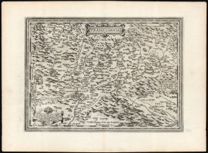
Transilvania / Hanc ultra Transilvaniam, quae et Panodacia, et Dacia Ripēsis, vulgo Sibemburgē Dicitur, edidit Viennae Ao. 1566 Nobiliss. atque Doctiss. Ioês Sâbucus Pannonius.
$750.00
Acquire
- Digital Map Information
- Suitable for large format printing
- DPI: 600
- File Size: 54.14 MB
- File Type: ZIP / TIFF
- ICC color profile embedded
- Delivered instantly via download link
This is Abraham Ortelius' 1575 map of Transylvania, from the first modern atlas, covering what is now central Romania. It is a superb engraving, dramatically presenting the mountains and forests of this frontier region of Europe and the Turkish Empire. (more details)
The Danube below Vienna.
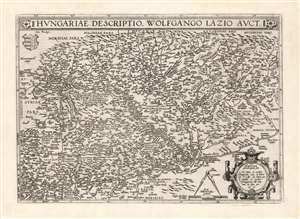
Hungariae Descriptio Wolfgango Lazio Auct.
$750.00
Acquire
- Digital Map Information
- Suitable for large format printing
- DPI: 600
- File Size: 62.82 MB
- File Type: ZIP / TIFF
- ICC color profile embedded
- Delivered instantly via download link
This is Abraham Ortelius' 1570 map of Hungary, the first acquirable, accurate map of that region, and the first atlas map of Hungary. The map includes parts of Austria, Slovakia and Romania, with parts of Croatia, Bosnia and Serbia in the south. The heart of the map is the River Danube, reaching from Vienna in the west to the Romanian river Olt (here in the German Alt and the Latin Aluta) Buda and Pest are shown. Belgrade appears at the confluence of the Sau and the Danube, with the antiquated German appellation Griechschweissenburg. (more details)
Modeling the Mapping of Switzerland for Two Centuries
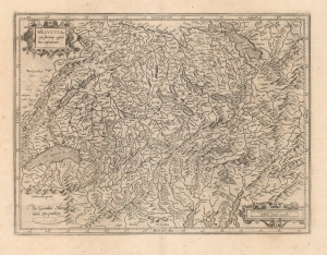
Helvetia cum finitimis regionibus confederatis.
$700.00
Acquire
- Digital Map Information
- Suitable for large format printing
- DPI: 600
- File Size: 45.8 MB
- File Type: ZIP / TIFF
- ICC color profile embedded
- Delivered instantly via download link
This is Gerard Mercator's 1585 map of Switzerland, the second map of the Confederation to appear in a modern atlas. It sharply improves upon its precursor, by Ortelius, both in overall delineation and detail. (more details)
The Danube below Vienna.
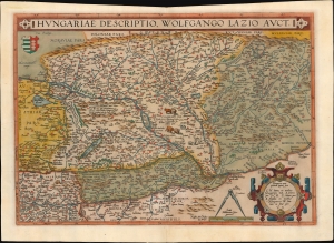
Hungariae Descriptio Wolfgango Lazio Auct.
$700.00
Acquire
- Digital Map Information
- Suitable for large format printing
- Full resolution TIFF file
- ICC color profile embedded
- Delivered instantly via download link
This is Abraham Ortelius' 1570 map of Hungary, the first acquirable, accurate map specifically of that region, and the first to appear in an atlas. (more details)
Tourism in the midst of WWII.
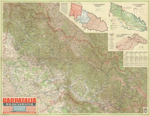
KÁRPÁTALJA. ПОДКАРПАТІЯ. KARPATENLAND. SUBCARPATHIE. SUBCARPAZIA.
$650.00
Acquire
- Digital Map Information
- Suitable for large format printing
- File Size: 84 MB
- File Type: ZIP / TIFF
- ICC color profile embedded
- Delivered instantly via download link
This is a 1940 Royal Hungarian Institute of Military Cartography map of Transcarpathia (Kárpátalja), today part of Ukraine known as Zakarpattia Oblast. The map was published less than a year after Hungary annexed the independent republic of Carpatho-Ukraine (discussed below). (more details)
Dramatic Map of Conquest.
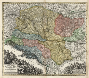
Nova et Accurata Hungariae cum Adiacentibus Regnis et Principatibus Tabula, Aeri Incisa et Venum Exposita À Matthaeo Seütter, Chalcographo Augustano.
$650.00
Acquire
- Digital Map Information
- Suitable for large format printing
- DPI: 600
- File Size: 73.61 MB
- File Type: ZIP / TIFF
- ICC color profile embedded
- Delivered instantly via download link
This is an early 18th century Matthias Seütter map of Hungary and its borderlands. The map follows Habsburg victories over the Ottoman Empire, resulting in the absorption of Ottoman lands by Hungary. It is among Seütter early corpus, prior to his becoming official cartographer for the Holy Roman Emperor - though likely no earlier than 1718, at which point most of the territorial acquisitions mapped here had been set by treaty. (more details)
Dominant 16th century model for the mapping of Austria.
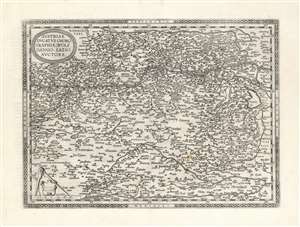
Austriae Ducatus Chorographia, Wolfgango Lazio Auctore.
$650.00
Acquire
- Digital Map Information
- Suitable for large format printing
- DPI: 600
- File Size: 57.8 MB
- File Type: ZIP / TIFF
- ICC color profile embedded
- Delivered instantly via download link
This is Abraham Ortelius' 1570 map of Austria. It depicts the lands lying between the Thaya River in the north and the Drava in the south. Between the two flows the Danube, from Waldkirchen am Wesen in the west to Bratislava in the east (here styled Bresburg). Vienna, of course, is prominently noted. (more details)
Rare, Venetian Imprint.
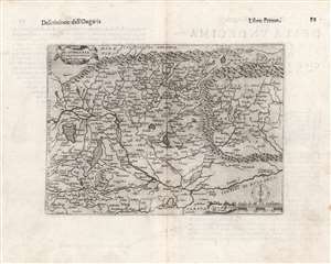
Di Hungaria et Transilvania Tavola novissima Franco for.
$600.00
Acquire
- Digital Map Information
- Suitable for large format printing
- DPI: 600
- File Size: 14.88 MB
- File Type: ZIP / TIFF
- ICC color profile embedded
- Delivered instantly via download link
This is a rare 1597 map of Hungary and Transylvania by the Venetian mapmaker Giacomo Franco. The map is credited as the work of Bernardino Valle, that draftsman's sole known work. It is derived from the cartography of János Zsámboky, probably via the intermediary of Abraham Ortelius. (more details)
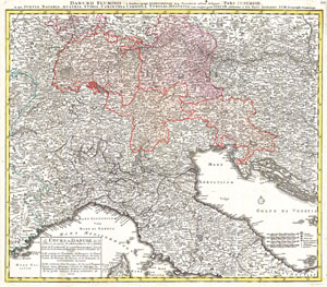
Danubii Fluminus ( a fontibus prope Doneschingam usq Posonium urbem defignati) Pars Superior, in qua Suevia, Bavaria, Asutria, Stiria, Carinthia, Carniola, Tyrolis et Helvetia com magna parte Italiae exhibentur a Ioh. Bapt. Homanno S.C. M. Geographo Norimbergae.
$600.00
Acquire
- Digital Map Information
- Suitable for large format printing
- Full resolution TIFF file
- ICC color profile embedded
- Delivered instantly via download link
A stunning map of the Northern Part of Italy. Switzerland, and parts of Germany. Covers from Rome in the south, north as far as Bavaria and Bohemia, to Provence in the west, and modern day Albania in the east. This highly detailed map was constructed to illustrate ... (more details)
The 16th Century European Frontier.
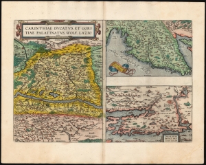
Carinthiae Ducatus, Et Goritiae Palatinus, Wolf. Lazio auctore./ Histriae tabula a Petro Coppo descr./ Zarae, et Sebenici Descriptio.
$550.00
Acquire
- Digital Map Information
- Suitable for large format printing
- Full resolution TIFF file
- ICC color profile embedded
- Delivered instantly via download link
This is Abraham Ortelius' 1573 engraving containing the maps of The Duchy of Carinthiae in Austria, Istria on the Adriatic coasts of Croatia and Slovenia, and the region around the Croatian ports of Zara and Srebrenica. Although the maps are not contiguous with one another, they all represent very contemporary maps of western strongholds near Europe's frontier with Habsburg Hungary and with the Ottoman Empire.
Ortelius was a keen compiler of sources: his map of the Duchy of Carinthia comes from the very current map of the Viennese Wolfgang Lazius; Carinthiae ducatus cum palatinate Goricia appeared in his 1561 atlas of Austria. Carinthia, the southernmost region of Austria, is now noted for the mountains of the Eastern Alps; the region on the map extends southwards beyond the Karawank Mountains into what is now northern Slovenia. The map is bisected by the Drava River running west to east. In addition to the mountains this region is also known for its lakes. The present map includes the Millstätter See, the Ossiacher See, and the Wörthersee. On the Slovenian side of the Karawank mountains near the city of Idria (Idrija) there is noted, Argenti viva fodine: a quicksilver, or mercury, mine. This is an accurate notation of keen interest: anyone seeking to purify mined silver or gold required quicksilver for the process; and the mine of Idrija had produced that rare metal going back to 1490.
The map of Istria - the Adriatic peninsula predominantly held by Croatia and Slovenia - Ortelius credited to its ultimate source, Pietro Coppo. The Venetian Coppo had lived in a town on the northwest coast of Istria for most of his life, and in about 1525 had produced a woodcut map of the area. Although in his text Ortelius also credits the scholar Leandro Alberti, Ortelius' map appears to be a closer to Bertelli's 1569 iteration of the Coppo.
The third map focuses on the region around the Croatian cities of Zadar (Zara) and Šibenik (Sebenici). Zadar is the oldest continuously inhabited city in Croatia and is a historical center of Dalmatia. The name 'Zara' began to be applied to the city when it was absorbed by the Republic of Venice in the 15th century. Šibenik is the third-largest city of Dalmatia, and like Zadar was held for a time by the Republic of Venice. Ortelius claimed his source to be anonymous; Meurer and Woodward have attributed the 1570 source map to Paolo Forlani. (more details)
Ortelius was a keen compiler of sources: his map of the Duchy of Carinthia comes from the very current map of the Viennese Wolfgang Lazius; Carinthiae ducatus cum palatinate Goricia appeared in his 1561 atlas of Austria. Carinthia, the southernmost region of Austria, is now noted for the mountains of the Eastern Alps; the region on the map extends southwards beyond the Karawank Mountains into what is now northern Slovenia. The map is bisected by the Drava River running west to east. In addition to the mountains this region is also known for its lakes. The present map includes the Millstätter See, the Ossiacher See, and the Wörthersee. On the Slovenian side of the Karawank mountains near the city of Idria (Idrija) there is noted, Argenti viva fodine: a quicksilver, or mercury, mine. This is an accurate notation of keen interest: anyone seeking to purify mined silver or gold required quicksilver for the process; and the mine of Idrija had produced that rare metal going back to 1490.
The map of Istria - the Adriatic peninsula predominantly held by Croatia and Slovenia - Ortelius credited to its ultimate source, Pietro Coppo. The Venetian Coppo had lived in a town on the northwest coast of Istria for most of his life, and in about 1525 had produced a woodcut map of the area. Although in his text Ortelius also credits the scholar Leandro Alberti, Ortelius' map appears to be a closer to Bertelli's 1569 iteration of the Coppo.
The third map focuses on the region around the Croatian cities of Zadar (Zara) and Šibenik (Sebenici). Zadar is the oldest continuously inhabited city in Croatia and is a historical center of Dalmatia. The name 'Zara' began to be applied to the city when it was absorbed by the Republic of Venice in the 15th century. Šibenik is the third-largest city of Dalmatia, and like Zadar was held for a time by the Republic of Venice. Ortelius claimed his source to be anonymous; Meurer and Woodward have attributed the 1570 source map to Paolo Forlani. (more details)
The Earliest Collectible Printed Image of Belgrade.
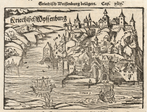
Kriechisch Wyssenburg.
$500.00
Acquire
- Digital Map Information
- Suitable for large format printing
- Full resolution TIFF file
- ICC color profile embedded
- Delivered instantly via download link
This is the 1550 Sebastian Münster woodcut view of Belgrade - the earliest obtainable printed image of that city. (more details)
Hungary and the Habsburgs.
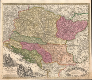
Regnorum Hungariae, Dalmatiae, Croatiae, Sclavoniae, Bosniae, Serviae et Principatus Transylvaniae novissima exhibitio.
$500.00
Acquire
- Digital Map Information
- Suitable for large format printing
- File Size: 26.6 MB
- File Type: ZIP / TIFF
- ICC color profile embedded
- Delivered instantly via download link
A striking example of Johann Baptist Homann's c. 1710 map of the Kingdom of Hungary and environs, produced for his Neuer Atlas. It reflects the most up-to-date information available at a time when this region was bitterly contested and underwent frequent territorial shifts. (more details)