
Austria - Switzerland - Hungary (sold)
First Edition, First State of a later censured Map of Hungary.
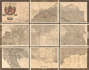
Magyar Ország, Horvát, Tót, Dalmát, és Erdély Országok, a tenger mellék és a végőri videkék kőzonséges pśták és útak főldabrosza... / Vollstaendige General Posten- und Strassen-Karte des Königreichs Ungran, der Königreiche Croatien, Slavonien, Dalmatien, des Grossfürstenth. Siebenbürgen, des Küstenlandes und der Militair-Grenze...
sold
- Digital Map Information
- Suitable for large format printing
- File Size: 591.44 MB
- File Type: ZIP / TIFF
- ICC color profile embedded
- Delivered instantly via download link
This is Blaschnék Sámuel and Schedius Lajos' lavish, very large-format bilingual (Hungarian-German) c. 1836 folding map of the Kingdom of Hungary, here in its first-edition first-state. It depicts the kingdom in the wake of the Napoleonic Wars, when it was in the midst of a reform movement, and represents the most detailed and up-to-date mapping of the kingdom in the first half of the 19th century. (more details)
Piedmontese Easter - a Massacre of Waldensians in the Europe Wars of Religion.
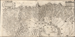
Topografica descrittione d'Alcune singolari Città in pian, e Valliprincipali nelle Alpi, per le quali come Porte del Italia dal Piemonte sipassa in Provenza, Delinato, Savioa, e Vallei, nelle quali resiedono la Missioni de PP. Capuccini.
sold
- Digital Map Information
- Suitable for large format printing
- File Size: 28.98 MB
- File Type: ZIP / TIFF
- ICC color profile embedded
- Delivered instantly via download link
This exceptional piece is the 1659 Paulus a Lotharinga map of the Italian Alps issued to illustrate ongoing efforts to suppress the Waldensians (Valdesi) sect in the wake of the 1655 'Piedmontese Easter' or the 'Massacre of the Waldensians' - one of the darkest episodes in the European Wars of Religion. It is known in academic circles as the Carta dei Cappuccini or 'Capuchin Map'. (more details)
Grandest, Most Beautiful Map of Switzerland of the 18th Century.
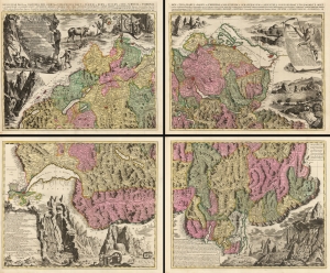
Nova Helvetiae Tabula Geographica Illustrissimis et Potentissimis Cantonibus et Rebuspublicis Reformatae Religionis Tigurinae, Bernensi Scaphusianae, Abbatis Cellanae...
sold
- Digital Map Information
- Suitable for large format printing
- Full resolution TIFF file
- ICC color profile embedded
- Delivered instantly via download link
This is Johann Jacob Scheuchzer's four-sheet map of Switzerland in its spectacular 1715 Pieter Schenk Amsterdam edition. Map historian Tony Campbell wrote, 'Its borders make it probably the most handsome map ever produced of Switzerland; yet the carefully labeled tableaux were intended as scientific illustrations, not just decoration.' Schenk's edition is brighter and more legible than the Zurich edition. (more details)
The Ringstrasse - planning the democratization of Vienna.
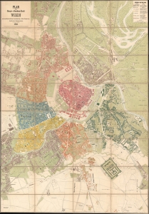
Plan der Haupt-u. Residenz Stadt Wein mit der neuen Bezirkseintheilung, Strassenbenennung under Häuser-Nummerirung.
sold
- Digital Map Information
- Suitable for large format printing
- File Size: 283.83 MB
- File Type: ZIP / TIFF
- ICC color profile embedded
- Delivered instantly via download link
A rare and significant 1866 official planning map of Vienna (Wein) drawn by Ludwig Zettle, one of the civil engineers working on the development of the Ringstrasse and the expansion of the city beyond its historic walls. The work represents a transitional moment, both for Vienna and for the Austrian Empire as a whole. One year after this map was issued, the Hapsburg Empire was reorganized as the constitutional Austro-Hungarian Monarchy. Likewise, the deconstruction of Vienna's walls, the expansion of the city, and the integration of the existing suburbs are evidence of an ongoing democratization of Austria and Europe in general. (more details)
The greatest map of Hungary ever made.
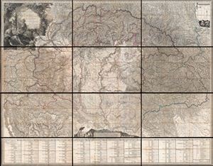
Mappa Generalis Regni Hungariae, partiumque adnexarum Croatiae, Slavoniae et Confiniorum Militarium. Magni item Principatus Transylvaniae geometricis partium dimensionibus, recentissimisque astronomicis observationibus superstructa, adjectis finibus Provinciarum Bukovinae, Galliciae, Silesiae, Austriae, Styriae, Carinthiae, Carnioliae, Dalmatiae, Bosniae, Serviae, Valachae, et Moldaviae.
sold
- Digital Map Information
- Suitable for large format printing
- DPI: 300
- File Size: 211.09 MB
- File Type: ZIP / TIFF
- ICC color profile embedded
- Delivered instantly via download link
Possibly the finest engraved map of Hungary ever produced, and certainly the most detailed, this is Janos's Lipszky's seminal 1806 wall map of Hungary. The map covers Hungary at the height of its territorial claims in the early 19th century, covering from Vienna ... (more details)
A Celebrated Victory.
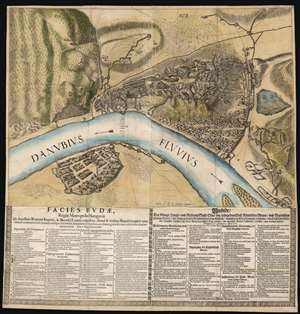
Facies Budae, Regiae Metropolis Hungariae Ab Aquilinis Romani Imperii, et Bavarici Leonis unguibus, simul et viribus Brandeburgicis unanimiter coadunatis, belli flammis undique deformatae, et Infidelium manibus, auxiliante gratiâ Divinâ, victricibus demúm armis ereptae. Die 2. Sept. Anno 1686.
sold
- Digital Map Information
- Suitable for large format printing
- DPI: 600
- File Size: 80.64 MB
- File Type: ZIP / TIFF
- ICC color profile embedded
- Delivered instantly via download link
This is an extremely rare political broadsheet map of Budapest, Hungary. It was engraved by Michael Wening to celebrate the September 2, 1686 victory of combined Holy League forces led by the Duke of Lorraine and the Elector of Bavaria over the Turkish forces occupying Buda, Hungary. (more details)
Centuries of War.
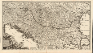
Novissima tabula regni Hungariae et regionum quondam ei unitarum ut Transilvaniae, Valachiae, Moldaviae, Serviae, Romaniae, Bulgariae, Bessarabiae, Croatiae, Bosniae, Dalmatiae, Slavoniae, Morlachiae et reipublicae Ragusanae...
sold
- Digital Map Information
- Suitable for large format printing
- File Size: 44.02 MB
- File Type: ZIP / TIFF
- ICC color profile embedded
- Delivered instantly via download link
Joachim Ottens' rare, large, and beautifully engraved c. 1700 map of the lands about the Danube captures the region in the wake of the 1699 Treaty of Karlowitz, which brought the Great Turkish War (1683 - 1699) to a close. Ottens' map encompasses the theatre of that war and records key battles in that region, stretching back to the 14th century. (more details)
Infographic map of the greatest natural disaster in Budapest history.
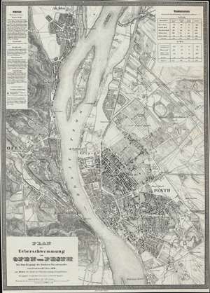
Plan der Ueberschwemmung von Ofen und Pesth bei dem Eisgang des höchsten Wasserstandes vom 15ten auf den 16ten März 1838.
sold
- Digital Map Information
- Suitable for large format printing
- DPI: 600
- File Size: 34.36 MB
- File Type: ZIP / TIFF
- ICC color profile embedded
- Delivered instantly via download link
An extremely rare 1838/1839 infographic map of Budapest, Hungary, issued directly following the disastrous Great Danube Flood of 1838 - likely the greatest natural disaster in Budapest history. Coverage embraces Pest, Buda, and Óbuda. The map shows the high-water marks on both the Buda and Pest sides of the Danube - although the Buda side, being of higher elevation, was mostly unharmed, while the Pest side, a flood plain, was completely destroyed. It also illustrates areas of higher elevation within Pest where residents took refuge. The detail throughout is strikingly granular, with hachured buildings representing surviving structures, and black buildings those that fully collapsed. (more details)
Behold! A Rare, Lafreri-school Geneva.
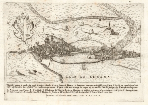
[Geneva].
sold
- Digital Map Information
- Suitable for large format printing
- File Size: 6.91 MB
- File Type: ZIP / TIFF
- ICC color profile embedded
- Delivered instantly via download link
This is a rare 1567 prospect of Geneva, Switzerland, engraved by Paolo Forlani. It presents the city as 'Protestant Rome,' the seat of the Reformation in Europe. The Italian Catholic engraver of the map addresses his audience: Behold how curious the world is today to see the site and form of Geneva! The city's distinctive profile, remoteness, and unfamiliarity to the Catholic reader doubtless inspired wonder. (more details)
A view and a fan!
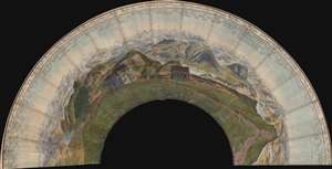
This is an c. 1860 fan-map panorama map of Switzerland as seen from the top of Rigi Kulm. Rigi Kulm is the summit of The Rigi (also known as Mount Rigi and Queen of the Mountains), part of the Swiss Plateau in central Switzerland. The map can sometimes be founds as a circular panorama, but was likely always intended to be a fan. The present example lacks sticks, which may have been removed at a later date so the fan could be more easily framed as a decorative piece - as became common in the late 19th century. (more details)
Restoring civilian governments in occupied and liberated Europe.
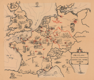
European Civil Affairs Division.
sold
- Digital Map Information
- Suitable for large format printing
- File Size: 22.76 MB
- File Type: ZIP / TIFF
- ICC color profile embedded
- Delivered instantly via download link
This is a 1945 Larry Furman World War II pictorial route map of western and central Europe highlighting the European Civil Affairs Division (ECAD). ECAD was responsible for reestablishing civilian governments in liberated and occupied territories. This map is true WWII scarcity, recorded only at the Library of Congress. (more details)
Scathing critique of the 1921 Treaty of Trianon.
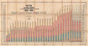
M.F.T.R. Hajóállomány 1894 - 1924.
sold
- Digital Map Information
- Suitable for large format printing
- File Size: 34.23 MB
- File Type: ZIP / TIFF
- ICC color profile embedded
- Delivered instantly via download link
This is a 1924 Hungarian River and Sea Shipping Company, Magyar Folyam – és Tengerhajózási Részvénytársaság (M.F.T.R.), multilingual chart depicting their shipping fleet between 1894 and 1924. A scathing critique of the Treaty of Trianon (the peace treaty signed between the Allied powers and Hungary to end World War I), the chart effectively displays the vast reduction in its fleet because of the treaty. The key, which is situated above the chart itself, is in Hungarian, German, French, and English and utilizes color to illustrate types of vessels. The 'ghost fleet', or those ships lost due to the peace treaty, is illustrated from 1921, as the Treaty of Trianon went into effect on July 31 of that year. (more details)
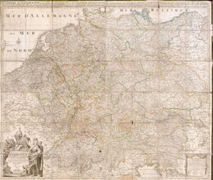
Germaniae L’Empire D’ Allemagne distingue suivant l’etendue tous les etats, principautes et souveradnettes qui passent ou qui ont passé jusque a present sous la nome D’Allemagne sur les Memoires les plus Nouveaux.
sold
- Digital Map Information
- Suitable for large format printing
- File Size: 13.05 MB
- File Type: ZIP / TIFF
- ICC color profile embedded
- Delivered instantly via download link
This is an extraordinary and gigantic c. 1730 map of Germany and the surrounding nations. Map is presented in case or pocket format on 48 linen backed panels. Covers most of what is today central Europe from eastern France and the Netherlands to Poland and ... (more details)
Hungary in the consolidated Austrian Empire.
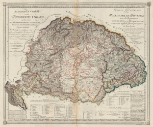
Allgemeine Charte vom Königreiche Ungarn mit Einschluss der Königreiche Croatien und Slavonien dann vom dem Grossfüstenthum Siebenbürgen. / Carte Générale du Royeaume de Hongrie avec les Royeaumes de Croatie et d'Esclavonie contenant aussi le Grand-principauté de Tansilvanie.
sold
- Digital Map Information
- Suitable for large format printing
- File Size: 34.84 MB
- File Type: ZIP / TIFF
- ICC color profile embedded
- Delivered instantly via download link
This is an 1805 Joseph Marx von Liechtenstern map of the Kingdom of Hungary and the Grand Principality of Transylvania. The map and the rare Kipferling atlas it was published in were issued as a celebration and administrative tool for the consolidated Austrian Empire, declared in reaction to Napoleon's First French Empire during the Napoleonic Wars (1803 - 1815). (more details)
First atlas map of Switzerland, in superb original color.
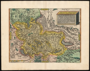
Helvetiae Descriptio Aegidio Tschudo Auct.
sold
- Digital Map Information
- Suitable for large format printing
- Full resolution TIFF file
- ICC color profile embedded
- Delivered instantly via download link
This is Abraham Ortelius' 1570 map of Switzerland, the first to appear in a modern atlas, in superb original color. This richly detailed, southern-oriented map provided the best delineation of the Swiss Confederation to date. (more details)
First atlas map of Switzerland.
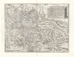
Helvetiae Descriptio Aegidio Tschudo Auct.
sold
- Digital Map Information
- Suitable for large format printing
- DPI: 600
- File Size: 53.28 MB
- File Type: ZIP / TIFF
- ICC color profile embedded
- Delivered instantly via download link
This is Abraham Ortelius' 1570 map of Switzerland, the first to appear in a modern atlas. This richly detailed, southern-oriented map provided the best delineation of the Swiss Confederation of the sixteenth century. (more details)
The finest 19th century map of the Mont Blanc Range.
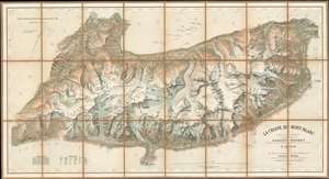
Le Chaine du Mont-Blanc.
sold
- Digital Map Information
- Suitable for large format printing
- File Size: 50.21 MB
- File Type: ZIP / TIFF
- ICC color profile embedded
- Delivered instantly via download link
Generally known as 'The Imfeld Map', this is a dramatic and stunning 1896 Xaver Imfeld chromolithograph map of the Mont Blanc Mountain Range in Switzerland's Alps - at the time the finest map of the region yet produced. The map is oriented slightly to the northwest and is centered on the peak of Mont Blanc itself. Coverage extends from Bon-Nant River in France to Orsières and from Gillot to Courmayeur. The map was highly praised when it was produced by journals of the time,
To this faultless production all explorers of the Chian are deeply indebted, and for the first time the Mont du Brouillard, the Glacier du Mont Blanc, the Rochers du Mont Blanc, the Glacier du Dôme, and the Aiguilles Grises are all beautifully delineated with scrupulous fidelity to nature. (Mathews, C. E., Annals of Mont Blanc, page 216)The whole employs the unique Swiss-style shading techniques employed by the engraver, Kümmerly, to display that country's intense topography. (more details)
Exceptionally rare wall map of Slovenia.
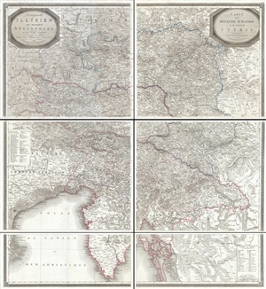
Königreich Illyrien und Herzogthum Steyermark… / Carte du Royaume d'Jllyrie et du Duché de Styrie.
sold
- Digital Map Information
- Suitable for large format printing
- DPI: 300
- File Size: 73.43 MB
- File Type: ZIP / TIFF
- ICC color profile embedded
- Delivered instantly via download link
An exceptional and rare 1819 wall map of Slovenia and Croatia by Georg Adam Zürner and Artaria. Centered on Ljubljana (Laibach), the map covers all of Slovenia along with parts of neighboring Croatia, Venice, and Austria It extends from Venice (Venezia, ... (more details)
Ephemeral WWII mimeograph Route Map following the 318th Infantry Regiment.
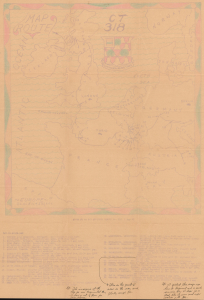
Map Route CT 318.
sold
- Digital Map Information
- Suitable for large format printing
- Full resolution TIFF file
- ICC color profile embedded
- Delivered instantly via download link
This is a 1945 mimeographed World War II unit route map of the 318th Infantry Regiment in Europe. It records the regiment's fight across Europe, noting milestones, and includes an operational report of the last days of combat in the European theatre, May 6-7, 1945, on the verso. As a mimeograph, this route map is unusual for the genre and limited by the medium, making it exceptionally ephemeral. (more details)
The Danube below Vienna.
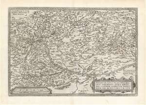
Ungariae Loca Praecipua Recens Emendata Atque Edita, per Ioannem Sambucum Pannonium, Imp. Ms. Historicum. 1579.
sold
- Digital Map Information
- Suitable for large format printing
- DPI: 600
- File Size: 47.53 MB
- File Type: ZIP / TIFF
- ICC color profile embedded
- Delivered instantly via download link
This is Ortelius' updated map of Hungary, derived from the similarly-titled and unacquirable 1571 map of János Zsámboky aka Johannes Sambucus. This new map supplemented Ortelius' earlier map of Hungary, based on the much older (1556) map of Wolfgang Lazio. (more details)
Battle for the Heart of Europe.
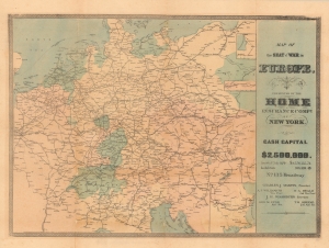
Map of the Seat of the War in Europe.
sold
- Digital Map Information
- Suitable for large format printing
- File Size: 62.39 MB
- File Type: ZIP / TIFF
- ICC color profile embedded
- Delivered instantly via download link
A scarce, unrecorded 1866 map by publisher Joseph H. Higginson produced for the Home Insurance Company of New York during the Austro-Prussian War. It was issued as a means of reassurance to clients that their assets would be safe despite turbulent global events. (more details)
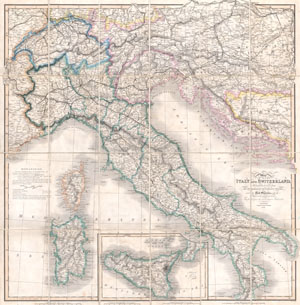
Map of Italy and Switzerland Particularly distinguishing the Different Travelling Roads and the Post Stations; with the number of posts between each Station. Compiled from the most recent Authorities.
sold
- Digital Map Information
- Suitable for large format printing
- File Size: 23.26 MB
- File Type: ZIP / TIFF
- ICC color profile embedded
- Delivered instantly via download link
A rare and beautiful case format map of Italy and Switzerland from 1859. Produced by London cartographer Charles Smith. Covers from Geneva in the west as far east as Turkey and Dalmatia, north to Vienna, and south to include Sicily. Also includes ... (more details)
Roads and Shipping in the Holy Roman Empire.
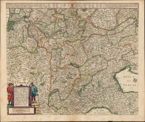
Carta Noua accurata del Passagio et strada dalli Paesi Bassi per via de Allemagna per Italia et per via di Paesi svizeri à Geneva, Lione et Roma per servizio delli Marchanti et viagianti in Genāle ad instanza delli Ss. scherer et sdi Momforti speditori delli Marchantie in Bregens. Dato in luce da Frederico de Wit di Amsterdam l'anno 1671.
sold
- Digital Map Information
- Suitable for large format printing
- DPI: 600
- File Size: 57.46 MB
- File Type: ZIP / TIFF
- ICC color profile embedded
- Delivered instantly via download link
This is a scarce road map engraved by Cornelis Danckerts in 1651, embellished and completed by Frederic De Wit for its most attractive edition, printed in 1671. It illustrates the land routes throughout the Holy Roman Empire connecting the Netherlands, France, Germany, Italy, Switzerland, Austria and Bohemia. It is a remarkable instance of a map commissioned by a specific mercantile concern, in this case the shippers Scherer and Montefort of Bregenz, on the Boden Zee in modern-day Austria. Maps depicting roads, particularly at this level of detail and at this scale, are unusual for this period; this one provides a unique glimpse on the business of transporting goods, and of travel in general, in the seventeenth century. (more details)
Vienna's many buildings and monuments illustrated in monumental fashion.
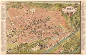
Wien aus der Vogelschau Plan von Wien mit sämtlichen Monumental-Bauten.
sold
- Digital Map Information
- Suitable for large format printing
- Full resolution TIFF file
- ICC color profile embedded
- Delivered instantly via download link
This is a beautiful c. 1907 Hartleben pictorial monumental map of Vienna, Austria. 155 locations are illustrated pictorially and numerically identified throughout the city, including St. Stephen's Cathedral (No. 1), the Rathaus (No. 41), and the Arsenal (No. 105). Forty-nine more locations (many of which are monuments) are illustrated and alphabetically identified. The extensive indexes occupy the left and right margins outside the map. Prominent red lines trace Vienna's tram network. (more details)
Northern Savoy Just After France Captured It.
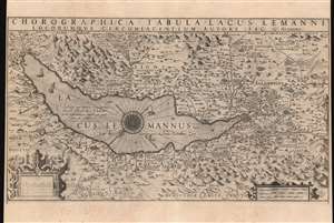
Chorographica Tabula Lacus Lemanni Locorumque Circumiacentium Auctore Iac. G. Genevensi.
sold
- Digital Map Information
- Suitable for large format printing
- DPI: 600
- File Size: 52.73 MB
- File Type: ZIP / TIFF
- ICC color profile embedded
- Delivered instantly via download link
An uncommon and beautiful map of Lake Geneva engraved by Jodocus Hondius for inclusion in his 1606 edition of the Mercator Atlas. This southeast-oriented map depicts the Canton of Geneva in detail and centers on Lake Geneva. The Rhone River can be seen flowing into the lake in the southeast and out again, through the city of Geneva in the west. It is a superb engraving, with elegant strapwork cartouches and dramatic, pictorially-represented mountains. The stippled Lake Geneva is graced with an elaborate compass rose, an array of ships, and even a handful of rowboats. Several geese menace the western coastline, while peeking from the water northwest of the compass rose is a remarkably understated sea monster. (more details)
Tank Destroyers during World War II.
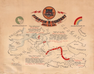
Fightin' 'B' Company 692 T.D. Bn.
sold
- Digital Map Information
- Suitable for large format printing
- File Size: 22.74 MB
- File Type: ZIP / TIFF
- ICC color profile embedded
- Delivered instantly via download link
This is a c. 1945 World War II unit route map of Company B, 692nd Tank Destroyer Battalion, in Europe. The map follows Company B from its September 26, 1944 debarkation in Europe through France, Belgium, and Germany until May 8, 1945, V-E Day, the end of the war in Europe. (more details)
Vienna's many buildings and monuments illustrated in monumental fashion.
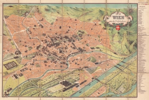
Wien aus der Vogelschau Plan von Wien mit sämtlichen Monumental-Bauten.
sold
- Digital Map Information
- Suitable for large format printing
- Full resolution TIFF file
- ICC color profile embedded
- Delivered instantly via download link
This is a beautiful c. 1900 Hartleben pictorial monumental map of Vienna, Austria. Ninety-two locations are illustrated pictorially and numerically identified, including St. Stephen's Cathedral (No. 1), the Rathaus (No. 40), and the Arsenal (No. 70). Thirty-two monuments are illustrated and alphabetically identified. The extensive index occupies the right margin outside the map. Prominent red lines trace Vienna's tram network. (more details)
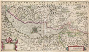
Chorographica Tabula Lacus Lemanni Locorumque Circumiacentium Auctore Iac. G. Genevensi
sold
- Digital Map Information
- Suitable for large format printing
- DPI: 300
- File Size: 12.49 MB
- File Type: ZIP / TIFF
- ICC color profile embedded
- Delivered instantly via download link
An uncommon and beautiful map of Lake Geneva engraved by Jodocus Hondius for inclusion in his 1606 edition of the Mercator Atlas. It is one of the best-detailed maps of the region based on firsthand report, derived from the manuscript map of native Jacques Goulart. (more details)
Hungarian-language map of Hungary on the Eve of the Austro-Hungarian Compromise.
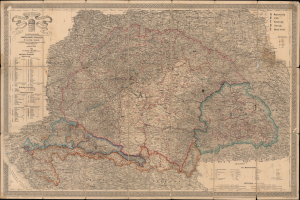
A magyar szent korona országai: Magyarország, Erdély, Horvát-, Tótország és a katonai végvidék a cs. k. hadi-földirati intézet legújabb felmérései és egyéb hiteles források nyomán.
sold
- Digital Map Information
- Suitable for large format printing
- File Size: 68.1 MB
- File Type: ZIP / TIFF
- ICC color profile embedded
- Delivered instantly via download link
This is a rare 1863 Hungarian-language folding map of the Kingdom of Hungary prepared by military officer and map publisher Adolf Ritter von Skrzeszewski. It presents the kingdom during the repressive period between the failed Springtime of Nations Revolutions (1848 - 1849) and the 1867 establishment of the Dual Monarchy. (more details)
Follow an ammunition supply battalion across Europe.
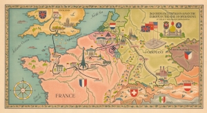
262 Ordnance Battalion (AM) in the European Theatre of Operations. Lt. Col. H.C. Holman Commanding.
sold
- Digital Map Information
- Suitable for large format printing
- Full resolution TIFF file
- ICC color profile embedded
- Delivered instantly via download link
This is an artistic World War II pictorial route map highlighting the campaign of the 262nd Ordnance Ammunition Battalion drawn by Walter Leonard. (more details)
Romanic steam travel on the Danube.
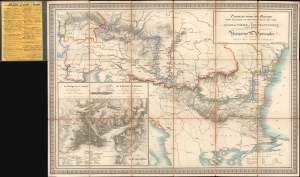
Carte du cours du Danube depuis Ulm jusqu'à son embouchure dans la Mer noire Guide de Voyage a Constantinople sur le Danube avec indication de tous les points de la Navigation des Pyroscaphes sur cette route.
sold
- Digital Map Information
- Suitable for large format printing
- Full resolution TIFF file
- ICC color profile embedded
- Delivered instantly via download link
A beautiful 1864 Artaria map harkening to the romantic early days of steam navigation on the Danube. (more details)
Mechanical Map Protesting the Dictate of Trianon.
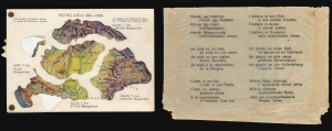
Hungaria 896-1918.
sold
- Digital Map Information
- Suitable for large format printing
- Full resolution TIFF file
- ICC color profile embedded
- Delivered instantly via download link
This is a 1920 mechanical paper map of Hungary, produced in the Interwar Period, by the Hungarian Women's National Association. This fascinating and ingeniously constructed postcard - here including its original protective envelope - is an exemplar of post-World War I Hungarian Irredentism (referring to a policy of advocating the restoration to a country of any territory formerly belonging to it.) It is propaganda in protest of the 1920 Treaty of Trianon, known in Hungary as the Dictate of Trianon. (more details)