
United States (whole) (sold)
Most complete extant example of Christopher Colles' 1794 unpublished and unfinished magnum opus.
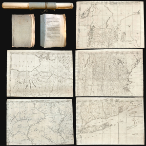
The Geographical Ledger.
sold
- Digital Map Information
- Suitable for large format printing
- Full resolution TIFF file
- ICC color profile embedded
- Delivered instantly via download link
The most complete extant example of Christopher Colles' 1794 unpublished and unfinished magnum opus, The Geographical Ledger, a loose-leaf indexed atlas of the United States whose sheets could be combined into a single enormous map. While not the first large-format American map, the Ledger, even unfinished, is unprecedented in its size and detail, and is the first general map to identify such items as early American forges (furnaces), mills, roads, farmsteads, property owners, roadside inns, fledgling settlements, early county configurations, etc. Although Colles is better known for his publication of the seminal 1790 Survey of the Roads, The Geographical Ledger was a work of boundless ambition that exceeded not only Colles' meager funds, but also the needs and values of the time. Nonetheless, the Ledger, even though unfinished, stands out as the masterwork of an unrecognized genius in pursuit of grandiose visions ahead of his time. (more details)
Exceptional complete example of the First American Road Atlas!
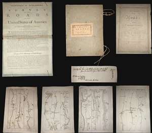
A superb example, entirely complete, of Christopher Colles' 1789 - 1790 A Survey of the Roads of the United States of America. This is the First American Road atlas, wherein at least some of the plates represent the first American maps engraved by a female - Colles' 13-year-old daughter Eliza. Covering depictions from Albany, New York to Williamsburg, Virginia, Colles' atlas consists of a prospectus, a title page, and 83 separate strip maps, each covering some 12 miles of roads and offering invaluable detail about the natural and human landscape of late 18th-century America and was published in commemoration of the founding of the new republic in 1789.
Bringing European Cartographic Ideas to America
The maps appear in a strip-map style previously unknown in North America, but common in European road maps, such as the 1720 Britannia Depicta, or Ogilby Improv'd. Colles' issued the work in separate sheets that could be mixed and matched in a modular format, as needed. This modular format was his own innovation and challenged the user to interpret American roads linearly, as only a traveler can (and must).
The atlas includes 83 separate sheet maps, numbered 1-33, 40-86, and 45*, 46* and 47*. The sheets are laid loose in their original portfolio, with Colles' pastedown title, the original ties and the prospectus pasted to the inside of the front board, as found in most examples. The title page bears the date 1789. It is important to note that it was believed, until recently, that the maps were issued in parts through 1792. However, a hand-written note, laid in by an early-though sadly unnamed-owner, demonstrates that the maps were in fact complete and delivered to subscribers by 1790.
A Federalist Document
In the words of historian Trish Loughran, writing in the The Republic in Print (page 236),
Colles originally intended to survey and map each and every road personally, and many of the maps are indeed based upon his own work. To accomplish this task Colles invented a new kind of perambulator - essentially a modified wagon wheel of a fixed circumference attached to counting cogs that could be used to record distances, a great improvement over the more traditional surveyor's chain. Colles found, however, that completion of the surveys was beyond his limited means, and so, relied upon existing work by military surveyors Simeon DeWitt and Robert Erskine for the maps of Maryland and Virginia. Ultimately, Colles never fully completed his atlas, with only 83 of the originally intended 100 maps published.
Engraved by Americas First Female Map Engraver - Eliza Colles
The maps were drafted by Colles, then engraved by Cornelius Tiebout, and later by his daughter Eliza Colles. It would seem that sometime in the middle of the engraving process, Colles had a falling out with Tiebout and recruited his 13-year-old daughter, Eliza, who may have been Tiebout's apprentice, to complete the engravings. Eliza thus became the first American female engraver. While there is no definitive proof that Eliza engraved for the Survey of Roads, many scholars note that the engraving style of the individual sheets does change, suggesting at least two different engravers were active. In particular the notion is supported by Walter Ristow (page 164) and Benson Lossing, who wrote in his History of New York,
A Financial Failure
Colles sold the maps found in his Survey of Roads by subscription, charging a quarter dollar up front, plus an eighth of a dollar for each delivered section of six sheets. (Nonsubscribers were charged 3 cents per sheet.) Despite a fair price (compare to Abraham Bradley's 1796 map of the United States at 3 1/2 - 5 dollars), accuracy, and fine workmanship, indeed ahead of its time, A Survey of the Roads of the United States of America floundered financially. The intended impact of the work; to promote travel, trade and real-estate transactions, failed to attract sufficient subscribers. As a result, the completed work was offered only in New York and Philadelphia. Deep in debt, Colles began to sell the completed sections of the work separately, with most buyers only acquiring those portions of the maps which they deemed most useful - thus the incompleteness of most known examples. (more details)
Bringing European Cartographic Ideas to America
The maps appear in a strip-map style previously unknown in North America, but common in European road maps, such as the 1720 Britannia Depicta, or Ogilby Improv'd. Colles' issued the work in separate sheets that could be mixed and matched in a modular format, as needed. This modular format was his own innovation and challenged the user to interpret American roads linearly, as only a traveler can (and must).
The atlas includes 83 separate sheet maps, numbered 1-33, 40-86, and 45*, 46* and 47*. The sheets are laid loose in their original portfolio, with Colles' pastedown title, the original ties and the prospectus pasted to the inside of the front board, as found in most examples. The title page bears the date 1789. It is important to note that it was believed, until recently, that the maps were issued in parts through 1792. However, a hand-written note, laid in by an early-though sadly unnamed-owner, demonstrates that the maps were in fact complete and delivered to subscribers by 1790.
A Federalist Document
In the words of historian Trish Loughran, writing in the The Republic in Print (page 236),
Colles placed the year 1789 on the title page in order to make the book's publication coincide with the ratification of the Constitution and the formation of the new government. Indeed, Colles even goes so far as to begin the book's fictional journey on Plate 1 at New York's Federal Hall, which was in 1789, the new national capitol and the recent site of Washington's inauguration. In this way, the book makes the continual literal and symbolic reference to the newly invented nation-state even as it attempts to collect and contain a map to every known space within it in the highly singular space of a book. That it does so in such a way that each represented space can also be experienced locally, by the body hold up any given map on any given road, makes this an exceptional artifact in the production of federalist space.The Work of a Mad Tinkerer
Colles originally intended to survey and map each and every road personally, and many of the maps are indeed based upon his own work. To accomplish this task Colles invented a new kind of perambulator - essentially a modified wagon wheel of a fixed circumference attached to counting cogs that could be used to record distances, a great improvement over the more traditional surveyor's chain. Colles found, however, that completion of the surveys was beyond his limited means, and so, relied upon existing work by military surveyors Simeon DeWitt and Robert Erskine for the maps of Maryland and Virginia. Ultimately, Colles never fully completed his atlas, with only 83 of the originally intended 100 maps published.
Engraved by Americas First Female Map Engraver - Eliza Colles
The maps were drafted by Colles, then engraved by Cornelius Tiebout, and later by his daughter Eliza Colles. It would seem that sometime in the middle of the engraving process, Colles had a falling out with Tiebout and recruited his 13-year-old daughter, Eliza, who may have been Tiebout's apprentice, to complete the engravings. Eliza thus became the first American female engraver. While there is no definitive proof that Eliza engraved for the Survey of Roads, many scholars note that the engraving style of the individual sheets does change, suggesting at least two different engravers were active. In particular the notion is supported by Walter Ristow (page 164) and Benson Lossing, who wrote in his History of New York,
Colles constructed and published a series of sectional road maps which were engraved by his daughter.It should be underlined that Eliza also engraved another of Colles' extremely rare but monumental Geographical Ledger, which appeared in 1794 shortly after the Survey of Roads and bears Eliza's imprint.
A Financial Failure
Colles sold the maps found in his Survey of Roads by subscription, charging a quarter dollar up front, plus an eighth of a dollar for each delivered section of six sheets. (Nonsubscribers were charged 3 cents per sheet.) Despite a fair price (compare to Abraham Bradley's 1796 map of the United States at 3 1/2 - 5 dollars), accuracy, and fine workmanship, indeed ahead of its time, A Survey of the Roads of the United States of America floundered financially. The intended impact of the work; to promote travel, trade and real-estate transactions, failed to attract sufficient subscribers. As a result, the completed work was offered only in New York and Philadelphia. Deep in debt, Colles began to sell the completed sections of the work separately, with most buyers only acquiring those portions of the maps which they deemed most useful - thus the incompleteness of most known examples. (more details)
The last edition of Melish's iconic 'Manifest Destiny' map of the United State to be published in his lifetime.
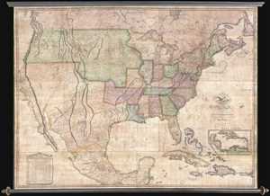
Map of the United States with the Contiguous British & Spanish Possessions Compiled from the latest & best authorities by John Melish . . . Improved to 1822.
sold
- Digital Map Information
- Suitable for large format printing
- DPI: 300
- File Size: 92.78 MB
- File Type: ZIP / TIFF
- ICC color profile embedded
- Delivered instantly via download link
An example of John Melish's important 1822 map of the United States. Melish's map is considered the most influential map of American published in the 19th century and is rivaled only by John Mitchell's 1755 map of North America as the single most influential map ... (more details)
The only published map to exhibit the Jedediah Smith's seminal explorations in the American west.
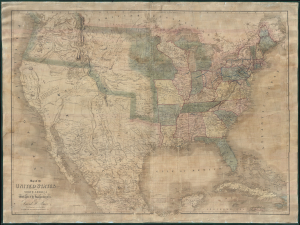
Map of the United States Of North America With parts of the Adjacent Countries.
sold
- Digital Map Information
- Suitable for large format printing
- DPI: 300
- File Size: 81.27 MB
- File Type: ZIP / TIFF
- ICC color profile embedded
- Delivered instantly via download link
This is David H. Burr's unobtainable 1839 wall map of the United States. Burr's map is significant as the only published example of Jedediah Smith's cartography, considered by C. I. Wheat a 'tour-de-force unprecedented and never equaled in the annals of Western exploration.' Smith's 'mountain man' cartography filled a gap in the mapping of the Transmississippi West - after Lewis and Clark (1804 - 06) but before the government-funded expeditions of Fremont (1840). (more details)
First map to name the United States and a contemporaneous illustration of the American Revolutionary War.
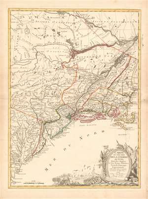
Carte du Théatre de la Guerre actuel entre les Anglais et les Trieze Colonies Unies de l'Amerique Septentrionale dressée par J. B. Eliot Ingénieurs des Etats Unis 1778.
sold
- Digital Map Information
- Suitable for large format printing
- DPI: 600
- File Size: 30.62 MB
- File Type: ZIP / TIFF
- ICC color profile embedded
- Delivered instantly via download link
A 1778 first edition American Revolutionary War era map of the northeastern United States by J. B. Elliot, considered to be of extreme significance. This is generally regarded as the earliest map to use the name 'United States', or in this case, 'Etats Unis'. Drawing on previously unused sources, Eliot's map illustrates the events of the Revolutionary War contemporaneously with the action, making it, essentially a living account of the War of Independence. Margaret Pritchard and Henry Taliaferro, published an essay on this map in Degrees of Latitude, Map 58, describing its significance in great detail, of which this is a short excerpt,
The map of the theater of war between Great Britain and America by J.B. Eliot is important because of its title, Les Treize Colonies Unies de l'Amerique Septentrionale, may include the first reference on a map to the United States. The cartographer was identified as Ingenieurs des Etats Unis. On November 15, 1777, the Continental Congress selected 'The United States of America,' as the name of the thirteen colonies that formed a government under the Articles of Confederation. One month later, French authorities learned of the victory at Saratoga and decided to recognize American independence. By January 8, French foreign minister, Charles Gravier, Comte de Vergennes, informed American envoys that France was ready to engage in an alliance. It is not surprising that the name United States was first mentioned on a map published in Paris in 1778.A decorative cartouche in the lower right incorporates a battle scene wherein British soldiers bombard a small town - possibly Valley Forge? (more details)
… It is also curious that he did not indicate on the map the general's 1777 winter headquarters at Valley Forge, misspelled Walay Forge. What Eliot did illustrate were the lines' march taken by the British and American forces during the campaign in 1777, including Lieutenant Colonel Barry St. Ledger's unsuccessful diversionary expedition down the Mohawk Valley, Burgoyne's march from Crown Point to Albany, and Howe's campaign to take Philadelphia.
… As was usually the case, Eliot appears to have borrowed from several sources in compiling the geography. Some areas were designated by French place-names while others are predominantly English, specifically in the northwestern territories that the French knew best. It is clear they were aware of the latest intelligence relating to the Revolutionary War.
First printed English Nautical Chart of the East Coast
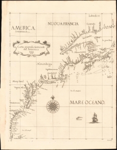
Carta Seconda Generale del' America. XXII.
sold
- Digital Map Information
- Suitable for large format printing
- File Size: 10.87 MB
- File Type: ZIP / TIFF
- ICC color profile embedded
- Delivered instantly via download link
This is the 1661 edition of Robert Dudley's general map of the east coast of North America. According to Burden, this is the 'first printed sea chart of North America by an Englishman and the first to record soundings.' It is a great rarity on the market and a keystone map for any collection of early American cartography. (more details)
'Hail Fredonia!'
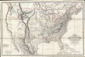
Fredonia, or the United States of North America; including also Cabotia, or the Canadian Provinces; the Western Territory to the Pacific Ocean; and the Northern Part of the Mexican States.
sold
- Digital Map Information
- Suitable for large format printing
- Full resolution TIFF file
- ICC color profile embedded
- Delivered instantly via download link
A fine example of the rare 1830 first obtainable edition of the famous Richard Holmes Laurie 'Fredonia' map of the United States. The map is best known for its advocation of a new name for the United States - Fredonia, which it is argued would build national pride and solidarity, as well as better distinguish it from Canada (Cabotia) and Mexico. Aside from the map's 'Fredish' qualities, this is considered one of the best early 'Manifest Destiny' maps issued in the wake of Lewis and Clark (1804 - 1806), thus illustrating the United States spreading coast-to-coast. It is derived from the most up-to-date sources and includes much of interest throughout. In Florida, it is one of the earliest maps to note the Cape Florida Settlement, a squatter community that was the precursor of modern-day Miami. (more details)
The only known example of Grierson's 1732 piracy of Herman Moll's Codfish Map of North America.
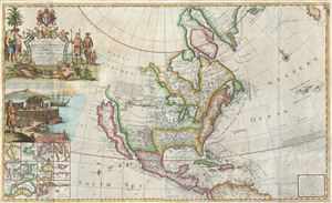
To His Grace Hugh, Lord Archbishop of Armagh, Primate and Metropolitan of all Ireland and One of the Lords Justices of the said Kingdom this map of North America According to the Newest and most Exact Observations is most humbly Dedicated by your Graces most humble Serv: Geo: Grierson.
sold
- Digital Map Information
- Suitable for large format printing
- Full resolution TIFF file
- ICC color profile embedded
- Delivered instantly via download link
An antique map discovery of the utmost rarity. Ostensibly, this is a fine example of Hermann MollÂ's important and highly desirable 1720 Codfish Map, entitled 'To the Right Honourable John Lord Sommers...' Upon closer inspection however, an entirely different ... (more details)
French bid for California.
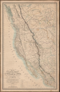
Carte De La Cote De L'Amerique Sur L'Ocean Pacifique Septentrional Le Territoire De L'Oregon, Les Californies, La Mer Vermeille, Partie des Territoires de la Compagnie de la Baie d'Hudson, Et De L'Amerique Russe. Dressee par Mr. Duflot de Mofras, Attache a la Legation de France a Mexico; Pour servir a l'intelligence de son Voyage d'exploration Publie Par Ordre Du Roi, sous les Auspices De Mr. Le Marechal Duc De Dalmatie, Mr. Le Ministre Des Affaires Etrangeres.
sold
- Digital Map Information
- Suitable for large format printing
- DPI: 600
- File Size: 1130.13 MB
- File Type: ZIP / TIFF
- ICC color profile embedded
- Delivered instantly via download link
Published in 1844, this is one of the most interesting and important maps of California, Oregon, and the American West predating the Mexican-American War (1846 - 1848). This map, prepared by the French diplomat and spy, Eugène Duflot de Mofras, was drawn in anticipation of a French bid for California in light of a crumbling and bankrupt Mexican state. (more details)
Definitive field Atlas of the Revolutionary War.
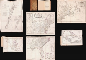
The American Military Pocket Atlas; being An approved Collection of Correct Maps, both General and Particular, of The British Colonies; Especially those which now are, or probably may be The Theatre of War.
sold
This is Sayer and Bennet's 1776 'Holster Atlas', one of the most sought-after cartographic works of the American Revolution. It was published at the beginning of the Revolution and presented as a collection of maps approved by British military authorities for use in the field. (more details)
Unrecorded first state of a foundational map with extensive manuscript additions relating to American Indian Reservations established in 1867-8.
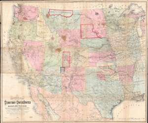
National Map of the Territory of the United States From The Mississippi River To The Pacific Ocean.
sold
- Digital Map Information
- Suitable for large format printing
- Full resolution TIFF file
- ICC color profile embedded
- Delivered instantly via download link
An extraordinary first-edition first-state example of William J. Keeler’s 1867 map of the Trans-Mississippi West - considered the finest post-Civil War railroad era map of the west - with unique manuscript annotations and additions relating to the American Indian Reservation System. This one of a kind historic document was likely the official example retained by the Indian Bureau, and possibly by Keeler himself, to administer and document the development of the American Indian Reservation system through the late 1860s. (more details)
A landmark - a great cartographical achievement … -Wheat
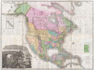
A Map of North America Constructed According to the Latest Information by H. S. Tanner.
sold
- Digital Map Information
- Suitable for large format printing
- DPI: 300
- File Size: 70.48 MB
- File Type: ZIP / TIFF
- ICC color profile embedded
- Delivered instantly via download link
An attractive example of Henry Schenk Tanner's remarkable 1825 landmark map of North America, considered to be the most important map of North America of the 19th century. Revolutionary in countless ways, this is the most accurate map of North America, in ... (more details)
Map used to promote investment in John Law's Compagnie d'Occident (Mississippi Bubble) and the first map to show Le Maire's discoveries.
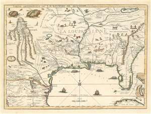
Partie Meridionale De La Riviere De Missisipi, et ses Environs dan L'Amerique Septentrionale.
sold
- Digital Map Information
- Suitable for large format printing
- DPI: 600
- File Size: 23.29 MB
- File Type: ZIP / TIFF
- ICC color profile embedded
- Delivered instantly via download link
A seminal map of the utmost importance and rarity, this is Nicolas de Fer's 1718 map of the Mississippi River Valley drawn to promote the Compagnie d'Occident. Essentially mirroring the coverage of De L'Isle's map of 1703, the map covers from just west of the Rio Grande (Rio del Norte) eastward as far as Charleston, north to include Lake Erie, and south as far as Cuba and the Gulf of Mexico. Per its title, the map is centered on the Mississippi Valley and was intended to illustrate the lush richness of this region. (more details)
A landmark - a great cartographical achievement … -Wheat
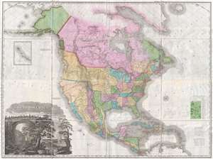
A Map of North America Constructed According to the Latest Information by H. S. Tanner.
sold
- Digital Map Information
- Suitable for large format printing
- DPI: 300
- File Size: 68.73 MB
- File Type: ZIP / TIFF
- ICC color profile embedded
- Delivered instantly via download link
An attractive example of Henry Schenk Tanner's remarkable 1825 landmark map of North America, considered to be the most important map of North America of the 19th century. Revolutionary in countless ways, this is the most accurate map of North America, in ... (more details)
Map used to promote investment in John Law's Compagnie d'Occident (Mississippi Bubble) and the first map to show Le Maire's discoveries.
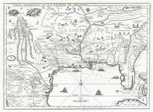
Partie Meridionale De La Riviere De Missisipi, et ses Environs dan L'Amerique Septentrionale.
sold
- Digital Map Information
- Suitable for large format printing
- DPI: 300
- File Size: 15.98 MB
- File Type: ZIP / TIFF
- ICC color profile embedded
- Delivered instantly via download link
A seminal map of the utmost importance and rarity, this is Nicolas de Fer's 1718 map of the Mississippi River Valley drawn to promote the Compagnie d'Occident . Essentially mirroring the coverage of De L'Isle's map of 1703, the map covers from just west ... (more details)
This is one of best early large maps of the United States and the premier map for its period.' - David Rumsey
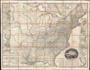
United States of America.
sold
- Digital Map Information
- Suitable for large format printing
- Full resolution TIFF file
- ICC color profile embedded
- Delivered instantly via download link
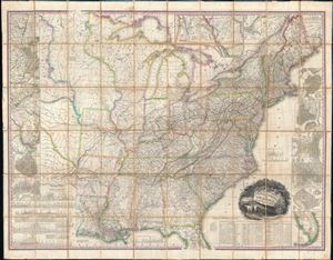
This, the first edition of Henry Schenck Tanner's 1829 wall map of the United States, is one of the most important American maps of the 19th century. The map covers from the Missouri river in the vicinity of Fort Mandan eastward to the Atlantic ... (more details)
This is one of best early large maps of the United States and the premier map for its period.' - David Rumsey
United States of America.
sold
- Digital Map Information
- Suitable for large format printing
- Full resolution TIFF file
- ICC color profile embedded
- Delivered instantly via download link
This, the first edition of Henry Schenck Tanner's 1829 wall map of the United States, is one of the most important American maps of the 19th century. The map covers from the Missouri river in the vicinity of Fort Mandan eastward to the Atlantic ... (more details)
Holy grail of Ge'hog'raphy.
This Porcineograph. / This Good-Cheer Souvenir.
sold
- Digital Map Information
- Suitable for large format printing
- File Size: 49.46 MB
- File Type: ZIP / TIFF
- ICC color profile embedded
- Delivered instantly via download link
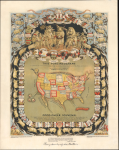
The coveted Porcineograph, considered one of the greatest examples of cartographic whimsy ever made! This is a comical 1876 William Emerson Baker chromolithograph pictorial map - geohography - of the United States as a pig. Initially issued as a party favor, the image is not only humorous but also examines the impact of pigs in American history, including their role in the foundation of the Massachusetts Senate and the Declaration of the War of 1812. (more details)
Mars, the God of War, look on as Fame proclaims the of the Birth of the United States.
Carte de l'Amerique Septle. pour Servir a l'Intelligence de la Guerre Entre les Anglois et les Insurgents.
sold
- Digital Map Information
- Suitable for large format printing
- Full resolution TIFF file
- ICC color profile embedded
- Delivered instantly via download link
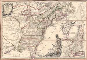
This is a rare 1777 Jean-Baptiste Jacques de Beaurain map of the United States during the American Revolutionary War, issued in anticipation of French entry into the war on the side of the revolutionaries. The map includes a bold illustration of the goddess Ossa (fame) unrolling an expansive map of the Theater of War in the Hudson corridor, proclaiming the newly formed United States. Mars, the god of War, looks on, shield and torch in hand, his arsenal ready - much like France itself. This map is thus an instrument of propaganda intended to prepare the public for French participation in the American Revolution - an event which followed in early 1778. (more details)
Extremely rare Map of the United States in Ottoman-Turkish Arabic Script.
Amerika.
sold
- Digital Map Information
- Suitable for large format printing
- DPI: 300
- File Size: 62.39 MB
- File Type: ZIP / TIFF
- ICC color profile embedded
- Delivered instantly via download link
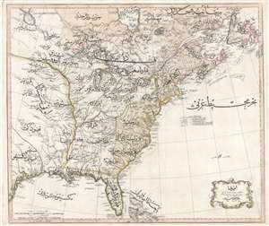
An extraordinary discovery of the utmost importance and rarity, this is Rāif Maḥmūd Efendi's 1803 Ottoman-Turkish map of the United States. The map covers the eastern part of North America from the mouth of the Rio Bravo (Texas) to ... (more details)
First American Board Game - fostering patriotism in the first generation of born U.S. citizens.
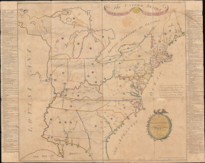
The United States Geographical Amusement / To the Youth of the United States this Map is dedicated by the Author.
sold
- Digital Map Information
- Suitable for large format printing
- Full resolution TIFF file
- ICC color profile embedded
- Delivered instantly via download link
This is the 1806 Jacob Johnson geography game map of the United States - the first American domestically-produced board game. With rich side panel content emphasizing patriotic themes surrounding the American Revolutionary War (1775 - 1783), this map was issued to foster the emerging sense of American identity in the first generation to come of age as citizens of the United States. The map game is, moreover, an important example of early American printing. (more details)
The most important and influential 18th century Colonial Era map of New England.
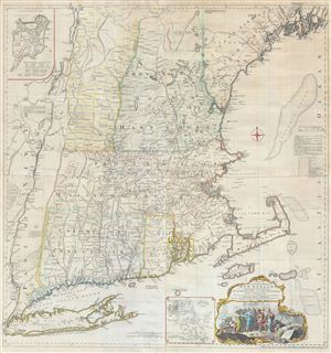
A Map of the most Inhabited part of New England containing the Provinces of Massachusets Bay and New Hampshire, with the Colonies of Connecticut and Rhode Island, divided into Counties and Townships: The whole composed form Actual Surveys and its Situation adjusted by Astronomical Observations.
sold
- Digital Map Information
- Suitable for large format printing
- Full resolution TIFF file
- ICC color profile embedded
- Delivered instantly via download link
A highly significant map, this is the 1774 'Jefferys' Map' of the Most Inhabited Part of New england . Centered on the Massachusetts Bay Colony, this map covers from Long Island to Lake Champlain and from the Hudson River to Cape Cod and ... (more details)
The most important and influential 18th century Colonial Era map of New England.
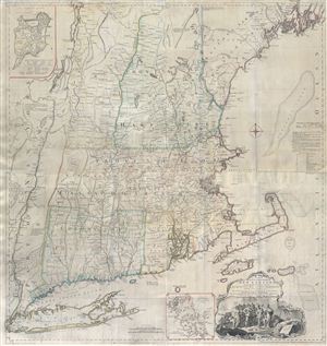
A Map of the most Inhabited part of New England containing the Provinces of Massachusets Bay and New Hampshire, with the Colonies of Connecticut and Rhode Island, divided into Counties and Townships: The whole composed form Actual Surveys and its Situation adjusted by Astronomical Observations.
sold
- Digital Map Information
- Suitable for large format printing
- Full resolution TIFF file
- ICC color profile embedded
- Delivered instantly via download link
A highly significant map, this is the 1774 'Jefferys' Map' of the Most Inhabited Part of New england . Centered on the Massachusetts Bay Colony, this map covers from Long Island to Lake Champlain and from the Hudson River to Cape Cod and ... (more details)
First map to show U.S. claims to British Columbia.
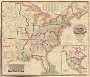
Map of the United States of North America Compiled from the Latest and most Authentic Information by David H. Vance.
sold
- Digital Map Information
- Suitable for large format printing
- DPI: 600
- File Size: 277.94 MB
- File Type: ZIP / TIFF
- ICC color profile embedded
- Delivered instantly via download link
This is the first edition of David Vance and Anthony Finley's outstanding wall map of the United States, published in 1825, here in a remarkable fresh state. This map is significant with regard to its early date, contemporaneous with Amos Lay's map, but more ambitions and predating the 1829 Tanner map by 4 years, as well as its detailed coverage of historic developments. Converge encompasses the Untitled States as it appeared at the time, extending from roughly the Texas Border (100° West of Greenwich / 27° West of Washington) to the Pacific and from the Saint Lawrence River to the Florida Keys. A large inset map appears in the lower right quadrant, illustrating the whole of North America. This is the first map to illustrate American claims to British Columbia that would later spark the 54°40' Debate. (more details)
Highly decorative map promoted as the 'largest best, and most detaled' map fo the United States to appear as of 1849.
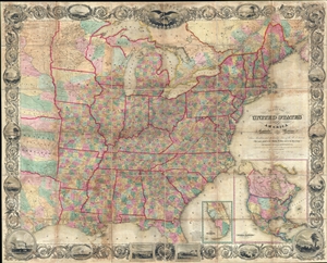
Map of the United States of America Including Canada, and a large portion of Texas, Showing Base Meridian and Township Lines of the U.S. Surveys, Including Lands alotted to the Indian Tribes west of the Mississippi, The various internal improvements.
sold
- Digital Map Information
- Suitable for large format printing
- DPI: 300
- File Size: 147.52 MB
- File Type: ZIP / TIFF
- ICC color profile embedded
- Delivered instantly via download link
A striking large format 1849 case map of the United States by J. Calvin Smith. The map covers from Austin Texas to the eastern seaboard and from Lake Superior to the Gulf of Mexico. When it was introduced, this map was hailed as the ... (more details)
Technological optimism of early 20th-century.
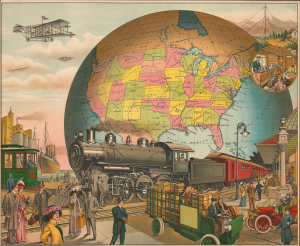
[20th Century Tranportation.]
sold
- Digital Map Information
- Suitable for large format printing
- Full resolution TIFF file
- ICC color profile embedded
- Delivered instantly via download link
A powerful 1910 Charles I. Felthousen / E. S. Yates chromolithograph broadside celebrating the technological optimism of early 20th-century America. It presents the United States as a nation dominating the globe, intoxicated by invention and increasingly convinced that technology will allow it to transcend geographic barriers. The broadside belongs to a broader tradition of aspirational progress imagery popular in the late 19th and early 20th centuries. Such works sought not simply to document technological progress, but to elevate it into a defining national identity. It is no surprise that this was published in Chicago, which, by 1910, saw itself as the embodiment of the future. (more details)
This is one of best early large maps of the United States and the premier map for its period.' - David Rumsey
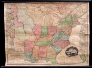
A rare wall map of the United States by H. S. ... (more details)
An eccentric millionaire's folly.
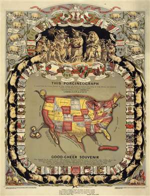
This Porcineograph. / This Good-Cheer Souvenir.
sold
- Digital Map Information
- Suitable for large format printing
- File Size: 7.75 MB
- File Type: ZIP / TIFF
- ICC color profile embedded
- Delivered instantly via download link
The coveted Porcineograph! One of the ... (more details)
A call for brotherhood against the hated English.
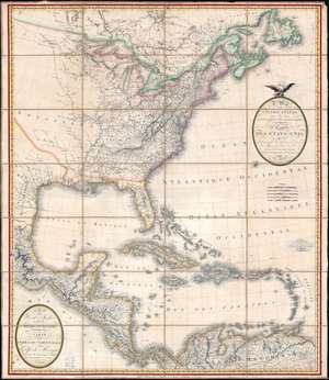
A Map of the United States and Canada, New-Scotland, New-Brunswick and New-Foundland. / Carte des Etats-Unis, avec le Canada, La Nouvelle Ecosse, Le Nouveau Brunswick et Terre-Neuve. / A Map of the West-Indies and of the Mexican-Gulph. / Carte des Indies Occidental et du Golfe du Méxique.
sold
- Digital Map Information
- Suitable for large format printing
- Full resolution TIFF file
- ICC color profile embedded
- Delivered instantly via download link
A lavish, large-scale French map of the United States and West Indies issued in September of 1812 - shortly after the outbreak of the War of 1812 (1812 - 1815). This is one of the few major French cartographic productions not focused on Europe to appear during the Napoleonic Wars (1803 - 1815) and needs to be addressed in this context to be fully understood. With titles both in English and French, it calls for brotherhood and alliance against the hated English. (more details)
Arguing the Texas Compromise of 1850. Mormons on Great Salt Lake.
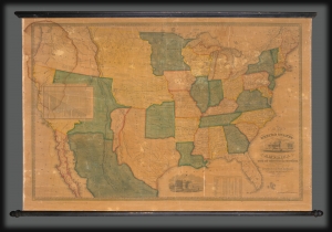
Map of the United States of America with its Territories and Districts. Including also a part of Upper and Lower Canada and Mexico.
sold
- Digital Map Information
- Suitable for large format printing
- DPI: 600
- File Size: 1774.84 MB
- File Type: ZIP / TIFF
- ICC color profile embedded
- Delivered instantly via download link
A most intriguing unrecorded early 1850 variant of the Reed and Barber map of the United States reflecting a nation in flux. The map was issued to satisfy popular curiously regarding the intensely debated newly acquired 'Mexican Cessions', as well as the new national and international borders. It illustrates ambiguity regarding the legislative arguments leading to the Compromise of 1850, which reshaped Texas into its modern configuration, Mormon settlement around Great Salt Lake, the changes brought about by the California Gold Rush, the Oregon Question, the Indian Territories, and more. (more details)
One of the first large-scale maps o the United States made by Americans for Americans.
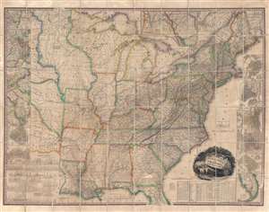
United States of America.
sold
- Digital Map Information
- Suitable for large format printing
- DPI: 600
- File Size: 144.44 MB
- File Type: ZIP / TIFF
- ICC color profile embedded
- Delivered instantly via download link
This, the first edition of Henry Schenck Tanner's 1829 wall map of the United States, is one of the most important American maps of the 19th century. With this important map Tanner initiated a new age of quintessentially American cartography. Unlike his predecessors, John Melish and Matthew Carey, Tanner was born and raised in the United States, and his maps are uniquely American productions, embracing American values and interests. Note the cartouche, with two deer grazing in a dense forest, while in the background three miniscule trains steam westward - a fitting metaphor for the United States, at the time undergoing brisk industrialization fueled by unlimited natural resources. Within the historical context, this map follows the territorial acquisitions of the 1819 Adams-Onís Treaty (Florida, Oregon?), but predates the major expansions in the southwest following the Mexican-American War (1846 - 1848) and the Treaty of Guadalupe-Hidalgo (1848). (more details)
The quintessential trail map of the American west.
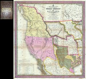
A New Map of Texas Oregon and California with the Regions Adjoining.
sold
- Digital Map Information
- Suitable for large format printing
- Full resolution TIFF file
- ICC color profile embedded
- Delivered instantly via download link
Considered 'the quintessential trail ... (more details)