
American Revolutionary War (sold)
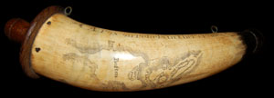
This is a rare and extraordinary powder horn dating to 1775, just prior to the Revolutionary War. Features a stunning scrimshaw map of Boston, Massachusetts, noting Bunker's Hill (Bunker Hill), Breeds Hill, Morton's Point, Charlestown, Mill Pond, Hancock's Warf, ... (more details)
First map to name the United States and a contemporaneous illustration of the American Revolutionary War.
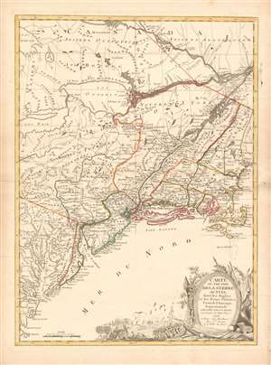
Carte du Théatre de la Guerre actuel entre les Anglais et les Trieze Colonies Unies de l'Amerique Septentrionale dressée par J. B. Eliot Ingénieurs des Etats Unis 1778.
sold
- Digital Map Information
- Suitable for large format printing
- DPI: 600
- File Size: 30.62 MB
- File Type: ZIP / TIFF
- ICC color profile embedded
- Delivered instantly via download link
A 1778 first edition American Revolutionary War era map of the northeastern United States by J. B. Elliot, considered to be of extreme significance. This is generally regarded as the earliest map to use the name 'United States', or in this case, 'Etats Unis'. Drawing on previously unused sources, Eliot's map illustrates the events of the Revolutionary War contemporaneously with the action, making it, essentially a living account of the War of Independence. Margaret Pritchard and Henry Taliaferro, published an essay on this map in Degrees of Latitude, Map 58, describing its significance in great detail, of which this is a short excerpt,
The map of the theater of war between Great Britain and America by J.B. Eliot is important because of its title, Les Treize Colonies Unies de l'Amerique Septentrionale, may include the first reference on a map to the United States. The cartographer was identified as Ingenieurs des Etats Unis. On November 15, 1777, the Continental Congress selected 'The United States of America,' as the name of the thirteen colonies that formed a government under the Articles of Confederation. One month later, French authorities learned of the victory at Saratoga and decided to recognize American independence. By January 8, French foreign minister, Charles Gravier, Comte de Vergennes, informed American envoys that France was ready to engage in an alliance. It is not surprising that the name United States was first mentioned on a map published in Paris in 1778.A decorative cartouche in the lower right incorporates a battle scene wherein British soldiers bombard a small town - possibly Valley Forge? (more details)
… It is also curious that he did not indicate on the map the general's 1777 winter headquarters at Valley Forge, misspelled Walay Forge. What Eliot did illustrate were the lines' march taken by the British and American forces during the campaign in 1777, including Lieutenant Colonel Barry St. Ledger's unsuccessful diversionary expedition down the Mohawk Valley, Burgoyne's march from Crown Point to Albany, and Howe's campaign to take Philadelphia.
… As was usually the case, Eliot appears to have borrowed from several sources in compiling the geography. Some areas were designated by French place-names while others are predominantly English, specifically in the northwestern territories that the French knew best. It is clear they were aware of the latest intelligence relating to the Revolutionary War.
Mars, the God of War, look on as Fame proclaims the of the Birth of the United States.
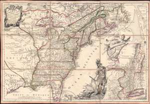
Carte de l'Amerique Septle. pour Servir a l'Intelligence de la Guerre Entre les Anglois et les Insurgents.
sold
- Digital Map Information
- Suitable for large format printing
- Full resolution TIFF file
- ICC color profile embedded
- Delivered instantly via download link
This is a rare 1777 Jean-Baptiste Jacques de Beaurain map of the United States during the American Revolutionary War, issued in anticipation of French entry into the war on the side of the revolutionaries. The map includes a bold illustration of the goddess Ossa (fame) unrolling an expansive map of the Theater of War in the Hudson corridor, proclaiming the newly formed United States. Mars, the god of War, looks on, shield and torch in hand, his arsenal ready - much like France itself. This map is thus an instrument of propaganda intended to prepare the public for French participation in the American Revolution - an event which followed in early 1778. (more details)
Likely used in the field during the American Revolutionary war.
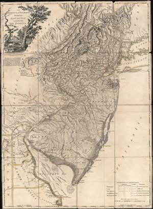
The Province of New Jersey Divided into East and West, commonly called The Jerseys.
sold
- Digital Map Information
- Suitable for large format printing
- Full resolution TIFF file
- ICC color profile embedded
- Delivered instantly via download link
A most fascinating 1777 first-state first-edition map of New Jersey by William Faden and Bernard Ratzer likely used in the field during the American Revolutionary War by the German Hessian supply officer, Friedrich Wilhelm von Wurmb. While focused on New Jersey, coverage extends to include eastern Pennsylvania, Delaware, and New York City. It captures the state's complex topography, noting the Jersey Highlands and the Palisades in the north and the Pine Barrens and coastal marshes in the south. New Jersey is here broken down into 12 counties, as they existed at the time, as well as multiple towns and roads. Note that there are no coastal routes through Monmouth County, requiring travelers instead to travel inland to Crosswicks, then south east to Egg Harbor, before continuing south. There is also an annotation regarding the settlement of Fort Helsingburg, near Salem on the Delaware River, where in 1640, Swedish settlers attempt to establish a colony. (more details)
Strong first-edition strike!
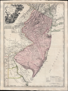
The Province of New Jersey Divided into East and West, commonly called The Jerseys.
sold
- Digital Map Information
- Suitable for large format printing
- Full resolution TIFF file
- ICC color profile embedded
- Delivered instantly via download link
A fine 1777 first-state first-edition map of New Jersey by William Faden and Bernard Ratzer - exhibiting the fine strong strike only evident on first editions. Focused on New Jersey, coverage extends to include eastern Pennsylvania, Delaware, and New York City. It captures the state's complex topography, noting the Jersey Highlands and the Palisades in the north and the Pine Barrens and coastal marshes in the south. New Jersey is here broken down into 12 counties, as they existed at the time, as well as multiple towns and roads. Note that there are no coastal routes through Monmouth County, requiring travelers instead to travel inland to Crosswicks, then south east to Egg Harbor, before continuing south. There is also an annotation regarding the settlement of Fort Helsingburg, near Salem on the Delaware River, where in 1640, Swedish settlers attempt to establish a colony. (more details)
Issued just after the Battle of Bunker Hill.
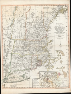
Bowles's New Pocket Map of the Most Inhabited Part of New England; comprehending the Provinces of Massachusets Bay and New Hampshire; with the Colonies of Connecticut and Rhode Island; Divided into their Counties, Townships, and c. Together with an Accurate Plan of The Town, Harbour and Environs of Boston.
sold
- Digital Map Information
- Suitable for large format printing
- DPI: 600
- File Size: 29.62 MB
- File Type: ZIP / TIFF
- ICC color profile embedded
- Delivered instantly via download link
A rare separately published 1776 American Revolutionary War map of New England by Carington Bowles - here in the scarce 4th edition that immediately followed the action at Bunker Hill. It represents one of the best and most up-to-date Revolutionary Era maps of New England. This map was initially issued by Carington Bowles in 1765 as a reduced and updated improvement upon the 1755 John Green / Braddock Mead map. The map transitioned through six known states, the present example representing the fourth state, updated with relevant content at the beginning of the American Revolutionary War (1775 - 1783). (more details)
Early days of American Revolutionary War.
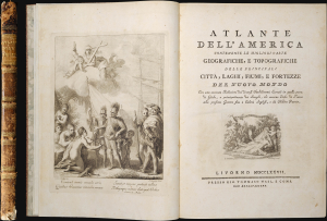
Atlante Dell'America Contenente le Migliori Carte Geografiche, e Topografiche delle Principale Citta, Laghi, Fiumi, e Fortezze del Nuovo Mondo.
sold
This is an important Tommaso Masi 1777 atlas of the Americas, issued in Livorno, Italy, to capitalize on the general interest in the Americas, particularly North America, sparked by the American Revolutionary War (1775-1783). (more details)
First view of New Orleans.
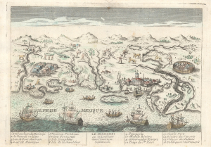
Le Mississipi ou la Louisiane dans l'Amerique Septentrionale.
sold
- Digital Map Information
- Suitable for large format printing
- File Size: 4.43 MB
- File Type: ZIP / TIFF
- ICC color profile embedded
- Delivered instantly via download link
This is a rare c. 1779 Basset / Chéreau broadside leaflet map-view of the Gulf of Mexico littoral c. 1720, just a few years after New Orleans was founded. It is likely the earliest printed view of New Orleans - though admittedly, it is not an accurate representation of the city at the time. The map was issued as a propaganda leaflet to promote New Orleans and French Louisiana. It is indeed one of the earliest maps to include a view of New Orleans and the indigenous peoples of the Gulf. The present example is the second state, issued in late 1770s by Basset to capitalize on French public interest in the American Revolutionary War (1775 - 1783). (more details)
Scarce final issue of the important Holland-Jefferys Map New York, New Jersey, and the Hudson Valley on the brink of the American Revolutionary War. The best obtainable Revolutionary War Era map of this region.
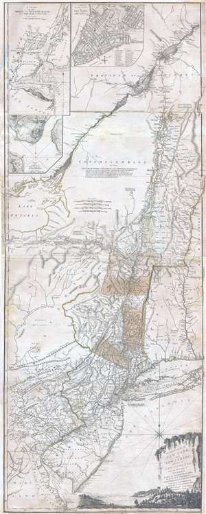
The Provinces of NEW YORK, and NEW JERSEY; with part of PENSILVANIA, and the Governments of TROIS RIVIERES, and MONTREAL: drawn by Major Holland, Surveyor General, of the Norther District in America. / A Chorographical Map of the Country between Albany, Oswego, Fort Frontenac, and Les Trois Rivieres; Exhibiting all the Grants made by the French Governors on Lake Champlain; & between that Lake & Montreal.
sold
- Digital Map Information
- Suitable for large format printing
- DPI: 300
- File Size: 26.6 MB
- File Type: ZIP / TIFF
- ICC color profile embedded
- Delivered instantly via download link
One of the most important, influential, and comprehensive American Revolutionary War Era map of New York, New Jersey, Vermont, and the Hudson Valley corridor, this is an final 1776 state of Major Samuel Holland and Thomas Jeffrey's Provinces of New York and New ... (more details)
Map that brought the French into the American Revolutionary War.
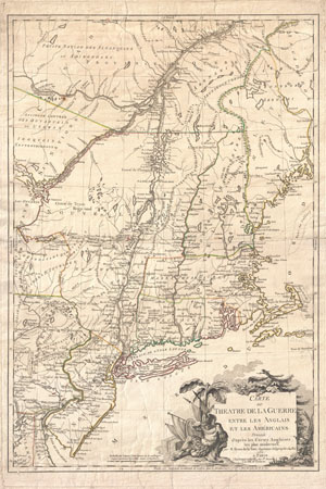
Carte du Theatre de la Guerre entre les Anglais et Les Americains.
sold
- Digital Map Information
- Suitable for large format printing
- DPI: 300
- File Size: 28.67 MB
- File Type: ZIP / TIFF
- ICC color profile embedded
- Delivered instantly via download link
First edition example of an extremely significant map of New York and New England. Issued by Brion de la Tour in 1777, this map was intended to illustrate the important events at the height of the American Revolutionary War. Brion's map covers from the ... (more details)
Recording the First Naval Battle of the American Revolution.
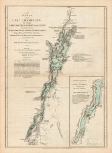
A Survey Of Lake Champlain, including Lake George, Crown Point And St. John. /A Particular Plan of Lake George.
sold
- Digital Map Information
- Suitable for large format printing
- DPI: 600
- File Size: 60.66 MB
- File Type: ZIP / TIFF
- ICC color profile embedded
- Delivered instantly via download link
This is William Furness Brasier's 1762 map of Lakes Champlain and George, in its 1776 second state. The map overall is the first separate map of Lake Champlain and Lake George. Both this and its earlier state would certainly have been in the hands of the British officers leading the Fall 1777 campaign during the American Revolutionary War (1775 - 1783) culminating in a pivotal American victory at Saratoga. (more details)
Revolutionary War Map for the Hessian Market.
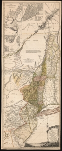
The Provinces of NEW YORK, and NEW JERSEY; with part of PENSILVANIA, and the Province of Quebec. Drawn by Major Holland, Surveyor General, of the Northern District in America. Corrected and Improved, from the Original Materials, By Governr. Pownall, Member of Parliament. Published by Harry Lodowick Broenner, Book-seller to Franckfort upon the Mayn. 1777.
sold
- Digital Map Information
- Suitable for large format printing
- DPI: 600
- File Size: 162.27 MB
- File Type: ZIP / TIFF
- ICC color profile embedded
- Delivered instantly via download link
This is a rare, separately issued German edition of the best-informed map available focusing on the northern theatre of the American Revolution: Samuel Holland's 1775 map of The Provinces of New York and New Jersey, in its final version corrected by Governor Thomas Pownall. This map was published by the heirs of Harry Lodowick Broenner, a Frankfurt-am-Main bookseller, whose forays into cartography were characterized by the swift reproduction of up-to-date maps, topically relevant to Frankfurter interests. As the Holland-Pownall map provided the best available view of the American war zone in which Hessian mercenaries were expected to be active, it would have been an apt target for the Broenners. (more details)
Essential Map Bringing the American Revolution to a French Audience.
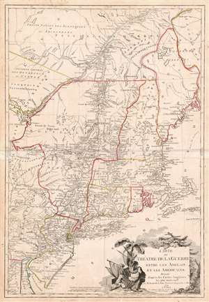
Carte du Theatre de la Guerre entre les Anglais et Les Americains.
sold
- Digital Map Information
- Suitable for large format printing
- DPI: 600
- File Size: 37.33 MB
- File Type: ZIP / TIFF
- ICC color profile embedded
- Delivered instantly via download link
This is a scarce, separately published American Revolutionary War map of New York and New England. First issued by Brion de la Tour in 1777, this map was intended to illustrate the important events at the height of the war. Brion de la Tour's map covers from the Delaware and Chesapeake Bays northward as far as Quebec City, inclusive of New York (with modern day Vermont), New Jersey, Massachusetts, Connecticut, New Hampshire, and parts of Pennsylvania, Maryland, Delaware, Maine, and Canada. It offers both political and topographical detail including mountains, rivers, roadways, regional boundaries, American Indian nations, towns, and cities. (more details)
United Colonies: First printed map devoted to the 13 states.
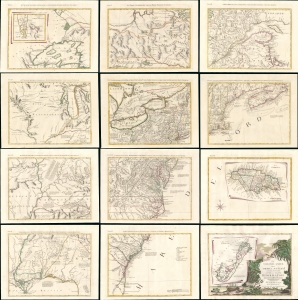
Le Colonie Unite Dell' America Settentrle. Di Nuova Projezione a S.S.E.E. Li Signori Riformatori Dello Studio Di Padovia.
sold
- Digital Map Information
- Suitable for large format printing
- File Size: 191.68 MB
- File Type: ZIP / TIFF
- ICC color profile embedded
- Delivered instantly via download link
This is a beautiful example of Antonio Zatta's 1778 12-sheet Revolutionary War era wall map of the United States - significant as the first printed map dedicated to the thirteen states, here distinguished from their former status as 'British Colonies' by the new term 'Colonies Unite' or 'United Colonies.' (more details)
Earliest Acquirable View of Charleston, South Carolina.
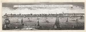
An Exact Prospect of Charlestown, the Metropolis of the Province of South Carolina.
sold
- Digital Map Information
- Suitable for large format printing
- Full resolution TIFF file
- ICC color profile embedded
- Delivered instantly via download link
This is the most important early view of Charleston, South Carolina. This view of Charleston was published in 1779 by the London Magazine. It is one of the few images available to the collector of the pre-Revolutionary colonial south, capturing the city when it was the fourth largest port in the North American British colonies. It is based on the unobtainable rare view of the same title engraved by William Henry Toms (c. 1700 - 1765) in 1739, in turn based on a watercolor painted from life by American artist Bishop Roberts between 1735 and 1739. (This original watercolor is in the collection of Colonial Williamsburg.) The view shows the waterfront of the city as seen from the opposite bank of the Cooper River. It clearly illustrates the town's shoreline batteries, warehouses, and wharves. Several structures are marked with a letter key: these are the Granville Bastion, the courthouse, the council chamber, the Quaker meeting house, the spire of Saint Philip's Church, the Customs House, and at the far-right Craven's Bastion. The waters of the Cooper are filled with ships, ranging from humble rowboats to British warships - underscoring both Charleston's prosperity and military significance. In the foreground, a group of fishermen wrestle a great fishnet ashore. The beautifully engraved sky above the city is teeming with birds. (more details)
Important Revolutionary war coastal chart of the Sea Islands in South Carolina, Georgia, and northern Florida.
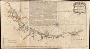
A Draught of South Carolina and Georgia from Sewee to St. Estaca.
sold
- Digital Map Information
- Suitable for large format printing
- DPI: 600
- File Size: 43.98 MB
- File Type: ZIP / TIFF
- ICC color profile embedded
- Delivered instantly via download link
A rare and important 1778 American Revolutionary War era Andrew Hughes nautical chart or maritime map of the coasts of South Carolina, Georgia, and northern Florida. During the early part of the Revolutionary War, this was the best obtainable nautical chart of the Sea Islands. Oriented to the east, this stunning map covers the Atlantic coast from the Santee River (Sewee River), South Carolina, past Charleston, Beaufort, and Savannah, to Saint Augustine, Florida. In addition, the map offers extensive and valuable piloting instructions addressing the entire coast line as well as most individual islands, including Tybee Island, Amelia Island, and Sapelo Island. It also includes excellent coverage of the region's shoals, anchorages, currents, marsh lands, river estuaries, and tides marks. (more details)
Separate issue map illustrating the ramifications of the American Revolutionary War in the East Indies.
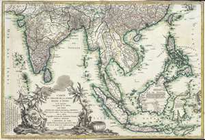
Carte du Theatre De La Guerre Dans L'inde ou se Trouvent Une Partie de La Chine, Les Iles De Sumatra, Java, Borneo, Moluques et Philippines. Dressee d'apres les Meilleures Cartes tant Francaises qu'Anglaises.
sold
- Digital Map Information
- Suitable for large format printing
- Full resolution TIFF file
- ICC color profile embedded
- Delivered instantly via download link
A rare and important 1781 separately issued map of the East Indies by Andre Basset. This map was issued to illustrate a series of conflicts in India and East Indies associated with the American Revolutionary War (1775–1783), including the Anglo-French ... (more details)
Among the first printed illustrated views of the American Revolutionary War.
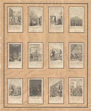
[Scenes from events and battles leading up to and during the American Revolution, 1775-1783, as depicted in 12 illustrations]
sold
- Digital Map Information
- Suitable for large format printing
- DPI: 300
- File Size: 10.62 MB
- File Type: ZIP / TIFF
- ICC color profile embedded
- Delivered instantly via download link
The full set of Chodowiecki's twelve 1784 card views illustrating the American Revolutionary War. Chodowiecki's twelve engraved images are among the first printed illustrations of the events in the colonies and were intended to capitalize on German ... (more details)
Important Revolutionary war coastal chart of the Sea Islands in South Carolina, Georgia, and northern Florida.
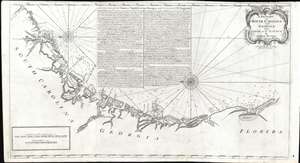
A Draught of South Carolina and Georgia from Sewee to St. Estaca.
sold
- Digital Map Information
- Suitable for large format printing
- DPI: 600
- File Size: 26.97 MB
- File Type: ZIP / TIFF
- ICC color profile embedded
- Delivered instantly via download link
A rare and important 1778 American Revolutionary War era Andrew Hughes nautical chart or maritime map of the coasts of South Carolina, Georgia, and northern Florida. During the early part of the Revolutionary War, this was the best obtainable nautical chart of the Sea Islands. Oriented to the east, this stunning map covers the Atlantic coast from the Santee River (Sewee River), South Carolina, past Charleston, Beaufort, and Savannah, to Saint Augustine, Florida. In addition, the map offers extensive and valuable piloting instructions addressing the entire coastline as well as most individual islands, including Tybee Island, Amelia Island, and Sapelo Island. It also includes excellent coverage of the region's shoals, anchorages, currents, marsh lands, river estuaries, and tides marks. (more details)
Revolutionary War map of the United States drawn to capitalize on French interest in the war.
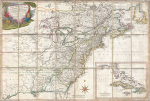
Carte Generale Des Colonies Angloises Dans L'Amerique Septentrionale.
sold
- Digital Map Information
- Suitable for large format printing
- Full resolution TIFF file
- ICC color profile embedded
- Delivered instantly via download link
This is an important and extremely rare 1779 case map of the English colonies in in North America at the height of the American Revolutionary War. Focusing on the English Colonies, this map covers the eastern part of North America from the Hudson ... (more details)
Revolutionary War Map of Amelia Island.
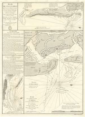
Plan de l'île d'Amelia à la Côte de la Floride Orientale. / Plan de la Barre et et de l'entrée de la Riviere de Nassau. / Plan de la Barre et du port d'Amelia, à la Côte de la Floride Orientale.
sold
- Digital Map Information
- Suitable for large format printing
- DPI: 600
- File Size: 24.35 MB
- File Type: ZIP / TIFF
- ICC color profile embedded
- Delivered instantly via download link
This is a rare 1779 American Revolutionary War map of Amelia Island, Florida, issued by Antoine de Sartine (1729 - 1801) and Jean-Nicholas Buache de Neuville (1741 - 1825). The chart was issued following the 1778 Treaty of Alliance, in which France formally recognized the United States and offered to aid the fledgling country against the British. Early in the war, French aid was primarily maritime, so the Depot de Marine recognized the need for better nautical charts and began to compile and improve British charts of the North American coastline. (more details)
Nautical map by the French during the American Revolutionary War.
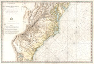
Carte Reduite Des Cotes Orientales De L'amerique Septentrionale Contenant Partie du Nouveau Jersey, la Pen-sylvanie, le Mary-land, la Virginie, la Caroline Septentrionale, la Caroline Meridionale et la Georgie, Assujettie aux Observations les plus recentes et aux Cartes de detail les plus estimées. Dressée au Dépôt Général des Cartes, Plans et Journaux de la Marine. Pour le Service des Vaisseaux Français Par Ordre de M. de Sartine, Conseiller d'Etat, Ministre et Secretaire d'Etat, ayant le Département de la Marine. 1778.
sold
- Digital Map Information
- Suitable for large format printing
- Full resolution TIFF file
- ICC color profile embedded
- Delivered instantly via download link
A rare and extraordinary map of considerable historic importance. This map, which covers from New Jersey and Pennsylvania southward through Maryland and Virginia, then along the Carolina coast to Georgia and Florida, was issued by the French 'Depot ... (more details)
Earliest Acquirable Printed Map to show Knox's Trail.
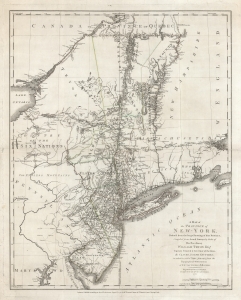
A Map of The Province of New-York, Reduc'd from the large Drawing of that Province, Compiled from Actual Surveys by order of His Excellency William Tryon Esq.r Captain General and Governor of the same, by Claude Joseph Sauthier, to which is added New-Jersey, from the Topographical Observations of C. J . Sauthier and B. Ratzer.
sold
- Digital Map Information
- Suitable for large format printing
- DPI: 600
- File Size: 82.53 MB
- File Type: ZIP / TIFF
- ICC color profile embedded
- Delivered instantly via download link
This is an important, detailed Revolutionary War era map focusing on the New York and Massachusetts theatres of the war, published in London by William Faden in August 1776, just after the Declaration of Independence. The map summarizes the best British surveys of the region available at the beginning of the Revolutionary War. It appears to be the first printed map to show the route taken by the 'Noble Train of Artillery,' which Henry Knox famously led from Fort Ticonderoga to Boston the previous winter, resulting in the expulsion of the British from that city. (more details)
The American Revolutionary War - in SE Asia!
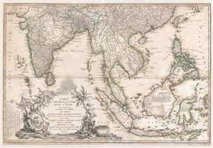
Carte du Theatre De La Guerre Dans L'inde ou se Trouvent Une Partie de La Chine, Les Iles De Sumatra, Java, Borneo, Moluques et Philippines. Dressee d'apres les Meilleures Cartes tant Francaises qu'Anglaises.
sold
- Digital Map Information
- Suitable for large format printing
- Full resolution TIFF file
- ICC color profile embedded
- Delivered instantly via download link
A rare and important 1781 separately issued map of the East Indies by Andre Basset. This map was issued to illustrate a series of conflicts in India and East Indies associated with the American Revolutionary War (1775 - 1783), including the Anglo-French War (1778 - 1783), Fourth Anglo-Dutch War (1780 - 1784), and the Second Anglo-Mysore War (1780 - 1784). The theater of war described is a vast expanse of East Asian territory centered on the Malay Peninsula, but extending from the Maldives to the Philippines and from China to Java, including all of the East Indies, the Indian Subcontinent, the Philippines, and Southeast Asia. (more details)
German edition of Sauthier's influential Revolutionary War Era map of New York and New Jersey.
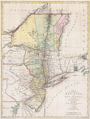
A Map of The Provinces of New-York and New-Jersey, with a part of Pennsylvania and the Province of Quebec from the Topographical Observations of C. J. Sauthier.
sold
- Digital Map Information
- Suitable for large format printing
- DPI: 300
- File Size: 23.99 MB
- File Type: ZIP / TIFF
- ICC color profile embedded
- Delivered instantly via download link
An important 1777 Revolutionary War era map of New York and New Jersey by Claude Joseph Sauthier and Matthew Lotter. This map is Lotter's German edition of Sauthier's map of 1776. The map covers from Quebec and Lake Champlain along the Hudson ... (more details)
The only published version of the Revolutionary War British manuscript headquarters map of New York City. Staggeringly huge and extremely rare!
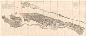
B. F. . Stevens's Facsimile of the Unpublished British Head Quarters Colored Manuscript Map of New York & Environs (1782) Reproduced from the Original Drawing in the War Office, London.
sold
- Digital Map Information
- Suitable for large format printing
- Full resolution TIFF file
- ICC color profile embedded
- Delivered instantly via download link
Quite a remarkable discovery of exceptional size, beauty, and rarity. This gigantic Revolutionary War Era map of New York City is the only published facsimile the the great manuscript map of New York City and environs that hung in the British ... (more details)
Best map of Beaufort during the American Revolution.
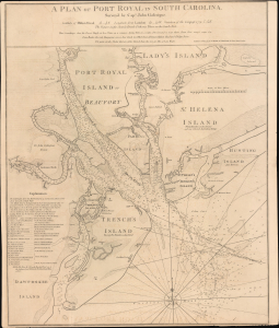
A Plan of Port Royal in South Carolina.
sold
- Digital Map Information
- Suitable for large format printing
- File Size: 27.98 MB
- File Type: ZIP / TIFF
- ICC color profile embedded
- Delivered instantly via download link
A superb example of the John Gascoigne map of Port Royal, modern-day Beaufort, South Carolina, here it is in its 1794 Laurie and Whittle edition. This map represents the best regional cartography available during the Revolutionary War Period, and it retained its relevance more than a decade later when this edition was published. (more details)
One of the few views of to show a walled New York.
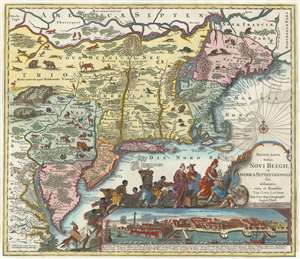
Recens Edita Totius Novi Belgii, in America Septentrionali siti, delineatio cura et sumtibus Tob. Conr. Lotteri, Sac. Caes. Maj. Geographi August. Vind.
sold
- Digital Map Information
- Suitable for large format printing
- Full resolution TIFF file
- ICC color profile embedded
- Delivered instantly via download link
This is Conrad Tobias Lotter's 1777 map of the Northeast and New York, the final map in the Jansson-Visscher series. Despite the map's cartography being over a century old, this map continued to capture the idea of this part of the world for Europeans in general and a German audience in particular. (more details)
Important map of the British Colonies in North America at the outset of the American Revolutionary War.
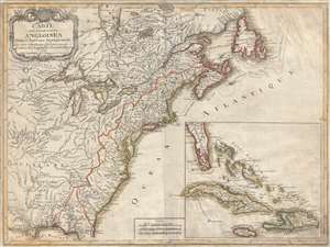
Carte des Possessions Angloises Dans L'Amerique Septentrional Pour Servir d'Intelligence á la Guerre presente Traduite de L'Anglois Par J. Leopold Imbert.
sold
- Digital Map Information
- Suitable for large format printing
- DPI: 300
- File Size: 15.9 MB
- File Type: ZIP / TIFF
- ICC color profile embedded
- Delivered instantly via download link
This is the rare 1777 separate issue, old color, first edition of J. Leopold Imbert's important map illustrating the theater of the American Revolutionary War (1775 - 1783). In addition to being a significant map in its own right, this Imbert ... (more details)
Beautifully illustrates the intriguing discoveries of the Baron Lahonton.
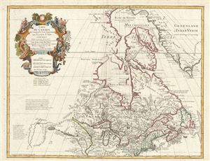
Carte du Canada Qui Comprend la Partie Septentrionale des Etats Unis D'Amerique.
sold
- Digital Map Information
- Suitable for large format printing
- DPI: 300
- File Size: 20 MB
- File Type: ZIP / TIFF
- ICC color profile embedded
- Delivered instantly via download link
This is the 1783 Dezauche issue of Phillipe Buache and Guillaume D L'Isle's important map of northern North America. The map covers the United States north of the Chesapeake and Canada or New France. De L'Isle first issued this map in 1703. ... (more details)
One of the earliest obtainable English maps to name and recognize the newly created United States.
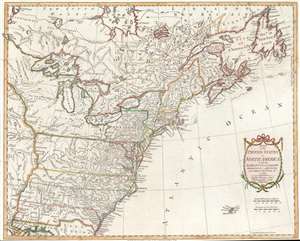
Map of the United States in North America: with the British, French and Spanish Dominions adjoining, according to the Treaty of 1783.
sold
- Digital Map Information
- Suitable for large format printing
- DPI: 600
- File Size: 19.55 MB
- File Type: ZIP / TIFF
- ICC color profile embedded
- Delivered instantly via download link
After nine years of war between the mother country and its American colonies, this first edition 1783 Thomas Kitchin map of the United States is one of the earliest obtainable English printed maps that names and recognizes the newly independent United States of America. The map depicts the nascent country from just west of the Mississippi River to the Atlantic Ocean and from Hudson Bay to New Orleans and the Gulf of Mexico. Unique geography catches the viewer's attention, with Pennsylvania occupying a fair portion of southern New York and Virginia, North Carolina, South Carolina, and Georgia stretching from the Atlantic coast to the Mississippi River. Myriad cities, towns, and villages are labeled, including Philadelphia, New York, Boston, Newport, Baltimore, Charleston, and Savannah. Native American tribes are referenced, including the Iroquois, Miami, Cherokee, Creek, Chickasaw, and Choctaw. Important coastal locations, such as Cape Cod, Boston Harbor, Delaware Bay, Chesapeake Bay, Cape May, Cape Hatteras, and Cape Fear are also identified. All five Great Lakes are labeled and rivers, lakes, and mountains are noted. (more details)
American colonies at the outset of the Revolutionary War.
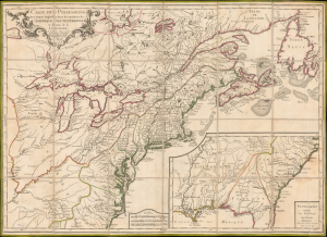
Carte des Possessions des Colonies Anglaises dans le Continent de L'Amérique Septentrionale et Partie de la Louisiane.
sold
- Digital Map Information
- Suitable for large format printing
- DPI: 600
- File Size: 19.55 MB
- File Type: ZIP / TIFF
- ICC color profile embedded
- Delivered instantly via download link
This is the 1776 edition of Sebastian G. Longchamps's map of eastern North America, published at the outset of the American Revolutionary War (1775 - 1783) to capitalize on popular French interest in the conflict. The map was first issued in 1756, during the French and Indian War (1754 - 1763), but has here been revived with significant new engraving, additional relevant details, and a new title to illustrate the opening theaters of the American Revolution. Key revisions give greater prominence to the individual New England colonies and expand the coastal nomenclature of northern Newfoundland, where France retained valuable fishing privileges despite losing Canada. (more details)