
Persia - Afghanistan (sold)
An Unusual Wall Map of the Gulf Region.
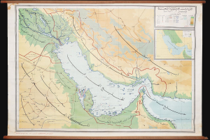
This is a rare c. 1972 wall map of the Persian / Arabian Gulf region by Ibrahim Hilmi al-Ghouri. Published by the Scientific Foundation for Educational Aids, it was likely intended for classroom use in the United Arab Emirates. (more details)
Resplendent primary-source manuscript illustrating the Kandahar theater fo the First Anglo-Afghan War.
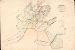
Districts of Kundahar 1840.
sold
- Digital Map Information
- Suitable for large format printing
- DPI: 600
- File Size: 26.75 MB
- File Type: ZIP / TIFF
- ICC color profile embedded
- Delivered instantly via download link
An exquisitely drafted manuscript map of the Kandahar Region, Afghanistan, during the First Anglo-Afghan War (1839 - 1942). Resplendently drafted and colored by the Indian Quartermaster General's Office (QMG), the map incorporates traditional Bengali handmade inks. During this conflict, Kandahar was the most important British base in Afghanistan, and the surrounding region was a theater of fierce and constantly evolving guerrilla war. The present map is the result of direct field mapping, completed under onerous war-footing, yet nonetheless represents one of the earliest broadly accurate maps of the Kandahar region. The map is roughly centered on the city of Kandahar and presents a stellar overview of the surrounding region, extending from Girishk and the Helmand Valley, in the west, to Qalati Giliji, in the east, covering parts of the modern Afghan provinces of Helmand, Kandahar, Uruzgan and Zabol. It is, moreover, one of very few surviving original manuscript maps from First Anglo-Afghan War, the first (not the last) major western foray into Afghanistan. (more details)
Vestiges of Assyria.
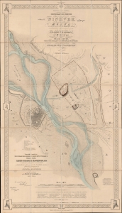
Vestiges of Assyria, sheet 1st, an ichnographic sketch of the remains of ancient Nineveh with the enceinte of the modern Mosul, the [Arabic inscription] of Arab M.S.S. and the ΜΕΣПΙΛΑ of the Anabasis constructed from the trigonometrical survey in the spring of 1852 at the command of the government of India.
sold
- Digital Map Information
- Suitable for large format printing
- File Size: 1761.26 MB
- File Type: ZIP / TIFF
- ICC color profile embedded
- Delivered instantly via download link
A striking 1855 ichnographic map of Mosul, Iraq, and the neighboring excavations at the ancient Assyrian capital of Nineveh. This map is significant, not only as one of the first modern surveys of Mosul, but also for its premier cartographic representation of the seminal archeological excavations at Nineveh performed by Austen Henry Layard. These excavations produced several paradigm-breaking discoveries, including the Epic of Gilgamesh and pre-Biblical 'Great Flood' narratives. (more details)
Vestiges of Assyria.
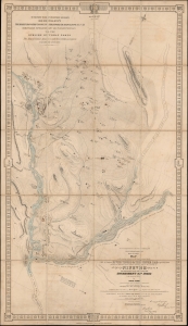
Vestiges of Assyria, sheet 3rd, being a Map of the Country in the Angle Formed by the River Tigris and the Upper Zab shewing the disposition of the various ancient sites in the vicinity of Nineveh from trigonometrical survey made by order of the Government of India in the spring of 1852.
sold
- Digital Map Information
- Suitable for large format printing
- File Size: 1789.73 MB
- File Type: ZIP / TIFF
- ICC color profile embedded
- Delivered instantly via download link
A very impressive 1855 map of the upper Tigris flood plain in the vicinity of Mosul, Iraq. The map is one of three prepared by James Felix Jones to illustrate the seminal Austen Henry Layard excavations at ancient Assyrian royal capitals of Nineveh and Nimrud, as well as the palace complex at Khorsabad. These excavations produced several paradigm-breaking discoveries, including the Epic of Gilgamesh and pre-Biblical 'Great Flood' narratives. (more details)
First 'Great Game' Map.
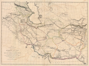
Map of the Countries lying between then Euphrates and Indus on the East and West, and the Oxus and Terek and Indian Ocean on the North and South.
sold
- Digital Map Information
- Suitable for large format printing
- File Size: 91.04 MB
- File Type: ZIP / TIFF
- ICC color profile embedded
- Delivered instantly via download link
This is John Macdonald Kinneir and Aaron Arrowsmith's 1813 large-scale map of Persia and parts of Afghanistan, Iraq, and Pakistan. This was the best obtainable map of Persia and Central Asia available in the leadup to the Great Game (1813 - 1895), and indeed, might be considered the first Great Game Map. It was issued at the end of the Russo-Persian War (1804 - 1813) and coincided with the Treaty of Gulistan, which opened up Persia for Russian invasion and set the stage for decades of Anglo-Russian conflict. (more details)
The Heart of Portuguese Power in the East.
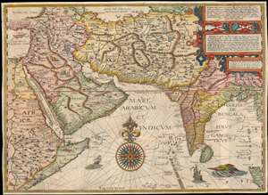
Deliniantur in hac tabula, Orae maritimae Abexiae, freti Mecani. al. Marís Rubri, Arabiae, Ormi, Persiae...
sold
- Digital Map Information
- Suitable for large format printing
- DPI: 600
- File Size: 59.14 MB
- File Type: ZIP / TIFF
- ICC color profile embedded
- Delivered instantly via download link
This is Jan van Linschoten's seminal 1596 map of the lands abutting the Indian Ocean, with coverage extending from the Arabian Peninsula to Sumatra. This map represents a significant advancement in accuracy and detail over any prior printed map of the region, setting the standard for most subsequent maps of the near east and south Asia for the remainder of the 16th and throughout the 17th century. Moreover, it exposed preciously guarded secrets of Portuguese maritime geography, paving the way for the Dutch seizure of the East India trade, thus spurring the Dutch Golden Age. (more details)
The largest and best map of Persia.
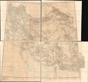
Map of Persia (in Six Sheets) Compiled in the Simla Drawing Office Survey of India.
sold
- Digital Map Information
- Suitable for large format printing
- File Size: 54.87 MB
- File Type: ZIP / TIFF
- ICC color profile embedded
- Delivered instantly via download link
This massive, six-sheet map of Persia produced in 1897 by the British Survey of India (updated to 1902) was the most detailed map of what is now Iran, Iraq, and parts of Azerbaijan and Turkmenistan that had been executed to date: we are aware of no comparable map prior. Its exhaustive detail would continue to command respect well into the 20th century: the German military faithfully copied this map in 1918, as they did with other British maps of important theaters in the Great War. (more details)
The first surveyed map of Karachi, Pakistan, issued by the East India Company exploratory mission to Sinde in preparation for the February 1839 occupation.
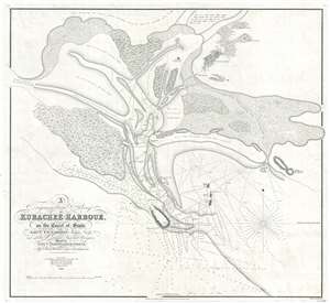
A Trigonometrical Survey of Kurachee Harbour, on the Coast of Sinde.
sold
- Digital Map Information
- Suitable for large format printing
- DPI: 300
- File Size: 12.67 MB
- File Type: ZIP / TIFF
- ICC color profile embedded
- Delivered instantly via download link
This is the first map of Karachi city and harbor, modern day Pakistan, drawn from Thomas Greer Carless' exploratory surveys of 1838. Carless, along with fellow India Navy Officers W. Jardine, Sheppard, and Grieve, was sent to survey the coast of Sinde in the ... (more details)
Afghanistan in the middle of the Second Anglo/Afghan War, following the Treaty of Gandamak
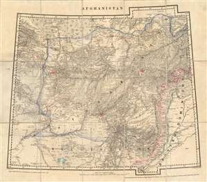
Afghanistan.
sold
- Digital Map Information
- Suitable for large format printing
- File Size: 47.54 MB
- File Type: ZIP / TIFF
- ICC color profile embedded
- Delivered instantly via download link
This is an extremely rare 1879 Survey of India map of Afghanistan, published immediately following the Treaty of Gandamak, which was presumed to be the end of the Second Anglo-Afghan War (in reality, it was a breathing space between the two phases of the conflict, which would span from 1878 to 1880. It was produced in July 1879 under the supervision of James Thomas Walker, who had become Surveyor General in 1878. The map is cartographically derived from Walker's fourth edition of the four-sheet Turkestan and the Countries between the British and Russian Dominions, but it is neither a copy of one of that map's sheets, nor a reduction of that map. Produced by the same team of mapmakers as that seminal map, this present piece focused directly on the territories affected by the recent treaty between Britain and the Emirate of Afghanistan. It was printed at the same scale as its source - thirty two miles to the inch - which implies the need for the swift and timely publication of the map outweighed any considerations of the enlargement of the map. (An 1883 map of the area produced by the same team would be printed at the scale of twenty four miles to the inch.) (more details)
Only known example. Beauchamp's manuscript map of Persia/ Iran and Iraq - the first scientific map of these regions.
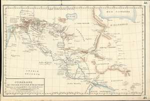
Itinéraire du Voyage Fait par Mr. Beauchamp Astronome et correspond de la cui dev. Acad. des Sciences.
sold
- Digital Map Information
- Suitable for large format printing
- DPI: 600
- File Size: 9.23 MB
- File Type: ZIP / TIFF
- ICC color profile embedded
- Delivered instantly via download link
An extraordinary discovery, this finely executed (hand-drawn) c. 1790 map of Syria, Iraq, and Iran / Persia is the only known map recording the explorations of the French astronomer and clergyman, Pierre-Joseph de Beauchamp. Comprising of the first scientific mapping of any significant part Persia/Iraq, coverage extends from the Mediterranean to the Persian Gulf and reaches as far north as Lake Van and the Caspian Sea. While we cannot definitively prove it, we believe this map to have been composed in Beauchamp's own hand for the use of Joseph Jérôme Lefrançois de Lalande (1732 - 1807), a fellow astronomer and friend. It may have been he who added additional annotations and place names to the map in light red ink. (more details)
The Theatre of the Anglo-Afghan Wars.
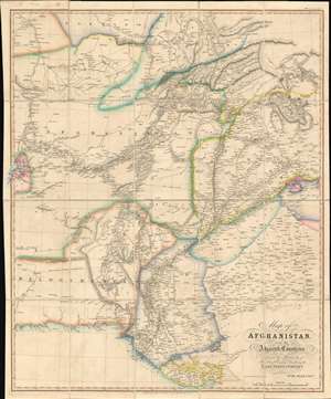
Map of Afghanistan and the Adjacent Countries Published by the Authority of the Hon.ble Court of Directors of the East India Company.
sold
- Digital Map Information
- Suitable for large format printing
- Full resolution TIFF file
- ICC color profile embedded
- Delivered instantly via download link
This is an 1842 Allen map of Afghanistan and its surrounds, showing the theatre of the First Anglo-Afghan War: the first major conflict of ‘The Great Game’ for British control of India. It was printed just four months after the disastrous Retreat from Kabul. Not only are the passes between Kabul and Peshawar shown in detail but the infamous 'Khyber Pass' is labeled clearly. (surpassing other contemporaneous maps of the area ) that it seems clear that the map reflects the best British understanding of Afghanistan’s geography at the time of the conflict. (more details)
'The trouble in Afghanistan...'
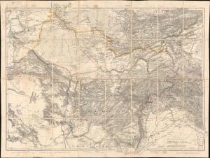
Wyld's Military Staff Map of Central Asia and Afghanistan.
sold
- Digital Map Information
- Suitable for large format printing
- Full resolution TIFF file
- ICC color profile embedded
- Delivered instantly via download link
This is James Wyld II's exceptional 1879 large-scale Military Staff Map of Afghanistan, issued for government and military planning at the height of the Second Anglo-Afghan War (1878 - 1880), part of the Great Game. Like Wyld's other 'military staff maps', this map was not part of his prolific commercial output, but rather made directly from the best government and private sources for the use of military commanders and strategists in the field. (more details)
One of the Earliest Modern Maps of the Indian Ocean.
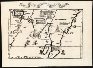
Tabu. Moder. Indiae.
sold
- Digital Map Information
- Suitable for large format printing
- Full resolution TIFF file
- ICC color profile embedded
- Delivered instantly via download link
This is Laurent Fries' edition of the earliest acquirable modern mapping of South Asia. While the topography and place names are faithfully drawn from Martin Waldseemüller's map of 1513, Fries' map also includes evocative woodcut illustrations and descriptive text drawn not from the 1513 Ptolemy, but instead from Waldseemüller's 1516 Carta Marina. Consequently, the geography shown here was thoroughly modern. (more details)
Presenting the East to an English Audience.
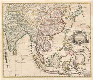
A New Map of India and China from the Latest Observations by I. Senex.
sold
- Digital Map Information
- Suitable for large format printing
- DPI: 600
- File Size: 65.27 MB
- File Type: ZIP / TIFF
- ICC color profile embedded
- Delivered instantly via download link
This is a scarce and elegant 1721 English map of Southeast Asia, the Far East, and the East Indies, drawn and engraved by John Senex. The map is dedicated to the British East Indian Company (EIC) and embraces its primary theaters of operation. At the time the EIC was the wealthiest company in the world and a dominant force in all British affairs, this making this map a subject of great interest to the British public. (more details)
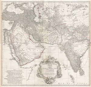
A foundational map of Persia, Arabia, and India.
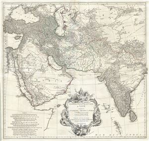
Premiere Partie de la Carte d'Asie contenant La Turquie, L'Arabie, La Perse, L'Inde en deca du Gange et de la Tartarie ce qui est limitrophe de la Perse et de l'Inde.
sold
- Digital Map Information
- Suitable for large format printing
- DPI: 300
- File Size: 36.34 MB
- File Type: ZIP / TIFF
- ICC color profile embedded
- Delivered instantly via download link
A monumental and highly detailed 1751 map of India, Persia, and Arabia by the French cartographer Jean Baptiste Bourguignon d'Anville. Centered on Persia, this map covers from Istanbul to eastern India and Tibet, and from the Black Sea to the Maldives. It ... (more details)
Theatre of the First Anglo-Afghan War: The Beginning of the Great Game and the scene of the Disaster in Afghanistan.
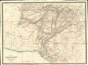
Map of Afghaunistan, Caubul, the Punjab, Rajpootana, and the River Indus.
sold
- Digital Map Information
- Suitable for large format printing
- Full resolution TIFF file
- ICC color profile embedded
- Delivered instantly via download link
This is an 1842 Wyld map of Afghanistan and its surrounds, illustrating the theatre of the First Anglo-Afghan War: the first major conflict of 'The Great Game' for British control of India. It was printed just three months after the disastrous Retreat from Kabul. Though the debacle is not specifically referred to here, the passes between Kabul and Peshawar are depicted with sufficient detail (surpassing other contemporaneous maps of the area ) that it seems clear that the map reflects the best British understanding of Afghanistan's geography at the time of the conflict. These include Gandamak - the pass approaching Jalalabad in which the massacre of Elphinstone's army took place between January 6 and January 13, 1842. (more details)
Unique! w/ Manuscript notations tracing Roberts' famous march from Kabul to Kandahar.
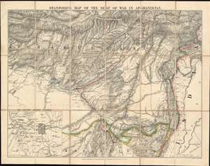
Stanford's Map of the Seat of War in Afghanistan.
sold
- Digital Map Information
- Suitable for large format printing
- File Size: 38.6 MB
- File Type: ZIP / TIFF
- ICC color profile embedded
- Delivered instantly via download link
This is an 1880 Edward Stanford map of Afghanistan during the Second Anglo-Afghan War. Manuscript notations trace the events of July through September 1880, including the General Roberts' famous march from Kabul to Kandahar in August 1880. Roberts' march, and that of the force under the command of General Phayre, are both illustrated here in red. The blue traces the movements of Ayub Khan. (more details)
The
Theatre of the First Anglo-Afghan War: The Beginning of The Great Game and
the scene of the Disaster in Afghanistan
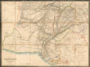
Map of
Afghaunistan, Caubul, the Punjab, Rajpootana, and the River Indus
sold
- Digital Map Information
- Suitable for large format printing
- DPI: 600
- File Size: 42.38 MB
- File Type: ZIP / TIFF
- ICC color profile embedded
- Delivered instantly via download link
This is an 1842 Wyld map of Afghanistan and its surrounds, showing the theatre of the First Anglo-Afghan War: the first major conflict of ‘The Great Game’ for British control of India. It was printed just three months after the disastrous Retreat from Kabul. Though the debacle is not specifically referred to on the map, the passes between Kabul and Peshawar are shown with sufficient detail (surpassing other contemporaneous maps of the area ) that it seems clear that the map reflects the best British understanding of Afghanistan’s geography at the time of the conflict. These include Gandamak - the pass approaching Jalalabad in which the massacre of Elphinstone's army took place between January 6 and January 13, 1842. (more details)
The Theatre of the First Anglo-Afghan War: The Beginning of The Great Game and the scene of the Disaster in Afghanistan
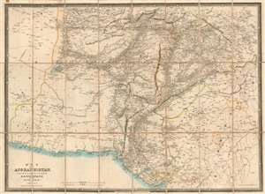
Map of Afghaunistan, Caubul, the Punjab, Rajpootana, and the River Indus
sold
- Digital Map Information
- Suitable for large format printing
- DPI: 600
- File Size: 37.01 MB
- File Type: ZIP / TIFF
- ICC color profile embedded
- Delivered instantly via download link
This is an 1842 Wyld map of Afghanistan and its surrounds, showing the theatre of the First Anglo-Afghan War: the first major conflict of ‘The Great Game’ for British control of India. It was printed just three months after the disastrous Retreat from Kabul. Though the debacle is not specifically referred to on the map, the passes between Kabul and Peshawar are shown with sufficient detail (surpassing other contemporaneous maps of the area ) that it seems clear that the map reflects the best British understanding of Afghanistan’s geography at the time of the conflict. These include Gandamak - the pass approaching Jalalabad in which the massacre of Elphinstone's army took place between January 6 and January 13, 1842. (more details)
The first scientific geological survey of Iran - and an all around stunning map.
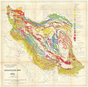
National Iranian Oil Company Geological Map of Iran.
sold
- Digital Map Information
- Suitable for large format printing
- File Size: 34.93 MB
- File Type: ZIP / TIFF
- ICC color profile embedded
- Delivered instantly via download link
An extremely rare, beautiful and important production, this is the 1959 geological map of Iran issued from original surveys by the National Iranian Oil Company (Shirkat-i Millī-i Naft-i Īrān) completed in 1957. This is the first detailed geological ... (more details)
A foundational map of Persia, Arabia, and India.
Premiere Partie de la Carte d'Asie contenant La Turquie, L'Arabie, La Perse, L'Inde en deca du Gange et de la Tartarie ce qui est limitrophe de la Perse et de l'Inde.
sold
- Digital Map Information
- Suitable for large format printing
- DPI: 300
- File Size: 34.98 MB
- File Type: ZIP / TIFF
- ICC color profile embedded
- Delivered instantly via download link
A monumental and highly detailed 1751 map of India, Persia, and Arabia by the French cartographer Jean Baptiste Bourguignon d'Anville. Centered on Persia, this map covers from Istanbul to eastern India and Tibet, and from the Black Sea to the Maldives. ... (more details)
The
Theatre of the First Anglo-Afghan War: The Beginning of The Great Game and
the scene of the Disaster in Afghanistan
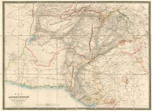
Map of
Afghaunistan, Caubul, the Punjab, Rajpootana, and the River Indus
sold
- Digital Map Information
- Suitable for large format printing
- Full resolution TIFF file
- ICC color profile embedded
- Delivered instantly via download link
This is an 1842 Wyld map of Afghanistan and its surrounds, showing the theatre of the First Anglo-Afghan War: the first major conflict of ‘The Great Game’ for British control of India. It was printed just three months after the disastrous Retreat from Kabul. Though the debacle is not specifically referred to on the map, the passes between Kabul and Peshawar are shown with sufficient detail (surpassing other contemporaneous maps of the area ) that it seems clear that the map reflects the best British understanding of Afghanistan’s geography at the time of the conflict. These include Gandamak - the pass approaching Jalalabad in which the massacre of Elphinstone's army took place between January 6 and January 13, 1842. (more details)
A foundational map of Persia, Arabia, and India.
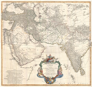
Premiere Partie de la Carte d'Asie contenant La Turquie, L'Arabie, La Perse, L'Inde en deca du Gange et de la Tartarie ce qui est limitrophe de la Perse et de l'Inde.
sold
- Digital Map Information
- Suitable for large format printing
- DPI: 300
- File Size: 25.92 MB
- File Type: ZIP / TIFF
- ICC color profile embedded
- Delivered instantly via download link
A monumental and highly detailed 1751 map of India, Persia, and Arabia by the French cartographer Jean Baptiste Bourguignon d'Anville. Centered on Persia, this map covers from Istanbul to eastern India and Tibet, and from the Black Sea to the Maldives. ... (more details)
Rare Farsi edition of Sahab's map!
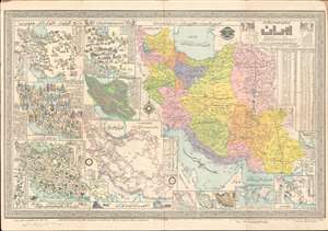
This is a 1957 Abbas Sahab map of Iran, in the rare Farsi (Persian) edition. The map depicts Iran in full, from Iraq and Turkey to Afghanistan and Pakistan and from the Caucasus, the Caspian Sea, and Turkmenistan to the Persian Gulf and the Gulf of Oman. Issued under the Shah, long before the Iranian Revolution, this map represents a golden age for Iran, when liberal reforms were going into effect, and Iran itself was an attractivce destination for both tourists and business. Using inset maps of varying size, Sahab illustrates political, cultural, historical, and economic aspects of Iran. A large political map highlighting the ostans, provinces, shahrestans, and townships within the country occupies the right half of the sheet. Each ostan is shaded a different color, and further subdivided into provinces and other administrative districts. Many cities, towns, and villages are labeled, including Tehran, Isfahan, and Shiraz. (more details)
Map illustrating Afghanistan during the Great Game! Rare!
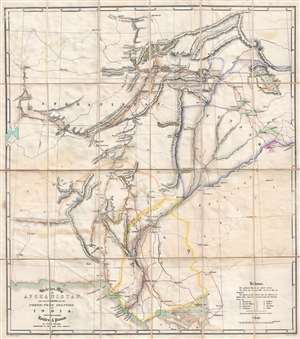
Skeleton Map of Afghanistan, and the Countries on the North-West Frontier of India, Shewing the principal Routes and Passes.
sold
- Digital Map Information
- Suitable for large format printing
- DPI: 300
- File Size: 17.99 MB
- File Type: ZIP / TIFF
- ICC color profile embedded
- Delivered instantly via download link
This is a rare 1848 John Walker map of Afghanistan illustrating the 'Great Game' wherein colonial powers jostled for control of Central Asia in a series of conflicts. Published in the years following the First Anglo-Afghan War, the map depicts the ... (more details)
A Study of India as the Maratha Empire shattered.
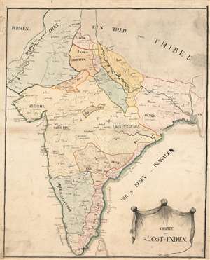
Charte von Ost=Indien.
sold
- Digital Map Information
- Suitable for large format printing
- Full resolution TIFF file
- ICC color profile embedded
- Delivered instantly via download link
This remarkable, early 19th century manuscript map of the Indian Peninsula captures the region during the fracture and turmoil of the turn of that century. In particular, it focuses most strongly on two theatres of conflict: those of the Anglo-Maratha Wars (1775 - 1782) in the north, and the Anglo-Mysore Wars (1767 - 1799) in the south, fought between those empires and the British East India Company. (more details)
Map of Kabul that traverses both Anglo-Afghan Wars and embodies The Great Game.
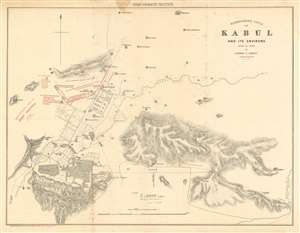
Reconnaissance Sketch of Kabul and its Environs made in 1842 by Captain F. Abbott Bengal Engineers.
sold
- Digital Map Information
- Suitable for large format printing
- File Size: 19.77 MB
- File Type: ZIP / TIFF
- ICC color profile embedded
- Delivered instantly via download link
This is an 1879 Quartermaster General's Office (QMG) and Royal Engineer Institute city plan or map of Kabul, Afghanistan and environs published during the Second Anglo-Afghan War (1878–1880) to illustrate the 1879 Siege of the Sherper Cantonment. This map is cartographically derived from an earlier survey completed in 1842 during the First Anglo-Afghan War under Captain Frederick Abbott of the 1842 Kabul Expedition. General Pollack's camp established during the 1842 Kabul Expedition is marked by a flag. (more details)
Unrecorded Proof State: Revealing Uzbek geography and toponymy.
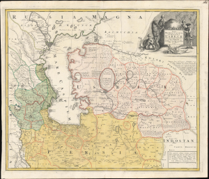
Nova Maris Caspii et Regionis Usbeck cum Provincijs adjacentibus vera Delineatio.
sold
- Digital Map Information
- Suitable for large format printing
- File Size: 26.38 MB
- File Type: ZIP / TIFF
- ICC color profile embedded
- Delivered instantly via download link
This is an unrecorded proof state of Abraham Maas' 1735 map of Uzbekistan and the Caspian Region, edited by Johann Peter von Ghelen and published by Homann Heirs. It is the first map to show the results of Peter the Great's initiatives to chart the ill-understood frontier of the Russian Empire, and it is the first printed map specifically of the Uzbek region. Moreover, it incorporates the first published records of the indigenous toponymy east of the Caspian. (more details)
Recalls a time when Afghanistan was considered one of the most beautiful and welcoming countries in Asia.
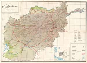
Recalling a time when Afghanistan was considered one of the most beautiful and welcoming countries in Central Asia, this is a 1965 Aminullah Dagarman and Afghan Tourist Organization map of Afghanistan. This map of Afghanistan depicts the entire country, then known as the 'Garden of Asia'. Thick red lines trace the principal roads, which connect major cities, including Kabul, Ghazni, Kandahar, and Herat. Distances between cities (in kilometers) appear as well. Towns and villages of all sizes are labeled throughout, along with mountain passes, rivers, and lakes. Afghanistan's twenty-nine provinces are labeled numerically and correspond with a table situated along the right border. Subtle artistic designs evoke Afghanistan's incredible terrain, and two green areas hint at the importance of the Helmand and Amoo Darya rivers for Afghanistan's agricultural industry. (more details)
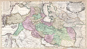
Regnum Persicum Imperium Turcicum in Asia Russorum Provinciae and Mare Caspium.
sold
- Digital Map Information
- Suitable for large format printing
- DPI: 300
- File Size: 15.73 MB
- File Type: ZIP / TIFF
- ICC color profile embedded
- Delivered instantly via download link
A scarce and altogether spectacular c. 1730 map of southwestern Asia, specifically focusing on Persia, by Reiner and Joshua Ottens. Covers from Egypt and Greece eastward to include Turkey, the northern part of the Arabian Peninsula, the Black and ... (more details)
One of the first western maps of Xinjiang, China illustrating a British trade mission from India into the region.
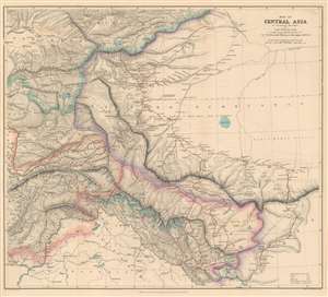
Map of Central Asia to accompany the Paper by Captain H. Trotter R.E., on the Geographical Results of Sir T.D. Forsyth's Mission to Kashgar, 1873 - 74.
sold
- Digital Map Information
- Suitable for large format printing
- File Size: 28.32 MB
- File Type: ZIP / TIFF
- ICC color profile embedded
- Delivered instantly via download link
This is an 1878 William John Turner and Royal Geographical Society map of Xinjiang, China that traces explorations of the Forsyth Mission of 1873 - 1874, making this one of the first detailed Western maps of the region. The map depicts the region from Peshawar, Pakistan to Tibet and from the Tian Shan Mountains to Pangong Lake. British, Russian, Chinese, and Afghan territory are outlined in different colors and are explained in a key situated in the lower right corner. The routes taken by the various different teams that constituted the Forsyth Mission are traced in red. Three different groups set out from Leh, in India, and met back up at Yarkand, in the 'Dominion of Yakoob Khan', and proceeded to Kashgar, where they met Yakub Beg. (more details)
Rare map of Tehran by the Father of Modern Iranian Cartography.
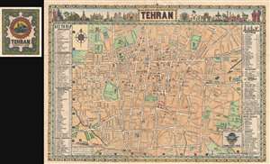
Tehran.
sold
- Digital Map Information
- Suitable for large format printing
- File Size: 18.52 MB
- File Type: ZIP / TIFF
- ICC color profile embedded
- Delivered instantly via download link
This is a rare pictorial map of Tehran issued in 1958 by Abbas Sahab, considered the 'Father of Iranian Cartography.' Based upon Addass's own pen and ink drawing, this map covers central Tehran centered on Parke E Shahr. It extends west roughly ... (more details)