
Asia (whole)
Separate-Issue Rarity. Vignettes illustrating Asian religous practices. 3 known examples.
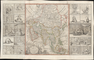
A new and correct map of asia Laid down from the latest and best Observations...
$15,000.00
Acquire
- Digital Map Information
- Suitable for large format printing
- File Size: 71.88 MB
- File Type: ZIP / TIFF
- ICC color profile embedded
- Delivered instantly via download link
This is an extremely rare, separately issued 1754 George Foster / Robert Sayer map of Asia. Although printed in 1754, the map's cartography dates to c. 1735, when it was first issued in a now-lost edition by the map seller George Foster. The map features elaborate decorative side panels, added in 1754 by Sayer, illustrating Asiatic religious practices. This map stands out for its remarkable rarity, being one of only 3 known surviving examples. It is also significant for its use of the term 'Sea of Corea' (Sea of Korea) to denote the sea between Japan and Korea, the naming of which is a matter of international contention. (more details)
The first official Japanese regional map using western cartographic technology. A wonder of copper engraving!

峨羅斯及亞西亞ノ圖 / [Map of Russia and Asia].
$12,000.00
Acquire
- Digital Map Information
- Suitable for large format printing
- File Size: 109.25 MB
- File Type: ZIP / TIFF
- ICC color profile embedded
- Delivered instantly via download link
An extraordinary 1867 (Keio 3) map of Siberia and Alaska illustrates a moment of cultural collision and transformation. Printed in Japan using a remarkable multi-color copperplate process, the map is a conic projection covering Asia from the Caspian Sea to the Bering Strait. It extends farther east to include Alaska, and south to encompass Nepal, Korea, Tibet, most of China, and all of Japan. This is the first Japanese regional map to incorporate contemporaneous western cartographic technology for official strategic and military use. (more details)
Imperial Struggle for the Manchu Homeland
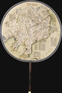
東三省俄部邊防全省圖說 / [Illustrated Description of the Russian Section of the Three Eastern Provinces for Border Defense].
$11,000.00
Acquire
- Digital Map Information
- Suitable for large format printing
- Full resolution TIFF file
- ICC color profile embedded
- Delivered instantly via download link
This is a stunning c. 1900 manuscript fan map of Manchuria prepared by a group of Qing military officers led by one surnamed Ren. Demonstrating astonishingly fine and meticulous workmanship, it covers the border region of Manchuria at a time when Qing rule of their Manchu homeland was greatly imperiled by both the Russian Empire and Imperial Japan. (more details)
Dramatic 18th century wall map!
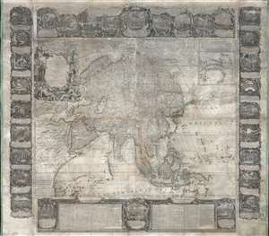
L'Asie Dressée Sur Les Nouvelles Observations Faites En Toutes Les Parties De La Terre Et Rectifiées.
$5,000.00
Acquire
This is an impressive and rare 1749 decorative wall map of Asia by Jean-Baptiste Nolin. It offers both decorative appeal and significant cartographic interest: Witsen's Peninsula, Lake Chiamay, Gamaland, ethnographic commentary, and more. (more details)
Pan-Eurasian Unity?
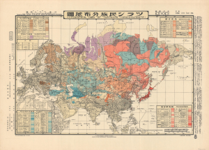
ツラン民族分佈地圖 / [Ethnographic Card of Turanians (Uralo-Altaians)].
$4,000.00
Acquire
- Digital Map Information
- Suitable for large format printing
- File Size: 36.62 MB
- File Type: ZIP / TIFF
- ICC color profile embedded
- Delivered instantly via download link
An intriguing piece of ethnographic Interwar-WWII propaganda, this bilingual Japanese-English map, based on a 1933 manuscript by Kato Ryūshirō, displays the purported peoples of the 'Turanian' community. The present example was printed in 1943 in Hungary by the Turan Federation of Hungary and the Royal Hungarian Defense Cartography Institute. (more details)
Spectacularly presented.
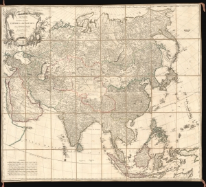
L'Asie divisée en ses Empires et Royaumes.
$3,500.00
Acquire
- Digital Map Information
- Suitable for large format printing
- Full resolution TIFF file
- ICC color profile embedded
- Delivered instantly via download link
A spectacularly presented c. 1787 Charles-François Delamarche / Robert de Vaugondy map of Asia. The beautifully presented map is laid down on unusual patterned linen and set into a fine royal blue slipcase with gold gilt tooling. (more details)
Indian Army's Showcase Campaign in the Great War.
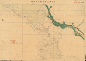
Mesopotamia. Sheet No. 1. Basrah. No.888 D.D.D. 1917 (2.D.O.) S.I. 2000.
$3,500.00
Acquire
- Digital Map Information
- Suitable for large format printing
- Full resolution TIFF file
- ICC color profile embedded
- Delivered instantly via download link
This is a rare 1917 Survey of India map focusing on the key strategic regions of Basra-Zubair in south-eastern Iraq and the adjacent Khorramshahr area of Persia, and it is one of the first maps to show Abadan, the first oil boomtown of the Middle East. It was also a showcase theater for the employment of units of the Indian Army, whose officers were given charge of the campaign at the beginning of the war. (more details)
Baroque Masterpiece in the Mapping of Asia.
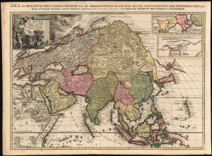
L'Asie selon les nouvelles Observations de Messrs. de l'Académie Royale des Sciences, etc./ Asia in praecipuas ipsius partes distributa, ad observationes academiae regiae scientiarum, et exquisitissimas tabulas, quae nunquam antehac lucem viderunt, Excusa A Francisco Halma, cum privilegio ordinum Hollandiae et westfrisiae.
$3,500.00
Acquire
- Digital Map Information
- Suitable for large format printing
- Full resolution TIFF file
- ICC color profile embedded
- Delivered instantly via download link
This is the rare first state of François Halma's c. 1699 separately issued map of Asia. Its unusually large folio size, bold and sophisticated engraving, and rich original color set this map apart as one of the most beautiful late-17th-century maps of the continent. (more details)
Strahlenberg's stolen 1715 map of Asiatic Russia and the Tatar Empire.
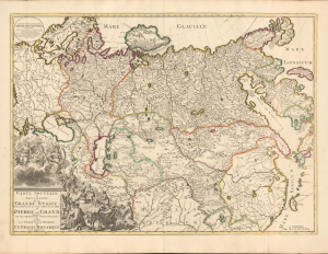
Carte nouvelle de tout l'Empire de la Grande Russie dans l'estat ou il s'est trouvé à la mort de Pierre le Grand. Dressée sur des observations toutes nouvelles et dedoée à l'immortelle memoire de ce Grand Monarque Avec Privilege à Amsterdam.
$3,500.00
Acquire
- Digital Map Information
- Suitable for large format printing
- DPI: 600
- File Size: 29.44 MB
- File Type: ZIP / TIFF
- ICC color profile embedded
- Delivered instantly via download link
This rare, separately issued map of the Russian Empire was printed by Renier and Josua Ottens c. 1730, but the map is based on the work of Philipp Johann von Strahlenberg. It is that mapmaker's first map of Russia and Siberia, stolen from him in 1715. Strahlenberg (1677 - 1747) would rebound to produce his superb 1730 Tattariae Magnae, one of the largest, most groundbreaking, and unique maps of Russia to appear in the first half of the 18th century. This beautiful engraving represents the first complete expression of Strahlenberg's efforts at his seminal mapping of Siberia and the Russian Arctic. (more details)
Rare Glimpse of the Efforts to Comprehend Northeastern Asia.
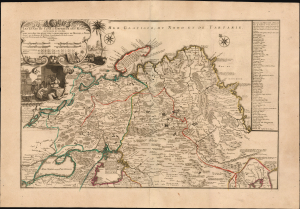
Les etats du Czar ou Empereur des Russes en Europe et en Asie...
$3,000.00
Acquire
- Digital Map Information
- Suitable for large format printing
- File Size: 38.72 MB
- File Type: ZIP / TIFF
- ICC color profile embedded
- Delivered instantly via download link
This large, beautiful, and rare map of the Russian Empire, engraved by Nicolas de Fer and published in 1722, is a fascinating revision of Nicolas Witsen's 1687 map of the Tatar Empire and Siberia. It incorporates the novel reports of Evert Ysbrandzoon Ides - derived from his journeys between Moscow and China - as well as the Central Asian voyage of Philippe Avril. (more details)
French-Printed Carte á Figures.
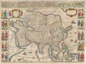
Asia recens summa cura delineata Auct: Iud Hondio.
$2,950.00
Acquire
- Digital Map Information
- Suitable for large format printing
- DPI: 600
- File Size: 54.48 MB
- File Type: ZIP / TIFF
- ICC color profile embedded
- Delivered instantly via download link
This is a beautiful Nicolas Picart edition of the Hondius carte-á-figures map of Asia. It was composed by Jodocus Hondius as early as 1623 and first appeared in the 1630 Hondius atlas. In this case, the map is an entirely new plate engraved in Paris in 1644 by Nicolas Picart. These French editions are beautiful and desirable rarities. (more details)
Bellin puts it all together...
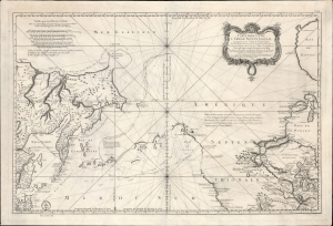
Remarques sur la Carte reduite de l'océan septentrional, compris entre l'Asie et l'Amérique, suivant les découvertes qui ont été faites par les Russes; dressée au Dépôt des cartes et plans de la Marine, pour le service des vaisseaux du roi, par ordre de M. le duc de Praslin, ministre d'etat, ayant le département de la Marine.
$2,750.00
Acquire
- Digital Map Information
- Suitable for large format printing
- File Size: 39.82 MB
- File Type: ZIP / TIFF
- ICC color profile embedded
- Delivered instantly via download link
A beautiful example of Bellin's splendidly engraved 1766 map of the Pacific Northwest, Alaska, the Bering Strait, and Siberia. This map is significant as a reactionary piece to the waves of cartographic speculation about the American Pacific Northwest that defined the first half of the 18th century. Bellin, the premier hydrographer of his generation, here attempts to make sense of it all, bringing together the speculations of the previous generation, his own geographical expertise, and issuing, for the first time on a French map, Frederick Müller's revolutionary cartography relating to the discoveries of Vitus Bering and Aleksei Chirikov. (more details)
From memory...
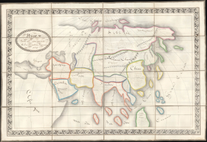
Asie Faite de Mémoire par Alexandrine Beaucousiu.
$2,500.00
Acquire
- Digital Map Information
- Suitable for large format printing
- Full resolution TIFF file
- ICC color profile embedded
- Delivered instantly via download link
An exceptionally well-executed 1832 French pen and ink schoolgirl map of Asia by Alexandrine Breaucousiu. Significantly, Breaucousiu drew the map from memory, which may account for the loose interpretation of geographical forms, but which at the same time exhibits a remarkable flair for geographic sketching (we tried this ourselves and could not produce a finer map). Moreover, individual countries and regions are filled with finely curving descriptive French script. (more details)
Striking map of Asia offering the best cartography of the period.
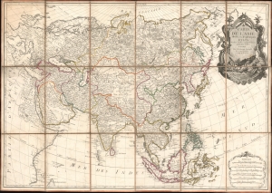
Carte de L'Asie divisée en ses principaux Etats.
$2,250.00
Acquire
- Digital Map Information
- Suitable for large format printing
- Full resolution TIFF file
- ICC color profile embedded
- Delivered instantly via download link
An exceptional large-format separate-issue c. 1779 map of Asia issued by Rigobert Bonne and Charles-François Delamarche. The map is a compilation of the best cartographic information regarding Asia available at the time of publication. (more details)
From lost Russian sources.
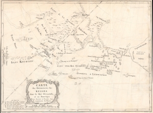
Carte des Découvertes des Russes dans la Mer Orientale, et en Amerique Pour Servir à L'essai, Sur le commerce de Russie.
$2,000.00
Acquire
- Digital Map Information
- Suitable for large format printing
- File Size: 378.74 MB
- File Type: ZIP / TIFF
- ICC color profile embedded
- Delivered instantly via download link
This is a rare and unusual 1777 map of the North Pacific in the vicinity of Alaska, the Bering Strait, and northeastern Siberia based upon Russian Promyshlenniki (trader) exploration. It appeared accompanying one of the earliest works on Russian commerce, the M. de Marbault's Essai sur le Commerce de Russie, avec l'Histoire de ses Decouvertes. (more details)
First Printed Modern Map of Asia.
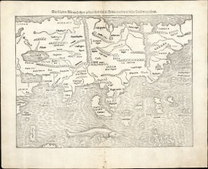
Die Laender Asie nach ihrer gelegenheit biss in India werden in diser Tafel verzeichnet.
$2,000.00
Acquire
- Digital Map Information
- Suitable for large format printing
- Full resolution TIFF file
- ICC color profile embedded
- Delivered instantly via download link
This is a 1574 strike of Sebastian Münster's 1540 map of Asia, the first printed map of that continent based on contemporary data and the earliest obtainable map of the continent overall. The map depicts the Asian continent from the Caspian Sea and the Persian Gulf to the Pacific Ocean and from the Arctic Ocean to the Indian Ocean. Although the interior detail is based heavily on Ptolemy, Münster also blends in information gleaned from recent discoveries by Portuguese traders and adventurers, including Vasco da Gama (c. 1460 - 1624). Both the Portuguese outposts of Goa and Calicut, on the Indian subcontinent, are labeled, and the depiction of India is improved, moving closer to a truly accurate depiction, although still undersized. The inclusion of Sri Lanka (Zaylon) as an island is also an improvement; Münster applies Ptolemy's historical name for Sri Lanka - Taprobana - to Sumatra, which is placed correctly to the west of the Malay peninsula. (more details)
Richly-Decorative, Separately-Issued Map of Asia.
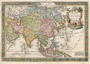
L'Asie Dressée sur de Nouveaux Mémoires Assujettis aux Observations Astronomique.
$2,000.00
Acquire
- Digital Map Information
- Suitable for large format printing
- DPI: 600
- File Size: 95.23 MB
- File Type: ZIP / TIFF
- ICC color profile embedded
- Delivered instantly via download link
This is a separately-issued 1732 Guillaume Danet map of Asia. It is a synthesis of the most advanced cartographic ideas of the age, including from piracies of Strahlenberg's stolen cartography. (more details)
One of the first maps to show the Pacific Northwest.

Tartariae Sive Magni Chami Regni typus.
$2,000.00
Acquire
- Digital Map Information
- Suitable for large format printing
- Full resolution TIFF file
- ICC color profile embedded
- Delivered instantly via download link
This is Abraham Ortelius' seminal 1570 map of Tartary, one of the first maps to focus on the North Pacific coasts of America and Asia, in a sharp, early edition of 1573. While the map is intended to the Asian empire of the Great Khan, it is also notable for what it presents of America. The map includes what is now the west coast of the United States, northwestern Canada, and Alaska, a part of the world almost entirely unknown at that time. It is the earliest obtainable map to name California. It also one of the most definitive early maps to distinctly separate the continents of Asia and America (via the Strait of Anian) well before the explorers of the 18th century proved that separation to be fact. (more details)
Geography for the Nation, in Greek!
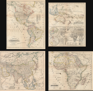
ΧAΡΤΗΣ ΤΗΣ ΑΜΕΡΙΚHΣ / ΧAΡΤΗΣ ΤΗΣ ΑΥΣΤΡΑΛIΑΣ / ΧΆΡΤΗΣ ΤΗΣ ΑΣIΑΣ / ΧAΡΤΗΣ ΤΗΣ ΑΦΡΙΚHΣ.
$2,000.00
Acquire
- Digital Map Information
- Suitable for large format printing
- File Size: 91.34 MB
- File Type: ZIP / TIFF
- ICC color profile embedded
- Delivered instantly via download link
This is an extremely rare c. 1856 set of four Greek-language educational maps published by the Athenian printer Karl Joseph Kolmann. The maps represent an early attempt by the newly independent Greece to reform and nationalize its educational system. (more details)
Muller's important map postulating a large peninsula in the North Atlantic.
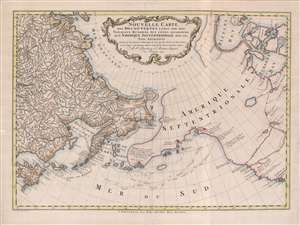
Nouvelle Carte des decouvertes Faites Par Des Vaisseaux Russiens Aux Côtes Inconnues de L'Amerique Septentrionale Avec Les Pais Adiacents.
$1,900.00
Acquire
- Digital Map Information
- Suitable for large format printing
- Full resolution TIFF file
- ICC color profile embedded
- Delivered instantly via download link
A beautiful example of Gerhard Friedrich Müller's important 1766 map of the Pacific Northwest, Alaska, the Bering Strait and Siberia, here in its rare Dutch second edition. Issued after the seminal explorations of Vitus Bering (1733 - 1743) on the Asia side of his namesake strait, but before the voyages of Captain James Cook similarly mapped the American side of the Bering Strait, this map is a smorgasbord of cartographic speculation – such as the exceptionally fine delineation of Friedrich Müller's Peninsula (Alaska / Aleutians). Centered on the Bering Strait, the map covers from Chinese Tartary to the Hudson Bay, and from the high Arctic, south as far as New Mexico, and Honshu (Japan). There is a striking contrast between the well explored Asiatic regions and the starkly bare and highly speculative mapping of America. (more details)
One of the first maps to show the Pacific Northwest.
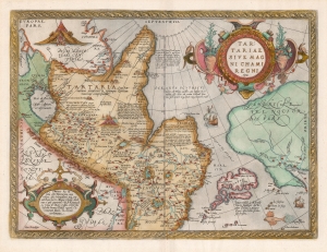
Tartariae Sive Magni Chami Regni typus.
$1,800.00
Acquire
- Digital Map Information
- Suitable for large format printing
- DPI: 600
- File Size: 46.45 MB
- File Type: ZIP / TIFF
- ICC color profile embedded
- Delivered instantly via download link
An example of Ortelius' seminal 1579 map of Tartary, one of the first maps to focus on the North Pacific. While the map is intended to detail Asia under the Great Khan, it is perhaps more notable for what it presents of America. The map includes what is now the west coast of the United States, northwestern Canada, and Alaska, lands then almost entirely unknown. It is the earliest obtainable map to name California. It also displays a strait separating Asia and America - the Strait of Anian - appearing long before Vitus Bering's exploration proved the existence of such. (more details)
Massive Pre-War map of Japan's imperial ambitions.
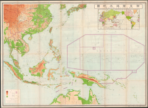
最新南支南洋大地圖 / [Latest Map of Southern China, Southeast Asia, and Northern Australia].
$1,800.00
Acquire
- Digital Map Information
- Suitable for large format printing
- Full resolution TIFF file
- ICC color profile embedded
- Delivered instantly via download link
This is a very large and rare 1937 Kobayashi Matashichi map of southern China, Southeast Asia, and the South Pacific. The map anticipates Japanese interest in this vast and resource-rich region, an area soon to be engulfed in the Pacific War (1941 - 1945) and subsumed to Japanese imperial ambitions. Given its tremendous size and detail, it is likely this map was prepared for internal military use in anticipation of Japanese expansion into the Pacific, the East Indies, Southeast Asia, and China. Centered on the strategically critical Philippine Islands, coverage extends from Korea to Australia and from the Bay of Bengal to Micronesia. (more details)
Magnificent Seventeenth-Century Asia.
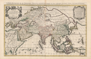
L'Asie diviseé en ses Principales Regions, et ou se peut voir l'estendue Des Empires, Monarchies, Royaumes et Estats qui partagent présentement L'Asie.
$1,500.00
Acquire
- Digital Map Information
- Suitable for large format printing
- DPI: 600
- File Size: 112.68 MB
- File Type: ZIP / TIFF
- ICC color profile embedded
- Delivered instantly via download link
This is a beautiful example of Hubert Jaillot's two-sheet map of Asia in its 1696 Mortier issue. While fundamentally based on Nicolas Sanson's mapping of the continent, the map has been updated to reflect advances in European knowledge of the Far East. Moreover, Jaillot's background as a sculptor has resulted in the artfully engraved cartouches which grace this work. (more details)
Supplying the Soviet War Effort.
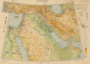
Persian Gulf. Asia Sheet 32 (1/M North F-J 36-40). M.D.R. 533/12035.
$1,500.00
Acquire
- Digital Map Information
- Suitable for large format printing
- Full resolution TIFF file
- ICC color profile embedded
- Delivered instantly via download link
This is a 1945 British War Office map of the Middle East, produced in the later stages of World War II (1939 - 1945). Among other features, it reflects improvements in rail and road infrastructure in Iran, which the Allies arranged to facilitate the ferrying of Lend-Lease supplies to the Soviet Union. (more details)
Rare Unrecorded Plate.
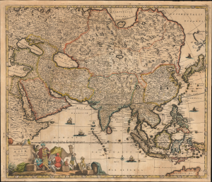
Accuratissima totius Asiae Tabula Recens Emendata Per Fredericum De Wit Amstelodami.
$1,500.00
Acquire
- Digital Map Information
- Suitable for large format printing
- File Size: 28.32 MB
- File Type: ZIP / TIFF
- ICC color profile embedded
- Delivered instantly via download link
This is an unrecorded, likely pirated map based on Frederic De Wit's c. 1680 map of Asia. While cartographically identical to the De Wit, there are enough variations in the engraving to conclude that it was printed from a different plate not referenced elsewhere. (more details)
Best English Wall Map of Asia of the 18th Century.
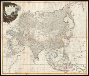
Asia and its Islands According to d'Anville; Divided into Empires, Kingdoms, States, Regions, and ca. with the European possessions and settlements in the East Indies and an exact delineation of all the discoveries made in the eastern parts by the English under Capt. Cook.
$1,500.00
Acquire
- Digital Map Information
- Suitable for large format printing
- Full resolution TIFF file
- ICC color profile embedded
- Delivered instantly via download link
A monumental 1794 wall map of Asia by Laurie and Whittle. Following the cartography of French mapmaker Jean Baptiste Bourguignon d'Anville, this is the best general map of Asia to be issued by a British cartographer in the 18th century. (more details)
The first generation of Meiji Maps drawn from Western sources.
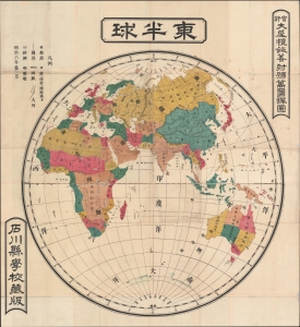
東半球 / Eastern Hemisphere.
$1,200.00
Acquire
- Digital Map Information
- Suitable for large format printing
- File Size: 74.36 MB
- File Type: ZIP / TIFF
- ICC color profile embedded
- Delivered instantly via download link
A rare 1873 or Meiji 6 wall map of the Eastern Hemisphere by the Japanese geographer Gaiko Oya (大屋 愷敆). The map follows the early Meiji Restoration convention of copying cartography from western sources. The practice was intended to modernize Japanese geographical conceptions and place Japan into a geographically accurate global reference. (more details)
Colonial Competition in the East Indies.
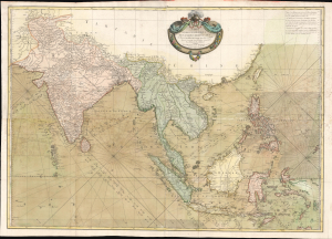
Carte Hydro-Geo-Graphique des Indes Orientales en deca et au dela du Gange avec leur Archipel Dressee et assujettie aux Observations Astronomiques.
$1,200.00
Acquire
- Digital Map Information
- Suitable for large format printing
- Full resolution TIFF file
- ICC color profile embedded
- Delivered instantly via download link
This is Rigobert Bonne's 1771 map of South and Southeast Asia (the East Indies) that appeared in Jean Lattre's 1778 edition of the Atlas Moderne - here in a full color joined example. It depicts the region during a period of competition between colonial empires in the aftermath of the Seven Years' War (1756 - 1763). (more details)
Cold War Propaganda: Gulag Archipelago.

Les camps de concentration en Union Soviétique. 'Jamais ça en France'. Votez Socialiste S.F.I.O.
$1,200.00
Acquire
- Digital Map Information
- Suitable for large format printing
- File Size: 127.92 MB
- File Type: ZIP / TIFF
- ICC color profile embedded
- Delivered instantly via download link
This is a c. 1951 Section Française de l'Internationale Ouvrière (French Section of the Workers' International) campaign propaganda poster of the Soviet Union's Gulag labor camp network. This is among the most influential works of anti-Soviet Cold War (1947 - 1991) propaganda. (more details)
Primary artery of the Russian Civil War.
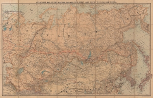
Stanford's Map of the Siberian Railway, the Great Land Route to China and Korea.
$1,200.00
Acquire
- Digital Map Information
- Suitable for large format printing
- Full resolution TIFF file
- ICC color profile embedded
- Delivered instantly via download link
This is a 1919 Edward Stanford map of Russia and the Trans-Siberian Railway - issued at the height of the Russian Civil War. Red lines, with major stops noted, highlight the extraordinary achievement of Russian railway engineers. The completion of a railway network across the world's largest continent opened Siberia to settlement, brought Russian influence to China, led to the Russo-Japanese War (1904 - 1905), and influenced the outcome of the Russian Civil War (1917 - 1920). (more details)
Presenting the proto-Alaska Muller Peninsula, refuting the Sea of the West.
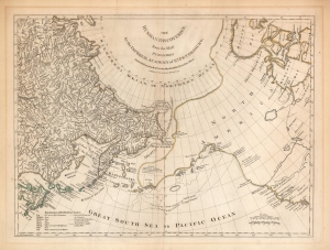
The Russian Discoveries from the Map Published by the Imperial Academy of St. Petersburg.
$1,100.00
Acquire
- Digital Map Information
- Suitable for large format printing
- Full resolution TIFF file
- ICC color profile embedded
- Delivered instantly via download link
An attractive example of Robert Sayer's 1775 translation of Gerhard Friedrich Müller's map presented to refute the spurious geography of the Pacific Northwest proposed by the French cartographers Philippe Buache and Joseph Nicolas De l'Isle. The map covers the same area as the 1752 Buache / De l'Isle map, and uses similarly state-of-the-art data from Russian explorers to show their successes in sailing via a Northeast Passage into the Pacific. This map however presents Müller's cartography of the American Northwest in explicit contradiction of the Buache/De l'Isle imaginary Sea of the West, and reliance on the fictional journeys of Admiral De Fonte. Thus, the map includes the North Pacific, including parts of Alaska, the Pacific Northwest, and Northeast Asia. Coverage extends from the Arctic Circle south to the latitudes of Vancouver and Japan. Most dramatically, the map includes a large, speculative peninsula extending westward from North America towards Asia. This, known as the Müller Peninsula, would become the dominant geographical model for the Pacific Northwest coast until the actual exploration of those coastal areas by Captain Cook in the 1770s. The map is also notable for its unusual Bulbous promontory in northern Siberia, an interpretation of the Witsen Peninsula, itself a mismapping of the Chukchi Peninsula. (more details)
Refining the Map of America's Northwest Coast.
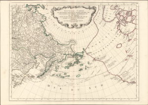
Nouvelle Carte des Decouvertes Faites par des Vaisseaux Russiens aux Cotes Inconnues de l'Amerique Septentrionale avec les Pais Adiacents. Dressée sur des memoires authentiques de ceux Qui ont assisté a ces decouverts, et sur d'autres Connoissances.
$1,000.00
Acquire
- Digital Map Information
- Suitable for large format printing
- Full resolution TIFF file
- ICC color profile embedded
- Delivered instantly via download link
This is Paolo Santini's pirated 1784 edition of Jacob von Staehlin's update to Gerhard Muller's map of the Pacific Northwest, Alaska, the Arctic, and Siberia. It illustrated the findings of Vitus Bering's Great Northern Expedition and subsequent Russian explorations, and was among the most accurate maps of the northwest coast of America available outside Russia before the voyages of Cook, La Pérouse, and Vancouver. (more details)