
Canada (sold)
First printed English Nautical Chart of the East Coast
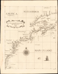
Carta Seconda Generale del' America. XXII.
sold
- Digital Map Information
- Suitable for large format printing
- File Size: 10.87 MB
- File Type: ZIP / TIFF
- ICC color profile embedded
- Delivered instantly via download link
This is the 1661 edition of Robert Dudley's general map of the east coast of North America. According to Burden, this is the 'first printed sea chart of North America by an Englishman and the first to record soundings.' It is a great rarity on the market and a keystone map for any collection of early American cartography. (more details)
The only known example of Grierson's 1732 piracy of Herman Moll's Codfish Map of North America.
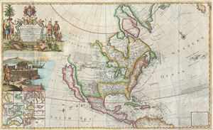
To His Grace Hugh, Lord Archbishop of Armagh, Primate and Metropolitan of all Ireland and One of the Lords Justices of the said Kingdom this map of North America According to the Newest and most Exact Observations is most humbly Dedicated by your Graces most humble Serv: Geo: Grierson.
sold
- Digital Map Information
- Suitable for large format printing
- Full resolution TIFF file
- ICC color profile embedded
- Delivered instantly via download link
An antique map discovery of the utmost rarity. Ostensibly, this is a fine example of Hermann MollÂ's important and highly desirable 1720 Codfish Map, entitled 'To the Right Honourable John Lord Sommers...' Upon closer inspection however, an entirely different ... (more details)
Auchagah Map, a unique synthesis of American Indian and European cartography.
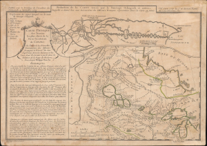
Réduction de la Carte tracée par le Sauvage Ochagach et autres. / Carte Physique des Terreins les plus eleves de la Partie Occidentale du Canada.
sold
- Digital Map Information
- Suitable for large format printing
- Full resolution TIFF file
- ICC color profile embedded
- Delivered instantly via download link
This is Philipe Buache's c. 1754 dual map of inland water routes west of Lake Superior extending, ostensibly, to the Pacific. It is an important and intellectually complex juxtaposition of two radically divergent cartographic conceptions of the North American interior: American Indian (Cree) geographic knowledge (known as the Auchagah Map) and Philippe Buache's speculative synthesis of French exploration, hydrographic theory, and the elusive dream of a navigable route to the Pacific. Within a decade of this map's issue, the route revealed here between Lake Superior and Winnipeg became the primary artery of the Canadian fur trade. (more details)
Earliest Acquirable, Separate Issue.
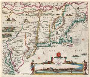
Novi Belgii Novaeque Angliae nec non Partis Virginiae Tabula multis in locis emendata a Nicolao Joannis Visschero.
sold
- Digital Map Information
- Suitable for large format printing
- Full resolution TIFF file
- ICC color profile embedded
- Delivered instantly via download link
This is the rare, c. 1656 second state of the Jansson/ Visscher map of the New Netherlands and New England. It is the earliest acquirable state of this work: the first, 'proof state', of this masterwork is an unobtainable rarity, known in only four examples in institutional and private collections. (more details)
The Earliest Acquirable, Separate Issue.

Novi Belgii Novaeque Angliae nec non Partis Virginiae Tabula multis in locis emendata a Nicolao Joannis Visschero.
sold
- Digital Map Information
- Suitable for large format printing
- Full resolution TIFF file
- ICC color profile embedded
- Delivered instantly via download link
This is the rare, c. 1656 second state of the Jansson/ Visscher map of the New Netherlands and New England. It is the earliest acquirable state of this work: the first, 'proof state', of this masterwork is an unobtainable rarity, known in only four examples in institutional and private collections. (more details)
A landmark - a great cartographical achievement … -Wheat
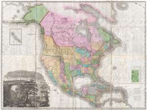
A Map of North America Constructed According to the Latest Information by H. S. Tanner.
sold
- Digital Map Information
- Suitable for large format printing
- DPI: 300
- File Size: 70.48 MB
- File Type: ZIP / TIFF
- ICC color profile embedded
- Delivered instantly via download link
An attractive example of Henry Schenk Tanner's remarkable 1825 landmark map of North America, considered to be the most important map of North America of the 19th century. Revolutionary in countless ways, this is the most accurate map of North America, in ... (more details)
A landmark - a great cartographical achievement … -Wheat
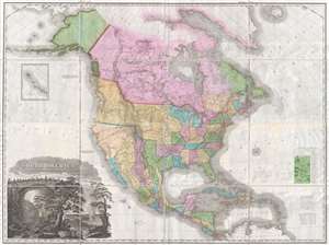
A Map of North America Constructed According to the Latest Information by H. S. Tanner.
sold
- Digital Map Information
- Suitable for large format printing
- DPI: 300
- File Size: 68.73 MB
- File Type: ZIP / TIFF
- ICC color profile embedded
- Delivered instantly via download link
An attractive example of Henry Schenk Tanner's remarkable 1825 landmark map of North America, considered to be the most important map of North America of the 19th century. Revolutionary in countless ways, this is the most accurate map of North America, in ... (more details)
Champlain's great lost map of 1616 hidden within a Duval Map of 1664! The first printed map showing Lake Ontario and Lake Huron!
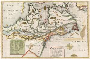
Le Canada faict par le Sr. de Champlain ou son La Nouelle France, La Nouvelle Angleterre, La Nouvelle Hollande, La Nouvelle Svede, La Virginie…
sold
- Digital Map Information
- Suitable for large format printing
- DPI: 300
- File Size: 9.35 MB
- File Type: ZIP / TIFF
- ICC color profile embedded
- Delivered instantly via download link
Truly one of the most intriguing maps we have had the privilege of working with. Ostensibly, this is the second edition of Pierre Du Val's map, Le Canada , but hidden within this map is one of the great historic maps – Samuel de Champlain's unpublished ... (more details)
The First Map to show New York Harbor; the First Map to name Canada.
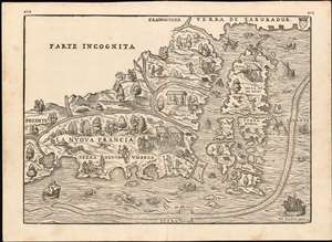
La Nuova Francia.
sold
- Digital Map Information
- Suitable for large format printing
- DPI: 600
- File Size: 14.84 MB
- File Type: ZIP / TIFF
- ICC color profile embedded
- Delivered instantly via download link
This is the seminal 1565 Giovanni Battista Ramusio map of the Northeast and Canada, 'The first printed map devoted to the New England region'(Osher) and the first map to apply a specific name to Canada. The map depicts the northeastern coast of North America from New York to the coast of Labrador, inclusive of New England and maritime Canada. In particular, it is the first map to reveal Giovanni da Verrazano's 1524 voyage to America and to depict his discoveries in what would become New York and New England. It is also among the most visually engaging early maps, being richly decorated with depictions of indigenous peoples, Europeans, flora and fauna, sailing ships, sea monsters, and demons. (more details)
First Map to show New York Harbor. The First Map to name Canada.
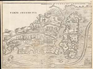
La Nuova Francia.
sold
- Digital Map Information
- Suitable for large format printing
- Full resolution TIFF file
- ICC color profile embedded
- Delivered instantly via download link
This is the seminal 1556 Giovanni Battista Ramusio map of the Northeast and Canada, 'the first printed map devoted to the New England region' (Osher), and the first map to apply a specific name to Canada. The map depicts the northeastern coast of North America from New York to the coast of Labrador, inclusive of New England and maritime Canada. It is the first map to reveal Giovanni da Verrazano's 1524 voyage to America and to depict his discoveries in what would become New York and New England. It is also among the most visually engaging early maps, being richly decorated with depictions of indigenous peoples, Europeans, flora and fauna, sailing ships, sea monsters, and demons. (more details)
First Map to detail New York Harbor; the First Map to name Canada.
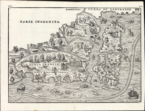
La Nuova Francia.
sold
- Digital Map Information
- Suitable for large format printing
- File Size: 13.96 MB
- File Type: ZIP / TIFF
- ICC color profile embedded
- Delivered instantly via download link
This is a superb example of the seminal 1565 Giovanni Battista Ramusio map of the Northeast and Canada, The first printed map devoted to the New England region (Osher) and the first map to apply a specific name to Canada. Significantly, it is the first map to focus specifically on Giovanni da Verrazzano's 1524 discoveries in what would become New York and New England - making it the first map to depict New York Bay and Harbor. (more details)
First printed map to show New York Harbor
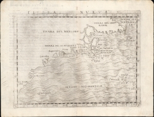
Tierra Nueva.
sold
- Digital Map Information
- Suitable for large format printing
- Full resolution TIFF file
- ICC color profile embedded
- Delivered instantly via download link
This is Giacomo Gastaldi's 1548 map of the eastern coast of North America. It is considered the first printed map specifically of the American eastern coastline and the first obtainable map to illustrate Narragansett Bay, Block Island, New York Harbor, Long Island, the Outer Banks, and Bermuda. (more details)
Heart of British Strategy in the Revolutionary War.
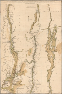
A Topographical Map of Hudsons River, with the channels depth of water, rocks, shoals etc. and the country adjacent, from Sandy-Hook, New York and bay to Fort Edward, also the communication with Canada by Lake George and Lake Champlain, as high as Fort Chambly on Sorel River.
sold
- Digital Map Information
- Suitable for large format printing
- Full resolution TIFF file
- ICC color profile embedded
- Delivered instantly via download link
This is Claude Joseph Sauthier's scarce, magnificent 1776 map of the Hudson River, Lake George, and Lake Champlain: the linchpin of Great Britain's strategy to swiftly achieve victory in the American Revolution. Control of the strategic New York - Montreal corridor would have divided the colonies effectively, allowing Britain to defeat the Revolution piecemeal. (more details)
Extremely rare, highly influential, and very important foundational map of the North Pacific showing Sea of the West and the apocryphal discoveries of Admiral de Fonte.
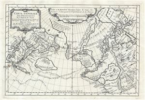
Carte General Des Decouvertes De L'Amiral de Fonte Et autres Navigateurs Espagnols, Anglois, et Russes, pour la recherche du Passage a la Mer du Sud.
sold
- Digital Map Information
- Suitable for large format printing
- DPI: 300
- File Size: 6.51 MB
- File Type: ZIP / TIFF
- ICC color profile embedded
- Delivered instantly via download link
An object of extreme historical importance and rarity, this map was the center of one of the most heated cartographic debates in history. This is an unrecorded state of Joseph-Nicolas de L'Isle's (Delisle) map of the Northern Pacific Ocean and Arctic. ... (more details)
The earliest obtainable specific map of the Great Lakes.
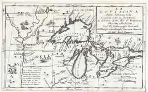
La Louisiana, Parte Settentrionalle, Scoperta sotto la Protettione di Luigi XIV, Re di Francia et Descritta, e Dedicata Dal P. Cosmografo Coronelli, All'Illustriss, et Eccellentiss, S. Zaccaria Bernardi su dell Ecc. S. Francesco.
sold
- Digital Map Information
- Suitable for large format printing
- DPI: 300
- File Size: 6.07 MB
- File Type: ZIP / TIFF
- ICC color profile embedded
- Delivered instantly via download link
This rare 1694 production by Venetian cartographer Vincenzo Coronelli is the earliest and most important obtainable map of the Great Lakes and the headwaters of the Mississippi. Coronelli's map centers on Lake Superior, but covers all five Great Lakes ... (more details)
Most Finely Detailed Dutch Map of the Northeast from the 17th Century.
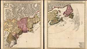
Nova Tabula Geographica Complectens Borealiorem Americae Partem: in qua Exacte Delineatae Sunt Canada sive Nova Francia, Nova Scotia, Nova Anglia, Novum Belgium, Pensylvania, Virginia, Carolina et Terra Nova, cum Omnibus Littorum. Pulvinorumque Profunditatibus. Amstelodami. à Nicolao Visscher. Cum Privilegio Ordinum Generalium Foederati Belgii./ Carte Nouvelle contenant la Partie d'Amerique la Plus Septentrionale, ou Sont Exactement Dècrites les Provinces Suivantes comme le Canada ou Nouvelle France, La Nouvelle Ecosse, la Nouvelle Angleterre, les Nouveaux Païs Bas, la Pensylvanie, la Virginie, la Caroline et l'Ile de Terre Neuve avec les profondeuis le Long des Côtes et sur les Bancs. Par Nicolas Visscher avec Privilege des Etats Géneraux.
sold
- Digital Map Information
- Suitable for large format printing
- DPI: 600
- File Size: 121.39 MB
- File Type: ZIP / TIFF
- ICC color profile embedded
- Delivered instantly via download link
This is Nicolas Visscher II's 1696 two-sheet map of the North American eastern seaboard and the Canadian Maritimes, in a beautiful example of its earliest acquirable state with rich original color. It represents the 17th century's most finely-detailed mapping of the coast from the Carolinas to Labrador. Also, it is the first Dutch map of the region to diverge from the 'Jansson-Visscher' precursor maps. (more details)
Henry Hudson's Final Voyage.
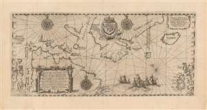
Tabula nautica, qua repraesentātur orae maritimae meatus, ac freta, noviter a H. Hudsono Anglo ad Caurum supra Novam Franciam indagata anno 1612.
sold
- Digital Map Information
- Suitable for large format printing
- Full resolution TIFF file
- ICC color profile embedded
- Delivered instantly via download link
This is Johann Theodore De Bry's 1613 edition of Hessel Gerritz' chart of the North Atlantic and the Canadian Maritimes, based on the reports of Henry Hudson's fourth, final voyage. Predated only by Gerritsz' much rarer 1612 issue, this is the first map of Hudson Bay and the surrounding region, and remained the best chart of the northern regions of Canada for decades. The chart reaches from the British Isles to the western shore of James Bay, extending from 50° - 70° N. (more details)
The first map to name Cape Cod and illustrate Prince Edward Island.
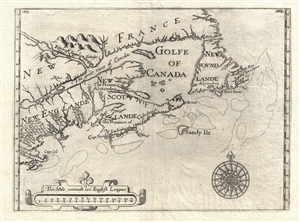
[Untitiled] New Englande, New Scotlande and New Foundlande.
sold
- Digital Map Information
- Suitable for large format printing
- DPI: 300
- File Size: 5.66 MB
- File Type: ZIP / TIFF
- ICC color profile embedded
- Delivered instantly via download link
An exceptional map of significant yet often underappreciated importance, this is Sir William Alexander's 1624 / 1625 map of New England, Nova Scotia, and Newfoundland. The map is notable for a number of first's including the first appearance of the ... (more details)
The earliest obtainable specific map of the Great Lakes.
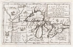
La Louisiana, Parte Settentrionalle, Scoperta sotto la Protettione di Luigi XIV, Re di Francia et Descritta, e Dedicata Dal P. Cosmografo Coronelli, All'Illustriss, et Eccellentiss, S. Zaccaria Bernardi su dell Ecc. S. Francesco.
sold
- Digital Map Information
- Suitable for large format printing
- DPI: 300
- File Size: 5.43 MB
- File Type: ZIP / TIFF
- ICC color profile embedded
- Delivered instantly via download link
This rare 1694 production by Venetian cartographer Vincenzo Coronelli is the earliest and most important obtainable map of the Great Lakes and the headwaters of the Mississippi. Coronelli's map centers on Lake Superior, but covers all five Great ... (more details)
Essential Canadianum: 'The primary map of this period... influenced the cartography of Canada for the next fifty years.' - Kershaw
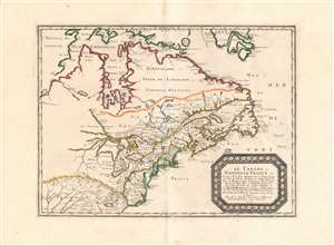
Le Canada, ou Nouvelle France...
sold
- Digital Map Information
- Suitable for large format printing
- DPI: 600
- File Size: 26.16 MB
- File Type: ZIP / TIFF
- ICC color profile embedded
- Delivered instantly via download link
This is Nicolas Sanson's 1656 map of Canada, the Northeast and the Great Lakes, in a superb, untrimmed example. It was among the most influential and important maps of the north part of the Americas to be printed in the 17th century - its depiction of Canada was not superseded until De l'Isle's 1703 Carte du Canada, and it featured the finest depiction of the Great Lakes until the 1687 Coronelli-Nolin. It is among the first printed maps to be informed by the reports of French Jesuit explorers, whose exploration of the Great Lakes region after Champlain's initial explorations was stalled by the 1648 escalation of the Beaver Wars (1603 - 1701) with the Iroquois Confederacy. Following the 1653 pause in the war, Jesuit and French fur traders resumed their push west, gradually revealing the form of the Great Lakes.
The map's treatment of the Arctic waters and Maritime Canada builds on Champlain's basic model, adding place names derived from Dutch and English exploration and preserving Button's explicit northwest passage leading from Button's Bay. (more details)
The map's treatment of the Arctic waters and Maritime Canada builds on Champlain's basic model, adding place names derived from Dutch and English exploration and preserving Button's explicit northwest passage leading from Button's Bay. (more details)
Spectacular pictorial world map illustrating Post-WII situation in Europe and America.
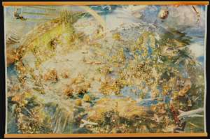
[Oliver Neerlands Bildkarta]
sold
- Digital Map Information
- Suitable for large format printing
- Full resolution TIFF file
- ICC color profile embedded
- Delivered instantly via download link
This is an utterly stunning 1949 pictorial color lithograph wall map of the northern part of the western world by the Norwegian artist Oliver Neerland. The map covers all of North America, the North Atlantic, and Europe as far east as the Caspian Sea, as well as from the North Pole to the Amazon River and Liberia. Lavish illustration depicts historic figures, monuments, art and architecture, animals, airplanes, dirigibles, sailing ships of all types, aircraft characters, and more. (more details)
Best early map of the Great Lakes.
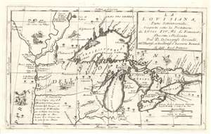
La Louisiana, Parte Settentrionalle, Scoperta sotto la Protettione di Luigi XIV, Re di Francia et Descritta, e Dedicata Dal P. Cosmografo Coronelli, All'Illustriss, et Eccellentiss, S. Zaccaria Bernardi su dell Ecc. S. Francesco.
sold
- Digital Map Information
- Suitable for large format printing
- Full resolution TIFF file
- ICC color profile embedded
- Delivered instantly via download link
This rare 1694 production by Venetian cartographer Vincenzo Coronelli is the earliest and most important obtainable map of the Great Lakes and the headwaters of the Mississippi. Coronelli's map centers on Lake Superior, but covers all five Great Lakes and extends westward as far as the Upper Mississippi River Valley. Cartographically this map is essentially an elaboration upon the 1688 Nolin/Coronelli map, Partie Occidentale du Canada ou de la Nouvelle France. Coronelli was particularly fascinated with the Great Lakes region and this map includes numerous updates and elaborations. (more details)
The rarest and earliest state of a seminal map.
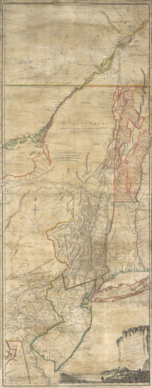
The Provinces of NEW YORK and NEW JERSEY with part of PENSILVANIA, and the Governments of TROIS RIVIERES, and MONTREAL: drawn by Capt. Holland. / A Chorographical Map of the Country between Albany, Oswego, Fort Frontenac, and Les Trois Rivieres; Exhibing all the Grands made by the French Governors on Lake Champlain; & between that Lake & Montreal.
sold
- Digital Map Information
- Suitable for large format printing
- Full resolution TIFF file
- ICC color profile embedded
- Delivered instantly via download link
A first issue first edition example of a seminal map. This is a rare and unusual version of the 1768 first edition of Holland and Jefferys seminal map of New York and New Jersey. Depicts the important trade corridor between New York and ... (more details)
One of the most influential maps in the history of North America.
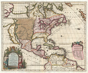
Amerique Septentrionalis Carte d'un tres grand Pays entre le Nouveau Mexique et la Mer Glaciace Dediee a Guilliaume IIIe. Roy de La Grand Bretagne Par le R. P. Louis de Hennepin Mission: Recol: et Not: Apost: Chez c. Specht a Utreght 1698.
sold
- Digital Map Information
- Suitable for large format printing
- DPI: 300
- File Size: 13.5 MB
- File Type: ZIP / TIFF
- ICC color profile embedded
- Delivered instantly via download link
A map that fundamentally impacted the cartographic history of America, this is the 1698 Friar Hennepin map of North America. Covering all of North America from the Equator to the Arctic, this map is remarkable on a number of levels ... (more details)
The Caribbean and American East Coast from the Finest Printed Globe of the 17th Century.
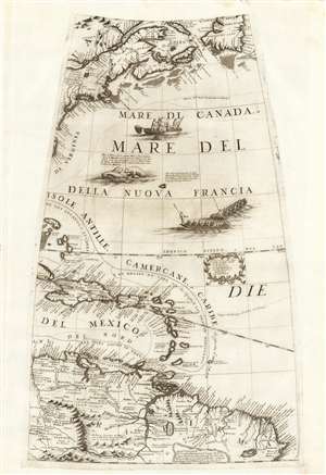
[Untitled Globe Gore of Eastern North and South America from the Equator to approximately 50º north].
sold
- Digital Map Information
- Suitable for large format printing
- Full resolution TIFF file
- ICC color profile embedded
- Delivered instantly via download link
This scarce, beautiful engraving is the globe gore presenting a map of the American northeast, the West Indies, and Terra Firma in South America, engraved in 1688 for Vincenzo Coronelli's 42-inch (3 1/2 foot) terrestrial globe, reprinted in 1697 for inclusion in his Libro dei Globi and Isolario. The map spans from the Equator in the south to Newfoundland in the north, centered on the Tropic of Cancer. It includes Canada in the vicinity of the Saint Lawrence River and Acadia, New England and New York, and part of the coastline around the Chesapeake Bay. The West Indies are shown from the Bahamas to Trinidad, stretching from the eastern part of Cuba to Barbados, including the imaginary island of Fonseca. The gore's southern extents show the northern parts of South America, from modern day Venezuela to the Orinoco Delta and the Guianas, and the fabled city of El Dorado. (more details)
'The primary map of this period... influenced the cartography of Canada for the next fifty years.' - Kershaw

Le Canada, ou Nouvelle France...
sold
- Digital Map Information
- Suitable for large format printing
- Full resolution TIFF file
- ICC color profile embedded
- Delivered instantly via download link
This is Nicolas Sanson's 1656 map of Canada, the Northeast, and the Great Lakes, in an attractive, untrimmed example. It ranks among the most influential and important maps of the north part of the Americas to be printed in the 17th century - its depiction of Canada was not superseded until De l'Isle's 1703 Carte du Canada, and it features the finest depiction of the Great Lakes until the 1687 Coronelli-Nolin. It is among the first printed maps to be informed by the reports of French Jesuit explorers, whose exploration of the Great Lakes region after Champlain's initial explorations was stalled by the 1648 escalation of the Beaver Wars (1603 - 1701) with the Iroquois Confederacy. Following the 1653 pause in the war, Jesuit and French fur traders resumed their push west, gradually revealing the form of the Great Lakes. (more details)
1st to show Vancouver Island and Puget Sound.
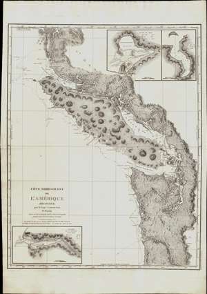
Cote Nord-Ouest de L'Amerique Reconnue par le Cape. Vanouver. 3e. Partie.
sold
- Digital Map Information
- Suitable for large format printing
- Full resolution TIFF file
- ICC color profile embedded
- Delivered instantly via download link
This is the 1799 French edition of George Vancouver's 1799 nautical map of the region around Vancouver Island, the Strait of Juan de Fuca, the mouth of the Columbia River, and Queen Charlotte Sound, extending from Cape Lookout (in modern-day Oregon) to Cape Swaine (Alaska). It is considered to be the great navigator George Vancouver's most important and influential map, among those he produced in his foundational reconnaissance of the northwest coast of America (1791 - 1795). (more details)
An early unrecorded variant of Senex's large map of North America.
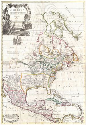
North America corrected from the observations communicated to the Royal Society at London, and the Royal Academy at Paris.
sold
- Digital Map Information
- Suitable for large format printing
- Full resolution TIFF file
- ICC color profile embedded
- Delivered instantly via download link
An exceptional and influential 1710 British map of North America by John Senex. Hands down the most ambitions British mapping of North America produced thus far, Senex's large format map covers all of North America from the ... (more details)
'Probably the best 17th-century representation of the geography of eastern Canada and the eastern seaboard of America.' -Kershaw
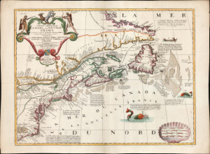
Partie Orientale du Canada ou de la Nouvelle France...
sold
- Digital Map Information
- Suitable for large format printing
- File Size: 27.19 MB
- File Type: ZIP / TIFF
- ICC color profile embedded
- Delivered instantly via download link
This is Vincenzo Coronelli and Jean Baptiste Nolin's separately-published map of Eastern Canada and the Northeastern part of the British Colonies in North America, in an attractive example. It is an essential Canadianum, incorporating up-to-date sources from both the French and English, whilst presenting pro-French territorial claims aggressively. (more details)
An unrecorded variant of Senex's large map of North America.

North America corrected from the observations communicated to the Royal Society at London, and the Royal Academy at Paris.
sold
- Digital Map Information
- Suitable for large format printing
- DPI: 300
- File Size: 21.34 MB
- File Type: ZIP / TIFF
- ICC color profile embedded
- Delivered instantly via download link
An exceptional and influential 1710 British map of North America by John Senex. Hands down the most ambitions British mapping of North America produced thus far, Senex's large format map covers all of North America from the ... (more details)
European Colonies of North America.
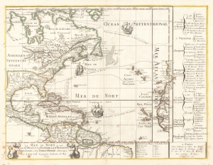
La Mer De Nort où sont la Nle. France, La Floride, La Nle. Espagne, Les Isles et La Terre-Ferme d'Amerique, Par P. Du-val Geographe Ordinaire du Roy 1679.
sold
- Digital Map Information
- Suitable for large format printing
- Full resolution TIFF file
- ICC color profile embedded
- Delivered instantly via download link
This is the rare, first state of Pierre DuVal's 1679 map of eastern North America, the Caribbean, and the Atlantic Ocean. DuVal's map significantly updates the earlier efforts of Nicolas Sanson, his uncle and teacher, and includes notations reflective of a new wave of exploration. Its eastern limits include the Atlantic coast of the Iberian Peninsula, the Azores, the Canary Islands and the Cap Verde Islands, and the coast of Africa from Morocco to the Guinea coast. (more details)
An award-winning map!
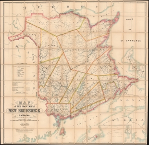
Map of the Province of New Brunswick, Canada.
sold
- Digital Map Information
- Suitable for large format printing
- File Size: 504.46 MB
- File Type: ZIP / TIFF
- ICC color profile embedded
- Delivered instantly via download link
A monumental piece, this is the 1885 Thomas Loggie wall map of New Brunswick, Canada. Awarded the bronze medal at the First International Forestry Exhibition (a world's fair held in Edinburgh in 1884), detail abounds with cities, towns, and villages labeled throughout the province. Several railways crisscross New Brunswick, including the Northern and Western Railway, the New Brunswick Railway, the Caraquette Railway, and the Intercolonial Railway. Major roads appear as well. Rivers, lakes, and other physical features are illustrated. Pale blue dotted and dashed lines labeled alphabetically delineate geological boundaries and correspond with an index along the left side above the title. (more details)