
Canada
First full-size folio map of North America.
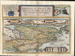
Americae Pars Borealis, Florida, Baccalaos, Canada, Corterealis.
$37,500.00
Acquire
- Digital Map Information
- Suitable for large format printing
- Full resolution TIFF file
- ICC color profile embedded
- Delivered instantly via download link
This is Cornelis De Jode's rare map of North America, printed in a single edition of 1593. The first full-size folio map specifically of North America, it was among the updated maps added to the De Jode atlas specifically to compete with Ortelius' Theatrum Orbis Terrarum. To this end, it combined cartographic information from current sources with a level of decorative flourish that had not yet appeared in any atlas. In the case of this map, Cornelis focused on a part of the world omitted from the elder De Jode's 1578 atlas. (more details)
Largest and Best Map of Lower Canada after the War of 1812.
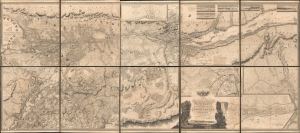
To His Royal Highness George Augustus Frederick, Prince of Wales, Duke of Cornwall ... and Prince Regent of the United Kingdom of Great Britain and Ireland; this Topographical map of the Province of Lower Canada, shewing its division into Districts, Counties, Seigniories, and Townships with all the Lands reserved both for the Crown and the Clergy ... Is with his Royal Hyghnes's Special Permission, Most gratefully dedicated by a Faithful and Zealous Canadian Subject, and His Royal Highnes's Most Obedient and Devoted Servant, Joseph Bouchette, His Majesty's Surveyor General of the Province and Lieutt. Colonel C.M.
$25,000.00
Acquire
- Digital Map Information
- Suitable for large format printing
- File Size: 317.57 MB
- File Type: ZIP / TIFF
- ICC color profile embedded
- Delivered instantly via download link
This is Joseph Bouchette's monumental 10-sheet map of Lower Canada. Appearing at the end of the War of 1812, this is the largest, best, and most influential map of Canada issued in the 19th century. David Rumsey correctly praises it, saying that the 'graphic elegance of the large map is the equal (or perhaps the superior) of any of the contemporary maps that I have seen'. In its pre-publication manuscript form, it played a significant role in the Treaty of Ghent, which ended the War of 1812 and began the establishment of formal U.S.-Canada borders. Due to its extreme rarity, the significance of this map is often overlooked, and it is poorly represented in scholarly literature. (more details)
Most important Canadian immigration and settlement initiative.
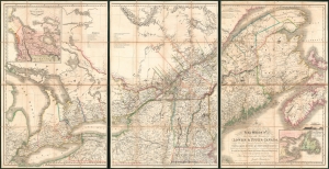
To His Most Excellent Majesty King William IVth This Map of the Provinces of Lower and Upper Canada, Nova Scotia, New Brunswick, Newfoundland and Prince Edwards Island, with a Large Section of the United States...
$19,500.00
Acquire
- Digital Map Information
- Suitable for large format printing
- Full resolution TIFF file
- ICC color profile embedded
- Delivered instantly via download link
This is Joseph-Francis Bouchette's rare large-scale 1831 map of Canada - a seminal map relating to Canadian development, immigration, and land usage. The map details the provinces of Upper and Lower Canada (Ontario and Quebec), which were established in 1791. Most significantly, the map focuses on lands, towns, roads, and districts designated to the Canada Company - the most important immigration and settlement initiative in Canadian history. The Canada Company’s copious settlements are indicated on the map by an asterisk or a cross next to each name. Bouchette notes land disputes between the United States and British North America in Maine and Oregon, but predictably advocates exclusively for British positions. (more details)
British Occupation of Acadia, in progress.
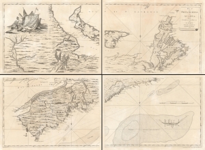
Map of Nova Scotia or Acadia with the Islands of Cape Breton and St. John's.
$16,000.00
Acquire
- Digital Map Information
- Suitable for large format printing
- Full resolution TIFF file
- ICC color profile embedded
- Delivered instantly via download link
This superb four sheet map is Captain John Montresor's 1768 map of Nova Scotia and Cape Breton Island. Montresor produced this map following the British victory in the French and Indian War (1754 - 1763) and during a period of growing unrest in Britain's American colonies prior to the American Revolution (1775 - 1783). His association with the region leads to French and Indian War; he accompanied British forces to Halifax and took part in the siege of Louisbourg. Following the French defeat, Montresor traveled throughout the region to elicit oaths of allegiance from these formerly French territories. It was during this period that he executed the surveys informing this map. (more details)
Most important map in 18th century American history.
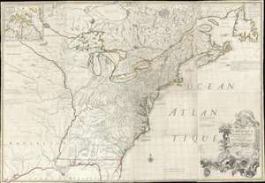
Amerique Septentrionale avec Les Routes, Distances et miles, Villages et Etablissements François et Anglois Par le Docteur Mitchel.
$12,000.00
Acquire
- Digital Map Information
- Suitable for large format printing
- Full resolution TIFF file
- ICC color profile embedded
- Delivered instantly via download link
This is the important 1777 Georges Le Rouge French edition of the seminal John Mitchell map of the eastern part of North America. The Mitchell map is considered the single most important map in 18th-century American history. It was used as a primary reference for nearly every treaty and boundary dispute in colonial North America from the French and Indian War (1754 - 1763) through the late 19th century. The map is all the more astounding because this is Mitchell's one and only map - a truly remarkable feat of virtuosity. (more details)
First large-scale map to show American postal routes.
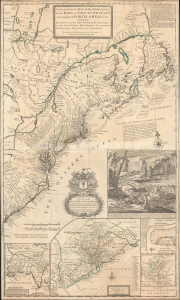
A New and Exact Map of the Dominions of the King of Great Britain on ye Continent of North America. Containing Newfoundland, New Scotland, New England, New York, New jersey, Pensilvania, Maryland, Virginia and Carolina.
$11,000.00
Acquire
- Digital Map Information
- Suitable for large format printing
- File Size: 44.83 MB
- File Type: ZIP / TIFF
- ICC color profile embedded
- Delivered instantly via download link
This is Herman Moll's 1715 'Beaver Map' of the British Colonies in America, here in its 1733 state (see below). In addition to its iconic and namesake image of Niagara Falls and the rich American peltries, this map is also significant as one of the most accurate maps of the period and the first large-scale map to show American postal routes. (more details)
A most important map of eastern Canada detailing British settlement and colonization in the early 19th century.
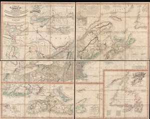
A Map of Cabotia; Comprehending The Provinces of Upper and Lower Canada, New-Brunswick And Nova-Scotia, with Breton Island, Newfoundland, &c. And Including also, The Adjacent Parts of the United States. Compiled from a great Variety of Original Documents. By John Purdy.
$10,500.00
Acquire
- Digital Map Information
- Suitable for large format printing
- DPI: 300
- File Size: 72.87 MB
- File Type: ZIP / TIFF
- ICC color profile embedded
- Delivered instantly via download link
A fine example of Purdy's important 1821 map of Cabotia or Canada and New England – at the time the largest and finest map of that region. Cabotia is Purdy's manufactured term for eastern Canada or those lands discovered by John Cabot in 1497. The map covers from Lake Michigan to Newfoundland and from Labrador to New York City. Within Canada, it includes all of Ontario, Quebec, Nova Scotia, New Brunswick and Nova Scotia, and Newfoundland. In the United States, it includes all of New England, Michigan, and New York, as well as parts of Ohio and Pennsylvania. There are no fewer than 10 inset detail maps including a map of the Great lakes, the environs of Quebec, the St. Lawrence River, Niagara and vicinity, Newfoundland, Nova Scotia, Halifax, St. John, and New York Harbor. (more details)
Foundation of Canadian coast-to-coast sovereignty!
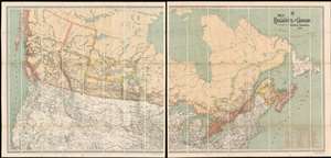
Map Shewing the Railways of Canada to Accompany Annual Report on Railway Statistics.
$7,500.00
Acquire
- Digital Map Information
- Suitable for large format printing
- Full resolution TIFF file
- ICC color profile embedded
- Delivered instantly via download link
The is the first official map of the Canadian Pacific Railroad issued after the railroad's completion in 1885. This map is of critical importance to the development of the Canadian Confederation, as well as the first complete map of the second North American intercontinental railroad. This enormous map was issued in 1886 by A. M. Edwards and Canadian Government Railways. Depicting the entire country in two sections, the map identifies ninety-three different railways throughout Canada - but the focus is the impressive Canadian Pacific Route, which stretches from Montreal to British Columbia. Maritime routes between North America and Europe and Asia, which connected to the Railroad and were part of the Canadian Pacific's marketing model, are also noted. (more details)
Scarce, separately issued 'carte-á-figures' of America.

Nova Totius Americae Descriptio Auct. F. de Wit.
$5,500.00
Acquire
- Digital Map Information
- Suitable for large format printing
- Full resolution TIFF file
- ICC color profile embedded
- Delivered instantly via download link
This is Frederic De Wit's scarce, separately issued 1660 carte à figures map of America. This beautifully engraved map was one of a handful produced by De Wit to showcase his skill as he struck out on his own as a mapmaker, after having worked for many years under the Blaeu family. It represents a synthesis of traditional imagery with state-of-the-art geographical ideas. It was not intended for any particular atlas, although surviving examples occasionally appear bound into other works, including Doncker's Zee-Atlas. (more details)
Seminal view of Quebec shortly after the French and Indian War.
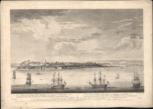
A View of the City of Quebec, the capital of Canada, taken partly from the Pointe des Peres, and partly on Board the Vanguard Man of War. / Vue de la Ville de Québec, capitale du Canada, prise en partie de la Pointe des Peres, et en partie abord de l'Avantgarde Vaisseau de Guerre.
$5,500.00
Acquire
- Digital Map Information
- Suitable for large format printing
- File Size: 25.18 MB
- File Type: ZIP / TIFF
- ICC color profile embedded
- Delivered instantly via download link
This is the rare 1868 Hervey Smyth view of Quebec City, published in 1768. It is one of the earliest obtainable views of Quebec City, offering a look at the city shortly after the French and Indian War (1754 - 1763). The view was published for the Scenographia Americana, one of the most influential and monumental pre-Revolutionary graphic works on North America. (more details)
Revealing the Virginia Colony in North America.
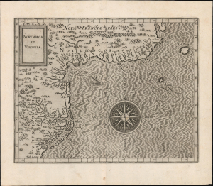
Norumbega et Virginia.
$5,500.00
Acquire
- Digital Map Information
- Suitable for large format printing
- File Size: 9.46 MB
- File Type: ZIP / TIFF
- ICC color profile embedded
- Delivered instantly via download link
A superb example of Cornelis Wytfliet's 1597 map of Virginia and the northeast part of America. The map prominently features the legendary city and land of Norumbega; at the same time, it is among the earliest acquirable maps to detail the Virginia colony, making it a superb demonstration of accuracy and error in close proximity. This map is among the earliest to show John White's cartography in Virginia. It is a foundational map for any collector of Virginia or the colonization of North America. (more details)
Canada attempts to regulate the Yukon Timber Boom.
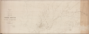
Plan Showing the Timber Berths in the Yukon Territory in Force on the 1st January 1910.
$5,000.00
Acquire
- Digital Map Information
- Suitable for large format printing
- Full resolution TIFF file
- ICC color profile embedded
- Delivered instantly via download link
This is a unique 1910 Canadian Department of the Interior map of the timber berths, transportation networks, waterways, and government outposts across the Yukon Territory at the close of the Klondike Gold Rush. It illustrates the Canadian government's attempt to regulate the Timber Boom that followed the Yukon Gold Rush. More than 100 licensed timber berths appear alongside the Klondike Mines Railway, the White Pass and Yukon Route, and numerous North-West Mounted Police posts. Published when Yukon sawmills produced more than two million board feet of lumber annually, the map offers a monumental (8.5 feet long!) record of resource management, industrial development, and transportation in northern Canada. (more details)
Promoting westward migration in 19th century Canada.
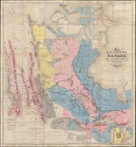
Map of the North West Part of Canada Indian Territories and Hudson's Bay.
$5,000.00
Acquire
- Digital Map Information
- Suitable for large format printing
- File Size: 79.93 MB
- File Type: ZIP / TIFF
- ICC color profile embedded
- Delivered instantly via download link
Magnificently huge, this is Thomas Devine's 1857 large-scale map of Canada west of the Hudson Bay. It is the first map of the West published and issued in Canada, and as such, it can be considered an essential document of the Canadian westward expansion. (more details)
Capturing a glimpse of Cartier's meeting with the St. Lawrence Iroquois.
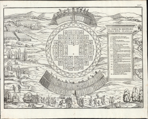
La Terra de Hochelaga Nella Nova Francia.
$4,500.00
Acquire
- Digital Map Information
- Suitable for large format printing
- File Size: 12.67 MB
- File Type: ZIP / TIFF
- ICC color profile embedded
- Delivered instantly via download link
This is an attractive example of the first map of 'Montreal,' in its scarce 1565 second edition. Its first 1556 printing was what Schwartz called 'The very first plan of a village in the United States or Canada,' and it is the earliest printed map to use the place name 'Monte Real,' which would become Montreal. Perhaps even more significantly, this woodcut is one of the only images from the Discovery Period of an intact indigenous town, reflecting its customs. (more details)
Source of a cartographic feud.
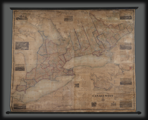
Tackabury's Map of Canada West, drawn from Government and special Local Surveys by H.F. Walling.
$4,500.00
Acquire
This is Henry Francis Walling's very large-format 1862 wall map of Canada West (formerly Upper Canada and subsequently Ontario), published by Robert M. Tackabury and George N. Tackabury. In addition to its size and magnificent level of detail, it is also significant for capturing this region in a period of political and social transformation, driven by railways, immigration, and moves towards greater political union and autonomy. (more details)
Featuring the Guif of Mexico and Lake Ontario!
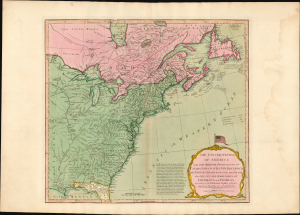
The United States of America with The British Possessions of Canada, Nova Scotia, New Brunswick, and Newfoundland divided with The French, also the Spanish Territories of Louisiana and Florida according to the Preliminary Articles of Peace Signed at Versailles the 20th of Jany. 1783.
$3,500.00
Acquire
- Digital Map Information
- Suitable for large format printing
- Full resolution TIFF file
- ICC color profile embedded
- Delivered instantly via download link
A striking 1794 Laurie and Whittle map of the newly independent United States, capturing North America's transformation in the turbulent decades between the American Revolution (1775 - 1783) and the War of 1812 (1812 - 1815). Most remarkable is its magnificent title cartouche, surmounted by one of the earliest printed representations of the thirteen-star American flag - a bold visual declaration of the new republic's place on the world stage. (more details)
Inset of Boston - first map of an English colonial city on a non-English map.
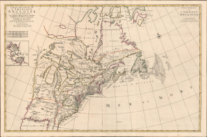
Carte Nouvelle De L'Amerique Angloise Contenant La Virginie, Maryland, Caroline, Pensylvania, Nouvelle Iorck, N. Iarsey, N.France, Et Les Terres Nouvellement Decouverte...
$3,200.00
Acquire
- Digital Map Information
- Suitable for large format printing
- Full resolution TIFF file
- ICC color profile embedded
- Delivered instantly via download link
An impressive large-scale Pierre Mortier 1700 map of the British Colonies in North America. The map features an important inset of Boston - the first map of a British colonial city on a non-British map (Burden). It was issued to capitalize on popular interest in King William's War (1689 - 1697). (more details)
North America from the Great Age of Exploration.
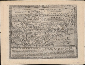
Novi Orbis Pars Borealis, America Scilicet, Complectens Floridam, Baccalaon, Canadam, Terram Corte . . . 1585.
$3,000.00
Acquire
- Digital Map Information
- Suitable for large format printing
- Full resolution TIFF file
- ICC color profile embedded
- Delivered instantly via download link
A beautifully engraved, rare, and important 1600 map of North America by Matthias Quad, in its first edition. This is one of the most significant obtainable maps to incorporate the cartography of Cornelis de Jode, John White, and Jacques Le Moyne. It is additionally significant for its postulation of an open Northwest Passage. (more details)
Monumental Scheme to Harness the Power of Niagara Falls.
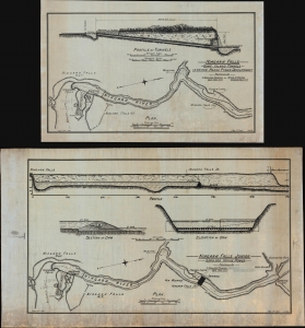
Niagara Falls Junior 2,000,000 Horse Power. / Niagara Falls Goat Island Tunnels 1,500,000 Horse Power Development.
$3,000.00
Acquire
- Digital Map Information
- Suitable for large format printing
- Full resolution TIFF file
- ICC color profile embedded
- Delivered instantly via download link
A detailed 1921 pair of manuscript schematic maps illustrating Niagara Falls Jr., a proposed dam on the Lower Niagara River, by civil engineer Thomas Kennard Thomson. The dam, which was never built, was an ambitious project advocated by Thomson and local politician Peter A. Porter. (more details)
England and France Wrestle over Nova Scotia.
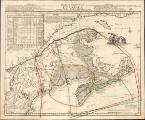
Partie Occidentale du Canada.
$2,850.00
Acquire
- Digital Map Information
- Suitable for large format printing
- File Size: 25.75 MB
- File Type: ZIP / TIFF
- ICC color profile embedded
- Delivered instantly via download link
This is the 1762 first state of Georges-Louis Le Rouge's scarce, informative map of maritime Canada, Nova Scotia, and New England. It details conflicting French and English territorial claims, particularly in Acadia. Although its topography is derived from Thomas Jefferys' 1755 A New Map of Nova Scotia, Le Rouge marshals a wealth of detail not present in that source in order to focus on international territorial concerns. (more details)
Monumental Sea Chart of the Coast of the Northeastern United States.
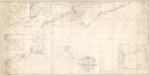
The north eastern coast of North America from New York to Cape Canso, including Sable Island.
$2,000.00
Acquire
- Digital Map Information
- Suitable for large format printing
- DPI: 600
- File Size: 102 MB
- File Type: ZIP / TIFF
- ICC color profile embedded
- Delivered instantly via download link
This is Edmund Blunt's rare, monumental 1840 nautical chart or map of the northeast United States, extending from New York to Cape Canso in Nova Scotia, and is the most authoritative American chart of these waters available at the time. It provides not only granular detail of the coastline, but also detailed soundings for the crucial sailing lanes from Halifax to Boston. It is a working chart - typically referred to as a 'blueback chart' due to the color of the reinforcing paper it was originally mounted to. Rather than contend with multiple charts, mariners typically preferred large charts composed of several sheets: hence the impressive expanse of the present chart. (more details)
The Americas crafted into a unique puzzle!
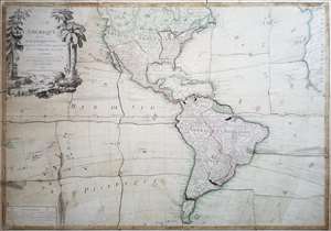
L'Amerique divisée en ses principaux états, assujetie aux observations astronomiques par le Sr. Janvier Geographe. A Paris.
$2,000.00
Acquire
This is Jean Janvier's 1760 rare, separately issued map of the western hemisphere, in its 1784 Paris edition. This map has, at an early date, been pasted down and hand-cut to form a simple jigsaw puzzle. Although the map does not name the new country, the colored national borders reflect the formation of the United States, which had been set according to the Treaty of Paris the year before this map was printed. The substance of the map is somewhat changed - dotted colonial borders have been burnished out and replaced with new ones, but the bulk of the engraving remains true to the 1760 edition. (more details)
'A foundation map.' -Tooley
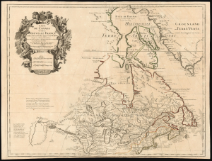
Carte du Canada ou de la Nouvelle France et des Decouverts qui y ont été faites...
$1,800.00
Acquire
- Digital Map Information
- Suitable for large format printing
- Full resolution TIFF file
- ICC color profile embedded
- Delivered instantly via download link
This is Guillaume de l'Isle's groundbreaking 1703 / 1718 map of Canada - one of the most important maps of the northern parts of North America. When De l'Isle first issued this map, it was the most sophisticated cartographic representation of this region yet published, referencing the most recent explorations, including the Jesuit Relations, Pierre Le Moyne d'Iberville, Pierre Le Sour, and Baron de Lahontan. (more details)
Quartet of Colonial-America Maps.
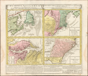
Dominia Anglorum in America Septentrionali. Specialibus Mappis Londini Primum a Mollio Edita, Nunc Recusa ab Homannianis Hered.
$1,600.00
Acquire
- Digital Map Information
- Suitable for large format printing
- Full resolution TIFF file
- ICC color profile embedded
- Delivered instantly via download link
This 1737 Homann Heirs engraving presents a quartet of maps depicting the British Colonies in North America. The four segments present Nova Scotia and Newfoundland, New England, Virginia and Maryland, and the Carolinas, respectively. The maps' detail is drawn closely from the work of Hermann Moll: each of the individual maps appeared as separate maps in Moll's Atlas Minor. Beyond this, the plate includes descriptive text pertaining to three of the four maps and includes a special commentary on the Iroquois Nation. (more details)
One of the Earliest Maps of the North American East Coast.
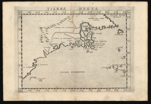
Tierra Nueva.
$1,600.00
Acquire
- Digital Map Information
- Suitable for large format printing
- Full resolution TIFF file
- ICC color profile embedded
- Delivered instantly via download link
This is Girolamo Ruscelli's 1574 map Tierra Nueva, one of the earliest maps to focus on the North American East Coast and the Canadian Maritime Provinces. (more details)
Spoils of the French and Indian War.
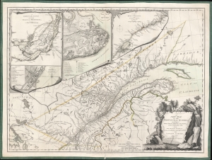
A New Map of the Province of Quebec, according to the Royal Proclamation of the 7th of October 1763 from the French Surveys Connected with those made after the War, by Captain Carver and Other Officers, in His Majesty's Service.
$1,600.00
Acquire
- Digital Map Information
- Suitable for large format printing
- Full resolution TIFF file
- ICC color profile embedded
- Delivered instantly via download link
This is the first state of the 1776 Sayer and Bennett Map of the newly-acquired Province of Quebec, with detail maps of the course of the St. Lawrence River, the Island of Montreal, and inset city plans of Montreal and Quebec City. This region passed from France to Great Britain following the signing of the Treaty of Paris in 1763 at the close of the French and Indian War (1754 - 1763). The map marks settlements, military outposts, major roads, and areas of Native American habitation with their tribal names noted. The two city plans include numbered and lettered keys indicating important structures and fortifications. (more details)
Essential French and Indian War Map, Made Relevant to the Revolution.
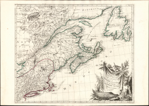
Partie Orientale du Canada avec la Nouvelle Angleterre, l'Acadie, et la Terre-Neuve.
$1,500.00
Acquire
- Digital Map Information
- Suitable for large format printing
- Full resolution TIFF file
- ICC color profile embedded
- Delivered instantly via download link
This is Paolo and Francesco Santini's 1776 map of eastern Canada, New England, Acadia, and Newfoundland. Produced to satisfy European interest in the events of the American Revolutionary War (1775 - 1783), it drew on the best French mapping of the region produced during the French and Indian War (1754 - 1763). (more details)
Victim of the French and Indian War.
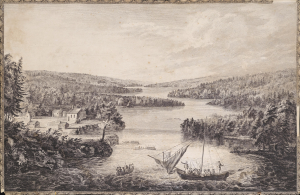
[A View of Miramichi, a French Settlement in the Gulf of St Laurence, destroyed by Brigadier Murray detached by General Wolfe for that purpose, from the Bay of Gaspe / Vue de Miramichi Établissement François dans le Golfe de St Laurent, détruit par le Brigadier Murray, détaché à cet e effet de la Baye de Gaspé, par le Général Wolfe].
$1,500.00
Acquire
- Digital Map Information
- Suitable for large format printing
- Full resolution TIFF file
- ICC color profile embedded
- Delivered instantly via download link
This is Hervey Smyth and Paul Sandby's portrayal of the settlement of Miramichi on the Miramichi River in New Brunswick that appeared in the 1760 Six Views of the Most Remarkable Places of the Gulf and River St. Laurence (later Scenographia Americana), published in London. The strategically located settlement was targeted by the British during the French and Indian War (Seven Years' War) and completely sacked. (more details)
Fastest route to Asia.
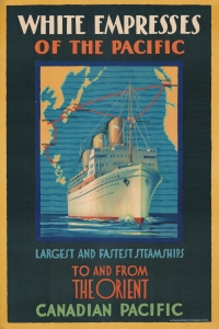
White Empresses of the Pacific. Largest and Fastest Steamships to and from the Orient Canadian Pacific.
$1,500.00
Acquire
- Digital Map Information
- Suitable for large format printing
- File Size: 46.37 MB
- File Type: ZIP / TIFF
- ICC color profile embedded
- Delivered instantly via download link
A striking 1930 chromolithograph travel poster map illustrating the routes of the Canadian Pacific White Empress line. The map illustrates the route between Vancouver, Honolulu, Tokyo, Kobe, Nagasaki, Shanghai, Hong Kong, and Manila. A massive three-stack steamship dominates the image - this is likely the Empress of Japan, which was inaugurated in the year this poster was published. (more details)
Foaming as white as milk and all in motion like a boiling cauldron.
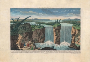
The Waterfall of Niagara...
$1,500.00
Acquire
- Digital Map Information
- Suitable for large format printing
- DPI: 600
- File Size: 33.09 MB
- File Type: ZIP / TIFF
- ICC color profile embedded
- Delivered instantly via download link
A colorful c. 1770 depiction of Niagara Falls, engraved by Robert Hancock and published by Robert Sayer. Below the map, French and English text discusses Niagara Falls' features and natural beauty. (more details)
Canada's Westward Expansion.
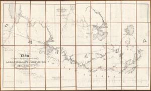
Plan Shewing The Proposed Route From Lake Superior To Red River Settlement...
$1,200.00
Acquire
- Digital Map Information
- Suitable for large format printing
- Full resolution TIFF file
- ICC color profile embedded
- Delivered instantly via download link
A historically significant 1858 map of the Canadian region stretching from Lake Winnipeg and the Red River Settlement to the western shores of Lake Superior. It is based on surveys by Simon James Dawson and William Napier, conducted during a Canadian government-sponsored expedition undertaken the previous year, and was published in Henry Youle Hind's Report on a Topographical and Geological Exploration of the Canoe Route Between Fort William, Lake Superior, and Fort Garry, Red River... The expedition's work, along with a concurrent British-financed expedition over some of the same territory, greatly stimulated interest in both London and Ottawa for Canada's westward expansion, which was realized in the following decades. (more details)
Benchmark Map of the Northwest Territory.
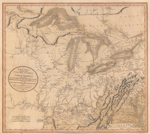
A New Map of Part of the United States of North America, exhibiting The Western Territory, Kentucky, Pennsylvania, Maryland, Virginia and C. Also, the Lakes Superior, Michigan, Huron, Ontario and Erie; with Upper and Lower Canada and C. From the Latest Authorities.
$1,200.00
Acquire
- Digital Map Information
- Suitable for large format printing
- File Size: 22.49 MB
- File Type: ZIP / TIFF
- ICC color profile embedded
- Delivered instantly via download link
Prepared by John Cary in 1805, this is one of the most interesting and attractive maps of the American Frontier and the Great Lakes to emerge in the first years of the 19th century. It provides a detailed snapshot of the western United States in the early years of the republic. (more details)