
Southeast Asia (sold)
The only indigenous Siamese map outside of Siam.
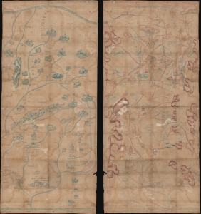
[Siam, Cambodia.]
sold
- Digital Map Information
- Suitable for large format printing
- Full resolution TIFF file
- ICC color profile embedded
- Delivered instantly via download link
Two c. 1800 Siamese / Thai manuscript maps, drawn back-to-back on hand loomed cotton. The significance of these maps cannot be understated. They are likely working drafts for parts of a series of maps compiled for and presented to the Siamese kings sometime between 1783 and 1825. Collectively, they represent the only examples of indigenous Siamese non-religious cartographic visualization outside 17 Royal Maps (really just 11, see below). As working draft, these maps may predate the Royal Siamese Maps, possibly making them the earliest known Thai maps. (more details)
The most important map of the Philippines, in the reduced 'B' variant. Engraved by a Philippine and printed in the Manila.
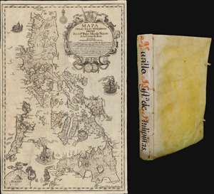
Mapa de Las Yslas Philipinas Hecho Por el Pe. Pedro Murillo Velarde de Compa. de Jesus.
sold
The first edition of Pedro Murillo Velarde's seminal 1749 history of the Philippines, complete with the desirable 1744 Bagay reduction of the 1734 Murillo-Bagay wall map of the Philippines. As a whole, the work is considered one of the most important productions in the history of Philippine printing and a unique Spanish-Philippine collaboration. The map is of particular significance, being the second major map of the Philippines published in the Philippines, engraved by the same hand that engraved the 1734 wall map, but with updates and revisions reflecting 10 years of discovery and development. (more details)
Largest map of the Philippines Printed in the Philippines w/ Distinguished Provenance.
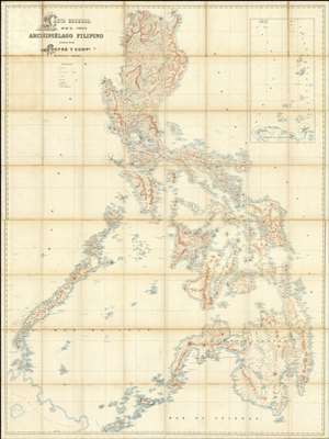
Carta General del Archipiélago Filipino.
sold
- Digital Map Information
- Suitable for large format printing
- File Size: 2002.83 MB
- File Type: ZIP / TIFF
- ICC color profile embedded
- Delivered instantly via download link
This is the only known example of Salvador Chofré's spectacular 1897 map of the Philippines - what must be considered the largest and most detailed Spanish map of the Philippines issued in the 19th century. The map was produced by Salvador Chofré, Manila's first lithographer at the height of his career, likely by government request in the face of the Philippine Revolution (1896 - 1898). The present example is likely a proof, as no other example or publishing history is known. What is known is that this example was acquired by American naval officer Henry Glass in 1898, when he participated in the invasion and surrender of Manila. The U.S. Navy reportedly reproduced it, very likely from this example, at a 50% reduced scale, although we have found no trace of said reproduction. The present map accompanied Glass when he returned to the United States, serving in San Francisco and attaining the rank of Rear Admiral, and was subsequently passed down through his family until we acquired it. (more details)
A stunning late 19th century Vietnamese manuscript map.
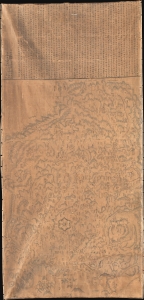
清化省圖本 / [Map of Thanh Hóa Province].
sold
- Digital Map Information
- Suitable for large format printing
- Full resolution TIFF file
- ICC color profile embedded
- Delivered instantly via download link
An incredible, one-of-a-kind large-format 1878 manuscript map depicting Thanh Hóa Province (清化省) in north-central Vietnam by Trần Lưu Huệ, an official at the court of the Nguyễn Dynasty. It is one of only a few examples of traditional Chinese-influenced Vietnamese cartography in private hands and outside of Vietnam. The area here covered was significant for the Nguyễn emperors, who had risen to prominence from Thanh Hóa in the early Lê Dynasty (r. 1428 - 1789). This, nonetheless, captures the Nguyễn Empire in decline as French Indochina began its push into the region. (more details)
The VOC's Secret Map of the South China Sea.
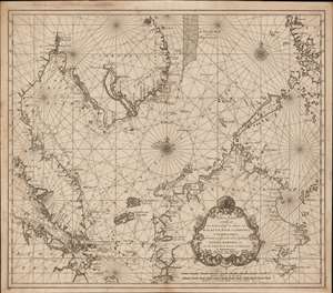
Nieuwe Caart strekkende van Banca, langs de kusten van Malacca, Siam, Cambodia, Cochinchina, als meede een gedeelte van de Eylanden Luçon, Borneo, et c. met alle dresslss Havens, Dieptens en Ankergronden.
sold
- Digital Map Information
- Suitable for large format printing
- DPI: 600
- File Size: 580.26 MB
- File Type: ZIP / TIFF
- ICC color profile embedded
- Delivered instantly via download link
The rare 1753 Johannes II van Keulen / Jan de Marre nautical map of the South China Sea compiled for the sixth volume of the Zee-Fakkel - the legendary Dutch East India Company (VOC - Vereenigde Oostindische Compagnie) 'Secret Atlas.' The map covers the South China Sea and Gulf of Thailand - thus embracing Singapore, Malaya, southern Thailand (Siam), Cambodia, southern Vietnam, most of Borneo, and parts of the Philippines. The map illustrates the most important waters and most dangerous sea passages in the East Indies. It was an essential navigational reference for VOC ships sailing from Malacca, through the Straits of Singapore, or north from Batavia for Siam (Bangkok), Laauwec (Cambodia), Nagasaki, Canton (Guangzhou), Macao, or Manila. (more details)
The only known traditional Vietnamese map outside of Vietnam. Illustrates the Long Wall of Quảng Ngãi, lost until 2005!
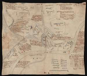
Plan du Huyen de Nghia Hanh. / [Untitled]
sold
- Digital Map Information
- Suitable for large format printing
- Full resolution TIFF file
- ICC color profile embedded
- Delivered instantly via download link
This fascinating c. 1819 Vietnamese manuscript map on linen depicts the huyên or district of Nghĩa Hành, located in the rural South-Central Coast region of Vietnam. This is the only known indigenous Vietnamese map to illustrate the Long Wall of Quảng Ngãi, one of the lost wonders of Southeast Asia. The map is fascinating and offers much else of interest. It follows the course of the Song Vé River from its mouth, to its intersection with the early 19th century Route Mandarine, to a great wall, also known as the Long Wall of Quảng Ngãi. The map identifies 14 villages, some quite large, others little more than familial homesteads, and has notations on local taxation. The overlaying late 19th century French text describes the situation of each village, how it can be reached, and notes that it is available for sale. (more details)
Unique first person espionage archive of the Great Game.
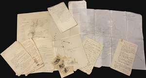
This is a fascinating, unrecorded archive of secret British Indian Army espionage documentation, dating from first decade of the 20th century, providing the modern reader a unique fly-on-the-wall view of the geopolitical, military, and social history of the frontiers of British India as the Great Game came to a close and as the Great War loomed. The documents predominantly date from 1906 to 1910, contain privileged information intended for an audience of prospective intelligence officers in the British Indian Army, and were mainly produced in Peshawar, headquarters of the British Indian army on the frontier with Afghanistan. Peshawar was an espionage hub, crucial to British efforts to counter threats by Russia and China to destabilize India, the Jewel in the Crown of the British Empire. (more details)
Comparing a Viet Cong POW and US Army analysis of Vietnam War battle.
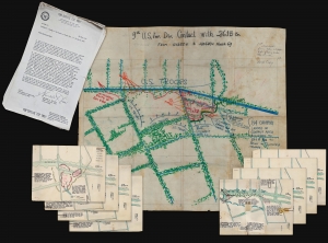
9th U.S. Inf. Div. Contact with 261. B Bn From 111255H to 120600H March 69.
sold
- Digital Map Information
- Suitable for large format printing
- Full resolution TIFF file
- ICC color profile embedded
- Delivered instantly via download link
A one-of-a-kind archive of manuscript maps accompanied by a report by Viet Cong prisoner of war, Pham Xuan Quy, and the U.S. Army 9th Infantry Division Col. Ira Hunt, to illustrate conflicting perspectives on the 1969 Vietnam War Battle of Thanh Phu, fought in the Mekong Delta southwest of Saigon. The collection consists of a large manuscript map, drawn by the Vietnamese Kot Mai, that provides an overview of the battle from start to finish, supplemented by 8 smaller manuscript maps detailing the battle's progression. The archive is significant for being a comparison of both the western and the Viet Cong perspective on the same battle - both of which are preserved in this, the Harris Report. (more details)
The first specific map of Vietnam!
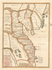
Carte du Royaume d'Annam, comprenant les Royaumes du Tumkin et de la Cocinchine.
sold
- Digital Map Information
- Suitable for large format printing
- DPI: 600
- File Size: 10.55 MB
- File Type: ZIP / TIFF
- ICC color profile embedded
- Delivered instantly via download link
An extraordinary rarity, this is the Alexander de Rhodes and Pierre Mariette 1653 map of Vietnam. This is considered the first specific map of the Kingdom of Annam, or Tonkin, what would later become North Vietnam. Coverage extends from roughly Quảng Ngãi, north to the Chinese border, and west as far as Laos and Cambodia. This map represents a major milestone in the mapping of Vietnam and would prove the underpinning cartography of this region through the mid-19th century. (more details)
The most extraordinary view of Saigon or Ho Chi Minh City during the French period.
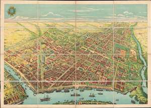
[Saigon]
sold
- Digital Map Information
- Suitable for large format printing
- File Size: 117.95 MB
- File Type: ZIP / TIFF
- ICC color profile embedded
- Delivered instantly via download link
The only known example of what can only be the largest and most spectacular panoramic bird's-eye view of Saigon (Ho Chi Minh City, Vietnam) ever produced. Drafted by Gaston Pusch and published in Saigon by Claude et Cie., this c. 1898 view was printed using a sophisticated multi-color chromolithograph process - a testament to the intellectual and industrial prosperity of Saigon at the height of French imperial rule. The perspective Bird's-eye view looks on Saigon from a high point to the east of the city just across the bustling Saigon River. The view celebrates the massive and all-encompassing rebuilding of Saigon on a grand scale in the late 19th century, reveling lively city full of imposing colonial buildings, sprawling formal gardens, and grand tree-lined boulevards. (more details)
Most engrossingly detail map of Southeast Asia to appear the first half of the 19th century.
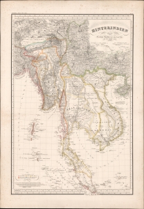
Hinterindien.
sold
- Digital Map Information
- Suitable for large format printing
- DPI: 600
- File Size: 1252.23 MB
- File Type: ZIP / TIFF
- ICC color profile embedded
- Delivered instantly via download link
This is a striking 1832 Heinrich Berghaus and Francis Buchanan-Hamilton map of Southeast Asia, comprising Burma, Siam (Thailand), Loas, Cambodia, Vietnam, Malaya, and Singapore. It was issued for Berghaus' looseleaf Atlas von Asien, the best informed general cartographic work on Asia to appear in the mid-19th century. (more details)

A New Chart of the Straits of Malacca and Sincapore Drawn from the Latest Surveys, with Additions and Improvemetns, by J. W. Norie.
sold
- Digital Map Information
- Suitable for large format printing
- DPI: 300
- File Size: 37.68 MB
- File Type: ZIP / TIFF
- ICC color profile embedded
- Delivered instantly via download link
An extremely scarce 1815 map of the Strait of Malacca and Singapore (Sincapore) by John William Norie. This map covers from Aceh in northwestern Sumatra (Acheen) to Singapore Island and Pulu Bintang. This map first appeared in 1803 when it was issued by William ... (more details)
A previously unknown early manuscript map of the early vicinity of Saigon or Ho Chi Minh City, Vietnam.
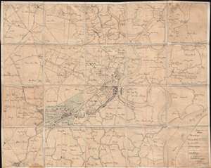
[Saigon and Cholon]
sold
- Digital Map Information
- Suitable for large format printing
- File Size: 40.34 MB
- File Type: ZIP / TIFF
- ICC color profile embedded
- Delivered instantly via download link
The finest and most detailed manuscript map yet discovered illustrating Saigon or Ho Chi Minh City, Vietnam. The map is centered on the center of Saigon City, west of the Song Sai Gon River between the Nhiêu Lộc River and the Bến Nghé River. It extends ... (more details)
Earliest Acquirable map to name 'America'
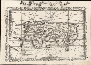
Orbis Typus Universalis Iuxta Hydrographorum Traditionem Exactissime Depicta. 1522 L. F.
sold
- Digital Map Information
- Suitable for large format printing
- File Size: 17.38 MB
- File Type: ZIP / TIFF
- ICC color profile embedded
- Delivered instantly via download link
This is Lorenz Fries' 1522 map of the world in its 1535 edition: a key discovery-era document, being the second earliest acquirable printed map to name 'America' (appearing here in South America). (more details)
Earliest Acquirable use of 'America' on a map.
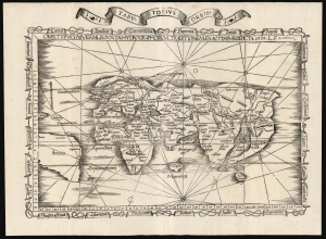
Orbis Typus Universalis Iuxta Hydrographorum Traditionem Exactissime Depicta. 1522 L. F.
sold
- Digital Map Information
- Suitable for large format printing
- File Size: 19.83 MB
- File Type: ZIP / TIFF
- ICC color profile embedded
- Delivered instantly via download link
This is a superb example of Lorenz Fries's 1522 map of the world in its 1535 edition: a key discovery-era document, being the second earliest, acquirable, printed map to name 'America' (appearing here in South America). (more details)
First map of the region printed in color.
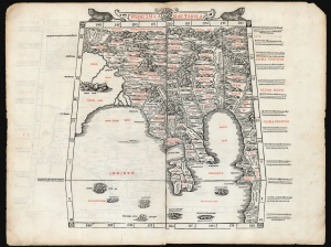
Undecima Asiae Tabula
sold
- Digital Map Information
- Suitable for large format printing
- File Size: 19.28 MB
- File Type: ZIP / TIFF
- ICC color profile embedded
- Delivered instantly via download link
This is a rare example of Bernard Sylvanus' 1511 Ptolemaic map of Southeast Asia and the Malay Peninsula. Printed in a single edition, it is one of the most visually distinctive early woodcut maps of the Far East, an area known to ancient geographers as 'India Extra Gangem' or 'India Beyond the Ganges'. By Ptolemy's reckoning, this map depicted the easternmost extreme of the Indian Ocean. This part of the world would soon be revealed to contain the East Indies and the Spice Islands. (more details)
Flawless example of one of the earliest modern maps of the East Indies.
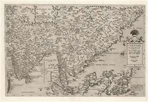
Tertiae Partis Asiae quae modernis India orientalis dicitur acurata delineatio Autore Iacobo Castaldo Pedemontano. Gerardus de Iode excudebat.
sold
- Digital Map Information
- Suitable for large format printing
- Full resolution TIFF file
- ICC color profile embedded
- Delivered instantly via download link
This is a flawless example of the rare 1578 first edition of Gerard De Jode's map of India, the East Indies, and the Philippines. It is broad in scope, including all of India, most of China, the Philippine Islands, and the Malay Peninsula. Singapore appears under the name 'Cingatola.' (more details)
Height of British Colonialism Land co-optation in Malaya.
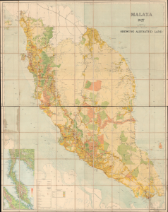
Malaya 1927 Showing Alienated Land.
sold
- Digital Map Information
- Suitable for large format printing
- File Size: 134.17 MB
- File Type: ZIP / TIFF
- ICC color profile embedded
- Delivered instantly via download link
This is a rare and important large format (72 x 56.25 in) 1927 F.M.S. Survey folding wall map of the Malay Peninsula, including Singapore and the Straits Settlements. Among other features, it provides a comprehensive view of land usage (or in this case, 'Alienation' of the lands from Malay populations into British company ownership) across the Malay Peninsula at the height of the colonial era. (more details)
Singapore and the disputed Spratly Islands.
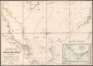
Reduzirte Karte vom Chinesischen Meere; 1stes oder Sudliches Blatt.
sold
- Digital Map Information
- Suitable for large format printing
- Full resolution TIFF file
- ICC color profile embedded
- Delivered instantly via download link
This is a striking 1835 Heinrich Burghaus nautical map of the South China Sea, Malay Archipelago, Singapore, and the Gulf of Siam. Significantly, it is among the finest mappings of the now disputed Spratly Archipelago. It was issued for Berghaus' looseleaf Atlas von Asien, the best informed general cartographic work on Asia to appear in the mid-19th century. (more details)
Sumatra during the pepper trade.
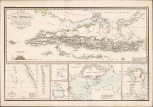
Karte von der Insel Sumatra.
sold
- Digital Map Information
- Suitable for large format printing
- DPI: 600
- File Size: 97.9 MB
- File Type: ZIP / TIFF
- ICC color profile embedded
- Delivered instantly via download link
This is a striking 1837 Heinrich Berghaus map of Sumatra with important insets of Singapore and the Maldives. It was issued for Berghaus' looseleaf Atlas von Asien, the best informed general cartographic work on Asia to appear in the mid-19th century. (more details)
British Colonial 'masterplan' of Malaya.
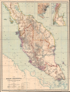
A Map of the Malay Peninsula Compiled by and Published for The Straits Branch of the Royal Asiatic Society Singapore.
sold
- Digital Map Information
- Suitable for large format printing
- File Size: 132.16 MB
- File Type: ZIP / TIFF
- ICC color profile embedded
- Delivered instantly via download link
One of the most important 19th-century maps of the Malay Peninsula to appear on the market in recent decades, this is the definitive large-scale 1898 masterplan created by and for the colonial administration of British Malaya. This chromolithograph map captures a critical moment in Malay history where Britain was beginning to consolidate its suzerainty over the resource-rich peninsula. (more details)
British Colonial 'masterplan' of Malaya.
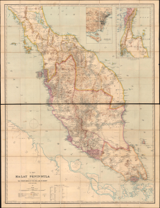
A Map of the Malay Peninsula Compiled by and Published for The Straits Branch of the Royal Asiatic Society Singapore.
sold
- Digital Map Information
- Suitable for large format printing
- File Size: 165.58 MB
- File Type: ZIP / TIFF
- ICC color profile embedded
- Delivered instantly via download link
One of the most important 19th-century maps of the Malay Peninsula to appear on the market in recent decades, this is the definitive large-scale 1898 masterplan created by and for the colonial administration of British Malaya. This chromolithograph map captures a critical moment in Malay history when Britain was beginning to consolidate its suzerainty over the resource-rich peninsula. The present example has an interesting provenance associating it with the assassinated rubber planter Sir John St. Maur Ramsden. (more details)
Reconciling New Discovery with Ptolemy.
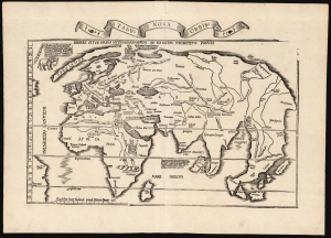
Tabu. Nova Orbis.
sold
- Digital Map Information
- Suitable for large format printing
- Full resolution TIFF file
- ICC color profile embedded
- Delivered instantly via download link
A superb example of Lorenz Fries's 1522 map of the world. This is one of the great Discovery-Era world maps, capturing the impact of contemporary exploration on the late-Roman cartographic models of Ptolemy. (more details)
Propaganda from both sides of the Vietnam War.
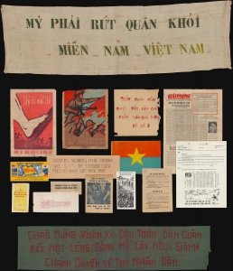
This is an extraordinary archive of Vietnam War (1955 - 1975) propaganda from the estate of Major General Ira A. Hunt Jr. It is a comprehensive retrospective on the propaganda produced by both sides of the long and nuanced war. The collection includes 41 items ranging from Viet Cong produced anti-American pieces to propaganda distributed among the Viet Cong by American Psychological Operations (PSYOPS). (more details)
Laying the groundwork for the French takeover of Cambodia.
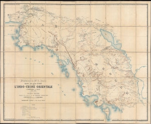
Itinéraires de Mr. A. Pavie dans le sud-ouest de L'Indo-Chine Orientale (Cambodge et Siam) (1880 - 1884).
sold
- Digital Map Information
- Suitable for large format printing
- File Size: 239.01 MB
- File Type: ZIP / TIFF
- ICC color profile embedded
- Delivered instantly via download link
Considered the first scientific survey of Cambodia and southeastern Thailand, this seminal map was published following the 1884 completion of the first and most controversial Mission Pavie (1879 - 1885). Pavie's exploration, mapping, construction of telegraph lines, and successful negotiations with Rama V of Siam, laid the groundwork for the French colonial takeover of Cambodia. The present example is the explorer Auguste Jean-Marie Pavie's own copy. (more details)
Extremely scarce nautical chart of Singapore and Malacca - the most desirable of Horsburgh's influential nautical charts.

To the Honourable The Court of Directors of the United East India Company This Chart of Malacca Strait Singapore Strait and the Southernmost Promontory of Asia Is Inscribed by Their Faithful and Obedient Servant James Horsburgh.
sold
- Digital Map Information
- Suitable for large format printing
- DPI: 300
- File Size: 31.46 MB
- File Type: ZIP / TIFF
- ICC color profile embedded
- Delivered instantly via download link
An extremely scarce 1844 James Horsburgh nautical chart of southern Malaysia, Singapore, and the straits of Malacca and ... (more details)
First map to use the term 'Thailand'. First official map of Thailand.
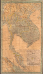
ไทย. [Thai.]
sold
- Digital Map Information
- Suitable for large format printing
- File Size: 245.6 MB
- File Type: ZIP / TIFF
- ICC color profile embedded
- Delivered instantly via download link
This exceptional 1939 Thai-language Royal Thai Survey Department map of Southeast Asia is the first national map of Thailand and the first to use the name 'Thailand' to describe the former Siamese Kingdom. It was published against a backdrop of growing Thai nationalism and Prime Minister Phibun's agenda of pan-Thaism, which sought to establish a 'Greater Thai Kingdom' encompassing the whole of Southeast Asia. (more details)
Important map reafirming Qing Unity and dominance following Jahangir's Holy War on the Turkestan Frontier.
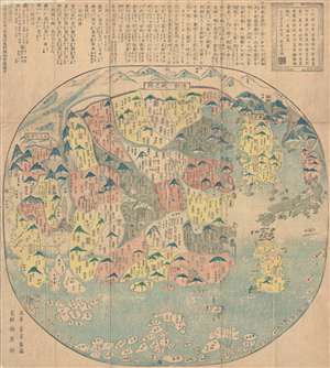
清朝一統之圖 / The unification of the Qing Dynasty. / Shinchō ittō no zu. / Chōi ichiran.
sold
- Digital Map Information
- Suitable for large format printing
- DPI: 300
- File Size: 16.52 MB
- File Type: ZIP / TIFF
- ICC color profile embedded
- Delivered instantly via download link
Ostensibly a天保 Tenpō 6 map of China under the Qing Dynasty, this map in fact covers from India to Japan, ... (more details)
Important map reafirming Qing Unity and dominance following Jahangir's Holy War on the Turkestan Frontier.
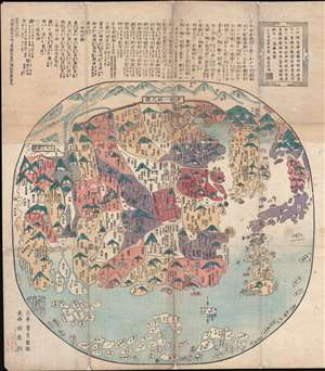
清朝一統之圖 / The unification of the Qing Dynasty. / Shinchō ittō no zu. / Chōi ichiran.
sold
- Digital Map Information
- Suitable for large format printing
- DPI: 300
- File Size: 22.29 MB
- File Type: ZIP / TIFF
- ICC color profile embedded
- Delivered instantly via download link
A 天保 Tenpō 6 map of China under the Qing Dynasty, covering from India to Japan, inclusive of all of China ... (more details)
First scientific map of Laos.
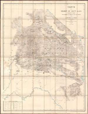
Carte de al Région du Haut Laos Explorée en 1888-1889 par les Membres e a Comission d'Etude des Frontieres entre L'Annam et le Siam.
sold
- Digital Map Information
- Suitable for large format printing
- Full resolution TIFF file
- ICC color profile embedded
- Delivered instantly via download link
Considered the first scientific survey of Laos, this seminal map was published immediately following the 1889 completion of the second Mission Pavie - the expedition that laid the groundwork for the French Protectorate in Laos. The map is signed by its creator, Auguste Jean-Marie Pavie, and dedicated to 'Monsieur Piquet', referring to Georges Jules Piquet (1839 - 1923), Gouverneur Général of French Indochina from 1888 - 1889, under whose auspices the Second Mission Pavie was undertaken. It further features manuscript content by another mission participant, Victor-Alphonse Massie (1854 - 1892), recommending the placement of a border watch post. The map further notes, in manuscript, Nam Youm (Laos), where the White Tai bandit leader Đèo Văn Trị, was then active. This map is significant on many levels: first as the result of one of the most extraordinary missions of exploration undertaken in Southeast Asia; second, as the first scientific survey of what is today northern Laos; third; as the underpinning of subsequent French Protectorate in Laos; fourth, as the personal copy owned by the Gouverneur Général of French Indochina who ordered the 2nd Mission Pavie. (more details)
The greatest map of Burma - ever.
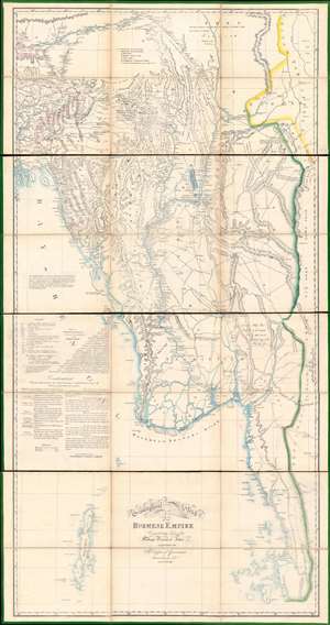
A Geographical Sketch of the Burmese Empire.
sold
- Digital Map Information
- Suitable for large format printing
- Full resolution TIFF file
- ICC color profile embedded
- Delivered instantly via download link
An extraordinary 1825 large-scale map of the Empire of Burma, modern-day Myanmar, issued by the Surveyor-General (QMG) and the private Asiatic Lithographic Press in Calcutta/Kolkata at the height of the First Anglo-Burmese War (1824 - 1826). Issued in four dissected and linen-backed sheets (18.75 x 39.25 in), the map is impressive, measuring nearly 76 inches high and 40 inches wide. Coverage extends from the Brahmaputra River in northern Assam to Domel Island (Letsok-aw Island) and the Mergui Archipelago. Despite its impressive size and apparent density, a close examination actually reveals how little Europeans then knew of the Burmese interior. (more details)
First European map specifically of China to appear in a modern atlas.
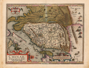
Chinae, olim Sinarum regionis, nova descriptio. auctore Ludovico Georgio.
sold
- Digital Map Information
- Suitable for large format printing
- Full resolution TIFF file
- ICC color profile embedded
- Delivered instantly via download link
This is Abraham Ortelius' 1584 map of China, the first specific map of China to appear in an atlas, here in a beautiful, original-color example of a 1602 Vrients edition. Based on reports of Portuguese missionaries, Ortelius' map was not substantially improved upon until the 1655 maps of Martino Martini (卫匡国; 1614 - 1661). The map is visually unique, with its western orientation and abundant decorative elements. (more details)