
Southeast Asia
Most comprehensive record of the My Lai Massacre in private hands.
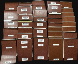
This is a 37-volume archive of documents from the 1971 My Lai Massacre court-martial of Colonel Oran K. Henderson. Henderson was the highest-ranking officer tried in connection with My Lai, one of the most horrific events in American military history, and the last soldier to face a court-martial. The court-martial lasted 62 days and on December 17, 1971, Henderson was found not guilty. Henderson's court-martial ties for the longest court-martial in U.S. Army history with that of Lieutenant William Calley, the only member of the U.S. Army found guilty in connection with My Lai. (more details)
Foundational manuscript plan of colonial Saigon.
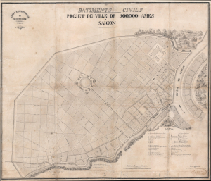
Batiments Civils Projet de Ville de 500,000 Ames Saîgon.
$35,000.00
Acquire
- Digital Map Information
- Suitable for large format printing
- File Size: 36.53 MB
- File Type: ZIP / TIFF
- ICC color profile embedded
- Delivered instantly via download link
This is Lucien Florent Paul Coffyn's 1862 manuscript masterplan of Saigon - the first and most significant map of Saigon (Ho Chi Minh City). Coffyn was the French military engineer tasked with transforming a war-torn fort into a model colonial capital. Following the 1861 French occupation of Saigon, authorities resolved to build a new city on the wartorn site at a monumental scale, reflecting boundless imperial ambition. Coffyn, driven by an unwavering belief in the colony's promise, envisioned a grand, European-style metropolis designed to accommodate half a million residents across 25 square kilometers. The present map - exquisitely drafted and signed by both Coffyn and Vice Admiral Louis Bonard, Governor of Cochinchina - is the likely original manuscript submitted for formal approval. Over the subseqeunt decades, Coffyn's street layout and placement of major sites were implemented with fidelity, though not comprehensively, marking this as the foundational document of colonial Saigon. It stands as a unique testament to French imperial planning and an unparalleled artifact of Asian colonial urbanism. (more details)
Most important chronicle and map of early Singapore.
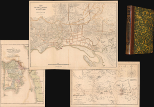
Notices of the Indian Archipelago, and adjacent countries; being a collection of papers relating to Borneo, Celebes, Bali, Java, Sumatra, Nias, the Philippine Islands, Sulu, Siam, Cochin China, Malayan Peninsula, etc.
$32,000.00
Acquire
- Digital Map Information
- Suitable for large format printing
- Full resolution TIFF file
- ICC color profile embedded
- Delivered instantly via download link
A rare example of John Henry Moor's 1837 Notices of the Indian Archipelago, containing within the most important early map of Singapore, as well as otherwise lost reprints of important articles from the Singapore Chronicle, and additional maps of Penang, Singapore Strait, the East Indian Archipelago, Malacca, and Borneo. Moor's work is considered one of the most significant records of early Singapore and one of the first books published in Singapore. (more details)
The first English Printed Nautical Chart to the Indies.
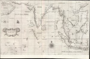
Carta prima Generale dell' Asia.
$25,000.00
Acquire
- Digital Map Information
- Suitable for large format printing
- File Size: 28.34 MB
- File Type: ZIP / TIFF
- ICC color profile embedded
- Delivered instantly via download link
This is a superb, first-state example of Robert Dudley's 1646 general nautical map of South Asia, from the Arabian Peninsula to the Philippines, including the coastlines of India, the Malay Peninsula, Cochinchina, and southern China. Countless islands of the Indian Ocean are charted, as are the western parts of the East Indies. It is the first printed chart of the route to the Spice Islands produced by an Englishman; it is the first to utilize the Mercator Projection, and the first to show prevailing winds, currents, and magnetic variation. The chart's portolan-like lines suggest its origin in the manuscript charts that informed it. Aesthetically, they distinguish this chart as one of the most elegant works dedicated to the region. It is a rarity on the market and a prize map for collectors. (more details)
The French set their eyes on Singapore.
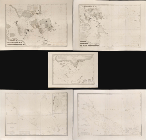
Carte des Atterrages de Singapore. / Carte Particulière des détroits de Singapore, Durian et Rhio. / Carte des Détroits de Singapore, Durian et Rhio et des Parages Environnants. / Carte du Détroit del Malacca Partie Septentrionale. / Carte du Détroit de Malacca Partie Méridionale.
$22,000.00
Acquire
- Digital Map Information
- Suitable for large format printing
- Full resolution TIFF file
- ICC color profile embedded
- Delivered instantly via download link
An exceptional set of five rare 1840s nautical maps/charts detailing Singapore, Malaya, and the Straits of Malacca and Singapore compiled by Urban Dortet de Tessan for the French Dépôt-Général de la Marine. The charts correspond to the Lagrené Mission, a French attempt to establish a colonial presence in East and Southeast Asia that challenged British regional hegemony. (more details)
Most engrossingly detailed map of Southeast Asia to appear the first half of the 19th century.
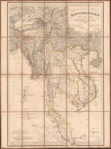
Hinterindien.
$12,000.00
Acquire
- Digital Map Information
- Suitable for large format printing
- File Size: 47.71 MB
- File Type: ZIP / TIFF
- ICC color profile embedded
- Delivered instantly via download link
This is a striking 1832 Heinrich Berghaus map of Southeast Asia, comprising Burma, Siam (Thailand), Laos, Cambodia, Vietnam, Malaya, and Singapore. It was issued for Berghaus' looseleaf Atlas von Asien, the best-informed general cartographic work on Asia to appear in the mid-19th century. (more details)
Holy grail of Siam map collecting.
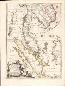
Royaume De Siam, avec Les Royaumes qui luy sont-Tributaries, et les Isles de Sumatra, Andemaon, etc.
$10,000.00
Acquire
- Digital Map Information
- Suitable for large format printing
- Full resolution TIFF file
- ICC color profile embedded
- Delivered instantly via download link
This is the important and influential Coronelli-Nolin map of Southeast Asia, considered one of the Holy Grails of Siam-related map collecting. Here in its 1742 edition, the map was first issued in 1687, following the 1685 first French embassy to Siam, led by Alexandre, Chevalier de Chaumont (1640 - 1710). Most Europeans were expelled from Siam a year later in 1688, making this the definitive model of all subsequent maps of Siam, and Southeast Asia in general until the 1821 John Crawfurd Embassy. (more details)
First specific map of Vietnam.
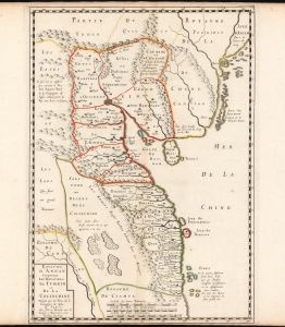
Carte du Royaume d'Annam, comprenant les Royaumes du Tumkin et de la Cocinchine.
$9,500.00
Acquire
- Digital Map Information
- Suitable for large format printing
- DPI: 600
- File Size: 12.7 MB
- File Type: ZIP / TIFF
- ICC color profile embedded
- Delivered instantly via download link
This is the Alexander de Rhodes and Pierre Mariette 1653 map of Vietnam, considered the first specific map of the Kingdom of Annam, or Tonkin, today's North Vietnam. This map represents a major milestone in the mapping of Vietnam and would prove the underpinning cartography of this region through the mid-19th century. (more details)
Extremely Rare Italian map of Southeast Asia.
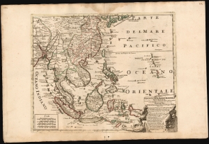
Penisola Dell Indie Orientali De La Del Gange Con Tutte l'Isole cosi Filippine della Sondaq, Ceilan, e Moluche Altre, seconde le Relationi piu moderne descritta da Nicolo De Fer.
$9,500.00
Acquire
- Digital Map Information
- Suitable for large format printing
- File Size: 26 MB
- File Type: ZIP / TIFF
- ICC color profile embedded
- Delivered instantly via download link
This is an exceptionally rare and beautifully engraved 1717 map of Southeast Asia by Neapolitan engraver Paolo Petrini, published in the composite atlas Atlante Partenopeo. Dated 1717, it presents Southeast Asia, the Philippines, and the East Indies after the cartography of the French mapmaker, Nicolas De Fer. (more details)
'The Bishop's Map', composite of Vietnamese and western cartography.
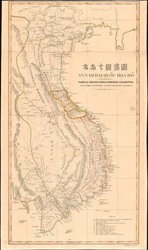
安南帝國畫圖 / An Nam Đại Quốc họa đồ seu Tabula Geographica Imperii Anamitici ab Auctore Dictionarii Latino-Anamitici disposita 1838.
$9,500.00
Acquire
- Digital Map Information
- Suitable for large format printing
- Full resolution TIFF file
- ICC color profile embedded
- Delivered instantly via download link
Known as the 'Bishop's Map', this is an exceptional and important 1838 map of Vietnam by Jean-Louis Taberd, a French missionary. Printed in Calcutta, India, the map is based on Taberd's 10 years of missionary work in Cochinchina, modern-day southern Vietnam, under the Nguyễn Emperors, and is thus the first major advancement on the mapping of Vietnam cartography since the 1653 Alexander de Rhodes map. The map illustrates the Nguyễn Empire at the height of its power and influence, near half a century before the French interventions and subsequent colonization known as 'French Indochina'. (more details)
Two significant rarities - Saigon and Shanghai - back to back.
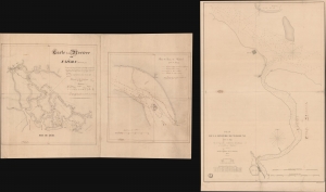
Carte de la Rivière de Saigon (Cochinchine). / Plan du Band de Corail (rivière de Saigon). / Plan de al Rivière de Woosung Levé en 1842 Par les Capitaines H. Kellet and R. Collinson, de la Marine Anglaise.
$7,500.00
Acquire
- Digital Map Information
- Suitable for large format printing
- Full resolution TIFF file
- ICC color profile embedded
- Delivered instantly via download link
This is a remarkable set of back-to-back maps - both are significant in different ways. The most interesting is a finely-executed c. 1860 manuscript chart detailing river approaches to Saigon (Ho Chi Min City). On the verso (or recto, depending) is an 1850 printed nautical chart of the approaches to Shanghai based on the cartography of the First Opium War (1839 - 1842). Both maps are significant, with the manuscript taking primacy as, in all likelihood, it is the first modern hydrographic survey of the Song Sai Gon Estuary. (more details)
EIC China Trade: Charting a new course.
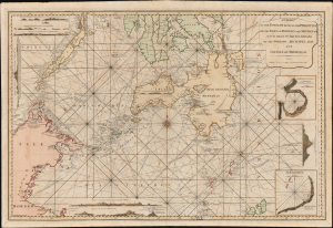
A Chart of the Passages Between the Philippine and The Isles Of Borneo And Mindanao With those to the Southward of the Sooloo Archipelago and the Isle of Mindanao.
$7,000.00
Acquire
- Digital Map Information
- Suitable for large format printing
- Full resolution TIFF file
- ICC color profile embedded
- Delivered instantly via download link
This large, rare nautical chart is Laurie and Whittle's 1794 maritime map of the southern Philippines, particularly Mindanao, Palawan, and the Sulu Sea. It presents improvements resulting from more than three decades of British East India Company voyages through these passages, and is certainly informed by, and possibly the work of, one of the EIC's most successful captains and ship owners, John Pascall Larkins. (more details)
Early urbanization of Phnom Penh.
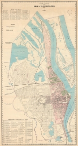
Royaume du Cambodge Plan de la Ville de Phnom-Penh.
$6,500.00
Acquire
- Digital Map Information
- Suitable for large format printing
- File Size: 56.26 MB
- File Type: ZIP / TIFF
- ICC color profile embedded
- Delivered instantly via download link
This is the only known surviving example of an exceptional c. 1935 wall map of Phnom-Penh, capital of Cambodia - the largest and best map of Phnom-Penh during the peak of its colonial era urbanization and development, thus recording a host of ambitious projects, including canals, parks, new neighborhoods, markets, railroads, and dredging efforts that transformed the swampy flood plain to a national capital. (more details)
Gigantic movie poster and map illustrating a Japanese perspecitive on World War II battle for the Pacific.
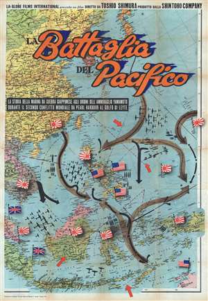
Battaglia del Pacifico.
$6,500.00
Acquire
- Digital Map Information
- Suitable for large format printing
- File Size: 152.77 MB
- File Type: ZIP / TIFF
- ICC color profile embedded
- Delivered instantly via download link
This monumental and rare movie poster and map of East Asia and the Pacific was issued by Vecchioni and Guadango to promote the 1959 Italian release of the post World War II (WW2) 1958 Japanese film Battaglia del Pacifico . The poster takes the form of an enormous ... (more details)
First view of Georgetown, Malaya, center of the Spice Trade. Manuscript.
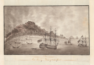
A View of Pulo Pinang or Prince of Wales Island.
$6,000.00
Acquire
- Digital Map Information
- Suitable for large format printing
- DPI: 600
- File Size: 27.08 MB
- File Type: ZIP / TIFF
- ICC color profile embedded
- Delivered instantly via download link
A remarkable, finely executed manuscript view of Georgetown, Penang Island (modern-day Malaysia), drawn in 1788, just 2 years after that colony's founding. This is most likely the earliest surviving image of Georgetown, the first British settlement in Southeast Asia and, by the early 19th century, the center of the spice trade and the epicenter of British power in Southeast Asia. (more details)
First European Atlas map specifically of China.
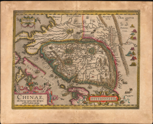
Chinae, olim Sinarum regionis, nova descriptio. auctore Ludovico Georgio.
$5,500.00
Acquire
- Digital Map Information
- Suitable for large format printing
- Full resolution TIFF file
- ICC color profile embedded
- Delivered instantly via download link
This is Abraham Ortelius' 1584 map of China, the first specific map of China, Southeast Asia, and the Philippines to appear in an atlas, here in an original-color example of a 1608 Vrients edition. This is the first printed European map of China and first atlas map to name the Philippines as an archipelago. This map remained definative regional map until superceded in 1655 maps of Martino Martini (卫匡国; 1614 - 1661). (more details)
Suppressed and groundbreaking first edition!
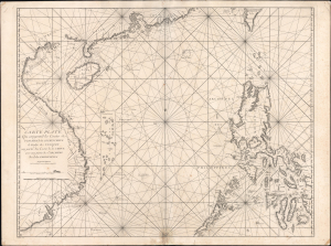
Carte Plate Qui comprend les Coste de Tsiompa, de la Cochinchine, le Golfe de Tunquin, une partie des Costes de la Chine aves une partie de l'Archipel des Isles Philippines.
$5,500.00
Acquire
- Digital Map Information
- Suitable for large format printing
- File Size: 47.63 MB
- File Type: ZIP / TIFF
- ICC color profile embedded
- Delivered instantly via download link
This is the exceedingly rare 1745 nautical map of the South China Sea and the Philippines, which appeared in Mannevillette's banned first edition of his groundbreaking nautical atlas, the Neptune Oriental. When published, this chart represented the finest available cartography of the South China Sea, Southeast China Coast, and the Philippines - thus defining the Canton-Macao-Manila triangle. It was so accurate that French authorities, fearing for the security of their colonial empire, ordered all examples banned and destroyed. The map is additionally notable for its early and idiosyncratic inclusion of various islands, banks, and atolls in the area, many of which have become hotly disputed in recent decades. (more details)
Manuscript map of Saigon made for an artillery officer.
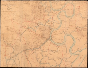
Environs de la Place de Saigon.
$4,500.00
Acquire
- Digital Map Information
- Suitable for large format printing
- File Size: 30.79 MB
- File Type: ZIP / TIFF
- ICC color profile embedded
- Delivered instantly via download link
An exceptional, highly detailed combination ferro-gallic and manuscript map of Saigon (Ho Chi Minh City), Vietnam, prepared in 1904 for Lieutenant Chantereau, an officer serving with the Artillerie Coloniale. The map captures Saigon at its peak as a colonial capital. (more details)
Superb Original Color.
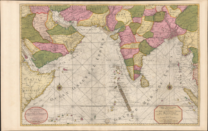
Carte Particuliere d'une Partie d'Asie ou sont Les Isles D'Andemaon, Ceylan, Les Maldives.../ Partie Occidentale d'une D'Asie ou sont les Isles De Zocotora De l'Amirante...
$4,000.00
Acquire
- Digital Map Information
- Suitable for large format printing
- Full resolution TIFF file
- ICC color profile embedded
- Delivered instantly via download link
This is a premium full-original-color example of Pierre Mortier's 1700 nautical chart and map of the Indian Ocean and the adjacent parts of eastern Africa, Arabia, Persia, India, and the Malay Peninsula. Countless islands are mapped, including the Maldives, Sri Lanka, and Sumatra. (more details)
Epic Thai-language Wall Map of Thailand.
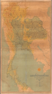
A huge and unrecorded c. 1958 Thai-language wall map of Thailand, produced by Shell (operating locally as the Shell Company of Thailand, Ltd.) and printed by George Philip and Son. Emphasizing highways and topographic detail, it reflects expanding geological knowledge and infrastructural development, both of which were of critical importance to both Thailand and Shell. (more details)
Spectacularly presented.
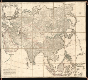
L'Asie divisée en ses Empires et Royaumes.
$3,500.00
Acquire
- Digital Map Information
- Suitable for large format printing
- Full resolution TIFF file
- ICC color profile embedded
- Delivered instantly via download link
A spectacularly presented c. 1787 Charles-François Delamarche / Robert de Vaugondy map of Asia. The beautifully presented map is laid down on unusual patterned linen and set into a fine royal blue slipcase with gold gilt tooling. (more details)
Pavie and the growth of French influence in Indo-china.
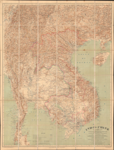
Indo-Chine Carte de la Mission Pavie.
$3,250.00
Acquire
- Digital Map Information
- Suitable for large format printing
- File Size: 101.68 MB
- File Type: ZIP / TIFF
- ICC color profile embedded
- Delivered instantly via download link
This is the 1914 edition of the general map illustrating Southeast Asia, comprising modern-day Thailand (Siam), Laos, Vietnam, and Cambodia. The focus is the theater of the Missions Pavie, a series of groundbreaking espionage, reconnaissance, and political expeditions led by the eccentric adventurer Auguste Jean-Marie Pavie from 1879 to 1895. (more details)
First authenticated European Contact with Australia; best Philippine Mapping to date.
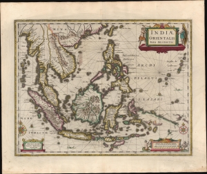
Indiae Orientalis Nova Descriptio.
$3,000.00
Acquire
- Digital Map Information
- Suitable for large format printing
- Full resolution TIFF file
- ICC color profile embedded
- Delivered instantly via download link
This is a gorgeous, original color example of Jan Jansson's 1630 map of the East Indies - the first printed map to present Willem Janszoon's 1606 contact with Australia. It also represents a milestone in the mapping of the Philippines, containing a markedly more precise depiction of the archipelago than any prior printed map. (more details)
The Route to the East Indies.
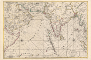
Carte Particuliere d'une Partie d'Asie ou sont Les Isles D'Andemaon, Ceylan, Les Maldives.../ Partie Occidentale d'une D'Asie ou sont les Isles De Zocotora De l'Amirante...
$2,800.00
Acquire
- Digital Map Information
- Suitable for large format printing
- DPI: 600
- File Size: 116.25 MB
- File Type: ZIP / TIFF
- ICC color profile embedded
- Delivered instantly via download link
This is a superb, original-color example of Pierre Mortier's 1700 chart and map of the Indian Ocean. This grand, two-sheet engraving also maps the surrounding lands of eastern Africa, Arabia, Persia, India, and the Malay Peninsula. Countless islands are mapped, including the Maldives, Sri Lanka, and Sumatra. As indicated by the presence of two separate cartouches, the two sheets could also be had as separate works; however, in Mortier's mammoth Neptune François they were frequently bound joined, as here. (more details)
Rare chart of the Singapore Strait.
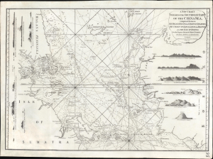
A New Chart Containing the Southwest Part of the China Sea, comprised between The Malaya Peninsula, Straits of Sincapore andc, The Straits of Banca, Gaspar and Billiton, and The Isle of Borneo.
$2,800.00
Acquire
- Digital Map Information
- Suitable for large format printing
- Full resolution TIFF file
- ICC color profile embedded
- Delivered instantly via download link
A scarce 1794 Laurie and Whittle nautical chart or maritime map of the southern tip of the Malay Peninsula, including the island of Singapore (the city had not yet been founded), the Straits of Malacca, and adjacent parts of Sumatra and Borneo. Cartographically, this chart is a vastly updated variant of Jean-Baptiste d'Après de Mannevillette's earlier chart issued in the Neptune Oriental. (more details)
First accurate map of Thailand.
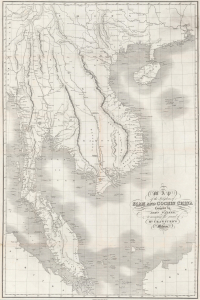
Map of the Kingdoms of Siam and Cochin China.
$2,800.00
Acquire
- Digital Map Information
- Suitable for large format printing
- DPI: 600
- File Size: 101.92 MB
- File Type: ZIP / TIFF
- ICC color profile embedded
- Delivered instantly via download link
This rare large-format 1828 map of Southeast Asia, compiled by John Walker to illustrate John Crawfurd's mission to Siam (Thailand), is the first accurate survey of the coasts of Siam. Coverage extends from China to Singapore and from the Gulf of Martaban (Burma) to Vietnam and Hainan. Siam at the time was inaccessible to European merchants and even diplomats, with its coasts and interior largely unknown. This map is an amalgam of European sources, but with regard to Siam, it was derived primarily from secretly acquired early 19th-century Siamese surveys previously unknown to Europeans and, for all intents and purposes, still lost. (more details)
One of the earliest views of Singapore!
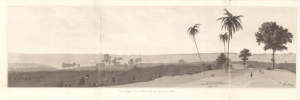
View of Singapore Town and Harbour taken from the Government Hill.
$2,800.00
Acquire
- Digital Map Information
- Suitable for large format printing
- Full resolution TIFF file
- ICC color profile embedded
- Delivered instantly via download link
This is William Daniell's 1830 aquatint panorama of Singapore that appeared in Memoir of the Life and Public Services of Sir Thomas Stamford Raffles. It is considered to be among the earliest views of Singapore. Raffles was the architect of Singapore, and his memoirs were published in 1830, following his death, by John Murray in London. (more details)
British Plan to 'Link India and the Yangtze.'
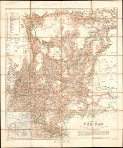
Map of Yün-nan. Topographical Section General Staff, No. 2112.
$2,750.00
Acquire
- Digital Map Information
- Suitable for large format printing
- File Size: 69.49 MB
- File Type: ZIP / TIFF
- ICC color profile embedded
- Delivered instantly via download link
This large folding map of Yunnan Province, China, was prepared by British military officer H. R. Davies in 1906 for the War Office. It was the culmination of years of travel and research by Davies, aimed in particular at planning a British railway to Yunnan that could compete with the French Kunming-Haiphong Railway, then under construction. Davies' map represented a major advancement in the cartography of Yunnan at a time when the province was being eyed by both the British and French as an entry point into China and a link with their wider Asian empires. (more details)
Preserving the Many Marvelous Temples of Angkor.
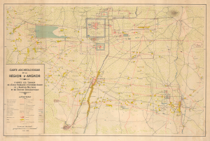
Carte Archéologique de la Région d'Angkor.
$2,500.00
Acquire
- Digital Map Information
- Suitable for large format printing
- File Size: 33.82 MB
- File Type: ZIP / TIFF
- ICC color profile embedded
- Delivered instantly via download link
This is a rare, large-format 1939 archaeological map of Angkor prepared by the Service géographique de l'Indochine. It reflects the culmination of years of surveying and conservation work by the École française d'Extrême-Orient in the early 20th century to document and understand the area's remarkable Khmer temple complexes. (more details)
Japan: A Grasping Octopus.
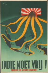
Indie Moet Vrij! Werkt en Vecht Ervoor! [The Indies Must Be Free! Work and Fight For It!]
$2,500.00
Acquire
- Digital Map Information
- Suitable for large format printing
- File Size: 25.05 MB
- File Type: ZIP / TIFF
- ICC color profile embedded
- Delivered instantly via download link
This powerful 1944 Patrick Cokayne Keely World War II propaganda image presents Japan as a menacing octopus with grasping tentacles extending throughout Southeast Asia, the Philippines, and the East Indies. (more details)
Exceptional large-format wartime Japanese map of the Philippines.
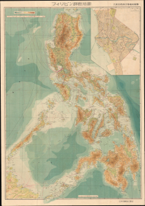
フィリピン詳密地圖 / Detailed Map of the Philippines. / Firipin shomitsu chizu.
$2,400.00
Acquire
- Digital Map Information
- Suitable for large format printing
- Full resolution TIFF file
- ICC color profile embedded
- Delivered instantly via download link
This is Kawamata Tetsuya's rare 1944 (Showa 19) Japanese large-format map of the Philippines, issued just 5 days after the WWII Philippines Campaign (1944 - 1945) began. The map is an expansion on a similar map issued for the 1942-43 'Greater East Asia Co-Prosperity Sphere' map series, which it stylistically resembles despite being four times the size. (See our listing coprosperityset-showa18-1943 for more detail on this series.) This map was issued to satisfy an increased Japanese need for information and reconnaissance following General Douglas MacArthur's landing at Leyte. (more details)
Censored Map: One of the first specific printed maps of the Gulf of Thailand and Cambodia.
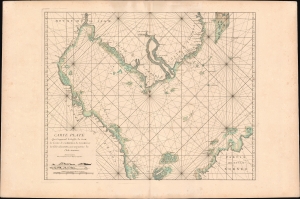
Carte plate qui comprend le Golfe de Siam, les costes de Cambodia, de Tsiompa et les Isles adjacentes, avec une partie de l'Isle Bornéo.
$2,300.00
Acquire
- Digital Map Information
- Suitable for large format printing
- Full resolution TIFF file
- ICC color profile embedded
- Delivered instantly via download link
This is a rare 1745 d'Après de Mannevillette nautical chart or maritime map of the South China Sea and the Gulf of Thailand. It is one of the first specific printed maps of the Gulf of Thailand and Cambodia. This map, and others from the 1745 edition of Mannevillette, were censured by the French Admiralty, and mostly destroyed - making them both exceedingly rare and poorly understood. (more details)