
India - Nepal - Bhutan - Tibet (sold)
First Japanese Printed Map to show European geographical information with Buddhist world-view.
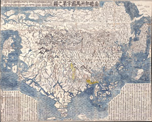
Nansenbushu Bankoku Shoka No Zu (Outline Map of All Countries of the Universe)
sold
- Digital Map Information
- Suitable for large format printing
- Full resolution TIFF file
- ICC color profile embedded
- Delivered instantly via download link
A seminal map. This is the first Japanese printed map to depict the world, including Europe and America, from a Buddhist cosmographical perspective. Printed by woodblock in 1710 (Hoei 7), this map was composed by the Buddhist monk Rokashi Hotan. Inspired by ... (more details)
The first Japanese map of the world from a Buddhist cosmographical perspective - a seminal map.
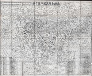
Nansenbushu Bankoku Shoka No Zu (Outline Map of All Countries of the Universe)
sold
- Digital Map Information
- Suitable for large format printing
- DPI: 300
- File Size: 91.94 MB
- File Type: ZIP / TIFF
- ICC color profile embedded
- Delivered instantly via download link
A seminal map of extreme significance. This is the first Japanese printed map to depict the world, including Europe and America, from a Buddhist cosmographical perspective. Printed by woodblock in 1710 (Hoei 7), this map was composed by the Buddhist monk ... (more details)
Nansenbushu: First Japanese Printed Map to show European geographical information with Buddhist world-view.
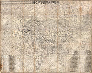
Nansenbushu Bankoku Shoka No Zu (Outline Map of All Countries of the Universe)
sold
- Digital Map Information
- Suitable for large format printing
- DPI: 300
- File Size: 330.31 MB
- File Type: ZIP / TIFF
- ICC color profile embedded
- Delivered instantly via download link
A seminal map of extreme significance. This is the first Japanese printed map to depict the world, including Europe and America, from a Buddhist cosmographical perspective. Printed by woodblock in 1710 (Hoei 7), this map was composed by the Buddhist monk ... (more details)
Unique first person espionage archive of the Great Game.
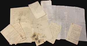
This is a fascinating, unrecorded archive of secret British Indian Army espionage documentation, dating from first decade of the 20th century, providing the modern reader a unique fly-on-the-wall view of the geopolitical, military, and social history of the frontiers of British India as the Great Game came to a close and as the Great War loomed. The documents predominantly date from 1906 to 1910, contain privileged information intended for an audience of prospective intelligence officers in the British Indian Army, and were mainly produced in Peshawar, headquarters of the British Indian army on the frontier with Afghanistan. Peshawar was an espionage hub, crucial to British efforts to counter threats by Russia and China to destabilize India, the Jewel in the Crown of the British Empire. (more details)
First Buddhist map of the world.
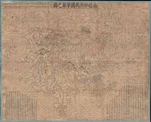
Nansenbushu Bankoku Shoka No Zu (Outline Map of All Countries of the Universe).
sold
- Digital Map Information
- Suitable for large format printing
- DPI: 600
- File Size: 168.79 MB
- File Type: ZIP / TIFF
- ICC color profile embedded
- Delivered instantly via download link
A seminal map of extreme significance. This is the first Japanese printed map to depict the world, including Europe and America, from a Buddhist cosmographical perspective. Printed by woodblock in 1710 (Hoei 7), this map was composed by the Buddhist monk Rokashi Hotan. Inspired by the 1653 publication of Si-yu-ki, a pilgrimage narrative of the Chinese monk Hsuang-Tsang's (602-604) travels to India in search of sacred Sanskrit writings. (more details)
Flawless example of one of the earliest modern maps of the East Indies.
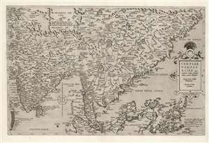
Tertiae Partis Asiae quae modernis India orientalis dicitur acurata delineatio Autore Iacobo Castaldo Pedemontano. Gerardus de Iode excudebat.
sold
- Digital Map Information
- Suitable for large format printing
- Full resolution TIFF file
- ICC color profile embedded
- Delivered instantly via download link
This is a flawless example of the rare 1578 first edition of Gerard De Jode's map of India, the East Indies, and the Philippines. It is broad in scope, including all of India, most of China, the Philippine Islands, and the Malay Peninsula. Singapore appears under the name 'Cingatola.' (more details)
The third episode in the 18th century British mapping of Bombay!
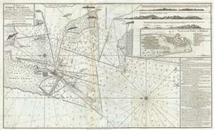
A Plan of Bombay-Harbour on th Coast of Malabar.
sold
- Digital Map Information
- Suitable for large format printing
- Full resolution TIFF file
- ICC color profile embedded
- Delivered instantly via download link
This is a fine example of Laurie and Whittle's 1794 nautical chart or maritime map of Bombay (Mumbai) Island, city, and harbor, India. This map is significant as the third major episode in the mapping of Bombay. The map covers from Salsette Island to the ... (more details)
The largest and most detailed map of Bombay (Mumbai) to appear in the 18th century.
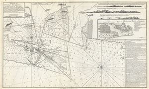
A Plan of Bombay-Harbour on th Coast of Malabar.
sold
- Digital Map Information
- Suitable for large format printing
- DPI: 300
- File Size: 20.38 MB
- File Type: ZIP / TIFF
- ICC color profile embedded
- Delivered instantly via download link
This is a fine example of Laurie and Whittle's 1794 nautical chart or maritime map of Bombay (Mumbai) Island, city, and harbor, India. The map covers from Salsette Island to the continent south to Hunary Island. There is a detailed plan of the city of ... (more details)
The earliest recognizable printed map of Bombay, India.
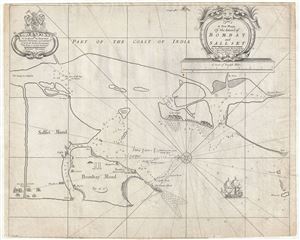
A New Mapp of the Island of Bombay and Sallset.
sold
- Digital Map Information
- Suitable for large format printing
- DPI: 300
- File Size: 12.17 MB
- File Type: ZIP / TIFF
- ICC color profile embedded
- Delivered instantly via download link
An extremely scarce map, this is John Thornton's 1711 map of Bombay Harbor, India. First drawn in 1685 for the Atlas Maritimus , this map is the first printed map to offer any real detail of Bombay harbor. Following in the style of the Thames School, ... (more details)
Important map reafirming Qing Unity and dominance following Jahangir's Holy War on the Turkestan Frontier.
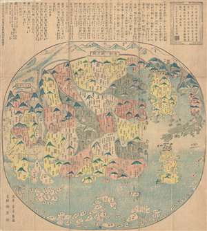
清朝一統之圖 / The unification of the Qing Dynasty. / Shinchō ittō no zu. / Chōi ichiran.
sold
- Digital Map Information
- Suitable for large format printing
- DPI: 300
- File Size: 16.52 MB
- File Type: ZIP / TIFF
- ICC color profile embedded
- Delivered instantly via download link
Ostensibly a天保 Tenpō 6 map of China under the Qing Dynasty, this map in fact covers from India to Japan, inclusive of all of China and Korea, reflecting a pan-Buddhist perspective. The Great Wall is evident at the top of the map and in fact forms ... (more details)
Important map reafirming Qing Unity and dominance following Jahangir's Holy War on the Turkestan Frontier.
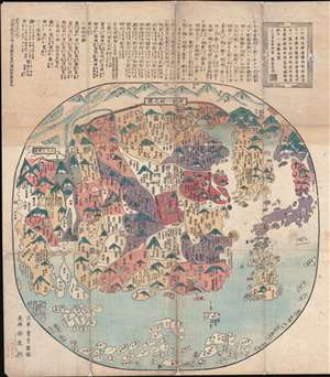
清朝一統之圖 / The unification of the Qing Dynasty. / Shinchō ittō no zu. / Chōi ichiran.
sold
- Digital Map Information
- Suitable for large format printing
- DPI: 300
- File Size: 22.29 MB
- File Type: ZIP / TIFF
- ICC color profile embedded
- Delivered instantly via download link
A 天保 Tenpō 6 map of China under the Qing Dynasty, covering from India to Japan, inclusive of all of China and Korea, reflecting a pan-Buddhist perspective. The Great Wall is evident at the top of the map and in fact forms part of the title. The ... (more details)
The Heart of Portuguese Power in the East.
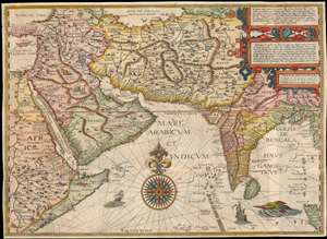
Deliniantur in hac tabula, Orae maritimae Abexiae, freti Mecani. al. Marís Rubri, Arabiae, Ormi, Persiae...
sold
- Digital Map Information
- Suitable for large format printing
- DPI: 600
- File Size: 59.14 MB
- File Type: ZIP / TIFF
- ICC color profile embedded
- Delivered instantly via download link
This is Jan van Linschoten's seminal 1596 map of the lands abutting the Indian Ocean, with coverage extending from the Arabian Peninsula to Sumatra. This map represents a significant advancement in accuracy and detail over any prior printed map of the region, setting the standard for most subsequent maps of the near east and south Asia for the remainder of the 16th and throughout the 17th century. Moreover, it exposed preciously guarded secrets of Portuguese maritime geography, paving the way for the Dutch seizure of the East India trade, thus spurring the Dutch Golden Age. (more details)
The greatest map of Burma - ever.
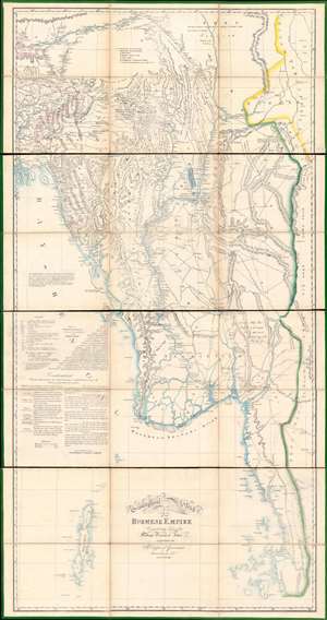
A Geographical Sketch of the Burmese Empire.
sold
- Digital Map Information
- Suitable for large format printing
- Full resolution TIFF file
- ICC color profile embedded
- Delivered instantly via download link
An extraordinary 1825 large-scale map of the Empire of Burma, modern-day Myanmar, issued by the Surveyor-General (QMG) and the private Asiatic Lithographic Press in Calcutta/Kolkata at the height of the First Anglo-Burmese War (1824 - 1826). Issued in four dissected and linen-backed sheets (18.75 x 39.25 in), the map is impressive, measuring nearly 76 inches high and 40 inches wide. Coverage extends from the Brahmaputra River in northern Assam to Domel Island (Letsok-aw Island) and the Mergui Archipelago. Despite its impressive size and apparent density, a close examination actually reveals how little Europeans then knew of the Burmese interior. (more details)
The first surveyed map of Karachi, Pakistan, issued by the East India Company exploratory mission to Sinde in preparation for the February 1839 occupation.
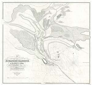
A Trigonometrical Survey of Kurachee Harbour, on the Coast of Sinde.
sold
- Digital Map Information
- Suitable for large format printing
- DPI: 300
- File Size: 12.67 MB
- File Type: ZIP / TIFF
- ICC color profile embedded
- Delivered instantly via download link
This is the first map of Karachi city and harbor, modern day Pakistan, drawn from Thomas Greer Carless' exploratory surveys of 1838. Carless, along with fellow India Navy Officers W. Jardine, Sheppard, and Grieve, was sent to survey the coast of ... (more details)
The earliest functional chart of the Maldives.
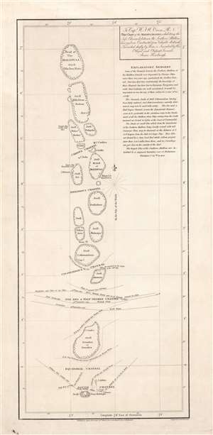
To Capt. W.F.W. Owen R.N. this chart of the Maldiva Islands, exhibiting the safe channels between the southern attollons.
sold
- Digital Map Information
- Suitable for large format printing
- DPI: 600
- File Size: 8.24 MB
- File Type: ZIP / TIFF
- ICC color profile embedded
- Delivered instantly via download link
This is a rare 1814 James Horsburgh nautical map of the central part of the Maldives or Maldivian Archipelago around Malé. Although seemingly simplistic, Horsburgh's chart marks a major advance in Europeans' geographical and hydrological knowledge of the archipelago. The dangerous, near impassible reefs, had long served as the archipelago's most effective and only line of defense against foreign imperialistic interests. This chart partially opened the islands to foreign navigation and marked the beginning of a long period of European influence. This Horsburgh chart served as the definitive mapping of the Maldives until the Robert Moresby surveys of 1834 - 1836. (more details)
First complete survey of the Maldives.
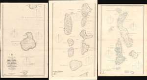
Trigonometrical Survey of the Maldive Islands.
sold
- Digital Map Information
- Suitable for large format printing
- Full resolution TIFF file
- ICC color profile embedded
- Delivered instantly via download link
The largest and most important 1904 chart of the Maldives, compiled by Indian Navy Commander Robert Moresby and Frederick Thomas Powell. The map consists of three joinable panels embracing the Maldive Islands in full, rich with soundings, details about available water supply, tide notes, and a wealth of other practical data for the mariner. This map, the result of meticulous hydrographic work in the mid-19th century, opened the Maldives to steam navigation and was essential to establishing viable steam navigation routes between the Red Sea and the East Indies. It remained the definitive mapping of the Maldives until the 1900s, when it was at last superseded by satellite hydrography. This map also reveals the extent to which the Maldives are at risk form sea-level rise and Global Warming, which is predicted to make the archipelago unhabitable by 2050. (more details)
Separate issue map illustrating the ramifications of the American Revolutionary War in the East Indies.
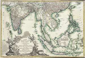
Carte du Theatre De La Guerre Dans L'inde ou se Trouvent Une Partie de La Chine, Les Iles De Sumatra, Java, Borneo, Moluques et Philippines. Dressee d'apres les Meilleures Cartes tant Francaises qu'Anglaises.
sold
- Digital Map Information
- Suitable for large format printing
- Full resolution TIFF file
- ICC color profile embedded
- Delivered instantly via download link
A rare and important 1781 separately issued map of the East Indies by Andre Basset. This map was issued to illustrate a series of conflicts in India and East Indies associated with the American Revolutionary War (1775–1783), including the ... (more details)
Earliest obtainable modern chart of the Maldives.
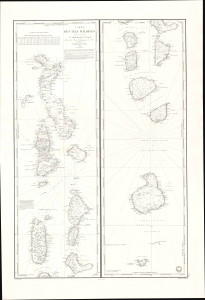
Carte des Iles Maldives. No. 942.
sold
- Digital Map Information
- Suitable for large format printing
- File Size: 28.83 MB
- File Type: ZIP / TIFF
- ICC color profile embedded
- Delivered instantly via download link
This is a rare large-format 1841 French Dépôt-général de la Marine nautical chart of the Maldives Islands in the Indian Ocean. Based on a now-unobtainable 1838 British chart by Robert Moresby, the first modern hydrographic survey of the islands, this is the earliest obtainable specific modern chart of the Maldives. (more details)
Rare administrative map of Calcutta / Kolkata by the Survey of India.
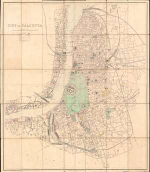
City of Calcutta.
sold
- Digital Map Information
- Suitable for large format printing
- File Size: 108.4 MB
- File Type: ZIP / TIFF
- ICC color profile embedded
- Delivered instantly via download link
A rare, spectacular, and meticulously surveyed large format 1912 city plan or map of Calcutta, or Kolkata, West Bengal, India. Issued in the year after the capital of British India, facing local religious and political unrest, relocated to New Delhi. Centered on Fort William, this massive map extends north as far as Chitpore, south to Parganas, and from the Botanical Gardens and Civil Engineering College in the west, east as far as Kohdaganj, Pagladanga, and Tangra. The Hooghly River features prominently at center with docks and piers noted throughout. The map offers extraordinary detail throughout, with every street, statue, monuments, theater, market, offices, church, hotel, hospital, press, and much more note. (more details)
One of the most influential nautical charts of the 19th century.
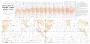
Monsoon and Trade Wind Chart of the Indian Ocean.
sold
- Digital Map Information
- Suitable for large format printing
- Full resolution TIFF file
- ICC color profile embedded
- Delivered instantly via download link
This is Matthew Fontaine Maury's seminal 1859 map of Indian Ocean monsoon winds, a practical tool meant help navigators plot the best routes throughout the year and significantly reduce their transit times. The map represents the culmination of Maury's remarkable efforts to map the Indian Ocean's complex seasonal currents. (more details)
A rare, early copperplate map of India, Persia, and Arabia.
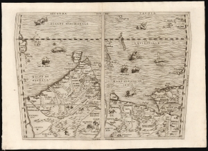
Seconda Tavola.
sold
- Digital Map Information
- Suitable for large format printing
- File Size: 10.98 MB
- File Type: ZIP / TIFF
- ICC color profile embedded
- Delivered instantly via download link
This is a scarce copperplate edition, commonly dated 1563, of the first accurate map of South Asia, including India, Arabia, and the Persian Gulf. It was drawn for Giovanni Battista Ramusio by his friend, the great cartographer Giacomo Gastaldi. The map was first published in Volume I of Ramusio's delle Navigationi et Viaggi in 1554, but this copperplate edition was engraved by Niccolo Nelli to replace the original woodblock after it was lost in a fire. (more details)
On the cusp of greatness.
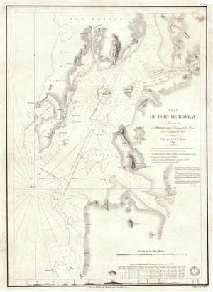
Plan du Port de Bombay.
sold
- Digital Map Information
- Suitable for large format printing
- Full resolution TIFF file
- ICC color profile embedded
- Delivered instantly via download link
This is a rare 1840 / 1843 nautical chart or maritime map of Bombay / Mumbai harbor, India. The map covers from Salsette to Kundaree Island. Detail focuses heavily on the inner harbor, where thousands of depth soundings in meters and trigonometric survey lines are included. This chart, compiled from the survey work of India Navy Lieutenant Robert Cogan represents the first major scientific survey of Bombay Harbor since the late 18th-century work of Captain John Watson. (more details)
No examples catalogued in OCLC or visible on the market
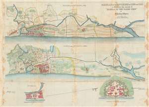
Madras and it Environs in 1733 and 1862 to illustrate the Annals of 'Madras in the Olden Time' by J. Talboys Wheeler.'
sold
- Digital Map Information
- Suitable for large format printing
- File Size: 44.22 MB
- File Type: ZIP / TIFF
- ICC color profile embedded
- Delivered instantly via download link
This is a rare 1862 map of Madras in India, now known as Chennai. It was printed for James Talboys Wheeler for inclusion in his history of the Presidency of Madras. The sheet actually contains two full maps of the city and its surrounds - one dated to 1733, and the other showing the 'present day' city, revealing Madras' growth and the extensive development of the plain surrounding it. (more details)
Includes extensive field-annotations relating to action during the Indian Mutiny of 1857.
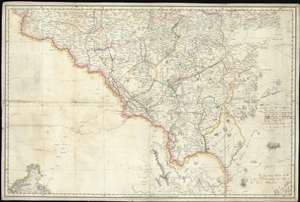
[Chandahpoor}
sold
- Digital Map Information
- Suitable for large format printing
- File Size: 41.08 MB
- File Type: ZIP / TIFF
- ICC color profile embedded
- Delivered instantly via download link
An extraordinary find, this 1856 map of the Chandrapur (Nagpur Division) is a relic of the Atlas of India, one of the East India Company's most ambitious projects, with unique manuscript annotations associated with the 1857 Indian Rebellion / Indian Mutiny. The map covers the Nagpur Division of Maharashtra, from the intersection of division of the Pranhita into the Wardah and Wainganga Rivers, about 30° N latitude, to about 45°N and from about 77.5° East meridian to about 80° East, including part of Maharashtra and the Deccan Plateau. Extensive annotations describe action under Captain W. H. Crichton relating to the suppression of a regional offshoot of the 1856 Indian Mutiny. As such this map represents unique primary source material for one of the most significant events in Indian history. (more details)
Giant blueback working nautical chart of the Indian Ocean with in manuscript navigational notes.
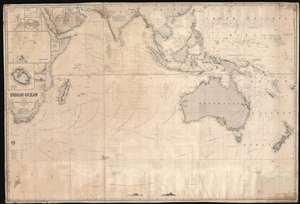
Indian Ocean.
sold
- Digital Map Information
- Suitable for large format printing
- Full resolution TIFF file
- ICC color profile embedded
- Delivered instantly via download link
This is a gigantic 1874 James Imray and Son blueback working nautical chart or maritime map of the Indian Ocean covered in manuscript notations. The map depicts the world from East Africa to Fiji and from Taiwan and the Persian Gulf to 60 degrees south latitude. Manuscript pencil notations trace at least three, possibly four, voyages across the Indian Ocean. These notations mark the vessel's location on its trip across the ocean and notes what is most likely the day of the expedition. Apart from these four voyages, numerous routes between various points throughout the region are also illustrated, with a particular concentration running from the Gulf of Aden to the East Indies, frequented trade routes between England and the Netherlands and these colonies rich in natural resources. Myriad locations are identified throughout, particularly along the coastlines and small islands making up parts of archipelagos situated throughout the Pacific Ocean and the China Sea. Eight inset maps are situated on the map's left side and illustrate Cargados Carajos, Coetivy, Rodrigues, Wood Island, Farquhar Passage, Tromelin, Réunion, and the cities of Saint Paul and Saint Denis on Réunion. (more details)
The birth of the Indian Passenger Railway system! First railroad map of India.
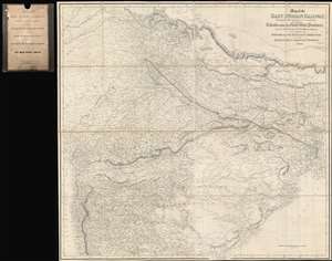
Map of the East Indian Railway, Shewing the Line proposed to be constructed to connect Calcutta with the North West Provinces and the intermediate Civil and Military Stations, to Accompany the Report of th Managing Director of the East Indian Railway Company. 1846.
sold
- Digital Map Information
- Suitable for large format printing
- DPI: 600
- File Size: 113.45 MB
- File Type: ZIP / TIFF
- ICC color profile embedded
- Delivered instantly via download link
In all likelihood, the first railroad map of any part of India. Illustrating a transformative moment in the infrastructure development of India, this is rare and important 1846 John and Charles Walker map northeastern India, defining the course of one of India's first passenger railroads. Published one year after the East India Railroad Company (EIR) was founded, this map was intended to raise funds and political support for their flagship initiative, a passenger and freight railroad connecting the port of Calcutta, then the economic capital of India, with the inland administrative center of Delhi. This is, in short, one of the most significant and influential maps relating to the early planning of the Indian railroad system ever published. (more details)
Manuscript map recording the betrayal and recapture of a French fort in Malabar by an Indian pirate-king.
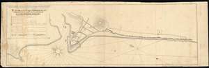
Plan, De, L'Attaque, Des, Retranchemens Et Du Fort De Mahé; Le Iie. Et Le Iiie, Decembre. M.DCC.XXV.
sold
- Digital Map Information
- Suitable for large format printing
- DPI: 600
- File Size: 12.85 MB
- File Type: ZIP / TIFF
- ICC color profile embedded
- Delivered instantly via download link
A remarkable c. 1726 finely executed manuscript map illustrating the 1725 pirate capture, betrayal, and recapture of the French East India Company Fort Mahé, Malabar (Kerala), India. Centered on the main fortification, the map is oriented to the northeast and follows the Malarbar Coast from roughly modern-day Parimadam to modern-day Thayyil Kudumba Kshethram. While the fortifications do not survive, some of the original streets have found their way into the modern city plan. In the upper left a legend detailed important defensive works and positions during the siege. (more details)
Asia's 1st major Railroad.
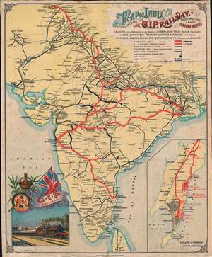
Map of India Shewing the G.I.P. Railway. Chief Connections and Through Routes.
sold
- Digital Map Information
- Suitable for large format printing
- File Size: 23.17 MB
- File Type: ZIP / TIFF
- ICC color profile embedded
- Delivered instantly via download link
A striking and rare discovery - this is a 1911 Waterlow and Company chromolithograph promotional broadside issued to promote the Great Indian Peninsular Railway (GIPR), Asia's first and greatest railroad. Boldly promoting the GIPR's expansive sub-continent wide rail network, this map was designed for display in railroad stations throughout India. The map covers the entire subcontinent, with GIPR trunk lines highlighted in red and subsidiary lines via a keyed network of symbols. In the lower right, a large inset of Bombay promotes GIPR services within the network's nucleus. In the lower-left, a finely executed vignette illustrates a GIPR train leaving Bombay's Victoria Terminus (Chhatrapati Shivaji Maharaj Terminus), with theIconic Mumbai Municipal Corporation Building (MMCB) recognizable in the background. (more details)
Key segment in the India and China Trade.
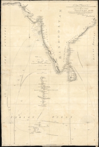
To Capt. P. Heywood R.N. as a testimony of gratitude for his liberal and voluntary assistance in nautical research and as a tribute of regard and esteem this chart intended as an accompaniment to the Book of directions for navigating to, from and in the East Indies.
sold
- Digital Map Information
- Suitable for large format printing
- File Size: 32.66 MB
- File Type: ZIP / TIFF
- ICC color profile embedded
- Delivered instantly via download link
This 1811 chart of the Indian Ocean was engraved by John Walker and produced by James Horsburgh, one of the most accomplished hydrographers of the early 19th century, and is addressed to Peter Heywood, himself an expert hydrographer with the Royal Navy. (more details)
Richly-Detailed Southeast Asia.
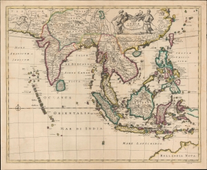
Tabula Indiae Orientalis Emendata a F. de Wit.
sold
- Digital Map Information
- Suitable for large format printing
- File Size: 20.83 MB
- File Type: ZIP / TIFF
- ICC color profile embedded
- Delivered instantly via download link
This is Frederick de Wit's map of India, Southeast Asia, southern China, and the East Indies, including an early mapping of the north coast of Australia. (more details)
'The trouble in Afghanistan...'
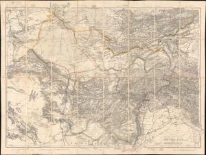
Wyld's Military Staff Map of Central Asia and Afghanistan.
sold
- Digital Map Information
- Suitable for large format printing
- Full resolution TIFF file
- ICC color profile embedded
- Delivered instantly via download link
This is James Wyld II's exceptional 1879 large-scale Military Staff Map of Afghanistan, issued for government and military planning at the height of the Second Anglo-Afghan War (1878 - 1880), part of the Great Game. Like Wyld's other 'military staff maps', this map was not part of his prolific commercial output, but rather made directly from the best government and private sources for the use of military commanders and strategists in the field. (more details)
Spectacular and rare wall map of India
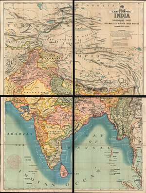
Gill's Cartographic India and Surrounding States with Railways and Border Trade Routes
sold
- Digital Map Information
- Suitable for large format printing
- Full resolution TIFF file
- ICC color profile embedded
- Delivered instantly via download link
A rare and majestically enormous c.1900 four-part map of India by George Gill and Sons. Presented in chromolithographic color and consisting of four linen back folding sections, this massive map covers from Mongolia to Sri Lanka and from Karachi to Bangkok, with the central focus being the Indian Subcontinent. The subcontinent is divided into various British run or influenced agencies and sub-agencies, ranging from British Baluchistan to the Indore Agency. As a schoolroom map, the chart is not excessively dense, has bold color, and large easy to read print. The intense blue coastal shading is apparently something the at Gill was rightfully proud of, as a note int the lower left margin, states 'Copyright coast shading protected. (more details)