
Maryland - Delaware (sold)
Exceptional complete example of the First American Road Atlas!
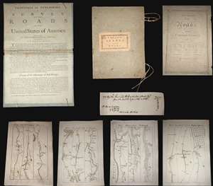
A superb example, entirely complete, of Christopher Colles' 1789 - 1790 A Survey of the Roads of the United States of America. This is the First American Road atlas, wherein at least some of the plates represent the first American maps engraved by a female - Colles' 13-year-old daughter Eliza. Covering depictions from Albany, New York to Williamsburg, Virginia, Colles' atlas consists of a prospectus, a title page, and 83 separate strip maps, each covering some 12 miles of roads and offering invaluable detail about the natural and human landscape of late 18th-century America and was published in commemoration of the founding of the new republic in 1789.
Bringing European Cartographic Ideas to America
The maps appear in a strip-map style previously unknown in North America, but common in European road maps, such as the 1720 Britannia Depicta, or Ogilby Improv'd. Colles' issued the work in separate sheets that could be mixed and matched in a modular format, as needed. This modular format was his own innovation and challenged the user to interpret American roads linearly, as only a traveler can (and must).
The atlas includes 83 separate sheet maps, numbered 1-33, 40-86, and 45*, 46* and 47*. The sheets are laid loose in their original portfolio, with Colles' pastedown title, the original ties and the prospectus pasted to the inside of the front board, as found in most examples. The title page bears the date 1789. It is important to note that it was believed, until recently, that the maps were issued in parts through 1792. However, a hand-written note, laid in by an early-though sadly unnamed-owner, demonstrates that the maps were in fact complete and delivered to subscribers by 1790.
A Federalist Document
In the words of historian Trish Loughran, writing in the The Republic in Print (page 236),
Colles originally intended to survey and map each and every road personally, and many of the maps are indeed based upon his own work. To accomplish this task Colles invented a new kind of perambulator - essentially a modified wagon wheel of a fixed circumference attached to counting cogs that could be used to record distances, a great improvement over the more traditional surveyor's chain. Colles found, however, that completion of the surveys was beyond his limited means, and so, relied upon existing work by military surveyors Simeon DeWitt and Robert Erskine for the maps of Maryland and Virginia. Ultimately, Colles never fully completed his atlas, with only 83 of the originally intended 100 maps published.
Engraved by Americas First Female Map Engraver - Eliza Colles
The maps were drafted by Colles, then engraved by Cornelius Tiebout, and later by his daughter Eliza Colles. It would seem that sometime in the middle of the engraving process, Colles had a falling out with Tiebout and recruited his 13-year-old daughter, Eliza, who may have been Tiebout's apprentice, to complete the engravings. Eliza thus became the first American female engraver. While there is no definitive proof that Eliza engraved for the Survey of Roads, many scholars note that the engraving style of the individual sheets does change, suggesting at least two different engravers were active. In particular the notion is supported by Walter Ristow (page 164) and Benson Lossing, who wrote in his History of New York,
A Financial Failure
Colles sold the maps found in his Survey of Roads by subscription, charging a quarter dollar up front, plus an eighth of a dollar for each delivered section of six sheets. (Nonsubscribers were charged 3 cents per sheet.) Despite a fair price (compare to Abraham Bradley's 1796 map of the United States at 3 1/2 - 5 dollars), accuracy, and fine workmanship, indeed ahead of its time, A Survey of the Roads of the United States of America floundered financially. The intended impact of the work; to promote travel, trade and real-estate transactions, failed to attract sufficient subscribers. As a result, the completed work was offered only in New York and Philadelphia. Deep in debt, Colles began to sell the completed sections of the work separately, with most buyers only acquiring those portions of the maps which they deemed most useful - thus the incompleteness of most known examples. (more details)
Bringing European Cartographic Ideas to America
The maps appear in a strip-map style previously unknown in North America, but common in European road maps, such as the 1720 Britannia Depicta, or Ogilby Improv'd. Colles' issued the work in separate sheets that could be mixed and matched in a modular format, as needed. This modular format was his own innovation and challenged the user to interpret American roads linearly, as only a traveler can (and must).
The atlas includes 83 separate sheet maps, numbered 1-33, 40-86, and 45*, 46* and 47*. The sheets are laid loose in their original portfolio, with Colles' pastedown title, the original ties and the prospectus pasted to the inside of the front board, as found in most examples. The title page bears the date 1789. It is important to note that it was believed, until recently, that the maps were issued in parts through 1792. However, a hand-written note, laid in by an early-though sadly unnamed-owner, demonstrates that the maps were in fact complete and delivered to subscribers by 1790.
A Federalist Document
In the words of historian Trish Loughran, writing in the The Republic in Print (page 236),
Colles placed the year 1789 on the title page in order to make the book's publication coincide with the ratification of the Constitution and the formation of the new government. Indeed, Colles even goes so far as to begin the book's fictional journey on Plate 1 at New York's Federal Hall, which was in 1789, the new national capitol and the recent site of Washington's inauguration. In this way, the book makes the continual literal and symbolic reference to the newly invented nation-state even as it attempts to collect and contain a map to every known space within it in the highly singular space of a book. That it does so in such a way that each represented space can also be experienced locally, by the body hold up any given map on any given road, makes this an exceptional artifact in the production of federalist space.The Work of a Mad Tinkerer
Colles originally intended to survey and map each and every road personally, and many of the maps are indeed based upon his own work. To accomplish this task Colles invented a new kind of perambulator - essentially a modified wagon wheel of a fixed circumference attached to counting cogs that could be used to record distances, a great improvement over the more traditional surveyor's chain. Colles found, however, that completion of the surveys was beyond his limited means, and so, relied upon existing work by military surveyors Simeon DeWitt and Robert Erskine for the maps of Maryland and Virginia. Ultimately, Colles never fully completed his atlas, with only 83 of the originally intended 100 maps published.
Engraved by Americas First Female Map Engraver - Eliza Colles
The maps were drafted by Colles, then engraved by Cornelius Tiebout, and later by his daughter Eliza Colles. It would seem that sometime in the middle of the engraving process, Colles had a falling out with Tiebout and recruited his 13-year-old daughter, Eliza, who may have been Tiebout's apprentice, to complete the engravings. Eliza thus became the first American female engraver. While there is no definitive proof that Eliza engraved for the Survey of Roads, many scholars note that the engraving style of the individual sheets does change, suggesting at least two different engravers were active. In particular the notion is supported by Walter Ristow (page 164) and Benson Lossing, who wrote in his History of New York,
Colles constructed and published a series of sectional road maps which were engraved by his daughter.It should be underlined that Eliza also engraved another of Colles' extremely rare but monumental Geographical Ledger, which appeared in 1794 shortly after the Survey of Roads and bears Eliza's imprint.
A Financial Failure
Colles sold the maps found in his Survey of Roads by subscription, charging a quarter dollar up front, plus an eighth of a dollar for each delivered section of six sheets. (Nonsubscribers were charged 3 cents per sheet.) Despite a fair price (compare to Abraham Bradley's 1796 map of the United States at 3 1/2 - 5 dollars), accuracy, and fine workmanship, indeed ahead of its time, A Survey of the Roads of the United States of America floundered financially. The intended impact of the work; to promote travel, trade and real-estate transactions, failed to attract sufficient subscribers. As a result, the completed work was offered only in New York and Philadelphia. Deep in debt, Colles began to sell the completed sections of the work separately, with most buyers only acquiring those portions of the maps which they deemed most useful - thus the incompleteness of most known examples. (more details)
A most important Civil War map of Washington D.C.
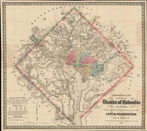
Topographical Map of the Original District of Columbia and Environs: Showing the Fortifications around the City of Washington.
sold
- Digital Map Information
- Suitable for large format printing
- File Size: 51.63 MB
- File Type: ZIP / TIFF
- ICC color profile embedded
- Delivered instantly via download link
Known as 'The Arnold Map', this is the most important Civil War era map of Washington D.C. and vicinity. This map was issued by Edward Greene 'Aloha Vivarttas' Arnold and G. W. Colton in 1862, just after the Second Battle of Bull Run. Centered on the White House, the map illustrates the 'original' ten-mile-square diamond-shaped land allocation set aside for the District of Columbia. As a cartographic piece, Arnold's map exceeded in quality all previous maps of the region, noting roads, canals, turnpikes, railroads, and mills, as well offering a meticulous presentation of topography. Significantly, it illustrates the 51 fortifications, army hospitals, and dozens of small batteries - all critical wartime reconnaissance. (more details)
First official large format plan of Washington D.C.
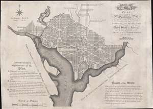
Plan of the City of Washington in the Territory of Columbia, ceded by the States of Virginia and Maryland to the United States of America, and by them established as the Seat of their Government, after the year MDCCC.
sold
- Digital Map Information
- Suitable for large format printing
- Full resolution TIFF file
- ICC color profile embedded
- Delivered instantly via download link
This is Andrew Ellicott's seminal 1792 official large format plan or map of Washington D.C., which would become, 8 years later, the capital of the United States. This is the grandest, most beautiful, and most important official founding plan of Washington D.C. The map illustrates the original urban layout of Washington D.C, then only a small part of the District of Colombia. Centered on the confluence of the Potomac and the Eastern Branch (Anacostia) Rivers, the map covers the Washington D.C. grid as far north as W Street. It also includes the older nearby city of Georgetown. (more details)
Best colonial map of Virginia and Maryland.
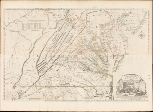
A Map of the most Inhabited part of Virginia containing the whole Province of Maryland with Part of Pensilvania, New Jersey and North Carolina drawn by Joshua Fry and Peter Jefferson in 1775.
sold
- Digital Map Information
- Suitable for large format printing
- Full resolution TIFF file
- ICC color profile embedded
- Delivered instantly via download link
This is the monumental 1775 Fry/Jefferson map of Virginia and Maryland, the most important colonial map of Virginia, in its original four-sheet English version. Drawn by Joshua Fry and Peter Jefferson in 1751 and first printed in 1753, this was the first accurate survey of the interior of Virginia. It was the first printed map to approximate the parallel ridges and valleys of the Appalachian Mountains, and the first to accurately depict the Blue Ridge Mountains. Following the revision of the map in 1755, this was the first map to include Virginia's road system, also marking routes used by frontier traders and Native Americans. Following that revision, it contained the best mapping of the Upper Ohio Valley and the Virginia frontier produced during the French and Indian War (1754 - 1763) and remained the prototype for all subsequent maps of Virginia until the 19th century. As both Fry and Jefferson were denizens of the colony, this further represents the first map of Virginia produced by Virginians. (more details)
First map to name the United States and a contemporaneous illustration of the American Revolutionary War.
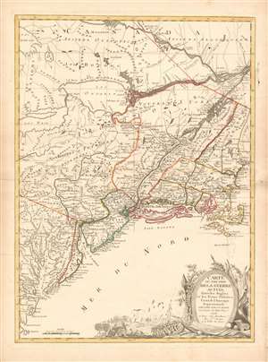
Carte du Théatre de la Guerre actuel entre les Anglais et les Trieze Colonies Unies de l'Amerique Septentrionale dressée par J. B. Eliot Ingénieurs des Etats Unis 1778.
sold
- Digital Map Information
- Suitable for large format printing
- DPI: 600
- File Size: 30.62 MB
- File Type: ZIP / TIFF
- ICC color profile embedded
- Delivered instantly via download link
A 1778 first edition American Revolutionary War era map of the northeastern United States by J. B. Elliot, considered to be of extreme significance. This is generally regarded as the earliest map to use the name 'United States', or in this case, 'Etats Unis'. Drawing on previously unused sources, Eliot's map illustrates the events of the Revolutionary War contemporaneously with the action, making it, essentially a living account of the War of Independence. Margaret Pritchard and Henry Taliaferro, published an essay on this map in Degrees of Latitude, Map 58, describing its significance in great detail, of which this is a short excerpt,
The map of the theater of war between Great Britain and America by J.B. Eliot is important because of its title, Les Treize Colonies Unies de l'Amerique Septentrionale, may include the first reference on a map to the United States. The cartographer was identified as Ingenieurs des Etats Unis. On November 15, 1777, the Continental Congress selected 'The United States of America,' as the name of the thirteen colonies that formed a government under the Articles of Confederation. One month later, French authorities learned of the victory at Saratoga and decided to recognize American independence. By January 8, French foreign minister, Charles Gravier, Comte de Vergennes, informed American envoys that France was ready to engage in an alliance. It is not surprising that the name United States was first mentioned on a map published in Paris in 1778.A decorative cartouche in the lower right incorporates a battle scene wherein British soldiers bombard a small town - possibly Valley Forge? (more details)
… It is also curious that he did not indicate on the map the general's 1777 winter headquarters at Valley Forge, misspelled Walay Forge. What Eliot did illustrate were the lines' march taken by the British and American forces during the campaign in 1777, including Lieutenant Colonel Barry St. Ledger's unsuccessful diversionary expedition down the Mohawk Valley, Burgoyne's march from Crown Point to Albany, and Howe's campaign to take Philadelphia.
… As was usually the case, Eliot appears to have borrowed from several sources in compiling the geography. Some areas were designated by French place-names while others are predominantly English, specifically in the northwestern territories that the French knew best. It is clear they were aware of the latest intelligence relating to the Revolutionary War.
Earliest Acquirable, Separate Issue.
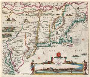
Novi Belgii Novaeque Angliae nec non Partis Virginiae Tabula multis in locis emendata a Nicolao Joannis Visschero.
sold
- Digital Map Information
- Suitable for large format printing
- Full resolution TIFF file
- ICC color profile embedded
- Delivered instantly via download link
This is the rare, c. 1656 second state of the Jansson/ Visscher map of the New Netherlands and New England. It is the earliest acquirable state of this work: the first, 'proof state', of this masterwork is an unobtainable rarity, known in only four examples in institutional and private collections. (more details)
The Earliest Acquirable, Separate Issue.

Novi Belgii Novaeque Angliae nec non Partis Virginiae Tabula multis in locis emendata a Nicolao Joannis Visschero.
sold
- Digital Map Information
- Suitable for large format printing
- Full resolution TIFF file
- ICC color profile embedded
- Delivered instantly via download link
This is the rare, c. 1656 second state of the Jansson/ Visscher map of the New Netherlands and New England. It is the earliest acquirable state of this work: the first, 'proof state', of this masterwork is an unobtainable rarity, known in only four examples in institutional and private collections. (more details)
Mars, the God of War, look on as Fame proclaims the of the Birth of the United States.
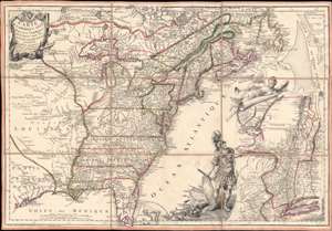
Carte de l'Amerique Septle. pour Servir a l'Intelligence de la Guerre Entre les Anglois et les Insurgents.
sold
- Digital Map Information
- Suitable for large format printing
- Full resolution TIFF file
- ICC color profile embedded
- Delivered instantly via download link
This is a rare 1777 Jean-Baptiste Jacques de Beaurain map of the United States during the American Revolutionary War, issued in anticipation of French entry into the war on the side of the revolutionaries. The map includes a bold illustration of the goddess Ossa (fame) unrolling an expansive map of the Theater of War in the Hudson corridor, proclaiming the newly formed United States. Mars, the god of War, looks on, shield and torch in hand, his arsenal ready - much like France itself. This map is thus an instrument of propaganda intended to prepare the public for French participation in the American Revolution - an event which followed in early 1778. (more details)
Iconic early map of New England and New York with 'Visscher View' of New Amsterdam.
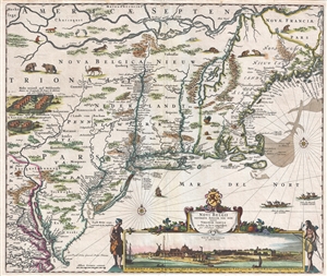
Novi Belgii Novaeque Angliae Nec Non Pennsylvaniae et Partis Virginiae Tabula multis in locis emendata.
sold
- Digital Map Information
- Suitable for large format printing
- DPI: 300
- File Size: 15.13 MB
- File Type: ZIP / TIFF
- ICC color profile embedded
- Delivered instantly via download link
A map of extreme importance, this is a fine example of Nicholaas Visscher's 1684 Novi Belgii or map of New York, New England, Pennsylvania, and Virginia. This is the first map in the Jansson-Visscher Series here presented in its 4th state (Burden, 315). Like most ... (more details)
Iconic early map of New England and New York with 'Visscher View' of New Amsterdam.
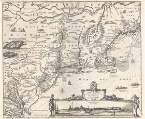
Novi Belgii Novaeque Angliae Nec Non Pennsylvaniae et Partis Virginiae Tabula multis in locis emendata.
sold
- Digital Map Information
- Suitable for large format printing
- DPI: 300
- File Size: 14.86 MB
- File Type: ZIP / TIFF
- ICC color profile embedded
- Delivered instantly via download link
A map of extreme importance, this is a fine example of Nicholaas Visscher's 1684 Novi Belgii or map of New York, New England, Pennsylvania, and Virginia. This is the first map in the Jansson-Visscher Series here presented in its 4th state (Burden, 315). Like most ... (more details)
First Map of Maryland - Promoting colonization.
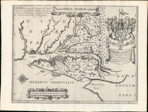
Nova Terrae-Mariae Tabula.
sold
- Digital Map Information
- Suitable for large format printing
- Full resolution TIFF file
- ICC color profile embedded
- Delivered instantly via download link
This is the 1671 John Ogilby second edition of the 1635 Lord Baltimore map of the Chesapeake Bay - considered the first map of Maryland. Although based on the 1635 map, this Ogilby edition is no slavish copy and includes unique and significant cartography not found elsewhere. It was issued to promote British colonization of Maryland and includes a wealth of unique, relevant detail, including new town sites, ten new county designations, and more defined borders. By all reports, it was successful, with nearly 25,000 English settlers moving to Maryland by 1681. (more details)
The only significant map of the Chesapeake Bay to be issued between the early 19th century Admiralty Charts and the Coast Survey Charts of the 1860s.
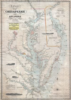
A Chart of the Chesapeake and Delaware Bays.
sold
- Digital Map Information
- Suitable for large format printing
- DPI: 300
- File Size: 40.07 MB
- File Type: ZIP / TIFF
- ICC color profile embedded
- Delivered instantly via download link
A scarce, important, and highly desirable 1852 nautical chart or maritime map of the Chesapeake and Delaware Bays by Fielding Lucas Jr. This chart covers the entirety of the Chesapeake Bay from Wrightsville (on the Susquehanna River) and Philadelphia (on the ... (more details)
A scarce map of exceptional importance illustrating early Swedish settlements in New Jersey, Pennsylvania, and Delaware.
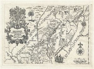
Delineatio Pennsilvaniae et Caesareae, nov. occident seu West N. Iersey in America
sold
- Digital Map Information
- Suitable for large format printing
- DPI: 300
- File Size: 3.74 MB
- File Type: ZIP / TIFF
- ICC color profile embedded
- Delivered instantly via download link
This is an extremely rare whimsical 1731 map focusing on the remnants of the ephemeral colony of New Sweden by Jonas Silferling and Tobias Biorck. New Sweden, which by 1731 had been assimilated into British New York, occupied parts of Delaware, New Jersey and ... (more details)
One of the Finest Northeast Charts of the Dutch Period.
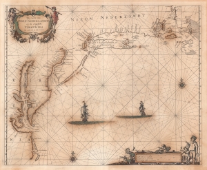
Pas Caerte van Nieu Nederlandt en de Engelsche Virginies van Capo Cod to Cabo Canrick.
sold
- Digital Map Information
- Suitable for large format printing
- Full resolution TIFF file
- ICC color profile embedded
- Delivered instantly via download link
A striking original color 1666 Pieter Goos nautical chart or maritime map of New England, New York, New Jersey, and Virginia. Coverage follows the coast of North America from Boston Harbor to Cape Hatteras, thus embracing one of the more active mid-17th century maritime corridors in North America. At the center of the map, two Dutch ships ply the seas. Finely engraved decorative cartouche work in the upper left and lower right emphasizes the region's rich fur trade and abundant fisheries. (more details)
The rare propaganda-ish 'Farm Animal' variant on the Visscher-Jansson Series map of New York, Virginia, and New England.
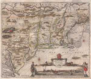
Novi Belgii Novaeque Angliae Nec Non Pennsylvaniae et Partis Virginiae Tabula multis in locis emendata.
sold
- Digital Map Information
- Suitable for large format printing
- Full resolution TIFF file
- ICC color profile embedded
- Delivered instantly via download link
An attractive old color example of Justus Danckerts' 1684 Novi Belgii or map of New York, New England, Pennsylvania, and Virginia. Some call this the 'farm animal map' for its novel incorporation of farm animals, ranging from horses and cows to chicken and ... (more details)
Most Finely Detailed Dutch Map of the Northeast from the 17th Century.
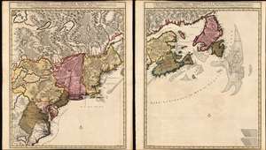
Nova Tabula Geographica Complectens Borealiorem Americae Partem: in qua Exacte Delineatae Sunt Canada sive Nova Francia, Nova Scotia, Nova Anglia, Novum Belgium, Pensylvania, Virginia, Carolina et Terra Nova, cum Omnibus Littorum. Pulvinorumque Profunditatibus. Amstelodami. à Nicolao Visscher. Cum Privilegio Ordinum Generalium Foederati Belgii./ Carte Nouvelle contenant la Partie d'Amerique la Plus Septentrionale, ou Sont Exactement Dècrites les Provinces Suivantes comme le Canada ou Nouvelle France, La Nouvelle Ecosse, la Nouvelle Angleterre, les Nouveaux Païs Bas, la Pensylvanie, la Virginie, la Caroline et l'Ile de Terre Neuve avec les profondeuis le Long des Côtes et sur les Bancs. Par Nicolas Visscher avec Privilege des Etats Géneraux.
sold
- Digital Map Information
- Suitable for large format printing
- DPI: 600
- File Size: 121.39 MB
- File Type: ZIP / TIFF
- ICC color profile embedded
- Delivered instantly via download link
This is Nicolas Visscher II's 1696 two-sheet map of the North American eastern seaboard and the Canadian Maritimes, in a beautiful example of its earliest acquirable state with rich original color. It represents the 17th century's most finely-detailed mapping of the coast from the Carolinas to Labrador. Also, it is the first Dutch map of the region to diverge from the 'Jansson-Visscher' precursor maps. (more details)
First edition of John Speed's transitional and influential map of Virginia, Maryland, and the Chesapeake Bay.
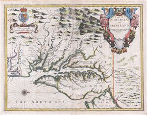
A Map of Virginia and Maryland.
sold
- Digital Map Information
- Suitable for large format printing
- DPI: 300
- File Size: 13.73 MB
- File Type: ZIP / TIFF
- ICC color profile embedded
- Delivered instantly via download link
A fine full color example of Francis Lamb's 1676 map of Virginia, Maryland, and the Chesapeake Bay. Oriented to the west, Lamb's map covers from Albemarle Sound to the Susquehanna River and from the Appalachian Mountains to the Delaware Bay and New ... (more details)
The rare propaganda-ish 'Farm Animal' variant on the Visscher-Jansson Series map of New York, Virginia, and New England.
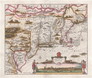
Novi Belgii Novaeque Angliae Nec Non Pennsylvaniae et Partis Virginiae Tabula multis in locis emendata.
sold
- Digital Map Information
- Suitable for large format printing
- DPI: 300
- File Size: 10.83 MB
- File Type: ZIP / TIFF
- ICC color profile embedded
- Delivered instantly via download link
A magnificent example of Justus Danckerts' 1690 Novi Belgii or map of New York, New England, Pennsylvania, and Virginia. Some call this the 'farm animal map' for its novel incorporation of farm animals, ranging from horses and cows to chicken and ... (more details)
Extraordinary and rare blueback nautical chart of the East Coast.
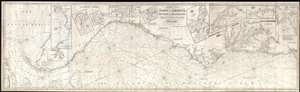
Chart of the Coast of America, from New York and Philadelphia, to the Strait or Gulf of Florida, and from thence to the Mississippi.
sold
- Digital Map Information
- Suitable for large format printing
- Full resolution TIFF file
- ICC color profile embedded
- Delivered instantly via download link
An utterly spectacular and sprawling 1850 John Williams Norie blueback nautical chart or maritime map depicting the North American coastline from New York to the Florida Keys. The map is oriented to the west, as a navigator from Europe would ... (more details)
The First European Edition of the Seminal Ellicott Plan.
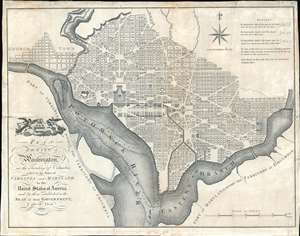
Plan of the City of Washington in the Territory of Columbia ceded by the States of Virginia and Maryland tothe United States of America and by them established as the Seat of their Government after the Year 1800.
sold
- Digital Map Information
- Suitable for large format printing
- DPI: 600
- File Size: 22.36 MB
- File Type: ZIP / TIFF
- ICC color profile embedded
- Delivered instantly via download link
This is the 1795 Russell edition of Andrew Ellicott's seminal plan or map of Washington D.C., published prior to its becoming in 1800 the capital of the United States. The map illustrates the original urban layout of Washington D.C, then only a small part of the District of Columbia. Centered on the confluence of the Potomac and the Eastern Branch (Anacostia) Rivers, the map covers the Washington D.C. grid as far north as W Street. It also includes the older nearby city of Georgetown. (more details)
One of the most important maps of America ever produced and certainly one of the greatest influence…' - P. Burden (Mapping of America)
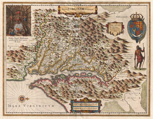
Nova Virginiae Tabula.
sold
- Digital Map Information
- Suitable for large format printing
- DPI: 300
- File Size: 13.15 MB
- File Type: ZIP / TIFF
- ICC color profile embedded
- Delivered instantly via download link
A very fine example of Henricus Hondius' 1630 map of the Virginia colony and the Chesapeake Bay. Oriented to the west, this map covers from Cape Henry to the Susquehanna River and inland as far as the Appalachian Mountains. The Chesapeake ... (more details)
The first state of Vaugondy's important map of Virginia showing the lands of Lord Fairfax.
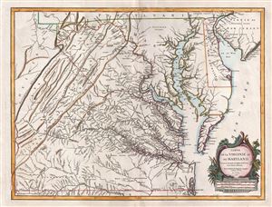
Carte de la Virginie et du Maryland.
sold
- Digital Map Information
- Suitable for large format printing
- DPI: 300
- File Size: 17.31 MB
- File Type: ZIP / TIFF
- ICC color profile embedded
- Delivered instantly via download link
A fine first edition example of Robert de Vaugondy's 1755 map of the Virginian, Delaware, and Maryland, including the Chesapeake Bay. The map extends from the Allegany Mountains eastward to the Chesapeake Bay, Delaware Bay, and Atlantic ... (more details)
Among the earliest Dutch attempts to map the Great Lakes and an important early representation New England and New Amsterdam (New York).
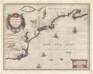
Nova Anglia Novum Belgium et Virginia.
sold
- Digital Map Information
- Suitable for large format printing
- Full resolution TIFF file
- ICC color profile embedded
- Delivered instantly via download link
A fine first edition first state old color example of Jan Jansson's 1636 map of the northeast American coastline from Cape Lookout (here identified as C. of Feare) to Nova Scotia. The map includes parts of modern day North Carolina, ... (more details)
One of Lotter's most iconic maps.
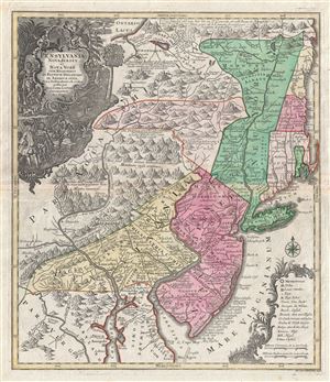
Pensylvania Nova Jersey et Nova York cum Regionibus Ad Fluvium Delaware In America Sitis, Nova Delinatione ob oculos posita . . .
sold
- Digital Map Information
- Suitable for large format printing
- DPI: 300
- File Size: 24.1 MB
- File Type: ZIP / TIFF
- ICC color profile embedded
- Delivered instantly via download link
A fine c. 1756 example of one of Tobias Conrad Lotter's most iconic maps. This is Lotter's important map of the Middle Atlantic and New England regions during the British colonial period. One of the most desirable, interesting and ... (more details)
The first state of Vaugondy's important map of Virginia showing the lands of Lord Fairfax.
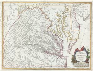
Carte de la Virginie et du Maryland.
sold
- Digital Map Information
- Suitable for large format printing
- Full resolution TIFF file
- ICC color profile embedded
- Delivered instantly via download link
This is a fine example of Robert de Vaugondy's 1755 map of the Virginian, Delaware, and Maryland, including the Chesapeake Bay. The map extends from the Allegany Mountains eastward to the Chesapeake Bay, Delaware Bay, and Atlantic ... (more details)
The 55th New York Infantry Regiment defending Washington, D.C.
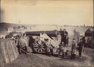
This is an 1861 Matthew Brady Civil War albumen photograph of the 55th New York Infantry manning the artillery at Fort Gaines in Washington, D.C. Based on the 55th New York Infantry Regiment's service record, this photo must have been taken in September or October 1861 when the regiment was on duty at Fort Gaines. Brady's photo-documentation of the Civil War is significant and played a role much like television journalism did during the Vietnam War - it brought the horrors and violence of the war to the home front, informing public opinion. (more details)
Among the earliest Dutch attempts to map the Great Lakes and an important early representation New England and New Amsterdam (New York).
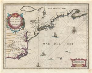
Nova Anglia Novum Belgium et Virginia.
sold
- Digital Map Information
- Suitable for large format printing
- DPI: 300
- File Size: 16.02 MB
- File Type: ZIP / TIFF
- ICC color profile embedded
- Delivered instantly via download link
A fine first edition first state old color example of Jan Jansson's 1636 map of the northeast American coastline from Cape Lookout (here identified as C. of Feare) to Nova Scotia. The map includes parts of modern day North ... (more details)
One of the first charts to name Philadelphia.
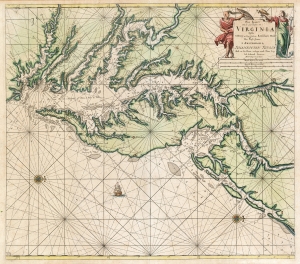
Pas kaart van de zee kusten van Virginia : tusschen C. Henry en t hooge land van Renselaars Hoek...
sold
- Digital Map Information
- Suitable for large format printing
- DPI: 600
- File Size: 27.92 MB
- File Type: ZIP / TIFF
- ICC color profile embedded
- Delivered instantly via download link
This is Van Keulen's 1695 nautical chart or maritime map of Chesapeake Bay, Delaware Bay, and the adjacent coastlines. It is one of the first charts to utilize the 1673 Hermann map as a source, making it one of the most up-to-date charts of the region - and a vast improvement on the 1675 Roggeveen, specifically because Van Keulen's chartmaker, Vooght, relied on the English Hermann map rather than Hessel Gerritz's c. 1630 chart. (more details)
Propaganda for Spotswood's settlement of Germans in Virginia: First State.
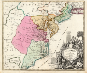
Virginia Marylandia et Carolina in America Septentrionali Britannorum industria excultae…
sold
- Digital Map Information
- Suitable for large format printing
- Full resolution TIFF file
- ICC color profile embedded
- Delivered instantly via download link
A striking example of Johann Baptist Homann's c. 1715 map of Virginia, Carolina, Maryland, and New Jersey, considered one of the most important maps of this region to appear in the 18th century, here in its first state. Homann drew this map to advocate for Virginia Lieutenant-Governor Alexander Spotswood's 1714 - 1717 plan to settle the little-known interior of Virginia with German immigrants. Shown here is the first mapping of 'Germantown Teutsche Statt' (Germanna) on the Rapidan River, a fork of the Rappahannock River, Fort Christanna (Christ Anna Fort) on the Makharing River, and 'Miester Krugs Plantasie' on the James River. The omission of Spotswood's connection to this map has long led it to be misunderstood and dismissed by scholars. (more details)
First large-scale commercial map of the Confederacy.
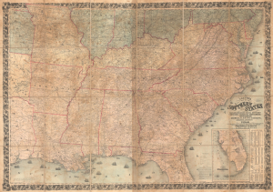
Colton's Map of the Southern States, including Maryland, Delaware, Virginia, Kentucky, Tennessee, Missouri, North Carolina, South Carolina, Georgia, Alabama, Mississippi, Arkansas, Louisiana, and Texas. Showing Also Part of Adjoining States and Territories Locating the Forts and Military Stations of the U. States and Showing all the Rail Roads, R.R. Stations, and other Internal Improvements.
sold
- Digital Map Information
- Suitable for large format printing
- File Size: 198.45 MB
- File Type: ZIP / TIFF
- ICC color profile embedded
- Delivered instantly via download link
This is an 1861 J. H. Colton map of the Confederacy published in the first year of the American Civil War (1861 - 1865). This is the first large-scale commercial map of the Confederacy, published early in 1861, in the immediate wake of the Secession. (more details)
Among the earliest Dutch attempts to map the Great Lakes and an important early representation New England and New Amsterdam (New York).
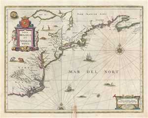
Nova Belgica et Anglia Nova.
sold
- Digital Map Information
- Suitable for large format printing
- DPI: 300
- File Size: 13.03 MB
- File Type: ZIP / TIFF
- ICC color profile embedded
- Delivered instantly via download link
A fine second state old color example of Jan Jansson's 1647 map of the northeast American coastline from Cape Lookout (here identified as C. of Feare) to Nova Scotia. The map includes parts of modern day North Carolina, ... (more details)
Charting North America's Atlantic Coast.
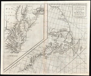
A Chart of the Atlantick Ocean from Buttons Island to Port Royall.
sold
- Digital Map Information
- Suitable for large format printing
- DPI: 600
- File Size: 54.71 MB
- File Type: ZIP / TIFF
- ICC color profile embedded
- Delivered instantly via download link
This is a scarce, elegant 1728 Senex chart of the east coast of North America, from Port Royal in South Carolina to Button Island in Arctic Canada. It includes an inset chart richly detailing Chesapeake and Delaware Bays, and New York Harbor. (more details)