
Maryland - Delaware
First Clash of Ironclads - by America's first female professional artist.
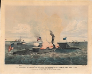
Terrific Engagement Between the 'Monitor' 2 guns, and 'Merrimac' 10 guns, in Hampton Roads, March 9th 1862. The First Fight between Iron Ships of War. In which the Merrimac was ripped, and the whole Rebel Fleet driven back to Norfolk.
$8,500.00
Acquire
- Digital Map Information
- Suitable for large format printing
- Full resolution TIFF file
- ICC color profile embedded
- Delivered instantly via download link
A striking 1862 Currier and Ives original lithograph view of the historic American Civil War battle of the Monitor and Merrimac. Considered the first clash of Ironclads, this was one of the most important naval engagements in the American Civil War (1861 - 1865), transforming future naval warfare. This is one of the first images of the historic battle that would have been available to the general public. Moreover, it is the work of Frances 'Fanny' Palmer, the first American woman to work as a professional artist. (more details)
Piracy of a seminal map detailing Trans-Appalachia.
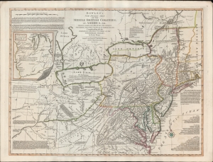
Bowles's New Pocket Map of the Middle British Colonies, in America, Vis. Virginia, Maryland, Delaware, Pensylvaia, New Jersey, New York, Connecticut and RHode Island. Comprending also the Habitations and Hunting Countries of the Confederate Indians: by Lewis Evans.
$6,500.00
Acquire
- Digital Map Information
- Suitable for large format printing
- DPI: 600
- File Size: 659.83 MB
- File Type: ZIP / TIFF
- ICC color profile embedded
- Delivered instantly via download link
A fine example of the 1780 Carington Bowles edition of the Lewis Evans map of the Middle British Colonies - one of the most important maps to emerge out of the French and Indian War (1754 - 1763). Essentially a piracy of a piracy, this is the Carington Bowles 1780 piracy of the 1771 Kitchen/Jefferys piracy of the 1755 Lewis Evans map - here given new relevance in the context of the American Revolutionary War (1775 - 1783). There are numerous subtle changes over earlier editions although the essential Lewis Evans chart - the finest and most comprehensive treatment of the Trans-Appalachia and the Ohio Valley from the French and Indian War through the Revolutionary period - remains the core. Pre-release editions of this map were circulated among British officers, including Major-General Edward Braddock (1695 - 1755), who consulted them during his disastrous 1755 expedition against the French-occupied Ohio River Valley (he was killed in the effort - but not for lack of cartographic reconnaissance). (more details)
Among the Earliest Obtainable Maps of the Chesapeake.
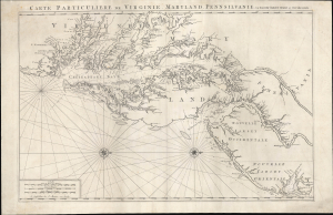
Carte Particuliere de Virginie, Maryland, Pennsilvanie, La Nouvelle Jarsey. Orient et Occidentale.
$4,500.00
Acquire
- Digital Map Information
- Suitable for large format printing
- Full resolution TIFF file
- ICC color profile embedded
- Delivered instantly via download link
This is Pierre Mortier and Alexis-Hubert Jaillot's c. 1700 large-format nautical chart of the Mid-Atlantic coast, including Chesapeake Bay and the Delaware River Estuary. One of the most important early modern maps of this region, it is significant for its early inclusion of Philadelphia and prodigious hydrographic information. (more details)
Important State of the dominant chart of Colonial Virginia.
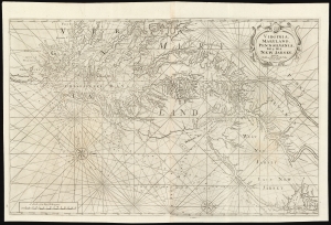
Virginia, Maryland, Pennsilvania, East and West New Jarsey...
$4,000.00
Acquire
- Digital Map Information
- Suitable for large format printing
- DPI: 600
- File Size: 89.65 MB
- File Type: ZIP / TIFF
- ICC color profile embedded
- Delivered instantly via download link
This is a superb example of William Mount and Thomas Page's large nautical map of the Chesapeake Bay and Delaware Bay in the 1742 first state. It represents the dominant English depiction of the water approaches to Virginia, Maryland, Delaware, and New Jersey for most of the Colonial Period. (more details)
Outbreak of the Civil War.
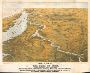
Birds Eye View of The Seat of War. Arranged after the latest Surveys, showing views of Washington, Baltimore, Harpers Ferry, Richmond, Manassas Junction, Ft. Monroe, Norfolk Harbor and c. Their Connections, and The General Surface of the Country in Maryland, Dist. of Columbia, and Virginia.
$3,400.00
Acquire
- Digital Map Information
- Suitable for large format printing
- File Size: 25.3 MB
- File Type: ZIP / TIFF
- ICC color profile embedded
- Delivered instantly via download link
This is a rare 1861 bird's-eye view of the vicinity of Washington, D.C., including Richmond, the mouth of the Chesapeake Bay, and the Potomac River in the early days of the American Civil War (1861 - 1865). The work was compiled by Boston's most talented lithographer, Louis Prang. It is novel in that it is anticipatory, a tool for Prang's audience to understand a conflict that was universally expected, but which had not yet developed. (more details)
Elegant Edition of the Pinnacle of the Colonial Mapping of Virginia.
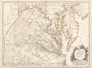
Carte de la Virginie et du Maryland Dressée sur la grande carte Angloise de Mrs. Josué Fry et Pierre Jefferson, Par le Sr. Robert de Vaugondy Géographe.
$2,200.00
Acquire
- Digital Map Information
- Suitable for large format printing
- Full resolution TIFF file
- ICC color profile embedded
- Delivered instantly via download link
This is Robert de Vaugondy's 1755 map of Virginia and Maryland, here in an attractive example of the 1793 5th state. (more details)
Rochambeau's March to Yorktown.
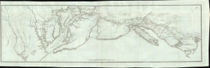
[Revolutionary War Map Showing Rochambeau's March from Boston to the Chesapeake.]
$2,200.00
Acquire
- Digital Map Information
- Suitable for large format printing
- File Size: 18.32 MB
- File Type: ZIP / TIFF
- ICC color profile embedded
- Delivered instantly via download link
This is the first edition of François Soulés map of the American coast during the Revolutionary War, illustrating Rochambeau's epic march from Boston to the Chesapeake Bay and Yorktown - a key achievement that contributed to the decisive American victory at Yorktown. (more details)
The largest Union prisoner-of-war camp during the Civil War.
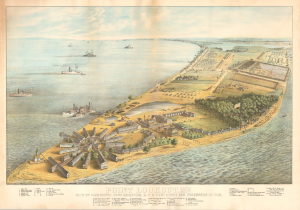
Point Lookout, Md. View of Hammond General Hospital and U.S. Genl. Depot for Prisoners of War.
$2,000.00
Acquire
- Digital Map Information
- Suitable for large format printing
- Full resolution TIFF file
- ICC color profile embedded
- Delivered instantly via download link
This is an 1864 George Everett chromolithograph bird's-eye view of Point Lookout, Maryland, at the height of the American Civil War (1861 - 1865). Point Lookout was home to the Hammond General Hospital (illustrated here in the foreground) and a notorious prisoner-of-war camp. It is one of the few large-format views issued during the war, likely in response to public interest. (more details)
Railroads in the Eastern Theater of the American Civil War.
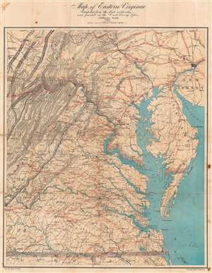
Map of Eastern Virginia.
$2,000.00
Acquire
- Digital Map Information
- Suitable for large format printing
- Full resolution TIFF file
- ICC color profile embedded
- Delivered instantly via download link
This is an 1862 Walter L. Nicholson map of eastern Virginia and Maryland, published during the second year of the American Civil War (1861 - 1865). The map embraces the Eastern Theater of war, from Pennsylvania south to the North Carolina - Virginia border. Washington, D.C. stands out on the Potomac River, while red concentric circles in ten mile increments focus upon Richmond. No battlefields are explicitly marked, but landmarks for which battles were named both before and after this map was published, including Fredericksburg, Chancellorsville, Spotsylvania Court House, and Gettysburg, appear. Red overprinting illustrates the railroad network, which proved critical to both the Union and Confederate war effort. Both sides used the railroads to move men and supplies to and from battlefields. Railroads and railroad hubs thus became strategic targets for raids and advancing armies. (more details)
Seat of the Civil War around Washington D.C. and the Chesapeake Bay.
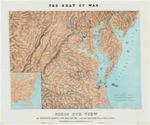
The Sea of War. Birds Eye View of Virginia, Maryland, Delaware and the District of Columbia.
$2,000.00
Acquire
- Digital Map Information
- Suitable for large format printing
- File Size: 56.72 MB
- File Type: ZIP / TIFF
- ICC color profile embedded
- Delivered instantly via download link
A striking 1861 three-color Schedler/Schaus chromolithograph view/map of the Chesapeake Bay region, including Maryland, Virginia, Delaware, and Washington D.C., shortly after the outbreak of the American Civil War (1861 - 1865). (more details)
Best 18th century map of the Ohio River Valley.
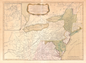
A New and General Map of the Middle Dominions Belonging to the United States of America, viz. Virginia, Maryland, the Delaware-Counties, Pennsylvania, New Jersey etc…
$1,850.00
Acquire
- Digital Map Information
- Suitable for large format printing
- DPI: 600
- File Size: 27.56 MB
- File Type: ZIP / TIFF
- ICC color profile embedded
- Delivered instantly via download link
This is the Laurie and Whittle 1794 updated edition of Lewis Evans' foundational 1755 map of the middle part of the British Colonies in North America. Evans' map was the earliest to accurately detail the American frontier at the time of its original publication. It exhibits superb detail in the northern Appalachian Mountains and the Ohio River Valley, providing information about Native American tribes and transport, French and English forts, and other details pertinent to the frontiersman, including sources of salt, roads, and trails. It was hailed by Schwartz and Ehrenberg as 'the most ambitious performance of its kind undertaken in America up to that time.' So widely was the excellence of Evans' map recognized that he was unable to make any money on it at all, as it was promptly pirated by Jefferys, Sayer, Kitchen, Bowles, Crevecoeur, and, as here, Laurie and Whittle. This 1794 edition, at least, updates the map to indicate the outcome of the American Revolution - it names the United States and includes the boundary line between the United States and Canada as determined by the 1783 Treaty of Paris. This is also the first edition of the Evans map to include the new state of Kentucky - although erroneously positioned north of the Ohio River. (more details)
First edition of Eldridge's Chesapeake Bay, the largest 19th century commercial chart of the Chesapeake.
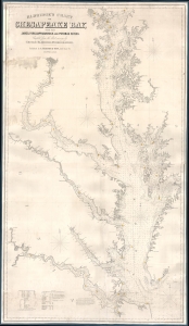
Eldridge's Chart of Chesapeake Bay, with the James, York, Rappahannock and Potomac Rivers.
$1,800.00
Acquire
- Digital Map Information
- Suitable for large format printing
- Full resolution TIFF file
- ICC color profile embedded
- Delivered instantly via download link
A rare first edition 1868 Eldridge / Thaxter nautical chart or maritime map of the Chesapeake Bay. This expansive chart covers the Chesapeake from its mouth at Cape Henry to Baltimore. It extends westward to include the James, York, Rappahannock, and Potomac River estuaries. In a brilliant aesthetic flourish, Washington D.C. appears centered directly below the title area, with the President's House, the Capitol, and the Smithsonian Institution labeled. Includes original hand color highlighting of lighthouses. (more details)
Unrecorded Pictorial Map of the U.S. Naval Academy and Annapolis.
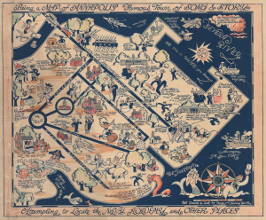
Being a Map of Annapolis Famous Town of Song and Story Attempting to Locate the Naval Academy and Other Places.
$1,500.00
Acquire
- Digital Map Information
- Suitable for large format printing
- Full resolution TIFF file
- ICC color profile embedded
- Delivered instantly via download link
This is a rare c. 1932 hand-colored Peggy and Richard Q. Yardley pictorial map of Annapolis, Maryland, with a focus on the U.S. Naval Academy. It celebrates the history and character of both the institution and the city in humorous fashion. (more details)
Eastern Theater of the American Civil War.
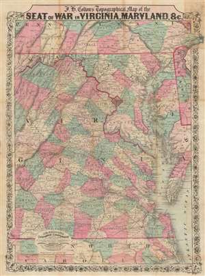
J.H. Colton's Topographical Map of the Seat of War in Virginia, Maryland, etc.
$1,200.00
Acquire
- Digital Map Information
- Suitable for large format printing
- Full resolution TIFF file
- ICC color profile embedded
- Delivered instantly via download link
This is a rare 1862 J. H. Colton map of Virginia, Maryland, and the Chesapeake Bay during the American Civil War (1861 - 1865). This map was issued for readers to follow Civil War events as they unfolded. In 1862, most of the Civil War had yet to come, but there was no doubt that most of the decisive battles would take place in the Mid-Atlantic theater, where the warring capitals stood just over 100 miles apart. (more details)
Delmarva Peninsula (Chesapeake Bay).
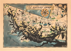
A Map of the Eastern Shore … Rich in History, Romance and (yum) Seafood.
$975.00
Acquire
- Digital Map Information
- Suitable for large format printing
- File Size: 52.49 MB
- File Type: ZIP / TIFF
- ICC color profile embedded
- Delivered instantly via download link
This is Richard Q. Yardley's charming map of the eastern shore of the Chesapeake Bay. It is an iconic representation of a region steeped in local and historical character. (more details)
1817 Thomson Map of the Southeastern United States: Georgia, Carolina, Virginia, Tennessee, Kentucky
A young nation looking west.
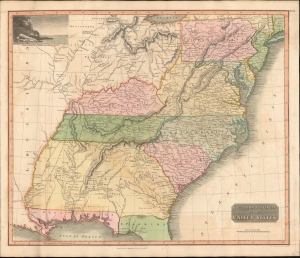
Southern Provinces of the United States.
$950.00
Acquire
- Digital Map Information
- Suitable for large format printing
- DPI: 600
- File Size: 633.59 MB
- File Type: ZIP / TIFF
- ICC color profile embedded
- Delivered instantly via download link
A scarce first edition of John Thomson's 1817 map of the southeastern part of the United States. Thomson prepared this map during a transitional period of expansion shortly following the American Revolutionary War and is among most thorough treatments of this region prior to the U.S. Government Surveys. It records early U.S. efforts to acquire and assimilate American Indian territories west of the Appalachian Mountains. (more details)
Edwin Tunis' first and finest pictorial map!
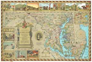
An Historical and Literary map of the Old Line State of Maryland Showing forth divers curious and notable facts relating to scenes, incidents and persons worthy to be recalled on the state's three hundredth anniversary.
$850.00
Acquire
- Digital Map Information
- Suitable for large format printing
- File Size: 58.9 MB
- File Type: ZIP / TIFF
- ICC color profile embedded
- Delivered instantly via download link
Issued during the Golden Age of American Pictorial Maps (c. 1920 - 1960), this wonderful 1931 first edition historical and pictorial map of Maryland was the first map issued by Edwin Burdette Tunis. The map covers all Maryland, including the Chesapeake Bay in full, as well as adjacent parts of Delaware and Virginia. Published in conjunction with the Enoch Pratt Free Library, this type of pictorial map is a natural extension of Tunis' meticulous attention to historical detail. Copious annotations throughout describe historical personages, locations, battles, and buildings, as well as expounding upon the general historical progression of the region. Vignettes above and to the left of the map proper illustrate the Battle of Long Island, the opening of the Chesapeake and Ohio Canal, the construction of Fort Frederick, the purchase of St. Mary's by Leonard Calvert from indigenous American Indian tribes, and more. An inset in the upper left details Annapolis and the U.S. Naval Academy. (more details)
One of the founding institutions of modern American medicine.
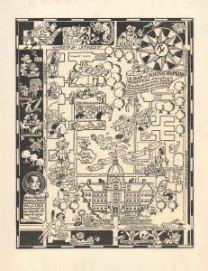
A Map of Johns Hopkins Hospital attempting to show the general plan, HABITS of the STAFF, STUDENTS, and PATIENTS, curious CUSTOMS etc. and so forth.
$750.00
Acquire
- Digital Map Information
- Suitable for large format printing
- Full resolution TIFF file
- ICC color profile embedded
- Delivered instantly via download link
This is a c. 1935 Richard Q. Yardley pictorial map of Johns Hopkins Hospital in Baltimore, Maryland. The hospital and its associated medical school were the progenitors of the modern American medical education system, and the hospital has long been considered among the best in the world. (more details)
Early Schoolgirl / Schoolboy Map of Delaware.
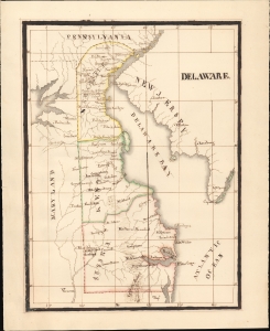
Delaware.
$750.00
Acquire
- Digital Map Information
- Suitable for large format printing
- Full resolution TIFF file
- ICC color profile embedded
- Delivered instantly via download link
An elegant example of a 19th century schoolgirl/boy map, this manuscript work presents the state of Delaware as of 1831. It is based on Anthony Finley's map of the state and includes the initials and surname of the maker, A. S. Wetherall, on the verso. (more details)
One of the founding institutions of modern American medicine.
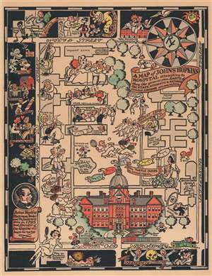
A Map of Johns Hopkins Hospital attempting to show the general plan, HABITS of the STAFF, STUDENTS, and PATIENTS, curious CUSTOMS etc. and so forth.
$750.00
Acquire
- Digital Map Information
- Suitable for large format printing
- File Size: 8.66 MB
- File Type: ZIP / TIFF
- ICC color profile embedded
- Delivered instantly via download link
This is a 1935 Richard Q. Yardley pictorial map of Johns Hopkins Hospital in Baltimore, Maryland. A fantastic illustration of the original Administration Building occupies the lower portion of the map and immediately draws the eye. From there, the hospital's various wards, clinics, and buildings are illustrated. Many of the illustrations are comical in nature. A researcher standing atop a large microscope is mocked by a germ in the General Pathology Department, while a researcher stares at question marks under a microscope in the research lab. Three nurses are shocked by a patient's temperature in the Osler Medical Clinic and a 'patient on the mend' watches the annual Turtle Derby. (The Turtle Derby was still an annual event as of 2015. It began in 1931 as a way to entertain the children at the Children's Clinic.) A surgeon to the right of the Administration Building attempts to operate on a shocked patient with a large knife. A pictorial border surrounds the hospital's campus on three sides and identifies local hangouts, shops, and other buildings related to the university, including Welch Library and Fraternity Row. 'A studious young gentleman' sits atop a pile of books near Welch Library, while a young couple awaiting a baby brought by a stork marks housing for married interns. (more details)
Comic yet honest pictorial map of Baltimore County.
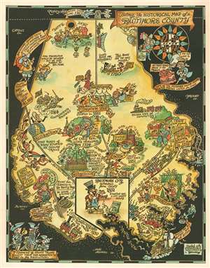
Being Ye Historical Map of Baltimore County.
$750.00
Acquire
- Digital Map Information
- Suitable for large format printing
- Full resolution TIFF file
- ICC color profile embedded
- Delivered instantly via download link
This is a c. 1935 Richard Yardley pictorial map of Baltimore County, Maryland. Populated by comical caricatures of the county's residents, Yardley both mocks and celebrates its history. Many of these vignettes illustrate historical events, such as the county's founding, its involvement in the American Revolution, the War of 1812, and the American Civil War. Baltimore itself does not appear on the map since it was separated from the county in 1851. Yardley acknowledges the role Native Americans played, stating that many of the modern-day county roads started as Indian trails. The other side of the coin was that Fort Garrison, near Pikesville, was built as a defense against those same Indians. Joppa occupies a sizable portion of the map, with its bustling trade with England and the West Indies prominently touted. A banner also states that the city was the county seat in 1712. (more details)
Earliest Atlas Map of Maryland Published in the American Republic.
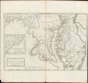
The State of Maryland, from the Best Authorities.
$600.00
Acquire
- Digital Map Information
- Suitable for large format printing
- Full resolution TIFF file
- ICC color profile embedded
- Delivered instantly via download link
An important map of Maryland from the early days of the American Republic, this 1795 work was drawn by Samuel Lewis and engraved by William Barker for inclusion in Matthew Carey's Carey's American Edition of Guthrie's Geography Improved, the first atlas published in the United States. (more details)
Illustrates land reserved for U.S. Soldiers after the American Revolutionary War.
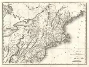
Carte De La Partie Septentrionale Des Etats-Unis.
$600.00
Acquire
- Digital Map Information
- Suitable for large format printing
- DPI: 600
- File Size: 21.41 MB
- File Type: ZIP / TIFF
- ICC color profile embedded
- Delivered instantly via download link
An important and highly detailed 1801 map of the northeastern United States by Pierre Francis Tardieu. The map was issued to a accompany Michel Guillaume de Crevecoeur's Le Voyage dans la Haute Pennsylvania et dans l'État de New-York, one of the most important post-Revolutionary War books about life and economy in the fledgling United States. Coverage extends from Maine to the District of Columbia and west as far as Ohio and the Connecticut Reserve, including modern-day New England, New York, New Jersey, Pennsylvania, and parts of Maryland, Delaware, and West Virginia. The map is notable for its exceptional detail, naming towns and roads, as well as surveyed military tracts intended to compensate Revolutionary War soldiers for their war effort. (more details)
Comic yet honest pictorial map of Baltimore County.
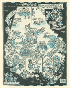
Being Ye Historical Map of Baltimore County.
$500.00
Acquire
- Digital Map Information
- Suitable for large format printing
- Full resolution TIFF file
- ICC color profile embedded
- Delivered instantly via download link
This is a c. 1935 Richard Yardley pictorial map of Baltimore County, Maryland, presented here in an unusual two-tone printing. Populated by comical caricatures of the county's residents, Yardley both mocks and celebrates Baltimore history. (more details)
The Potomac River during the American Civil War.
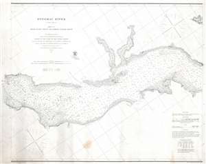
Potomac River (in four sheets) Sheet No. 2 From Piney Point to Lower Cedar Point.
$500.00
Acquire
- Digital Map Information
- Suitable for large format printing
- File Size: 21.56 MB
- File Type: ZIP / TIFF
- ICC color profile embedded
- Delivered instantly via download link
This is an 1862 U.S. Coast Survey nautical chart or maritime map of part of the Potomac River. Separating Maryland and Virginia, the map depicts from Lower Cedar Point to Piney Point. Depth soundings are indicated throughout, including in St. Clement's Bay and Breton's Bay. Points and other coastal features, including the Nomini Cliffs, are labeled. Navigational aids, such as buoys and lights, are illustrated and labeled, along with navigational hazards, including shoals and islands. (more details)
First Map of the first state to be published in the United States.
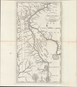
Delaware, from the best authorities.
$500.00
Acquire
- Digital Map Information
- Suitable for large format printing
- DPI: 600
- File Size: 24.55 MB
- File Type: ZIP / TIFF
- ICC color profile embedded
- Delivered instantly via download link
An example of Matthew Carey and William Barker's 1795 map of Delaware, which appeared in Carey's American Edition of Guthrie's Geography Improved, the first atlas published in the United States of America. It provides a fascinating snapshot of America's first state in the years following independence. (more details)
Civilian nuclear energy in the Senate.
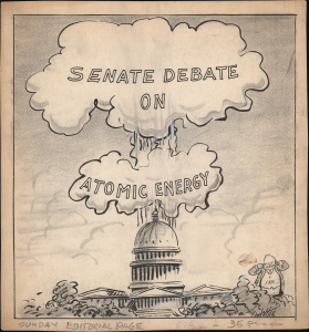
A powerful image, this is George White's 1954 original art for a political cartoon presenting the U.S. Capitol exploding in an atomic mushroom cloud. The piece references the contemporary 'Senate Debate on Atomic Energy' that appears within the cloud. President Eisenhower ('Ike') occupies the lower-right corner and is plugging his ears against the 'explosion'. (more details)
Striking map of Washington, D.C.
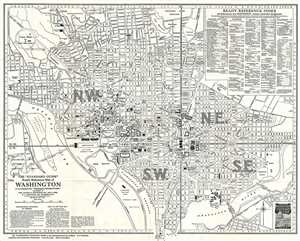
The 'Standard Guide' Ready Reference Map of Washington, to accompany the 'Washington Standard Guide'.
$500.00
Acquire
- Digital Map Information
- Suitable for large format printing
- File Size: 9.28 MB
- File Type: ZIP / TIFF
- ICC color profile embedded
- Delivered instantly via download link
This is a striking 1937 map or plan of Washington, D.C. by the Foster and Reynolds Company of New York. It covers Washington D.C. from the Arlington National Cemetery and Georgetown College eastward as far as 28th Street and the Congressional Cemetery and from the ... (more details)
The 'District of Maine' and the Connecticut Western Reserve!
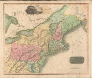
Northern Provinces of the United States.
$450.00
Acquire
- Digital Map Information
- Suitable for large format printing
- DPI: 600
- File Size: 631.07 MB
- File Type: ZIP / TIFF
- ICC color profile embedded
- Delivered instantly via download link
A scarce first edition example of John Thomson's 1817 map of the northeastern parts of the United States, including New York, Massachusetts, Connecticut, Vermont, New Hampshire, Maine, Pennsylvania, New Jersey, Maryland, Rhode Island, and parts of adjacent Virginia, Canada, and the Great Lakes. There appears a large inset of Niagara Falls along the top border. (more details)
Idyllic Island in the Potomac.
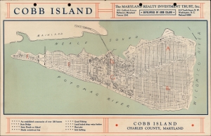
Cobb Island / Cobb Island Charles County, Maryland.
$450.00
Acquire
- Digital Map Information
- Suitable for large format printing
- Full resolution TIFF file
- ICC color profile embedded
- Delivered instantly via download link
A one-of-a-kind c. 1935 real estate map of Cobb Island, Maryland, prepared by Maryland Realty Investment Trust, promoting real estate investment and settlement on the island. (more details)
Early railroad infrastructure.
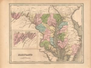
Maryland.
$400.00
Acquire
- Digital Map Information
- Suitable for large format printing
- File Size: 10.38 MB
- File Type: ZIP / TIFF
- ICC color profile embedded
- Delivered instantly via download link
This is Thomas G. Bradford's 1846 map of Maryland. It presents the state at a time when multiple transportation infrastructure projects (canals and railroads) were underway, linking the state (especially Baltimore) more closely with other coastal cities and the Appalachian region. (more details)
Canals vs. Railroads.
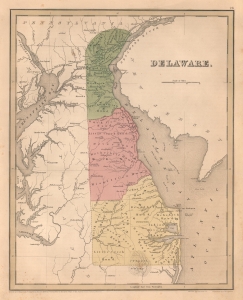
Delaware.
$400.00
Acquire
- Digital Map Information
- Suitable for large format printing
- DPI: 600
- File Size: 18.3 MB
- File Type: ZIP / TIFF
- ICC color profile embedded
- Delivered instantly via download link
This is an 1838 Thomas G. Bradford map of Delaware. It is one of the few American atlas maps specifically of Delaware - most bundle it with either Maryland or New Jersey. Coverage embraces from the Susquehanna River and Chesapeake Bay to New Jersey and from Pennsylvania and New Jersey to Maryland and the Atlantic Ocean. (more details)