
North Carolina - South Carolina (sold)
First printed nautical chart of Virginia and North Carolina.
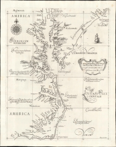
Carta particolare della Virginia Vecchia e Nuoua : la longitune comica da l'Isola di Pico di Asores : d'America carta, III.
sold
- Digital Map Information
- Suitable for large format printing
- File Size: 13.05 MB
- File Type: ZIP / TIFF
- ICC color profile embedded
- Delivered instantly via download link
A seminal chart, this is a superb 1661 example of Sir Robert Dudley's 1647 maritime map of the mouth of the Chesapeake Bay and the Carolina Sounds. In its first edition, this was the first printed nautical chart of that region. As per the title, the chart depicts the coasts of 'Old and New Virginia,' meaning the colonial efforts of Sir Walter Raleigh and the Jamestown Colony, respectively. Due to the Virginia Colony's importance to the English, Dudley's chart focuses more sharply on the region than on his other North American charts. (more details)
One of the rarest maps of the American southeast
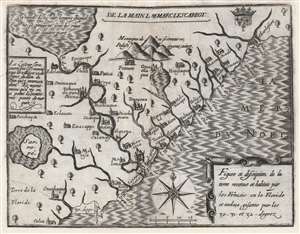
Figure et description de la terre reconue et habitée par les François en la Floride et audeça, gisante par les 30-31 - et 32 - degrez.
sold
- Digital Map Information
- Suitable for large format printing
- DPI: 600
- File Size: 10.61 MB
- File Type: ZIP / TIFF
- ICC color profile embedded
- Delivered instantly via download link
One of the great unobtainable maps of early attempts to settle North America. This is Marc Lescarbot's 1612 map of the American Southeast, one of the earliest specific maps detailing modern-day Florida, Georgia, and South Carolina. It chronicles 1562-1565 French attempts to establish a Huguenot colony in the region. Coverage extends roughly from 30° to 33° N, covering parts of modern-day Florida, Georgia, and South Carolina. (more details)
The first detailed map of any part of North America by an actual Colonist.
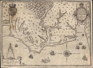
Americae Pars, Nunc Virginia dicta, primum ab Anglis inventa sumtibus Dn. Walteri Raleigh Equestris ordinis Viri Anno Dni. M.D LXXXV...
sold
- Digital Map Information
- Suitable for large format printing
- Full resolution TIFF file
- ICC color profile embedded
- Delivered instantly via download link
This is John White's 1590 map of the first Virginia colony. It is one of the first maps of any part of the modern-day United States, and the first map of a settled area produced by a colonist. Specifically, it is the first map to result from England's efforts to colonize North America. It is the earliest map available to the collector of Virginia and North Carolina, and it is the first map to name Chesapeake Bay. It is among the most influential early Americas maps, the traces of which are found on maps for decades to follow. (more details)
Mars, the God of War, look on as Fame proclaims the of the Birth of the United States.
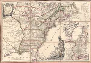
Carte de l'Amerique Septle. pour Servir a l'Intelligence de la Guerre Entre les Anglois et les Insurgents.
sold
- Digital Map Information
- Suitable for large format printing
- Full resolution TIFF file
- ICC color profile embedded
- Delivered instantly via download link
This is a rare 1777 Jean-Baptiste Jacques de Beaurain map of the United States during the American Revolutionary War, issued in anticipation of French entry into the war on the side of the revolutionaries. The map includes a bold illustration of the goddess Ossa (fame) unrolling an expansive map of the Theater of War in the Hudson corridor, proclaiming the newly formed United States. Mars, the god of War, looks on, shield and torch in hand, his arsenal ready - much like France itself. This map is thus an instrument of propaganda intended to prepare the public for French participation in the American Revolution - an event which followed in early 1778. (more details)
One of the rarest and finest Revolutionary War era maps of Charleston, South Carolina.
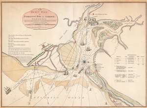
An Exact Plan of Charleston Bar and Harbour From an Actual Survey.
sold
- Digital Map Information
- Suitable for large format printing
- Full resolution TIFF file
- ICC color profile embedded
- Delivered instantly via download link
This is the 1791 Robert Sayer map of Charleston, South Carolina, one of the rarest and best Revolutionary War maps of that city. The map was issued to illustrate the 1776 Battle of Sullivan's Island, the first decisive American victory over the seemingly invincible British Royal Navy - the achievement shocked the world and protected Charleston during a critical early stage of the American Revolution (1775 - 1783). The British did not again attempt to retake the southern colonies until 1778. Moreover, unlike smaller plans by Faden which illustrate only the Attack on Fort Sullivan, this plan provides a detailed account of the British movements throughout the battle and captures significantly more information. (more details)
Important colonial period map of the American Southeast - with seashell and coral cartouche!
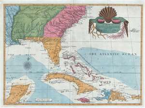
A Map of Carolina, Florida and the Bahama Islands with the Adjacent Parts.
sold
- Digital Map Information
- Suitable for large format printing
- DPI: 300
- File Size: 9.49 MB
- File Type: ZIP / TIFF
- ICC color profile embedded
- Delivered instantly via download link
A fine example of Mark Catesby’s rare 1743 / 1771 map of the southeastern parts of North America. This map is considered one of the finest maps of the colonial era American southeast. The map covers from the Mississippi River and from Cape Charles and Cape Henry to Jamaica, including all of North Carolina, South Carolina, Georgia, Florida, Louisiana, Cuba, Hispaniola, the Bahamas, Porto Rico, and parts of the Yucatan. Among other features, the map is notable for its remarkable cartouche design, which includes shells, corals, and seaweeds indigenous to the Americas. The map is furthermore an important reference for early forts, Indian tribes, English factories, and more in the southeast. The river systems of Georgia and Carolina are particularly impressive in their detail. (more details)
Among the earliest obtainable maps of Charleston.
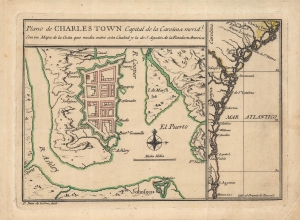
Plano de Charles Town capital de la Carolina Medl. con un mapa de la costa que media entre esta ciudad y la de S. Agustin de la Florida en America.
sold
- Digital Map Information
- Suitable for large format printing
- Full resolution TIFF file
- ICC color profile embedded
- Delivered instantly via download link
This is Juan de la Cruz's important and rare c. 1753 plan of Charleston, South Carolina. It is one of the earliest printed maps of Charleston, and perhaps the earliest specific printed map of Charleston. It updates the city plan included, via inset, on the unobtainable 1711 Edward Crisp map. As such, it reflects the precarity of the settlement just 30 years after its founding, as a distant colonial outpost, heavily fortified against anticipated attacks. (more details)
Geographical Reader for Dixie Children.
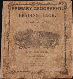
Primary Geography Arranged as a Reading Book, with Questions and Answers Attached.
sold
- Digital Map Information
- Suitable for large format printing
- Full resolution TIFF file
- ICC color profile embedded
- Delivered instantly via download link
This is a rare 1864 geographical atlas by Marinda Branson Moore prepared for Confederate children. Published during the American Civil War (1861 - 1865), the work only maps the Confederate States and contains historically relevant, if racially offensive, text critical of the Union. The work, as expressed by historians O. L. Davis, Jr. and Serena Rankin Parks, addresses the concerns of Southern schoolteachers who saw existing published textbooks as 'blighted with by Yankee biases and inaccuracies.' (more details)
Most Finely Detailed Dutch Map of the Northeast from the 17th Century.
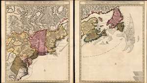
Nova Tabula Geographica Complectens Borealiorem Americae Partem: in qua Exacte Delineatae Sunt Canada sive Nova Francia, Nova Scotia, Nova Anglia, Novum Belgium, Pensylvania, Virginia, Carolina et Terra Nova, cum Omnibus Littorum. Pulvinorumque Profunditatibus. Amstelodami. à Nicolao Visscher. Cum Privilegio Ordinum Generalium Foederati Belgii./ Carte Nouvelle contenant la Partie d'Amerique la Plus Septentrionale, ou Sont Exactement Dècrites les Provinces Suivantes comme le Canada ou Nouvelle France, La Nouvelle Ecosse, la Nouvelle Angleterre, les Nouveaux Païs Bas, la Pensylvanie, la Virginie, la Caroline et l'Ile de Terre Neuve avec les profondeuis le Long des Côtes et sur les Bancs. Par Nicolas Visscher avec Privilege des Etats Géneraux.
sold
- Digital Map Information
- Suitable for large format printing
- DPI: 600
- File Size: 121.39 MB
- File Type: ZIP / TIFF
- ICC color profile embedded
- Delivered instantly via download link
This is Nicolas Visscher II's 1696 two-sheet map of the North American eastern seaboard and the Canadian Maritimes, in a beautiful example of its earliest acquirable state with rich original color. It represents the 17th century's most finely-detailed mapping of the coast from the Carolinas to Labrador. Also, it is the first Dutch map of the region to diverge from the 'Jansson-Visscher' precursor maps. (more details)
The finest 19th century chart of Cape Fear and Bald Head Island!
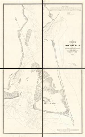
A Chart of the Entrance of Cape Fear River.
sold
- Digital Map Information
- Suitable for large format printing
- DPI: 300
- File Size: 52.16 MB
- File Type: ZIP / TIFF
- ICC color profile embedded
- Delivered instantly via download link
Without a doubt, this 1839 wall-map sized chart by James Glynn is the finest map of Cape Fear and vicinity to appear in the 19th century. Although much changed from repeat storms, this 1839 chart covers roughly from Kure Beach and Fort Fish Historic Site to the southern part of Bald Head Island (Smith Island) and from Southport (Smithville) to the Atlantic. The map exhibits a wealth of detailed soundings as well as some landside information including the course of rivers and streams, the positions of the Federal Point and Cape Fear lighthouse, and the street grid of Smithville / Southport. (more details)
One of the first renderings of the Carolina colony's interior.
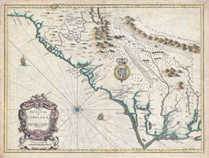
A New Description of Carolina.
sold
- Digital Map Information
- Suitable for large format printing
- Full resolution TIFF file
- ICC color profile embedded
- Delivered instantly via download link
A beautiful example of John Speed's important 1676 map of the Carolina colony. Heavily based upon the explorations of John Lederer and Ogilby's Lords Proprietor's Map of 1674. This seminal map represents one of the earliest attempts to map the Carolina interior. ... (more details)
Rare Civil War map with remarkable abolitionist provenance.
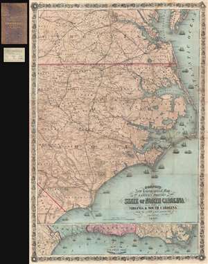
Colton's New Topographical Map of the Eastern Portion of the State of North Carolina with Part of Virginia and South Carolina from the latest and best authorities.
sold
- Digital Map Information
- Suitable for large format printing
- File Size: 29.25 MB
- File Type: ZIP / TIFF
- ICC color profile embedded
- Delivered instantly via download link
This is an impressive large scale 1863 J. H. Colton map of the eastern part of North Carolina during the American Civil War. It is from the library of Union Brigadier General Edward Augustus Wild, the abolitionist leader of the United Stated Colored Troops. This ... (more details)
The most important and influential map of Virginia and Carolina to appear in the 17th century.
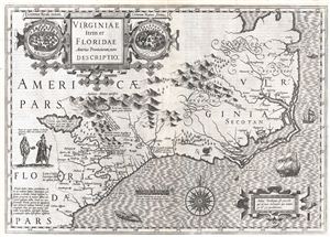
Virginiae Item et Floridae Americae Provinciarum, nova Descriptio.
sold
- Digital Map Information
- Suitable for large format printing
- DPI: 300
- File Size: 12.17 MB
- File Type: ZIP / TIFF
- ICC color profile embedded
- Delivered instantly via download link
Published in 1606 by the Mercator – Hondius firm, this is the most influential map of the southeastern part of North America to emerge in the 17th century and the first map to depict by Virginia and Florida. entitled, 'Virginiae Item et Floridae', Hondius’ map ... (more details)
The Heart of North America from the Finest Globemaker of the 17th Century.
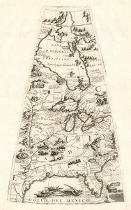
[Untitled Globe Gore of North America from the Tropic of Cancer to the Arctic Circle].
sold
- Digital Map Information
- Suitable for large format printing
- Full resolution TIFF file
- ICC color profile embedded
- Delivered instantly via download link
This is a beautiful 1688 Vincenzo Maria Coronelli globe gore focused on North America east of the Mississippi and west of the Chesapeake, engraved Coronelli's masterpiece 3 1/2 foot globe. The copperplate was adapted in 1697 for inclusion in Coronelli's bound atlases, masked off between the Tropic of Cancer and the Equator to fit book format. The gore covers most of North America east of the Mississippi, spanning from the Tropic of Cancer to the Arctic Circle. Thus, it shows the northern Gulf Coast, Florida, Chesapeake Bay, the Mississippi River (after La Salle), the Great Lakes, and Hudson's Bay. The geography is substantively the same as that on Coronelli's two-sheet America Settentrionale. Although that map bears the date 1688, it was not actually published any earlier than 1690 and it is very probable that the globes represent the earlier appearance of this geographical information. (more details)
Earliest Acquirable View of Charleston, South Carolina.
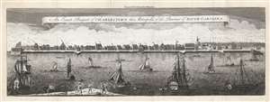
An Exact Prospect of Charlestown, the Metropolis of the Province of South Carolina.
sold
- Digital Map Information
- Suitable for large format printing
- Full resolution TIFF file
- ICC color profile embedded
- Delivered instantly via download link
This is the most important early view of Charleston, South Carolina. This view of Charleston was published in 1779 by the London Magazine. It is one of the few images available to the collector of the pre-Revolutionary colonial south, capturing the city when it was the fourth largest port in the North American British colonies. It is based on the unobtainable rare view of the same title engraved by William Henry Toms (c. 1700 - 1765) in 1739, in turn based on a watercolor painted from life by American artist Bishop Roberts between 1735 and 1739. (This original watercolor is in the collection of Colonial Williamsburg.) The view shows the waterfront of the city as seen from the opposite bank of the Cooper River. It clearly illustrates the town's shoreline batteries, warehouses, and wharves. Several structures are marked with a letter key: these are the Granville Bastion, the courthouse, the council chamber, the Quaker meeting house, the spire of Saint Philip's Church, the Customs House, and at the far-right Craven's Bastion. The waters of the Cooper are filled with ships, ranging from humble rowboats to British warships - underscoring both Charleston's prosperity and military significance. In the foreground, a group of fishermen wrestle a great fishnet ashore. The beautifully engraved sky above the city is teeming with birds. (more details)
Extraordinary and rare blueback nautical chart of the East Coast.
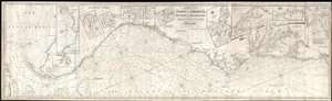
Chart of the Coast of America, from New York and Philadelphia, to the Strait or Gulf of Florida, and from thence to the Mississippi.
sold
- Digital Map Information
- Suitable for large format printing
- Full resolution TIFF file
- ICC color profile embedded
- Delivered instantly via download link
An utterly spectacular and sprawling 1850 John Williams Norie blueback nautical chart or maritime map depicting the North American coastline from New York to the Florida Keys. The map is oriented to the west, as a navigator from Europe would approach the American ... (more details)
Blockade Runners on the Carolina Coast.
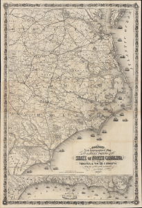
Colton's New Topographical Map of the Eastern Portion of the State of North Carolina with Part of Virginia and South Carolina from the latest and best authorities.
sold
- Digital Map Information
- Suitable for large format printing
- File Size: 81.37 MB
- File Type: ZIP / TIFF
- ICC color profile embedded
- Delivered instantly via download link
This is J. H. Colton's rare, large-format 1863 map of the eastern part of North Carolina during the American Civil War. Among other features, it highlights the Union blockade of the coastlines of these Confederate states, a somewhat porous but still important factor in constraining the Southern economy throughout the war. (more details)
Important Revolutionary war coastal chart of the Sea Islands in South Carolina, Georgia, and northern Florida.
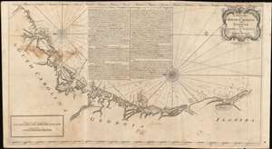
A Draught of South Carolina and Georgia from Sewee to St. Estaca.
sold
- Digital Map Information
- Suitable for large format printing
- DPI: 600
- File Size: 43.98 MB
- File Type: ZIP / TIFF
- ICC color profile embedded
- Delivered instantly via download link
A rare and important 1778 American Revolutionary War era Andrew Hughes nautical chart or maritime map of the coasts of South Carolina, Georgia, and northern Florida. During the early part of the Revolutionary War, this was the best obtainable nautical chart of the Sea Islands. Oriented to the east, this stunning map covers the Atlantic coast from the Santee River (Sewee River), South Carolina, past Charleston, Beaufort, and Savannah, to Saint Augustine, Florida. In addition, the map offers extensive and valuable piloting instructions addressing the entire coast line as well as most individual islands, including Tybee Island, Amelia Island, and Sapelo Island. It also includes excellent coverage of the region's shoals, anchorages, currents, marsh lands, river estuaries, and tides marks. (more details)
Charting the contours of the early Civil War.
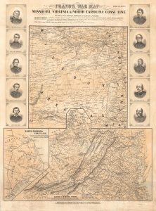
Prang's War Map Missouri, Virginia and North Carolina Coast Line.
sold
- Digital Map Information
- Suitable for large format printing
- File Size: 71.19 MB
- File Type: ZIP / TIFF
- ICC color profile embedded
- Delivered instantly via download link
A rare 1861 Louis Prang map of three theaters of the American Civil War (1861 - 1865), providing an as-it-happened snapshot of the war in its early months, when both Union and Confederate forces rushed to raise armies, produce war materiel, and grasp disputed territory. (more details)
Important Revolutionary war coastal chart of the Sea Islands in South Carolina, Georgia, and northern Florida.
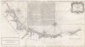
A Draught of South Carolina and Georgia from Sewee to St. Estaca.
sold
- Digital Map Information
- Suitable for large format printing
- DPI: 300
- File Size: 500.78 MB
- File Type: ZIP / TIFF
- ICC color profile embedded
- Delivered instantly via download link
A rare and important 1778 American Revolutionary War era Andrew Hughes nautical chart or maritime map of the coasts of South Carolina, Georgia, and northern Florida. During the early part of the Revolutionary War, this was the best obtainable nautical chart of ... (more details)
Important Revolutionary war coastal chart of the Sea Islands in South Carolina, Georgia, and northern Florida.
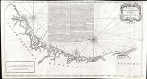
A Draught of South Carolina and Georgia from Sewee to St. Estaca.
sold
- Digital Map Information
- Suitable for large format printing
- DPI: 600
- File Size: 26.97 MB
- File Type: ZIP / TIFF
- ICC color profile embedded
- Delivered instantly via download link
A rare and important 1778 American Revolutionary War era Andrew Hughes nautical chart or maritime map of the coasts of South Carolina, Georgia, and northern Florida. During the early part of the Revolutionary War, this was the best obtainable nautical chart of the Sea Islands. Oriented to the east, this stunning map covers the Atlantic coast from the Santee River (Sewee River), South Carolina, past Charleston, Beaufort, and Savannah, to Saint Augustine, Florida. In addition, the map offers extensive and valuable piloting instructions addressing the entire coastline as well as most individual islands, including Tybee Island, Amelia Island, and Sapelo Island. It also includes excellent coverage of the region's shoals, anchorages, currents, marsh lands, river estuaries, and tides marks. (more details)
A ground-breaking map of Carolina showing the contentions geography of Jonathan Lederer.
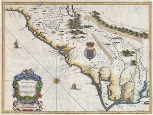
A New Description of Carolina.
sold
- Digital Map Information
- Suitable for large format printing
- Full resolution TIFF file
- ICC color profile embedded
- Delivered instantly via download link
A very attractive example of John Speed's important and rare 1676 map of the Carolina colony - representing the first serious attempts to map the interior of the Carolinas based upon actual exploration. Speed heavily based his cartography of Carolina upon the explorations of John Lederer and Ogilby's Lords Proprietor's Map of 1674. Oriented to the West, map covers from the Spanish colony of St. Augustine, Florida, north to the English colony of Jamestown, Virginia. It extends inland as far as the Appalachian (Apalathean) Mountains. (more details)
An Essential American Revolutonary War map rvised to reflect the independence of the United States.
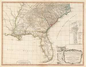
A New and General Map of the Southern Dominions Belonging to The United States of America, viz: North Carolina, South Carolina, and Georgia: with the Bordering Indian Countries, and The Spanish Possessions of Louisiana and Florida.
sold
- Digital Map Information
- Suitable for large format printing
- DPI: 600
- File Size: 24.8 MB
- File Type: ZIP / TIFF
- ICC color profile embedded
- Delivered instantly via download link
A scarce 1794 map of the southeastern part of the United States and Florida issued by the London firm of Laurie and Whittle. The coverage extends from North Carolina to the Florida Keys and from just beyond the Mississippi River to the Atlantic seaboard and the Bahamas. It encompasses the modern-day states of North Carolina, South Carolina, Georgia, Kentucky, Tennessee, Alabama, Mississippi, Louisiana (very little detail), and Florida. At right, there are inset detail maps of Charleston and St. Augustine. (more details)
Nautical map by the French during the American Revolutionary War.
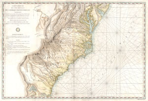
Carte Reduite Des Cotes Orientales De L'amerique Septentrionale Contenant Partie du Nouveau Jersey, la Pen-sylvanie, le Mary-land, la Virginie, la Caroline Septentrionale, la Caroline Meridionale et la Georgie, Assujettie aux Observations les plus recentes et aux Cartes de detail les plus estimées. Dressée au Dépôt Général des Cartes, Plans et Journaux de la Marine. Pour le Service des Vaisseaux Français Par Ordre de M. de Sartine, Conseiller d'Etat, Ministre et Secretaire d'Etat, ayant le Département de la Marine. 1778.
sold
- Digital Map Information
- Suitable for large format printing
- Full resolution TIFF file
- ICC color profile embedded
- Delivered instantly via download link
A rare and extraordinary map of considerable historic importance. This map, which covers from New Jersey and Pennsylvania southward through Maryland and Virginia, then along the Carolina coast to Georgia and Florida, was issued by the French 'Depot General de ... (more details)
Southern frontiers of the British Colonies in North America.
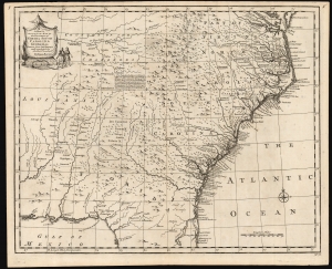
A New and Accurate Map of the Provinces of North and South Carolina etc.
sold
- Digital Map Information
- Suitable for large format printing
- DPI: 600
- File Size: 28.04 MB
- File Type: ZIP / TIFF
- ICC color profile embedded
- Delivered instantly via download link
This is a strong example of Emmanuel Bowen's 1747 map of the Carolinas and Georgia. The map reveals the region against the rising hostilities that would soon culminate in the French and Indian War (1754 - 1763). Among its highlights are the defenses of the Georgia colony - then just 13 years old. It also notes the American Indian treaties and alliances that were the cornerstone of British colonial governance and commerce. (more details)
Made for blockade running.
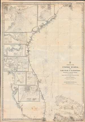
Coast of the United States from Cape Fear to the Bahamas, with plans of the Principal Harbors on an Enlarged Scale; Compiled from the most Recent Surveys, Made by order of the United States Government, and Adjusted by the Latest Astronomical Observations.
sold
- Digital Map Information
- Suitable for large format printing
- File Size: 48.52 MB
- File Type: ZIP / TIFF
- ICC color profile embedded
- Delivered instantly via download link
This is a rare 1865 Civil War Era Charles Copley 'blockade runner's' nautical chart or maritime map of the southeastern coast of the United States extending roughly from Cape Fear, North Carolina, to Miami, Florida, and the northern Bahamas. (Miami does not yet exist, but the Miami River and the Cape Florida Light, built in 1860, are illustrated.) Insets within the peninsula of Florida detail the most important southern harbors: Charleston, Georgetown Harbor, the Savannah River, Jacksonville (St. John's River), Fernandina Harbor, Cape Canaveral, Turtle Harbor, and Cedar Keys. The northern Bahamas are covered in some detail, but the chart does not extend as far south as Nassau. (more details)
One of the Earliest Colonial Maps of the North American East Coast.
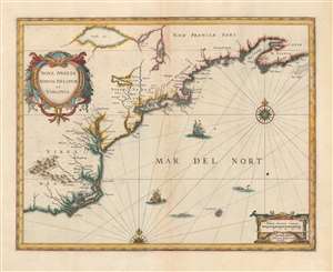
Nova Anglia Novum Belgium et Virginia.
sold
- Digital Map Information
- Suitable for large format printing
- Full resolution TIFF file
- ICC color profile embedded
- Delivered instantly via download link
A beautiful first state example of Jan Jansson's 1636 map of the North American coastline from Cape Lookout (here identified as C. of Feare) to Nova Scotia. The map includes parts of modern-day North Carolina, Virginia, Maryland, Delaware, New York, New Jersey, Massachusetts, Connecticut, Rhode Island, Vermont, New Hampshire, Maine, and Nova Scotia. Most particularly, it offers some of the earliest depictions of the Chesapeake Bay, Delaware Bay, Manhattan Island, New Amsterdam, Long Island, and the Great Lakes. It is also among the first maps to accurately portray the position of Bermuda vis-a-vis the American coastline. (more details)
Issued during the American Civil War for Spanish Blockade Runners!
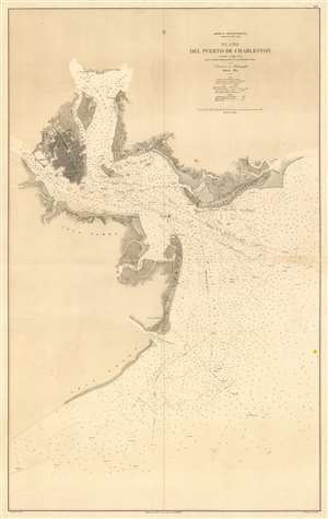
América Septentrional Carolina del Sur. Plano del Puerto de Charleston.
sold
- Digital Map Information
- Suitable for large format printing
- File Size: 38.38 MB
- File Type: ZIP / TIFF
- ICC color profile embedded
- Delivered instantly via download link
An utterly stunning 1864 Civil War Era Spanish Direccion de Hidrografia nautical chart or maritime map of Charleston Harbor, South Carolina. Probably issued for use by Spanish blockade runners during the American Civil War. The map covers the South Carolina coast from Sullivan Island to Folly Island, with a focus on Charleston Harbor. Charleston itself is beautiful engraved and situated between the Ashley and Cooper Rivers. The street grid is detailed, including piers, parks, individual buildings, and more. Similar attention has been given to the Charleston Harbor town of Mount Pleasant and Moultrieville, both of which have since been folded into greater Charleston. (more details)
The finest large scale atlas map of North and South Carolina to appear in the 19th century.
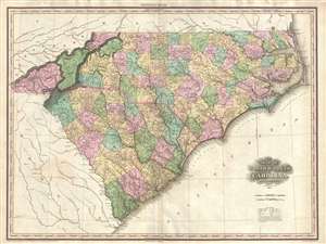
Map of North and South Carolina by H. S. Tanner.
sold
- Digital Map Information
- Suitable for large format printing
- DPI: 300
- File Size: 17.88 MB
- File Type: ZIP / TIFF
- ICC color profile embedded
- Delivered instantly via download link
A rare and important map of North Carolina and South Carolina by H. S. Tanner. This elephant folio map covers all of Georgia and Alabama as well as, in less detail, adjacent parts of Georgia, Tennessee, and Virginia. The map shows rivers, topography by ... (more details)
Among the earliest Dutch attempts to map the Great Lakes and an important early representation New England and New Amsterdam (New York).
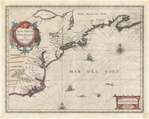
Nova Anglia Novum Belgium et Virginia.
sold
- Digital Map Information
- Suitable for large format printing
- Full resolution TIFF file
- ICC color profile embedded
- Delivered instantly via download link
A fine first edition first state old color example of Jan Jansson's 1636 map of the northeast American coastline from Cape Lookout (here identified as C. of Feare) to Nova Scotia. The map includes parts of modern day North Carolina, Virginia, Maryland, ... (more details)
Rare view of the of Seat of the Civil War around Washington D.C. and the Chesapeake Bay.
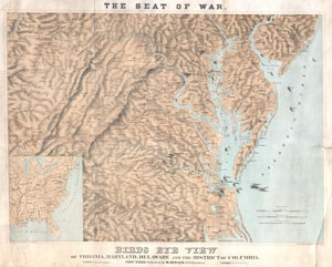
Seat of War. Bird's Eye View of Virginia, Maryland, Delaware and the District of Columbia.
sold
- Digital Map Information
- Suitable for large format printing
- File Size: 29.24 MB
- File Type: ZIP / TIFF
- ICC color profile embedded
- Delivered instantly via download link
A striking 1861 three-color Schedler/Schaus chromolithograph view/map of the Chesapeake Bay region, including Maryland, Virginia, Delaware, and Washington D.C., shortly after the outbreak of the American Civil War (1861 - 1865). Centered on the Chesapeake Bay, the view covers roughly from Gettysburg to Albemarle Sound and from the Ohio River to the Atlantic seaboard. Steam/Sail ships cluster around the mouth of the Chesapeake and Delaware Bays, presumably an attempt to illustrate the ad hoc Union naval blockade of Confederacy. (more details)
One of the most decorative early nautical charts of the American Southeast.
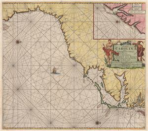
Pas Kaart van de Kust van Carolina tusschen C de Canaveral en C Henry.
sold
- Digital Map Information
- Suitable for large format printing
- DPI: 300
- File Size: 21.25 MB
- File Type: ZIP / TIFF
- ICC color profile embedded
- Delivered instantly via download link
Among the most scarce and decorative Dutch nautical charts of the American southeast, this is Johannis Van Keulen's and C. J. Vooght's 1687 maritime map of the Virginia, Carolina, Georgia and Florida coasts. Oriented to the west (with north to the ... (more details)