Authenticity Guaranteed — We sell only original antique maps.
Geographicus Rare Antique Maps
Authenticity Guaranteed — We sell only original antique maps.
Navigation
Shopping Cart
Sort By Price: highest first

James W. Roy

A veteran of the antique map trade, drawn to maps by way of fantasy literature and a background in Medieval history.


James is drawn to maps from moments when new knowledge reached a wide audience for the first time — when a place known to only a few suddenly entered the wider world's picture of geography. Much of 16th-century Europe fits this mold, especially the work of Sebastian Münster, Giacomo Gastaldi, and later Abraham Ortelius and Gerard Mercator.

He's also drawn to maps that mark a turning point, for better or worse — including ones that introduced errors other cartographers kept copying for decades. A favorite example: Girolamo Ruscelli's 1561 map, which borrowed Nicolo Zeno's invented lands of Frisland, Drogeo, and Estotiland as if they were real.

Monthly Digest of James' Picks

Portrait of James W. Roy
Sort by
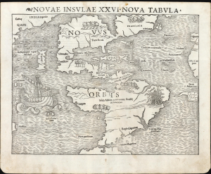
First printed map of the Western Hemisphere in one of its earliest printings.

Novae Insulae XVII Nova Tabula.

1545 (undated)
11 x 14 in (27.94 x 35.56 cm)
America-munster-1545

$12,500.00

Acquire
A Closer Look
  • Digital Map Information
  • Suitable for large format printing
  • Full resolution TIFF file
  • ICC color profile embedded
  • Delivered instantly via download link
This is a superb example of Sebastian Münster's 1540 map of America, the first printed map of the Western Hemisphere. It is the first map to name the Pacific Ocean and the Straits of Magellan, and among the earliest acquirable maps to show and name Japan (Zipangri, located surprisingly close to America). This is the 2nd state of the map from the 1545 3rd printing of Geographia, marking this map as one of the handful printed during Münster's lifetime. (more details)
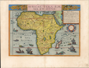
Most unique atlas map of Africa to appear in the 16th century.

Africae Vera Forma, et Situs.

1593 (undated)
13 x 17.75 in (33.02 x 45.08 cm)
AfricaeVeraForma-dejode-1593

$11,000.00

Acquire
A Closer Look
  • Digital Map Information
  • Suitable for large format printing
  • Full resolution TIFF file
  • ICC color profile embedded
  • Delivered instantly via download link
This is Cornelis De Jode's superb, rare map of Africa, printed in a single edition of 1593. It is the most unique atlas map of Africa to appear in the 16th century, being the only such based on Petrus Plancius' 1592 wall map of the world. (more details)
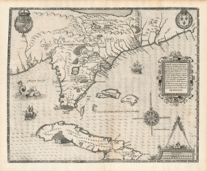
First specific map of Florida.

Floridae Americae Provinciae Recens and Exactissima Descriptio Auctore Iacobo Le Moyne cui Cognomen de Morgues, qui Laudonierum…

1591 (undated)
14 x 18 in (35.56 x 45.72 cm)
Florida-debry-1591-2

$10,000.00

Acquire
A Closer Look
  • Digital Map Information
  • Suitable for large format printing
  • Full resolution TIFF file
  • ICC color profile embedded
  • Delivered instantly via download link
…the most remarkable and important map, which has been preserved from the sixteenth century maps, of that part of the East Coast which lies between Cape Hatteras and Cape Florida … the first French map to show Florida … considered the most important map of Florida. - Johns Matthews Baxter
A map of extraordinary rarity and seminal importance, this is one of the earliest and most influential maps of the American southeast ever published. Drawn by the French artist Jacques Le Moyne de Morgues c. 1565 and published by Theodore de Bry in 1591, this magnificent map details the Florida peninsula and Carolina coast from Cuba to the Bahamas, to 'Prom Terra flag' or, as it is known today, Cape Lookout near Beaufort, North Carolina. (more details)
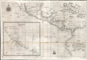
Earliest published sea chart focusing on the California coast!

Carta prima generale d'America dell'India Occidentale e Mare del Zur.

1647 (undated)
20.5 x 28 in (52.07 x 71.12 cm)
AmericaPacificCACoast-dudley-1647-2

$7,000.00

Acquire
A Closer Look
  • Digital Map Information
  • Suitable for large format printing
  • File Size: 26.19 MB
  • File Type: ZIP / TIFF
  • ICC color profile embedded
  • Delivered instantly via download link
This is the 1646 first state of Robert Dudley's chart of the middle part of the Americas, illustrating the proximity of the Caribbean Sea and the Pacific Ocean and emphasizing the narrow parts of Central America dividing the two bodies of water. The chart features the western part of the Caribbean, but it is particularly noted for being the first printed sea chart to focus on the Pacific coast, including California. It is, along with Dudley's more narrowly focused charts, the first printed chart of the West Indies and South Florida to employ the Mercator Projection. An inset chart in the lower left focuses specifically on the coast of California, from Baja to Cap Mendocino. (more details)
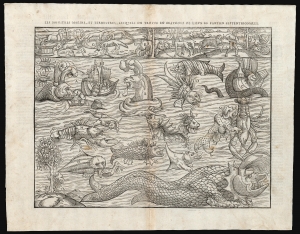
Bestiary of fantastical northern monsters - in a rare superior edition.

Les Monstres Marins, et Terrestres, Lesquelles on Trouve en Beaucoup di Lieux es Parties Septentrionales.

1575 (undated)
10.75 x 13.75 in (27.30 x 34.92 cm)
MunstersMonsters-belleforest-1575

$5,000.00

Acquire
A Closer Look
  • Digital Map Information
  • Suitable for large format printing
  • Full resolution TIFF file
  • ICC color profile embedded
  • Delivered instantly via download link
Euphemistically referred to as Munster's Monsters, this is the rare 1575 Belleforest edition of Münster's bestiary of sea serpents and other astonishing monsters. Bellforest editions are highly desirable for their superior presentation and engraving. The image first appeared in the expanded 1550 editions of Munster's Cosmographia, a work which, for more than half a century, provided the European literate layperson their best source of information about the world. This scarce second block was cut in Paris for inclusion in the 1575 Belleforest edition of Cosmographia. (more details)
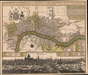
George II's London in Rich Detail.

Londinum celeberrima Metropolis, splendidissima Regia et opulentissimum Angliae Emporium, accuratissime delineata per Matthaeum Seutter. / Eigentlicher Grund Riss und Prospect der Weldberühmten Haupt Stadt, Prächtigsten Königl Residenz und reichesten Handel Stadt London in Englland, herauss gegeben von M. Seutter. / Prospect der Konigl Haupt und Residetz Stadt London.

1727 (undated)
19.5 x 22.5 in (49.53 x 57.15 cm)
London-seutter-1727

$3,000.00

Acquire
A Closer Look
  • Digital Map Information
  • Suitable for large format printing
  • Full resolution TIFF file
  • ICC color profile embedded
  • Delivered instantly via download link
This is Matthias Seutter's superbly-executed, elegant combined plan and panorama of the City of London, composed and published c. 1727 in honor of British King (and Imperial Elector) George II. (more details)
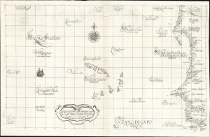
Earliest Detailed Chart of the Cape Verde Islands, Senegal, and the lower Gambia River.

Carta particolare della Barberia Australe che comincia con il capo Matas è Finiscie con il C. Himilas con l'Isole di capo Verde.

1647 (undated)
18.25 x 29.25 in (46.36 x 74.30 cm)
CapeVerde-dudley-1647

$3,000.00

Acquire
A Closer Look
  • Digital Map Information
  • Suitable for large format printing
  • Full resolution TIFF file
  • ICC color profile embedded
  • Delivered instantly via download link
This is a superb example of Robert Dudley's rare 1647 nautical chart or map of the coast of Africa, focusing on the Cape Verde Islands and the mainland from the Western Sahara to the northern part of Guinea. It is both beautifully engraved and an important, early work. It is the earliest accurate printed chart of the Cabo Verde Islands and the coastlines of Senegal, The Gambia, and Guinea. (more details)
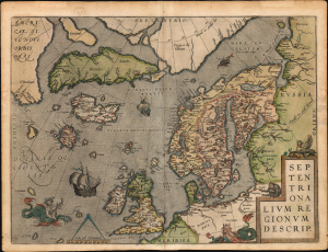
First Atlas Map of the North Parts of the World.

Septentrionalium Regionum Descrip.

1570 (undated)
14.5 x 20 in (36.83 x 50.80 cm)
SeptentrionaliumRegionum-ortelius-1570-6

$3,000.00

Acquire
A Closer Look
  • Digital Map Information
  • Suitable for large format printing
  • Full resolution TIFF file
  • ICC color profile embedded
  • Delivered instantly via download link
A beautiful example of one of Abraham Ortelius' most interesting maps, his 1570 map of Scandinavia and the Arctic. During the Age of Discovery, the Arctic was as remote and unfamiliar as the coasts of America, Africa, or Asia. This map played a role in propagating several cartographic fallacies, including the Zeno Fraud: Frisland, Estotiland, Drogeo. The present example, in a 1602 Vrients edition, features warm, original color. (more details)
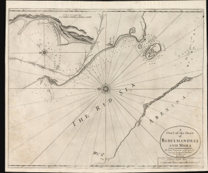
Earliest Printed, Accurate Chart of the Source of London's Coffee.

A Chart of the Straits of Babelmandell and Moha.

1703 (undated)
17.25 x 21.25 in (43.82 x 53.98 cm)
Babelmandell-thornton-1703

$2,000.00

Acquire
A Closer Look
  • Digital Map Information
  • Suitable for large format printing
  • Full resolution TIFF file
  • ICC color profile embedded
  • Delivered instantly via download link
This is John and Samuel Thornton's scarce c. 1703/1707 chart of Bab el Mandab, the Strait of Mandeb, or 'the Gate of Lamentation.' For centuries, this has represented a chokepoint between the Arabian Peninsula and the Horn of Africa and also forms a strategic bottleneck between the Red Sea and the Gulf of Aden. The present chart is the first of the Strait to benefit from a firsthand survey at a time when this region supplied most of Europe's coffee. (more details)
One of the first maps to show the Pacific Northwest.

Tartariae Sive Magni Chami Regni typus.

1570 (undated)
14.5 x 19 in (36.83 x 48.26 cm)
Tartary-ortelius-1570-3

$2,000.00

Acquire
A Closer Look
  • Digital Map Information
  • Suitable for large format printing
  • Full resolution TIFF file
  • ICC color profile embedded
  • Delivered instantly via download link
This is Abraham Ortelius' seminal 1570 map of Tartary, one of the first maps to focus on the North Pacific coasts of America and Asia, in a sharp, early edition of 1573. While the map is intended to the Asian empire of the Great Khan, it is also notable for what it presents of America. The map includes what is now the west coast of the United States, northwestern Canada, and Alaska, a part of the world almost entirely unknown at that time. It is the earliest obtainable map to name California. It also one of the most definitive early maps to distinctly separate the continents of Asia and America (via the Strait of Anian) well before the explorers of the 18th century proved that separation to be fact. (more details)
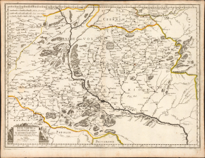
Kyiv after Beauplan's Firsthand Survey. During the Russo-Polish War (1654 - 1667).

Basse Volhynie, ou Palatinate de Kiow.

1665 (dated)
16.75 x 22.75 in (42.54 x 57.78 cm)
Ukraine-sanson-1665

$2,000.00

Acquire
A Closer Look
  • Digital Map Information
  • Suitable for large format printing
  • Full resolution TIFF file
  • ICC color profile embedded
  • Delivered instantly via download link
This is a beautifully engraved 1665 map of central Ukraine by Nicolas Sanson. Published during the Russo-Polish War (1654 - 1667), it is the earliest French iteration of the geography of Franco-Polish cartographer, engineer, and architect Guillaume Levasseur de Beauplan. Beauplan produced the best 17th-century survey of the Dniepr and laid the foundation for the modern mapping of Ukraine. (more details)
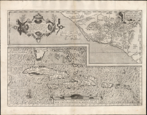
First Atlas Map of the Caribbean in its First Printing

Culiacanae, America Regionis Descriptio./ Hispaniolae, Cubae, Aliarumque Insularum Circumiacentium, Delineatio./ Cum Imp. et Regio./ privilegio decennali 1579.

1579 (dated)
14 x 19.5 in (35.56 x 49.53 cm)
CuliacanCuba-ortelius-1579-4

$2,000.00

Acquire
A Closer Look
  • Digital Map Information
  • Suitable for large format printing
  • Full resolution TIFF file
  • ICC color profile embedded
  • Delivered instantly via download link
This is a superb, first-edition example of Ortelius' 1579 map of Cuba and the Caribbean, combined with his map of the Viceroyalty of Culiacan in Northwestern Mexico. While Ortelius' Theatrum had been in print since 1570, it was not until 1579 that this map was added to the book. This example exhibits a bold, sharp strike resulting from the youth of its plate; it is consequently very desirable. (more details)
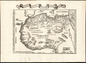
Reconciling ancient geography with new discoveries.

Tabu. Nova Partis Aphri.

1522 (undated)
12.5 x 15.5 in (31.75 x 39.37 cm)
NorthAfrica-waldseemullerfries-1522

$1,900.00

Acquire
A Closer Look
  • Digital Map Information
  • Suitable for large format printing
  • Full resolution TIFF file
  • ICC color profile embedded
  • Delivered instantly via download link
This is Laurent Fries' 1535 edition of the earliest acquirable modern mapping of Africa north of the Equator. This is one of the earliest printed maps to incorporate contemporary Portuguese discoveries while preserving classical Ptolemaic geography. (more details)
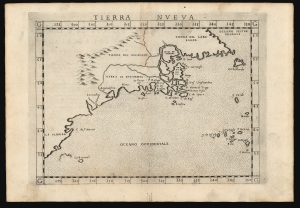
One of the Earliest Maps of the North American East Coast.

Tierra Nueva.

1574 (undated)
7.5 x 10.5 in (19.05 x 26.67 cm)
TierraNveva-ruscelli-1574-2

$1,600.00

Acquire
A Closer Look
  • Digital Map Information
  • Suitable for large format printing
  • Full resolution TIFF file
  • ICC color profile embedded
  • Delivered instantly via download link
This is Girolamo Ruscelli's 1574 map Tierra Nueva, one of the earliest maps to focus on the North American East Coast and the Canadian Maritime Provinces. (more details)
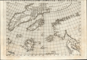
Earliest acquirable state of the Zeno map.

Septentrionalium Partium Nova Tabula.

1561 (undated)
7.5 x 9.5 in (19.05 x 24.13 cm)
Zeno-ruscelli-1561-3

$1,400.00

Acquire
A Closer Look
  • Digital Map Information
  • Suitable for large format printing
  • Full resolution TIFF file
  • ICC color profile embedded
  • Delivered instantly via download link
This is the most important map of Girolamo Ruscelli's 1561 - 1564 edition Ptolemy: the earliest acquirable iteration of Nicoló Zeno's 1558 Carta Da Navegar De Nicolo et Antonio Zeni Furono In Tramontana Lano MCCCLXXX, revealing the alleged 14th-century voyages of Zeno's ancestors, Nicoló and Antonio. Zeno's fraud, likely intended to enhance his political power in Venice and later embraced to co-opt the 1492 Columbia discovery of America, was responsible for the initial appearance and subsequent tenacity of the apocryphal islands Frisland, Icaria, Drogeo, and the coastline of Estotiland, which was taken by some of Europe's finest geographers to be the coast of Labrador. (more details)
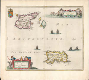
Most beautiful 17th century map of the Channel Islands.

Sarnia insula, vulgo Garnsey et Insula Caesaraea, Vernacule Jarsey.

1645 (undated)
15.25 x 18.5 in (38.74 x 46.99 cm)
ChannelIslands-blaeu-1645

$1,200.00

Acquire
A Closer Look
  • Digital Map Information
  • Suitable for large format printing
  • Full resolution TIFF file
  • ICC color profile embedded
  • Delivered instantly via download link
This is a gorgeous, original-color example of Joan Blaeu's 1645 map of Guernsey and Jersey, the most beautiful map of the primary Channel Islands to be produced in the 17th century. (more details)
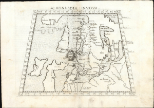
One of the Earliest Maps of Scandinavia, Greenland and Ultima Thule.

Schonlandia Nuova.

1561 (undated)
7.5 x 9.75 in (19.05 x 24.76 cm)
Scandinavia-ruscelli-1561

$1,000.00

Acquire
A Closer Look
  • Digital Map Information
  • Suitable for large format printing
  • Full resolution TIFF file
  • ICC color profile embedded
  • Delivered instantly via download link
This is a handsome example of Girolamo Ruscelli's 1561 map of Scandinavia, after Gastaldi. It is among the earliest generally acquirable modern maps of the northern parts of the world, capturing a period when geographers were struggling to integrate new geographical information with heretofore authoritative classical knowledge. Ruscelli's map is an expanded, more clearly-engraved and legible iteration of Gastaldi's 1548 Schonlandia Nova. (more details)
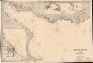
Plotting the Rio de la Plata.

River Plate.

1872 (dated)
34.5 x 50.5 in (87.63 x 128.27 cm)
RiodeLaPlata-imray-1872

$975.00

Acquire
A Closer Look
  • Digital Map Information
  • Suitable for large format printing
  • Full resolution TIFF file
  • ICC color profile embedded
  • Delivered instantly via download link
This large, richly detailed, and rare work is James Imray's 1872 working, blueback nautical chart of the Río de la Plata in South America. It was surveyed during, and printed shortly after, the War of the Triple Alliance (1864 - 1870), fought by Brazil, Uruguay, and Argentina against Paraguay, largely over control of this waterway. It is the premier nautical mapping of the Río de la Plata to appear in the second half of the 19th century. (more details)
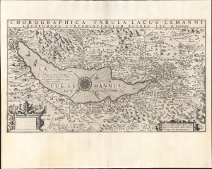
One of the earliest maps of Lake Geneva based on local knowledge.

Chorographica Tabula Lacus Lemanni Locorumque Circumiacentium Auctore Iac. G. Genevensi.

1606 (undated)
12 x 21.25 in (30.48 x 53.98 cm)
LakeGeneva-hondius-1606-2

$850.00

Acquire
A Closer Look
  • Digital Map Information
  • Suitable for large format printing
  • Full resolution TIFF file
  • ICC color profile embedded
  • Delivered instantly via download link
An uncommon and beautiful map of Lake Geneva engraved by Jodocus Hondius for his 1606 edition of the Mercator Atlas. It is one of the best-detailed maps of the region based on firsthand description, derived from the manuscript map of native Jacques Goulart. (more details)
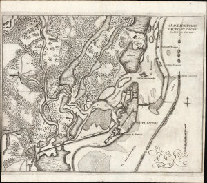
Establishing Dutch Territorial Claims in Brazil.

Mauritiopolis, Reciffa et circumjacentia castra.

1647 (undated)
11.5 x 14.5 in (29.21 x 36.83 cm)
Mauritiopolis-blaeu-1647

$800.00

Acquire
A Closer Look
  • Digital Map Information
  • Suitable for large format printing
  • Full resolution TIFF file
  • ICC color profile embedded
  • Delivered instantly via download link
This is Joan Blaeu and Georg Marcgrave's 1647 map of the environs of Mauritiopolis and Recife, the main Dutch colonial foothold in Brazil during the impactful tenure of Dutch Governor Johan Maurits van Nassau-Siegen (1604 - 1679). The map was issued to promote Maurits' leadership and incontrovertible Dutch claims in the region. (more details)
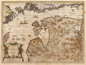
Estonia and Latvia as the Swedish Frontier

Nova Totius Livoniae accurata Descriptio. Apud Janssonio Waesbergios et Mosem Pitt.

1680 (undated)
15.5 x 20.25 in (39.37 x 51.44 cm)
Livonia-jansson-1680

$750.00

Acquire
A Closer Look
  • Digital Map Information
  • Suitable for large format printing
  • Full resolution TIFF file
  • ICC color profile embedded
  • Delivered instantly via download link
A beautifully engraved map of Livonia and the Duchy of Estonia - encompassing much of modern Latvia and Estonia - originally published in Jan Jansson's Atlas and revised for inclusion in Moses Pitt's rare 1680 English Atlas. Derived from Anders Bure's seminal map of the Swedish Empire, it depicts the region during Swedish rule following Sweden's victories over the Polish-Lithuanian Commonwealth. Sweden retained Estonia and Livonia until its defeat by Russia in the Great Northern War (1700 - 1721). (more details)
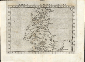
First Edition of the Earliest Acquirable Englishman's Map of the British Isles.

Anglia et Hibernia Nova.

1561 (undated)
7.25 x 9.75 in (18.42 x 24.76 cm)
BritishIsles-ruscelli-1561-2

$750.00

Acquire
A Closer Look
  • Digital Map Information
  • Suitable for large format printing
  • Full resolution TIFF file
  • ICC color profile embedded
  • Delivered instantly via download link
This is a handsome example of Girolamo Ruscelli's 1561 map of the British Isles. Of the maps prepared for Ruscelli's Ptolemy, it is among the most important: while most were larger, superior copies of the maps appearing in the 1548 Gastaldi Ptolemy, this map was a unique, updated work based on an English source, George Lily. (more details)
Among the Earliest Acquirable Contemporary Maps of the Baltic Coast.

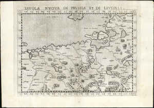
Tavola nuova di Prussia et di Livonia.

1561 (undated)
7.25 x 9.75 in (18.42 x 24.76 cm)
Livonia-ruscelli-1561

$650.00

Acquire
A Closer Look
  • Digital Map Information
  • Suitable for large format printing
  • Full resolution TIFF file
  • ICC color profile embedded
  • Delivered instantly via download link
This is the 1561 first Ruscelli edition of Giacomo Gastaldi's map of the Baltic Coast of Prussia and Livonia, now the coastline of Poland, Lithuania, Latvia, and Estonia. It is among the earliest detailed maps of this part of the world based on contemporary geographical knowledge, particularly with respect to the Gulf of Riga. (more details)
The Middle East by an Anarchical anti-authoritarian internationalist.

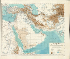
L'Asie antérieure : d'après le texte de la Nouvelle Géographie Universelle et d'autres documents récent.

1883 (dated)
17.5 x 21.25 in (44.45 x 53.98 cm)
NearEast-reclus-1883-2

$500.00

Acquire
A Closer Look
  • Digital Map Information
  • Suitable for large format printing
  • Full resolution TIFF file
  • ICC color profile embedded
  • Delivered instantly via download link
This beautifully detailed 1883 map of the Middle East is the work of geographer, anarchist, free union advocate, and nudist Jacques Élisée Reclus, produced in conjunction with fellow anarchist Charles Eugène Perron as part of Reclus's nineteen-volume Nouvelle Géographie Universelle. Reclus' maps were widely admired for their scientific precision and detail; his atlas was notable for its reflection and support of anti-authoritarian internationalism. (more details)
Romantic, Melancholy Mystery.

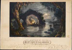
The Grottoes of the Sea.

1869 (dated)
10.5 x 15 in (26.67 x 38.10 cm)
Grottoes-currierives-1869

$500.00

Acquire
A Closer Look
  • Digital Map Information
  • Suitable for large format printing
  • File Size: 7.64 MB
  • File Type: ZIP / TIFF
  • ICC color profile embedded
  • Delivered instantly via download link
This eerie, beautiful hand-tinted 1869 Currier and Ives lithograph depicts an imaginary, romantic grotto. It is not a real-world location, but rather a theatrical image on a theme inspired by contemporary paintings and descriptions of actual European locales, such as Mark Twain's description of Capri's Blue Grotto in his Innocents Abroad, also published in 1869. Currier and Ives produced a number of such fantasy scenes, such as The Fairy Grotto in 1867. (more details)
Mapping Gascony.

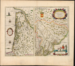
Carte du Bourdelois, du pais de Medoc, et de la prevosté de Born./ Principatus Benearnia. La Principaute de Bearn.

1631 (undated)
15.25 x 20 in (38.74 x 50.80 cm)
Gascony-blaeu-1631

$450.00

Acquire
A Closer Look
  • Digital Map Information
  • Suitable for large format printing
  • Full resolution TIFF file
  • ICC color profile embedded
  • Delivered instantly via download link
This is Willem Blaeu's 1631 map of the Basque country of Gascony in southwestern France, including the wine country of Bordeaux and Medoc. It is printed along with a map focusing on the Principality of Béarn, also part of the Duchy of Gascony. The region is now the western part of Nouvelle-Aquitaine, mainly the départements of Gironde, Landes, and Pyrénées-Atlantique. (more details)
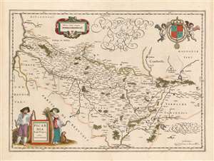
Humorous yet puzzling cartouche.

Picardia Regio Belgica, Auctore Ioanne Surhonio.

1644 (undated)
15 x 20.75 in (38.10 x 52.70 cm)
Picardy-blaeu-1644

$300.00

Acquire
A Closer Look
  • Digital Map Information
  • Suitable for large format printing
  • DPI: 600
  • File Size: 20.02 MB
  • File Type: ZIP / TIFF
  • ICC color profile embedded
  • Delivered instantly via download link
This is Willem Blaeu's map of Picardy, easily the most entertaining map ever produced of this region of northern France. The map focuses on the Somme River valley. Amiens, St. Quentin, and La Fere are given particular emphasis. Putti bear a superb coat of arms with Fleurs-de-lis aloft in the upper right, and the scales are presented in a strapwork frame. (more details)

Stay Informed

First Look at New Acquisitions

New inventory updates delivered directly to your inbox.