
Royal Geographical Society (sold)

Royal Geographical Society (fl. 1830 - present) is a British Society established in 1830 to promote geographical science and exploration. Originally titled the "Geographical Society of London", the RGS received its royal charter from Queen Victoria in 1859 shortly after absorbing several similar but more regional societies including the African Association, the Raleigh Club and the Palestine Association. The RGS sponsored many of the most important and exciting voyages of exploration ever undertaken, including the exploration of Charles Darwin, David Livingstone, Robert Falcon Scott, Richard F. Burton, John Speke, George Hayward, H. M Stanley, Ernest Shackleton and Sir Edmond Hillary. Today, the RGS remains a leading global sponsor of geographical and scientific studies. The Society is based in Lowther Lodge, South Kensington, London.
One of the Earliest Maps of the Colony of Western Australia
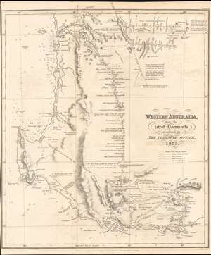
Western Australia from the Latest Documents received in The Colonial Office 1832.
sold
- Digital Map Information
- Suitable for large format printing
- DPI: 600
- File Size: 8.3 MB
- File Type: ZIP / TIFF
- ICC color profile embedded
- Delivered instantly via download link
This 1832 Royal Geographical Society map of Western Australia is one of the earliest printed maps of the newly established Colony of Western Australia, hitherto known as the Swan River Colony. The map encompasses the area north of Perth and south coast beyond Albany. The mapping of the interior reveals the first European efforts to explore the region. (more details)
Summary of seventy years of Antarctic exploration.
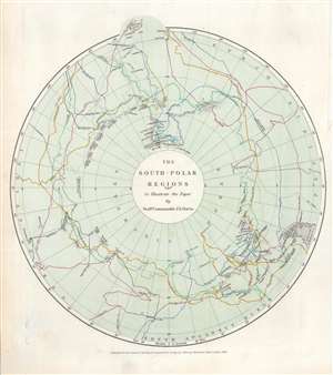
The South Polar Regions to Illustrate the Paper by Staff Commander J.E. Davis.
sold
- Digital Map Information
- Suitable for large format printing
- File Size: 4.23 MB
- File Type: ZIP / TIFF
- ICC color profile embedded
- Delivered instantly via download link
This is an 1869 John Murray map of Antarctic / South Pole explorations between 1773 and 1845. Dashed lines traced in hand color follow the expeditions of Cook, Bellinghausen, Weddel, Biscoe, Kemp, D'Urville, Balleny, Wilkes, Ross, and Moore. Each explorer's course is labeled, many with the month and year, and an arrow illustrating the direction they were traveling. Very little detail on the Antarctic continent itself is present. Islands, points, 'lands' named by or for explorers, and notes concerning the concentrations of sea ice appear throughout. Parts of New Zealand and South America are included and provide some geographical context for the map's audience. (more details)
Corfu, a popular tourist destination for the ultra-wealthy.
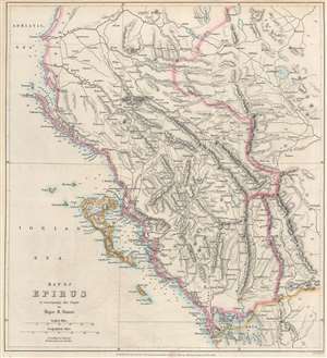
Map of Epirus to accompany the Paper by Major R. Stuart.
sold
- Digital Map Information
- Suitable for large format printing
- File Size: 9.01 MB
- File Type: ZIP / TIFF
- ICC color profile embedded
- Delivered instantly via download link
An important geographical region in antiquity and a popular tourist destination today, this is an 1869 John Murray map of Corfu and Epirus, Greece. Corfu appears in the Ionian Sea just off the coast of Epirus. Cities and towns throughout, including Corfu, the largest city on the island of Corfu, and Ioannina (labeled here as Yanina), the regional capital. (more details)
Early study on manmade climate change.
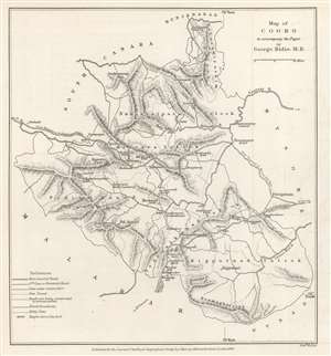
Map of Coorg to accompany the Paper by George Bidie, M.B.
sold
- Digital Map Information
- Suitable for large format printing
- File Size: 2.88 MB
- File Type: ZIP / TIFF
- ICC color profile embedded
- Delivered instantly via download link
This is an 1869 John Murray map of Kodagu (formerly Coorg) District in Karnataka, India. This is one of the earliest maps we are aware of to deal with manmade climate change. Created to accompany a paper published in The Journal of the Royal Geographical Society. The paper's author, George Bidie, described Coorg to his readers:
Coorg lies near the centre of the Western Ghâts, and chiefly in the eastern aspect of the range. On its western margin the crests of the chain rise up in bold peaked mountain masses, some of which attain the height of 5000 feet above the sea, and to the east of these the country consists of a series of low, long-backed hills, with intersecting deep-set valleys, running out towards, and gradually subsiding in, the table-land of Mysore.(more details)
Farthest north...
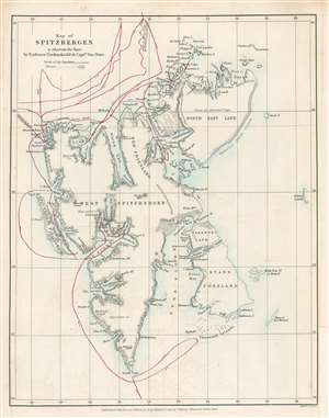
Map of Spitzbergen to illustrate the Paper by Professor Nordenskiöld and Captain Von Otter.
sold
- Digital Map Information
- Suitable for large format printing
- File Size: 3.25 MB
- File Type: ZIP / TIFF
- ICC color profile embedded
- Delivered instantly via download link
This is an 1868 John Murry Map of Spitsbergen in the Svalbard Archipelago, Norway, drawn to illustrate the 1868 Arctic expedition led by Adolf Erik Nordenskiöld and Frederick Wilhelm von Otter. Situated off the northern coast of Norway, Spitsbergen is the only permanently inhabited island in the archipelago. Numerous bays, points, coastal islands, fjords, and other important coastal locations are identified. Red lines trace the expedition's route. Its goals were to study the region's fauna, flora, geography, and geology. Its most notable achievement is that Nordenskiöld and Von Otter reached the highest latitude ever visited by humans in the Eastern Hemisphere up until that time, 81°40' North Latitude. Nordenskiöld and Von Otter both contended that if their ship, the Sofia had not been damaged by ice at that latitude, they would have been able to travel significantly further north, perhaps even to 83°N. (more details)
Follows the founder of the Denver and Rio Grande Railroad.
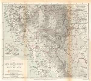
Map of the Southwestern Portion of the United States, and of Sonora and Chihuahua.
sold
- Digital Map Information
- Suitable for large format printing
- File Size: 14.77 MB
- File Type: ZIP / TIFF
- ICC color profile embedded
- Delivered instantly via download link
This is an 1870 Ernst Georg Ravenstein map of the southwestern United States. The map traces William Abraham Bell's travels in the region, including his time with the Kansas Pacific Railroad Survey. A red line illustrates Bell's peregrinations from Kansas west to the Pacific Ocean, his voyage up the Pacific coast to San Francisco, and his overland trek back to Kansas. From Kansas, Bell headed east where he booked passage across the Atlantic to England. After the expedition Bell co-founded the Denver and Rio Grande Railway. (more details)
Farthest extent of European settlement in America before Columbus.
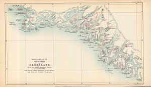
Sketch chart of the south west of Greenland from the Danish Admiralty Survey, corrected to 1873, with Professor Rafn's adaptation of the ancient sites from Ivar Bardsen's chorography.
sold
- Digital Map Information
- Suitable for large format printing
- File Size: 5.16 MB
- File Type: ZIP / TIFF
- ICC color profile embedded
- Delivered instantly via download link
A fascinating 1873 map of the southwest coast of Greenland, lithographed by Edward Weller for the Journal of the Royal Geographical Society, published by John Murray. It accompanied an article by Richard Henry Major, one of the journal's editors, which argued for two instances of pre-Columbian discovery of the Americas, one (later debunked) by the Venetian Zeno Brothers in the 14th century, and one by the Norse settlers of Greenland, later corroborated. (more details)
Highlights the Dead Sea and the Sea of Galilee.
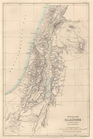
Physical Map of Palestine to accompany the Paper by Major C.W. Wilson R.E.
sold
- Digital Map Information
- Suitable for large format printing
- File Size: 6.77 MB
- File Type: ZIP / TIFF
- ICC color profile embedded
- Delivered instantly via download link
This is an 1873 John Murray map of Palestine, Israel, and the Holy Land highlighting the region's physical features. Depicting from Beirut south to Petra, the region's striking topography becomes immediately apparent. Many peaks are identified, including the Mount of Olives near Jerusalem, and their elevations provided. Both the Dead Sea and the Sea of Galilee are illustrated and labeled. The region's river network is detailed as well. Haifa, Jaffa, Tyre, Bethlehem, Hebron, Jericho, and Gaza are among the identified cities. (more details)
A guide to the historically and archaeologically rich region of Sistan.
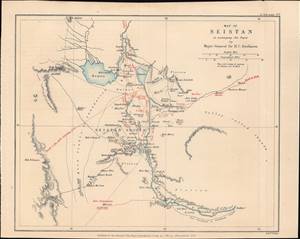
Map of Seistan, to accompany the Paper by Major-General Sir H.C. Rawlison.
sold
- Digital Map Information
- Suitable for large format printing
- File Size: 3.47 MB
- File Type: ZIP / TIFF
- ICC color profile embedded
- Delivered instantly via download link
This is a rare 1873 Weller and H. C. Rawlinson map of Sistan (Seistan), on the border of modern Iran and Afghanistan near Baluchistan, Pakistan. It was prepared to illustrate the British intelligence officer, H. C. Rawlinson's, expedition into the region - a strategic reconnaissance in the Great Game. This region remains to this day little known and is rarely prested cartographically - this possibly being the only 19th-century specific map. (more details)
Pre-Columbian Discovery of America, or an Elaborate Hoax?
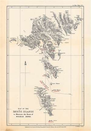
Map of the Færöe Islands, to Illustrate the Route of Nicolo Zeno.
sold
- Digital Map Information
- Suitable for large format printing
- File Size: 10.7 MB
- File Type: ZIP / TIFF
- ICC color profile embedded
- Delivered instantly via download link
This is Edward Weller's map of the Faroe Islands, published in 1873 in the Journal of the Royal Geographical Society, outlining the presumed route of Nicolò Zeno, a Venetian mariner who may have visited the islands in the late 14th century. The potential travels of Nicolò and his brother Antonio, including a possible discovery of the New World a century before Columbus, have been one of the most enduring debates in the history of cartography. (more details)
First scientific survey of Central Madagascar.
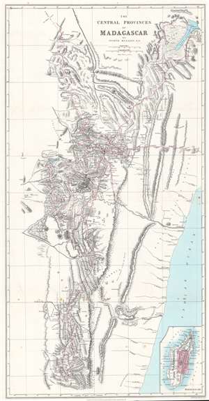
The Central Provinces of Madagascar.
sold
- Digital Map Information
- Suitable for large format printing
- File Size: 21.02 MB
- File Type: ZIP / TIFF
- ICC color profile embedded
- Delivered instantly via download link
This is an 1875 John Mullens map of the central provinces of Madagascar - considered the first scientific survey of the central provinces around Antananarivo, the island's capital. Red lines trace Mullens's peregrinations as an official of the London Missionary Society. He was widely welcomed as a guest and given free rein to collect geographical and cartographic data. Throughout, cites, towns, and villages are identified for the first time on a modern map. Mountains are named and elevations given. An inset in the lower right illustrates this map in the context the entirety of Madagascar. (more details)
One of the first western maps of Xinjiang, China illustrating a British trade mission from India into the region.
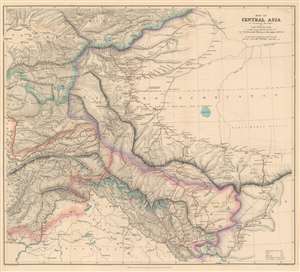
Map of Central Asia to accompany the Paper by Captain H. Trotter R.E., on the Geographical Results of Sir T.D. Forsyth's Mission to Kashgar, 1873 - 74.
sold
- Digital Map Information
- Suitable for large format printing
- File Size: 28.32 MB
- File Type: ZIP / TIFF
- ICC color profile embedded
- Delivered instantly via download link
This is an 1878 William John Turner and Royal Geographical Society map of Xinjiang, China that traces explorations of the Forsyth Mission of 1873 - 1874, making this one of the first detailed Western maps of the region. The map depicts the region from Peshawar, Pakistan to Tibet and from the Tian Shan Mountains to Pangong Lake. British, Russian, Chinese, and Afghan territory are outlined in different colors and are explained in a key situated in the lower right corner. The routes taken by the various different teams that constituted the Forsyth Mission are traced in red. Three different groups set out from Leh, in India, and met back up at Yarkand, in the 'Dominion of Yakoob Khan', and proceeded to Kashgar, where they met Yakub Beg. (more details)
Exploring Kilimanjaro.
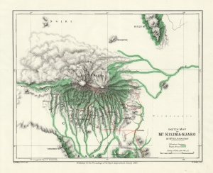
Sketch Map of Mt. Kilima-Njaro.
sold
- Digital Map Information
- Suitable for large format printing
- File Size: 11.4 MB
- File Type: ZIP / TIFF
- ICC color profile embedded
- Delivered instantly via download link
This is an 1884 Henry Johnston map of Mount Kilimanjaro, Tanzania. It is one of the earliest obtainable specific maps of Kilimanjaro. The Johnston expedition was set against the colonial backdrop of conflict between German and British claims in East Africa. (more details)
Exploring Mt. Kilimanjaro.
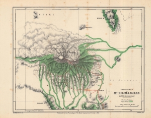
Sketch Map of Mt. Kilima-Njaro.
sold
- Digital Map Information
- Suitable for large format printing
- File Size: 12.08 MB
- File Type: ZIP / TIFF
- ICC color profile embedded
- Delivered instantly via download link
This is an 1884 Henry Johnston map of Mount Kilimanjaro, Tanzania. It is one of the earliest obtainable specific maps of Kilimanjaro. The Johnston expedition was set against the colonial backdrop of conflict between German and British claims in East Africa. (more details)
First successful summit of Kilimanjaro by Hans Meyer.
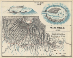
Kilima Njaro Mtn. to illustrate the Paper of Dr. Hans Meyer.
sold
- Digital Map Information
- Suitable for large format printing
- File Size: 16 MB
- File Type: ZIP / TIFF
- ICC color profile embedded
- Delivered instantly via download link
This is an 1890 Hans Meyer map of Mount Kilimanjaro, highlighting his successful summit attempt, making Meyer the first European to successfully summit Kilimanjaro. (more details)
Partition of Africa as it happened.
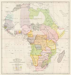
A Map of Africa Showing the Boundaries Settled by International Treaties and Agreements.
sold
- Digital Map Information
- Suitable for large format printing
- File Size: 10.02 MB
- File Type: ZIP / TIFF
- ICC color profile embedded
- Delivered instantly via download link
This is an 1890 Edward Stanford and Royal Geographical Society map of Africa. The map was created as a visual summary of the international treaties and agreements governing the partition of Africa by the European powers. Various colors correspond with different European spheres of influence: British territory is pink, while French territory is purple, etc. Portuguese, Italian, German, and Spanish claims are also delineated. 'Independent' nations supposedly free of European influence / suzerainty are colored black. The Congo Free State, which roughly corresponds with today's Democratic Republic of the Congo, is shaded orange and is not referenced as being claimed by any specific country as it was personally owned by King Leopold II of Belgium. (more details)
Earliest printed specific map of Kurdistan.
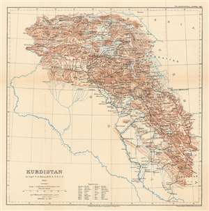
Kurdistan.
sold
- Digital Map Information
- Suitable for large format printing
- File Size: 8.17 MB
- File Type: ZIP / TIFF
- ICC color profile embedded
- Delivered instantly via download link
The earliest printed map specifically of Kurdistan - and a politically charged discovery resonant with modern times. Published in 1894, this map is based upon the firsthand explorations of Captain F. R. Munsell, who visited the region as British spy in the summer of 1892. The map covers what today is a hotly contested and unstable multi-national border region consisting of a mountainous region embracing parts of eastern turkey, Armenia, northern Iraq, northeastern Syria, and northwestern Iran. (more details)
Depicts the newly surveyed border between British and Portuguese Central East Africa.
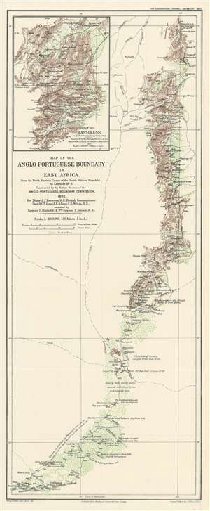
Map of the Anglo Portuguese Boundary in East Africa.
sold
- Digital Map Information
- Suitable for large format printing
- File Size: 7.43 MB
- File Type: ZIP / TIFF
- ICC color profile embedded
- Delivered instantly via download link
This is an 1893 George Philip map of the border between British and Portuguese Central East Africa decided upon in the Anglo-Portuguese Treaty of 1891. Depicting the border as it was surveyed by the Anglo-Portuguese Delimination Commission in 1892, innumerable rivers, mountain peaks, and roads are identified. Green is used to highlight areas of trees and brush, while brown marks the spine of mountains that forms part of the newly designated border. Notes provide commentary on the terrain, water supply, vegetation, and animal life. (more details)
Comprised of six charts on one sheet illustrating rain and snow fall, temperature, river basins, and vegetation in the Arctic Basin.
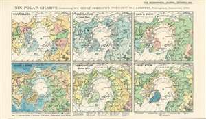
Six Polar Charts illustrating Mr. Henry Seebohm's Presidential Address, Nottingham, September, 1893.
sold
- Digital Map Information
- Suitable for large format printing
- File Size: 8.66 MB
- File Type: ZIP / TIFF
- ICC color profile embedded
- Delivered instantly via download link
This is an 1893 Ernst Georg Ravenstein map of the Arctic consisting of six small maps printed on one sheet created to help illustrate Mr. Henry Seebohm’s address to the Royal Geographical Society. Each map illustrates a different aspect of the Arctic Basin, with a map focusing on river basins, temperature (coldest month), rain and snow, heights and depths, temperature (coldest month), and vegetation. An incredible amount of detail is present on each map. For example, four different colors are used to illustrate variations in precipitation and temperature in three of the maps, while five colors are employed to highlight different vegetation zones. The map detailing heights and depths, which would more traditionally be referred to as a topographic map, very much resembles other maps within that genre. (more details)
Follows the little-studied 1889 Pevtsov Expedition in Central Asia.
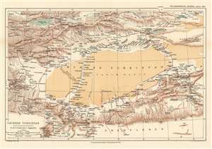
Chinese Turkistan Showing the Surveys and Routes of Col. M.B. Pevtsof and K.I. Bogdanovitch.
sold
- Digital Map Information
- Suitable for large format printing
- File Size: 11.36 MB
- File Type: ZIP / TIFF
- ICC color profile embedded
- Delivered instantly via download link
This is an 1893 Henry Sharbau map of Xijiang Province in China and Kyrgyzstan. The map depicts the movements of the 1889 Imperial Russian Geographical Society expedition to Central Asia led by Mikhail Vasilievich Pevtsov, which are traced by the thick red line. An impressive level of detail is present. Numerous towns and villages are identified, as are rivers and mountain peaks. Issyk Kul, the second largest salt water lake in the world, is situated in the upper left corner. (more details)
A rare map of Southeast Asia that includes the famous route mandarine.
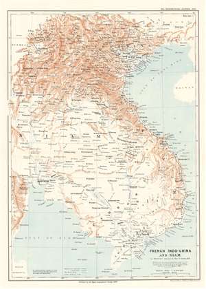
French Indo-China and Siam to illustrate journeys by Hon. G. Curzon, M.P.
sold
- Digital Map Information
- Suitable for large format printing
- File Size: 13.9 MB
- File Type: ZIP / TIFF
- ICC color profile embedded
- Delivered instantly via download link
This is an 1893 William Shawe map of Southeast Asia, encompassing modern-day Vietnam, Cambodia, Laos, and Thailand (Siam). A note in the Geographical Journal states that, while the international boundaries were not included because they had not yet been settled, ‘the topography differs considerably from that shown in maps previously published,’ and continues, ‘The present map also contains a large amount of detail in districts previous left nearly blank’. These details include labeling numerous cities, towns, and villages, and tracing the courses of rivers both large and small. Railroads, both those in operation and those under construction, are also illustrated. The ruins at Angkor are identified as well. (more details)
Murray provides scientific proof of the long believed in southern continent - Antarctica!
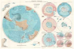
Antarctic Research. Series of Maps Illustrating Dr. John Murray's Address, 1893.
sold
- Digital Map Information
- Suitable for large format printing
- File Size: 30.55 MB
- File Type: ZIP / TIFF
- ICC color profile embedded
- Delivered instantly via download link
This is an 1894 John George Bartholomew map of Antarctica created to accompany Dr. John Murray's address to the Royal Geographical Society (RGS) in 1893. Consisting of one large map of the south polar regions and several smaller ones on one sheet, each map center's on Murray's proposed outline of Antarctica as he believed it existed following his experience as part of the Challenger Expedition. Over the course of his presentation to the RGS, Murray stated that, because of the presence of certain rocks dredged from the ocean floor in the south polar region, he was capable of scientifically confirming the long-hypothesized existence of an Antarctic continent. He even went so far as to state that he believed the continent to be larger than Australia! Each of the maps present on this sheet bears an illustration of Murray's proposed outline of Antarctica. A large portion of the data presented in these maps came directly from the archives of the Challenger Expedition, making a large portion of it new information to the public. (more details)
The first scientifically executed survey of Johor, Malaysia.
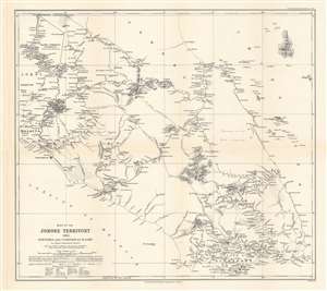
Map of the Johore Territory 1893. Surveyed and Compiled by H. Lake.
sold
- Digital Map Information
- Suitable for large format printing
- File Size: 11.52 MB
- File Type: ZIP / TIFF
- ICC color profile embedded
- Delivered instantly via download link
This is an 1894 Harry Lake map of Johor (Johore), Malaysia. The first scientifically executed survey of the state, the map depicts the region from Malacca and Johol to the South China Sea and Pulau Pemangil and from Pahang to Singapore. Executed over the course of two years, Lake did his utmost to create a detailed survey of the state. Detailed illustrations of the rivers are present and mountains throughout the region are illustrated and labeled with elevations given as well. Supposed courses of rivers are also included, as is the route of a proposed railway. Because of references in the map's title and in Lake's paper, it is known that he was an 'Engineer in Service of the Sultan' but little more is known about him. (more details)
A reduction of the survey by Bjorn Gunnlaugsson - the first scientific survey of Iceland.
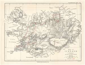
Map of Iceland to illustrate the Paper by Dr. K. Grossmann.
sold
- Digital Map Information
- Suitable for large format printing
- File Size: 5.08 MB
- File Type: ZIP / TIFF
- ICC color profile embedded
- Delivered instantly via download link
This is an 1894 Edward Weller map of Iceland. Created to accompany the paper given by Karl Grossmann to the Royal Geographical Society (RGS), the map depicts the entire island and is a reduction of the ground-breaking survey of Björn Gunnlaugsson. Grossmann's route is traced in red. His justification for presenting what may have appeared as 'a superfluous task' before the RGS was multiple, stating that the abundance of interesting physiographical features in Iceland is 'surprising' and that they 'are not always accessible', which led to a 'very fragmentary' understanding of Iceland. Grossmann also made a point of photographically documenting his journey, one of the first explorers to do so, stating that very few illustrations have ever been produced, with those that are most commonly reproduced in illustrated publications either being 'incorrect' or 'old time-honoured woodcuts, often copied secondhand, and mostly without acknowledgement'. (more details)
Illustrates some of Amundsen's travels in Sichuan and Yunnan Provinces as a Christian missionary.
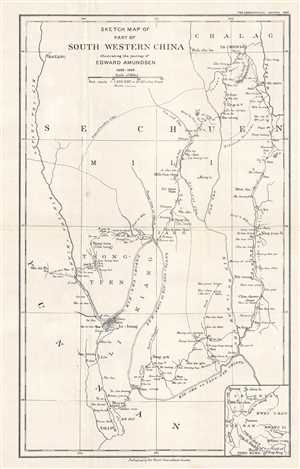
Sketch Map of Part of South Western China illustrating the journey of Edward Amundsen 1898 - 1899.
sold
- Digital Map Information
- Suitable for large format printing
- File Size: 2.37 MB
- File Type: ZIP / TIFF
- ICC color profile embedded
- Delivered instantly via download link
This is a 1900 Edward Amundsen map of the Sichuan and Yunnan Provinces in China. The map depicts the region from Batang and Ta-Chien-Lu to Dali City (Tali Fu). Illustrating Amundsen's excursion through this territory, a dashed line traces his journey from Wei-shi ... (more details)
Illustrates the rail line constructed by the colonial British in modern-day Zimbabwe in the hopes of exporting large quantities of gold.
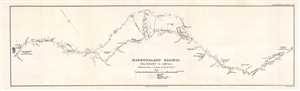
Mashonaland Railway. Salisbury to Umtali.
sold
- Digital Map Information
- Suitable for large format printing
- File Size: 1.89 MB
- File Type: ZIP / TIFF
- ICC color profile embedded
- Delivered instantly via download link
This is a 1900 British South Africa Company map of the railway line between Salisbury (Harare) and Umtali (Mutare) in Rhodesia (Zimbabwe). Printed to accompany a short article in the Geographical Journal published in February 1900, this section of the railway ... (more details)
Illustrates the first thorough survey by a Western explorer of part of Tibet and Xinjian, China.
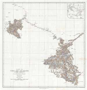
Part of Tibet and Sin-Chiang (Chinese Turkestan) Showing the Surveys of Captain H. H. P. Deasy.
sold
- Digital Map Information
- Suitable for large format printing
- File Size: 7.74 MB
- File Type: ZIP / TIFF
- ICC color profile embedded
- Delivered instantly via download link
This is a 1900 Henry Hugh Peter Deasy map of Tibet and Xinjian (Sin-Chiang), China illustrating Deasy's exploration in the region. The map depicts the region from the Taghdumbash Pamir to the Tolan Khoja River and from Kashgar, China to the Yarkand Valley. ... (more details)
Arthur Donaldson Smith's explorations in East Africa.
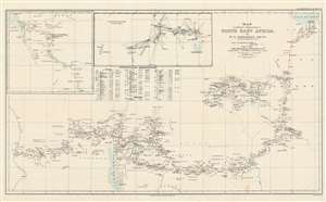
Map to illustrate Explorations in North East Africa.
sold
- Digital Map Information
- Suitable for large format printing
- File Size: 19.99 MB
- File Type: ZIP / TIFF
- ICC color profile embedded
- Delivered instantly via download link
This is a 1900 Arthur Donaldson Smith map of East Africa. The map depicts from the Gulf of Aden south into modern-day Ethiopia and then west across modern-day Kenya and Uganda to the Nile River. Red lines trace Donaldson Smith's two expeditions through the region, with a dotted line following his 1894 - 1895 expedition and a solid line highlighting his route in 1899 - 1900. Locations along both routes are labeled, and Donaldson Smith provides dates when his party arrived at certain places, allowing the viewer to follow both expedition's progress across the continent. An inset map of the 1895 expedition's path south from Lake Rudolf is situated in the upper left corner next to a triangulation survey of most of the territory between Lake Rudolf and the Nile River. A chart of Donaldson Smith's astronomical observations during both expeditions appears below the inset devoted to the triangulation survey. (more details)
Possibly the first printed specific map of the St Kilda archipelago in Scotland.
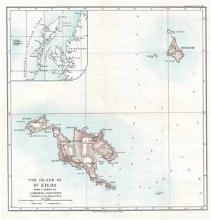
The Island of St. Kilda.
sold
- Digital Map Information
- Suitable for large format printing
- File Size: 3.38 MB
- File Type: ZIP / TIFF
- ICC color profile embedded
- Delivered instantly via download link
This is a 1900 John Norman Heathcote map of the St Kilda archipelago, the outermost islands of the Outer Hebrides of Scotland. The map depicts all four islands, which are Hirta (the largest), Dùn, Soay, and Boreray, along with an inset map in the upper ... (more details)
Created by one of the premier geographers and surveyors in British India.
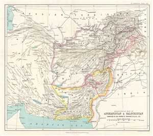
Orographical Map of Afghanistan and Baluchistan.
sold
- Digital Map Information
- Suitable for large format printing
- File Size: 3.7 MB
- File Type: ZIP / TIFF
- ICC color profile embedded
- Delivered instantly via download link
This is a 1900 Sir Thomas Holdich map of Afghanistan and Pakistan. The map depicts the region from Iran (Persia) to India and from the Caspian Sea, Turkmenistan and Tajikistan (Russian Turkistan) to the Arabian Sea. Orographic maps are essentially ... (more details)
Depicts a trek to 'Cleopatra's Emerald Mines' - once exploited by both the Ptolemaic Egyptians and the Romans.
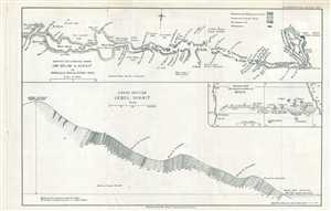
Survey of a Route From Um Selim to Sikait.
sold
- Digital Map Information
- Suitable for large format printing
- File Size: 1.86 MB
- File Type: ZIP / TIFF
- ICC color profile embedded
- Delivered instantly via download link
This is a 1900 Donald A. MacAlister route map from Um Selim to the Sikait District in Egypt. Incredibly detailed, MacAlister notes numerous waypoints in his party's trek from Um Selim to Jebel Sikait along several wâdis. Different rock formations are noted along the trek, including metamorphic and granite formations. A cross section of Jebel Sikait is included below the route map, along with an inset map of the wâdis in the region. (more details)
Illustrates early British expeditions into Tibet - which foreigners were then forbidden to enter.
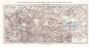
Map of the Mountains on the Northern Border of Kumaon and of the Adjacent Part of Tibet.
sold
- Digital Map Information
- Suitable for large format printing
- File Size: 6.22 MB
- File Type: ZIP / TIFF
- ICC color profile embedded
- Delivered instantly via download link
This is a 1900 Royal Geographical Society map tracing the three surveying expeditions mounted by Sir Henry Strachey, his brother, Sir Richard Strachey, and J. E. Winterbottom, despite the longstanding prohibition on the entry of Europeans into ... (more details)
Kurdistan as mapped by a British diplomat and spy!
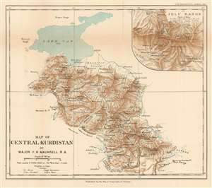
Map of Central Kurdistan.
sold
- Digital Map Information
- Suitable for large format printing
- File Size: 5.69 MB
- File Type: ZIP / TIFF
- ICC color profile embedded
- Delivered instantly via download link
This is a 1901 Francis Richard Maunsell map of central Kurdistan, in what is today the southeastern part of modern-day Turkey. Depicting the region south and east of Lake Van, the area's complex topography is illustrated in detail. Its many streams and two major rivers, the Bohtan and the Great Zab, are identified and mountain peaks are labeled. Inhabited mostly by nomads, the few settlements located here are identified, while the larger city of Van is illustrated along the eastern banks of Lake Van. An inset of the Jelu Range, which makes up the southern portion of the depicted region, is situated in the upper right corner. A glossary of local names used on the map is included below the title along the bottom border. Maunsell was serving in the British Consulate at Van when he created this piece. (more details)
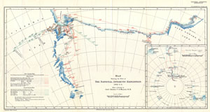
Map Showing the Work of The National Antarctic Expedition. 1902 - 3 - 4.
sold
- Digital Map Information
- Suitable for large format printing
- File Size: 7.67 MB
- File Type: ZIP / TIFF
- ICC color profile embedded
- Delivered instantly via download link
This unusual map details the explorations of the British National Antarctic Expedition. The British National Antarctic Expedition, also known as the Discovery Expedition, (1901 – 1904) was the first official British Exploration of the ... (more details)
The earliest Western city plan of Lhasa.
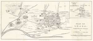
Plan of Lhasa.
sold
- Digital Map Information
- Suitable for large format printing
- Full resolution TIFF file
- ICC color profile embedded
- Delivered instantly via download link
This is a 1904 Laurence Austine Waddell city map or plan of Lhasa, Tibet, created during the 1903 - 1904 British Expedition to Tibet. Likely the earliest detailed plan of the city available outside of Tibet, numerous locations are identified, including bridges, walls, cathedrals, restaurants, and theaters. Markets, including the mule market, the horse market, and the meat market, are noted. Waddell differentiates between Nepalese, Bhutanese, and Chinese shops, and also includes two 'pleasure gardens', and even specifies the Lama's pleasure garden. Another note describes the cemetery as 'infested by dogs.' Ninety locations are numerically identified, but unfortunately, the index has been lost. We have included a screenshot of the index that we located online, but this is not included with the map. An inset map situated in the upper right corner the environs of Lhasa and identifies monasteries, cathedrals, and parade grounds. (more details)
An extremely rare map of the Tian Shan Mountains and the first to accurately locate Khan Tengri.
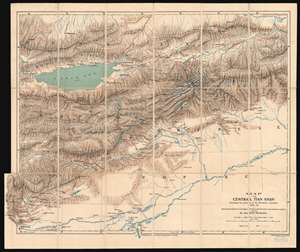
Map of the Central Tian Shan illustrating the journeys of the Merzbacher Expedition 1902 - 03.
sold
- Digital Map Information
- Suitable for large format printing
- File Size: 34.25 MB
- File Type: ZIP / TIFF
- ICC color profile embedded
- Delivered instantly via download link
This is an extremely rare 1905 Dr. Gottfried Merzbacher map of the central Tian Shan Mountains in modern-day western China and Kyrgyzstan. It is the first map to accurately locate Khan Tengri, a nearly 23,000-foot peak known but not mapped. The map depicts the region from Kashgar to the Shakh Yar River, and from the Kunges River to Khol Kol (Khol Lake). Red lines trace the Merzbacher expedition's peregrinations through the region over a period of two years, with their ultimate goal being determining an accurate location for Khan Tengri. Settlements, rivers, and lakes encountered along their routes are labeled, but detail becomes scarcer the farther away from territory physically explored by the expedition. During their two years in the region, Merzbacher and his associates collected a trove of data, most of which is not represented here due to the desire to quickly publish the map to accompany Merzbacher's book. Glaciers, some of which the team explored on foot, while others they simply observed, are illustrated throughout. Khan Tengri, the expedition's stated goal, is illustrated and labeled above and to the right of center and is surrounded by glaciers. Unfortunately, the label on this example is bisected by the linen fold line. Issyk-Kul (Issik Kul), an endorheic lake in eastern Kyrgyzstan that is the second largest saline lake in the world, is also illustrated and labeled. (more details)
A record-setting Antarctic expedition.
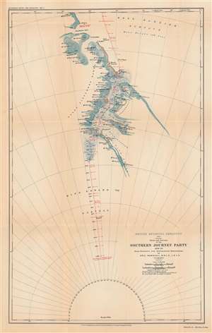
British Antarctic expedition, 1907: route and surveys of the Southern Journey Party, 1908-09.
sold
- Digital Map Information
- Suitable for large format printing
- File Size: 47.2 MB
- File Type: ZIP / TIFF
- ICC color profile embedded
- Delivered instantly via download link
This is a map of the course of the Southern Party of the 1907 - 1909 British Antarctic Expedition, also known as the Nimrod Expedition, after the ship used to reach the Antarctic, or the Shackleton Expedition, named after the expedition's leader, Ernest Shackleton. The Southern Party, led by Shackleton, traveled to a further latitude south than any previous expedition and nearly reached the South Pole before having to turn back to ensure the group's survival. (more details)
The first expedition to reach the South Magnetic Pole.
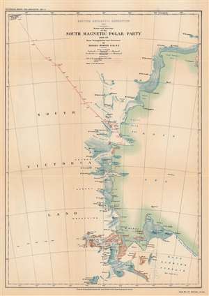
British Antarctic Expedition, 1907 : route and surveys of the South Magnetic Polar Party, 1908-09: from triangulation and traverses.
sold
- Digital Map Information
- Suitable for large format printing
- File Size: 33.12 MB
- File Type: ZIP / TIFF
- ICC color profile embedded
- Delivered instantly via download link
This is a map of the course of the Northern Party of the 1907 - 1909 British Antarctic Expedition, also known as the Nimrod Expedition, after the ship used to reach the Antarctic, or the Shackleton Expedition, named after the expedition's leader, Ernest Shackleton. The Northern Party, led by Edgeworth David, was the first to reach the approximate location of the South Magnetic Pole. (more details)
One of the most successful expeditions of Antarctic exploration.
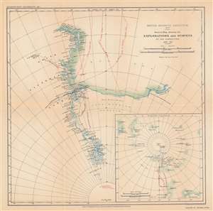
British Antarctic expedition, 1907 : general map showing the explorations and surveys of the expedition, 1907-09.
sold
- Digital Map Information
- Suitable for large format printing
- File Size: 33.24 MB
- File Type: ZIP / TIFF
- ICC color profile embedded
- Delivered instantly via download link
This is a map of the progress of the 1907 - 1909 British Antarctic Expedition, also known as the Nimrod Expedition, after the ship used to reach the Antarctic, or the Shackleton Expedition, named after the expedition's leader, Ernest Shackleton. One of the most notable expeditions of the 'Heroic Age of Antarctic Exploration,' the British Antarctic Expedition reached the furthest latitude south to that point (88° 23' S), within 100 nautical miles of the South Pole. The expedition's members were also the first to climb Mt. Erebus and the first to reach the approximate location of the South Magnetic Pole. (more details)
Details the ethnic tensions that resulted in World War I.
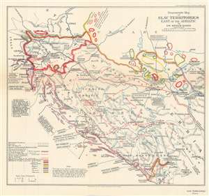
Diagrammatic Map of Slav Territories East of the Adriatic.
sold
- Digital Map Information
- Suitable for large format printing
- File Size: 9.82 MB
- File Type: ZIP / TIFF
- ICC color profile embedded
- Delivered instantly via download link
This is a 1916 Arthur Evans ethnographic map of Yugoslavia. Depicting the region from Italy and the Adriatic Sea to Belgrade and from Graz to Albania, Evans employs color coding to identify areas inhabited by different ethnic groups. He differentiates between Serbo-Croats, Slovenes, Germans, Magyars, Italians, Roumans, and Albanians. Red lettering also marks regions by the dominant religions: Islam, Orthodox, and Roman Catholicism. Ethnic and religious strife had roiled this region since at least the late 19th century and, along with nationalistic desires, directly led to the outbreak of World War I. (more details)
The first scientific mapping of the Rio Negro in Brazil!
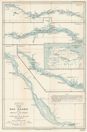
Survey of the Rio Negro from Manáos to São Gabriel.
sold
- Digital Map Information
- Suitable for large format printing
- File Size: 57.04 MB
- File Type: ZIP / TIFF
- ICC color profile embedded
- Delivered instantly via download link
This is a 1918 Alexander Hamilton Rice Jr. map of the Rio Negro in Brazil and is the first scientific map of the Rio Negro - the largest blackwater river in the world. Rice's map divides the river into four sections and depicts from Manaos (Manaus) to Sao Gabriel. A stated goal of Rice's 1917 expedition to the region was to map the river, which despite its immensity and significance, was at the time, almost unknown. Sao Gabriel and Manaos are both labeled, as are numerous villages and other settlements along the river's banks. Numerous islands within the river are illustrated, as are tributaries (all of which are labeled). Latitude and longitude references are provided in many locations, and a short paragraph to the right of center states that the map was 'constructed from compass traverses and distances by log and time, adjusted by astronomical observations taken with a 6-inch micrometer theodolite at the places indicated'. An inset detailing northern South America and situating the four sections of the Rio Negro presented here is situated along the right border. (more details)
The oldest connection between Europe and Asia: the Aleppo - Basra Caravan Route.
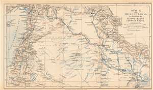
Syria and Mesopotamia to illustrate the Aleppo-Basra Caravan Route.
sold
- Digital Map Information
- Suitable for large format printing
- File Size: 7.57 MB
- File Type: ZIP / TIFF
- ICC color profile embedded
- Delivered instantly via download link
This is a 1918 Royal Geographical Society map of Syria and Mesopotamia, highlighting the ancient caravan route between Aleppo and Basra. Depicting from Cyprus to the Persian Gulf, red dotted lines trace the old caravan routes between Aleppo, Syria, and Baghdad and Basra, Iraq. Aleppo, Baghdad, and Basra are underlined in red to emphasize their importance. Numerous other cities, including Jerusalem, Beirut, Mosul, Gaza, and Damascus, are identified, and the region's rivers, including the Tigris and Euphrates, are illustrated in blue. The Hamrin Mountains, a mountain range in northeastern Iraq, act as the map's eastern boundary. (more details)
Highlights German plans to build railroads in East Africa during World War I.
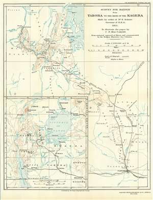
Survey for Railway from Tabora to the Bend of the Kagera. Made by Order of Dr. H. Schnee Governor of G.E.A. 1913. To Illustrate the paper by C. P. MacCarthy.
sold
- Digital Map Information
- Suitable for large format printing
- File Size: 9.57 MB
- File Type: ZIP / TIFF
- ICC color profile embedded
- Delivered instantly via download link
This is a 1918 Royal Geographical Society map of Rwanda and Burundi highlighting German plans for railroad construction in the region before World War I. Tabora, situated in the lower right corner, hosted a station of the Central Railroad of German East Africa. Here, dashed a dashed line marks the projected railway from Tabora through Rwanda and Burundi to the Kagera River. This new line would bring railroads to underserved populations and connect to Lake Victoria through the Kagera. Also, since the Kagera River was a likely invasion route - the Belgians had entered Rwanda via the river in 1916 already - a railway between Tabora and the River would be strategically important. Printed names identify regions and mountain peaks, along with villages, the Usuwi military post, rivers, and gulfs and bays in Lake Victoria. Brown lines present the region's topography and are marked with altitudes. An inset on the lower left details the region from north of Lake Victoria to Lake Tanganyika and includes its rivers, lakes, towns and villages. (more details)
Traces the route of the first Western expedition to Mount Everest - the 1921 British Mount Everest Reconnaissance Expedition.
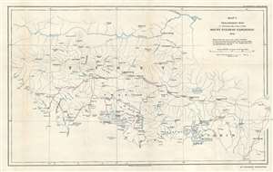
Map 1. Preliminary Map to illustrate the route of the Mount Everest Expedition 1921.
sold
- Digital Map Information
- Suitable for large format printing
- File Size: 3.83 MB
- File Type: ZIP / TIFF
- ICC color profile embedded
- Delivered instantly via download link
This is a 1922 Henry Triese Morshead and Royal Geographical Society map of Tibet and the route followed by the first western expedition to Mount Everest in 1921. Mapping previously uncharted territory, the map depicts the region from Pekhü Tso to Kala Tso and Bam Tso and from the Tsangpo River to Chumbi. Myriad rivers, glaciers, settlements, and passes are labeled. With the goal of discovering a route that would lead to the summit, the expedition team made a thorough reconnaissance of the area. This map is a reduction of a map produced by Morshead and his team that charted over 12,000 square miles of previously unknown terrain, possibly making it the first obtainable map of the Everest region. (more details)
Compiled from photographs and sketches done by the first western expedition to Mount Everest.
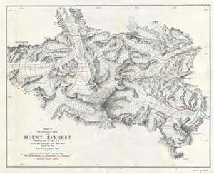
Map II. Preliminary Map of Mount Everest constructed at the R. G. S. from photographs and sketches made by the Expedition of 1921.
sold
- Digital Map Information
- Suitable for large format printing
- File Size: 6.08 MB
- File Type: ZIP / TIFF
- ICC color profile embedded
- Delivered instantly via download link
This is a 1922 Royal Geographical Society map of the vicinity of Mount Everest. The map depicts the region from the West Rongbuk Glacier to Kharta Chu and from Rongbuk Chu to Mount Everest itself. Compiled from photographs and sketches brought back by the members of the 1921 British Mount Everest Expedition, this is the first obtainable detailed map of the immediate vicinity of Mount Everest. Over one dozen individual photographs were consulted by cartographers at the Royal Geographical Society's headquarters in London to compile this map. Locations where these photographs were taken are noted on the map, along with the routes taken to reach these viewpoints. Camps established by the expedition's members are also noted, as are numerous glaciers and mountain peaks, along with the elevation of the summits. (more details)
The Summation of the First European Surveys of Northern Arabia Embracing the History of the Arab Revolt
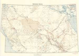
Northern Arabia/ Shakespear's Last Journey. Carruthers. GSGS 2931.
sold
- Digital Map Information
- Suitable for large format printing
- File Size: 46.17 MB
- File Type: ZIP / TIFF
- ICC color profile embedded
- Delivered instantly via download link
This 1922 Royal Geographic Society map of northern Arabia, Jordan, Kuwait and Southern Iraq, capturing the first European surveys of this region, frames the dramatic story of the first efforts on the part of the British government not only to map this previously uncharted part of the world, but also to build alliances in the sweep of the Great War. The map - very probably the work of Douglas Carruthers, but attributed only to the General Staff Geographical Section of the British War Office - has been further overprinted by Carruthers himself to highlight the heroic accomplishments of Captain William Shakespear, the first European to map the north-central part of the Arabian Peninsula and the friend and military advisor to Ibn Saud, the man who would become King of Arabia and founder of the ruling family. (more details)
Summation of the First European Surveys of Northern Arabia Embracing the History of the Arab Revolt.
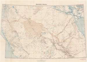
Northern Arabia/ Shakespear's Last Journey. Carruthers. GSGS 2931.
sold
- Digital Map Information
- Suitable for large format printing
- File Size: 51.07 MB
- File Type: ZIP / TIFF
- ICC color profile embedded
- Delivered instantly via download link
This 1922 Royal Geographic Society map of northern Arabia, Jordan, Kuwait and Southern Iraq, capturing the first European surveys of this region, frames the dramatic first British government efforts to map this previously uncharted region and build new alliances before and during World War I (1914 - 1918). The map - very probably the work of Douglas Carruthers but attributed only to the General Staff Geographical Section of the British War Office - has been further overprinted to highlight the heroic accomplishments of Captain William Shakespear, the first European to map the north-central part of the Arabian Peninsula and an advisor to Ibn Saud (1876 - 1953), future King of Saudi Arabia. (more details)
The first detailed mapping of the Okavango Delta, a Natural Wonder of Africa and a UNESCO World Heritage Site.
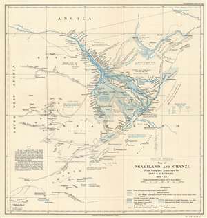
South Africa. Map of Ngamiland and Ghanzi. From Compass Traverses by Capt. A.G. Stigand. 1910 - 1922.
sold
- Digital Map Information
- Suitable for large format printing
- File Size: 8.96 MB
- File Type: ZIP / TIFF
- ICC color profile embedded
- Delivered instantly via download link
Recognized as one of the most significant maps of the region, this is the influential 1923 Almar Gordon Stigand map of Ngamiland or North-West District and Ghanzi, Botswana, including the world-famous Okavango Delta. Created after nearly ten years of surveying, Stigand's map contains more detail than any previously published, including those of the Livingstone era. Even Stigand believed in the importance of his work. In the article published in the Geographical Journal, he stated that
This paper has been written as an adjunct to the writer's sketch-map - the results of numerous journeys by land and water in Ngamiland during the last thirteen years - rather than the map being supplementary to the paper.Regarding the level of detail, villages, islands, rivers, and streams are labeled, all in Sechwana, the native language. Stigand also includes notes concerning landscape, flooding tendencies, and water levels. (more details)
Chronicles a botany expedition through the Tsangpo Gorge and southern Tibet.
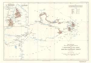
Map showing the Plane-table and Compass Traverse by F. Kingdon Ward and Earl Cawdor in South-Eastern Tibet.
sold
- Digital Map Information
- Suitable for large format printing
- File Size: 7.69 MB
- File Type: ZIP / TIFF
- ICC color profile embedded
- Delivered instantly via download link
This is a 1926 Frank Kingdon-Ward and John Duncan Vaughan Campbell, Earl Cawdor, map of southeastern Tibet tracing their botany expedition of 1924 - 1925. Published in the Geographical Journal, the map depicts the region from Lhasa to Showa, and from Atsa Tso to Tsöna Dzong. (more details)
Created by noted Arctic explorer Knud Rasmussen.
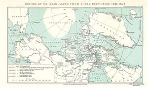
Routes of Dr. Rasmussen's Fifth Thule Expedition 1921 - 1924.
sold
- Digital Map Information
- Suitable for large format printing
- File Size: 4.51 MB
- File Type: ZIP / TIFF
- ICC color profile embedded
- Delivered instantly via download link
This is a 1926 Knud Rasmussen map of the Arctic and the Fifth Thule Expedition. Depicting the region from Siberia to Iceland and from the North Pole to Churchill, Canada, on Hudson Bay, eight routes record separate parts of the expedition. A key in the lower left presents the various patterns employed to differentiate between these lines and specify which explorer's exploits are traced. Individual islands throughout the Arctic Ocean are labeled, along with bays, peninsula, inlets, and other coastal features. Rivers and lakes in Canada are also illustrated. (more details)