
East Indies (sold)
The most important map of the Philippines, in the reduced 'B' variant. Engraved by a Philippine and printed in the Manila.
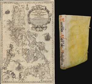
Mapa de Las Yslas Philipinas Hecho Por el Pe. Pedro Murillo Velarde de Compa. de Jesus.
sold
The first edition of Pedro Murillo Velarde's seminal 1749 history of the Philippines, complete with the desirable 1744 Bagay reduction of the 1734 Murillo-Bagay wall map of the Philippines. As a whole, the work is considered one of the most important productions in the history of Philippine printing and a unique Spanish-Philippine collaboration. The map is of particular significance, being the second major map of the Philippines published in the Philippines, engraved by the same hand that engraved the 1734 wall map, but with updates and revisions reflecting 10 years of discovery and development. (more details)
Largest map of the Philippines Printed in the Philippines w/ Distinguished Provenance.
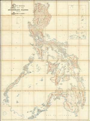
Carta General del Archipiélago Filipino.
sold
- Digital Map Information
- Suitable for large format printing
- File Size: 2002.83 MB
- File Type: ZIP / TIFF
- ICC color profile embedded
- Delivered instantly via download link
This is the only known example of Salvador Chofré's spectacular 1897 map of the Philippines - what must be considered the largest and most detailed Spanish map of the Philippines issued in the 19th century. The map was produced by Salvador Chofré, Manila's first lithographer at the height of his career, likely by government request in the face of the Philippine Revolution (1896 - 1898). The present example is likely a proof, as no other example or publishing history is known. What is known is that this example was acquired by American naval officer Henry Glass in 1898, when he participated in the invasion and surrender of Manila. The U.S. Navy reportedly reproduced it, very likely from this example, at a 50% reduced scale, although we have found no trace of said reproduction. The present map accompanied Glass when he returned to the United States, serving in San Francisco and attaining the rank of Rear Admiral, and was subsequently passed down through his family until we acquired it. (more details)
The VOC's Secret Map of the South China Sea.
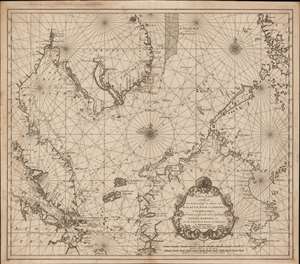
Nieuwe Caart strekkende van Banca, langs de kusten van Malacca, Siam, Cambodia, Cochinchina, als meede een gedeelte van de Eylanden Luçon, Borneo, et c. met alle dresslss Havens, Dieptens en Ankergronden.
sold
- Digital Map Information
- Suitable for large format printing
- DPI: 600
- File Size: 580.26 MB
- File Type: ZIP / TIFF
- ICC color profile embedded
- Delivered instantly via download link
The rare 1753 Johannes II van Keulen / Jan de Marre nautical map of the South China Sea compiled for the sixth volume of the Zee-Fakkel - the legendary Dutch East India Company (VOC - Vereenigde Oostindische Compagnie) 'Secret Atlas.' The map covers the South China Sea and Gulf of Thailand - thus embracing Singapore, Malaya, southern Thailand (Siam), Cambodia, southern Vietnam, most of Borneo, and parts of the Philippines. The map illustrates the most important waters and most dangerous sea passages in the East Indies. It was an essential navigational reference for VOC ships sailing from Malacca, through the Straits of Singapore, or north from Batavia for Siam (Bangkok), Laauwec (Cambodia), Nagasaki, Canton (Guangzhou), Macao, or Manila. (more details)
Malaspina hydrography and Ildefonso de Aragón geography.
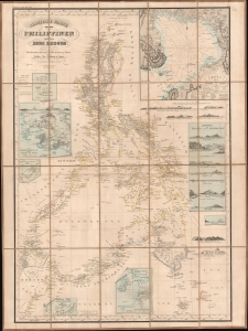
Reduzierte Karte von den Philippinen und den Sulu Inseln.
sold
- Digital Map Information
- Suitable for large format printing
- File Size: 1049.97 MB
- File Type: ZIP / TIFF
- ICC color profile embedded
- Delivered instantly via download link
This is a striking 1832 Heinrich Berghaus map of the Philippines. It was issued for Berghaus' looseleaf Atlas von Asien, the best-informed general cartographic work on Asia to appear in the mid-19th century. It is the first large-scale map to comprehensively incorporate both the Malaspina hydrography and Ildefonso de Aragón seminal geographical surveys. (more details)
A hand drawn manuscript map - most likely the first accurate nautical chart of west Sumatra's Pepper Coast.
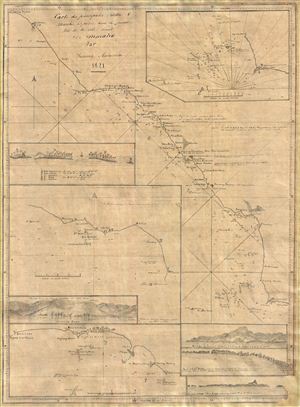
Cartes de principales Rades and Marchés à poivre dans la partie Nord de la Cote Ouest De Sumatra Par Samuel Ashmore.
sold
- Digital Map Information
- Suitable for large format printing
- DPI: 300
- File Size: 10.71 MB
- File Type: ZIP / TIFF
- ICC color profile embedded
- Delivered instantly via download link
Drawn by Australian-Irish sea captain Samuel Ashmore, this important and one of a kind 1821 manuscript (hand drawn) nautical chart or maritime map is the first accurate depiction of the pepper ports of northwestern Sumatra, modern day Aceh. The map covers the ... (more details)

A New Chart of the Straits of Malacca and Sincapore Drawn from the Latest Surveys, with Additions and Improvemetns, by J. W. Norie.
sold
- Digital Map Information
- Suitable for large format printing
- DPI: 300
- File Size: 37.68 MB
- File Type: ZIP / TIFF
- ICC color profile embedded
- Delivered instantly via download link
An extremely scarce 1815 map of the Strait of Malacca and Singapore (Sincapore) by John William Norie. This map covers from Aceh in northwestern Sumatra (Acheen) to Singapore Island and Pulu Bintang. This map first appeared in 1803 when it was issued by ... (more details)
Extraordinary Spanish military map of the Philippines.
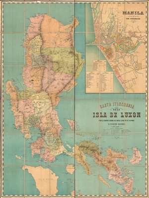
Carta Itineraria de la Isla de Luzon por el Teniente Coronel de E. M. del Ejercity de Filipinas.
sold
- Digital Map Information
- Suitable for large format printing
- Full resolution TIFF file
- ICC color profile embedded
- Delivered instantly via download link
A very rare and important large-scale 6-color chromolithograph 1882 map of Luzon and Manila, the Philippines, by the Spanish military engineer Anselmo Olleros y Mansilla. The map details all of Luzon as well as the surrounding waters. It is color coded by political-military districts (as defined by the Spanish administration) and shows proposed railroads, telegraph stations, existing roads broken down by grade, and more. Topography is illustrated throughout using delicate shading with mountain peaks labeled in red. (more details)
Revealing Dutch Secrets in the East.
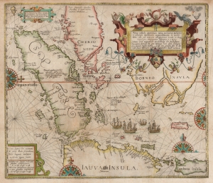
Nova Tabula Insularum Javae, Sumatrae, Borneonis et Aliarum Mallaccam usquae delineate in insula Iava...
sold
- Digital Map Information
- Suitable for large format printing
- DPI: 600
- File Size: 34.83 MB
- File Type: ZIP / TIFF
- ICC color profile embedded
- Delivered instantly via download link
This scarce, beautiful map of the East Indies is Theodore De Bry's 1598 edition of the suppressed work of Cornelis Claesz and Willem Lodewijcksz. The map represents the first Dutch voyage to the Spice Islands and thus the dawn of the Dutch ascendency as a global trade powerhouse. It is also among the earliest printed maps to include Bali. (more details)
Singapore and the disputed Spratly Islands.
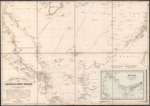
Reduzirte Karte vom Chinesischen Meere; 1stes oder Sudliches Blatt.
sold
- Digital Map Information
- Suitable for large format printing
- Full resolution TIFF file
- ICC color profile embedded
- Delivered instantly via download link
This is a striking 1835 Heinrich Burghaus nautical map of the South China Sea, Malay Archipelago, Singapore, and the Gulf of Siam. Significantly, it is among the finest mappings of the now disputed Spratly Archipelago. It was issued for Berghaus' looseleaf Atlas von Asien, the best informed general cartographic work on Asia to appear in the mid-19th century. (more details)
Sumatra during the pepper trade.
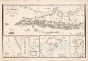
Karte von der Insel Sumatra.
sold
- Digital Map Information
- Suitable for large format printing
- DPI: 600
- File Size: 97.9 MB
- File Type: ZIP / TIFF
- ICC color profile embedded
- Delivered instantly via download link
This is a striking 1837 Heinrich Berghaus map of Sumatra with important insets of Singapore and the Maldives. It was issued for Berghaus' looseleaf Atlas von Asien, the best informed general cartographic work on Asia to appear in the mid-19th century. (more details)
First map of a Philippine Province - printed in Manila!
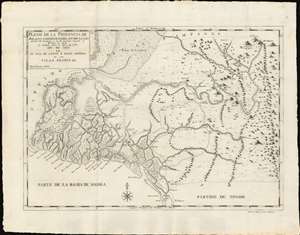
Plano de la Prouincia de Bulacan Comprehendida Entra La Lon gitud de 18' Occidental à los 14' Oriental Respecto al Meridiano de Manila Su Latiud Norte de 14° y 42' à 15° Año de 1818 en La Ysla de Luzon ò Nueua Castilla de la Yslas Filipinas.
sold
- Digital Map Information
- Suitable for large format printing
- DPI: 600
- File Size: 459.07 MB
- File Type: ZIP / TIFF
- ICC color profile embedded
- Delivered instantly via download link
An outstanding example of the 1818 Deposito Topografico / Ildefonso de Aragón map of the province of Bulacan, Philippines, accompanied by the 21-page text Provicia de Bulacan. This is the first specific map of a Philippine province, compiled as part of Ildefonso, and the Deposito's flagship effort to bring structured modern survey techniques to the archipelago. (more details)
First map of a Philippine Province - printed in Manila!
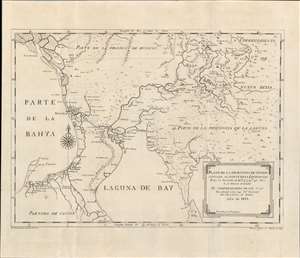
Plano de la Prouincia de Tondo situada al Norte de la Equinocial.
sold
- Digital Map Information
- Suitable for large format printing
- DPI: 600
- File Size: 14.89 MB
- File Type: ZIP / TIFF
- ICC color profile embedded
- Delivered instantly via download link
An outstanding example of the 1819 Deposito Topografico / Ildefonso de Aragón map of the province of Tondo, Philippines, accompanied by the 56-page text ' Provicia de Tondo. This is the first specific map of a Philippine province, compiled as part of Ildefonso, and the Deposito's flagship effort to bring structured modern survey techniques to the archipelago. (more details)
A hand drawn manuscript map - most likely the first accurate nautical chart of west Sumatra's Pepper Coast.
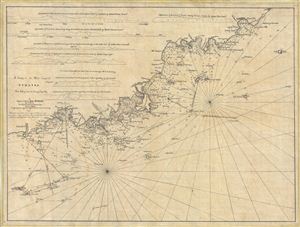
A Survey of the West Coast of Sumatra From Padang head to batang Capay Bay.
sold
- Digital Map Information
- Suitable for large format printing
- DPI: 300
- File Size: 13.45 MB
- File Type: ZIP / TIFF
- ICC color profile embedded
- Delivered instantly via download link
A remarkable discovery, this is a c. 1820 manuscript map of the western coasts of Sumatra (Indonesia) around the city of Pedang by Scottish sea captain John MacDonald. The map covers the west central Sumatra coastline from, roughly, Pedang (regional ... (more details)
Extremely scarce nautical chart of Singapore and Malacca - the most desirable of Horsburgh's influential nautical charts.

To the Honourable The Court of Directors of the United East India Company This Chart of Malacca Strait Singapore Strait and the Southernmost Promontory of Asia Is Inscribed by Their Faithful and Obedient Servant James Horsburgh.
sold
- Digital Map Information
- Suitable for large format printing
- DPI: 300
- File Size: 31.46 MB
- File Type: ZIP / TIFF
- ICC color profile embedded
- Delivered instantly via download link
An extremely scarce 1844 James Horsburgh nautical chart of southern Malaysia, Singapore, and the straits of Malacca and ... (more details)
First European map specifically of China to appear in a modern atlas.
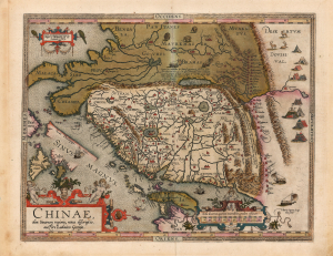
Chinae, olim Sinarum regionis, nova descriptio. auctore Ludovico Georgio.
sold
- Digital Map Information
- Suitable for large format printing
- Full resolution TIFF file
- ICC color profile embedded
- Delivered instantly via download link
This is Abraham Ortelius' 1584 map of China, the first specific map of China to appear in an atlas, here in a beautiful, original-color example of a 1602 Vrients edition. Based on reports of Portuguese missionaries, Ortelius' map was not substantially improved upon until the 1655 maps of Martino Martini (卫匡国; 1614 - 1661). The map is visually unique, with its western orientation and abundant decorative elements. (more details)
Remarkable early French map of Singapore representing the forefront of scientific mapping of the region I the 1840s.
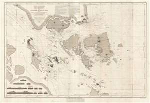
Carte Particulière des Détroits de Singapore, Durian et Rhio.
sold
- Digital Map Information
- Suitable for large format printing
- DPI: 300
- File Size: 22 MB
- File Type: ZIP / TIFF
- ICC color profile embedded
- Delivered instantly via download link
An exceptionally rare nautical chart of Singapore and vicinity issued by Urban Dortet de Tessan, under the patronage of ... (more details)
One of the earliest and most important nautical charts showing Singapore Island.
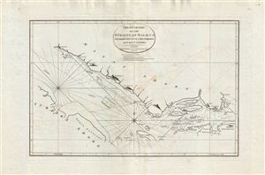
The South Part of the Straits of Malacca inscribed to Captn. G. G. Richardson, by Captn. J. Lindsey.
sold
- Digital Map Information
- Suitable for large format printing
- DPI: 300
- File Size: 27.17 MB
- File Type: ZIP / TIFF
- ICC color profile embedded
- Delivered instantly via download link
An exceptionally scarce and important 1798 nautical map of the Malacca and Singapore Straits by the English maritime ... (more details)
Horsburgh chart of Singapore as the epicenter of British Power in east Asia.
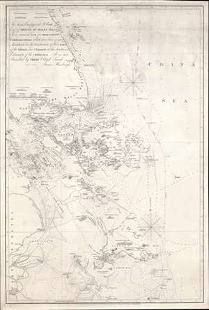
To James Carnegy and R. Scott Esqrs. of Prince of Wales Island As a Tribute due for their valuable Communications which have been of great Assistance in the construction of this chart of the Islands and Channels at the Southwest Extremity of the China Sea. It is not Inscribed by their Obliged Friend James Horsburgh.
sold
- Digital Map Information
- Suitable for large format printing
- DPI: 600
- File Size: 1154.6 MB
- File Type: ZIP / TIFF
- ICC color profile embedded
- Delivered instantly via download link
The rare 1850 final edition of the James Horsburgh nautical map of Singapore and the surrounding waters when it was the epicenter of British power in the East Indies. The chart covers the southern extreme of the Malay Peninsula, including all of Singapore Island and Singapore Strait, as well as adjacent islands and parts of eastern Sumatra. It was Horsburgh's first chart of the dangerous waters surrounding the Strait of Singapore and was the definitive mapping of these seas for nearly 30 years. (more details)
The most detailed complete map of Singapore Island to appear in the 1950s.
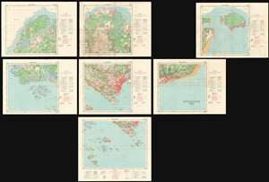
Singapore 1958.
sold
- Digital Map Information
- Suitable for large format printing
- Full resolution TIFF file
- ICC color profile embedded
- Delivered instantly via download link
An extremely important and scarce set of Singapore Maps issued in 1958 under the Surveyor General Malaya. This map set was created during the 1955 - 1958 period of partial internal self-governance and compilated in the year Singapore attained full internal self-governance. The maps cover all of Singapore island as well adjacent islands, and include two supplementary maps, one focusing on Keppel Harbor, and the other extending the coverage eastward to Pulau Tekong. The detail throughout is astounding, with individual buildings, alleyways, roads, and more identified. A key shows the locations of temples (noting religious affiliation), hospitals, schools, government offices, dispensaries, community centers, and fire stations, and other constructions. The map also notes topography, geographical features, the extent of natural and cultivated vegetation, maritime details. (more details)
Rare China Trade Charles Wilson nautical chart illustrating the East India Islands.
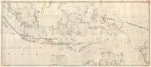
The Lower Part of the China Sea.
sold
- Digital Map Information
- Suitable for large format printing
- File Size: 60.47 MB
- File Type: ZIP / TIFF
- ICC color profile embedded
- Delivered instantly via download link
An extremely rare large format 1856 Charles Wilson nautical chart or maritime map covering most of the East Indies ... (more details)
First European map specifically of China to appear in a modern atlas.
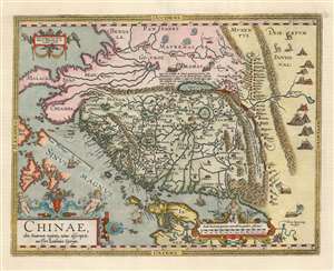
Chinae, olim Sinarum regionis, nova descriptio. auctore Ludovico Georgio.
sold
- Digital Map Information
- Suitable for large format printing
- Full resolution TIFF file
- ICC color profile embedded
- Delivered instantly via download link
This is Abraham Ortelius' 1584 map of China, the first specific map of China to appear in an atlas. Based ultimately on reports of Portuguese missionaries, it would not be substantially improved upon until Martino Martini's (卫匡国; 1614-1661) 1655 maps. The map is visually very distinctive, with its western orientation and abundant decorative elements. (more details)
The earliest functional chart of the Maldives.
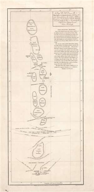
To Capt. W.F.W. Owen R.N. this chart of the Maldiva Islands, exhibiting the safe channels between the southern attollons.
sold
- Digital Map Information
- Suitable for large format printing
- DPI: 600
- File Size: 8.24 MB
- File Type: ZIP / TIFF
- ICC color profile embedded
- Delivered instantly via download link
This is a rare 1814 James Horsburgh nautical map of the central part of the Maldives or Maldivian Archipelago around Malé. Although seemingly simplistic, Horsburgh's chart marks a major advance in Europeans' geographical and hydrological knowledge of the archipelago. The dangerous, near impassible reefs, had long served as the archipelago's most effective and only line of defense against foreign imperialistic interests. This chart partially opened the islands to foreign navigation and marked the beginning of a long period of European influence. This Horsburgh chart served as the definitive mapping of the Maldives until the Robert Moresby surveys of 1834 - 1836. (more details)
First complete survey of the Maldives.
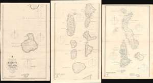
Trigonometrical Survey of the Maldive Islands.
sold
- Digital Map Information
- Suitable for large format printing
- Full resolution TIFF file
- ICC color profile embedded
- Delivered instantly via download link
The largest and most important 1904 chart of the Maldives, compiled by Indian Navy Commander Robert Moresby and Frederick Thomas Powell. The map consists of three joinable panels embracing the Maldive Islands in full, rich with soundings, details about available water supply, tide notes, and a wealth of other practical data for the mariner. This map, the result of meticulous hydrographic work in the mid-19th century, opened the Maldives to steam navigation and was essential to establishing viable steam navigation routes between the Red Sea and the East Indies. It remained the definitive mapping of the Maldives until the 1900s, when it was at last superseded by satellite hydrography. This map also reveals the extent to which the Maldives are at risk form sea-level rise and Global Warming, which is predicted to make the archipelago unhabitable by 2050. (more details)
Separate issue map illustrating the ramifications of the American Revolutionary War in the East Indies.
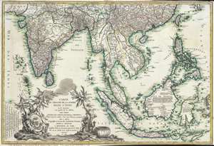
Carte du Theatre De La Guerre Dans L'inde ou se Trouvent Une Partie de La Chine, Les Iles De Sumatra, Java, Borneo, Moluques et Philippines. Dressee d'apres les Meilleures Cartes tant Francaises qu'Anglaises.
sold
- Digital Map Information
- Suitable for large format printing
- Full resolution TIFF file
- ICC color profile embedded
- Delivered instantly via download link
A rare and important 1781 separately issued map of the East Indies by Andre Basset. This map was issued to ... (more details)
Extremely scarce early nautical chart of the East Indies and Singapore.
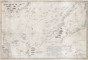
China Sea Sheet 1. To Capt. D. Ross and His Assistants Lieut. P. Maugham, J. Crawford, and J. Houghton, of the Bombay Marine; Who under the auspices of the Honble East India Company, having performed with Arduous Zeal a difficult and dangerous Exploration of the China Sea, so Essential to the safety of Navigation, This Chart Although with an extension of Limits being Chiefly Construction from Their Valuable Surveys, is now Inscribed as a Tribute due to Those Laudable Exertions By their Sincerely Obliged Friend, James Horsburgh.
sold
- Digital Map Information
- Suitable for large format printing
- DPI: 300
- File Size: 41.26 MB
- File Type: ZIP / TIFF
- ICC color profile embedded
- Delivered instantly via download link
An extremely scarce 1842 James Horsburgh nautical chart of parts of the east Indies and Southeast Asia, ... (more details)
The first major resurvey of the Singapore Straits since the 1840s.
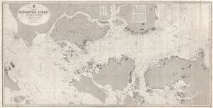
China Sea Singapore Strait.
sold
- Digital Map Information
- Suitable for large format printing
- File Size: 67.1 MB
- File Type: ZIP / TIFF
- ICC color profile embedded
- Delivered instantly via download link
A rare 1870 British Admiralty nautical chart or maritime map of the Singapore Strait. Centered ... (more details)
The American Revolutionary War - in SE Asia!
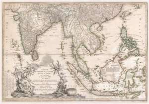
Carte du Theatre De La Guerre Dans L'inde ou se Trouvent Une Partie de La Chine, Les Iles De Sumatra, Java, Borneo, Moluques et Philippines. Dressee d'apres les Meilleures Cartes tant Francaises qu'Anglaises.
sold
- Digital Map Information
- Suitable for large format printing
- Full resolution TIFF file
- ICC color profile embedded
- Delivered instantly via download link
A rare and important 1781 separately issued map of the East Indies by Andre Basset. This map was issued to illustrate a series of conflicts in India and East Indies associated with the American Revolutionary War (1775 - 1783), including the Anglo-French War (1778 - 1783), Fourth Anglo-Dutch War (1780 - 1784), and the Second Anglo-Mysore War (1780 - 1784). The theater of war described is a vast expanse of East Asian territory centered on the Malay Peninsula, but extending from the Maldives to the Philippines and from China to Java, including all of the East Indies, the Indian Subcontinent, the Philippines, and Southeast Asia. (more details)
One of the earliest views of Singapore!
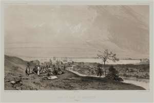
Rade et Ville de Sincapour. (Malaisie).
sold
- Digital Map Information
- Suitable for large format printing
- Full resolution TIFF file
- ICC color profile embedded
- Delivered instantly via download link
One of the earliest obtainable views of Singapore, this is Eugène Cicéri's 1846 view of Singapore drawn from original sketches and maps compiled during Dumont d'Urville's (1790 - 1842) circumnavigation of the globe. The source sketches were created when d'Urville's ships, Astrolabe and Zellee, were at Singapore between June 27 and July 2, 1839. (more details)
The Source of Dutch Wealth Revealed.
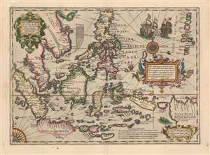
Insulae Indiae Orientalis Praecipuae, In quibus Moluccae celeberrime sunt.
sold
- Digital Map Information
- Suitable for large format printing
- DPI: 600
- File Size: 49.93 MB
- File Type: ZIP / TIFF
- ICC color profile embedded
- Delivered instantly via download link
This is a beautiful, original color example of Jodocus Hondius' 1606 map of the East Indies and Spice Islands, reflecting state of the art cartography for the early years of Dutch influence there. It also includes details of English exploration, specifically Francis Drake's passage and landfalls during his circumnavigation. (more details)
Singapore's Chinatown.
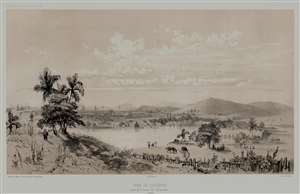
Rade de Sincapour Prise de la maison du Gouverneur. (Malaisie).
sold
- Digital Map Information
- Suitable for large format printing
- Full resolution TIFF file
- ICC color profile embedded
- Delivered instantly via download link
One of the earliest obtainable views of Singapore, this is Eugène Cicéri's 1846 view of Singapore drawn from original sketches and maps compiled during Jules Sébastien César Dumont d'Urville's (1790 - 1842) circumnavigation of the globe. The source sketches were created when d'Urville's ships, Astrolabe and Zélée, were at Singapore between June 27 and July 2, 1839. (more details)
First published plan of Singapore.
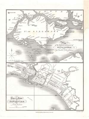
Plan of the Town of Singapore by Lieut. Jackson. / Plan of the British Settlement of Singapore by Capt. Franklin and Lieut. Jackson.
sold
- Digital Map Information
- Suitable for large format printing
- DPI: 600
- File Size: 9.23 MB
- File Type: ZIP / TIFF
- ICC color profile embedded
- Delivered instantly via download link
Known as the Jackson Plan or Raffles Plan, this is the first published map of Singapore. Published in 1828, the map was drawn by Lieutenant Philip Jackson at the request of the founder of modern Singapore, Sir Stamford Raffles (1781 - 1826). It is divided into two sections, a map of the island of Singapore at top, and a close-up plan of the town of Singapore at bottom, oriented towards the west. The city plan presents an idealized version of Singapore following the Raffles vision and, while not fully implemented, was influential in the early development of the colony. (more details)
'The Fifth Part of the World'.
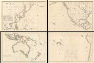
Océanie ou Cinquième Partie du Monde Comprenant L'Archipel d'Asie, L'Australasie et la Polynésie (ou le Continent de la Nouvelle-Hollande et les Îles du Grand Ocean.) en outre Une Grande Partie de L'Amérique et des Còtes de L'Asie.
sold
- Digital Map Information
- Suitable for large format printing
- Full resolution TIFF file
- ICC color profile embedded
- Delivered instantly via download link
A striking large scale 1814 map of the Pacific by Adrian-Hubert Brué. This is one of the earliest general maps of the Pacific to be offered commercially - partially responsible for introducing the vastness of Oceania to the general European public. It is moreover the first map to coin the term Océanie for the Pacific Islands - previously it was known as Océanique. (more details)