
Africa
African-American Creoles in Britain's Atlantic Empire.
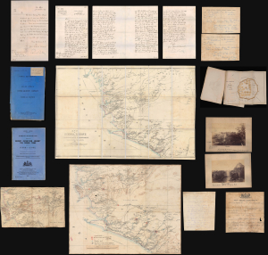
A remarkable find, this is an archive of maps, intelligence documents, and correspondence produced by the British War Office and Sir Francis de Winton relating to the 1887 Yoni Expedition in Sierra Leone, which de Winton led. This war had profound implications for the futures of freed African-American slaves settling in Freetown. The British launched this punitive military campaign against the Yoni to protect allied tribes in Sierra Leone's interior. Though a minor colonial conflict, the Yoni Expedition had wider significance as part of the 'Scramble for Africa'. Moreover, it included the British 1st West India Regiment, composed of descendants of enslaved people from Britain's North American colonies, including those who had joined the British during the American Revolution. (more details)
Roman-Era Egypt, as drafted by a Native Son.
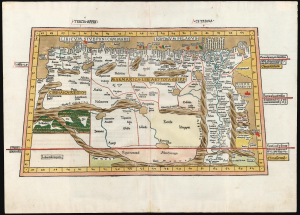
Tercia Affrice Tabula.
$11,000.00
Acquire
- Digital Map Information
- Suitable for large format printing
- Full resolution TIFF file
- ICC color profile embedded
- Delivered instantly via download link
This is a superb example, in rich original color, of one of the earliest printed maps of any part of Africa - this one focusing on the region of Libya and Egypt extending to the Red Sea, according to the second-century knowledge of Claudius Ptolemy. It appeared in the Ulm Ptolemy, the first such work printed north of the Alps, in 1482 and 1486. It is the first map of the region by someone who lived there. (more details)
Most unique atlas map of Africa to appear in the 16th century.
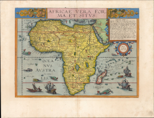
Africae Vera Forma, et Situs.
$11,000.00
Acquire
- Digital Map Information
- Suitable for large format printing
- Full resolution TIFF file
- ICC color profile embedded
- Delivered instantly via download link
This is Cornelis De Jode's superb, rare map of Africa, printed in a single edition of 1593. It is the most unique atlas map of Africa to appear in the 16th century, being the only such based on Petrus Plancius' 1592 wall map of the world. (more details)
Gold Rush Promotional Map of Johannesburg.
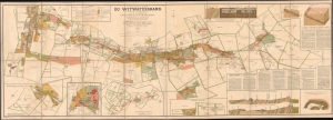
Carte du District Aurifère du Witwatersrand. Transvaal - Afrique du Sud. A'après le cadastre officiel du gouvernement.
$5,500.00
Acquire
- Digital Map Information
- Suitable for large format printing
- Full resolution TIFF file
- ICC color profile embedded
- Delivered instantly via download link
A rare and stunning 1895 large-format folding cadastral map of gold claims during the Witwatersrand Gold Rush, prepared by the appropriately-names Charles Sydney Goldman, printed by Langonnet et Langlet, and published by Henry Dupont. It demonstrates the evolution of mining methods and the rapid growth of Johannesburg and surrounding towns with the influx of miners. (more details)
Earliest Official Map of the Suez Canal.
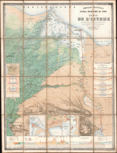
Compagnie Universelle du Canal Maritime de Suez Carte de l'Isthme.
$5,000.00
Acquire
- Digital Map Information
- Suitable for large format printing
- Full resolution TIFF file
- ICC color profile embedded
- Delivered instantly via download link
This is a 1866 large-format chromolithographic folding map issued by the Compagnie universelle du canal maritime de Suez, under the direction of its chief engineer, François-Philippe Voisin. Published in 1866, three years before the canal's completion, this rare first edition of the official canal map is among the most visually compelling and technically detailed maps ever made of the project. During World War I (1914 - 1918), the Imperial German Army deemed it so accurate and useful that it issued a faithful pirated edition for commanders planning an assault on the canal. (more details)
Earliest Acquirable Map showing the True Source of the Blue Nile.
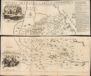
Imperii Abassini tabula geographica ex sculatis relationibus patrum soc. Jesu aliorumque inter se comparatis and ad trutinam regulae geographicae examinatis rejectis iis quae concordi eorumdem historiae que mater est geographiae repugnabant
$5,000.00
Acquire
- Digital Map Information
- Suitable for large format printing
- Full resolution TIFF file
- ICC color profile embedded
- Delivered instantly via download link
This is Francesco Eschinardi's rare 1674 map of Abyssinia (Ethiopia) in Eastern Africa. It is the first detailed map focusing on the headwaters of the Blue Nile, informing regional cartography for a century. It is also the largest map to focus on this region for at least a century, being printed to four separate sheets, joined in upper and lower pairs. Its geographic detail is supplemented with pictorial mountains, depictions of the region's notable animals, settlements, ruins, and scenes of the martyrdom of Jesuit missionaries at the hands of both Abyssinian Christian 'heretics' and their Ottoman overlords. The map includes two inset views: one of the church complex of the Tadbaba Maryam and a bird's-eye view of the source of the Nile. (more details)
Classic Dutch Gold Age Map Africa: Old Color highlighted with Gold!
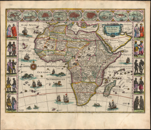
Africae nova descriptio. Auct: Guiljelmo Blaeuw.
$5,000.00
Acquire
- Digital Map Information
- Suitable for large format printing
- Full resolution TIFF file
- ICC color profile embedded
- Delivered instantly via download link
This is a superb, original-color, second-state example of Willem Blaeu's 1630 carte à figure atlas map of Africa, in its 1640 Latin-text atlas edition. It is one of the most desirable maps of the Dutch Golden Age. Norwich hailed it rightly as 'one of the most decorative and popular of all the early maps of Africa.' (more details)
Superb Original Color.
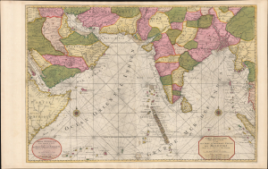
Carte Particuliere d'une Partie d'Asie ou sont Les Isles D'Andemaon, Ceylan, Les Maldives.../ Partie Occidentale d'une D'Asie ou sont les Isles De Zocotora De l'Amirante...
$4,000.00
Acquire
- Digital Map Information
- Suitable for large format printing
- Full resolution TIFF file
- ICC color profile embedded
- Delivered instantly via download link
This is a premium full-original-color example of Pierre Mortier's 1700 nautical chart and map of the Indian Ocean and the adjacent parts of eastern Africa, Arabia, Persia, India, and the Malay Peninsula. Countless islands are mapped, including the Maldives, Sri Lanka, and Sumatra. (more details)
Last surviving of the Seven Wonders of the Ancient World.
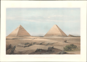
Pyramids of Geezeh.
$4,000.00
Acquire
- Digital Map Information
- Suitable for large format printing
- File Size: 17.81 MB
- File Type: ZIP / TIFF
- ICC color profile embedded
- Delivered instantly via download link
A scarce 1848 David Roberts' dramatic hand-tinted lithographic view of the Great Pyramids of Giza, Egypt - considered one of his most influential and iconic images. Roberts' work was influential in driving the Orientalism movement in 19th-century Europe. (more details)
Enigmatic Lafreri Map of Madagascar.
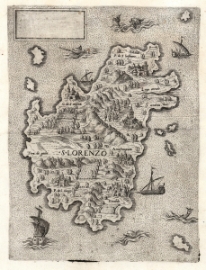
S. Lorenzo.
$4,000.00
Acquire
- Digital Map Information
- Suitable for large format printing
- File Size: 13.67 MB
- File Type: ZIP / TIFF
- ICC color profile embedded
- Delivered instantly via download link
This is a beautifully engraved and evocative 1570 map of Madagascar (San Lorenzo) attributed to Antonio Lafreri. The map is enigmatic, presenting an alternative view of Madagascar at odds with the established cartographic canon. The blank cartouche, moreover, suggests incompleteness or possibly a proof, though admittedly no later states are known. The existence of this map underscores the significance of Madagascar as a stop on voyages to Asia - it is one of the few regional Lafreri maps depicting a location other than Europe. (more details)
Earliest Detailed Chart of the Cape Verde Islands, Senegal, and the lower Gambia River.
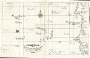
Carta particolare della Barberia Australe che comincia con il capo Matas è Finiscie con il C. Himilas con l'Isole di capo Verde.
$3,000.00
Acquire
- Digital Map Information
- Suitable for large format printing
- Full resolution TIFF file
- ICC color profile embedded
- Delivered instantly via download link
This is a superb example of Robert Dudley's rare 1647 nautical chart or map of the coast of Africa, focusing on the Cape Verde Islands and the mainland from the Western Sahara to the northern part of Guinea. It is both beautifully engraved and an important, early work. It is the earliest accurate printed chart of the Cabo Verde Islands and the coastlines of Senegal, The Gambia, and Guinea. (more details)
Rare, French-printed Edition.
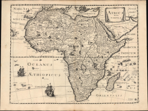
Africae nova Tabula.
$3,000.00
Acquire
- Digital Map Information
- Suitable for large format printing
- File Size: 18.78 MB
- File Type: ZIP / TIFF
- ICC color profile embedded
- Delivered instantly via download link
This is Peter Mariette's 1650 map of Africa, published in his Theatre Géographique de France. The present example is a rare French edition that does not appear in OCLC and has appeared only twice on the market since 2008. (more details)
The Most Beautiful 17th Century English Map of Africa, in a. beautiful old color example.
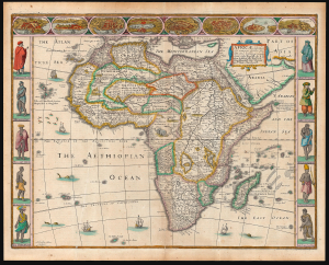
Africae described, the manners of their Habits, and buildings newly done into English by I. S. Are to be sold by Tho Basset in Fleet Street, and Ric Chiswell in St. Pauls Churchyard.
$3,000.00
Acquire
- Digital Map Information
- Suitable for large format printing
- Full resolution TIFF file
- ICC color profile embedded
- Delivered instantly via download link
This is John Speed's 1626 map of Africa, the first English map of the continent, in a beautifully colored 1676 edition. This beautiful map is one of the most desirable early maps of Africa, combining superb engraving, attractive Dutch styling, and entertaining and abundant English text. Moreover, the present example sports old color of unusually high quality. (more details)
The Route to the East Indies.
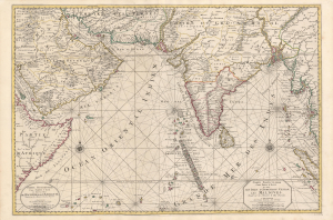
Carte Particuliere d'une Partie d'Asie ou sont Les Isles D'Andemaon, Ceylan, Les Maldives.../ Partie Occidentale d'une D'Asie ou sont les Isles De Zocotora De l'Amirante...
$2,800.00
Acquire
- Digital Map Information
- Suitable for large format printing
- DPI: 600
- File Size: 116.25 MB
- File Type: ZIP / TIFF
- ICC color profile embedded
- Delivered instantly via download link
This is a superb, original-color example of Pierre Mortier's 1700 chart and map of the Indian Ocean. This grand, two-sheet engraving also maps the surrounding lands of eastern Africa, Arabia, Persia, India, and the Malay Peninsula. Countless islands are mapped, including the Maldives, Sri Lanka, and Sumatra. As indicated by the presence of two separate cartouches, the two sheets could also be had as separate works; however, in Mortier's mammoth Neptune François they were frequently bound joined, as here. (more details)
Desirable Edition of the Earliest Printed Map of the African Continent.
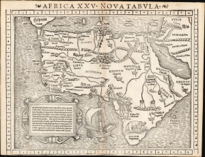
Africa XXV Nova Tabula.
$2,750.00
Acquire
- Digital Map Information
- Suitable for large format printing
- Full resolution TIFF file
- ICC color profile embedded
- Delivered instantly via download link
This is Sebastian Münster's 1540 map of Africa, the earliest detailed map of the continent available to the collector, here in the distinctive 1552 state appearing in the last edition of Münster's Ptolemy. This attractive and evocative map was broadly influential. For more than 30 years during the age of discovery, this map would be the predominant representation of Africa available to the European reader. Moreover, it is one of the last issues of this map printed during the author's lifetime. (more details)
The Foundation for British Rule in East Africa.
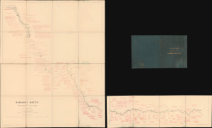
Rough Road Chart of Sabakhi Route from Makangeni to Machagos.
$2,500.00
Acquire
- Digital Map Information
- Suitable for large format printing
- Full resolution TIFF file
- ICC color profile embedded
- Delivered instantly via download link
This rare 1890 map of Kenya illustrates Frederick Lugard's first expedition along the Sabaki River between Mombasa and Machakos. The expedition and Lugard's subsequent public pressure campaign were important steps in establishing a British 'sphere of influence' and, eventually, protectorates over Kenya (British East Africa) and Uganda. (more details)
Visually Entertaining English Map of Africa.
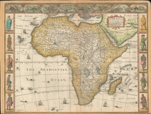
Africae described , the manners of their Habits, and buildings newly done into English by I. S. Are to be sold by Tho Basset in Fleet Street, and Ric Chiswell in St. Pauls Churchyard.
$2,500.00
Acquire
- Digital Map Information
- Suitable for large format printing
- Full resolution TIFF file
- ICC color profile embedded
- Delivered instantly via download link
This is John Speed's 1626 map of Africa. It is the first English map of the continent. This beautiful map is one of the most desirable early maps of Africa, combining superb engraving, attractive Dutch styling, and entertaining and abundant English text. Speed was an accomplished historian and compiler, drawing his maps from state-of-the-art sources. His atlases of the British Isles and the World are among the signal cartographic works of the 17th century. The cartography for this map is drawn from the maps of Jodocus Hondius (whose student Goos actually engraved the map). Hondius' source was ultimately Willem Blaeu's 1608 wall map of Africa. As is the case with all of these maps, the map demonstrates 17th century European geography's detailed knowledge of Africa's coasts wedded to a deep mystification of the interior. The course of the Nile, for example, is shown in substantially the same configuration as was supposed in the second century by Claudius Ptolemy. Speed adds descriptive text - for example, noting areas in western and central Africa where gold is said to be found, and indicating areas said to be occupied by Amazons. (more details)
Propagandizing Egypt's National Awakening.
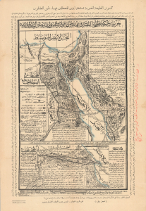
...خريطة حكمدارية بيتِ المقدسِ ومحملِ الحجازِ والجزائرِ المصريةِ / [Map of the Governorship of Jerusalem, the Hajj Caravan, the Egyptian Provinces...].
$2,500.00
Acquire
- Digital Map Information
- Suitable for large format printing
- File Size: 14.2 MB
- File Type: ZIP / TIFF
- ICC color profile embedded
- Delivered instantly via download link
This is a unique and striking c. 1926 Arabic-language map of the Suez and environs, including Palestine, the Hijaz, and Egypt, printed by the Damanhur Industrial School Press. Replete with religious and patriotic messages, the map was part of a wider national awakening in early 20th-century Egypt that eventually rebuffed British de facto rule over the country. More specifically, it promotes a never-built railway through Egypt's Eastern Desert linking the Nile and the Red Sea that would have provided economic benefits as well as a faster route for Hajj pilgrims from the Nile's heartland. (more details)
Scramble for Africa manuscript map.
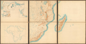
[Africa, West Africa.]
$2,500.00
Acquire
- Digital Map Information
- Suitable for large format printing
- File Size: 57.24 MB
- File Type: ZIP / TIFF
- ICC color profile embedded
- Delivered instantly via download link
A remarkable c. 1885 French manuscript map of Africa, drafted on six sheets and mounted on linen. Taken together, these maps represent a unique window to French colonial ambitions in Africa at the time of the 1886 Berlin Conference. (more details)
Geographical Reassessment of the eastern Sahara and the Lower Nile.
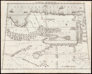
Africae Tabula VI.
$2,500.00
Acquire
- Digital Map Information
- Suitable for large format printing
- DPI: 600
- File Size: 42.73 MB
- File Type: ZIP / TIFF
- ICC color profile embedded
- Delivered instantly via download link
This elegant map of Egypt, focusing on the Lower Nile and Eastern Mediterranean coast was printed in a single edition in 1588 for Livio and Giulio Sanuto's twelve-sheet 'atlas' of Africa. Of the 16th century maps focusing north Africa, Sanuto is unique. His depiction of the continent differed sharply from any contemporaneous map, the result of his thorough reconsideration of African geography in the light of both conventional and newly available sources - marking it as a unique and underappreciated masterpiece of geographical thought. (more details)
One of the Earliest Modern Maps of Africa.
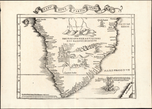
Tabu. Nova Partis Aphri.
$2,000.00
Acquire
- Digital Map Information
- Suitable for large format printing
- Full resolution TIFF file
- ICC color profile embedded
- Delivered instantly via download link
This is Laurent Fries' 1535 edition of the earliest acquirable modern mapping of South Africa, among the first to reveal the discoveries of the Portuguese explorers Dias and De Gama. This map represents an effort to reconcile two contrasting depictions of southern Africa by Martin Waldseemüller: the 1513 Tabula Moderna Secunde Porcionis Aphrice, and the 1516 Carta Marina. In the past, it has been erroneously described as a more decorative version of the former, but closer study reveals it as cartographically distinct and independently significant. (more details)
Key passage on the route to India.
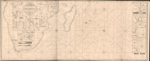
A New Chart From the Cape of Good Hope to the Islands of Madagascar, Mauritus, and c. Shewing the Mozambique Passages, drawn from the Surveys and Observations of Several Distinguished Navigators, Including all the Modern Discoveries.
$2,000.00
Acquire
- Digital Map Information
- Suitable for large format printing
- Full resolution TIFF file
- ICC color profile embedded
- Delivered instantly via download link
This is the 1818 / 1827 edition of John Norie's essential nautical map of the Cape of Good Hope and passages to Madagascar, Reunion, and other Indian Ocean ports. It was a key China Trade chart marking one of the most important and fraught passages on the voyage - rounding Africa and passing through the pirate-filled waters around Madagascar to reach the Indian Ocean. (more details)
Geography for the Nation, in Greek!
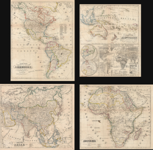
ΧAΡΤΗΣ ΤΗΣ ΑΜΕΡΙΚHΣ / ΧAΡΤΗΣ ΤΗΣ ΑΥΣΤΡΑΛIΑΣ / ΧΆΡΤΗΣ ΤΗΣ ΑΣIΑΣ / ΧAΡΤΗΣ ΤΗΣ ΑΦΡΙΚHΣ.
$2,000.00
Acquire
- Digital Map Information
- Suitable for large format printing
- File Size: 91.34 MB
- File Type: ZIP / TIFF
- ICC color profile embedded
- Delivered instantly via download link
This is an extremely rare c. 1856 set of four Greek-language educational maps published by the Athenian printer Karl Joseph Kolmann. The maps represent an early attempt by the newly independent Greece to reform and nationalize its educational system. (more details)
D'Anville's influential mapping of Africa.
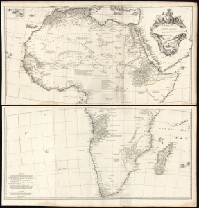
Afrique Publiée sous les Auspices de Monseigneur le Duc D'Orléans Prémier Prince du Sang.
$2,000.00
Acquire
- Digital Map Information
- Suitable for large format printing
- File Size: 73.62 MB
- File Type: ZIP / TIFF
- ICC color profile embedded
- Delivered instantly via download link
This is Jean-Baptiste Bourguignon d’Anville's 1749 map of Africa, one of the largest and most influential maps of the continent to appear in the 18th century. (more details)
Last Stage of the French Protectorate in Morocco.
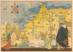
Maroc sous le regne de S.M. Mohammed V / المغرب الأقصى خريطة الإيالة الشريفة أيام سلطنة سيدي محمد الخامس.
$2,000.00
Acquire
- Digital Map Information
- Suitable for large format printing
- Full resolution TIFF file
- ICC color profile embedded
- Delivered instantly via download link
This is a rare c. 1947 Gabriel Carriat-Rolant bilingual French and Arabic pictorial map of Morocco - issued to promote tourism. At the time, Morocco was divided into three administrative zones: protectorates managed by France and Spain, respectively, and the remarkable, cosmopolitan Tangier International Zone. (more details)
Ottoman Irredentism in Africa.

مفصل افريقا خريطة / [Detailed Map of Africa].
$2,000.00
Acquire
- Digital Map Information
- Suitable for large format printing
- Full resolution TIFF file
- ICC color profile embedded
- Delivered instantly via download link
This is a rare, large-format Ottoman Turkish wall map of Africa, produced c. 1908 by the empire's Ministry of Public Education. It reflects the efforts of Ottoman reformers to disseminate geographic knowledge through the education system while also reinforcing pride in the empire through irredentism and maximalist territorial claims. (more details)
Earliest acquirable medieval plan of Jerusalem.
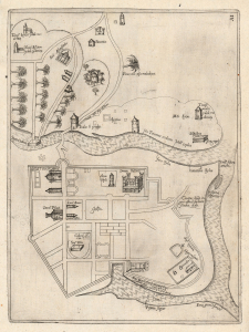
[Jerusalem.]
$2,000.00
Acquire
- Digital Map Information
- Suitable for large format printing
- Full resolution TIFF file
- ICC color profile embedded
- Delivered instantly via download link
This rare plan of Jerusalem is the earliest printed iteration of Pietro Vesconte's manuscript plan of the city. While not committed to print until this 1611 edition by Jacques Bongars, the map is the work of the 14th-century Venetian cartographer Vesconte, who produced it c. 1320 to promote Marino Sanudo's proposed crusade to recapture the city. As such, it is one of the earliest surviving plans to support a specific military effort. (more details)
Best 16th century map of the region around Marrakesh.
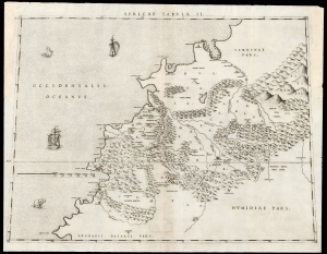
Africae Tabula II.
$2,000.00
Acquire
- Digital Map Information
- Suitable for large format printing
- DPI: 600
- File Size: 44.36 MB
- File Type: ZIP / TIFF
- ICC color profile embedded
- Delivered instantly via download link
This is Livio Sanuto's rare and beautiful 1588 map of central Morocco, focusing on Marrakesh and the area lying between the Oum Er-Rbia and the Sous Rivers. The map depicts the rugged western end of the Atlas Mountains with details drawn almost exclusively from the reports of the Berber-Andalusi traveler, diplomat, and author Johannes Leo Africanus (1494 - 1554). It is moreover a strikingly beautiful engraving, a masterwork of Livio's brother Giulio, who engraved all twelve of the maps comprising their atlas of Africa. (more details)
Summation of European Cartography of Africa.
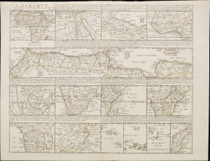
L'Afrique par le Sieur Du Val, Geographe Ord. du Roy.
$2,000.00
Acquire
- Digital Map Information
- Suitable for large format printing
- File Size: 20.34 MB
- File Type: ZIP / TIFF
- ICC color profile embedded
- Delivered instantly via download link
This is Pierre Duval's 1661 mapping of Africa, a comprehensive and detailed single-sheet presentation achieved by dividing the sheet up into 15 separate maps: one map of the entire African continent along with 14 regional maps. (more details)
Vector for the resurgence of Italian maritime power.
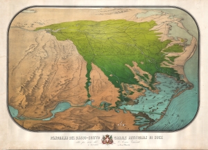
Panorama del Basso-Ecitto Canale Artificale di Suez edito per cura del Cre. Cesare Vimercati e dedicato a Sua Maestà.
$2,000.00
Acquire
- Digital Map Information
- Suitable for large format printing
- File Size: 65.52 MB
- File Type: ZIP / TIFF
- ICC color profile embedded
- Delivered instantly via download link
A striking 1869 chromolithograph view of the Suez Canal and the Nile Delta, Egypt. The view was issued in Florence by Cesare Vimercati to promote the canal as a vector for Italian resurgence as a maritime power. (more details)
Forgotten Portuguese explorers of Africa's interior.
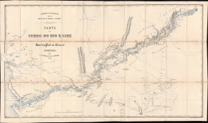
Carta do curso do rio Zaire de Stanley-Pool au Oceano.
$1,900.00
Acquire
- Digital Map Information
- Suitable for large format printing
- Full resolution TIFF file
- ICC color profile embedded
- Delivered instantly via download link
This is a remarkable 1883 map of the Congo River and adjoining regions produced by the Portuguese Comissão de Cartografia das Colónias. It highlights knowledge gained from the forgotten but important 1877 - 1879 Capelo-Ivens Expedition, a Portuguese effort to map and claim the lands along the river in the early days of the Scramble for Africa. (more details)
Reconciling ancient geography with new discoveries.
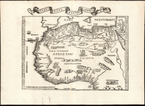
Tabu. Nova Partis Aphri.
$1,900.00
Acquire
- Digital Map Information
- Suitable for large format printing
- Full resolution TIFF file
- ICC color profile embedded
- Delivered instantly via download link
This is Laurent Fries' 1535 edition of the earliest acquirable modern mapping of Africa north of the Equator. This is one of the earliest printed maps to incorporate contemporary Portuguese discoveries while preserving classical Ptolemaic geography. (more details)