
North America (sold)
The only known unmounted North American globe gores from an extremely rare 17th century globe.
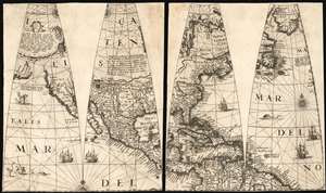
[Four Untitled Globe Gores on Two Sheets]
sold
- Digital Map Information
- Suitable for large format printing
- Full resolution TIFF file
- ICC color profile embedded
- Delivered instantly via download link
A once-in-a-lifetime addition to a collection: the sole known example of this quartet of globe gores, printed in 1623 by Jodocus Hondius II and Jan Jansson for the construction of their 17-inch globe. These four globe gores cover all of North America. The only known copies of these loose gores, they represent a remarkable survival and present unique geographical data. This is the earliest acquirable depiction of North America to show a specific Great Lake based on actual report, and features a unique depiction of the Saint Lawrence River. It contains a remarkable delineation of the American Southwest, with a correct depiction of its rivers not typical for Dutch maps of the period. Such features can be ascribed to the globe being a new work by Jodocus Hondius II and his brother-in-law Jansson, rather than derivative of the elder Hondius, or indeed any other acquirable work of his or their own. (more details)
A Sumptuous Example of a Rare Map of the Americas and the Pacific
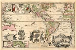
Carte Nouvelle de la Mer du Sud, dressee par Ordre des principaux Directeurs des Memoires les plus recents et des Relations des Navigateurs les plus Modernes.
sold
- Digital Map Information
- Suitable for large format printing
- Full resolution TIFF file
- ICC color profile embedded
- Delivered instantly via download link
A superb example of a rare map, by Hendrik De Leth, presenting the reader with a compendium of European exploration and discovery. Not confined to the Pacific Ocean - as suggested by the title - the map includes richly detailed mapping of the Americas and coastal Africa as well as the Pacific, Southeast Asia, and Australia. Though it is clearly based in part on de Fer's map of 1713 and the 1719 Chatelain, this finely engraved map is easily the match of its predecessors for the elegance of its decorative vignettes. These include - along the bottom center of the map - scenes depicting the manner of turtle-hunting on Pacific Islands, the operation of a sugar mill, gold mining and bird hunting in Mexico, the manner of human sacrifice in mezo America, and a depiction of Cortez destroying Mexican idols. To the lower right is a magnificent scene of the Cape Town settlement, filled with ships and surrounded by a magnificent frame decorated with lions, monkeys, and native figures. (more details)
The only known example of Grierson's 1732 piracy of Herman Moll's Codfish Map of North America.
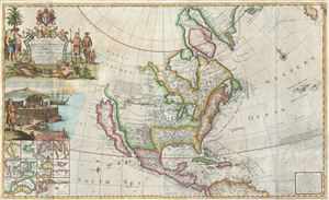
To His Grace Hugh, Lord Archbishop of Armagh, Primate and Metropolitan of all Ireland and One of the Lords Justices of the said Kingdom this map of North America According to the Newest and most Exact Observations is most humbly Dedicated by your Graces most humble Serv: Geo: Grierson.
sold
- Digital Map Information
- Suitable for large format printing
- Full resolution TIFF file
- ICC color profile embedded
- Delivered instantly via download link
An antique map discovery of the utmost rarity. Ostensibly, this is a fine example of Hermann MollÂ's important and highly desirable 1720 Codfish Map, entitled 'To the Right Honourable John Lord Sommers...' Upon closer inspection however, an entirely different ... (more details)
Auchagah Map, a unique synthesis of American Indian and European cartography.
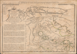
Réduction de la Carte tracée par le Sauvage Ochagach et autres. / Carte Physique des Terreins les plus eleves de la Partie Occidentale du Canada.
sold
- Digital Map Information
- Suitable for large format printing
- Full resolution TIFF file
- ICC color profile embedded
- Delivered instantly via download link
This is Philipe Buache's c. 1754 dual map of inland water routes west of Lake Superior extending, ostensibly, to the Pacific. It is an important and intellectually complex juxtaposition of two radically divergent cartographic conceptions of the North American interior: American Indian (Cree) geographic knowledge (known as the Auchagah Map) and Philippe Buache's speculative synthesis of French exploration, hydrographic theory, and the elusive dream of a navigable route to the Pacific. Within a decade of this map's issue, the route revealed here between Lake Superior and Winnipeg became the primary artery of the Canadian fur trade. (more details)
Definitive field Atlas of the Revolutionary War.
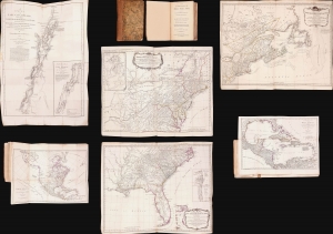
The American Military Pocket Atlas; being An approved Collection of Correct Maps, both General and Particular, of The British Colonies; Especially those which now are, or probably may be The Theatre of War.
sold
This is Sayer and Bennet's 1776 'Holster Atlas', one of the most sought-after cartographic works of the American Revolution. It was published at the beginning of the Revolution and presented as a collection of maps approved by British military authorities for use in the field. (more details)
One of the most beautiful and sumptuously illustrated maps of the 18th century.
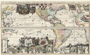
Carte très curieuse de la Mer du Sud, contenant des Remarques Nouvelles et très utiles non seulement sur des Ports et Îles de cette Mer, mais aussy sur les principaux Pays de l'Amerique tant Septentrionale que Méridionale en a été faite.
sold
- Digital Map Information
- Suitable for large format printing
- DPI: 300
- File Size: 52.8 MB
- File Type: ZIP / TIFF
- ICC color profile embedded
- Delivered instantly via download link
One of the most spectacularly decorative maps of the 18th century, this is Henri Chatelain's magnificent 1719 map of the Americas and the Pacific. This sumptuously engraved map is centered on the American continent, but extends west to include all of the ... (more details)
One of the most beautiful and sumptuously illustrated maps of the 18th century.
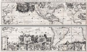
Carte très curieuse de la Mer du Sud, contenant des Remarques Nouvelles et très utiles non seulement sur des Ports et Îles de cette Mer, mais aussy sur les principaux Pays de l'Amerique tant Septentrionale que Méridionale en a été faite.
sold
- Digital Map Information
- Suitable for large format printing
- DPI: 300
- File Size: 76.5 MB
- File Type: ZIP / TIFF
- ICC color profile embedded
- Delivered instantly via download link
One of the most spectacularly decorative maps of the 18th century, this is Henri Chatelain's magnificent 1719 map of the Americas and the Pacific. This sumptuously engraved map is centered on the American continent, but extends west to include all of the ... (more details)
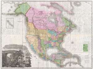
A landmark - a great cartographical achievement … -Wheat
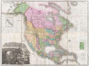
A Map of North America Constructed According to the Latest Information by H. S. Tanner.
sold
- Digital Map Information
- Suitable for large format printing
- DPI: 300
- File Size: 70.48 MB
- File Type: ZIP / TIFF
- ICC color profile embedded
- Delivered instantly via download link
An attractive example of Henry Schenk Tanner's remarkable 1825 landmark map of North America, considered to be the most important map of North America of the 19th century. Revolutionary in countless ways, this is the most accurate map of North America, in ... (more details)
Map used to promote investment in John Law's Compagnie d'Occident (Mississippi Bubble) and the first map to show Le Maire's discoveries.
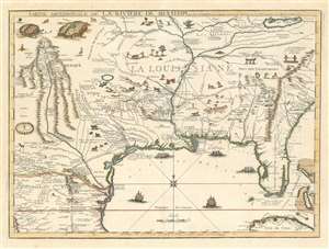
Partie Meridionale De La Riviere De Missisipi, et ses Environs dan L'Amerique Septentrionale.
sold
- Digital Map Information
- Suitable for large format printing
- DPI: 600
- File Size: 23.29 MB
- File Type: ZIP / TIFF
- ICC color profile embedded
- Delivered instantly via download link
A seminal map of the utmost importance and rarity, this is Nicolas de Fer's 1718 map of the Mississippi River Valley drawn to promote the Compagnie d'Occident. Essentially mirroring the coverage of De L'Isle's map of 1703, the map covers from just west of the Rio Grande (Rio del Norte) eastward as far as Charleston, north to include Lake Erie, and south as far as Cuba and the Gulf of Mexico. Per its title, the map is centered on the Mississippi Valley and was intended to illustrate the lush richness of this region. (more details)
A landmark - a great cartographical achievement … -Wheat
A Map of North America Constructed According to the Latest Information by H. S. Tanner.
sold
- Digital Map Information
- Suitable for large format printing
- DPI: 300
- File Size: 68.73 MB
- File Type: ZIP / TIFF
- ICC color profile embedded
- Delivered instantly via download link
An attractive example of Henry Schenk Tanner's remarkable 1825 landmark map of North America, considered to be the most important map of North America of the 19th century. Revolutionary in countless ways, this is the most accurate map of North America, in ... (more details)
Map used to promote investment in John Law's Compagnie d'Occident (Mississippi Bubble) and the first map to show Le Maire's discoveries.
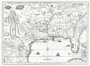
Partie Meridionale De La Riviere De Missisipi, et ses Environs dan L'Amerique Septentrionale.
sold
- Digital Map Information
- Suitable for large format printing
- DPI: 300
- File Size: 15.98 MB
- File Type: ZIP / TIFF
- ICC color profile embedded
- Delivered instantly via download link
A seminal map of the utmost importance and rarity, this is Nicolas de Fer's 1718 map of the Mississippi River Valley drawn to promote the Compagnie d'Occident . Essentially mirroring the coverage of De L'Isle's map of 1703, the map covers from just west ... (more details)
Extremely rare Map of the United States in Ottoman-Turkish Arabic Script.
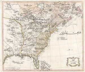
Amerika.
sold
- Digital Map Information
- Suitable for large format printing
- DPI: 300
- File Size: 62.39 MB
- File Type: ZIP / TIFF
- ICC color profile embedded
- Delivered instantly via download link
An extraordinary discovery of the utmost importance and rarity, this is Rāif Maḥmūd Efendi's 1803 Ottoman-Turkish map of the United States. The map covers the eastern part of North America from the mouth of the Rio Bravo (Texas) to Newfoundland ... (more details)
Dramatic Sea of the West.
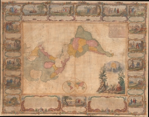
L'Amerique Divisee En Tous Ses Pays Et Etats dressée sur de nouveaux Memoires et sur les derniers Observations.
sold
- Digital Map Information
- Suitable for large format printing
- File Size: 185.45 MB
- File Type: ZIP / TIFF
- ICC color profile embedded
- Delivered instantly via download link
This is a dramatic 1754 east-oriented wall map of the Americas by Jean Janvier and Sebastian G. Longchamps - better known as Voltaire's valet. The dramatic map includes one of cartography's boldest iterations of the Sea of the West. This map appeared at the outset of the French and Indian War (1754 - 1763) and correspondingly details France's bold claims to much of North America. (more details)
A Magnificent, Boldly Decorative Wall Map of the Americas.
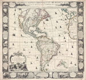
Amerique Septentrionale et Meridionale Divisée en ses Principaux Pais et Subdivisée par Audience. / Nle. Carte D'Amerique Dressée sur les Mémories le plus récens et assujetie aux derniers Observations Astronomiques.
sold
- Digital Map Information
- Suitable for large format printing
- Full resolution TIFF file
- ICC color profile embedded
- Delivered instantly via download link
A rare and highly decorative 1761 French wall map of America issued by Louis Charles Desnos. The map covers all of America, from the northern reaches of Hudson Bay to Tierro del Fuego - which just breaks the lower border. Items of note include a bold depiction of the imaginary Sea of the West (Mer d l'Ouest) and a large 'Lac des Zarayes' in South America. An inset in the lower right details the Pacific Northwest and the Bering Strait, incorporating the Sea of the West with the Apocryphal voyages of Admiral Bartholomew de Fonte and the Chinese legends of an American colony named 'Fusang'. A wealth of ships fill the seas as well as nautical routes by famous explorers. The whole is surrounded by a strikingly engraved border illustrating the indigenous peoples of the Americas - frequently in the processes of martyring missionaries and worshiping idols, but also engaging in trade, fishing, and other more mundane activities. (more details)
First edition.
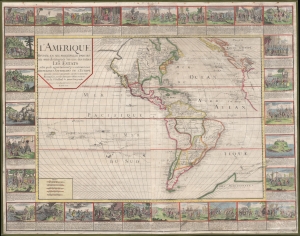
L'Amerique divisée en ses principales parties où sont distingués les uns des autres les estats : selon quils appartiennent presentement aux differents souverains de l'Europe : dressée sur les relations les plus recentes et rectifiées sur les dernieres observations.
sold
- Digital Map Information
- Suitable for large format printing
- Full resolution TIFF file
- ICC color profile embedded
- Delivered instantly via download link
A stunning 1752 wall map of the Americas by Nicolas Baillieul 'le jeune.' Aside from its aesthetic qualities, including elaborate border vignettes, it is also notable for reflecting developing notions of American geography, including tentative mapping of the northwest coast. (more details)
Revelatory map of the Americas.
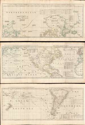
A Chart of North and South America, including the Atlantic and Pacific Oceans, with the nearest Coasts of Europe, Africa, and Asia.
sold
- Digital Map Information
- Suitable for large format printing
- Full resolution TIFF file
- ICC color profile embedded
- Delivered instantly via download link
A wonderful 1775 map of the Americas or Western Hemisphere by John Green, also known as Braddock Mead. The map in fact consists of three related maps covering, from top: Canada and the Arctic; the modern day United States, Central America, and the West Indies; and South America. The map is a masterpiece of late 18th century cartography by one of the least understood and most controversial cartographers of his age. Mead composed the map in protest to what he believed to be the flagrantly spurious and irresponsible speculative cartography of Frenchmen Joseph-Nicolas De l'Isle (1688 - 1768) and Phillipe Buache (1700 - 1773). (more details)
Only know example of George Thompson's 1799 broadside map of the Americas.
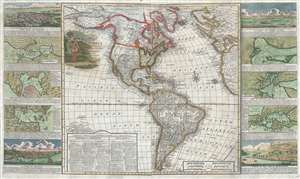
New Map of America divided into its Kingdoms, States, Governments and other Subdivisions, from the latest observations.
sold
- Digital Map Information
- Suitable for large format printing
- DPI: 300
- File Size: 24.5 MB
- File Type: ZIP / TIFF
- ICC color profile embedded
- Delivered instantly via download link
An exceptionally rare separately issued 1799 broadside map of America by the English printer and mapmaker George Thompson. Thompson's map covers the Americas from the Arctic Circle (Arctic Land) to Tierra de Fuego and Cape Horn. It extends westward ... (more details)
Penned by a Benjamin Franklin correspondent
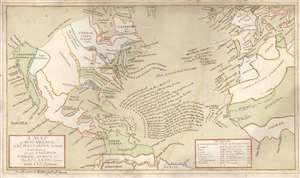
A Map of North America, and the West India Islands, with part of South America, Europe, Africa and The Atlantic Ocean with It's Islands von Benjamin Webb gezeichnet.
sold
- Digital Map Information
- Suitable for large format printing
- Full resolution TIFF file
- ICC color profile embedded
- Delivered instantly via download link
This is a beautifully executed c. 1763 manuscript map by Benjamin Webb, a German emigre working in London and a sometime correspondent with Benjamin Franklin. The map depicts the British Colonies in North America and the Atlantic, highlighting the European spheres of influence pursuant to the 1763 Treaty of Paris, which ended the Seven Years' War (1756 - 1763). It is uniformly meticulous and completed in a fine hand. It very likely was produced by Webb as part of his employment as a schoolmaster in London. Webb's map utilizes a geographical framework of mid-eighteenth century German cartography but includes numerous annotations bringing the map up to date with the 1763 Treaty of Paris. The combination of these elements are unique to this map, and fix its date with reasonable accuracy. (more details)
Map exhiiting French interest in a California colony and the Republic of Texas.
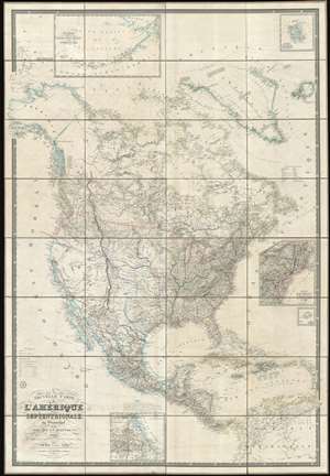
Nouvelle Carte de l'Amérique Septentrionale, du Groenland et des îles qui en dépendent.
sold
- Digital Map Information
- Suitable for large format printing
- DPI: 600
- File Size: 1001.97 MB
- File Type: ZIP / TIFF
- ICC color profile embedded
- Delivered instantly via download link
This is a spectacular and enormous 1843 French wall map of North America, including the Republic of Texas, dissected and on linen, issued by Adrien-Hubert Brué and Charles Picquet. The map represents an ephemeral historical period when France, coming out of the First French Intervention in Mexico, was seriously considering a colonizing play for California. With increased hegemony over Mexico, a mutually beneficial alliance with the Republic of Texas, and a potential colony in California, France was well positioned to push for dominance over all of western North America - inspiring considerable French enthusiasm and great interest in North America among the French populace. This map is perhaps the signal largest and most impressive cartographic statement of King Louis Phliippe ambitions of a new French empire in North America. While it may simply be chance, it is striking the light blue used to represent French properties is also used for Mexico, California, and Russian Alaska. (more details)
Extremely rare, highly influential, and very important foundational map of the North Pacific showing Sea of the West and the apocryphal discoveries of Admiral de Fonte.
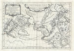
Carte General Des Decouvertes De L'Amiral de Fonte Et autres Navigateurs Espagnols, Anglois, et Russes, pour la recherche du Passage a la Mer du Sud.
sold
- Digital Map Information
- Suitable for large format printing
- DPI: 300
- File Size: 6.51 MB
- File Type: ZIP / TIFF
- ICC color profile embedded
- Delivered instantly via download link
An object of extreme historical importance and rarity, this map was the center of one of the most heated cartographic debates in history. This is an unrecorded state of Joseph-Nicolas de L'Isle's (Delisle) map of the Northern Pacific Ocean and ... (more details)
First specific map to reveal America as separate continent. First European map to show Japan. First map to identify the Pacific Ocean.

Die neuwen inseln so hinder Hispanien gegen Orient bey dem land Indie ligen.
sold
- Digital Map Information
- Suitable for large format printing
- Full resolution TIFF file
- ICC color profile embedded
- Delivered instantly via download link
A fine 1554 example of Sebastian Munster's map of America or the New World. This is one the earliest and most influential obtainable maps of the Americas. This is the first specific published map to reveal all of North and South America in ... (more details)
Outstanding 1849 broadside promoting routes the California Gold Rush.
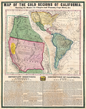
Map of the Gold Regions of California. Showing the Routes via Chagres and Panama, Cape Horn, & c.
sold
- Digital Map Information
- Suitable for large format printing
- DPI: 300
- File Size: 14.37 MB
- File Type: ZIP / TIFF
- ICC color profile embedded
- Delivered instantly via download link
A rare and remarkable example of Ensign and Thayer's 1849 promotional broadside map illustrating routes to and from the California Gold Fields. 'Forty-Niners' traveling across the continent to California faced a daunting and dangerous ... (more details)
Moll vs. De l'Isle.
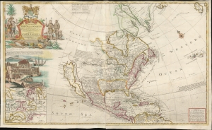
To The Right Honorable John Lord Sommers...This Map of North America According To Ye Newest and Most Exact Observations . . .
sold
- Digital Map Information
- Suitable for large format printing
- File Size: 45.84 MB
- File Type: ZIP / TIFF
- ICC color profile embedded
- Delivered instantly via download link
An attractive example of Hermann Moll's 1720 'Codfish' Map of North America. The map was issued to bolster British North American claims, countering Guillaume De l'Isle's 1718 Carte de La Louisiane , whose bold claims of French territory sparked outrage amongst the English. (more details)
First Dutch Atlas Map of North America.
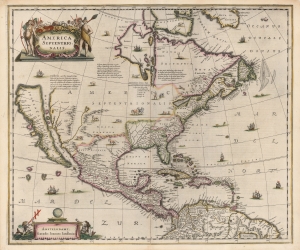
America Septentrionalis.
sold
- Digital Map Information
- Suitable for large format printing
- Full resolution TIFF file
- ICC color profile embedded
- Delivered instantly via download link
This is a beautiful old-color example of Jan Jansson's 1636 map of North America. It is the first folio map to focus on North America specifically after De Jode's 1593 map, and as such features several cartographic primacies. It is the first general Dutch map of North America to depict a Great Lake connected to the St. Lawrence, and the first obtainable Dutch atlas map of North America to embrace the theory of Insular California. Map historian Carl Wheat considered the many accurate depictions of America's fauna on the map to 'represent its most authentic information, so far as what is now western United States is concerned'. (more details)
An early, rarely seen, wall map of North America.
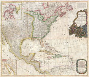
A New Map of North America with the West India Islands, divided according to the Preliminary Articles of Peace, Singed at Versailles, 20, jan 1783, wherein are particularly Distinguished The United States, and the Several Provinces, Governments & ca which Compose the British Dominions, Laid down according to the Latest Surveys, and Corrected from teh Original Materials of Goverr. Pownall, Membr. of Parlimt.
sold
- Digital Map Information
- Suitable for large format printing
- DPI: 300
- File Size: 62.52 MB
- File Type: ZIP / TIFF
- ICC color profile embedded
- Delivered instantly via download link
An extraordinary monumentally proportioned 1794 map of North American by Governor Pownell. Issued shortly after the end of the American Revolutionary War, this map details the newly formed United States, the British dominions in ... (more details)
The first appearance of the Marquette-Joliet Mississippi River cartography.
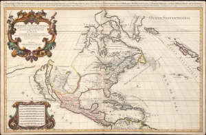
Amerique septentrionale divisée en ses principales parties, ou sont distingués les vns des autres les estats suivant qu'ils appartiennent presentemet aux Francois, Castillans, Anglois, Suedois, Danois, Hollandois, tirée des relations de toutes ces nations par le S. Sanson, geographe ordinaire du roy. 1674.
sold
- Digital Map Information
- Suitable for large format printing
- Full resolution TIFF file
- ICC color profile embedded
- Delivered instantly via download link
An impressive and scarce 1674 map of North America issued by Alexis-Hubert Jaillot, offered here in its first edition, and likely exhibiting preliminary data from the 1673 Marquette-Joliet Expedition. The map covers North America and Central America from Baffin Bay to the Spanish Main. It extends westward past an Insular California to include Terre de Iesso (a speculative mapping of Hokkaido) and eastwards past the Azores to include the British Isles. It includes a striking mapping the Mississippi (Chucagua), that while inaccurate in the southernmost regions, likely reflects Joliet's verbal reports from the seminal 1673 Marquette-Joliet Expedition. (more details)
Spectacular pictorial world map illustrating Post-WII situation in Europe and America.
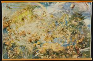
[Oliver Neerlands Bildkarta]
sold
- Digital Map Information
- Suitable for large format printing
- Full resolution TIFF file
- ICC color profile embedded
- Delivered instantly via download link
This is an utterly stunning 1949 pictorial color lithograph wall map of the northern part of the western world by the Norwegian artist Oliver Neerland. The map covers all of North America, the North Atlantic, and Europe as far east as the Caspian Sea, as well as from the North Pole to the Amazon River and Liberia. Lavish illustration depicts historic figures, monuments, art and architecture, animals, airplanes, dirigibles, sailing ships of all types, aircraft characters, and more. (more details)
One of the most influential maps in the history of North America.
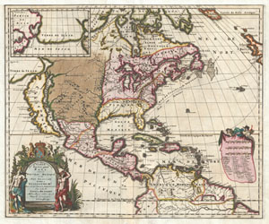
Amerique Septentrionalis Carte d'un tres grand Pays entre le Nouveau Mexique et la Mer Glaciace Dediee a Guilliaume IIIe. Roy de La Grand Bretagne Par le R. P. Louis de Hennepin Mission: Recol: et Not: Apost: Chez c. Specht a Utreght 1698.
sold
- Digital Map Information
- Suitable for large format printing
- DPI: 300
- File Size: 13.5 MB
- File Type: ZIP / TIFF
- ICC color profile embedded
- Delivered instantly via download link
A map that fundamentally impacted the cartographic history of America, this is the 1698 Friar Hennepin map of North America. Covering all of North America from the Equator to the Arctic, this map is remarkable on a number of ... (more details)
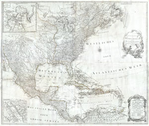
General Karte von Nord America samt den Westindischen Inseln Verfasst von Herrn Pownall
sold
- Digital Map Information
- Suitable for large format printing
- Full resolution TIFF file
- ICC color profile embedded
- Delivered instantly via download link
A rare and extraordinary post-colonial wall map of North America by Vienna map publisher Franz Anton Schraembal. Printed in 1788 for inclusion in Schraembal's Allgemeiner Grosser Atlas , this is one of the first maps issued ... (more details)
First printed map to illustrate the Chesapeake Bay.
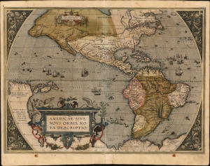
Americae Sive Novi Orbis Nova Descriptio.
sold
- Digital Map Information
- Suitable for large format printing
- Full resolution TIFF file
- ICC color profile embedded
- Delivered instantly via download link
This is Abraham Ortelius' map of the Americas in an attractive, early example of the 1587 third plate, printed in 1589. It represents the state-of-the-art mapping of the Western Hemisphere during the initial period of European Colonization. It is significant as the first printed map to illustrate the Chesapeake Bay, predating John White's 1590 map of Virginia. (more details)
Rare first edition of Lahontan's highly influential map of the supposedly apocryphal Riviere Longue (Missouri River?)
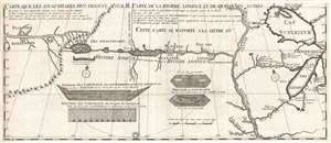
Carte que les Gnacsitares ont Dessine sur / Carte de la Riviere Longue et de quelques Autres qui se Dechargent dans le Grand Fleuve Missisipi.
sold
- Digital Map Information
- Suitable for large format printing
- DPI: 300
- File Size: 7.06 MB
- File Type: ZIP / TIFF
- ICC color profile embedded
- Delivered instantly via download link
A foundational map of extreme importance and influence, this is the rare 1703 first edition of Baron Louis-Armand de Lom d'Arce de Lahontan's, seminal map of the westernmost Great Lakes, the Mississippi River, and an ... (more details)
Rare first edition of Lahontan's highly influential map of the supposedly apocryphal Riviere Longue (Missouri River?)
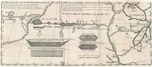
Carte que les Gnacsitares ont Dessine sur / Carte de la Riviere Longue et de quelques Autres qui se Dechargent dans le Grand Fleuve Missisipi.
sold
- Digital Map Information
- Suitable for large format printing
- DPI: 300
- File Size: 8.32 MB
- File Type: ZIP / TIFF
- ICC color profile embedded
- Delivered instantly via download link
A foundational map of extreme importance and influence, this is the rare 1703 first edition of Baron Louis-Armand de Lom d'Arce de Lahontan's, seminal map of the westernmost Great Lakes, the Mississippi River, and an ... (more details)