
Georgia - Alabama (sold)
Seminal map of Georgia.
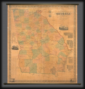
Map of the State of Georgia compiled under the direction of His Excellency George W. Crawford by Wm. G. Bonner, Civil Engineer.
sold
- Digital Map Information
- Suitable for large format printing
- DPI: 600
- File Size: 122.68 MB
- File Type: ZIP / TIFF
- ICC color profile embedded
- Delivered instantly via download link
An excellent example of William G. Bonner's rare, important, and monumental 1847 map of Georgia, here in its first edition, first state. When issued, this was the first major map of the state to appear in almost 20 years, and thus the first to represent Georgia with some approximation of its modern borders. It is, moreover, the first major map to illustrate the westward expansion of Georgia in the 1830s and 40s, with the annexation of Creek and Cherokee territory. It is also one of the few maps to clearly delineate the Georgia-Florida border dispute. (more details)
One of the rarest maps of the American southeast
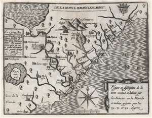
Figure et description de la terre reconue et habitée par les François en la Floride et audeça, gisante par les 30-31 - et 32 - degrez.
sold
- Digital Map Information
- Suitable for large format printing
- DPI: 600
- File Size: 10.61 MB
- File Type: ZIP / TIFF
- ICC color profile embedded
- Delivered instantly via download link
One of the great unobtainable maps of early attempts to settle North America. This is Marc Lescarbot's 1612 map of the American Southeast, one of the earliest specific maps detailing modern-day Florida, Georgia, and South Carolina. It chronicles 1562-1565 French attempts to establish a Huguenot colony in the region. Coverage extends roughly from 30° to 33° N, covering parts of modern-day Florida, Georgia, and South Carolina. (more details)
Cavalry field map for the Atlanta Campaign of the American Civil War.
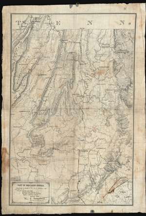
Map of Northern Georgia.
sold
- Digital Map Information
- Suitable for large format printing
- File Size: 32.27 MB
- File Type: ZIP / TIFF
- ICC color profile embedded
- Delivered instantly via download link
'Printed in the Field, Chattanooga, Tenn.', this map of northwestern Georgia is a remarkable artifact of the American Civil War (1861 - 1864) issued by William E. Merrill and William C. Margendant days before the launching of the Atlanta Campaign (May 7, 1863 - Sep 2, 1864). Printed on muslin specifically for Union Calvary officers, this map covers the northeastern part of Georgia, from Chattanooga and the Tennessee border south as far as Dallas and east to include Kennesaw. There can be little doubt that this map saw action in the field, with period manuscript annotations marking routes after May 17th, when Sherman split Union forces south of Adairsville into three separate armies headed by Maj. Generals John Schofield, George H. Thomas, and James B. McPherson. (more details)
Mars, the God of War, look on as Fame proclaims the of the Birth of the United States.
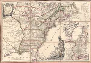
Carte de l'Amerique Septle. pour Servir a l'Intelligence de la Guerre Entre les Anglois et les Insurgents.
sold
- Digital Map Information
- Suitable for large format printing
- Full resolution TIFF file
- ICC color profile embedded
- Delivered instantly via download link
This is a rare 1777 Jean-Baptiste Jacques de Beaurain map of the United States during the American Revolutionary War, issued in anticipation of French entry into the war on the side of the revolutionaries. The map includes a bold illustration of the goddess Ossa (fame) unrolling an expansive map of the Theater of War in the Hudson corridor, proclaiming the newly formed United States. Mars, the god of War, looks on, shield and torch in hand, his arsenal ready - much like France itself. This map is thus an instrument of propaganda intended to prepare the public for French participation in the American Revolution - an event which followed in early 1778. (more details)
Important colonial period map of the American Southeast - with seashell and coral cartouche!
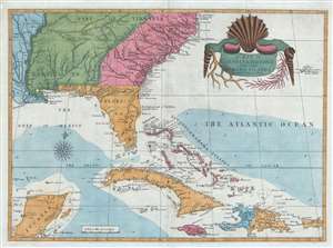
A Map of Carolina, Florida and the Bahama Islands with the Adjacent Parts.
sold
- Digital Map Information
- Suitable for large format printing
- DPI: 300
- File Size: 9.49 MB
- File Type: ZIP / TIFF
- ICC color profile embedded
- Delivered instantly via download link
A fine example of Mark Catesby’s rare 1743 / 1771 map of the southeastern parts of North America. This map is considered one of the finest maps of the colonial era American southeast. The map covers from the Mississippi River and from Cape Charles and Cape Henry to Jamaica, including all of North Carolina, South Carolina, Georgia, Florida, Louisiana, Cuba, Hispaniola, the Bahamas, Porto Rico, and parts of the Yucatan. Among other features, the map is notable for its remarkable cartouche design, which includes shells, corals, and seaweeds indigenous to the Americas. The map is furthermore an important reference for early forts, Indian tribes, English factories, and more in the southeast. The river systems of Georgia and Carolina are particularly impressive in their detail. (more details)
Geographical Reader for Dixie Children.
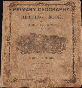
Primary Geography Arranged as a Reading Book, with Questions and Answers Attached.
sold
- Digital Map Information
- Suitable for large format printing
- Full resolution TIFF file
- ICC color profile embedded
- Delivered instantly via download link
This is a rare 1864 geographical atlas by Marinda Branson Moore prepared for Confederate children. Published during the American Civil War (1861 - 1865), the work only maps the Confederate States and contains historically relevant, if racially offensive, text critical of the Union. The work, as expressed by historians O. L. Davis, Jr. and Serena Rankin Parks, addresses the concerns of Southern schoolteachers who saw existing published textbooks as 'blighted with by Yankee biases and inaccuracies.' (more details)
First view of New Orleans.
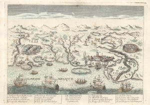
Le Mississipi ou la Louisiane dans l'Amerique Septentrionale.
sold
- Digital Map Information
- Suitable for large format printing
- File Size: 4.43 MB
- File Type: ZIP / TIFF
- ICC color profile embedded
- Delivered instantly via download link
This is a rare c. 1779 Basset / Chéreau broadside leaflet map-view of the Gulf of Mexico littoral c. 1720, just a few years after New Orleans was founded. It is likely the earliest printed view of New Orleans - though admittedly, it is not an accurate representation of the city at the time. The map was issued as a propaganda leaflet to promote New Orleans and French Louisiana. It is indeed one of the earliest maps to include a view of New Orleans and the indigenous peoples of the Gulf. The present example is the second state, issued in late 1770s by Basset to capitalize on French public interest in the American Revolutionary War (1775 - 1783). (more details)
The First Large Format Map of Chatham County, Georgia.
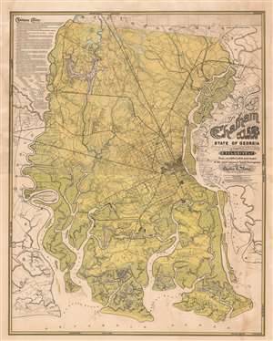
Chatham County State of Georgia Compiled Exclusively from certified plats and maps of the most eminent local surveyors by Charles G. Platon.
sold
- Digital Map Information
- Suitable for large format printing
- File Size: 98.41 MB
- File Type: ZIP / TIFF
- ICC color profile embedded
- Delivered instantly via download link
A rare and extraordinary 1875 Reconstruction Era map of Chatham County, Georgia, illustrating in large the vicinity of Savannah. This map was published by Charles G. Platen, who incorporated local survey work, the 1818 John McKinnon map, and the meticulous work of the U.S. Coast survey to compile this, the largest and most detailed map of the Savannah area ever issued. The intent behind the map, to develop agricultural lands, is evident in the color coding, with green referencing lowlands, swamps, and other wetlands, blue representing water, and yellow arable land. Platen advances the map considerably by drawing on the work of 36 local surveyors, all of which are named, to add property lots and owners throughout. (more details)
Extraordinary and rare blueback nautical chart of the East Coast.
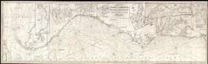
Chart of the Coast of America, from New York and Philadelphia, to the Strait or Gulf of Florida, and from thence to the Mississippi.
sold
- Digital Map Information
- Suitable for large format printing
- Full resolution TIFF file
- ICC color profile embedded
- Delivered instantly via download link
An utterly spectacular and sprawling 1850 John Williams Norie blueback nautical chart or maritime map depicting the North American coastline from New York to the Florida Keys. The map is oriented to the west, as a navigator from Europe would approach the American ... (more details)
Scarce nautical chart of the Gulf Coast.
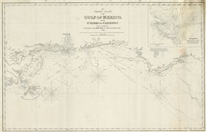
The North Coast of th Gulf of Mexico from St. Marks to Galveston.
sold
- Digital Map Information
- Suitable for large format printing
- DPI: 300
- File Size: 15.24 MB
- File Type: ZIP / TIFF
- ICC color profile embedded
- Delivered instantly via download link
An extremely scarce 1865 nautical chart or maritime map of the Gulf Coast by e and G. W. Blunt. This map, though titled ‘From St. Marks to Galveston' in fact only follows the coast from St. Marks to the Delta of the Mississippi River – suggesting that a ... (more details)
Enormous unpublished draft of a Florida-Louisiana map.
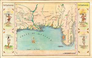
Loüissianne.
sold
- Digital Map Information
- Suitable for large format printing
- File Size: 76.81 MB
- File Type: ZIP / TIFF
- ICC color profile embedded
- Delivered instantly via download link
A striking and impressively proportioned cartographic curiosity, this is a c. 1920 manuscript map of Florida and the Gulf Littoral as far as Texas. The image is surrounded by front and back-facing images of American Indians. Most likely this is the original art for an unpublished educational poster, as it exhibits a professional level of execution. The map is drawn in ink with color added using what appears to be colored pencil or pastels. (more details)
Most important map of Georgia issued before the Revolutionary War.
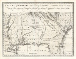
A New Map of Georgia with Part of Carolina, Florida and Louisiana.
sold
- Digital Map Information
- Suitable for large format printing
- Full resolution TIFF file
- ICC color profile embedded
- Delivered instantly via download link
One of the most important large-scale maps of colonial Georgia, here in a superb example. This is Emmanuel Bowen's 1748 map of the colony of Georgia, considered the first obtainable specific map of that region. (more details)
Important Revolutionary war coastal chart of the Sea Islands in South Carolina, Georgia, and northern Florida.
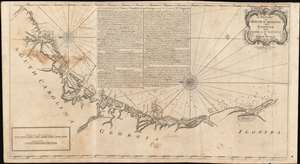
A Draught of South Carolina and Georgia from Sewee to St. Estaca.
sold
- Digital Map Information
- Suitable for large format printing
- DPI: 600
- File Size: 43.98 MB
- File Type: ZIP / TIFF
- ICC color profile embedded
- Delivered instantly via download link
A rare and important 1778 American Revolutionary War era Andrew Hughes nautical chart or maritime map of the coasts of South Carolina, Georgia, and northern Florida. During the early part of the Revolutionary War, this was the best obtainable nautical chart of the Sea Islands. Oriented to the east, this stunning map covers the Atlantic coast from the Santee River (Sewee River), South Carolina, past Charleston, Beaufort, and Savannah, to Saint Augustine, Florida. In addition, the map offers extensive and valuable piloting instructions addressing the entire coast line as well as most individual islands, including Tybee Island, Amelia Island, and Sapelo Island. It also includes excellent coverage of the region's shoals, anchorages, currents, marsh lands, river estuaries, and tides marks. (more details)
Important Revolutionary war coastal chart of the Sea Islands in South Carolina, Georgia, and northern Florida.
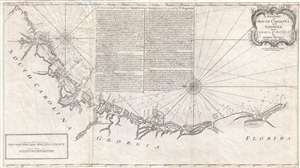
A Draught of South Carolina and Georgia from Sewee to St. Estaca.
sold
- Digital Map Information
- Suitable for large format printing
- DPI: 300
- File Size: 500.78 MB
- File Type: ZIP / TIFF
- ICC color profile embedded
- Delivered instantly via download link
A rare and important 1778 American Revolutionary War era Andrew Hughes nautical chart or maritime map of the coasts of South Carolina, Georgia, and northern Florida. During the early part of the Revolutionary War, this was the best obtainable nautical chart ... (more details)
A ground-breaking map of Carolina showing the contentions geography of Jonathan Lederer.
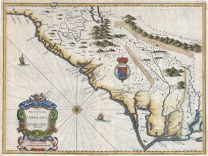
A New Description of Carolina.
sold
- Digital Map Information
- Suitable for large format printing
- Full resolution TIFF file
- ICC color profile embedded
- Delivered instantly via download link
A very attractive example of John Speed's important and rare 1676 map of the Carolina colony - representing the first serious attempts to map the interior of the Carolinas based upon actual exploration. Speed heavily based his cartography of Carolina upon the explorations of John Lederer and Ogilby's Lords Proprietor's Map of 1674. Oriented to the West, map covers from the Spanish colony of St. Augustine, Florida, north to the English colony of Jamestown, Virginia. It extends inland as far as the Appalachian (Apalathean) Mountains. (more details)
The most important map of Georgia issued before the American Revolutionary War.
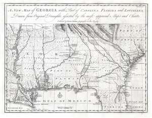
A New Map of Georgia with Part of Carolina, Florida and Louisiana.
sold
- Digital Map Information
- Suitable for large format printing
- DPI: 600
- File Size: 16.01 MB
- File Type: ZIP / TIFF
- ICC color profile embedded
- Delivered instantly via download link
One of the finest and most important large-scale maps of Georgia ever produced, this is Emmanuel Bowen's 1748 map of the colony of Georgia, considered the first obtainable specific map of that region. The map covers the Atlantic coast from Charleston (South Carolina) to Cape Canaveral (Florida) and extends westward to just beyond the Mississippi River, covering the Gulf Coast and the Mississippi Delta. It extends north along the Mississippi to about 35° N Latitude. This map was drawn by Bowen just 15 years after General James Oglethorpe received the Georgia charter from King George II, for whom the colony is named (April 21, 1732). It was intended to accompany the expanded 1748 edition of John Harris's work Navigantium atque Itinerantium Bibliotheca, which included a new chapter on the founding of Georgia. (more details)
The earliest specific large scale map of Georgia, issued just 15 years after the colony's founding.
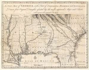
A New Map of Georgia with Part of Carolina, Florida and Louisiana.
sold
- Digital Map Information
- Suitable for large format printing
- DPI: 600
- File Size: 16.7 MB
- File Type: ZIP / TIFF
- ICC color profile embedded
- Delivered instantly via download link
One of the finest and most important large-scale maps of Georgia ever produced, this is Emmanuel Bowen's 1748 map of the colony of Georgia, considered the first obtainable specific map of that region. The map covers the Atlantic coast from Charleston (South Carolina) to Cape Canaveral (Florida) and extends westward to just beyond the Mississippi River, covering the Gulf Coast and the Mississippi Delta. It extends north along the Mississippi to about 35° N Latitude. This map was drawn by Bowen just 15 years after General James Oglethorpe received the Georgia charter from King George II, for whom the colony is named (April 21, 1732). It was intended to accompany the expanded 1748 edition of John Harris's work Navigantium atque Itinerantium Bibliotheca, which included a new chapter on the founding of Georgia. (more details)
The earliest specific large scale map of Georgia, issued just 15 years after the colony's founding.
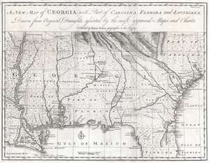
A New Map of Georgia with Part of Carolina, Florida and Louisiana.
sold
- Digital Map Information
- Suitable for large format printing
- DPI: 300
- File Size: 8.38 MB
- File Type: ZIP / TIFF
- ICC color profile embedded
- Delivered instantly via download link
One of the finest and most important large-scale maps of Georgia ever produced, this is Emmanuel Bowen's 1748 map of the colony of Georgia, considered the first obtainable specific map of that region. The map covers the Atlantic coast from Charleston (South Carolina) to Cape Canaveral (Florida) and extends westward to just beyond the Mississippi River, covering the Gulf Coast and the Mississippi Delta. It extends north along the Mississippi to about 35° N Latitude. This map was drawn by Bowen just 15 years after General James Oglethorpe received the Georgia charter from King George II, for whom the colony is named (April 21, 1732). It was intended to accompany the expanded 1748 edition of John Harris's work Navigantium atque Itinerantium Bibliotheca, which included a new chapter on the founding of Georgia. (more details)
An Essential American Revolutonary War map rvised to reflect the independence of the United States.
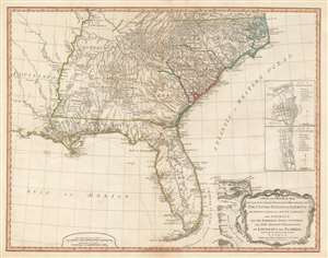
A New and General Map of the Southern Dominions Belonging to The United States of America, viz: North Carolina, South Carolina, and Georgia: with the Bordering Indian Countries, and The Spanish Possessions of Louisiana and Florida.
sold
- Digital Map Information
- Suitable for large format printing
- DPI: 600
- File Size: 24.8 MB
- File Type: ZIP / TIFF
- ICC color profile embedded
- Delivered instantly via download link
A scarce 1794 map of the southeastern part of the United States and Florida issued by the London firm of Laurie and Whittle. The coverage extends from North Carolina to the Florida Keys and from just beyond the Mississippi River to the Atlantic seaboard and the Bahamas. It encompasses the modern-day states of North Carolina, South Carolina, Georgia, Kentucky, Tennessee, Alabama, Mississippi, Louisiana (very little detail), and Florida. At right, there are inset detail maps of Charleston and St. Augustine. (more details)
Nautical map by the French during the American Revolutionary War.
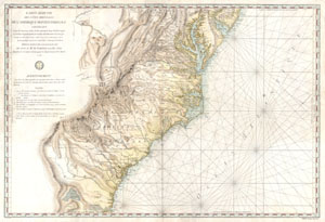
Carte Reduite Des Cotes Orientales De L'amerique Septentrionale Contenant Partie du Nouveau Jersey, la Pen-sylvanie, le Mary-land, la Virginie, la Caroline Septentrionale, la Caroline Meridionale et la Georgie, Assujettie aux Observations les plus recentes et aux Cartes de detail les plus estimées. Dressée au Dépôt Général des Cartes, Plans et Journaux de la Marine. Pour le Service des Vaisseaux Français Par Ordre de M. de Sartine, Conseiller d'Etat, Ministre et Secretaire d'Etat, ayant le Département de la Marine. 1778.
sold
- Digital Map Information
- Suitable for large format printing
- Full resolution TIFF file
- ICC color profile embedded
- Delivered instantly via download link
A rare and extraordinary map of considerable historic importance. This map, which covers from New Jersey and Pennsylvania southward through Maryland and Virginia, then along the Carolina coast to Georgia and Florida, was issued by the French 'Depot General ... (more details)
Southern frontiers of the British Colonies in North America.
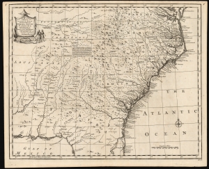
A New and Accurate Map of the Provinces of North and South Carolina etc.
sold
- Digital Map Information
- Suitable for large format printing
- DPI: 600
- File Size: 28.04 MB
- File Type: ZIP / TIFF
- ICC color profile embedded
- Delivered instantly via download link
This is a strong example of Emmanuel Bowen's 1747 map of the Carolinas and Georgia. The map reveals the region against the rising hostilities that would soon culminate in the French and Indian War (1754 - 1763). Among its highlights are the defenses of the Georgia colony - then just 13 years old. It also notes the American Indian treaties and alliances that were the cornerstone of British colonial governance and commerce. (more details)
Atlanta as a center of African American Education.
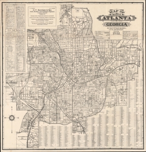
Map of the City of Atlanta Georgia.
sold
- Digital Map Information
- Suitable for large format printing
- File Size: 43.79 MB
- File Type: ZIP / TIFF
- ICC color profile embedded
- Delivered instantly via download link
This is the 1912 O. F. Kauffman map of Atlanta, Georgia, the earliest obtainable detailed map of that city. The map emerged during a period of growth and urbanization as Atlanta transformed into a manufacturing and transport hub. It is also significant for its delineation, for one of the first times on a commercial map, Atlanta's many historically black schools and universities. (more details)
Made for blockade running.
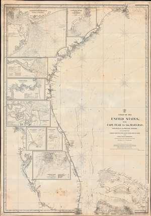
Coast of the United States from Cape Fear to the Bahamas, with plans of the Principal Harbors on an Enlarged Scale; Compiled from the most Recent Surveys, Made by order of the United States Government, and Adjusted by the Latest Astronomical Observations.
sold
- Digital Map Information
- Suitable for large format printing
- File Size: 48.52 MB
- File Type: ZIP / TIFF
- ICC color profile embedded
- Delivered instantly via download link
This is a rare 1865 Civil War Era Charles Copley 'blockade runner's' nautical chart or maritime map of the southeastern coast of the United States extending roughly from Cape Fear, North Carolina, to Miami, Florida, and the northern Bahamas. (Miami does not yet exist, but the Miami River and the Cape Florida Light, built in 1860, are illustrated.) Insets within the peninsula of Florida detail the most important southern harbors: Charleston, Georgetown Harbor, the Savannah River, Jacksonville (St. John's River), Fernandina Harbor, Cape Canaveral, Turtle Harbor, and Cedar Keys. The northern Bahamas are covered in some detail, but the chart does not extend as far south as Nassau. (more details)
The only 'realistic' view of the most notorious Anderson confederate Civil War Prison.
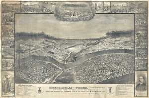
Andersonville Prison. Camp Sumter, GA. As It Appeared August 1st, 1864 When It Contained 35,000 Prisoners of War.
sold
- Digital Map Information
- Suitable for large format printing
- File Size: 378.82 MB
- File Type: ZIP / TIFF
- ICC color profile embedded
- Delivered instantly via download link
This is an 1885 large-format Thomas O'Dea view of the infamous Confederate Civil War Prisoner of War Camp at Andersonville, Georgia. After the Civil War, Andersonville became synonymous with the horrors the country inflicted on itself, encapsulating the ... (more details)
One of the most decorative early nautical charts of the American Southeast.
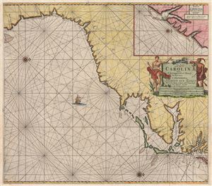
Pas Kaart van de Kust van Carolina tusschen C de Canaveral en C Henry.
sold
- Digital Map Information
- Suitable for large format printing
- DPI: 300
- File Size: 21.25 MB
- File Type: ZIP / TIFF
- ICC color profile embedded
- Delivered instantly via download link
Among the most scarce and decorative Dutch nautical charts of the American southeast, this is Johannis Van Keulen's and C. J. Vooght's 1687 maritime map of the Virginia, Carolina, Georgia and Florida coasts. Oriented to the west (with north to the ... (more details)
The rarest significant late 19th century map of Mobile.
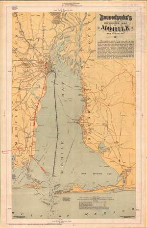
Boudousquie's Reference Map of Mobile and Vicinity.
sold
- Digital Map Information
- Suitable for large format printing
- File Size: 19.68 MB
- File Type: ZIP / TIFF
- ICC color profile embedded
- Delivered instantly via download link
A map of the utmost rarity, this is Paul Charles Boudousquie's map of Mobile Bay. It is considered by Mobile historian Caldwell Delaney, head of the Museum of the City of Mobile for 40 years and author of Howes' U.S.iana (1650 - 1950), the rarest of maps delineating Mobile. It is moreover, the only significant locally published map of Mobile Bay to appear in the 19th century. The map covers all of Mobile Bay as well as the Mobile River Delta, the city of Mobile, and much of the surrounding country. The newly dredged ship channel is boldly denoted through the center of the Bay. This map appeared during a period of revived optimism following years of social, political, and economic decline. (more details)
A Civil War blockade-runners map of the Savannah River.
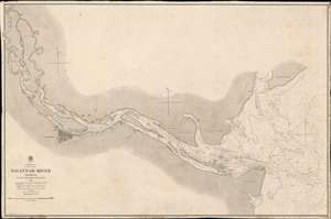
Savannah River Georgia From the United States Coast Survey 1855.
sold
- Digital Map Information
- Suitable for large format printing
- File Size: 46.2 MB
- File Type: ZIP / TIFF
- ICC color profile embedded
- Delivered instantly via download link
This is an extremely scarce 1861 British Admiralty Chart of the Savannah River and city of Savannah, Georgia, issued at the outset of the American Civil War (1961 - 1865). Although formally neutral in the conflict, British private interests financed blockade runners that sent munitions and luxuries to Confederate ports in return for cotton and tobacco. This map of the Savannah River was doubtless produced for this purpose.
The map is derived from U.S. Coast Survey work in the Savannah region completed in 1855, and although the Admiralty chart is superior in construction and presentation, is substantively similar. Coverage extends from the mouth of the Savanna River, Hilton Head, and Tybee Island, westward towards savanna, as far north as Argyle Island. The triangulation for this map was completed by E.O. Cord, C. O. Boutelle, C. P. Bolles and D. T. Van Buren. The topography is the work of H. I. Whiting. The Hydrography was accomplished by a party under the command of J. N. Maffitt. (more details)
The map is derived from U.S. Coast Survey work in the Savannah region completed in 1855, and although the Admiralty chart is superior in construction and presentation, is substantively similar. Coverage extends from the mouth of the Savanna River, Hilton Head, and Tybee Island, westward towards savanna, as far north as Argyle Island. The triangulation for this map was completed by E.O. Cord, C. O. Boutelle, C. P. Bolles and D. T. Van Buren. The topography is the work of H. I. Whiting. The Hydrography was accomplished by a party under the command of J. N. Maffitt. (more details)
Massive blueblack Nautical Chart of the southeastern United States coastline.
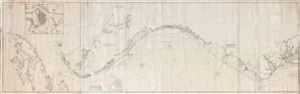
[Chesapeake Bay to Cuba]
sold
- Digital Map Information
- Suitable for large format printing
- File Size: 80.38 MB
- File Type: ZIP / TIFF
- ICC color profile embedded
- Delivered instantly via download link
A massive four panel 1861 Edmund Blunt blueback nautical chart or maritime map covering the southeastern coast of the United States from the entrance to the Chesapeake Bay to Florida and Cuba, including Virginia, North Carolina, South Carolina, and Georgia coasts. This highly detailed chart is a fine example of Blunt's work offering limited inland detail but a wealth of nautical information including countless depth soundings, light houses, shore lines, river soundings, shipping lanes, and other practical information for the mariner. Although mostly focused on the southeastern United States, the leftmost map or southern sheet, extends to cover Cuba and offers an excellent inset of Havana. (more details)
First large-scale commercial map of the Confederacy.
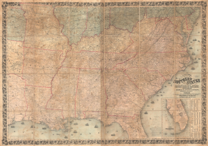
Colton's Map of the Southern States, including Maryland, Delaware, Virginia, Kentucky, Tennessee, Missouri, North Carolina, South Carolina, Georgia, Alabama, Mississippi, Arkansas, Louisiana, and Texas. Showing Also Part of Adjoining States and Territories Locating the Forts and Military Stations of the U. States and Showing all the Rail Roads, R.R. Stations, and other Internal Improvements.
sold
- Digital Map Information
- Suitable for large format printing
- File Size: 198.45 MB
- File Type: ZIP / TIFF
- ICC color profile embedded
- Delivered instantly via download link
This is an 1861 J. H. Colton map of the Confederacy published in the first year of the American Civil War (1861 - 1865). This is the first large-scale commercial map of the Confederacy, published early in 1861, in the immediate wake of the Secession. (more details)
Best general map of the Southeast of the 18th Century.
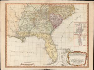
A New and General Map of the Southern Dominions Belonging to the United States of America, viz: North Carolina, South Carolina, and Georgia: with the Bordering Indian Countries and The Spanish Possessions of Louisiana and Florida.
sold
- Digital Map Information
- Suitable for large format printing
- DPI: 600
- File Size: 723.14 MB
- File Type: ZIP / TIFF
- ICC color profile embedded
- Delivered instantly via download link
A scarce 1794 Laurie and Whittle / Sayer map of the southeastern part of the United States and Florida. This is the second edition of Sayer's map of the southeast, and the first to recognize the United States as an independent nation. At the time of initial publication, it represented the finest general cartography of the southeast obtainable. (more details)
Transporting goods (including cotton) in the southern United States.
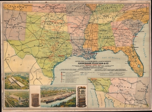
Cotton Map of the United States of North America.
sold
- Digital Map Information
- Suitable for large format printing
- Full resolution TIFF file
- ICC color profile embedded
- Delivered instantly via download link
This is a c. 1920s Anderson, Clayton and Company chromolithograph railroad wall map of the southern United States issued to celebrate the firm's rapid expansion and growth. Anderson, Clayton, and Company was an American cotton and dry goods firm that exported worldwide. This map was issued to celebrate Anderson, Clayton's growth from small town mills to a national and global logistic network. Towns identified by red text hosted either an Anderson, Clayton, and Company office or a Clayton Roundtable-Compress. An inset in the lower right details the American Southwest from Los Angeles to El Paso, noting Los Angeles was home to an Anderson, Clayton office. Three views in the lower left illustrate cotton processing centers in Houston (which had two centers) and New Orleans, noting bale capacity for each. (more details)
Colonial rivalries in early America - fine original color.
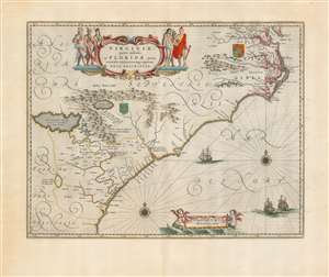
Virginiae Partis australis, et Floridae partis orientalis, interjacentiumque regionum Nova Descriptio.
sold
- Digital Map Information
- Suitable for large format printing
- Full resolution TIFF file
- ICC color profile embedded
- Delivered instantly via download link
This is Willem Blaeu's beautiful map of Virginia and Florida, engraved in 1638 and appearing here in a superb example of the 1662 Atlas Maior edition, printed for Joan Blaeu's mammoth masterpiece atlas. This classic Dutch map, which encompassed the Carolinas and what would become Georgia and part of Florida, has been called 'the most correct map of this area yet to appear.' (Cumming) (more details)