
Polar: Arctic & Antarctic (sold)
Thorough, early defense of the Sea of the West and the Northwest Passage.
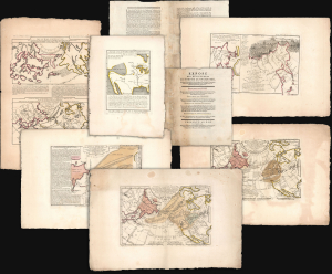
Exposé des Découvertes au Nord de la Grande Mer...
sold
- Digital Map Information
- Suitable for large format printing
- Full resolution TIFF file
- ICC color profile embedded
- Delivered instantly via download link
This is an extremely rare example of Philippe Buache's 1753 Exposé des Découvertes au Nord de la Grande Mer, the essential maps published to support the astonishing geographical theories of Philippe Buache and Joseph Nicolas De l'Isle, presented in August 1752 to the Paris Academie des Sciences. It was then the most complete cartographical defense of Nicolas De l'Isle's 'exposé' of Russian cartographic advances, along with Buache's synthesis of several mappings of the Pacific Northwest, revealing compelling (if ultimately false) evidence of a viable Northwest Passage. These maps were later included in the 1753-1755 Considérations Géographiques, 'the magnum opus of the Delisle-Buache theory of the layout of lands in the North Pacific space,' (Lada-Mocarski, 1969) appearing there in their second states. These six sheets are all first state examples, indicating that the Exposé enjoyed an earlier publication, spurred perhaps by the novelty of Buache and De l'Isle's arguments and the urgency with which the two geographers wished to assuage and rebut critics of their presentation to the Academie. (more details)
Rare Polar Projections.
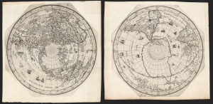
[Untitled Planispheres.]
sold
- Digital Map Information
- Suitable for large format printing
- DPI: 600
- File Size: 33.37 MB
- File Type: ZIP / TIFF
- ICC color profile embedded
- Delivered instantly via download link
These are Isaac Habrecht's rare 1628 north and south polar projection maps, in their Fürst edition of 1666. These were prepared for inclusion in Habrecht's 1628 instructional booklet on the construction of globes to present the dominant geography of the first part of the 17th century. Decorated with ships and sea monsters, the maps evoke the Age of Discovery, while presenting several of the fascinating geographical hallmarks of the period; these mainly draw on Dutch geographers, notably Plancius and van der Keere. The planispheres incorporate lines of latitude and longitude, and the ecliptic, including the zodiacal symbols. In addition to the geographic north and south poles, Habrecht has included both the north and south magnetic poles. (more details)
The most important map of the Northeast Passage and pre-Behring map of the NE Asian Arctic.
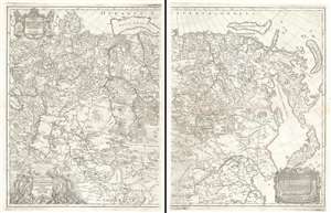
Nova Descriptio Geographica Tattariae Magnae Tam Orientalis Quam Occidentalis In Particularibus Et Generalibus Territoriis Una Cum Delineatione Totius Imperii Russici Imprimis Siberiae Accurate Ostensa.
sold
- Digital Map Information
- Suitable for large format printing
- DPI: 600
- File Size: 71.2 MB
- File Type: ZIP / TIFF
- ICC color profile embedded
- Delivered instantly via download link
A cartographic masterpiece defined by imprisonment, war, and obsession. This is the first edition of Philipp Johann von Strahlenberg's 1730 map of Russia and Siberia. Strahlenberg's expansive map is considered one of the largest, most groundbreaking, and unique maps of Russia to appear in the first half of the 18th century. It is of particular importance to the mapping of Siberia and the Russian Arctic, to establishing expectations for the viability of a Northeast Passage, and to the pre-Bering mapping of the Bering Strait. (more details)
Extremely rare, highly influential, and very important foundational map of the North Pacific showing Sea of the West and the apocryphal discoveries of Admiral de Fonte.
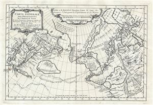
Carte General Des Decouvertes De L'Amiral de Fonte Et autres Navigateurs Espagnols, Anglois, et Russes, pour la recherche du Passage a la Mer du Sud.
sold
- Digital Map Information
- Suitable for large format printing
- DPI: 300
- File Size: 6.51 MB
- File Type: ZIP / TIFF
- ICC color profile embedded
- Delivered instantly via download link
An object of extreme historical importance and rarity, this map was the center of one of the most heated cartographic debates in history. This is an unrecorded state of Joseph-Nicolas de L'Isle's (Delisle) map of the Northern Pacific Ocean and Arctic. De ... (more details)
Published in only one edition.
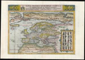
Nova Totius Europae Tabula.
sold
- Digital Map Information
- Suitable for large format printing
- Full resolution TIFF file
- ICC color profile embedded
- Delivered instantly via download link
This is Cornelis De Jode's rare map of Europe, printed in a single edition of 1593. It was among the updated maps added to the De Jode atlas specifically to compete with Ortelius' powerhouse Theatrum Orbis Terrarum. To this end, it combined cartographic information from the most current sources with a level of decorative flourish that had not yet appeared in any atlas. It also presented its subject with a broader focus to incorporate newer information about the northern parts of the world not present on the elder De Jode's map. (more details)
Henry Hudson's Final Voyage.
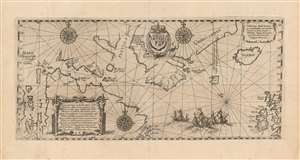
Tabula nautica, qua repraesentātur orae maritimae meatus, ac freta, noviter a H. Hudsono Anglo ad Caurum supra Novam Franciam indagata anno 1612.
sold
- Digital Map Information
- Suitable for large format printing
- Full resolution TIFF file
- ICC color profile embedded
- Delivered instantly via download link
This is Johann Theodore De Bry's 1613 edition of Hessel Gerritz' chart of the North Atlantic and the Canadian Maritimes, based on the reports of Henry Hudson's fourth, final voyage. Predated only by Gerritsz' much rarer 1612 issue, this is the first map of Hudson Bay and the surrounding region, and remained the best chart of the northern regions of Canada for decades. The chart reaches from the British Isles to the western shore of James Bay, extending from 50° - 70° N. (more details)
Essential Canadianum: 'The primary map of this period... influenced the cartography of Canada for the next fifty years.' - Kershaw
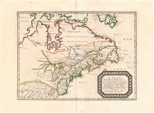
Le Canada, ou Nouvelle France...
sold
- Digital Map Information
- Suitable for large format printing
- DPI: 600
- File Size: 26.16 MB
- File Type: ZIP / TIFF
- ICC color profile embedded
- Delivered instantly via download link
This is Nicolas Sanson's 1656 map of Canada, the Northeast and the Great Lakes, in a superb, untrimmed example. It was among the most influential and important maps of the north part of the Americas to be printed in the 17th century - its depiction of Canada was not superseded until De l'Isle's 1703 Carte du Canada, and it featured the finest depiction of the Great Lakes until the 1687 Coronelli-Nolin. It is among the first printed maps to be informed by the reports of French Jesuit explorers, whose exploration of the Great Lakes region after Champlain's initial explorations was stalled by the 1648 escalation of the Beaver Wars (1603 - 1701) with the Iroquois Confederacy. Following the 1653 pause in the war, Jesuit and French fur traders resumed their push west, gradually revealing the form of the Great Lakes.
The map's treatment of the Arctic waters and Maritime Canada builds on Champlain's basic model, adding place names derived from Dutch and English exploration and preserving Button's explicit northwest passage leading from Button's Bay. (more details)
The map's treatment of the Arctic waters and Maritime Canada builds on Champlain's basic model, adding place names derived from Dutch and English exploration and preserving Button's explicit northwest passage leading from Button's Bay. (more details)
Presenting the obsolete, geocentric, model of the universe
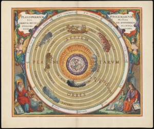
Planisphaerium Ptolemaicum, sive Machina Orbium Mundi Ex Hypothesi Ptolemaica in Plano Disposita.
sold
- Digital Map Information
- Suitable for large format printing
- File Size: 28.06 MB
- File Type: ZIP / TIFF
- ICC color profile embedded
- Delivered instantly via download link
This beautiful work is Andreas Cellarius' celestial chart, in its 1708 Valk and Schenk edition, illustrating the geocentric solar system imagined by Claudius Ptolemy in the 2nd century, and which remained the standard model of the universe until the 16th century and the discoveries of Nicolas Copernicus. It is among the most beautiful depictions of the Earth-centered solar system produced in the 17th century. (more details)
'The primary map of this period... influenced the cartography of Canada for the next fifty years.' - Kershaw

Le Canada, ou Nouvelle France...
sold
- Digital Map Information
- Suitable for large format printing
- Full resolution TIFF file
- ICC color profile embedded
- Delivered instantly via download link
This is Nicolas Sanson's 1656 map of Canada, the Northeast, and the Great Lakes, in an attractive, untrimmed example. It ranks among the most influential and important maps of the north part of the Americas to be printed in the 17th century - its depiction of Canada was not superseded until De l'Isle's 1703 Carte du Canada, and it features the finest depiction of the Great Lakes until the 1687 Coronelli-Nolin. It is among the first printed maps to be informed by the reports of French Jesuit explorers, whose exploration of the Great Lakes region after Champlain's initial explorations was stalled by the 1648 escalation of the Beaver Wars (1603 - 1701) with the Iroquois Confederacy. Following the 1653 pause in the war, Jesuit and French fur traders resumed their push west, gradually revealing the form of the Great Lakes. (more details)
Important second edition of Mercator and Hondius' Map of the Arctic showing a break with 16th century cartographic convention.
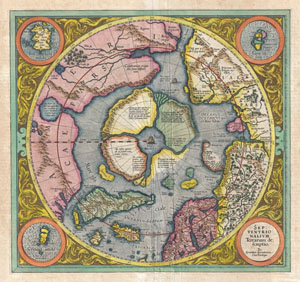
Septentrionalium Terrarum descriptio.
sold
- Digital Map Information
- Suitable for large format printing
- DPI: 300
- File Size: 10.52 MB
- File Type: ZIP / TIFF
- ICC color profile embedded
- Delivered instantly via download link
This is the second edition of Gerard Mercator's map of the North Pole or Arctic, one of the great cartographer's most interesting and important maps. Mercator's Arctic projection has its roots in his magnificent 1569 wall map of the world in which Mercator ... (more details)
Map In Transition.
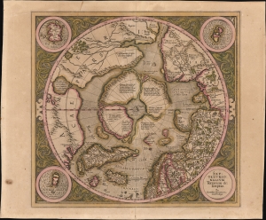
Septentrionalium Terrarum descriptio.
sold
- Digital Map Information
- Suitable for large format printing
- Full resolution TIFF file
- ICC color profile embedded
- Delivered instantly via download link
This is the 1606 second Hondius state of Gerard Mercator's map of the North Pole or Arctic, one of the great cartographer's most interesting and important maps. This map marks a significant step forward in the cartographic understanding of the high Arctic, representing the transition between medieval and modern cosmographical perspectives. (more details)
Important second edition of Mercator and Hondius' Map of the Arctic showing a break with 16th century cartographic convention.
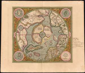
Septentrionalium Terrarum descriptio.
sold
- Digital Map Information
- Suitable for large format printing
- DPI: 600
- File Size: 23.59 MB
- File Type: ZIP / TIFF
- ICC color profile embedded
- Delivered instantly via download link
This is the second state of Gerard Mercator's 1606 map of the North Pole or Arctic, one of the great cartographer's most interesting and important maps. Mercator's Arctic projection has its roots in a magnificent 1569 wall map of the world in which Mercator first introduces his revolutionary projection. As regards the Arctic, the difficulty with the Mercator Projection is that to accurately depict the Polar Regions, a map would have to be infinitely tall. Mercator compensated for this by including a polar projection, very similar to the map shown here, in the lower-left hand corner of his great map. This may rightly be considered to be the world's first specific map of the North Pole. Mercator later reissued this map in an expanded format for his 1595 atlas. Following a number of important expeditions to the Arctic in subsequent 10 years, Mercator's successor Jodocus Hondius reissued the original 1595 map with a number of revolutionary and highly significant changes. (more details)
Realities in conflict.
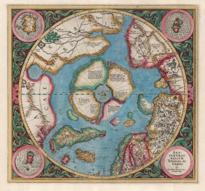
Septentrionalium Terrarum descriptio.
sold
- Digital Map Information
- Suitable for large format printing
- Full resolution TIFF file
- ICC color profile embedded
- Delivered instantly via download link
This is the second state of Gerard Mercator's 1606 map of the North Pole or Arctic, one of the great cartographer's most interesting and important maps. This map marks a significant step forward in the cartographic understanding of the high Arctic, more importantly, is a groundbreaking transition between mediaeval and modern cosmographical perspectives. (more details)
Violent Antarctic seas, peaceful birds.
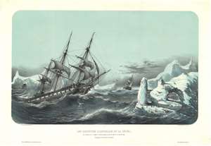
Les Corvettes L'Astrolabe et la Zélée, aux ordres du Ct. Dumont D'Urville, dans le coup de vent du Janvier 1840. Parages de cercle Polaire Antarctique.
sold
- Digital Map Information
- Suitable for large format printing
- Full resolution TIFF file
- ICC color profile embedded
- Delivered instantly via download link
A striking c. 1841 Louis Le Breton maritime view of the Dumont d'Urville's third expedition in violent Antarctic seas. Le Breton's view depicts the Astrolabe (left) and Zéllée (right), struggling against extreme Antarctic conditions. High waves and dangerous icebergs make for a treacherous scene - a sharp contrast to the penguins at right enjoying what, for them at least, must have seemed a fine warm day. (more details)
First cartobibliography of the Northwest Passage.
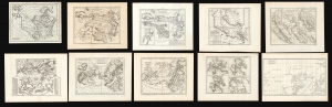
Carte des parties nord et oust de L'Amerique/ Carte des parties Nord et est de L'Asie/Nouvelle représentation Des Côtes Nord et Est de l'Asie/ Carte de la Californie et des Pays Nord-Ouest separés de l'Asie par le détroit d'Anian./ Carte de la Californie Suivant.../ Carte des Nouvelles Decouvertes dressée par Phil. Buache/ Carte Générale des Découvertes de l'Amiral de Fonte…/ Carte Generale des Découvertes de l'Amiral de Fonte ... Jefferys/ Carte qui Représente les différentes connoissances que l'on a eues des Terres Arctiques depuis 1650 jusqu'en 1747 / Partie de la Carte du Capitaine Cluny…
sold
This is Robert de Vaugondy's seminal 1772 map series exploring the mapping of North America, Asia, and specifically the Northwest Passage, summarizing three centuries of cartography. Included as a supplement to Diderot's 1772 Encyclopédie, this was among the first studies in comparative cartography committed to print. The cartographic survey embraced some of the most important topics in 18th-century geography and might justifiably be proposed as the first cartobibliography.
(more details)
(more details)
One of the earliest maps to show Mercator's speculative Arctic islands, the apocryphal Friesland, and Zeno's fraudlent version of Labrador, Estotiland.
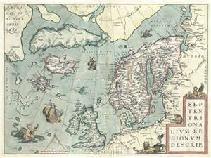
Septentrionalum Regionum Desrip.
sold
- Digital Map Information
- Suitable for large format printing
- DPI: 300
- File Size: 11.16 MB
- File Type: ZIP / TIFF
- ICC color profile embedded
- Delivered instantly via download link
One of Abraham Ortelius' most interesting maps, this is his 1570 map of Scandinavia and the Arctic. During the Age of Discovery, these northern parts of the world represented regions as remote and unfamiliar as the coasts of America, Africa, and Asia. (more details)
First Atlas Map of the North Parts of the World.
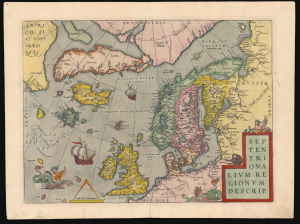
Septentrionalium Regionum Desrip.
sold
- Digital Map Information
- Suitable for large format printing
- Full resolution TIFF file
- ICC color profile embedded
- Delivered instantly via download link
A handsome example of one of Abraham Ortelius' most interesting maps, his 1570 map of Scandinavia and the Arctic. During the Age of Discovery, these northern parts of the world represented regions as remote and unfamiliar as the coasts of America, Africa, and Asia. (more details)
First Atlas Map of the North Parts of the World.
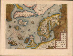
Septentrionalium Regionum Desrip.
sold
- Digital Map Information
- Suitable for large format printing
- Full resolution TIFF file
- ICC color profile embedded
- Delivered instantly via download link
A handsome example of one of Abraham Ortelius' most interesting maps, his 1570 map of Scandinavia and the Arctic. During the Age of Discovery, the Arctic was as remote and unfamiliar as the coasts of America, Africa, or Asia. This map played a role in propagating several cartographic fallacies, including the Zeno Fraud: Frisland, Estotiland, Drogeo. The present example features warm, original color. (more details)
The quest for Terre Australis.
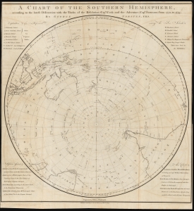
A Chart of the Southern Hemisphere according to the latest Discoveries with the Tracks of the Resolution, Cap.n Cook; and the Adventure, Cap.n Furneaux; from 1772, to 1775.
sold
- Digital Map Information
- Suitable for large format printing
- DPI: 600
- File Size: 68.68 MB
- File Type: ZIP / TIFF
- ICC color profile embedded
- Delivered instantly via download link
A rare 1777 George Forster map of James Cook's second voyage of exploration to the South Pole, from 1772 to 1775. (more details)
Spanish commentary on the Sea of the West.
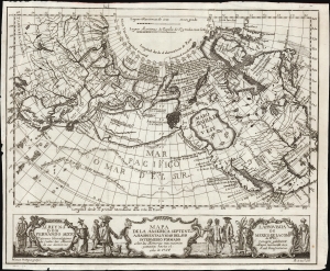
Mapa de la America Septentl. Asia Oriental y Mar Del Sur Intermedio Formado sobre las Memorias mas recientes y exactas hasta el año de 1754.
sold
- Digital Map Information
- Suitable for large format printing
- File Size: 9.44 MB
- File Type: ZIP / TIFF
- ICC color profile embedded
- Delivered instantly via download link
This is a rare 1757 Madrid edition of Joseph Nicolas De l'Isle and Philippe Buache's 1752 map of North America, Siberia, the Arctic, and the North Pacific. The map presents De L'Isle's accurate mapping of the Asian northeast alongside Buache's fabricated Northwest Passage. This unusual Spanish edition of the map was issued to illustrate an unambiguous argument by the editor attacking the credibility of the map and the reports upon which it was founded. (more details)
Early Woman Map Publisher.
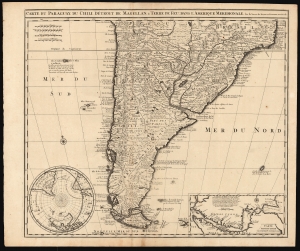
Carte du Paraguay, du Chili, Détroit de Magellan, et Terre de Feu dans l'Amerique Meridionale.
sold
- Digital Map Information
- Suitable for large format printing
- DPI: 600
- File Size: 64.4 MB
- File Type: ZIP / TIFF
- ICC color profile embedded
- Delivered instantly via download link
This is Elizabeth Verseyl Visscher's scarce, c. 1710 map of southern South America, based on the 1703 map by Guillaume De l'Isle. It is notable in particular for being the first published map to include a new, 1702 charting of the Strait of Magellan, which had been suppressed by the Chancellor of France, the Comte de Pontchartrain. (more details)
Strait of Magellan, and the imagined lands to the south.
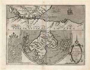
Chica Sive Patagonica et Australis Terra. MDC.
sold
- Digital Map Information
- Suitable for large format printing
- DPI: 600
- File Size: 19.86 MB
- File Type: ZIP / TIFF
- ICC color profile embedded
- Delivered instantly via download link
This scarce and fascinating map is Matthias Quad's 1600 depiction of the Straits of Magellan and the southern polar regions, including Terre Australis - the massive continent believed by many sixteenth and seventeenth century geographers to cover the south part of the world. It is closely derived from a 1597 map by Cornelis Wytfliet, but is much scarcer than the earlier work. (more details)
The Northern Limits of Geographical Knowledge in the Age of Discovery
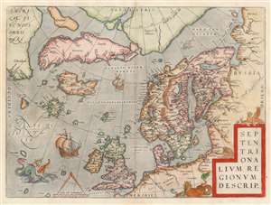
Septentrionalium Regionum Desrip.
sold
- Digital Map Information
- Suitable for large format printing
- DPI: 600
- File Size: 49.65 MB
- File Type: ZIP / TIFF
- ICC color profile embedded
- Delivered instantly via download link
One of Abraham Ortelius' most interesting maps, this is his 1570 map of Scandinavia and the Arctic. During the Age of Discovery, these north parts of the world represented regions as remote and unfamiliar as the coasts of America, Africa, and Asia. The map covers the northern regions from the English Channel to the just south of the North Pole and from America to Russia, including England, Scandinavia, Finland, Denmark, Iceland, and Greenland, as well as parts of America (Estotiland), the apocryphal island of Frisland, and Mercator's speculative Arctic islands. (more details)
An enigmatic map and the first specific map of Northern Canada and the Northwest Passage.
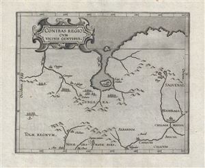
Conibas Regio Cum Vicins Gentibus.
sold
- Digital Map Information
- Suitable for large format printing
- DPI: 300
- File Size: 4.42 MB
- File Type: ZIP / TIFF
- ICC color profile embedded
- Delivered instantly via download link
An intriguing and enigmatic production, this is Cornelis van Wytfliet's uncommon 1597 map of northern central Canada, indeed it is the first specific map to detail this entirely unknown region. The scope of the map, though hard to immediately perceive, is ... (more details)
Whimsical Schoolgirl Manuscript Polar Projection.
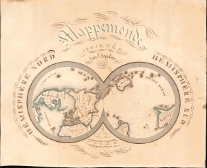
Mappemonde projetée sur l'Equateur. Hemisphere Nord. Hemisphere Sud.
sold
- Digital Map Information
- Suitable for large format printing
- File Size: 13.45 MB
- File Type: ZIP / TIFF
- ICC color profile embedded
- Delivered instantly via download link
This is a striking 1841 Constance Parisis manuscript schoolgirl map of the world on a dual hemisphere polar projection. (more details)
North Part of the World Known to Europe in the Age of Discovery.
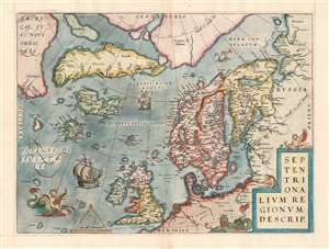
Septentrionalum Regionum Desrip.
sold
- Digital Map Information
- Suitable for large format printing
- Full resolution TIFF file
- ICC color profile embedded
- Delivered instantly via download link
One of Abraham Ortelius' most interesting maps, this is his 1570 map of the Arctic, here in a transitional example between the first and second states as recorded in van den Broecke. The map covers the northern regions from the English Channel to the just south of the North Pole and from America to Russia, including England, Scandinavia, Finland, Denmark, Iceland, and Greenland, as well as parts of America (Estotiland), the apocryphal island of Friesland, and Mercator's speculative Arctic islands. (more details)
Only known example of this map overprinted to illustrate the Cook-Peary North Pole discovery debate of 1909.
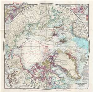
The Arctic Regions Showing Exploration towards the North Pole.
sold
- Digital Map Information
- Suitable for large format printing
- Full resolution TIFF file
- ICC color profile embedded
- Delivered instantly via download link
An extremely rare 1909 separately issued map of the Arctic showing exploratory routes towards the North Pole as of 1909. The map covers the Arctic regions as far south as Iceland and the Bearing Straits. The map is based upon a 1907 map issued by J. N. ... (more details)
First generally acquirable Map of Scandinavia, Iceland and Greenland.
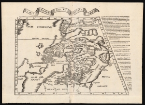
Norbegia et Gottia.
sold
- Digital Map Information
- Suitable for large format printing
- Full resolution TIFF file
- ICC color profile embedded
- Delivered instantly via download link
This is Lorenz Fries' 1522 map, in a 1535 edition, of one of the earliest maps to focus on the northern parts of Europe, including Iceland and Greenland. It is one of the earliest acquirable maps to include the geography of Claudius Clavus (1388 - 14??). (more details)
An unusual separate issue without verso text.
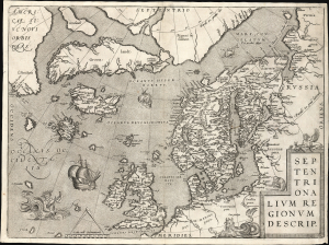
Septentrionalium Regionum Desrip.
sold
- Digital Map Information
- Suitable for large format printing
- File Size: 22.83 MB
- File Type: ZIP / TIFF
- ICC color profile embedded
- Delivered instantly via download link
A handsome example of one of Abraham Ortelius' most interesting maps, his 1570 map of Scandinavia and the Arctic. During the Age of Discovery, these northern parts of the world represented regions as remote and unfamiliar as the coasts of America, Africa, and Asia. (more details)
Unusual map illustrating the discoveries of Russian fur traders in the Aleutian Islands after Bering's expedition but before Cook.
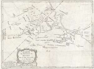
Carte des Découverts des Russes dans la Mer Orientale, et en Amerique Pour Servir à L'essai, Sur le commerce de Russie.
sold
- Digital Map Information
- Suitable for large format printing
- DPI: 300
- File Size: 9.14 MB
- File Type: ZIP / TIFF
- ICC color profile embedded
- Delivered instantly via download link
This is a rare and unusual 1777 map of the north Pacific in the vicinity of Alaska, the Bering Straits, and northeastern Siberia based upon Russian Promyshlenniki (trader) exploration. The map post-dates Russian state sponsored Vitus Bering Great ... (more details)
Richest Whaling Grounds.
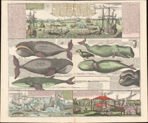
Historia Animantium Marinorum Iconographica et quidem Repraesentatio ejus Specialis I. in qua BALAENARUM Species, Figura, Magnitudo, Vita, Victus, Captura, et provenientis inde coste sartoria, as unguibusque praeparatio, nec non Oceani Glacialis memorabilia spectanda exhibentur. Omnia ex Fr. Martens, Zorndrager etc. itinerariis hausta, et in oblectamentum naturae curiosorum edita ab Homannia Heredibus.
sold
- Digital Map Information
- Suitable for large format printing
- File Size: 33.18 MB
- File Type: ZIP / TIFF
- ICC color profile embedded
- Delivered instantly via download link
This is a most fascinating c. 1760 Homann Heirs chart illustrating the Arctic whale fishery in the vicinity of Spitsbergen and Greenland. The image emerged at the peak of 18th-century whaling just as Arctic whale populations began to decline due to over-harvesting. (more details)
An updated version of Muller's iconic map of the discoveries of Vitus Bering.
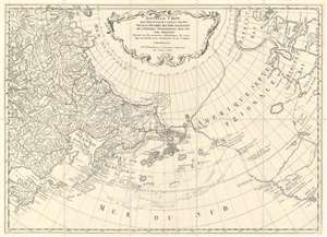
Nouvelle Carte des Decouvertes Faites par des Vaisseaux Russiens aux Cotes Inconnues de l'Amerique Septentrionale avec les Pais Adiacents. Dressée sur des memoires authentiques de ceux Qui ont assisté a ces decouverts, et sur d'autres Connoissances.
sold
- Digital Map Information
- Suitable for large format printing
- DPI: 600
- File Size: 27.6 MB
- File Type: ZIP / TIFF
- ICC color profile embedded
- Delivered instantly via download link
This is a 1773 Jacob von Staehlin map of the Pacific Northwest, the Arctic, and Siberia, which has been updated from Fredrick Muller's iconic 1754 map of the same region illustrating the findings of Vitus Bering's Great Northern Expedition. The map depicts from eastern Novaya Zemlya (Nowaja Semlja) to Hudson Bay and from the Arctic Ocean to California and Honshu, Japan. Von Staehlin's map includes a depiction of an archipelago in the place of Muller's namesake peninsula, which, although inaccurate, is closer to the real geography of the region. The Aleutians are illustrated as a string of islands emitting from a larger island which, although not connected to North America, certainly appears to be a proto-Alaska. (more details)