
Polar: Arctic & Antarctic
First full-size folio map of North America.
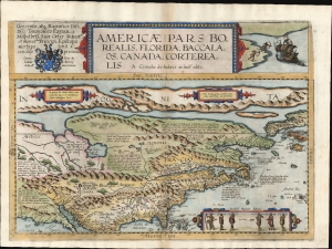
Americae Pars Borealis, Florida, Baccalaos, Canada, Corterealis.
$37,500.00
Acquire
- Digital Map Information
- Suitable for large format printing
- Full resolution TIFF file
- ICC color profile embedded
- Delivered instantly via download link
This is Cornelis De Jode's rare map of North America, printed in a single edition of 1593. The first full-size folio map specifically of North America, it was among the updated maps added to the De Jode atlas specifically to compete with Ortelius' Theatrum Orbis Terrarum. To this end, it combined cartographic information from current sources with a level of decorative flourish that had not yet appeared in any atlas. In the case of this map, Cornelis focused on a part of the world omitted from the elder De Jode's 1578 atlas. (more details)
Holy Grail Map - 1st Map of the North Pole.
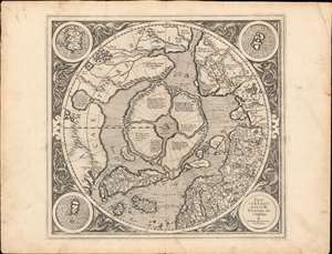
Septentrionalium Terrarum descriptio.
$30,000.00
Acquire
- Digital Map Information
- Suitable for large format printing
- Full resolution TIFF file
- ICC color profile embedded
- Delivered instantly via download link
This is the first edition, first state of Gerard Mercator's seminal 1595 map of the Arctic, the great cartographer's most interesting and important atlas map. In this first edition, it is the scarcest of Mercator's atlas maps and a holy grail for any Arctic collector. For all its flaws and inaccuracies, it is a schematized interpretation of factual voyages between Norway, England, Iceland, Greenland, and Labrador (Markland). (more details)
First separate map of the Pacific - in an exceptional old color example.
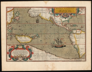
Maris Pacifici (quod vulgo Mar del Zur).
$17,500.00
Acquire
- Digital Map Information
- Suitable for large format printing
- Full resolution TIFF file
- ICC color profile embedded
- Delivered instantly via download link
This is Abraham Ortelius' 1589 map of the Pacific; here is the best example to appear on the market in recent years, with a strong strike and fine original color. Abraham Ortelius' map is as important as it is beautiful - Burden hailed it as 'one of the most important maps that appeared in the Ortelius atlases' and 'one of Ortelius' most desirable maps'. The map is not only the first to focus on the Pacific Ocean, but it is also the first acquirable map to separately identify North and South America. (more details)
Cold War Era Soviet Plan to Repel an American Arctic Invasion.

Организация и ведение противодесантной операции на морском побережье во взаимодействии с военно-морским флотом / [Organization and Conduct of an Anti-Amphibious Operation on the Seacoast in Coordination with the Navy].
$7,500.00
Acquire
This is a one-of-a-kind 1952 Cold War Era top-secret report with maps, prepared for the Operations Directorate of the Northern Military District of the Armed Forces of the Soviet Union. The booklet discusses detailed plans to repel a much-feared 'Anglo-American imperialist' invasion of the Soviet Union from the Arctic. It offers unique insight into the Soviet perspective and defensive planning at the height of the Cold War (1947 - 1991). (more details)
Scarce, separately issued 'carte-á-figures' of America.

Nova Totius Americae Descriptio Auct. F. de Wit.
$5,500.00
Acquire
- Digital Map Information
- Suitable for large format printing
- Full resolution TIFF file
- ICC color profile embedded
- Delivered instantly via download link
This is Frederic De Wit's scarce, separately issued 1660 carte à figures map of America. This beautifully engraved map was one of a handful produced by De Wit to showcase his skill as he struck out on his own as a mapmaker, after having worked for many years under the Blaeu family. It represents a synthesis of traditional imagery with state-of-the-art geographical ideas. It was not intended for any particular atlas, although surviving examples occasionally appear bound into other works, including Doncker's Zee-Atlas. (more details)
First flight over Antarctica.
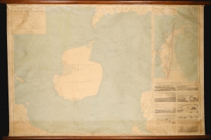
Wilkins-Hearst Antarctic Expedition 1928-1929. Map of the Antarctic.
$5,000.00
Acquire
- Digital Map Information
- Suitable for large format printing
- Full resolution TIFF file
- ICC color profile embedded
- Delivered instantly via download link
A rare 1929 American Geographical Society wall map of Antarctica issued to celebrate the 1928-29 Wilkins-Hearst Expedition (1928 - 29), wherein George Hubert Wilkins (1888 - 1958) accomplished the first Antarctic flight, revealing some 1000 miles of uncharted territory. (more details)
Copernicus Centers the Sun.
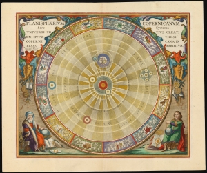
Planisphaerium Copernicanum Sive Systema Universi Totius Creati Ex Hypothesi Copernicana in Plano Exhibitum.
$4,500.00
Acquire
- Digital Map Information
- Suitable for large format printing
- File Size: 27.24 MB
- File Type: ZIP / TIFF
- ICC color profile embedded
- Delivered instantly via download link
This beautiful work is Andreas Cellarius' celestial chart, in its 1708 Valk and Schenk edition, illustrating the solar system theorized by Nicolaus Copernicus in the 16th century. It is among the most vivid and unambiguous depictions of the heliocentric solar system produced in the 17th century. (more details)
French Cartography and Dutch Decorative Engraving.
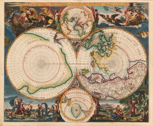
Les Deux Poles Arctique ou Septentrional, et Antarctique ou Meridional, ou Description des Terres Arctiques et Antarctiques ; et des Pays circomvoisins jusques aux 45. Degres de Latitude.
$4,000.00
Acquire
- Digital Map Information
- Suitable for large format printing
- Full resolution TIFF file
- ICC color profile embedded
- Delivered instantly via download link
This is a beautiful example of Peter Mortier's 1696 double-hemisphere map of the northern and southern hemispheres. The primary hemispheres focus on the northern and southern thirds of the world. The secondary hemispheres show the entire world, centered respectively on Paris and its antipodes. (more details)
North America from the Great Age of Exploration.
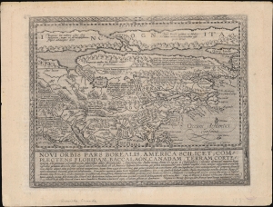
Novi Orbis Pars Borealis, America Scilicet, Complectens Floridam, Baccalaon, Canadam, Terram Corte . . . 1585.
$3,000.00
Acquire
- Digital Map Information
- Suitable for large format printing
- Full resolution TIFF file
- ICC color profile embedded
- Delivered instantly via download link
A beautifully engraved, rare, and important 1600 map of North America by Matthias Quad, in its first edition. This is one of the most significant obtainable maps to incorporate the cartography of Cornelis de Jode, John White, and Jacques Le Moyne. It is additionally significant for its postulation of an open Northwest Passage. (more details)
First Atlas Map of the North Parts of the World.
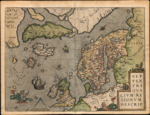
Septentrionalium Regionum Descrip.
$3,000.00
Acquire
- Digital Map Information
- Suitable for large format printing
- Full resolution TIFF file
- ICC color profile embedded
- Delivered instantly via download link
A beautiful example of one of Abraham Ortelius' most interesting maps, his 1570 map of Scandinavia and the Arctic. During the Age of Discovery, the Arctic was as remote and unfamiliar as the coasts of America, Africa, or Asia. This map played a role in propagating several cartographic fallacies, including the Zeno Fraud: Frisland, Estotiland, Drogeo. The present example, in a 1602 Vrients edition, features warm, original color. (more details)
Race to the North Pole.
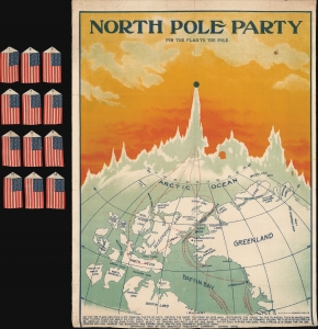
North Pole Party Pin the Flag to the Pole.
$2,200.00
Acquire
- Digital Map Information
- Suitable for large format printing
- Full resolution TIFF file
- ICC color profile embedded
- Delivered instantly via download link
This is a 1909 Saalfield Publishing Co. map game published amid the furor associated with disputed claims of the nearly-concurrent expeditions of Robert Peary and Frederick Cook concerning who had reached the North Pole first. (more details)
One of the first maps to show the Pacific Northwest.

Tartariae Sive Magni Chami Regni typus.
$2,000.00
Acquire
- Digital Map Information
- Suitable for large format printing
- Full resolution TIFF file
- ICC color profile embedded
- Delivered instantly via download link
This is Abraham Ortelius' seminal 1570 map of Tartary, one of the first maps to focus on the North Pacific coasts of America and Asia, in a sharp, early edition of 1573. While the map is intended to the Asian empire of the Great Khan, it is also notable for what it presents of America. The map includes what is now the west coast of the United States, northwestern Canada, and Alaska, a part of the world almost entirely unknown at that time. It is the earliest obtainable map to name California. It also one of the most definitive early maps to distinctly separate the continents of Asia and America (via the Strait of Anian) well before the explorers of the 18th century proved that separation to be fact. (more details)
One of the first maps to show the Pacific Northwest.
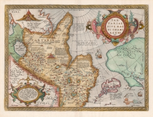
Tartariae Sive Magni Chami Regni typus.
$1,800.00
Acquire
- Digital Map Information
- Suitable for large format printing
- DPI: 600
- File Size: 46.45 MB
- File Type: ZIP / TIFF
- ICC color profile embedded
- Delivered instantly via download link
An example of Ortelius' seminal 1579 map of Tartary, one of the first maps to focus on the North Pacific. While the map is intended to detail Asia under the Great Khan, it is perhaps more notable for what it presents of America. The map includes what is now the west coast of the United States, northwestern Canada, and Alaska, lands then almost entirely unknown. It is the earliest obtainable map to name California. It also displays a strait separating Asia and America - the Strait of Anian - appearing long before Vitus Bering's exploration proved the existence of such. (more details)
Revealing a separate Asia and America.
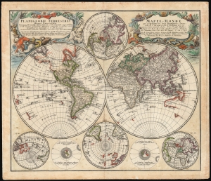
Planiglobii Terrestris/ Mappe-Monde.
$1,500.00
Acquire
- Digital Map Information
- Suitable for large format printing
- File Size: 29.97 MB
- File Type: ZIP / TIFF
- ICC color profile embedded
- Delivered instantly via download link
This is an elegant and detailed 1759 world map by Johann Matthias Hase and Georg Maurice Lowitz, contributors to the firm of Homann Heirs. The map was first issued in 1746, reflecting the best available cartographic detail of the day both from French and Russian sources. The present example was updated c. 1759 to reflect the discoveries of Bering and Chirikov according to the 1754 Müller map, confirming the separation of the continents of Asia and North America. (more details)
Earliest acquirable state of the Zeno map.
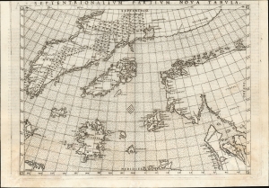
Septentrionalium Partium Nova Tabula.
$1,400.00
Acquire
- Digital Map Information
- Suitable for large format printing
- Full resolution TIFF file
- ICC color profile embedded
- Delivered instantly via download link
This is the most important map of Girolamo Ruscelli's 1561 - 1564 edition Ptolemy: the earliest acquirable iteration of Nicoló Zeno's 1558 Carta Da Navegar De Nicolo et Antonio Zeni Furono In Tramontana Lano MCCCLXXX, revealing the alleged 14th-century voyages of Zeno's ancestors, Nicoló and Antonio. Zeno's fraud, likely intended to enhance his political power in Venice and later embraced to co-opt the 1492 Columbia discovery of America, was responsible for the initial appearance and subsequent tenacity of the apocryphal islands Frisland, Icaria, Drogeo, and the coastline of Estotiland, which was taken by some of Europe's finest geographers to be the coast of Labrador. (more details)
Under the Antarctic ice.
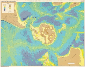
This is a 1972 American Geographical Society map of Antarctica depicting submarine and subglacial topography. Compiled by geologist Bruce Heezen and glaciologist Charles Bentley, this revolutionary map reveals the bizarrely shaped continent hidden under miles of Antarctic ice. (more details)
Aviation and Polar Exploration.
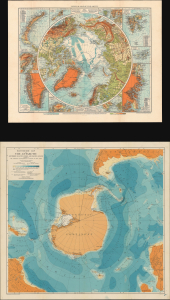
Physical Map of the Arctic. / Bathymetric Map of the Antarctic / Two Polar Maps with Notes on Recent Polar Exploration.
$950.00
Acquire
- Digital Map Information
- Suitable for large format printing
- Full resolution TIFF file
- ICC color profile embedded
- Delivered instantly via download link
This is a pair of 1929 maps of the Arctic and Antarctic, respectively, published in a 1930 report of the American Geographical Society to illustrate the significance of aviation to Polar Exploration. At the time, they represented the most detailed and up-to-date maps of the polar regions. These maps are accompanied by a report titled Brief History of Polar Exploration since the Introduction of Flying. (more details)
Predicts a Solar Eclipse and reveals Arctic Explorations.
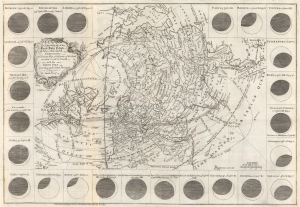
The geography of the great solar eclipse of July 14 MDCCXLVIII. : exhibiting an accurate map of all parts of the Earth in which it will be visible with the North Pole according to the latest discoveries.
$950.00
Acquire
- Digital Map Information
- Suitable for large format printing
- File Size: 12.65 MB
- File Type: ZIP / TIFF
- ICC color profile embedded
- Delivered instantly via download link
This elegant 1748 north polar projection map was drawn by the English astronomer and writer George Smith and engraved by the great English mapmaker Thomas Jefferys. It was produced for inclusion in Smith's pamphlet describing and predicting the path of the July 14, 1748, solar eclipse. (more details)
Advocating for a Northwest Passage.
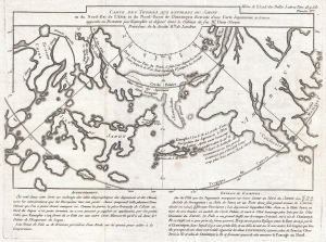
Carte Des Terres aux environs du Japon ou du Nord-Est de l'Asie et du Nord-Ouest de l'Amerique Extraite d'une Carte Japonnoise de l'univer apportee en Europe par Kaempfer et depose dans le Cabinet de feu Mr. Hans-Sloane President de la Societe Rle. de Londres.
$900.00
Acquire
- Digital Map Information
- Suitable for large format printing
- Full resolution TIFF file
- ICC color profile embedded
- Delivered instantly via download link
This is a rare 1758 map related to the Phillipe Buache / Robert de Vaugondy debate at the Paris Académie des Sciences over the cartographic configuration of the Pacific polar regions. This map was prepared for publication with Buache's Considerations Geographiques. (more details)
Failing to discover the Northwest Passage.
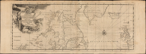
Neue Karte von den Gegenden wo eine Nordwest Durchfahrt in den Iahren 1746-1747...
$850.00
Acquire
- Digital Map Information
- Suitable for large format printing
- File Size: 8.62 MB
- File Type: ZIP / TIFF
- ICC color profile embedded
- Delivered instantly via download link
This is a rare, German edition of Henry Ellis' A New Chart of the Parts where a Northwest Passage was Sought in the Years 1746 and 1747. This map was included translations of Ellis' A Voyage to Hudson's - Bay, which chronicled his journey - largely on behalf of Arthur Dobbs - to northern and Maritime Canada to discover the Northwest Passage, which Dobbs believed had been kept hidden by the machinations of the Hudson's Bay Company. (more details)
Estonia and Latvia as the Swedish Frontier
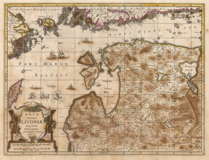
Nova Totius Livoniae accurata Descriptio. Apud Janssonio Waesbergios et Mosem Pitt.
$750.00
Acquire
- Digital Map Information
- Suitable for large format printing
- Full resolution TIFF file
- ICC color profile embedded
- Delivered instantly via download link
A beautifully engraved map of Livonia and the Duchy of Estonia - encompassing much of modern Latvia and Estonia - originally published in Jan Jansson's Atlas and revised for inclusion in Moses Pitt's rare 1680 English Atlas. Derived from Anders Bure's seminal map of the Swedish Empire, it depicts the region during Swedish rule following Sweden's victories over the Polish-Lithuanian Commonwealth. Sweden retained Estonia and Livonia until its defeat by Russia in the Great Northern War (1700 - 1721). (more details)
Japan Joins the Great Age of Polar Exploration,
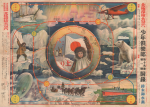
北極探檢大双六 / [Great Arctic Exploration Sugoroku].
$750.00
Acquire
- Digital Map Information
- Suitable for large format printing
- File Size: 29.48 MB
- File Type: ZIP / TIFF
- ICC color profile embedded
- Delivered instantly via download link
This vibrant 1932 chromolithographic broadsheet map was prepared by artist Suzuki Gyosui as a sugoroku game board, a supplement to the New Year's edition of Boys Club magazine, published by Kodansha. It was produced at a time of heightened interest in great feats of exploration in Japan, especially among the country's youth. (more details)
International competition to reach the North Pole.
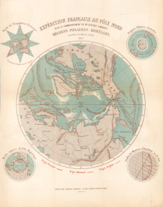
Expédition Française au Pôle Nord sou le Commandement de Mr. Gustave Lambert. Régions Polaires Boréales.
$750.00
Acquire
- Digital Map Information
- Suitable for large format printing
- File Size: 7.71 MB
- File Type: ZIP / TIFF
- ICC color profile embedded
- Delivered instantly via download link
This is an 1867 Victor-Auguste Malte-Brun and Georges Erhard Schièble map of the North Pole highlighting three proposed polar expeditions. The map captures the peak of the global competition to reach the North Pole. Reaching the Pole was considered a matter of national pride, with both government-funded and private expeditions making the attempt. This map captures rival proposals by French, English, and German explorers. (more details)
Adrift on an Arctic ice floe.
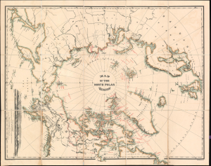
Map of the North Polar Region.
$750.00
Acquire
- Digital Map Information
- Suitable for large format printing
- File Size: 36.91 MB
- File Type: ZIP / TIFF
- ICC color profile embedded
- Delivered instantly via download link
This is a 1876 William Bauman map of the North Polar region, highlighting over 400 years of Arctic Exploration. The map is notable for its illustration of the ill-fated Polaris Expedition - one of the first American attempts to reach the North Pole. (more details)
Highlights the 'Terrestrial Hemisphere' on a newly-conceived projection.
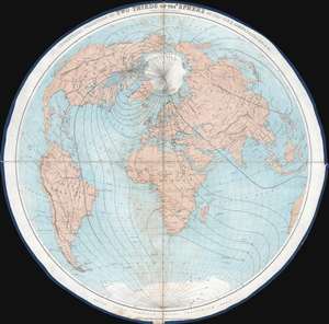
Geometrical Projection of Two Thirds of the Sphere. (Africa Central).
$750.00
Acquire
- Digital Map Information
- Suitable for large format printing
- File Size: 27.56 MB
- File Type: ZIP / TIFF
- ICC color profile embedded
- Delivered instantly via download link
This is an 1860 Henry James geometrical projection circular map of two-thirds of the world, focusing on the 'terrestrial hemisphere'. Centered on northern Africa, the world appears as if on the inside of a sphere. Dashed lines represent lines of longitude. Some countries, although not all, are labeled. A handful of cities are identified as well, including the major meridian cities: London, Paris, Rome, New York, and Washington, D.C. (more details)
Tracking down the lost Franklin Expedition.
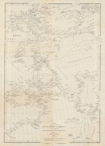
Map of a portion of the Arctic shores of America to accompany Captn. McClintock's narrative.
$600.00
Acquire
- Digital Map Information
- Suitable for large format printing
- File Size: 12.28 MB
- File Type: ZIP / TIFF
- ICC color profile embedded
- Delivered instantly via download link
An intricate map of the waters and islands of Nunavut in northeastern Canada, near Greenland, tracing the lost 'Franklin Expediton'. It was produced by John Arrowsmith in 1859 for Captain Francis McClintock's The Voyage of the 'Fox' in the Arctic Seas: A Narrative of the discovery of the fate of Sir John Franklin and his companions. (more details)
Unusal polar projection.
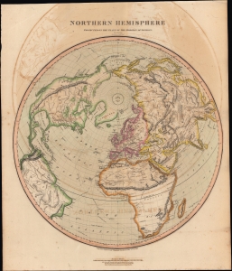
Northern Hemisphere Projected on the Plane of the Horizon of London.
$500.00
Acquire
- Digital Map Information
- Suitable for large format printing
- DPI: 600
- File Size: 581.8 MB
- File Type: ZIP / TIFF
- ICC color profile embedded
- Delivered instantly via download link
A lovely 1816 offset polar projection map of the Northern Hemisphere that appeared in Edinburgh cartographer John Thomson's New General Atlas. (more details)
Venice Discovers America! Maybe not.
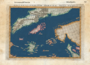
Septenirionalium Partium Nova Tabula.
$500.00
Acquire
- Digital Map Information
- Suitable for large format printing
- DPI: 600
- File Size: 9.93 MB
- File Type: ZIP / TIFF
- ICC color profile embedded
- Delivered instantly via download link
This is Girolamo Ruscelli's 1599 edition of the 1558 Carta Da Navegar De Nicolo et Antonio Zeni Furono In Tramontana Lano MCCCLXXX by Nicoló Zeno the Younger, revealing the alleged 14th-century voyages of his ancestors, Nicoló and Antonio Zeno. The fraud, seen largely as an attempt to co-opt the 1492 Columbia discovery of America, is responsible for the tenacious mapping of the apocryphal islands Frisland, Icaria, and Drogeo, and the coastline of Estotiland, which was taken to be the coast of Labrador. (more details)
Celebrating Antarctica.
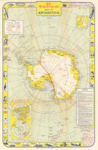
This is a 1957 Geographica and Daily Telegraph pictorial map of Antarctica, celebrating the Commonwealth Trans-Antarctic Expedition of 1955 - 1958 and the International Geophysical Year. While the map names various international claims, within 2 years of its publication, the Antarctic Treaty would transform Antarctica into a jointly-owned international scientific reserve. (more details)
Fascinating Depiction of Siberia based on a Hard-to-Find Source.

Suite de la Carte de La Siberie Et le Pays de Kamtschatka Pour l'Histoire Générale des Voyages.
$450.00
Acquire
- Digital Map Information
- Suitable for large format printing
- Full resolution TIFF file
- ICC color profile embedded
- Delivered instantly via download link
This is a beautifully engraved 1780 map of northeastern Asia, including Siberia and the Kamchatka Peninsula. Executed by Bellin, the map's details are drawn from the Asian portions of Gerhard Friedrich Müller's landmark 1754 Nouvelle Carte Des Decouvertes. Although Müller is lionized for its revelations of the voyages of Vitus Bering (1681 - 1741) and Aleksei Chirikov (1703 -1748), it also provided remarkably state-of-the-art details for the northeastern extremes of Siberia and Kamchatka. Müller's map was intended to counter the fraudulent maps produced of the same regions by fellow Academians Joseph-Nicolas De l’Isle (1688 - 1768) and Phillippe Buache (1700 - 1773), and the adoption of his geography by no lesser a figure than Bellin is a sign of his success. While mountains are shown pictorially, the delineation of the Sea of Ochosk, Sakhalin Island and the Kamchatka Peninsula is remarkably accurate. The Tschukschi Peninsula is shown in vague hachure, with a note explaining that its size is not understood. (more details)
The First Byrd Expedition's discoveries.
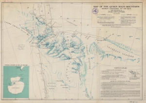
Map of the Queen Maud Mountains Between Longitudes 175° and 135° W. From the Surveys of The Byrd Antarctic Expedition.
$450.00
Acquire
- Digital Map Information
- Suitable for large format printing
- File Size: 68.52 MB
- File Type: ZIP / TIFF
- ICC color profile embedded
- Delivered instantly via download link
This is a 1931 American Geographical Society map of the Queen Maud Mountains, Antarctica. Named by Roald Amundsen after the Norwegian queen Maud of Wales, the Queen Maud Mountains are a group of mountains, ranges, and subordinate features of the Transantarctic Mountains. They are situated between the Beardmore and Reedy Glaciers and run from the Ross Ice Shelf to the Antarctic Plateau. (more details)
Increasing knowledge of the North Polar region.
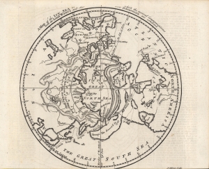
A Map of the Icy Sea in which the several Communications with the Land Waters and other new Discoveries are exhibited.
$300.00
Acquire
- Digital Map Information
- Suitable for large format printing
- Full resolution TIFF file
- ICC color profile embedded
- Delivered instantly via download link
A fascinating c. 1760 John Gibson map of the North Polar region that appeared in the London Gentleman's Magazine. Highlighting the latest discoveries by several nations as well as a host of speculations, it provides insight into the extent and limits of geographical knowledge at the time. (more details)