
This item below is out of stock, but another example (left) is available. To view the available item, click "Details."
Details
1962 Uganda Department of Lands and Surveys Atlas
$950.00
1962 Uganda Department of Lands and Surveys Atlas
UgandaAtlas-UgandaGovernment-1962$475.00

Title
Atlas of Uganda.
1962 (dated) 21 x 19.75 in (53.34 x 50.165 cm) 1 : 1500000
1962 (dated) 21 x 19.75 in (53.34 x 50.165 cm) 1 : 1500000
Description
This is a 1962 atlas of the then-imminently-independent nation of Uganda. It was compiled, under the direction of Bruce B. Whittaker, by Uganda’s Department of Lands and Surveys. Uganda's independence was scheduled for October 9, 1962. The Department of Lands and Surveys - who had begun gradual work on the Atlas as early as the late fifties - found itself confronted with a deadline, since with independence many of the Department's staff would leave the country. The forward of the Atlas, written in August two months in advance of independence and just as printing began, anticipated that the completion of the atlas would beat the deadline. The production of the resultant atlas thus represented something of a birthday present to the new nation from the bureaucracy of the British Protectorate. It is a remarkable, well-executed, and uniform work.
In the Book
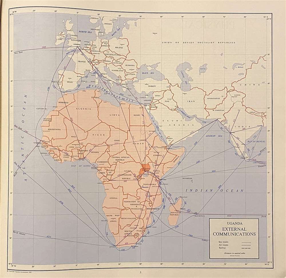
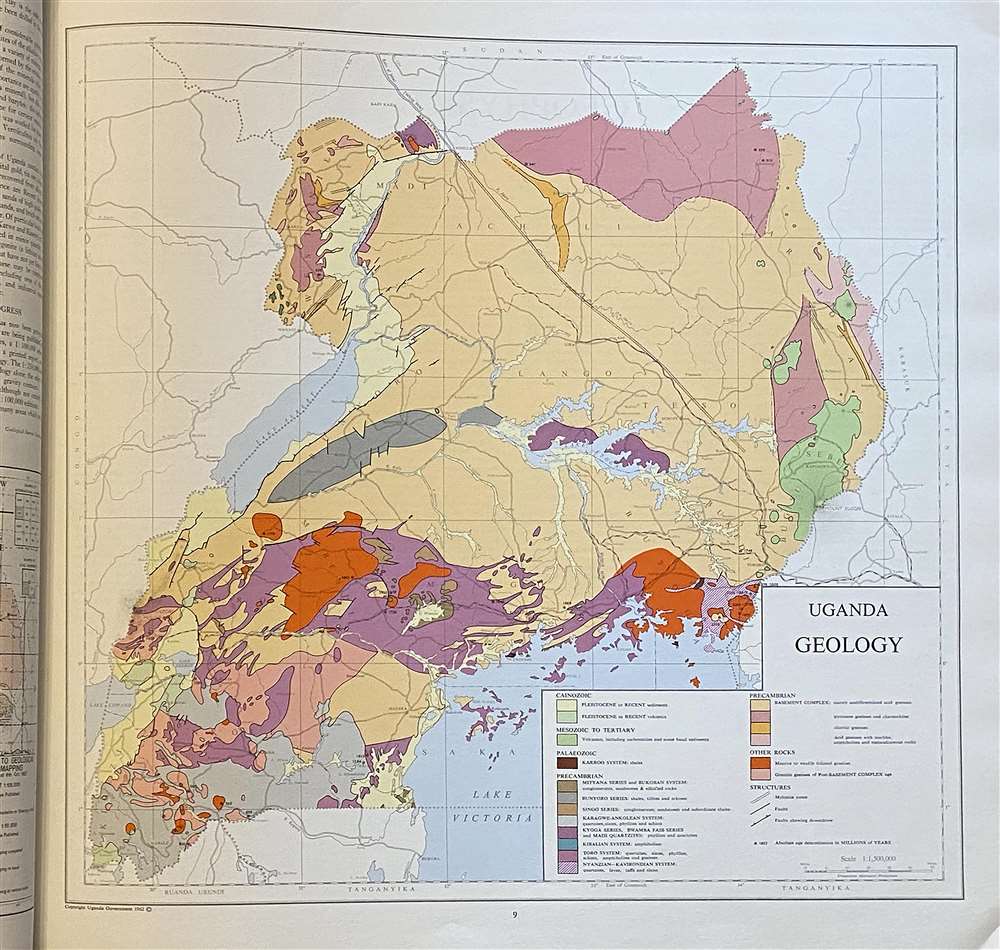
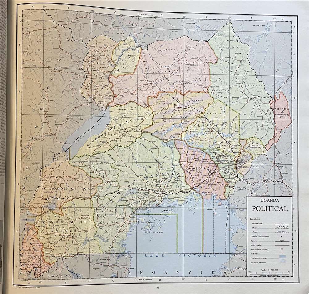
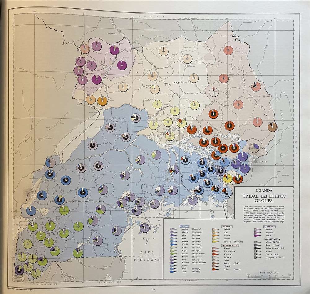
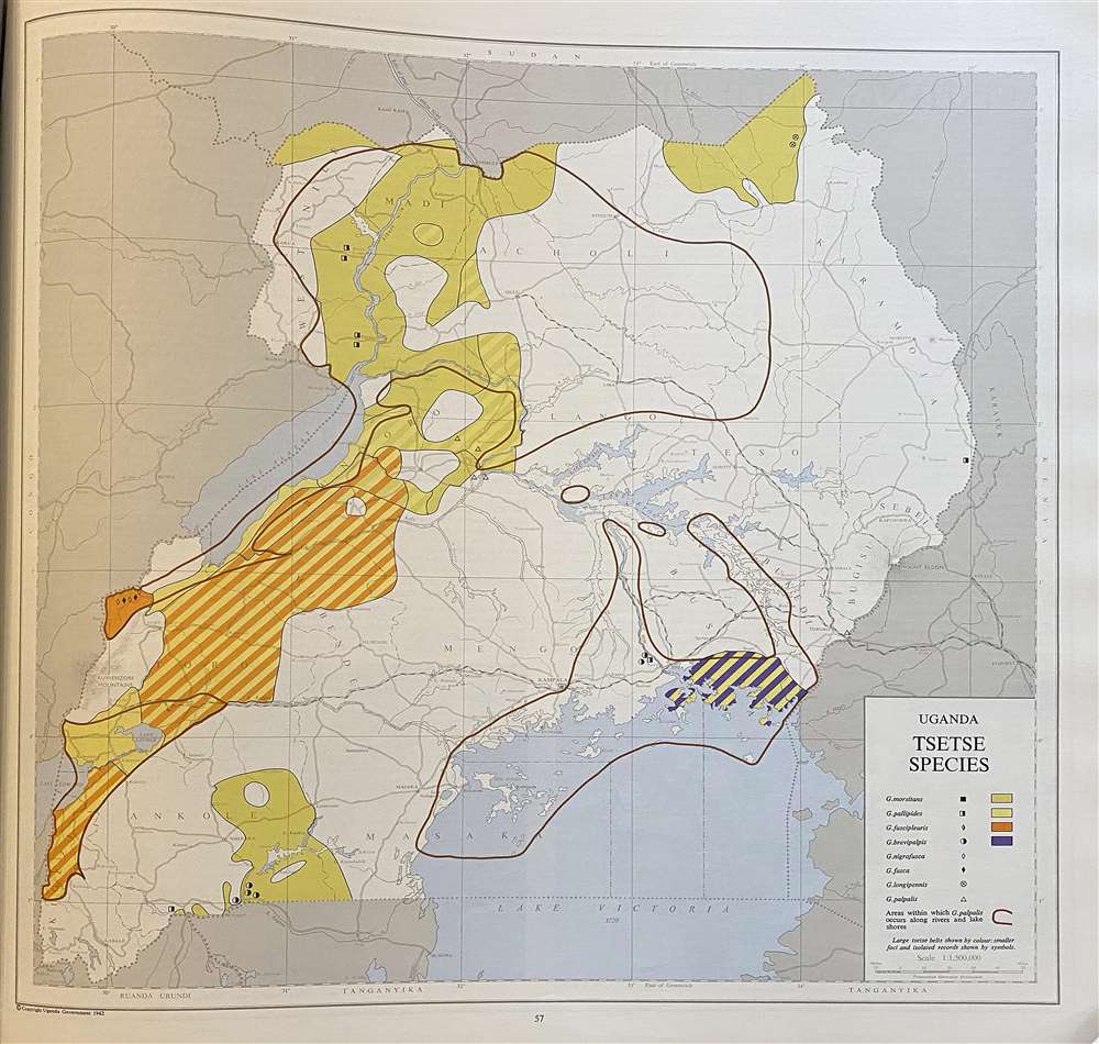
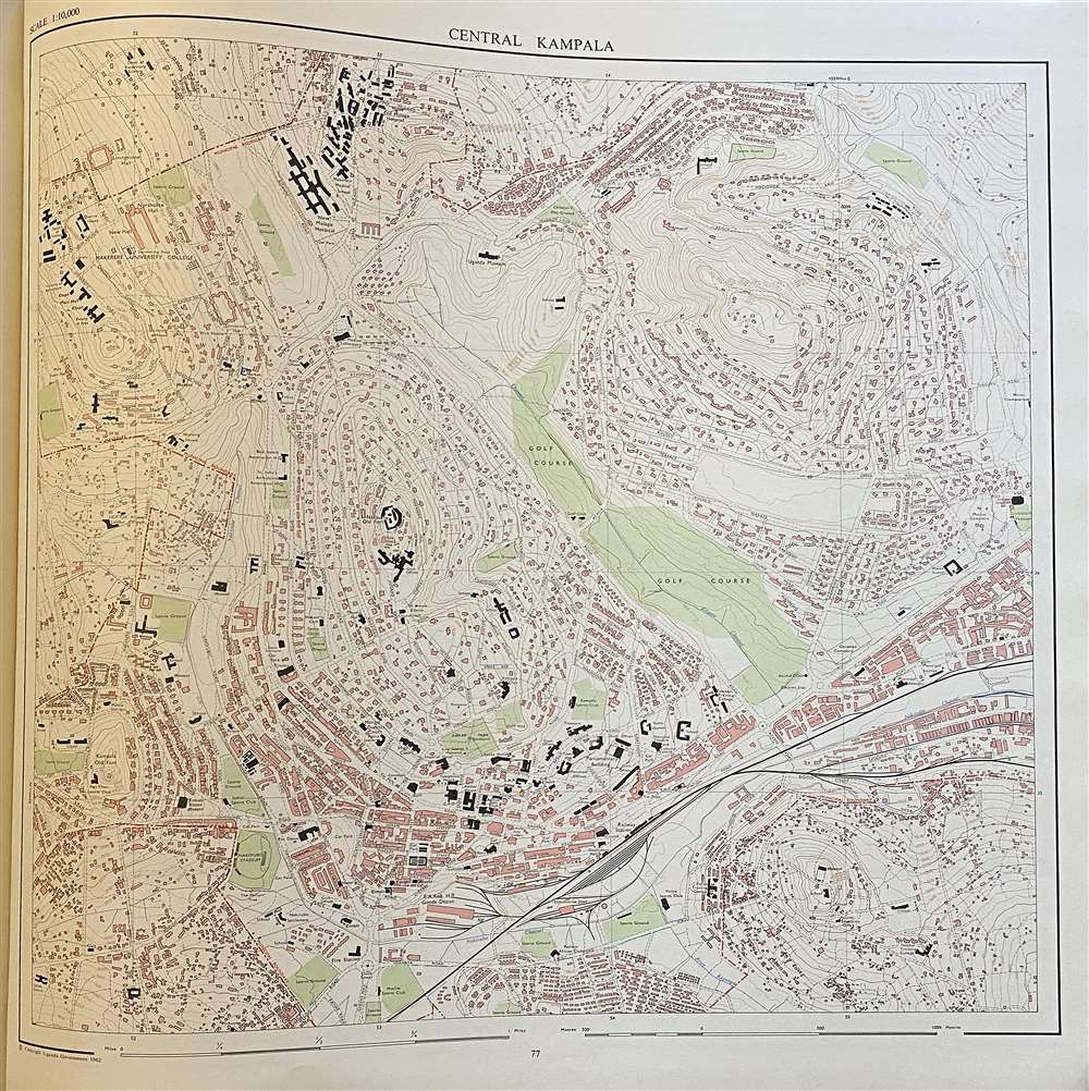
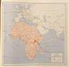
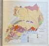
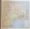
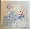
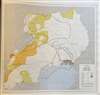
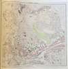
The atlas contains thirty five maps and two city plans, all printed in color. The maps of the full country - physical, cultural and statistical - are at the scale of 1 : 1,500,000 (unless otherwise noted) while the plans of Kampala and Jinja are at 1 : 10,000. The maps are of a statistical nature, focusing not only on the country's physical and political geography but its climate, flora and fauna, industry, and what the atlas refers to as 'Human Geography': fascinating maps revealing breakdowns of the country's tribal and ethnic groups, medical and educational facilities, and an abundance of maps focusing not only on Uganda's economic sources of wealth but also threats to it. There is a map showing the distribution of the Tsetse fly.An Atlas of Decolonization
The sixth volume of The History of Cartography, edited by Mark Monmonier, references this work in discussing trends of decolonialism in 20th century cartography:A comparison of two atlases published the same year (1962), one from a country recently decolonized (Uganda) and the other from a country still under colonial rule (Mozambique), is revealing in this respect. The Atlas of Uganda, divided into eight sections, begins with a plate situating Uganda vis-à-vis its transportation and communication links with the rest of Africa, Europe, and the Atlantic and Indian Oceans... It is an atlas that looks to Uganda’s future and stresses its situatedness in a broader world of trade and commerce. Historical maps of travelers and encounters only appear, and at that briefly, at the end of the atlas. In contrast, the Atlas de Moçambique begins with a map of Vasco da Gama’s 'discovery' of the country. Centered on the Atlantic Ocean, it shows only the coastlines of the continents, the itinerary of Vasco da Gama's ships, and a portrait of the navigator himself. Subsequent plates outline internal political districts oriented toward colonial governance.
Publication History and Census
This is the first edition of the atlas, printed in 1962. A further edition was printed in 1967. Both are well represented in institutional collections, but the book appears to be scarce on the market.Cartographer
Bruce Bownas Whittaker CBE (June 4, 1915 - 2000) was a British civil servant who worked in the Uganda Protectorate, eventually becoming Director of Uganda's Department of Lands and Surveys. Though his career appears to be largely cloaked in anonymity, he appears to have remained courant in his field, co-authoring a study of photogrammetry in the service of land tenure surveys in the early 60s. His tenure in Uganda would last until Uganda's independence in October 1962, but not before the completion of the first national atlas of Uganda in August of that year. More by this mapmaker...
Condition
Very good condition. Some scuffing on title page. Covers and pages dented at lower right corner. 83 pages illustrations, color maps, diagrams (some color) tables.
References
OCLC 123284155. Not in Afriterra.